
New Logan flood code could block housing projects, expert calls for code overhaul
A town planning expert claims the state’s housing crisis is partly due to “impractical” new rules banning new homes be built on certain land, even if that property already had a house on it.

A fire which gutted a rural Logan residence in 2022 has prompted a town planning expert to blame part of the state’s housing crisis on “impractical” updates to flood mapping and call for state government intervention.
Town planner and director of Steffan Harries Planning Alex Steffan said recent changes to Logan City Council’s flood mapping code barred houses being built on land that did not have road access to shops and essential services during a low-risk flood event.
Mr Steffan said the adjustments to Logan’s Dual Occupancy and Dwelling House code were “impractical” and could rule out hundreds of new homes being built.
He said the new code, overhauled in October along with new flood mapping, required all new houses in Logan to have a flood-free vehicle route to shops and essential services.
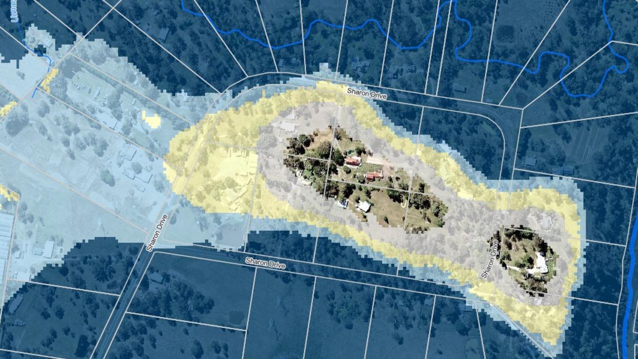
The flood mapping anomaly came to light when Mr Steffan was advising a land owner who wanted to build on a North Maclean acreage block, left vacant after a fire razed the house.
“The landowner came to us before they put a contract on the property because they wanted to build a new house but then came across this flood provision,” Mr Steffan said.
“Even though there was a house there for many years until the fire, the council could not technically approve a new building under the rules which now apply to hundreds of hectares of developable land.

“In Logan, there are many properties not in immediate flood zones, which fall under these stringent regulations.
“The wording of the temporary code needs to be changed before it is included in the next Logan Planning Scheme, which comes into effect in 2025.”
Mr Steffan said after a pre-lodgement meeting with the council, the landowner reached a resolution which allows any future construction to proceed on the North Maclean block under specific conditions.
Logan City Council said it was reviewing and refining its flood policy ahead of the delivery of the 2025 Logan Plan with flood-free access requirements part of the review.
Residents and industry representatives will be invited to provide their feedback during the community consultation period, which will follow a state review of the draft Logan Plan 2025.
Mr Steffan was speaking out after the council, this month, released details of its latest independent hydrology studies for Windaroo, Belivah and Upper Oxley creeks.
The new mapping studies are part of Logan’s rolling Flood Studies Review Program, endorsed in 2022, which initially centred on the Logan and Albert rivers along with Slacks and Scrubby creeks.
The council said its new mapping of the three areas was designed to help residents more confidently plan to improve the flood resilience of their properties.
The Logan flood mapping was raised at a federal inquiry, convened in the southeast last month, to discuss flood insurance following the 2022 disaster.
Logan mayor Jon Raven addressed the inquiry calling for the industry to be more upfront with calculations for premiums and gave examples of possible cases of insurance company price gouging following the 2022 flood in Logan.
In one case, the inquiry heard insurance premiums had soared more than 400 per cent at a Logan property.
Mr Raven also called for the insurance industry to “properly consider” the risks identified in the council’s new maps and “not sting” people with “unreasonable premiums” during a cost-of-living crisis.
Better education of council staff and councillors would also alleviate future problems, Mr Steffan said.
“The ongoing dialogue between the council and the community about the flood mapping will be crucial to shaping a fair and effective planning framework.”


550km run an ultra show of support for cop who took his own life
