
Qld weather: Storms bring hail, heavy rain to South East
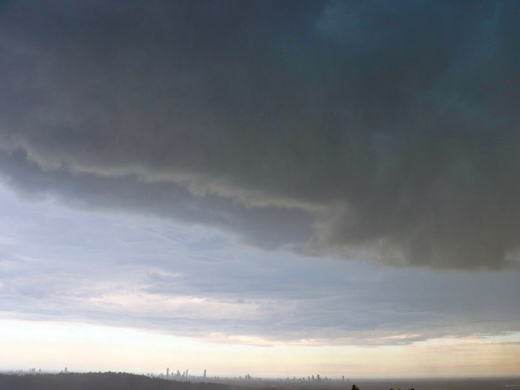
Severe storms have smashed the state’s south, with warnings still in place for heavy rain and large hailstones Monday night as the Sunshine Coast hinterland copped a 55mm downpour in half an hour.
QLD News
Don't miss out on the headlines from QLD News. Followed categories will be added to My News.
Severe storms have smashed the state’s south, with warnings still in place for heavy rain Monday night.
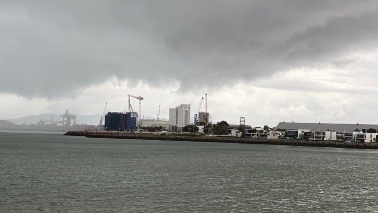
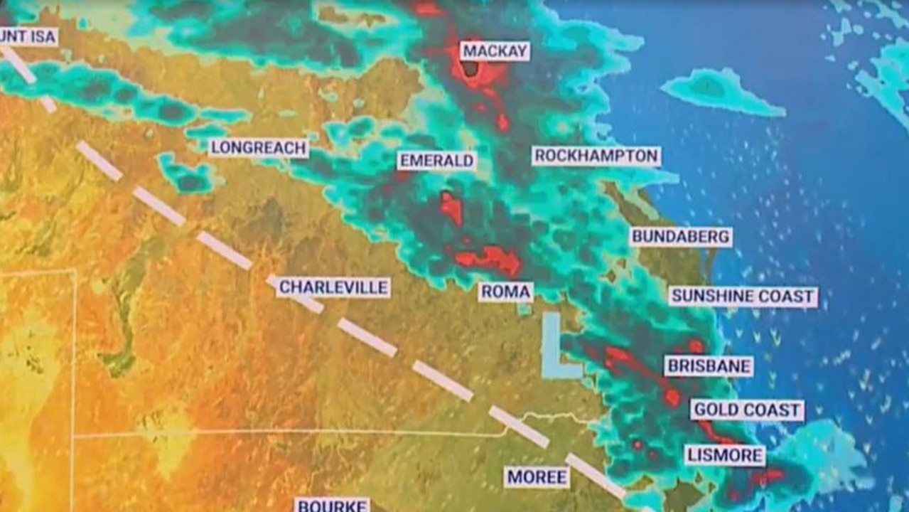
The Bureau of Meteorology issued a number of warnings for large hailstones, heavy rain and damaging winds as storms moved across Queensland throughout Monday afternoon, stretching across the South East region.
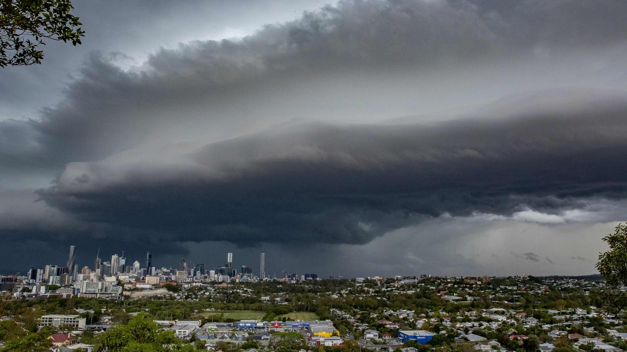
The most recent warning, issued at 8.30pm, severe thunderstorms were detected on the weather radar near Cooran. These thunderstorms are moving towards the northeast,” the warning said.
“They are forecast to affect the area southeast of Gympie and Kin Kin by 9pm and the area east of Gympie by 9.30 pm.
“Heavy rainfall that may lead to flash flooding is possible.”
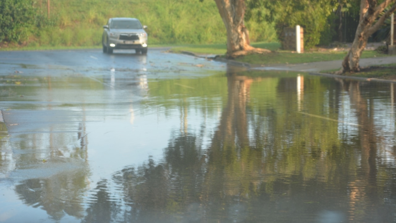
Hail was reported on the Darling Downs, and a downpour of 55mm of rain was recorded in the 30 minutes to 7.15pm at Mapleton in the Sunshine Coast hinterland.
In Calamvale, 35mm of rain fell within an hour, while Mansfield and Upper Tallebudgera recorded 32mm and Underwood received 28mm of rain.
Oyster Creek received 26mm in an hour and at least 19mm has fallen at Beaudesert.
Glen Dhu Road, inland of Ingham, recorded 92mm in the two hours to 5.45pm.
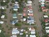
Flash flooding had also been reported in several locations including Goodna.
A seperate warning, updated by BoM at 7.20pm, said parts of Peninsula, North Tropical Coast and Tablelands, Northern Goldfields and Upper Flinders, Herbert and Lower Burdekin, Central Coast and Whitsundays, Central Highlands and Coalfields, Capricornia, Wide Bay and Burnett and Southeast Coast were in the firing line of heavy rainfall.
“A trough over inland Queensland is extending through the southeast of the state and connecting up with a cold front moving through northeast NSW,” the warning said.
“Thunderstorms are continuing on this trough this evening in the southeast, as well as along areas of convergence inland of the northeast coast.
“Severe thunderstorms are likely to produce heavy rainfall that may lead to flash flooding in the warning area over the next several hours. Locations which may be affected include Gympie, Charters Towers, Biloela, Pentland, Palmerville, Cooroy, Gin Gin, Imbil and Nambour.”
Currently at Goodna pic.twitter.com/wiGhVOeN15
— SEQUEST (@SEQUESTRADIO) November 28, 2022
Residents are warned to secure outdoor items, move cars from under trees and expect flash flooding.
Bureau meteorologist Jonathon How had earlier said there were reports of hail, strong winds and heavy rainfall in Warwick.
“The storms are quite fast moving, but there has been 16mm of rain at Warwick,” Mr How said.
“Higher totals are possible as storms move across this afternoon.”
It comes as parts of Queensland experienced triple the average rainfall for November, with more rain forecast this week.
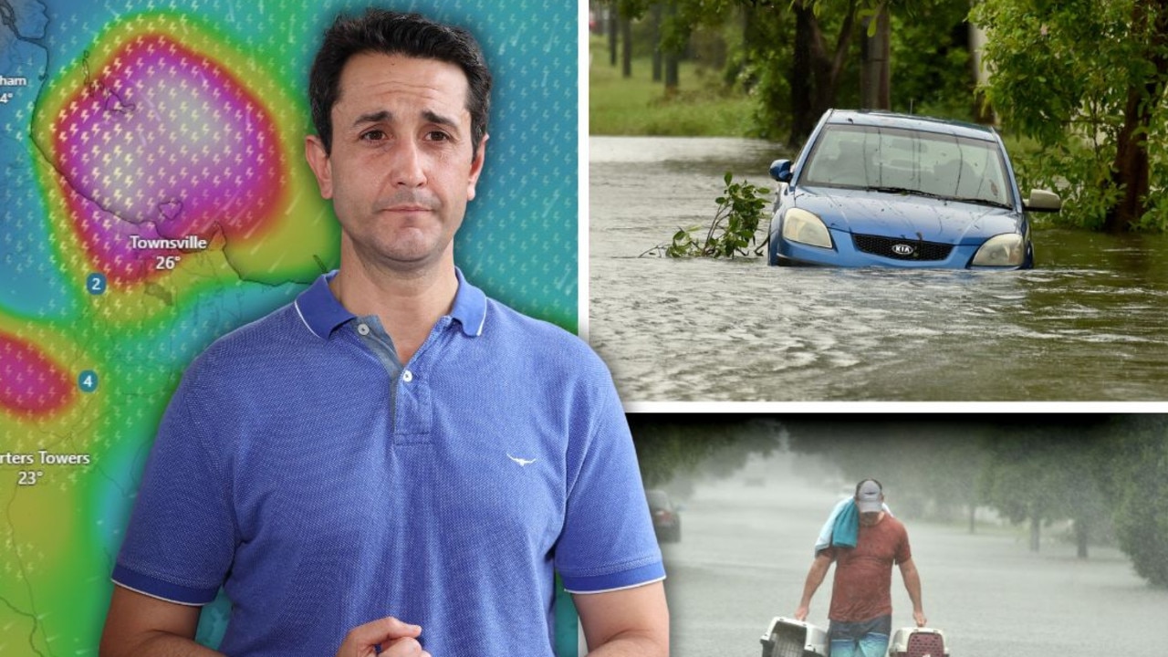
Bureau of Meteorology meteorologist Livio Regano said Queensland was hit with severe storms on Sunday, with some areas recording significant rainfall.
Townsville recorded about 160mm in 24 hours, which Mr Regano said was triple the average rainfall for the month in the tropics.
Other parts of the sunshine state recorded large rainfall totals, including the northern Brisbane suburb of Petrie, which saw about 70mm fall overnight.
The Sunshine Coast airport also recorded 76mm.
Mr Regano said the concern was the short bursts of rainfall in a short time across the state could lead to flash flooding.
“There’s two main waves, one already came through in the early afternoon and then later another is forecast today,” he said.
“It’ll come again today and could potentially be severe within the next few hours.”
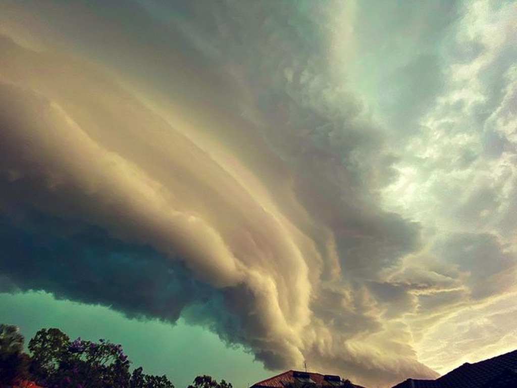
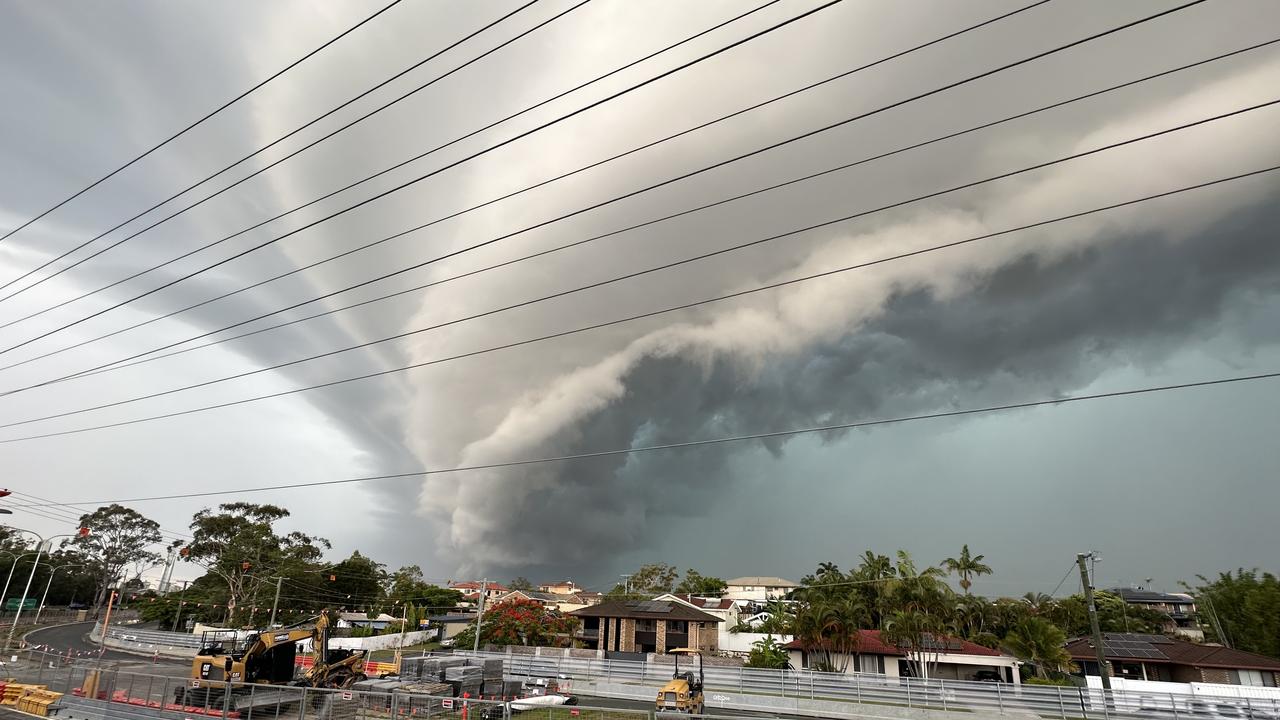
Huge storm front rolling through the Gold Coast right now. The @BOM_Qld has issued warnings from Ipswich to Coolangatta. @9NewsQueensland @9NewsGoldCoast pic.twitter.com/v4omDQn2UJ
— Jordan Fabris (@JordanFabris9) November 28, 2022
Mr Regano said while it was hard to isolate where there the severe storms could strike, he warned residents from the north of Brisbane to Cairns should be prepared for wild weather over the coming days.
“It’s going to be a very volatile week” he said.
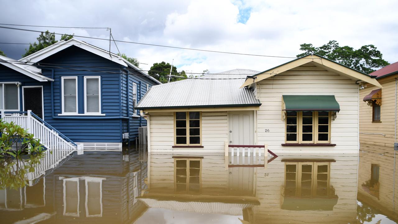
It comes as a new report found natural disasters have wreaked about $40 billion worth of economic damage in Queensland since the 1970s, with $7.7 billion of that being in the past year.
The damage bill is more than any other state or territory, exceeding three times the cost faced by Victoria and 50 per cent more than NSW.
Former Queensland fire commissioner Lee Johnson said Queensland was in the firing line for natural disasters and should brace itself for more disasters ahead.

The Climate Council’s Great Deluge report found that natural disasters had caused about $30 billion in economic damage to Queensland from 1970 to 2019, adjusted for inflation.
A further $7.7 billion in damage was done in 2022, particularly from the February and March floods which inundated parts of the state, while there was about $254 million in damage to a agriculture sector.
“The city of Brisbane suffered $1.38 billion in insured losses from this year’s floods; higher than any other local government area in Australia,” the report stated.
“Queensland suffers more economic damage from disasters than any other state or territory,” he stated.
Mr Johnson, who is a director with the Bushfire and Natural Hazards Co-operative Research Centre as well as part of Emergency Leaders for Climate Action, said since Cyclone Larry Queensland had dealt with at one or more natural disasters a year.
“This is a threat to our way of life. It should mean something to Queenslanders because we are in the firing line,” Mr Johnson said.
“We’re copping it and we’re going to keep copping it. Action needs to be taken.”
He said there needed to be more political action not just on reducing emissions, but in building more resilient infrastructure that is able to withstand disasters.
Climate Council ecologist professor Lesley Hughes, who contributed to the report, said after the floods this year catchments were already saturated.
“If we do get more intense rainfall, the ground is waterlogged, so more rain on top of that means the impacts will be felt sooner rather than later,” she said.
The report noted that while La Nina weather patterns were likely to continue this year, they may start to ease early next year, but that sea surface temperatures remained above average which could contribute to a wet seasonal outlook.
More Coverage


Originally published as Qld weather: Storms bring hail, heavy rain to South East
Join the conversation

Robbie and Trent swallow our Oscars on the Gold Coast
The TV adaptation of a Queensland-inspired book and a Robbie Williams biopic cleaned up at the Australian version of the Oscars. FULL WINNER’S LIST
Read more

‘Did she forget her pants?’ Best and worst moments from the Gold Coast
The 2025 AACTA Awards had everything — heartwarming wins, unexpected onstage moments, and even a few red carpet mishaps.
Read more

Albo ditches flood-hit NQ to take taxpayer jet to Labor fundraiser
The Prime Minister left flood-ravaged North Queensland to attend a Labor fundraising dinner in Brisbane, using his taxpayer-funded jet for a trip that lasted just six hours.
Read more

What the best dressed stars wore to the AACTAs
From Sophie Monk’s fiery red gown to Robbie Williams’ rockstar twist on a classic suit, here’s a roundup of the most talked-about fashion moments from the AACTAS red carpet.
Read more

‘Something must give – let’s stop our insane obsession with renewable energy’
Trim the fat, cancel the Olympics or blame both sides of politics. What’s the fix to Queensland’s finances? HAVE YOUR SAY
Read more
‘Testing NQ’s resilience’: Life-threatening flood warning, 250mm weekend forecast
Extra swiftwater rescue crews, police and boats are being sent north from SEQ ahead of what the Premier has warned will be another severe weekend of devastation for an already-saturated and “hurting” region.
Read more