
Qld weather: More rain on the horizon after weekend reprieve
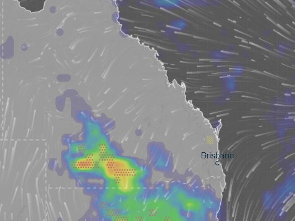
Severe thunderstorms that may deliver large hail, damaging winds and flash flooding are on the cards for large chunks of the state, as more wet weather looms. Here’s when and where the worst is expected.

QLD weather news
Don't miss out on the headlines from QLD weather news. Followed categories will be added to My News.
The Bureau of Meteorology is advising South East Queenslanders to enjoy the sunny weather while it lasts, as more rain is on the way, starting with possible severe thunderstorms later today.
A 10.03am forecast warns of possible severe storms that may bring “damaging winds, large hail, heavy rainfall leading to flash flooding” for the southwest and the southern interior, continuing overnight.
⛈ï¸Severe storms possible for southwest and southern interior with activity likely to continue overnight. Primary hazards of damaging winds, large hail, heavy rainfall leading to flash flooding possible. Storms possible in western QLD and southern interior. https://t.co/luymMfbh8jpic.twitter.com/9YsZJB9CXB
— Bureau of Meteorology, Queensland (@BOM_Qld) October 7, 2022
Despite a temporary reprieve from the wet weather for the southeast, BOM meteorologist Brooke Pagel said showers are expected to return on Sunday and Monday, with total rainfalls of around 10mm across the region.
“Today we’ll have some reprieve from the rain, Saturday is expected to remain dry for the South East, with showers returning later in the weekend, with around 5 to 10mm of rain on Sunday” she said.
“Overnight, 13mm of rain was recorded in Mansfield, and 14mm was recorded in Townson near Toowoomba”.
Parts of Southern Queensland, including Charleville, Cooladdi and Windorah are also forecast to be hit with isolated heavy showers, with more than 25mm of rainfall expected over the next 24 hours as a trough system moves across the region.
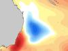
It comes as experts have discovered a freak weather phenomenon off South East Queensland that could explode to life post-La Nina, triggering another severe flood event.
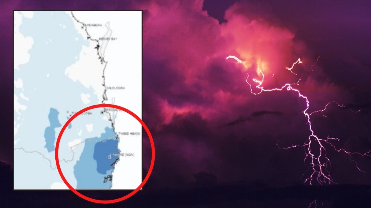
Hay fever, asthma alert ahead of severe storm triple-threat
The first severe thunderstorms of the season are expected early next week as hay fever and asthmas sufferers are put on high alert.
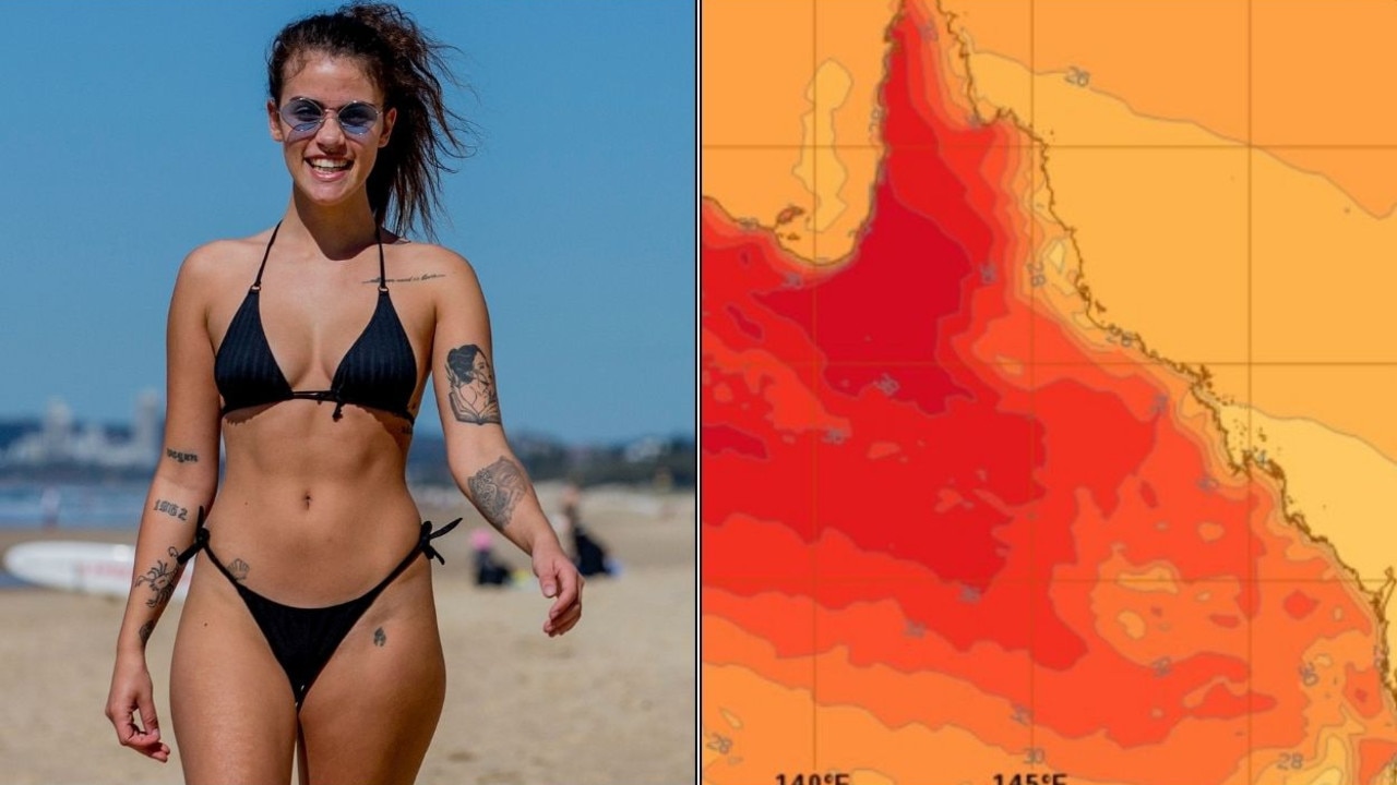
King’s Birthday scorcher coming in hot for SEQ
South East Queensland is set to swelter over the King’s Birthday long weekend with four consecutive days over 30C. Check the forecast here.