
Qld weather: 300mm in 3hrs as SEQ smashed by slow-moving deluge
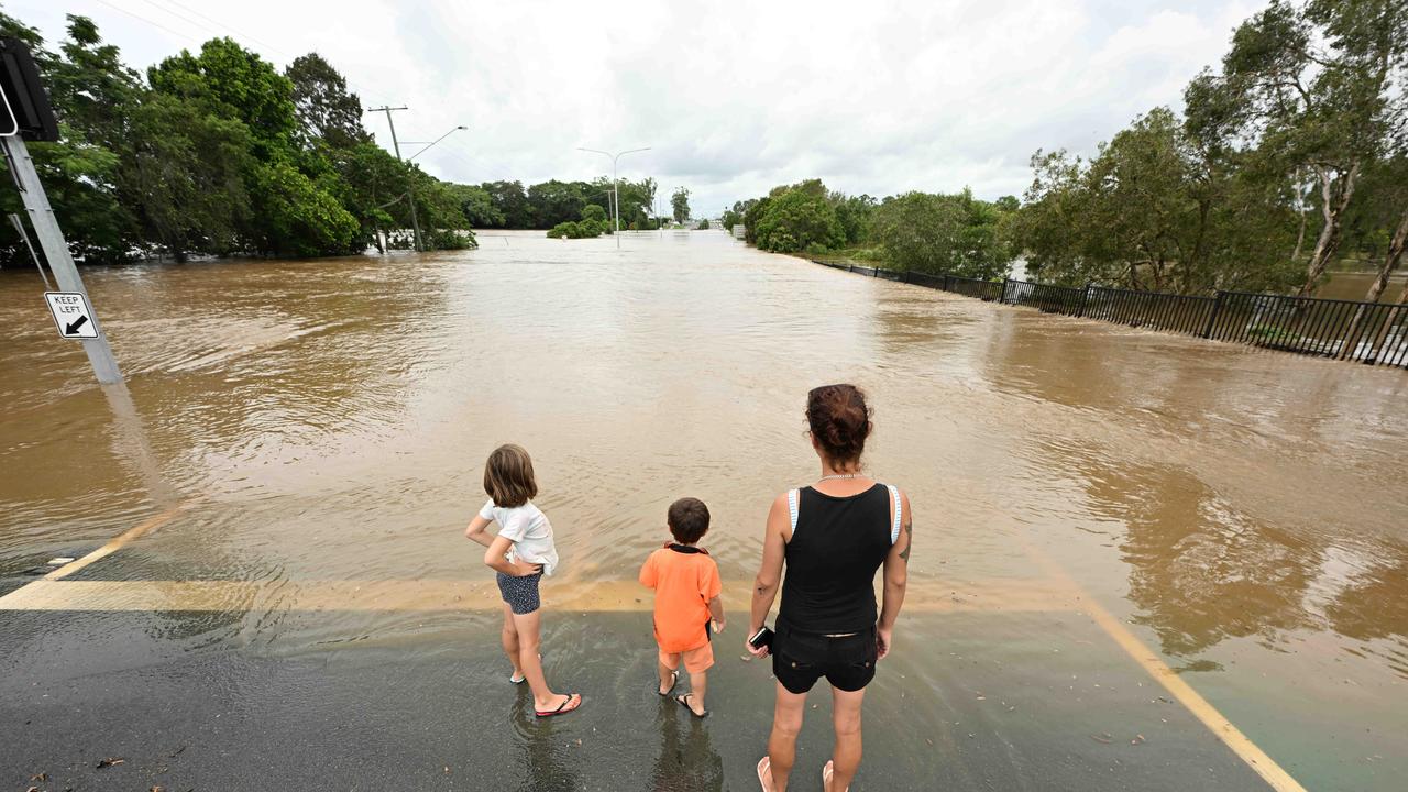
Residents say Tuesday’s floodwaters came faster than the 2022 event, with one South East Queensland mayor saying the impacts would continue for weeks, even months. It comes as parts of the region prepare for a new 150mm deluge.
QLD weather news
Don't miss out on the headlines from QLD weather news. Followed categories will be added to My News.
Evacuation centres have opened after three communities north of Brisbane were warned to prepare to leave as parts of South East Queensland face a possible 150mm deluge Tuesday night in the wake of a rain bomb that dumped 300mm in just three hours, leaving homes flooded and communities cut off.
Emergency services have made several rescues throughout the day.
City of Moreton Bay Mayor Peter Flannery said flooding impacts in his electorate would continue for weeks, even months.
Prime Minister Anthony Albanese visited the Queensland Disaster Management Centre at Kedron on Tuesday afternoon to get a first-hand look at the flood response.
“It’s been good for myself and the Premier to take the opportunity to be properly briefed on what is occurring in Queensland with these weather events,” he said.
“We will provide whatever support we can as the federal government to Queensland as it goes through this difficult time.”
Mr Albanese paid tribute to emergency services personnel which responded to the storm in the northern Brisbane area.
Premier Steven Miles said while floodwaters were receding authorities “continue to be concerned” about Moreton Bay where the ground was “so saturated that wherever the rain falls we could see flash flooding”.
BUREAU’S LATEST WARNING
On Tuesday afternoon the Bureau of Meteorology updated its severe weather warning for heavy rainfall to only include the area between Noosa and Bundaberg.
Heavy rainfall which may lead to flash flooding was forecast for areas between Noosa and Bundaberg overnight and into Wednesday morning.
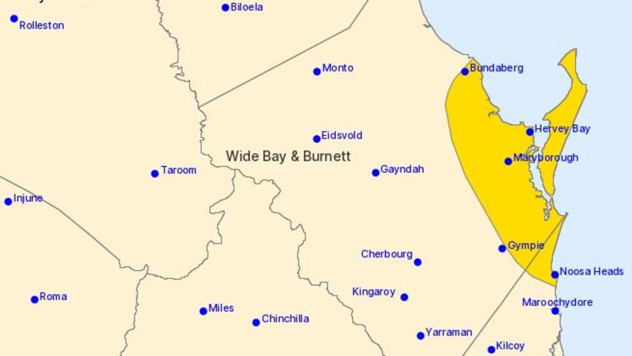
Locations which may be affected include Bundaberg, Noosa Heads, Hervey Bay, Maryborough, Rainbow Beach and Tiaro.
The BoM said six-hourly rainfall totals between 80mm to 150mm were possible.
A developing low pressure system was offshore of Noosa at 5pm and gradually moving north.
It could bring heavy rain chiefly to coastal areas on Tuesday night and early Wednesday morning.
The Bureau forecast the system to move away from Queensland’s east coast during Wednesday.
FLOODING IMPACT ‘TO LAST WEEKS, MONTHS’
City of Moreton Bay Mayor Peter Flannery said flooding impacts in his electorate would continue for weeks, even months.
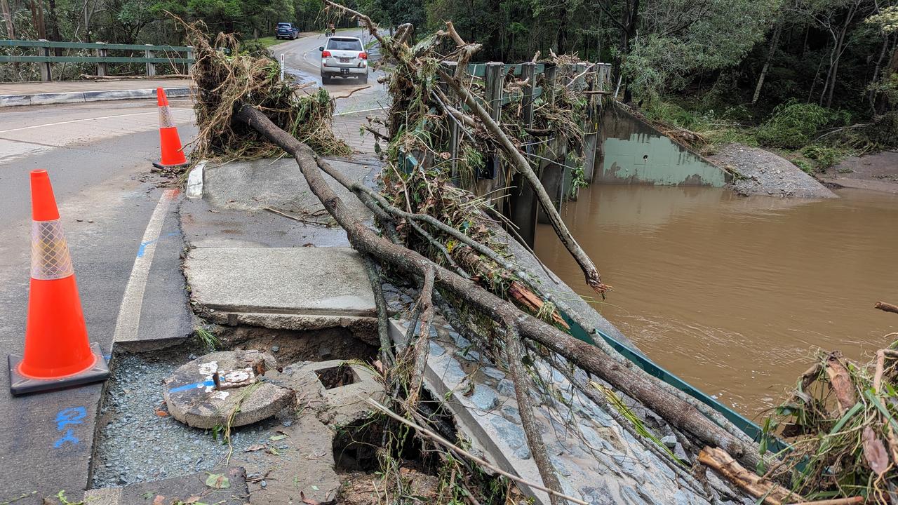
Flooding in his electorate had caused flash flooding, road closures, livestock issues and landslides.
Samford, Bray Park and Caboolture South areas were heavily impacted, with many other suburbs also suffering damage to homes, roads and infrastructure.
“Samford received 244mm of rainfall since midnight,” he said Tuesday afternoon.
“There is a 0.05 per cent chance of this happening annually, making the rainfall event in Samford extreme.
“Bray Park had 235mm since midnight and 275 mm was recorded at Bribie Island Road. These rainfall intensities far exceeded those experienced in these areas during the February 2022 severe weather and flooding event.”
In a statement on Tuesday afternoon Mr Flannery said the northern parts of City of Moreton Bay, especially the upper Caboolture River, remained a concern.
“This is a rapidly developing situation, and our priority is the safety of our residents, we encourage people to view the Disaster Dashboard for up-to-date details,” he said.
“Once the wet weather response is under control we will focus fully on the recovery phase, but our Moreton Recovery Group has already moved to start preparatory actions to understand the situation now.”
Mr Flannery said the City of Moreton Bay Disaster Management teams and SES had been active since Monday night supporting impacted residents with over 84 requests for assistance received and 92 roads closed as at 1pm.
“It is currently too difficult to assess the impact on infrastructure in several areas including Samford due to road closures, but we are continuing to work to gain access and identify all impacts across our city,” he said
There were 558 residences without power in the City of Moreton Bay Council area, over 330 of them in Morayfield.
“Over 10 swift water rescues occurred this morning in the Bray Park area:” said Mr Flannery.
“City of Moreton Bay SES has requested assistance from Redlands and Brisbane SES for this afternoon.”
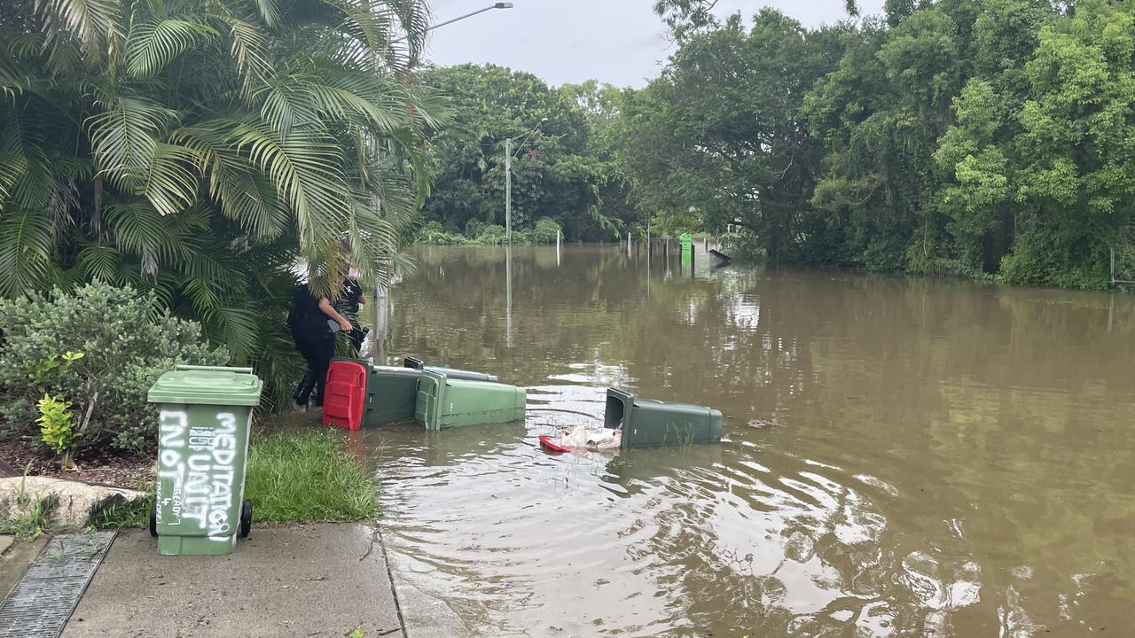
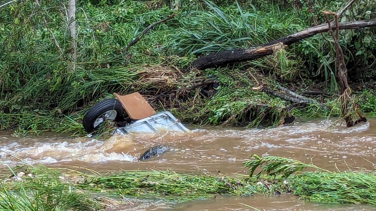
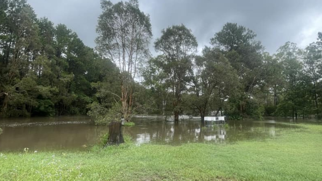
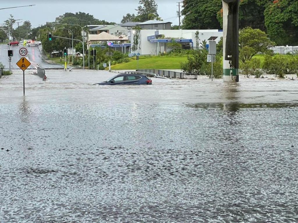
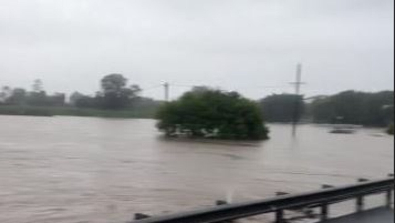
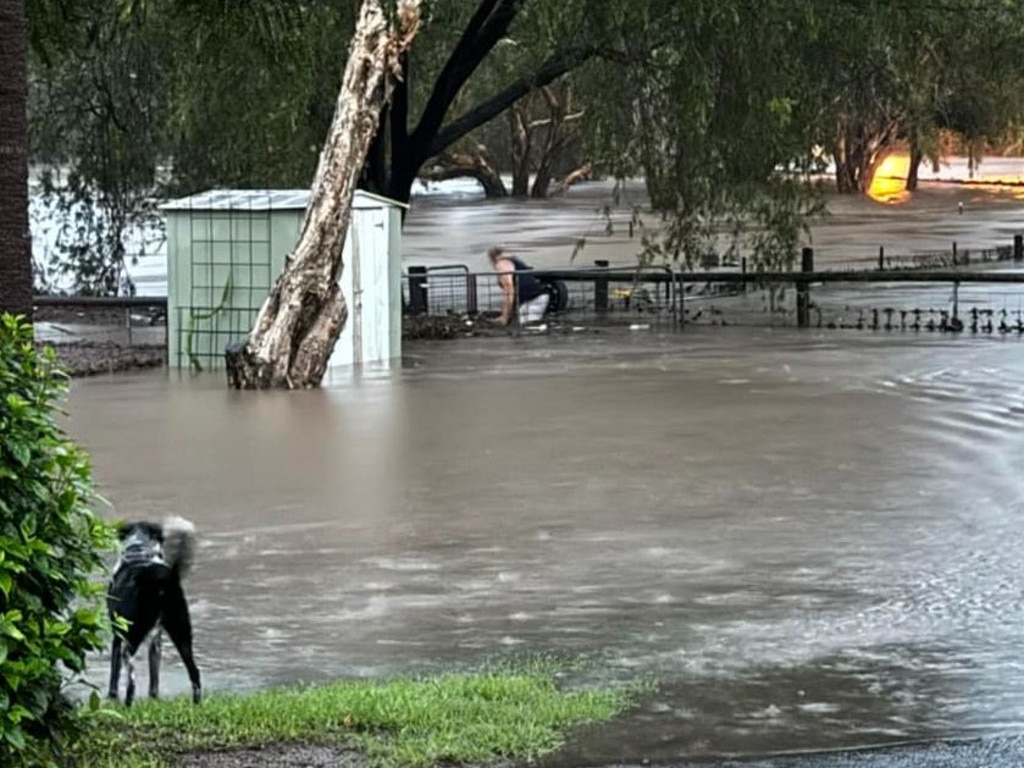
South East Queensland was smashed by 300mm of rain in just three hours overnight, leaving homes flooded, communities cut off and schools closed, with warnings there is still up to 200mm of rain to come.
EVACUATION CENTRES OPEN AS RIVER NEARS ‘MAJOR FLOODING’ LEVEL
Moreton Bay Regional Council announced six evacuation centres would open after residents of Caboolture, Morayfield and Beachmere were warned to prepare to leave, as floodwaters continue to rise following a “very dangerous" and slow-moving thunderstorm.
An alert was issued at 12.05pm for residents in Morayfield and Caboolture, warning locals to prepare to evacuate.
Beachmere residents in the vicinity of Beachmere Rd near Adcock Rd, Bakers Flat Rd, Newman Rd, Goong Creek Rd, Timothy Esp and Whiting St are urged to stay informed of the latest weather and flood warnings.
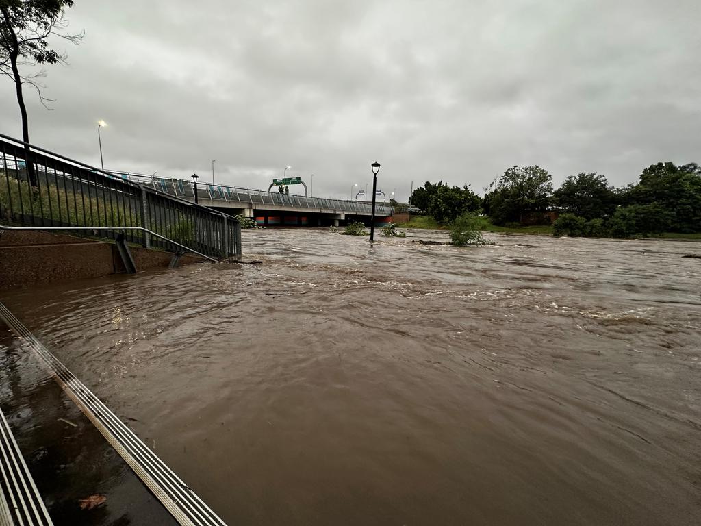
Caboolture River rapidly rose Tuesday morning to a height of more than 9.7m just before 1pm at King Street – five metres above its regular levels.
As of 1.06pm Tuesday the Caboolture River at Caboolture water treatment plant was at 9.6m and still rising, experiencing close to major flooding, according to the Bureau of Meteorology.
Council advised residents major flooding could occur if a further rise of 0.8m or more occurred.
But the levels have since subsided, with the Caboolture River at Caboolture water treatment plant falling to 9.55m as of 1.37pm.
At Short St the Caboolture River was still rising as of 1.36pm, when a water level of 7.4m was recorded. This was up from 7.25m at 1.08pm.
By late Tuesday afternoon most of the Bureau’s stations in the Caboolture/Pine River system recorded steady or falling flood levels.
Minor flooding was still occuring at 4.20pm at Burpengary Creek at Dale St and the Caboolture River at Hausmann Lane and the Caboolture Water Treatment Plant, with waters falling.
Caboolture River’s historical high of 10.94m was recorded in January 2011, with locals on Tuesday concerned about being “trapped” in their homes.
A Code Brown has been activated at Caboolture Hospital, with ambulances asked to divert care to alternate emergency departments in the area due to localised flooding and road closures nearby.
The Caboolture Satellite Hospital would be closing at 3.30pm Tuesday due to staff shortages.
“Patients and staff will continue to be supported by Caboolture Hospital, including those that are ready for discharge but cannot safely return home,” the post by Metro North Health read.
A total of 126mm of rain fell in just two hours at Upper Caboolture – 209mm in the six hours to 9:52am – while 187mm in the six hours to 11:04am was recorded at Bells Creek South as the storm headed northeast over the Moreton Bay region.
Schools and worksites in the area were forced to close for the day following widespread power outages.
RESCUES CONTINUE INTO LATE AFTERNOON
Emergency services have made several rescues throughout the day.
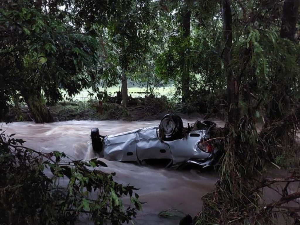
Dozens of emergency service personnel as well as PolAir units had searched for a potential driver after a car was located in floodwaters near Elimbah, north of Brisbane.
At 4.15pm a QFES spokeswoman said crews proceeded downstream and searched nearby banks for the vehicle’s occupant. She said it was believed the driver was not in the vehicle and was safe.
Two QFES IRBs were used to access the car, which was completely submerged in fast-flowing floodwaters.
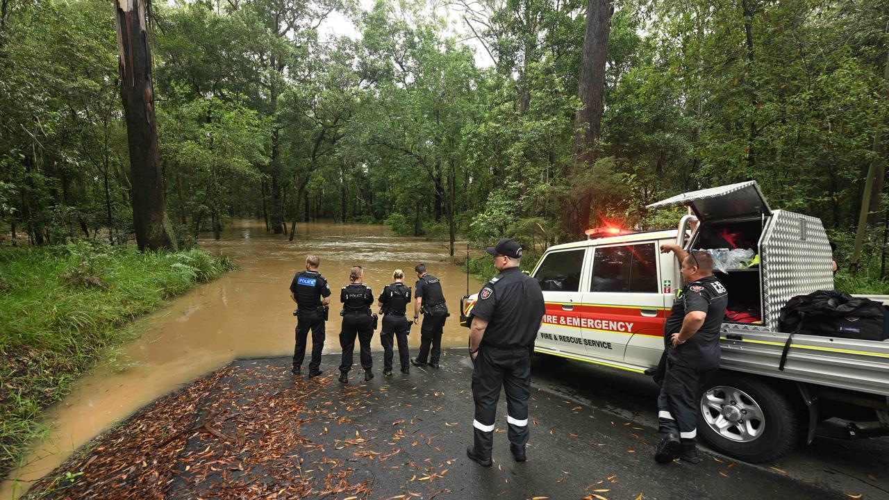
From the shoreline only a tail light could be seen as extra police crews on-foot attempted to access the vehicle from one of the river banks.
Crews onshore believe the driver of the car, a local Elimbah resident, was found safe and well at his home.
PolAir remained in the area at 4.30pm.
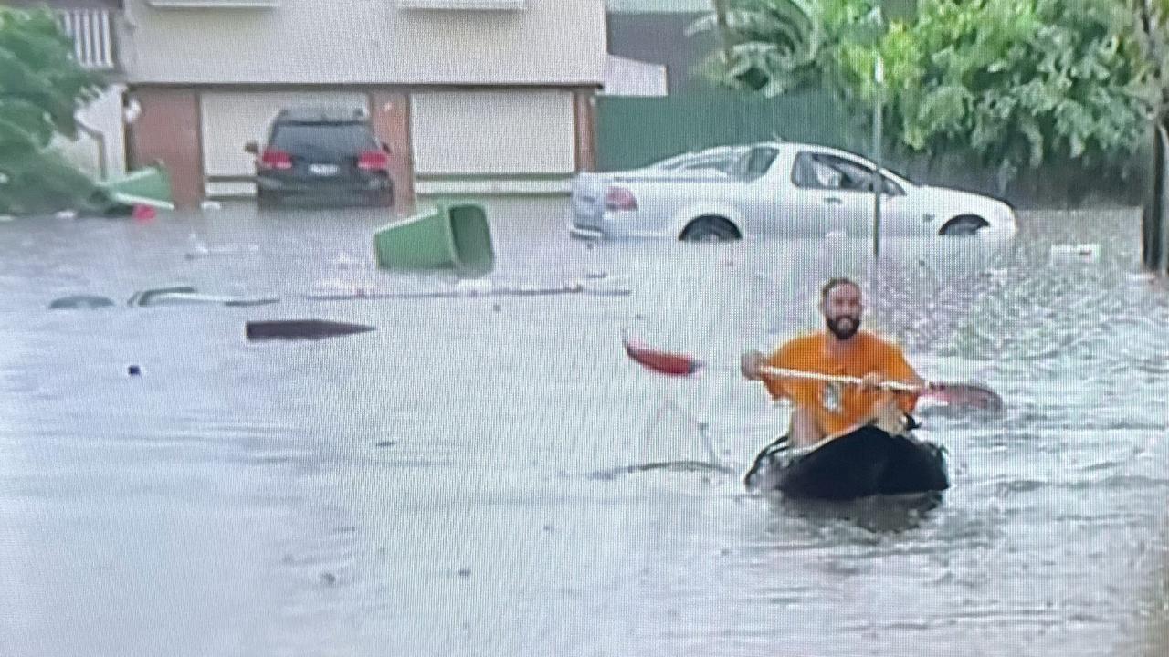
It comes after rescuers had to make their way through a kilometre of water to rescue a driver stuck in floodwaters in Beachmere - one of several rescues on Tuesday.
Six rescue crews rushed to Beachmere Rd at Riversleigh Road after a car became trapped in floodwater around 2pm.
A QFES spokeswoman said when crews arrived at 2.40pm there was one occupant making their way out of the vehicle with crews having to travel through a kilometre of water to assist them.
Crews were still at the scene at 3.15pm, with QAS not arriving until just after 3.15pm due to access issues from flooding.
The occupant was not injured and did not require treatment from paramedics.
RESIDENTS SAY FLOODWATERS CAME FASTER THAN 2022
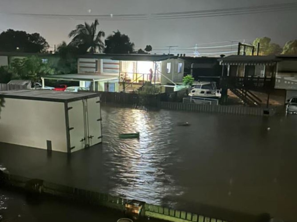
Caboolture residents Katrina and Michael Bender’s granny flat and backyard were completely underwater by midday and both feared the tide would only rise.
The double-storey house, which backs on to the Caboolture River, has now been hit three times in the past 13 years with a “once in a 100-year” flood event.
“In 2022 the house was completely underwater, our granny flat had to be completely redone and the whole under part of the house was riddled with mould,” Mrs Bender said.
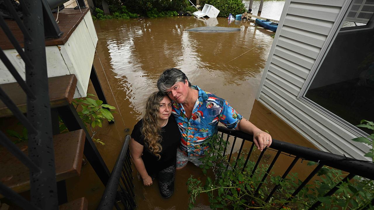
“I’m a bit concerned as ... the first day of the 2022 floods the water wasn’t nearly as this high but by the second day everything was underwater.
“I’m quite worried we could be hit with that but worse.
“I actually lost my voice for six months due to mould poisoning in 2022 because it took the insurance company a while to come out and evaluate and we obviously couldn’t touch anything.”
Both Mr and Mrs Bender who work in the area also rescue stranded animals and say flood events are a busy time for them.
“We have ended up rescuing a few pigs, lots of stranded birds and injured cats because of the floods.”
Caboolture was on a watch and act alert for most of the day as levels in the Caboolture River skyrocketed after an overnight rain bomb.
Caboolture resident Jason, from William Street, is only a few houses up from where the street is underwater and unpassable by car.
He said it took four to five days of rainfall for the water to reach the same level as on Tuesday during the last flooding event a few years ago. On Tuesday it took a matter of hours.
“If I get told to leave by the police I suppose I have to,” he said.
“I don’t know anybody here or have anywhere to go.
“I’d have to pack up some things and head to the evacuation centre.
Six evacuation centres were set to open at 2pm at South Pine Indoor Sports Centre, Caboolture Memorial Hall, Woodford Community Hall, Beachmere Hub, Samford Community Hub and Bribie Island Recreation Hall.
Residents had been advised to leave despite floodwaters on roads and have been told conditions can change rapidly.
Residents in Caboolture have taken to the local footy oval with paddle boats and blow up floaties after the Caboolture River copped an extra four metres of rain.
Locals were spotted back flipping off the home and away dugouts while kayakers did laps of the flooded fields
Jen Ison, who is on Dances Road at the King John Creek Bridge, said: “Can’t get out and staff can’t get in.”
The city at 1.35pm remained on a watch and act alert with rain forecast in the region in the afternoon.
A storm warning has been issued for the wider area encompassing the Wide Bay and Burnett, Darling Downs and Granite Belt and Southeast Coast forecast districts.
“A surface trough over southeast Queensland is expected to sharpen today, then gradually move north overnight tonight, potentially deepening into a low pressure system around Hervey Bay,” it said.
“This system is forecast to move away from Queensland’s east coast during Wednesday, clearing all severe weather by the afternoon or evening.
“Heavy rainfall which may lead to flash flooding is forecast for areas of southeast Queensland north of about Dalby and Redcliffe, and east of Dalby, Gayndah to Bundaberg. Six-hourly rainfall totals between 80mm to 150mm are likely.”
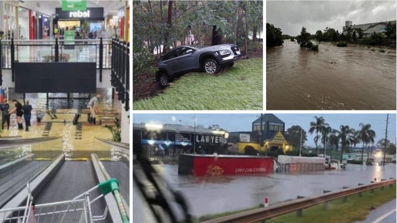
MORNING MAYHEM: RESCUES, ROADS CUT, SHOPPING CENTRE FLOODS
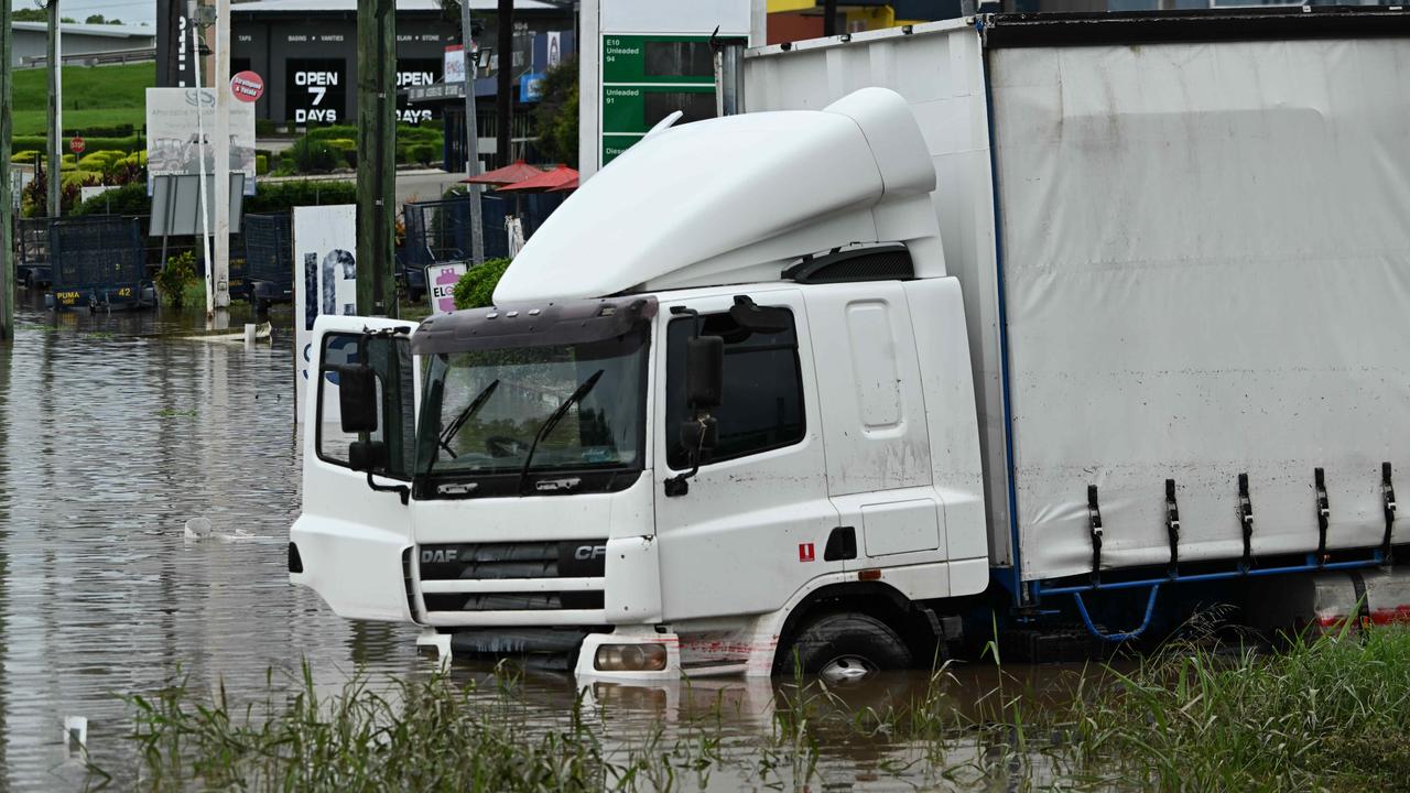
A man was rescued from the roof of a truck in Morayfield Tuesday morning after the vehicle became inundated by flood waters.
Queensland Fire and Emergency Services were called to Visentin Rd at Morayfield just before 11am where a truck was stuck in flood waters.
The driver managed to escape to the roof of the vehicle.
Rescue crews launched a boat and retrieved the man from the roof.
Overnight, 13 swiftwater rescues were carried out in the Moreton Bay Somerset, Lockyer Valley and Darling Downs regions, with waist-deep water inundating properties, with the aftermath hitting towns and suburbs from the Western downs to Pine Rivers.
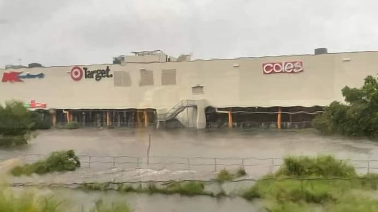
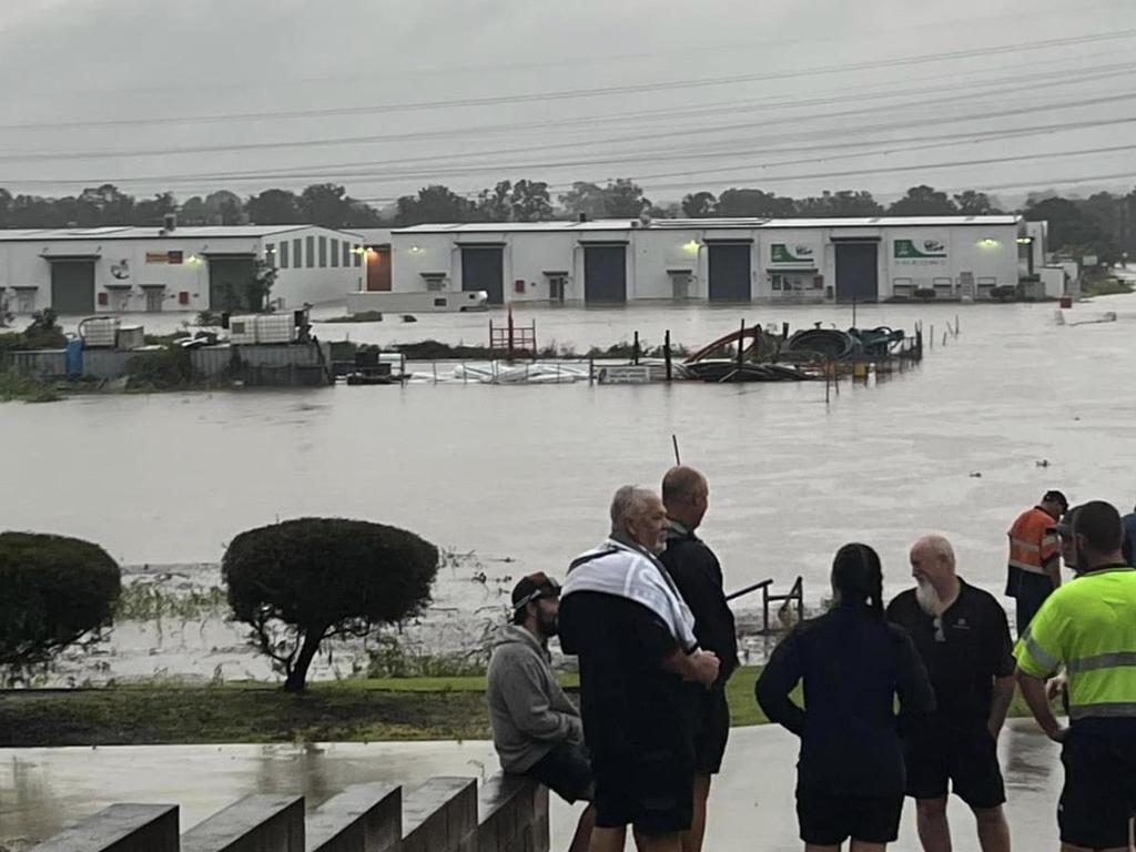
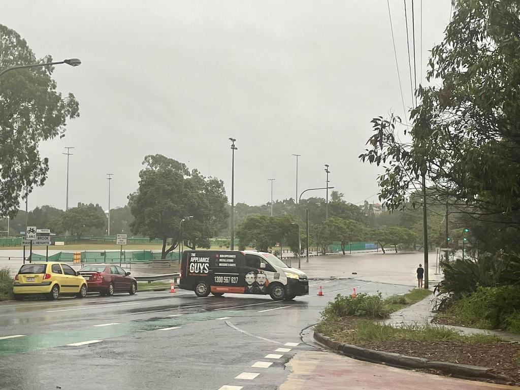
The entry to Morayfield Shopping Centre via the lower level car park was blocked off as water has started to pool at the bottom of the escalators Tuesday morning.
Many shops inside the shopping centre were closed, with staff unable to make it to work from flood-affected areas, turning the centre into a ghost town.
Mainstayers Target, Big W and Woolworths are some of the shops still open, with a number of notable stores such as Rebel, City Beach, Best & Less and the movie theatre shut.
The bottom car park levels have been closed off but shoppers can still park on the upper levels.
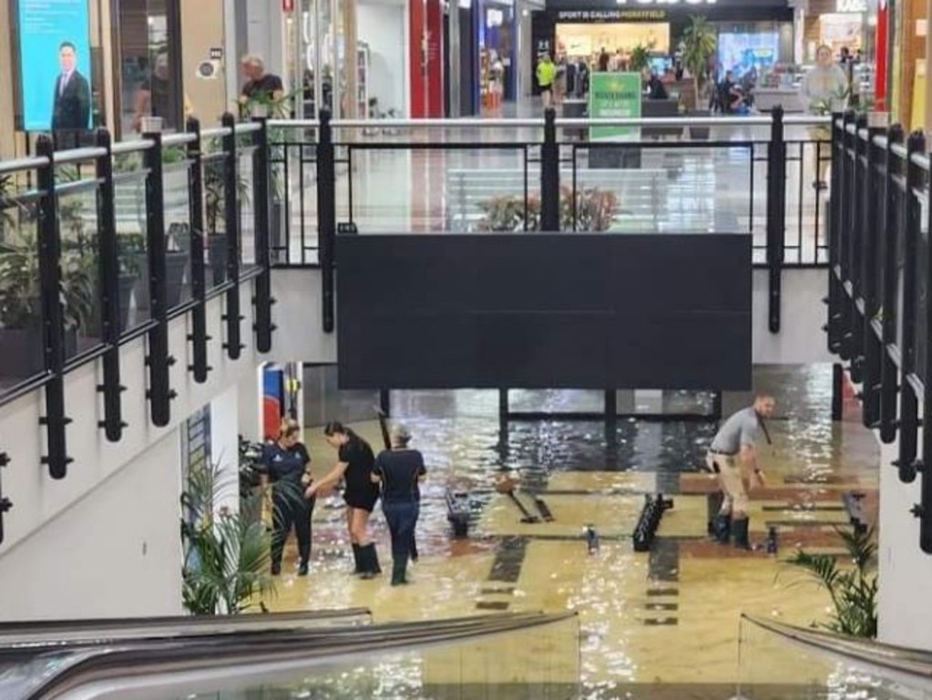
Morayfield Shopping Centre on Tuesday afternoon assured shoppers the centre was still open despite extensive flooding in the undercover parking area near Kmart.
“Our Centre is open, however, some stores have chosen to close for the day. Please check with your favourite stores for more information. Phone numbers are all on our website. If you do visit us today the best parking is in the West car park (next to Bus Station),” the post read.
LIST: SCHOOL AND ROAD CLOSURES DUE TO FLASH FLOODING
IN PICTURES: FLOOD EMERGENCY HITS SOUTH EAST QUEENSLAND
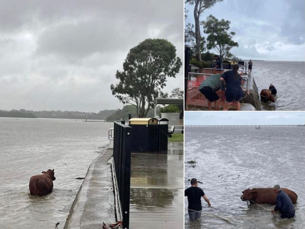
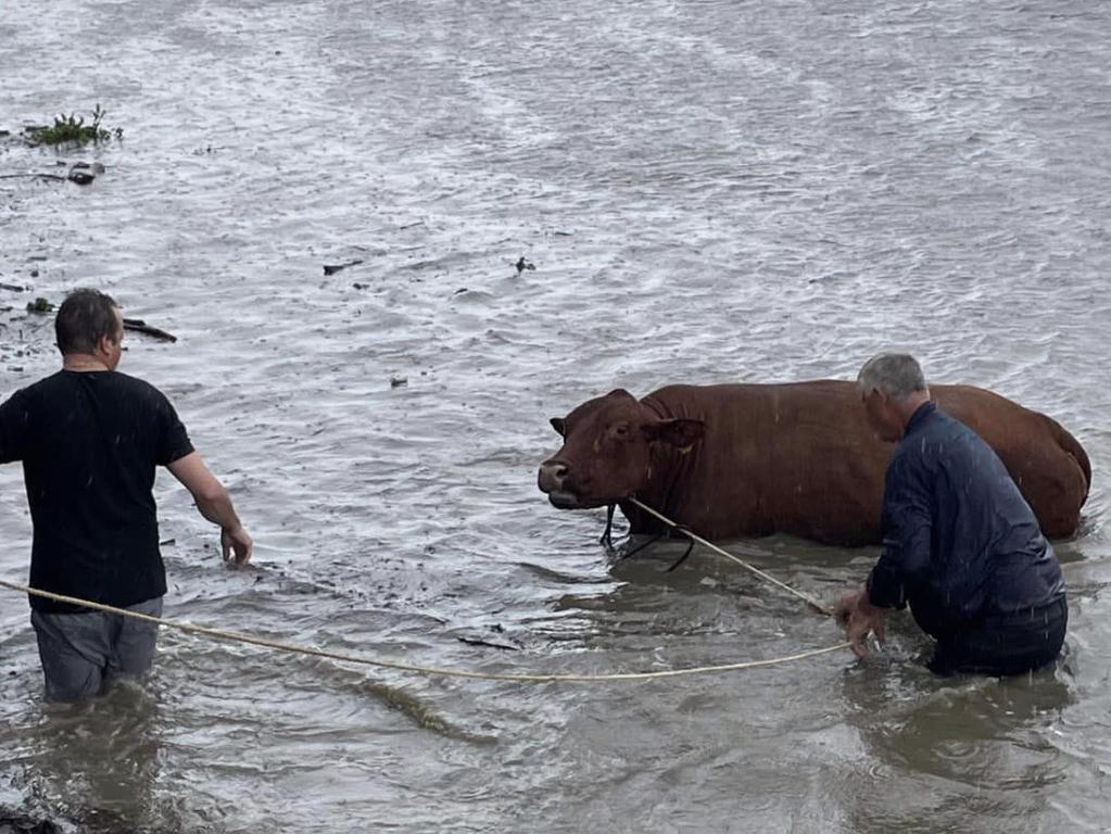
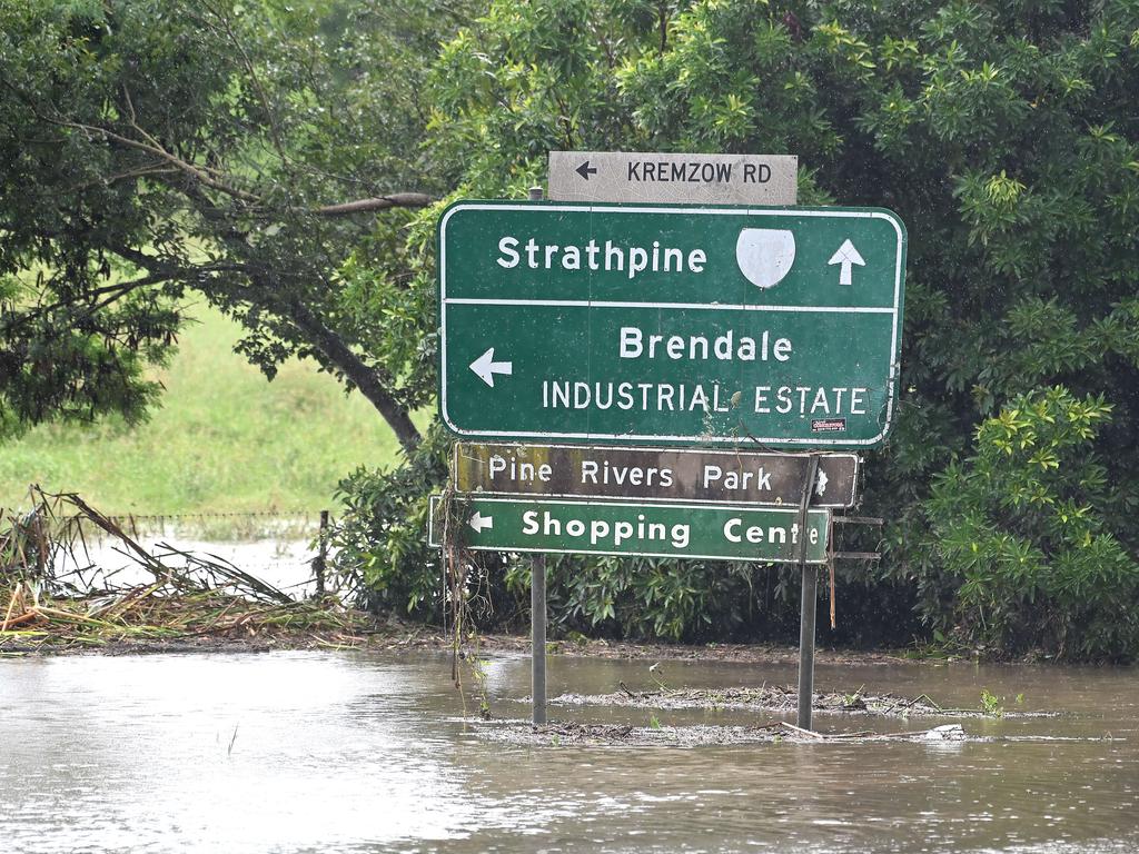
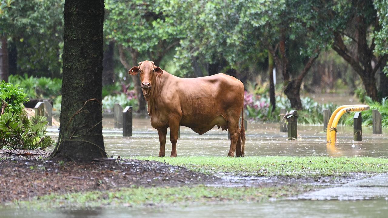
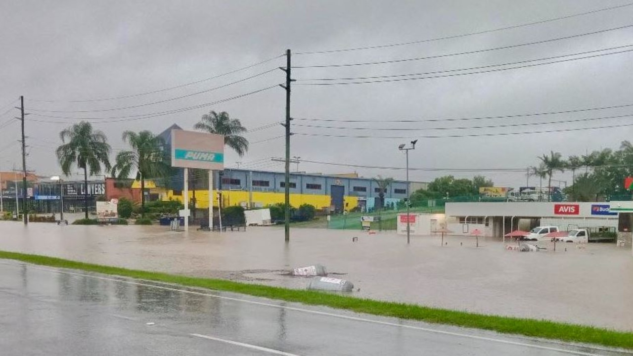
Rogue cows escaped their paddock, becoming stuck in flood waters at the Strathpine Community Centre right outside Peter Dutton’s electorate office.
Emergency services were notified of the incident after residents spotted up to three cows in the Community Centres parking lot just before 9.30am on Tuesday morning.
The cows were placed back in their nearby paddock when locals herded the animals back to safety.
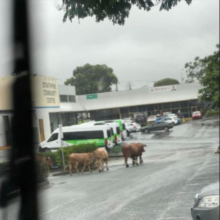
The Houdini act comes after Strathpine, Bray Park and Bald Hill were all hit by a torrential downpour overnight.
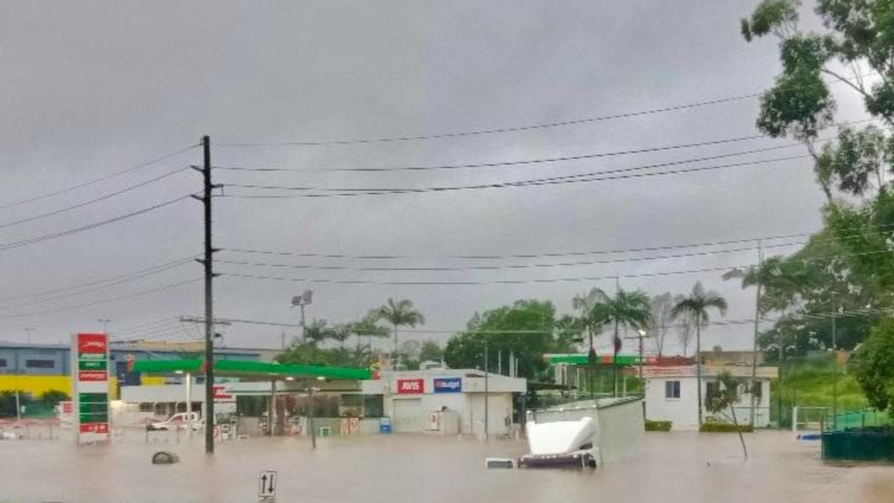
Puma Strathpine shop attendant Sharma said the petrol station was covered by eight inches of water when he arrived at 5am.
“The water came all the way up to till and cut the electricity off as well as the internet,” he said.
“It just came down in one big burst.
“The station was flooded during the 2011, 2022 floods. It’s one of the first places to flood whenever it really rains in Brisbane.”
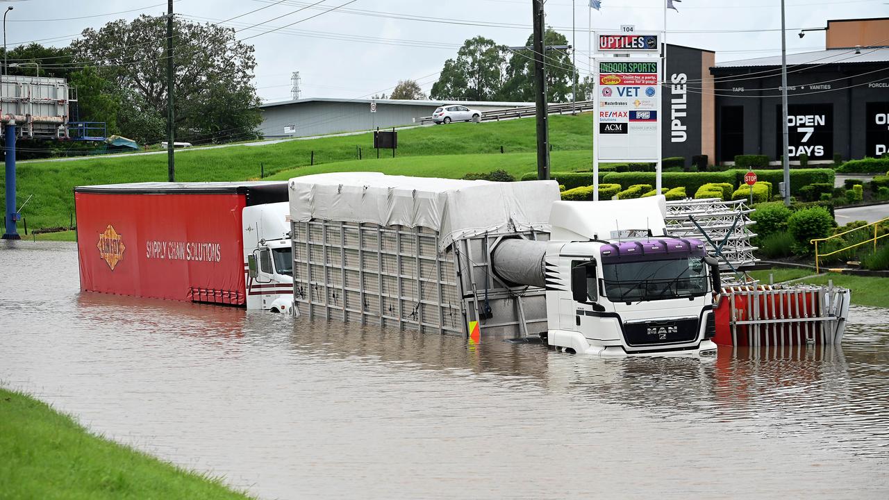
Three trucks became stuck during the storm.
Major roads including Gympie Rd in the area have been flooded, with traffic lights down due to power outages.
Train services are suspended in the Strathpine area due to rising flood waters.
In a statement Queensland Rail advised customers to expect long delays due to the severe flooding.
“Services remain suspended between Strathpine and Petrie stations,” a 11.55am update said.
Access to the town of Samford has been blocked along Samford Rd, Ferny Grove with road closure signs blocking the way from the intersection of Arbor St.
Earlier, trains were delayed by up to an hour on Brisbane’s northside, with water over the tracks at Bray Park.
Education Queensland has closed a number of state schools across multiple regions due to the deluge.
Bureau of Meteorology senior meteorologist Angus Hines warned that while the worst of the rain had likely passed, falls of up to 200mm were still possible.
Widespread rainfall of between 50mm and 100mm was experienced across most of South East Queensland overnight with some areas experiencing much more.
“Northwest of Brisbane is where we saw the most significant rainfall accumulations overnight last night, in particular, a place called Samford Valley, which had 342mm of rain, that’s really heavy rainfall particularly within just the space of one night,” Mr Hines said.
“That has contributed to areas of flash flooding … we have seen some riverine flooding where the rivers and the creeks and the streams across southeast Queensland … those water levels have slipped up pretty sharply.”
Mr Hines says the storm isn’t over yet with more rainfall expected over the next day or so and thunderstorms set to get worse as the day gets warmer.
“We’ll often find storm activity does ramp up a little bit when we get to the warmest hours of the day, so even if it does ease after the course of this morning by the time we roll into this afternoon we certainly see that risk once again of thunderstorms and the possibility of those severe thunderstorms bringing [more] locally heavy or locally intense rainfall.
“We could see quite a lot more rainfall, another 50 to 100mm, the chance of some more thunderstorms bringing local pockets again 100 to 200 millimetres of rain,” he said.
“It’s been a very wet night for some places and it’s still a wet day here for others.”
Overnight, the Bureau of Meteorology issued two severe thunderstorm warnings between 1am and 3am warning of a very a dangerous thunderstorm producing “heavy, locally intense rainfall that may lead to dangerous and life-threatening flash flooding” near Strathpine, Samford and Albany Creek.
The storm sat over the area for around three hours, producing significant rainfall including 300mm at Samford, according to the BOM, with warnings there is still more to come.
A commenter on a Moreton Bay City Council flood warning post said Samford Village was “inundated” and there was no way in or out.
QFES reported 13 swiftwater rescues across the southeast overnight.
Eight of these rescues were in the Moreton Bay region, with Fire and Emergency Services also called to homes in Somerset, Lockyer Valley and Darling Downs regions.
Crews received multiple calls to save people trapped in their homes around Bray Park and Brendale.
A QFES spokeswoman said 10 people were rescued from flooded homes and cars, but luckily no one was injured in the ordeal.
The State Emergency Service (SES) was also called to 28 calls for assistance in 24 hours in the Moreton Bay region overnight.
More than 3600 customers are without power in the Moreton Bay Council area, with more than 1500 of those in Morayfield, and more than 1200 in Burpengary.
Train services were suspended between Strathpine and Petrie after rail lines at Bray Park flooded overnight.
Signal electricians have since certified the use of the Bray Park lines as water receded, with residual delays of up to one hour experienced from Caboolture to Petrie, Caboolture to Beerburrum and Petrie to Kippa-Ring.
By 8.30am those delays were down to 15 minutes.
A Sunshine Coast train has also been suspended between Beerburrum and Nambour due to a tree caught on the overhead lines, causing delays of one hour.
A Queensland Rail spokeswoman said train services from Strathpine to Central will continue to run and will be stopping at all stations for commuters.
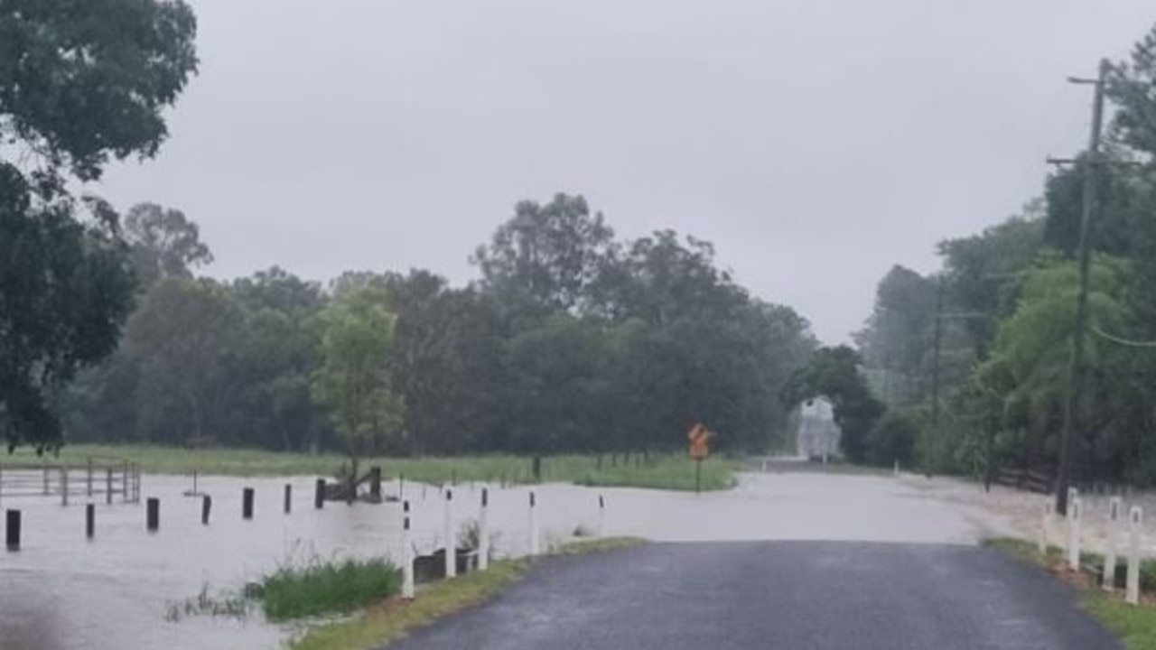
Further west, flood alerts have been issued for residents of Laidley and Forest Hill, between Ipswich and Toowoomba, as water continues to rise.
Queensland Fire and Emergency Service issued the Watch and Act alerts about 4.40am, advising flooding may occur in the townships and that residents in low lying areas are encouraged to enact their emergency plans.
Residents in the Western Downs town of Jandowae woke up on Tuesday morning to emergency services warnings of “dangerous flooding” and told by authorities to seek higher ground.
A watch and act alert has been issued for Jandowae by the Western Downs Regional Council as of 7.30am on Tuesday.
At 3am, Moreton Bay City Council issued an alert to Bray Park residents to prepare to leave.
“The Four Mile Creek water level gauge at John Bray Park is now at 3 metres and RISING. This is 2.8 metres ABOVE the usual creek level,” the alert read.
“Major flooding could occur if there is a further rise of 0.9 metres which could occur within 30 mins.”
It advised people in the following streets to prepare to leave:
• Irula St
• Danube Dr
• Durham Cr
• Embassy St
• Federation Dr
• Gympie Rd
• Paxton Ct
• Symphony Av
Alerts were also issued for potential flooding at Eatons Hill, Samford Village and Albany Creek.
A prepare to leave alert was also issued to residents on Wade Court at Lawnton where Todds Gully was four metres above the regular creek level.
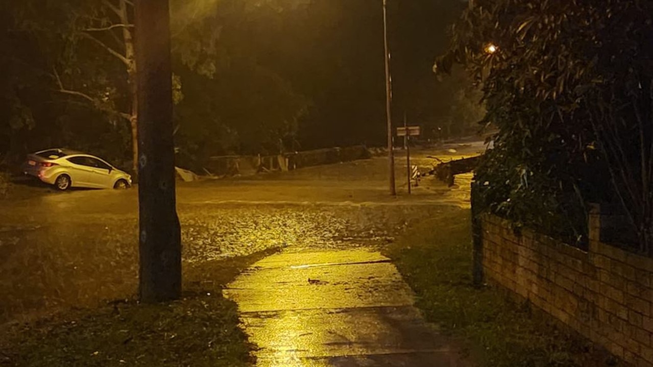
Mount Samson Road and Gympie Road at Bald Hills were closed in the early hours of the morning, with Moreton Bay City Council crews understood to be in the process of assessing and closing more roads.
At 3.30am, Moreton Bay Regional Council issued a Watch and Act alert for Albany Creek, where the South Pine River water gauge at Cash’s Crossing was 5.6 metres and rising.
At 4am, residents in Eatons Hill and Albany Creek were told to prepare to leave due to rising flood waters.
The streets affected include Birmingham St and Paringa Close at Eatons Hill, and Barwing Court, Kingfisher Street and Tanager Street at Albany Creek.
EMERGENCY ALERT for FOREST HILL as at 4.40am Tuesday, 30 Jan:https://t.co/70BymwKTBM
— Qld Fire & Emergency (@QldFES) January 29, 2024
EMERGENCY ALERT for LAIDLEY as at 4.30am Tuesday, 30 Jan:https://t.co/ZTzVlqKd5j
— Qld Fire & Emergency (@QldFES) January 29, 2024
“The South Pine River water level gauge at Birmingham Street, Eatons Hill is now at 4.1 metres and RISING. This is 4.1 metres ABOVE the usual creek level,” the alert read.
“Major flooding could occur if there is a further rise of 1.5 metres which could occur within 30 mins.
“You might need to leave if the flood gets worse. Do not expect emergency services to come to your door.”

The alert said based on current and predicted weather conditions, the following could occur:
– Flooding above ground floor level likely in some places.
– Major roads and rail lines may be underwater and inaccessible.
– Evacuation routes might be cut off. You could be stuck.
– Power, phones, internet and water might stop working.
– Public transport will be disrupted.
– Low-lying properties and some backyards can expect to be flooded above floor level.
– Sewerage and stormwater may overflow. Report to Unitywater.
-Power and water services are expected to be impacted.
Moreton Bay City Council posted at 4am that flood warnings were active across the region.
“We urge drivers to be cautious and expect disruption on the road today,” the post read.
“Youngs Crossing is closed. Areas of Brendale, Eatons Hill, Samford, Warner, Bald Hills, Arana Hills, Lawnton and Bunya are flooded.”
A commenter on the post said Samford Village was “inundated” and there was no way in or out.
On Tuesday morning, an Eatons Hill resident of over 30 years, Neville Collins, said he had never seen the South Pine River so high.
“The high watermark today is the highest I’ve seen since we’ve been here,” Mr Collins said.
“That rain last night, I have never seen such a large amount of rain in a short length of time since we’ve been here.
“There is a platypus viewing area out there which got half washed away in the last big flood, and it’s been roped off, I would suspect it’s probably gone now, this one might have knocked it over I think.”
Mr Hines said the Brisbane area has fallen out of the warning zone as the rain moves northward towards Sunshine Coast.
“We’re still seeing some areas of heavy rain and thunderstorms continuing into today, the trends that we’re expecting to see today as the heaviest rain thunderstorms move a bit northward,” he said.
“Brisbane in particular probably had its worst rainfall overnight last night … there will still be further showers and the chance of a storm around Brisbane particularly this afternoon and into tomorrow morning.
“But by the time we get to the end of the day on Wednesday, it looks like the majority of the rain, if not all the rain, really should have cleared out of Brisbane and then the second half of this week we get a much drier stretch of weather.”

Join the conversation

Why is it so cold? What about these winds? Your Qld weather questions answered
Multiple flights have been cancelled and temperatures have plummeted – so what does it all mean for Qld?
Read more

Strong winds, freezing temps as ‘cyclone bomb’ delivers parting shot
Wild winds have continued to smash South East Queensland, as icy blasts from the “cyclone bomb” hitting NSW and forcing the cancellation of multiple flights deliver more knock-on effects in the Sunshine State.
Read more