
Logan’s flood laws clash with state population growth strategy
State-backed growth zones southeast of Brisbane are under a strict council flood overlay, blocking even small builds and fuelling backlash from landowners fearing devaluation and exclusion.

QLD News
Don't miss out on the headlines from QLD News. Followed categories will be added to My News.
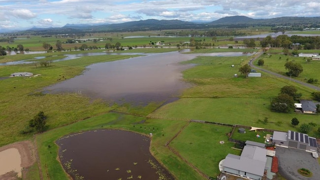
Suburbs earmarked to house more than 200,000 new residents in southeast Queensland’s population plan are now facing a building ban under Logan City Council’s flood controls.
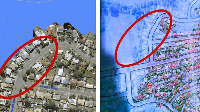
A controversial planning rule introduced under the council’s Temporary Local Planning Instrument (TLPI) has imposed a “High Flow Area” overlay across parts of Jimboomba, Logan Village, Meadowbrook, Cedar Grove and Beenleigh — blocking even minor works like carports and garden sheds.
The same suburbs are central to the state government’s Shaping SEQ 2023 strategy and have already received millions in public infrastructure investment.
But while the state promises growth, locals say the council is shutting the gate on development, sparking confusion, anger and warnings of plummeting land values.
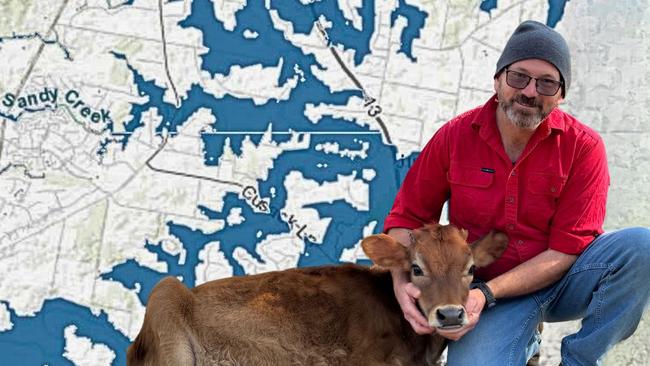
Munruben resident Benjamin Parkinson, who has led a year-long grassroots campaign against the policy, said the overlay had effectively frozen development across vast parts of Logan.
“These are supposed to be our future growth areas but instead, they’ve been turned into no-go zones,”
“Council and the state can’t promise growth and spend big on roads, rail and water upgrades, while simultaneously banning people from building on their own land,” he said.
“This isn’t just about flood risk, it’s about transparency, planning integrity and basic fairness.”
Mr Parkinson’s own attempt to build a raised, open-sided carport on his property, initially approved by council, was knocked back after the TLPI came into effect in early 2024.
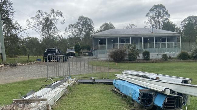
Even after submitting engineering plans and flood mitigation measures, his application was denied.
Residents claim the overlay appears to override existing planning law, including the Queensland Development Code and the State Planning Policy, both of which usually allow performance-based solutions.
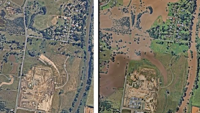
The “High Flow Area” is based on national flood plain management principles outlined in AIDR Guideline 7-3.
But residents argue Logan council has selectively applied the advice, ignoring companion Guideline 7-4 that allows more nuanced, risk-based development decisions based on vulnerability and land use.
“High Flow is a Logan-specific term that doesn’t exist in other council areas or any state or federal flood framework,” Mr Parkinson said.
“It lumps together different levels of vulnerability and bans everything, even when engineering controls could safely allow construction.
“Responsible flood planning is essential but what’s happening here isn’t planning, it’s exclusion, without explanation.”
The policy’s rollout has sparked speculation in community forums that zoning changes and restrictions may be clearing the path for major redevelopment projects, favouring large developers at the expense of existing landholders.
Town planner Alexander Steffan said the High Flow overlay, unique to Logan, was designed to identify areas subject to high velocity flood events which would potentially cause a lot of damage, quickly.
He said the majority of local councils have similar overlays but Logan’s was less flexible.
“Logan’s overall outcome for the overlay code explicitly states that buildings or structures cannot be located in a high flow area,” Mr Steffan said.
“This aims to put fewer buildings and people at risk of being affected by a flood, but it does not allow for any alternative outcomes such as building on structurally engineered piers capable of withstanding any flood waters.
“Having a ‘you can’t do this’ in an overall outcome of a planning scheme code completely removes the ability to have a conversation about the outcome which contradicts the intention of Queensland’s performance-based planning system. It should be revisited – again”.
The Logan Plan 2025, currently in its final consultation phase, is expected to permanently incorporate the High Flow Area overlay.
But many, including Mr Parkinson, are demanding a full review before that happens.
They are rallying against the overlay, with an e-petition calling for its removal now live on the council’s website.
The petition closes on May 30 and claims the overlay is not a genuine flood hazard map and is not backed by consistent risk data.
In a written response, Logan City Council said the High Flow Area designation was designed to solve serious safety concerns and was part of a broader flood management framework, not a standalone rule.
“High flow areas are high hazard areas where significant, deeper, faster flow of flood water occurs and where buildings are vulnerable to structural damage or failure from that flood water,” the council said.
“Lives may also be at risk in these areas.
“We need to safely manage our city’s growth and development in terms of flood risk.
“The TLPI moved away from [a blanket policy] by introducing the risk-based approach that considers how vulnerable different areas are to different flood events and characteristics.”
The council said its planning decisions were made on a case-by-case basis with each development assessed according to the applicable parts of the city’s planning policy, based on the type of development and the area.
Logan council said full public consultation would be held before the overlay was finalised in the Logan Plan.
More Coverage
Originally published as Logan’s flood laws clash with state population growth strategy
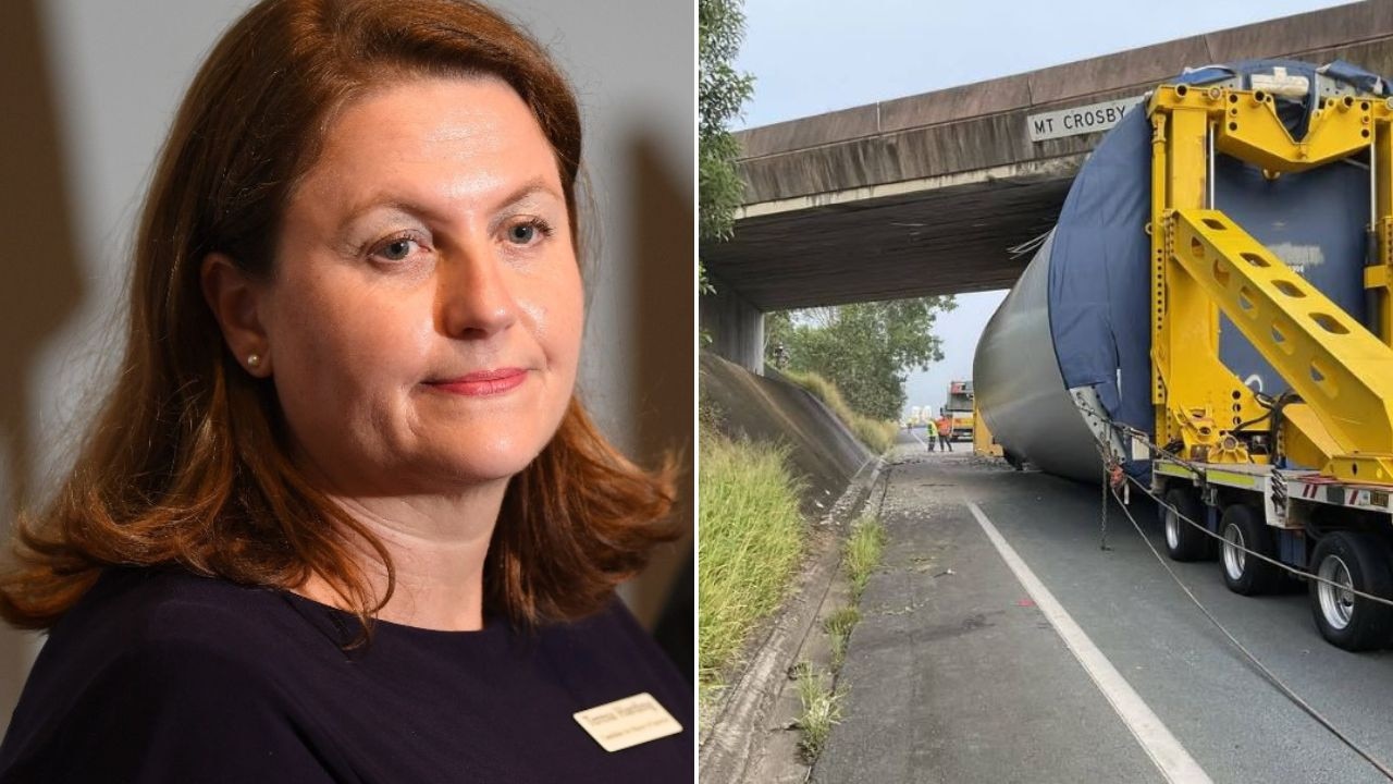
Fears highway overpass could be closed for a year after crash nightmare
The wind turbine that blocked a major arterial southwest of Brisbane has been cleared but Ipswich Mayor Teresa Harding says residents fear the Mt Crosby Rd overpass could be closed for a year.
SEQ lashed with unrelenting rain as storm threat looms
South East Queensland residents have woken to another wet Saturday, with the chance of isolated storms, in a frustrating pattern of weather for the region. SEE THE FIGURES