Mapped: Proposed Whitsunday mountain bike network revealed
Almost 200km of new trails have been included in the detailed concept plan.
Whitsunday
Don't miss out on the headlines from Whitsunday. Followed categories will be added to My News.
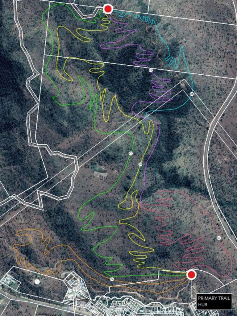
A concept plan for a new mountain bike trail network has been revealed, giving a glimpse into where paths could be built under the proposed project.
Whitsunday Regional Council engaged Dirt Art to develop the concept plan, which councillors resolved to send out to the community and stakeholders for consultation at the last council meeting of the year.
A feedback report will be prepared for the councillors.
Questions were raised about risk and insurance during the council meeting, but council’s development services director Neil McGaffin said it was a work in progress.
Division 5 Councillor Gary Simpson stressed his support for the project.
“I’ve been told this is the fastest growing pastime in the world so if the rest of the world can get away with it with their liability insurance surely we can, I don’t want to miss this opportunity,” he said.
More stories:
Money on offer for region’s next big tourism adventure
Proserpine Mill’s sweet welcome to new apprentices
Tourism Whitsundays to attract competitive business events
The concept plan suggested the popularity of mountain bike riding had grown exponentially over the past several years, but formal mountain bike infrastructure had failed to keep up with demand in Australia.
However, developments such as Blue Derby, Maydena Bike Park and Thredbo Resort were bringing tens of thousands of visiting riders to mountain bike destinations each year and delivering tens of millions of dollars in annual economic impact.
The Whitsundays has been identified as a strong potential area for development for multiple reasons, including its proximity to major tourist centres, terrain, elevation, climate and soil type.
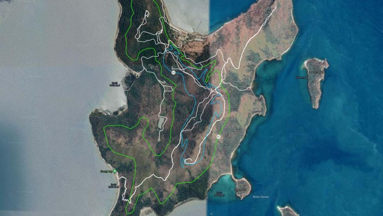
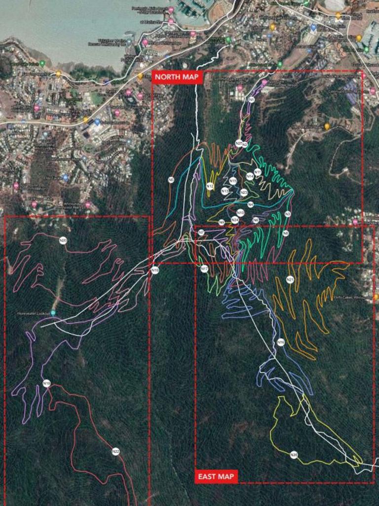
The plan proposed a total of 183km new trails across the region, with a primary trail concept developed for land behind Airlie Beach and South Molle Island.
A secondary trail concept covers Collinsville, Bowen, Dingo Beach and Lake Proserpine.
According to the concept plan, the project would have an indirect economic impact of more than $6.7m in the first year with 20,000 ride days/visitors expected.
Over three years, the trail network was expected to have a direct and indirect economic impact of $17.1m.
The project is expected to create 10 new jobs during construction and 15 full-time equivalent jobs when operational across new mountain-bike specific businesses.
“Mountain biking has been driving visitation into small regional areas for several years now, though the focus on mountain biking as an effective driver of tourism and economic development is relatively new,” the report reads.
“Destinations such as Blue Derby (Tasmania) have proven that small towns can be reinvigorated with mountain biking spearheading this change.”
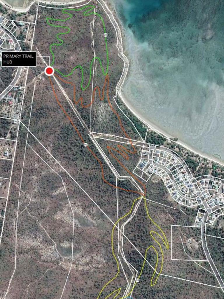
The plan included concept maps of where proposed trails could be located in each location.
There are 26 proposed trails for Airlie Beach ranging from beginner-friendly loops to trails for advanced riders.
They range in distance from 600m to 12km.
The plan includes two proposed trails for South Molle Island, one for Bowen, six for Collinsville, four for Dingo Beach and five for Lake Proserpine.
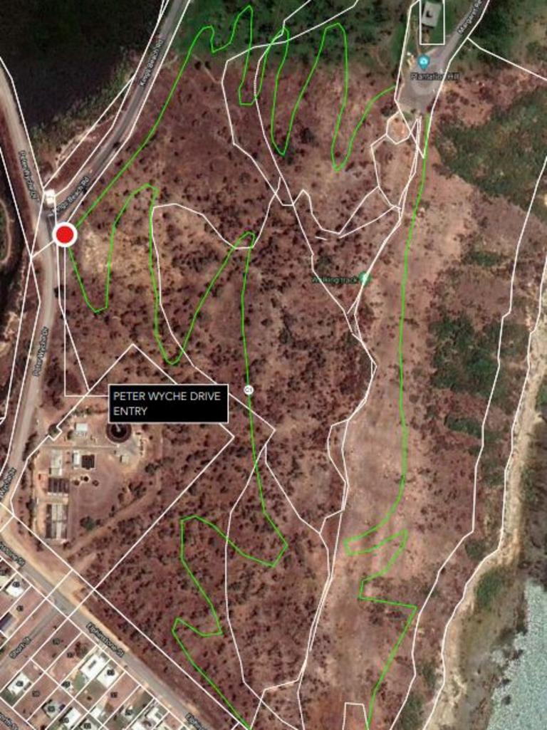
It was suggested no existing trails, such as the Conway Circuit, be incorporated in the new network.
Dirt Art indicated the trails would need detailed design, including route flagging on the ground, and approvals for a Queensland Parks and Wildlife Service assessment, a development application and geotechnical assessment would be needed.
The concept plan stated if a large trail construction company was used to do the trail works, it could be finished within 12 months after the project was started.
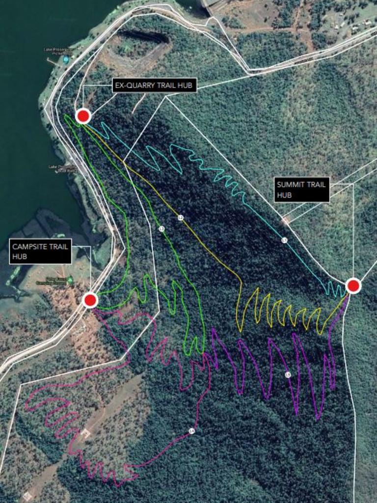
“The Whitsundays MTB Project offers a significant opportunity to develop a mountain bike destination of national and international significance,” the plan reads.
“Combining a large, world-class network of trails, with the world-renowned reef and coastline of the Whitsundays will prove extremely compelling to riders from across Australia and around the world.”
The plan would now be sent out for consultation with a feedback report to be prepared for Whitsunday councillors.
