
East Point fishing spot access could close to protect turtles and dunes
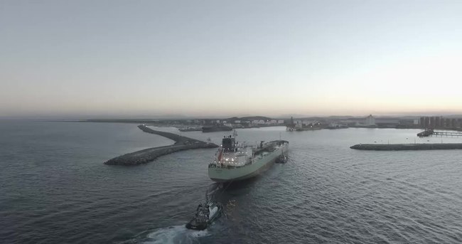
The highly contentious East Point detour that preserved access to the popular Pioneer River mouth has been shut with immediate effect ‘until further notice’.
Mackay
Don't miss out on the headlines from Mackay. Followed categories will be added to My News.
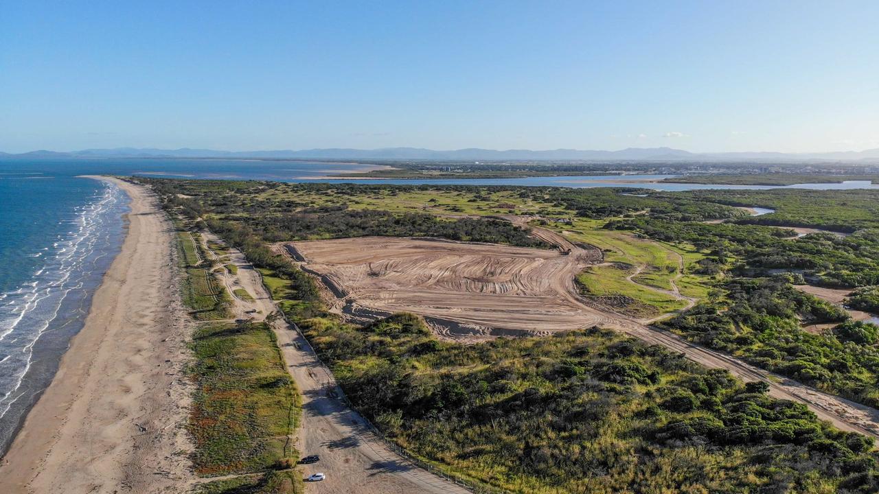
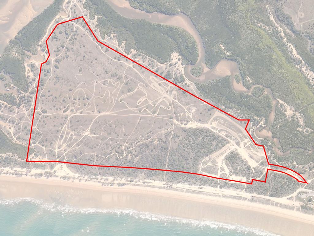
The East Point access detour to the mouth of the Pioneer River will remain off-limits after vandals destroyed 500m of fencing at the weekend.
Mackay Regional Council has shut the detour route until further notice after the damage to fencing was discovered.
The council, in a statement, said the fencing had been “needlessly pulled down onto the track and then driven over” which damaged the contractor’s property.
“The closure, at the end of the constructed section of Dunes Boulevard, will be
implemented immediately so the damaged fencing can be retrieved,” the statement read.
“About 300m of fencing was damaged on the beach side of the track at the start of
the road, and a further 200m was pushed over on the private land side at the end
of the road.
“In addition, there were two to three access points created by the vandals on each side
of the road along the fence line.”
The fenced-off detour access was put in place after a council vote on July 13 which allowed vehicle access to continue to the popular fishing spot.
After the councillors delayed a vote on two separate occasions, but council officers continued to recommend closing East Point access, it seemed a foregone conclusion the fishing spot would be closed.
But councillor Laurence Bonaventura offered an alternate option, described as a “middle-ground solution”.
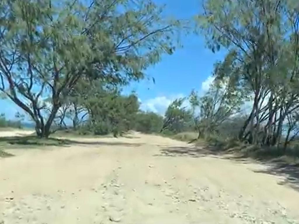
The former access point was closed to prevent further damage to the environment.
In its place was the new track off Dunes Boulevard to link the existing track to East Point.
This was considered a temporary measure while the council works on a more long-term solution.
Councillor Alison Jones, who described herself as a “light green, greenie”, said while the current access needed to be blocked, she would only have approved it with an alternative access option.
She said this was “the only option that seems to work with council and the developer”, and she would vote on behalf of Mackay region families and accept the motion.
The councillors voted unanimously in favour of the alternate access point.
Mayor Greg Williamson said the community’s historical connection with the mouth of the Pioneer River and the requirement in the developer’s application to maintain access to East Point, meant the alternate route was a good result for all parties for the time being.
The council’s preferred option is to build a formed gravel road.
“Council has a duty of care as Trustee of the Environmental Reserve, but also acknowledges the existing vehicle track is popular with anglers accessing East Point and the four-wheel drive enthusiasts,” Mr Williamson said.
“This informal access has been in place for many decades.”
A decision on closing vehicle access to the popular Pioneer River mouth is imminent.
Despite councillors voting to delay the decision for further consultation, the recommendation remains to restrict vehicle access to protect turtles and dunes at East Point.
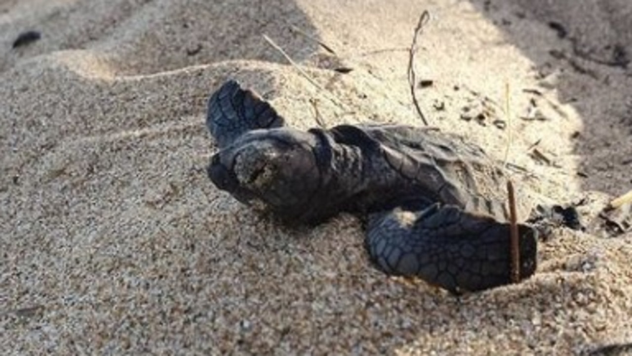
The area is regularly used for land-based fishing and coastal recreation but Mackay Regional Council officers say vehicle access has “caused significant damage to the foredune, impacting on coastal flora and fauna, turtle nesting sites and the ecological integrity of this area”.
An initial plan, floated at an April 27 council meeting and left on the table to get more information, related to State Government conditions on the $250m seaside Dunes Estate development and complaints from new residents.

At that meeting, Cr Justin Englert moved the motion to delay a decision so councillors would have more time to ensure all alternatives were explored.
He said he was still awaiting answers to questions he raised and suggested some of the evidence used to describe the environmental damage appeared “anecdotal”.
A council briefing was received on May 18 to “identify any further information required” before a decision could be made.
“From this briefing, it was identified that more information was required with such information including liaison with the applicant as well as council staff,” new council documents state.
“As such it is being recommended that the matter continue to lay on the table pending receipt of the required information, with this information expected during June to enable the item to be reconsidered by council during July.”
The matter is listed again for consideration on July 13.
Popular Pioneer River mouth fishing spot closure stalled
The State Government, as part of its approvals for the East Point development, required the company to revegetate the foreshore reserve that ran adjacent to the estate, council documents stated.
“To do this, the use of this area for vehicle traffic must cease,” Mackay Regional Council Development Services director Aletta Nugent wrote in council documents.
“The option of doing nothing is not considered appropriate as it will result in the continuing and worsening degradation of the foredune, with associated environmental impacts.
“This will also prevent the developer from complying with their obligations to revegetate this area and lead to ongoing impacts from noise and dust on the residents of the Dunes Estate.”
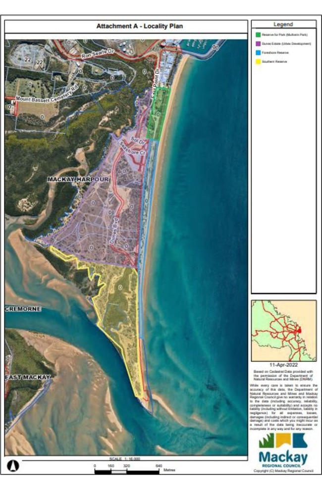
The council noted a boat ramp had been foreshadowed for the southern reserve which is exclusive Native Title land.
So alternate access would be considered in the future but council officers recommend, as Trustees of the Foreshore Reserve, determined no other options beyond closure would “prevent the ongoing degradation to the southern section of the Foreshore Reserve, which is having a significant detrimental impact on turtle nesting sites as well as the stability of the remaining foreshore dunal system”.
The move would not prevent public pedestrian access to the beach and East Point.
“The Dunes Estate already incorporates a pedestrian beach access point and more will be constructed as the development progresses, along with a pedestrian footpath along the foreshore,” council documents state.
“Pedestrian access along the beach will be uninterrupted by the closure to vehicle access along the Foreshore Reserve.
“There are already reports of safety concerns arising from interactions between pedestrians using this area and vehicles travelling through the Foreshore Reserve, and the proposed closure of the reserve to vehicle traffic will address this issue.”
The council plans to spend $28,510 to install a road closed barrier across the access track and install other temporary and permanent signs.
Backlash was expected from the move which the council plans to mitigate through information about reaching the destination on foot.
“There is a risk that some community members will be aggrieved by the closure of the Foreshore Reserve to vehicle traffic, and that it will be seen by local residents as the taking away of public access to East Point,” the report read.
“There is a risk that people may seek to create new unlawful tracks to bypass the closure, including through damaging council infrastructure installed to implement the closure of vehicle access to the Foreshore Reserve.
“To mitigate this risk, council will need to invest in appropriately designed and constructed barriers, and be responsive to moving or repairing infrastructure to prevent unlawful accesses being created.”
“The community’s historical connection and practices relating to driving along the Foreshore Reserve to access East Point and the river mouth are acknowledged,” Ms Nugent said. “However, this practice can no longer be supported given the significant environmental damage that is being caused by this practice, increased risk arising from higher numbers of pedestrians accessing the beach as the development progresses and the inconsistency of vehicle access with the purpose of the reserve.
“The closure and revegetation of this area will be of long-term benefit to the amenity of the area, shoreline stability and the natural environment.
“Pedestrian access to East Point will remain, and will be enhanced as the adjacent development continues.
“Formal vehicle access that does not have this same level of environmental impact will be established at a point in the future.
“It is therefore recommended that council endorse the implementation of measures to prevent vehicle access within the Foreshore Reserve.”
Mayor Greg Williamson said the council had been caught between a “rock and a hard place” on the issue.
He acknowledged that while fishing at East Point had been going for decades, it had caused “a lot of destruction of the environment” and despite the delay of a decision from council there may be no alternative options available.
“There is no road there, it is a reserve for environmental purposes,” Mr Williamson said.
“The public have made that road. There is no road access in the planning scheme.
“It’s up to us to stop the road access, that’s all we can do.”
He said that as part of the proposed development, access to East Point would be constructed but it could be some time before that was ready.
Do you have thoughts on this decision? Write a letter to the editor by emailing mackay@news.com.au
More Coverage

Originally published as East Point fishing spot access could close to protect turtles and dunes
Join the conversation

Dad charged with toddler murder heads to supreme court
A murder charge against a Qld father accused of causing the death of his youngest daughter has been committed to the supreme court.
Read more

Mackay cricket: What we’ve learned so far
With three rounds of one-day cricket in the books for Mackay first grade, let’s take a look at what we’ve learned about each team so far.
Read more

Sex disease-spreading charges against alleged rapist dropped
A Queensland “gym bro” is no longer accused of knowingly spreading a sexually transmitted infection to multiple women he met online. However, he still faces a raft of serious allegations including rape and stalking.
Read more

REVEALED: The best rugby league clubs in regional Queensland
Rugby league clubs from Townsville, Mackay, Rockhampton, Cairns, the Sunshine Coast, Toowoomba and Mount Isa feature in our list of the best local clubs in regional Queensland. Find out which clubs from your local comp made the cut.
Read more

Puppy with slit throat left for dead beside major Qld highway
A rescue group is seeking help after a puppy was found on the side of a Queensland motorway with a slashed throat, following a “deliberate” act. WARNING: Distressing
Read more
MPs unleash on ‘dodgy Dave’ over funding
Armed with two long lists full of what they say will be cut if the LNP is elected, two Labor MPs have called out “dodgy” David Crisafulli, saying he hasn’t given enough details on how the party will fund their promises.
Read more