
‘Life-threatening’: Fears as downpour continues, causing floods, landslides
Emergency flood alerts were issued for parts of Queensland’s south Tuesday evening, with residents told to move to higher ground.
QLD News
Don't miss out on the headlines from QLD News. Followed categories will be added to My News.
Emergency flood alerts were issued for parts of Queensland’s south Tuesday night, with Beaudesert and Leyburn residents told to collect their belongings, warn their neighbours and move to higher ground.
It came ahead of another massive rain band moving across the region, with a thunderstorm warning for damaging winds and heavy rainfall issued for people in parts of Central Highlands and Coalfields, Wide Bay and Burnett, Darling Downs and Granite Belt and the southeast coast forecast districts.
The massive rainband had passed much of the region by midnight but the tail end of it continued to pass over the Gold Coast as it headed east.
An updated thunderstorm warning for heavy rainfall was issued at 11.37pm for people in parts of Central Highlands and Coalfields, Wide Bay and Burnett and Darling Downs and Granite Belt forecast districts.
“Severe thunderstorms are likely to produce heavy rainfall that may lead to flash flooding in the warning area over the next several hours,” the warning said.
“Locations which may be affected include Cherbourg, Gayndah, Murgon, Mundubbera, Biggenden and Eidsvold.”
Earlier, an emergency alert for Leyburn was issued by the Southern Downs Local Disaster Management Group about 8.45pm Tuesday.
It advised that the Canal Creek at Leyburn was likely to reach a minor to moderate flood level in the coming hours due to rainfall.
“Residents are advised to secure their belongings, warn their neighbours about the potential for flooding and move to higher ground if in a low-lying area,” it said.
It followed an earlier emergency alert issued at 6.55pm by the Scenic Rim Local Disaster Management Group for residents of Beaudesert.
It advised the Logan River at Beaudesert had reached the major flood level due to heavy rainfall.
“Properties in the area may experience flooding. Residents in the area have been asked to secure their belongings, warn their neighbours and move to higher ground,” it said.
A major flood warning has been issued for the Logan River and moderate flood warning for the Albert River.
The BoM had also issued major flood warnings for Bremer River, Warrill and Laidley Creeks, Macintyre River, Paroo River and Bulloo River.
Earlier, Gold Coast City Council issued a “watch and act” emergency alert to northern Gold Coast residents as heavy rainfall continues to pose a flooding risk to the city.
Shortly after 3.30pm, thousands of residents in areas including Pimpama, Ormeau and Jacobs Well received text messages warning them of the possibility that they may need to move to higher ground if conditions continue to deteriorate.
Council also said areas such as Wongawallan may be affected.
Since 9am today, the highest rainfall totals have been on the Gold Coast with Upper Springbrook recording 108mm followed by Nerang with 79mm, Molendinar (69mm) and Helensvale (69).
Further west, areas around Gatton recorded up to 46mm while the wettest Brisbane suburbs have been Forest Lake with 39mm and Chandler with 32mm.
Meanwhile, a major flooding warning has been issued for the Logan River in the Scenic Rim, expected to impact areas including Beaudesert and Rathdowney.
At 3pm this afternoon the Bureau of Meteorology updated their flood warnings to include the areas on the Logan River already impacted by continuous heavy rainfall.
Earlier, severe weather warnings were still active for much of the Southeast Corner and are expected to be ongoing due to a rainband coming from western QLD.
Meteorologist James Thompson said the heavy rainfall would continue overnight and into Wednesday morning.
“The rainband is expected to continue until Wednesday where it will clear off the coast and be replaced by drier and more settled conditions” James said.
The damaging and potentially dangerous weather will continue through the week for other northern regions.
Severe thunderstorms with heavy rainfall and damaging wind gusts are possible about the southeast interior today, and heavy rainfall is also a risk with storms across the Northwest.
The Gold Coast has dodged a bullet in the extraordinary weather cell slamming Queensland, but Mayor Tom Tate has warned it’s not over yet.
More than 100mm is predicted to fall on parts of the Gold Coast between Tuesday afternoon and Wednesday morning, but with small tides and a lack of strong wind, it is hoped the coast will be spared widespread damage.
However Cr Tate urged people to remain vigilant until the weather clears.
“It’s not over yet,” he said.
“Flash flooding is still a cause for concern and we’ve already seen people losing their cars.
“You’re endangering not only yourself but also the people coming to rescue you.”
Three evacuation centres have been placed on standby but so far there has been no need to activate them.
Thousands of properties in southeast Queensland have been left without power, including more than 2000 at Yarrabilba in Logan.
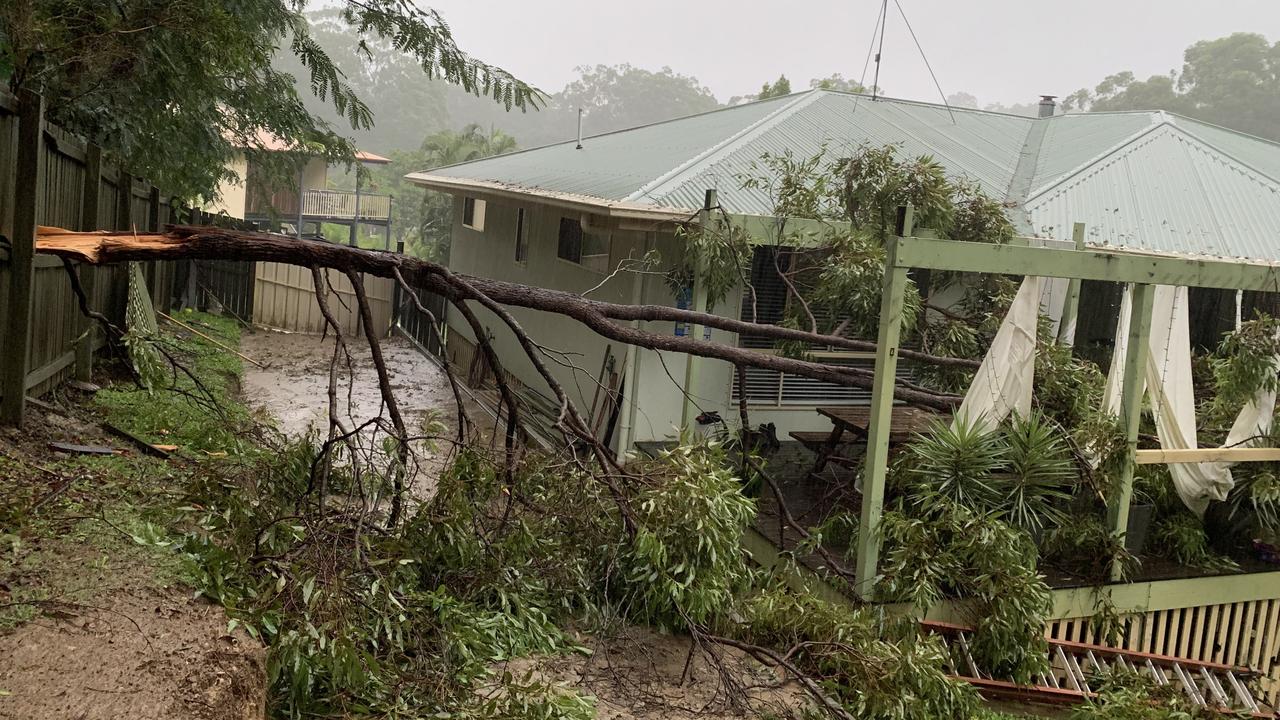
Numerous power lines have been brought down by waterlogged trees that have fallen.
Energex spokesman Danny Donald said crews had been having trouble accessing fallen power lines due to flooding.
Mr Donald urged the community to have patience, saying Energex was aiming to have the issue fixed by 5.30pm.
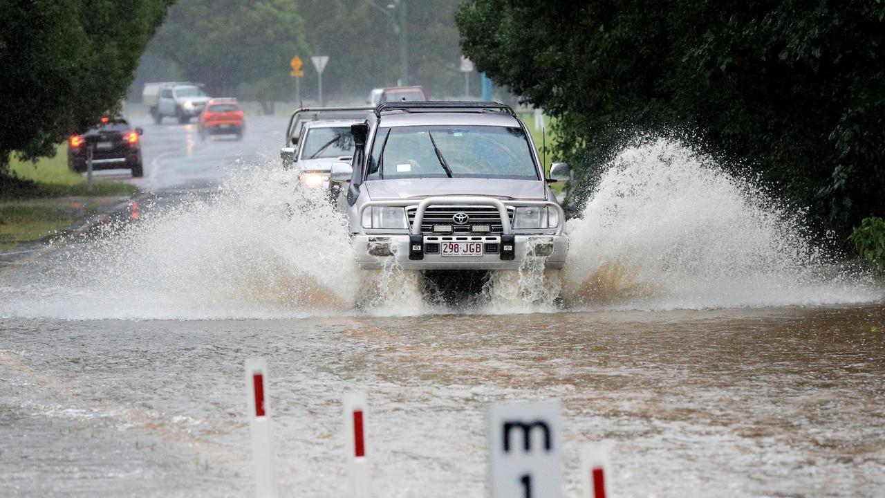
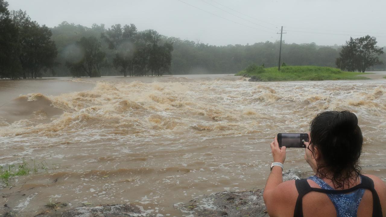
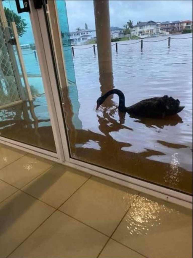
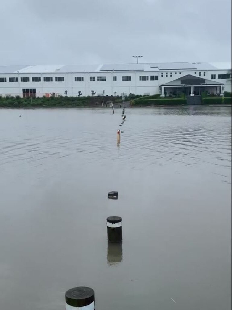
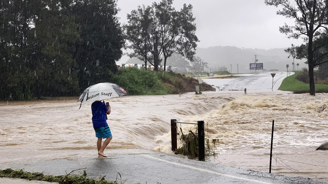
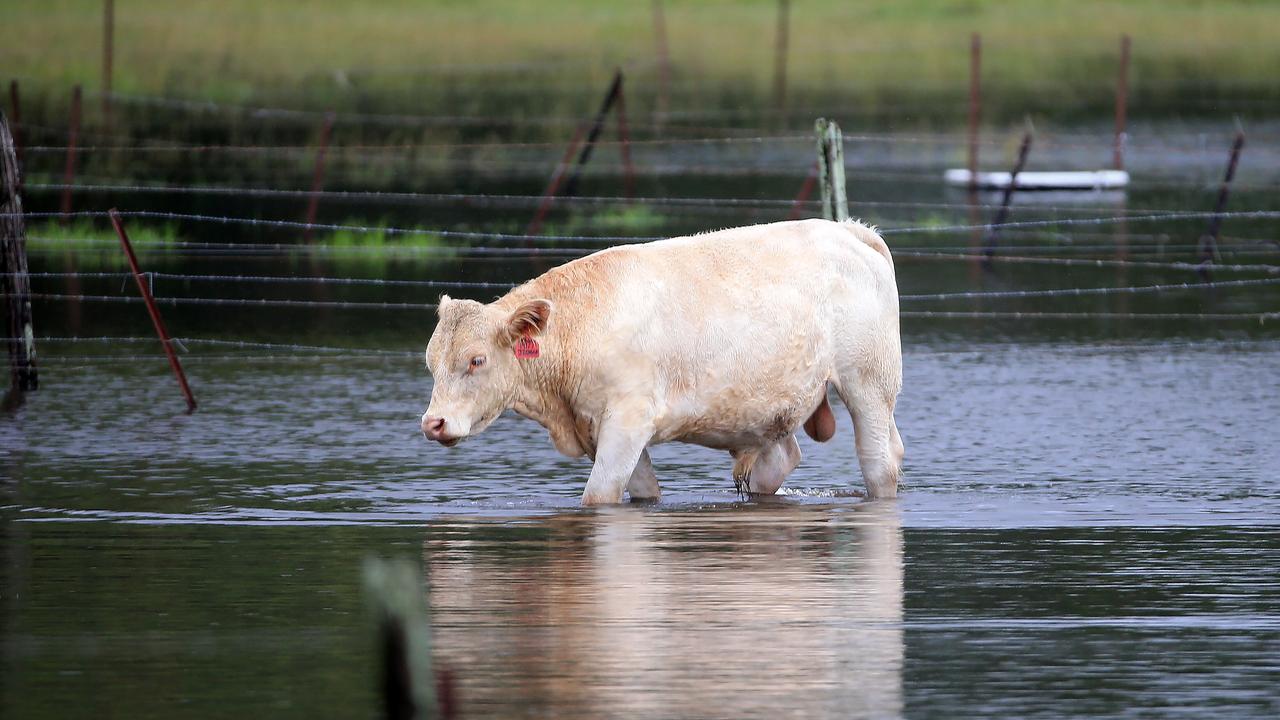
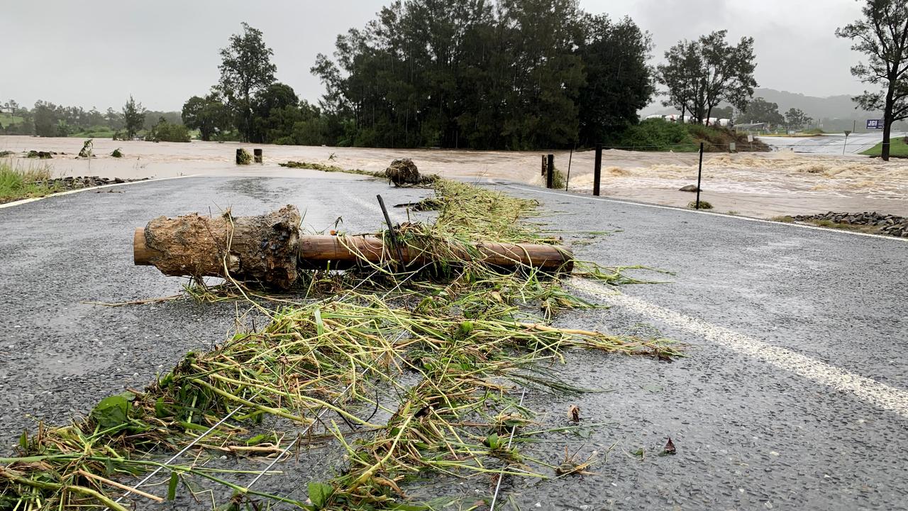
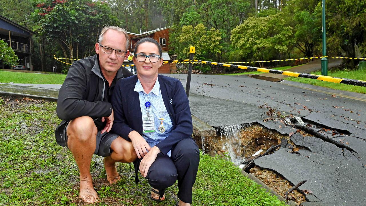
Parts of southeast Queensland have recorded almost half a year’s worth of rain in two days as the relentless deluge continues, with fears that even more rain could cause flash flooding and potentially deadline landslips.
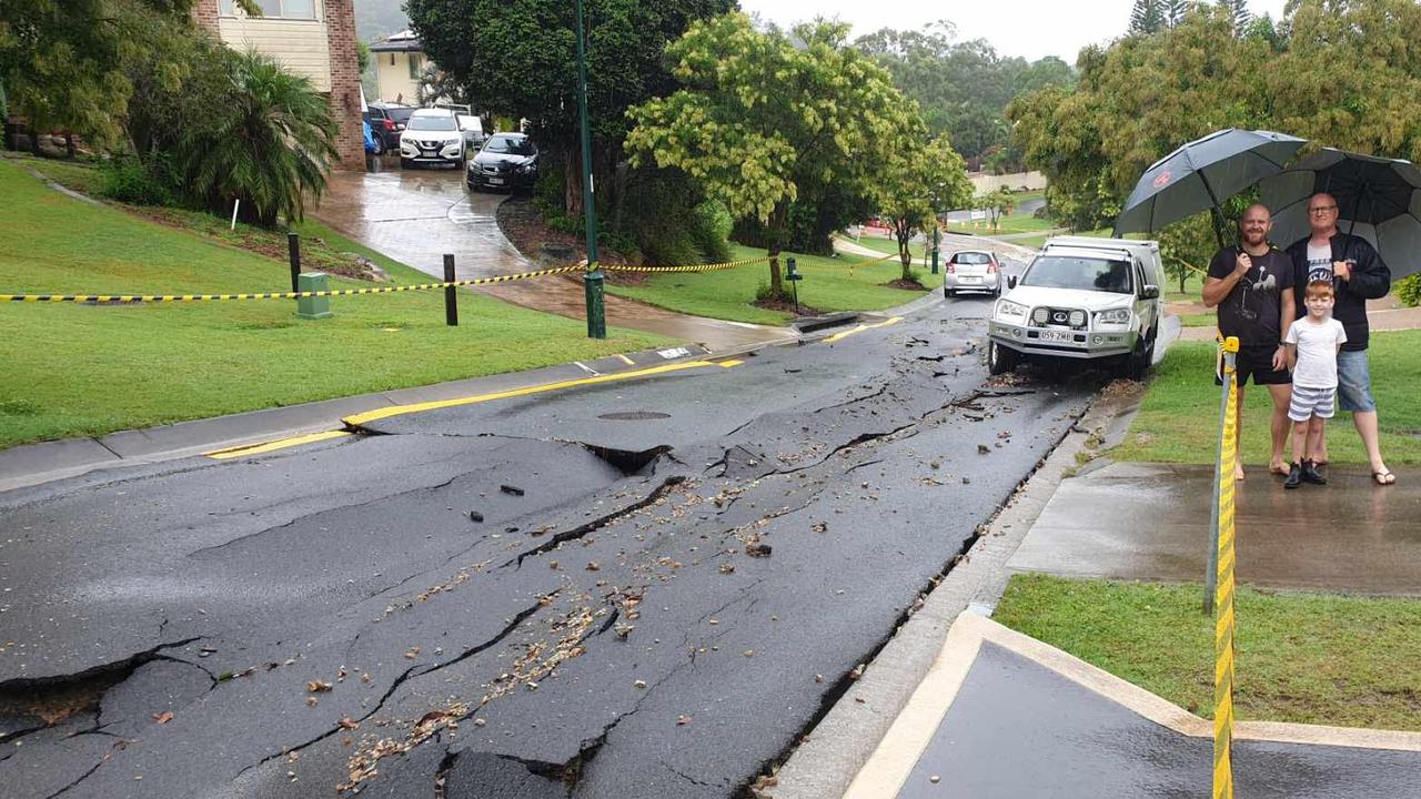
From Birdsville in the west to the southeast coast, hundreds of roads were cut, including the Cunningham Highway, and properties isolated, while homes in the Gold Coast hinterland were evacuated as torrential rain sent landslides and waterfalls tumbling down hillsides.
Rainfall records that have stood for more than a century in some places have been smashed.
In the 24 hours to 9am, North Tamborine recorded 242mm, with more than 550mm recorded in the past two days.
Nearby Mount Tamborine, Upper Springbrook and Hotham Creek all recorded over 200mm in the past 24 hours, with two-day tallies of well over 400mm.
North Stradbroke Island also recorded more than 200mm yesterday.
Further west, Stanthorpe recorded its wettest March day in more than a century, while Applethorpe set a new March daily rainfall record with 86mm.
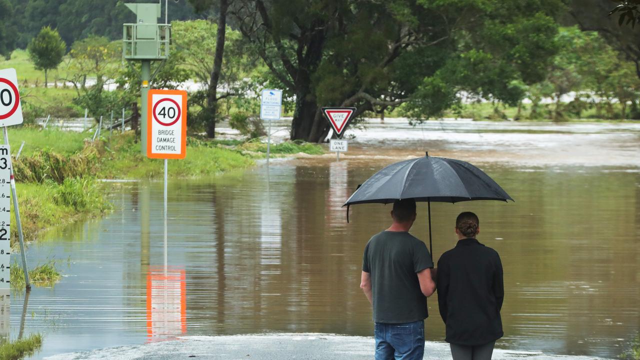
Flooding is predicted for Beaudesert on Tuesday afternoon, but it is expected to fall well short of the levels seen in the wake of Cyclone Debbie four years ago.
Springbrook has borne the brunt of Queensland’s heavy weather over the past week with 397mm of recorded rainfall. North Tamborine closely followed with 382mm recorded rainfall, Worongary Creek 369mm, Bonogin 364mm, Mount Tamborine 349mm, Clearview 361mm, Possum Creek 342mm, Oxenford Weir 331mm, Tallebudgera Creek Road 318mm and Molendinar being hit with 314mm.
James Thompson from the Bureau of Meteorology said Brisbane could anywhere between 35-60mm of rainfall today.
“We do have the risk of some severe storms moving through tonight, so that is something to watch out for, because it can lead to even higher rainfall totals.”
A major flood warning has been issued for the Logan River at Beaudesert after it reached 7.32 metres and rising.
The river level is expected to exceed the major flood level (8.30m) this morning as heavy rainfall continues.
Warnings of moderate flooding in the Albert River have also been issued, and higher levels are likely to occur as heavy rainfall continues throughout the catchment.
The Alert River at Wolffdene currently stands at 6.0 metres and rising, and the Bureau of Meteorology predict that it may exceed the moderate flood level (8.0m) later today as rainfall continues.
Premier Annastacia Palaszczuk said 12 state schools were closed, along with six independent schools.
She said 78 homes in the Moreton district were being inspected for damage and up to 40 in Shailer Park.
“On the Gold Coast, four houses have been evacuated due to the risk of landslide,” she told Parliament this morning.
The Premier said supplies to the southeast’s dams had increased to 59.8 per cent.
“These past three days, much of southeast and western Queensland has been subject to an extreme weather event: a rain bomb that will continue for at least another day,” she said.
A severe weather warning was updated this morning, with forecasts of life-threatening conditions, particularly in relation to landslides in areas of steep terrain.
The warning, issued at 4.30am, forecasts widespread heavy rain and thunderstorms across the south of the state today and overnight into Wednesday.
It says flash flooding is likely about the Darling Downs, Granite Belt and southeast coast.
Areas already hit hard by big falls offer serious risk of life-threatening landslips in steep terrain.
The Bureau warns of six-hour totals of between 100 and 150mm of rain, with the possibility of thunderstorms.
Flash flooding is expected further west in the Maranoa and Warrego districts, with rainfall of up to 70mm in six hours, with even heavier falls in some localised areas.
PHOTOS: SOUTHEAST QLD DEVASTATED BY WILD WEATHER
The at-risk locations, stretching thousands of kilometres across the state, included Warwick, the Gold Coast, Toowoomba, Brisbane, Dalby, Maroochydore, Roma, Charleville, Stanthorpe, Goondiwindi and Ipswich.
A separate Flood Watch is current for southern parts of Queensland from the South Australian border to Queensland’s southeast coast.
Locations which may be affected include Brisbane, Ipswich, Gold Coast, Toowoomba, Warwick, Stanthorpe, Kingaroy, Dalby, Goondiwindi, Roma, Charleville, St George, Cunnamulla, Quilpie and Thargomindah.
Premier Annastacia Palaszczuk earlier pleaded for Queenslanders to stay off the roads.
“We want everyone to be on alert over the next 24 hours,” she said Monday afternoon.
Emergency Services Minister Mark Ryan said Queenslanders needed to be prepared for more wet weather.
“(It) will give rise to flash flooding in areas, it will give rise to the potential for landslides,” he said.
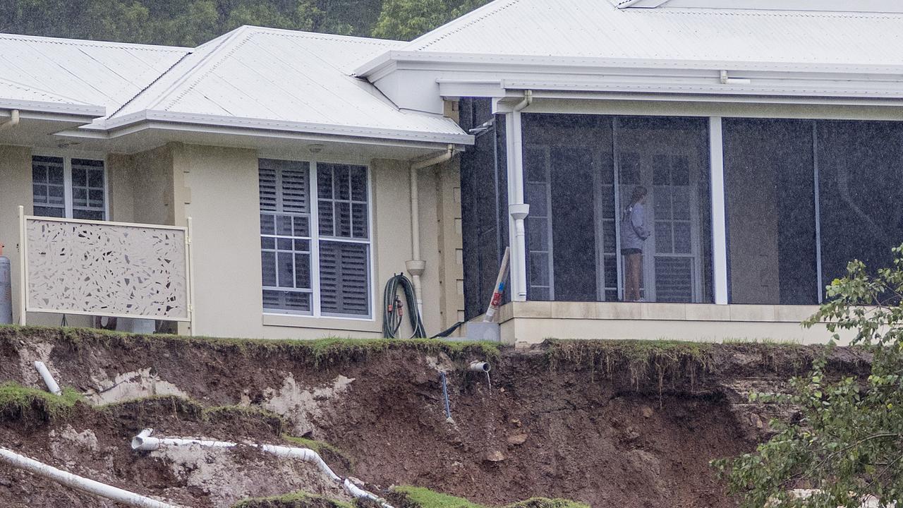
At Wongawallan, a rural enclave halfway between the western Gold Coast and Mt Tamborine, a mudslide carved out a precarious cliff underneath a home, with debris wiping out part of the front fence.
Meanwhile, at Mudgeeraba, a woman has been left heartbroken after her home was inundated with water as ceilings collapsed under the heavy rain.
“The water came down at such a volume, it came under the iron and then got between the ceiling and has just collapsed the whole ceiling,” the woman said.
“It’s so heartbreaking, you just feel so helpless.”
Among the hardest hit areas by rain yesterday were North Stradbroke Island which received 138mm between 9am and 9.20pm, Carbrook with 132mm and North Tamborine with 116mm in the same time.
On Sunday, some communities recorded more than 200mm in the space of 24 hours, leaving creeks and rivers swollen with raging torrents and those in flood-prone areas feared the worst.
Bureau meteorologist Rosa Hoff said while the current coastal convergence causing the downpour in the southeast is weakening, a new system from the west will hit in coming days.
“We have some coastal convergence thanks to a trough that is lying along the coastal fringe through today, which is what has been bringing the significant totals to the southeast coast,” she said.
“But we also have a trough moving into southwestern Queensland which will be increasing the rainfall tomorrow and in the west today.”
Gold Coast Mayor Tom Tate yesterday said the city had so far “dodged a bullet”, thanks in part to the rainfall not coinciding with significant high tides.
Since Saturday, RACQ has received 150 claims due to the wild weather.
A total of 119 of those claims were for property damages and the remaining 31 were for motor vehicles. RACQ spokeswoman Kirsty Clinton said that with more wet weather predicted, families should discuss emergency plans.
The SES had received 408 calls for assistance, with most of those coming from the Gold Coast and Brisbane.
The wild weather also saw thousands of homes and businesses lose power.
More than 3000 homes and businesses were without power across the southeast at about 6.30pm, mainly due to down powerlines. The worst hit areas were Logan and Brisbane, with power restored to most by 11pm.
At about 10.30pm more than 1000 Sunshine Coast homes and businesses were without power but Energex was working to restore it.
More than 50mm of rain is forecast across much of the southeast today with clear skies expected on Thursday.
More Coverage


Originally published as ‘Life-threatening’: Fears as downpour continues, causing floods, landslides
Join the conversation

Protests and power struggles: Inside the rise of the CFMEU
Love it or hate it, the CFMEU wields power right across Queensland. This is the story of its rise. SPECIAL REPORT
Read more

‘Pull your heads in’: Fury over Mt Coot-tha’s ‘nightmare’ Games plan
Brisbane’s latest Olympic Games transformation – a Mt Coot-tha redevelopment – has divided opinion. HAVE YOUR SAY
Read more

These people made Qld what it is today, so where are they now?
They’re our shopping centre owners, development titans and business entrepreneurs – and they all have one thing in common. SEE THE LIST
Read more

Traffic chaos as snap CFMEU protests shut down CBD streets
Multiple intersections across the Brisbane CBD are blocked and there are major delays as the militant CFMEU stages pop-up protests over yesterday’s High Court decision.
Read more

Lord Mayor defends controversial rollout of green bins
Brisbane Lord Mayor Adrian Schrinner has defended the rollout of green “garden waste” bins.
Read more

Man fights for life after accident in Brisbane’s north
A man has been rushed to the Royal Brisbane and Women’s Hospital after sustaining life-threatening head injuries in an accident at Nundah this morning.
Read more