
Roads turn to raging torrents, motorists rescued
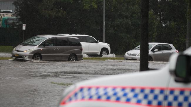
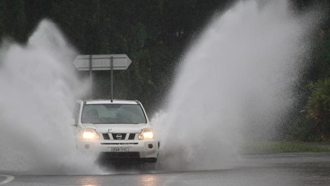
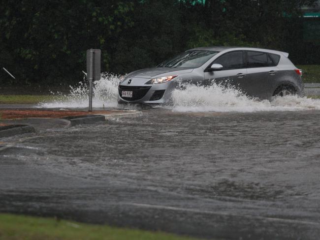
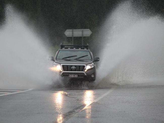
Chaotic scenes have unfolded in southeast Queensland on Sunday as torrential rain and flash flooding saw cars submerged, swiftwater rescues, damaged roads and torrents of water gushing down streets.
QLD weather news
Don't miss out on the headlines from QLD weather news. Followed categories will be added to My News.
Chaotic scenes have unfolded in southeast Queensland on Sunday as torrential rain and flash flooding saw cars submerged, swiftwater rescues, damaged roads and torrents of water gushing down streets.
Almost 300mm of rain fell in some parts over the weekend, with severe storm warnings issued throughout much of the day.
Three severe weather warnings remained current at 9pm.
SCROLL DOWN FOR WARNING DETAILS AND RAINFALL TOTALS
There were 263 calls to the SES for assistance in the 24 hours to 7pm, including three swiftwater rescues in southeast Queensland and an emergency alert issued for parts of the Gold Coast.
By 5.40pm there were more than 120 roads closed across the state.
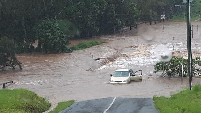
Multiple videos have been uploaded to social media of cars being submerged in floodwaters, including at Mudgeeraba Creek, near Austinville Rd, as well as in Logan.
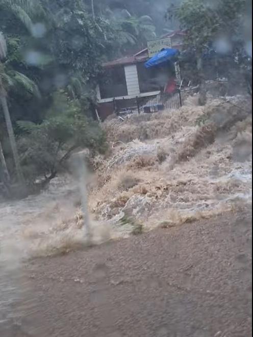
Following emergency alerts for the area, Mt Tamborine was smashed by heavy falls causing flash flooding.
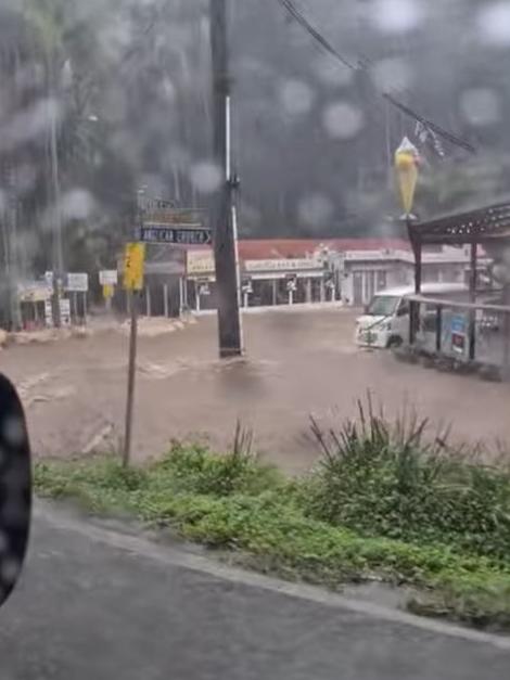
Video shows cars stranded outside shopfronts that were overrun with floodwaters.
Motorists were urged to avoid low-lying roads where flood water is rapidly rising.
In Logan, a street in Shailer Park was subject to flash flooding that caused significant damage to the road.
Drains were unable to deal with the immense volume of water, causing large cracks and potholes to break open the bitumen and raise the road above the curb.
A Mercedes-Benz was seen trapped in flood water on Bahrs Scrub road.
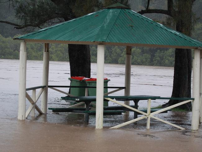
Pictures from areas including Beenleigh and Logan Village show roads blocked off with low-lying areas beside creeks and rivers overwhelmed with flash flooding.
Among the three severe weather warnings still current at 9pm, one was a severe thunderstorm warning for heavy rainfall for people in parts of the southeast coast.
“A coastal trough that is located over eastern parts of the Southeast Coast is forecast to deepen overnight and into Monday. The trough is expected to then slip southward into Tuesday as a cold front approaches southeast Queensland from the west,” the warning said.
“Heavy rainfall which may lead to flash flooding is possible across areas east of about Jimna, Ipswich and Rathdowney overnight and into Monday. Six-hourly rainfall totals between 100mm to 180mm are possible with isolated heavier totals in thunderstorms.”
A separate Flood Warning is current for Nerang and Coomera Rivers.
Locations which may be affected include Gold Coast, Brisbane, Maroochydore, Caboolture, Coolangatta, Moreton Island, Cleveland, Caloundra, Beaudesert, Jimboomba, Mount Tamborine and Redcliffe.
A severe weather warning for heavy rainfall was also issued for people in parts of the Capricornia forecast region.
“Severe thunderstorms are likely to produce heavy rainfall that may lead to flash flooding in the warning area over the next several hours. Locations which may be affected include Marlborough and Byfield,” the warning, issued at 8.24pm, said.
“Thunderstorms have eased below severe thresholds across the Southeast Coast. However, heavy rain areas with embedded thunderstorm activity will continue across parts of the Southeast Coast tonight and into Monday.”
A severe weather warning for heavy rainfall was also issued for people in parts of Channel Country and Maranoa and Warrego.
“An amplifying upper trough will combine with deep, tropical moisture to produce a significant rainband across southwest Queensland this evening. As the cloudband thickens into Monday, areas of heavy rain will develop during the morning,” it said.
“Heavy rainfall which may lead to flash flooding is forecast to develop across the Channel Country from Monday morning, becoming more likely in the afternoon and evening. Six-hourly rainfall totals between 50mm to 75mm are likely in areas with locally heavier falls possible in thunderstorms.”
Earlier, an emergency alert was issued for parts of the Gold Coast, with residents in low-lying areas urged to brace for potential flash flooding.
Queensland Fire and Emergency Services issued an emergency alert at 3.45pm, urging residents of the Currumbin, Mudgeeraba and Tallebudgera catchments to monitor the situation.
Residents of low-lying properties are being asked to consider moving to higher ground.
“Due to heavy rainfall, low-lying properties in these areas are likely to be impacted by floodwater in coming hours,” the alert said.
The heaviest rainfall recorded on the Gold Coast was at Hotham Creek, near Pimpama, with 169mm from 9am to 5pm Sunday. The area was walloped by 113mm of rain in just one hour and 243mm over the weekend. The same weekend total was also recorded at Clearview.
Bonogin, west of Tallebudgera, recorded 267mm of rain over the weekend to 5pm Sunday.
The most significant falls in the Brisbane region included Jindalee, with 114mm, Cedar Creek 89mm, and Forest Lake 73mm.
The Bureau of Meteorology warns our wet start to autumn is set to continue for days to come.
SES calls from 5pm Saturday to 5pm Sunday (mm):
Gold Coast: 131 calls for assistance
Logan: 27
Scenic Rim: 13
Brisbane: 12
Sunshine Coast: 9
Redlands: 5
Ipswich: 4
Fraser Coast: 3
RAINFALL FIGURES (in mm):
Gold Coast (Sunday figures, Saturday figures):
Upper Springbrook 146, 64
Lower Springbrook 127, 30
Hinze dam, 98, 86
Clearview AL 137, 96
Clearview T M 144, 100
Bonogin 177, 91
Worongary Creek 130, 113
Tallebudgera Ck Rd 109, 102
Mudgeeraba 92, 93
Currumbin 137, 35
Clagiraba Road (near Coomera) 153, 49
Mt Tamborine 111, 82
North Tamborine 143, 57
Oxenford 103, 98
Hotham Creek (near Pimpama) 169, 74
Mt Nimmel 101, 22
Southeast figures today since 9am
Brisbane:
Jindalee 114
Forest Lake 75
Calamvale 71
Enoggera Dam 62
Cedar creek 89
Clear Mountain 82
Knobble creek 74
Burpengary 126
Deception Bay 127
Mt Coot-tha 79
Gold Creek Reservoir (south of Enoggera) 106
Inala 52
Upper Kedron 78
Logan:
Schmidts rd (near Waterford) 71
Mt Cotton West 47
Bahrs Scrub 70
Beenleigh 60
Waterford
Couran Point (Stradbroke 40)
Sunshine Coast:
Bundilla 55
Old Gympie Rd 68
Beerwah 58
Maroochydore 54
EARLIER
A severe thunderstorm warning has been issued for people in Ipswich, Redland City, Brisbane City and Moreton Bay council areas, with the Bureau of Meteorology identifying “heavy and slow-moving activity”.
The Bureau warns at 3.10pm, severe thunderstorms were detected on the weather radar near Brisbane CBD and Enoggera.
“These thunderstorms are slow moving,” it said.
“They are forecast to affect Upper Brookfield and Samford by 3:40pm and Mount Nebo and Highvale by 4:10pm.
“Heavy rainfall that may lead to flash flooding is likely.”
Jindalee recorded 70mm in 1 hour to 2:55pm and Mount Tamborine recorded 98mm in under 2 hours to 2:15pm. Forest Lake recorded 59mm in 1 hour to 1:45pm and Hotham Creek recorded 113mm in 1 hour to 1:15pm.
Bonogin also recorded 82mm in 1 hour to 11:40am and 136mm in 2 hours to 12:40pm.
Mount Nathan recorded 105mm in 1 hour (storm spotter report) earlier today.
👇👇Watch and Act - Gold Coast City Council👇👇 Continue to monitor GCCC for updates and monitor BOM warnings at https://t.co/5XobASONZh and https://t.co/K5weYrDJF5 RE-THINK YOUR NEED TO TRAVEL - stay indoors and off the roads during severe weather https://t.co/zpuoHZRY7Y
— Queensland Police (@QldPolice) March 21, 2021
Queensland Fire and Emergency Services have said there were 83 calls for help in southeast Queensland in the 24 hours to 1pm Sunday.
The majority of those jobs are leaky roofs, trees down and water in the house.
It comes as large swathes of New South Wales face yet another day of torrential rain and flooding. The same system is driving today’s wet weather between the Sunshine Coast and the Tweed.
Mr Marshall said more rain was on the way for the bottom third of Queensland.
“We’re probably not going to see a proper sunny day until Thursday,” he said.
“Over the next couple of days we’re going to see another system coming in from the west.”
“That’s actually going to bring rainfall to lots of parts of the southern interior.
“Probably what we’ll see over the next couple of days is less of the more intense rainfall, but more widespread.”
The Gold and Sunshine Coasts were hammered with heavy rain last night, with flash flooding in some areas.
BOM meteorologist Matt Marshall said the heaviest falls overnight were on the Gold Coast and Sunshine Coast, with Carrara picking up 144mm since 9am Saturday and Pelican Waters recording 68mm.
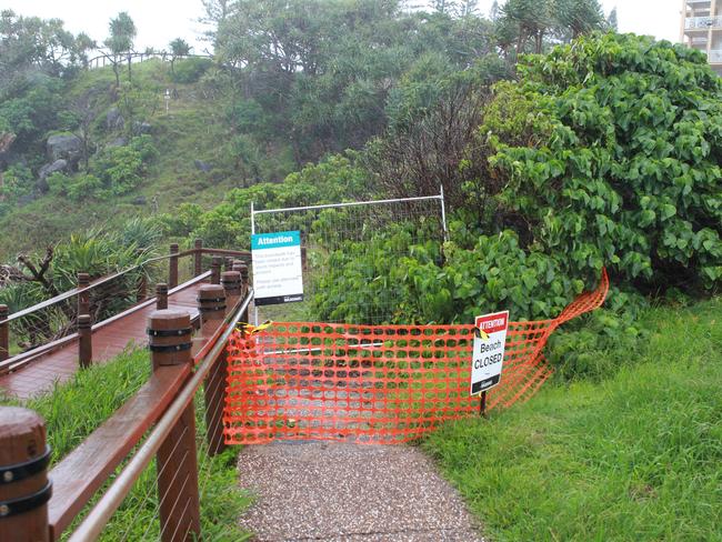
Wild weather has also closed a number of beaches along the southeast Queensland coast, with Surf Life Saving Queensland confirming the following beaches are closed:
- Burleigh Heads
- Coolangatta
- Currumbin
- Miami Beach
- North Burleigh
- Palm Beach
- Rainbow Bay
- Tugun
- Main Beach Point Lookout
- Currimundi
Beachgoers are being asked to lifesavers directions and stay out of the water.
The Bureau of Meteorology last night issued a severe thunderstorm warning on the Gold Coast with potential for flash flooding in Coolangatta, Coomera and Hope Island.
There was 77mm that fell from 10pm to 11pm at Carrara.
Firefighters performed two swift water rescues, one in Currumbin and the other in Tallebudgera.
There are no reported injuries.
There was flash flooding on Stewart Rd at Currumbin Waters, the Gold Coast Highway at the Miller Rd intersection in Tugun and Hardys Rd in Mudgeeraba.
A hazardous surf warning is in place for waters off the Gold Coast, Sunshine Coast and Fraser Island, with people told to consider staying out of the water and walking near surf-exposed areas.
Mr Marshall said swell up to 2.5m had been observed this morning along the southeast coast.
“It’s just hitting the threshold that we send a hazardous surf warning out but we’re expecting it to peak today and then ease off tomorrow,” Mr Marshall said.
He said severe thunderstorms were possible in far west Queensland but not forecast for southeast Queensland today.
RAINFALL TOTALS 9AM SATURDAY TO 7AM SUNDAY
Carrara 144mm
Mudgeeraba 93mm
Pelican Waters 68mm
Eumundi 54mm
Mount Mee 31mm
Gympie 23mm
Burpengary 16mm
Brisbane City 2mm
Toowoomba 1mm

Hail, rain, wind, SNOW: Winter storm on Qld collision course
A rare winter storm threatens to dump 15cm of snow on Queensland's Granite Belt this weekend as forecasters warn of an incoming polar air mass.

‘Can’t be ruled out’: Potential for freak Qld snowfall this week
Queensland could see snow this week with weather models predicting up to 14cm falling on the Granite Belt.