
Flash flooding hits Logan roads
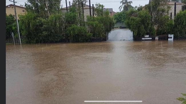
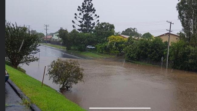
UPDATED 5pm: Two days of constant rain and a Sunday afternoon thunderstorm has drenched Logan, leaving many roads closed and a car submerged.

Logan
Don't miss out on the headlines from Logan. Followed categories will be added to My News.
Two days of constant rain and a Sunday afternoon thunderstorm has drenched Logan, leaving many roads off limits and a car submerged.
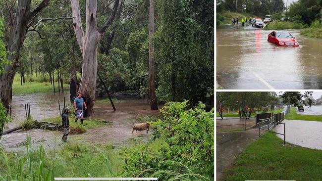
Worst hit were roads in and around Beenleigh with a red Mercedes-Benz sedan swept up in waters on Bahrs Scrub Rd at Windaroo just after 2pm.
Police were called to the scene around 2.30pm to assist and so far, nobody has been reported injured.
Logan City Council did not list roads that were closed or offer sand bags.
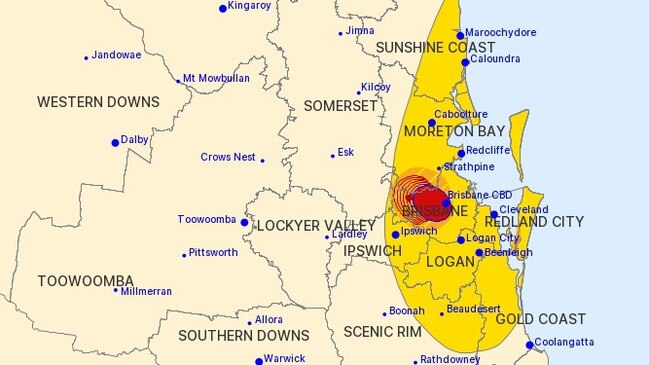
At 5pm on Sunday, the council issued a warning, following a Bureau of Meteorology alert saying there was a risk of widespread heavy rainfall developing overnight across the Southeast Coast.
The alert said Beaudesert, Jimboomba, Mount Tamborine, Gold Coast, Brisbane, Maroochydore, Caboolture, Coolangatta, Moreton Island, Cleveland, Caloundra and Redcliffe would be affected.
Next week marks the fourth anniversary of Logan’s worst flood.
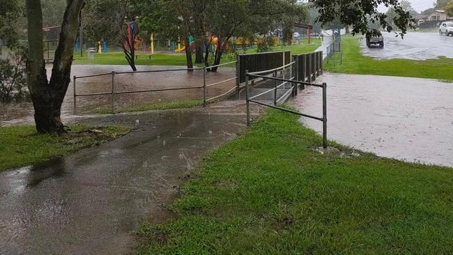
However, Dauth Park at Beenleigh along with nearby Boundary Rd were both under water.
Dairy Creek Rd at Holmview and the roundabout at Logan River Rd are also underwater.
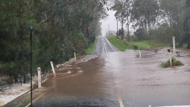
To the city’s south, road at Tamborine and Upper Coomera were also inundated after the flash storm.
Logan was still experiencing heavy rain after the Bureau of Meteorology issued a severe thunderstorm warning at 3.12pm for Logan, Ipswich, Redlands and Scenic rim.
The thunderstorm also hit parts of Redlands this afternoon, with flash flooding in parts of southern Redland Bay.
In southern Redland Bay, more than 25ml was dumped in an hour.
The Bureau said at 3.10pm, severe thunderstorms were detected on the weather radar near Brisbane CBD and Enoggera.
The thunderstorms are slow moving and forecast to affect Upper Brookfield and Samford by 3.40pm and Mount Nebo and Highvale by 4.10pm.

Inside US Navy’s largest missile sub during Brisbane visit
USS Ohio's sailors are breathing fresh air in Brisbane after joining the Talisman Sabre military exercise, as a rare tour reveals life inside America's most heavily-armed submarine. PICTURES

Calls for Straddie probe after glamping tents cost $244k EACH
A push is under way for an investigation into funding to boost tourism on North Stradbroke Island after claims nine glamping tents were built at a cost of more than $244,000 each.