
Gympie to Bundaberg natural disasters: Worst floods and storms over five decades
From ‘hailnadoes’ to devastating storms and floods these are the natural disasters which caused billions of dollars of damage from Gympie to Bundaberg. See the pictures and damage bills.

Gympie
Don't miss out on the headlines from Gympie. Followed categories will be added to My News.
From “hailnadoes” to tornadoes and floods, the regions across the Wide Bay and Burnett have been at the centre of a number of natural disasters over the years.
The financial blow has not been cheap with homes and businesses wrecked by floodwaters, hail and extreme wind contributing towards a final bill which stretches into the billions.
These are the disasters which have shaped Gympie, the Fraser Coast, Bundaberg and the North and South Burnett across the years, and the cost of cleaning them up.
All figures have been sourced from the Insurance Council of Australia data.
They have are normalised to the financial equivalent of what would have been lost had they occurred in the 21st century, and are calculated across the entirety of the disaster areas, as they are unable to be broken down by region or postcode.
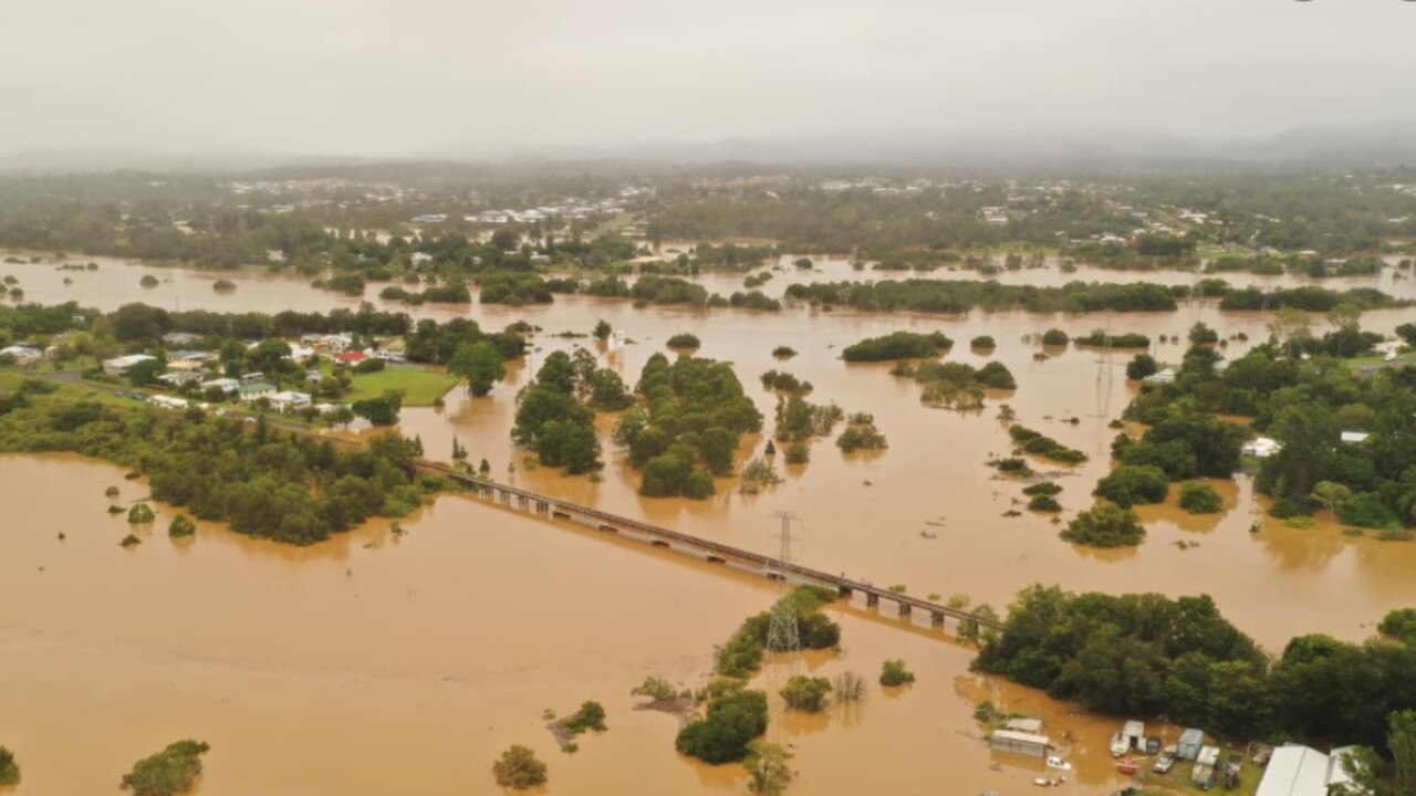
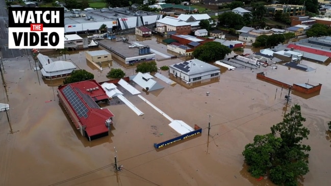
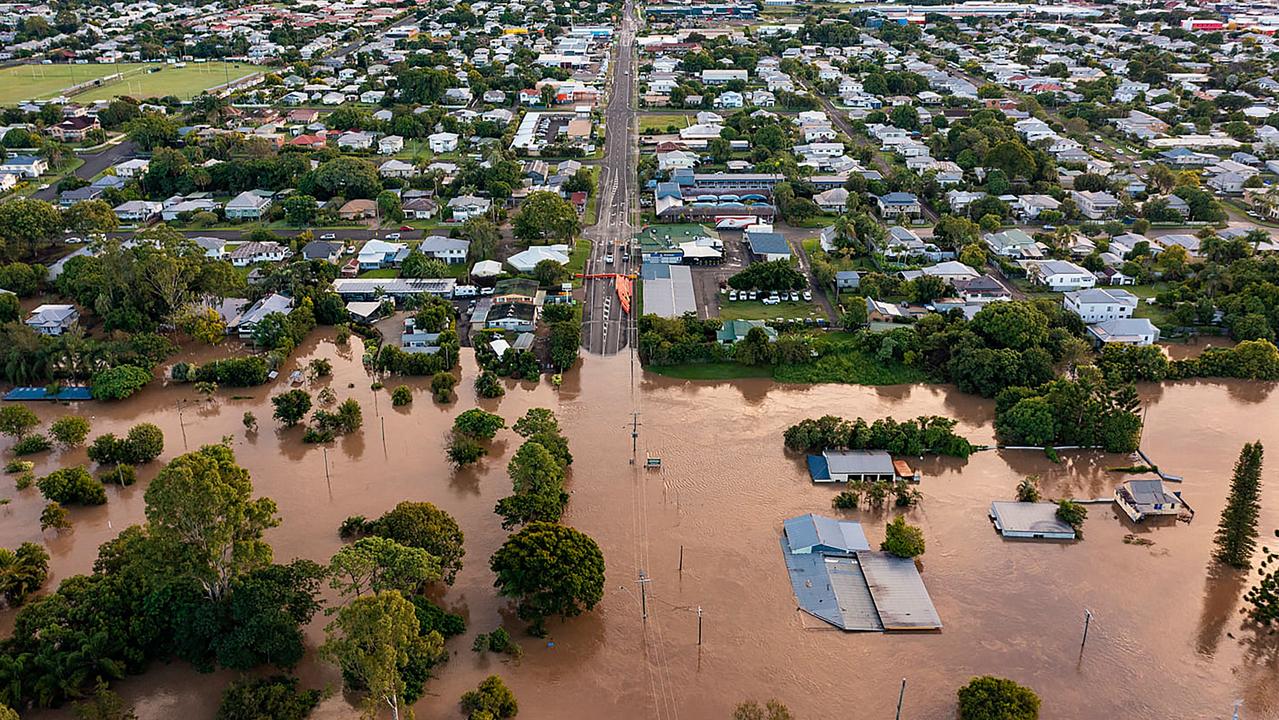
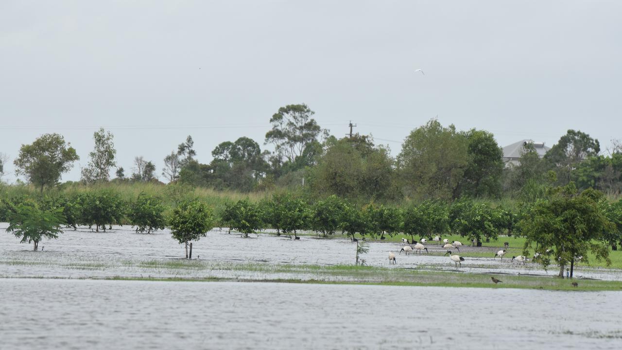
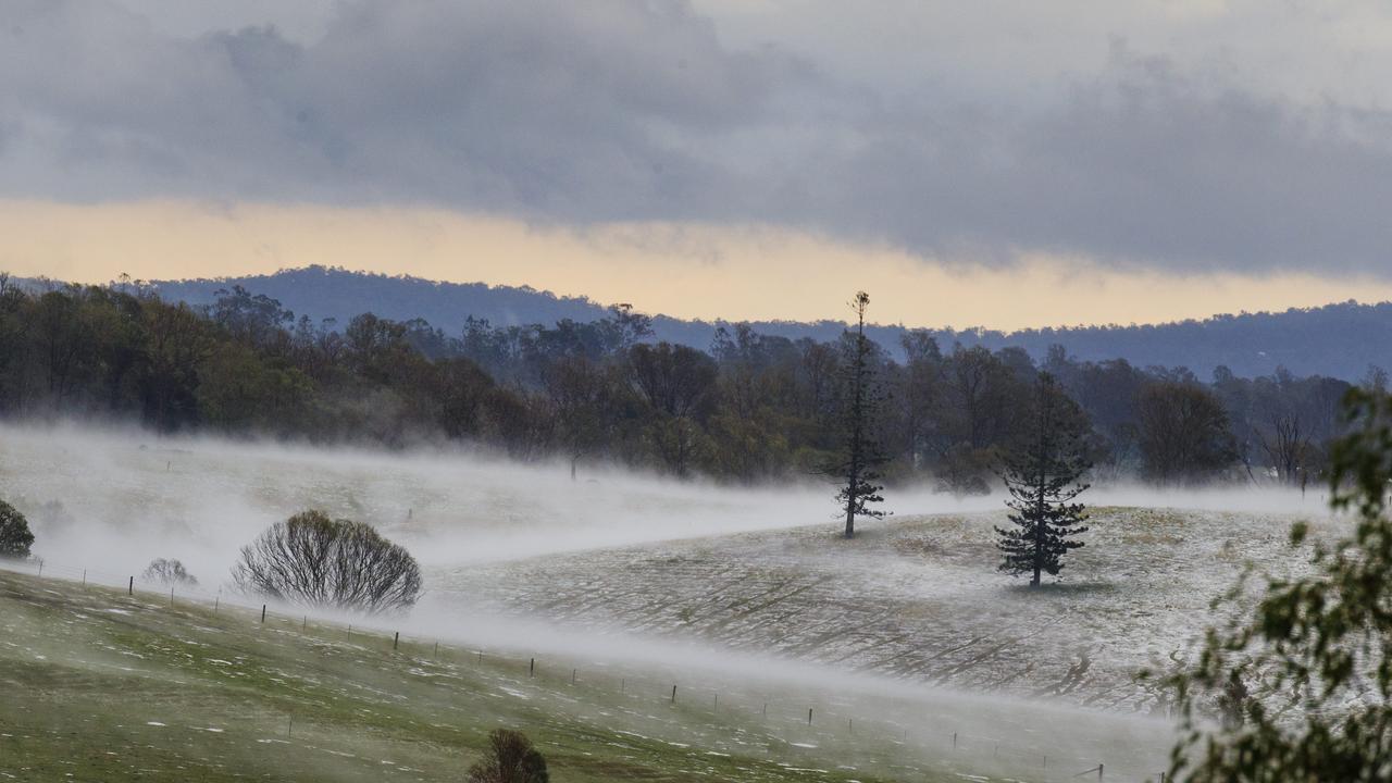
Floods, March 2022, $5.45bn (to date)
Gympie and parts of the Fraser Coast were inundated at the beginning of one of the largest disasters in Australia’s recorded history, which impacted communities all the way down to northern New South Wales.
The Mary River at Gympie peaked at 22.96m, the second highest on record, cutting the city off for days.
Hundreds of homes and businesses were inundated and several lives were lost across the regions amid the floods, and downstream at Maryborough emergency crews worked day and night to keep the floodwaters out of the historic city’s centre.
More details here
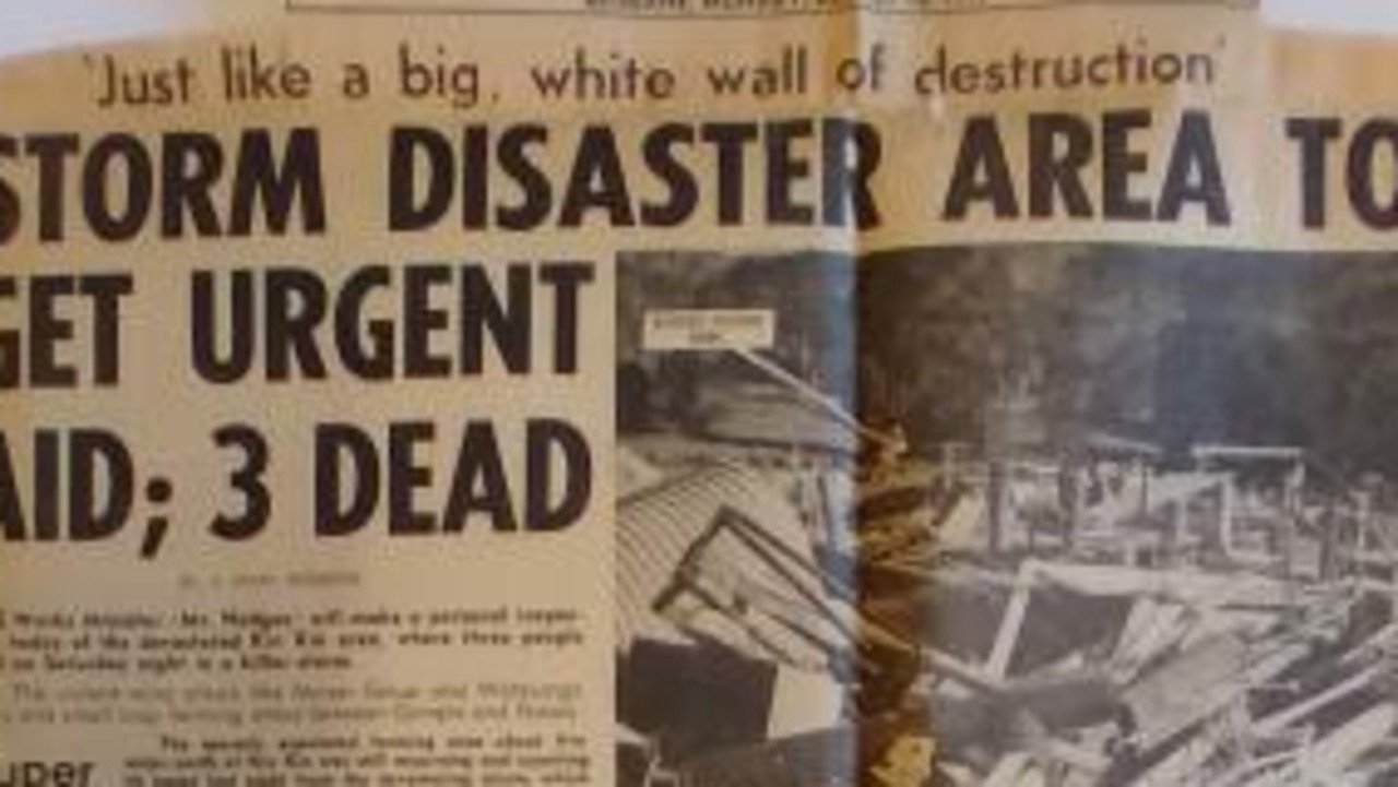
Cyclone Dinah, January 1967, $4.68bn
The Maryborough and Bundaberg areas were caught in the crossfire of Cyclone Dinah, which unleashed devastation along the Queensland coastline.
Houses were unroofed at Bundaberg and Maryborough and the huge seas and storm surge caused severe erosion at Emu Park, Yeppoon.
At Bargara winds tore off a large section of roofing from a unit in Clarke St and a number of other houses had damage.
A storm surge of 2m covered the flats inland from Double Island Point and a storm surge inundated cane farms at Bli Bli on the Sunshine Coast and was knee deep in Hastings St Noosa.
Gympie, Brisbane flooding, January 2011, $2.3bn
A Mary River peak of 19.45m in early 2011 was part of a wider flooding disaster to unfold across the state’s southeast corner in 2011.
The city was cut off as a result of the rising river, and the CBD was inundated.
Cyclone Debbie, March-April 2017, $1.78bn
Category four Cyclone Debbie struck the coast in the vicinity of Airlie Beach before making its way south, inundating areas across southeast Queensland and through to northern New South Wales.
Ex-Cyclone Oswald, January 2013, $1.13bn
A relatively weak storm, Oswald nonetheless unleashed torrential rains across the state.
Flooding and storm activity resulting from Ex TC Oswald wreaked havoc, causing severe flooding in the Bundaberg and North Burnett areas and Bundaberg was struck by six tornadoes.
Rooftop rescues were needed across parts of the Gympie region.
More details here
West Qld Flooding, February 2010, $532m
Unprecedented rainfall caused serious flooding across Queensland, with more than a dozen waterways inundated by the downpour in the Mary and the Burnett.
Roads, railways and bridges were ruined as a result of the floods while agriculture and horticulture industries including farms, crops and livestock were severely impacted.
Cyclone Daisy, February 1972, $121m
Daisy made landfall on Fraser Island and the bar at Sandy Cape dropped to 968.8 hPa.
More than 200 homes were damaged at Pialba and roofs were scattered across the town.
Forestry officials reported serious damage to plantations near Maryborough and on Fraser Island.
Severe erosion occurred down to Brunswick Heads and on the western side of Fraser Island where a 3m storm surge was reported.
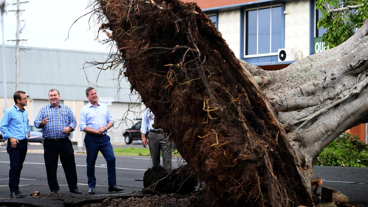
Gympie region hailstorm, October 2018, $63.2m
The “hailnado” that ripped across Gympie unleashed destruction and blanketed the region in ice, causing millions of dollars of damage.
Roofs were damaged, crops were destroyed and trees were torn down in the storm which started from a supercell.
The damage was so severe SES crews were brought in from Brisbane and Redlands to help with the clean up.
More details here
SEQ severe storms, January 2004, $60.5m
Maryborough was among the main cities impacted by the severe storms which tore across Queensland over three days at the start of 2004.
The widespread damage from the severe weather, which included wind gusts of more than 100km/h, was recorded in Brisbane, Ipswich and the Gold and Sunshine Coasts. Towns affected included Currumbin, Coolangatta, Fortitude Valley, Woolloongabba, Oxley, Coorparoo, Warrick, Ipswich, Bundamba, Bellbowrie, Calliope, Jimboomba, Beaudesert, Gatton, Nanango, Archerfield, Toowoomba, Kawana Waters, Caloundra, Moreton Bay, Maryborough and Rockhampton.
Cyclone Beth, February 1976, $38.6m
Beth crossed the Queensland coast near and to the north of Bundaberg, causing widespread damage between the city and Maryborough.
More than 200 homes lost their roofs, two aircraft were damaged, and up to 200mm of rain caused flash flooding and cut roads for 18 hours.
Kin Kin tornado, August 1971, $20.3m
On August 14, 1971 a tornado struck Kin Kin killing three people, destroying eight farmhouses and causing considerable damage to part of the town.
The storm descended on the small township southeast of Gympie about 9.30pm, bringing hail and leaving a damage bill of more than $100,000 (at the time).
Bundaberg storms, November 2017, $10m
On November 7, 2017 severe thunderstorms brought wild winds, heavy rain and 2cm hail stones, with the Wide Bay region/Bundaberg being the hardest hit. In excess of 1,100 claims were lodged.
It was the second of two storm disasters to strike the region in as many months.
Bundaberg storms, October 2017, $7m
On October 2, 2017 severe storms rolled across southeast Queensland, bringing with them record rainfalls for the month across the Wide Bay Burnett.
Tornadoes were reported by a number of residents and roofs, caravans, and cars were all wrecked by the severe weather system.
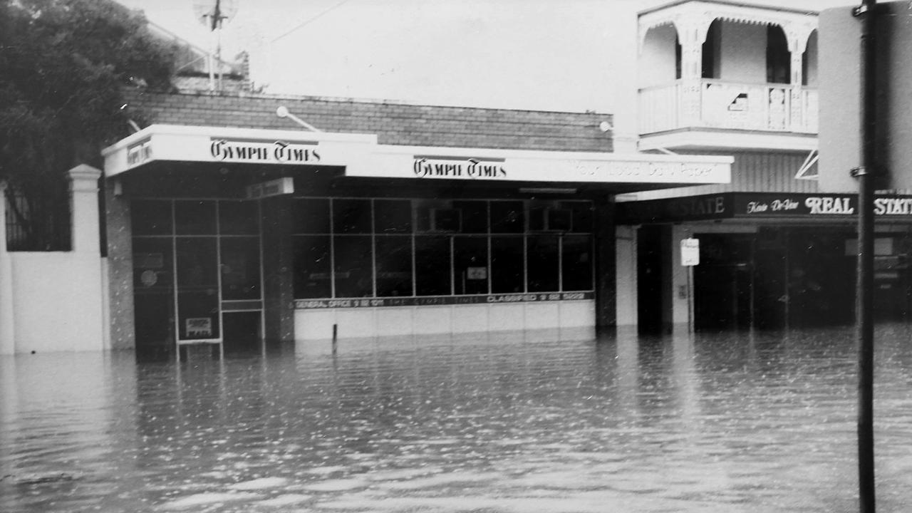
Gympie flood 1999, February, N/A
The city was submerged under its fourth highest flood in record history at the end of the 20th century when the Mary river peaked at 21.95m.
Damage from the disaster was immense with homes and shops inundated, signs and trees knocked down and roads cut and washed out by the rising waters, which then flowed downstream to submerge parts of Maryborough and the Fraser Coast.
Images here
Gympie flood 1992, February, N/A
Seven years before the 1999 “flood of the century”, parts of Gympie were sunk under a Mary River which rose to 21.4m, washing out roads, flooding homes and forcing people to evacuate.
More details here
Boxing Day storms, December 2017, N/A
A severe storm cell on Boxing Day 2017 impacted the South Burnett and Darling Downs.
About 100 homes were damaged with roofs ripped off and more than 4000 homes lost power for more 12 hours.
Cyclone Dawn, March 1976, N/A
Cyclone Dawn developed on the north Queensland coast and moved down before crossing Fraser Island in March 1976.
Flash flooding occurred at Bundaberg, while further north trees were uprooted on Heron Island.
Rainfall of up to 230mm between Proserpine and Bundaberg caused flash flooding.
Cyclone Wanda, January 1974, N/A
Tropical Cyclone Wanda, a category 1 storm, crossed the coast south of Bundaberg.
It caused extensive flooding in the region and particularly Brisbane where 14 people were killed.
Originally published as Gympie to Bundaberg natural disasters: Worst floods and storms over five decades

‘Bloody rabble’: Readers have say on historic post-election LNP split
Fallout from the historic LNP coalition split in the wake of the parties’ epic federal election failure has divided readers, leaving them split on whether it is a boon or a ‘political desert’. VOTE IN THE POLL

Vote Now: Gympie’s favourite Prep teacher of 2025
Who will be crowned Gympie’s favourite Prep teacher of 2025? Vote now from our list of dedicated and beloved finalists.

Speedway driver with spinal injuries still in hospital after crash
A speedway driver who became trapped after his car crashed at the Maryborough Speedway on the weekend was still in hospital four days later.

‘Hothead’ Origin debutant exactly what Qld wants
The fire has been lit for a spicy State of Origin series courtesy of a ‘hothead’ debutant who is set to bring a level of aggression that is exactly what Queensland wants.

Man chases ex’s partner with axe in frightening death by cop bid
A man’s axe-wielding threats to his ex-partner and her boyfriend near a popular picnic spot nearly ended in suicide by cop.

Former rising-star jockey’s life spirals into crime spree
A one-time rising star Qld jockey has landed in court over a string of almost 20 offences committed when her life spiralled due to meth.