
Granville Bridge reopens after Mary River flooding event
Granville Bridge has reopened after closing due to rising floodwaters while the Lamington Bridge currently remains closed. UPDATES, ROAD CLOSURES.
Fraser Coast
Don't miss out on the headlines from Fraser Coast. Followed categories will be added to My News.
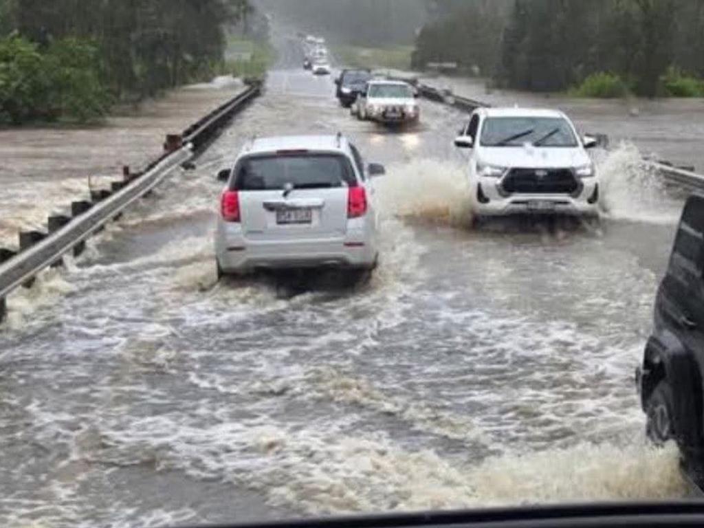
The Granville Bridge has reopened after closing due to floodwaters on Saturday night.
It comes after the Bruce Highway was blocked at Apple Tree Creek after Childers near Bundaberg was battered by a storm with torrential rain on Saturday night.
The Department of Main Roads advised that as of 8pm Saturday all lanes were impacted.
The Bruce Highway reopened at Tiaro about 6pm after being cut during Saturday’s rain event but a major flood warning for Tiaro remained in place Sunday morning.
The Lamington Bridge and Granville Bridges closed on Saturday at Maryborough.
As of 8pm Saturday the weather bureau warned an “unstable air mass combined with a weak trough” was producing heavy rainfall and a thunderstorm warning was issued for Bundaberg, Gladstone, Hervey Bay and the Rockhampton regions.
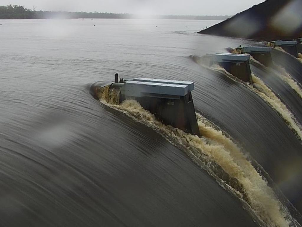
The Mary River at Maryborough was also rising and being watched closely.
Granville Bridge closed to traffic about 7pm.
Minor flooding was also occurring in nearby Howard and the council bridge over the Burrum River between Torbanlea and Howard was closed as a precaution.
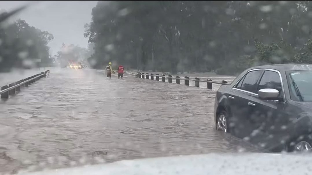
Water was over the road on the Bruce Hwy and some back roads at Tiaro, and the Department of Main Roads warned drivers to keep clear of floodwaters around Tiaro and Glenorchy, south of Maryborough where a man was killed in a crash on Friday afternoon.
Tiaro resident Samantha Thompson shared a video of Tahiti Rd under and said she and her family were cut off by floodwaters but had thankfully prepared in case.
She said ex-Tropical Cyclone had totally missed their property two weeks ago but this week they were smashed by 172mm of rain from Tuesday to Friday.
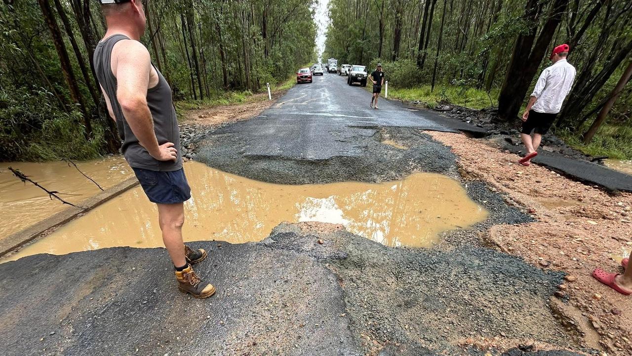
After sharing photos showing the flooding across Tahiti Rd, Ms Thompson shared another photo when the waters receded showing the shocking damage done to the road.
She urged drivers travelling between Maryborough and Gympie not to try and take the detour down Tahiti Rd even though some navigation systems were sending drivers that way.
She recorded 150mm overnight to 7am Saturday.
Minor flooding was occurring along the Burrum River at Howard on Saturday night but the Cherwell River at Pacific Haven was receding and the threat had been reduced to moderate.
River levels were elevated along the Isis, Gregory, and Elliott Rivers, with minor to moderate flooding occurring on Saturday night.
Earlier, as of 8.37am Saturday the major warning for Pacific Haven was in place as the Burrum and Cherwell Rivers was rising.
“Major flooding is expected along the Cherwell River at Pacific Haven during Saturday morning,” the Bureau of Meteorology warned.

“Further rainfall is possible over the next few days and the situation is being closely monitored, and this warning will be updated as required.”
Fraser Coast Mayor George Seymour said houses in Pacific Haven usually flooded at 4.5m but sheds could get water though.
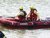
He said as of 9am the SES was responding to about 10 jobs there, mainly sandbagging.
The Burrum River at Howard was at 6.51m and rising, above the minor flood level (6m) and could peak near 7.50 metres early Saturday afternoon with minor flooding.
The Cherwell River at Pacific Haven was at 3.39m and rising with moderate flooding and was expected to exceed the major flood level (3.50m) in the next few hours, possibly peaking near 3.80m late Saturday morning.
River levels were also rising along the Isis and Gregory Rivers with moderate flooding recorded on the Elliott River.
It comes just weeks after record flash flooding left hundreds of homes and businesses damaged in Hervey Bay and residents across the Wide Bay endured a nervous night.
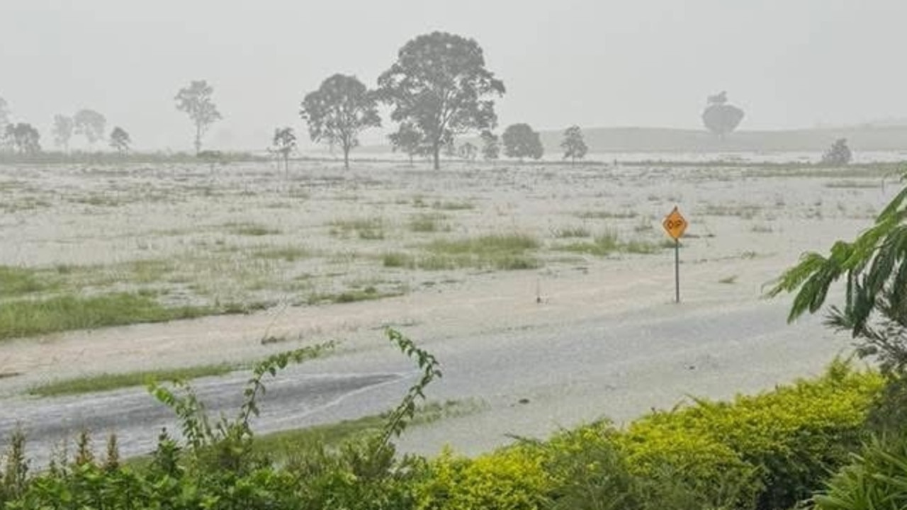
Heavy rain was continuing to fall across the region early Saturday with up to 80mm recorded in some parts within just a few hours (more than 200m has fallen in the past 72 hours).
The Bureau of Meteorology has issued an alert for people in the Wide Bay Burnett to “stay informed” with flash flooding likely.
The warning was originally issued for Hervey Bay and Bundaberg on Friday night.
In the early hours of Saturday morning however, the warning area had been updated to Hervey Bay, Maryborough, K’gari, Gympie, Rainbow Beach and Tiaro.
The Mary River was flooding at Kidd Bridge, Gympie and Tiaro and the Lamington Bridge was expected to be closed as a precaution while dozens of roads across the region were also closed (see list at bottom of article).
“A moist air mass offshore of Wide Bay is producing heavy falls in showers and thunderstorms through the southern Wide Bay and Burnett this morning,” the BOM alert reads.
“Severe thunderstorms are likely to produce heavy rainfall that may lead to flash flooding in the warning area over the next several hours.”
By 8am Saturday the warning zone had moved further south with Gympie, Noosa Heads, Cooroy, Nambour and Rainbow Beach still on alert while rain continued to fall in Maryborough and Hervey Bay.
On March 9 residents in Hervey Bay woke to a wall of water rushing through low-lying homes after up to 500mm fell in some parts of the city.

Key areas of concern include Freshwater St and the Bay Plaza complex at Pialba where the Woolworths remains closed along with several other surrounding businesses while some of the stores in the complex have only recently reopened.
The weather bureau is expected to issue an update just after midnight.
Emergency services advise people to:
* Park your car undercover away from trees.
* Close doors and windows.
* Keep asthma medications close by. Storms and wind can trigger asthma attacks.
* Charge mobile phones and power banks in case the power goes out.
* Put your pets somewhere safe and make sure they can be identified in case they get lost.
* Do not drive now unless you have to because conditions are dangerous.
* Tell friends, family and neighbours in the area.
* Go inside a strong building now. Stay inside until the storm has passed.
ROAD CLOSURES
*Source: Disaster Dashboard
Bundaberg
South Kolan – Gin Gin Rd
Sharon – Bundaberg Gin Gin Rd
Avondale/Berajondo/Oakwood/ Rosedale/ Taunton – Bundaberg Miriam Vale Rd (Rosedale Rd)
Round Hill Rd
Elliott – Goodwood Rd
Fraser Coast
Boonooroo Plains – Maryborough Cooloola Rd
Nissen St, Urraween
Nikenbah – Booral Rd
Aramara – Maryborough Biggenden Rd
Gootchie /Gundiah – Bauple Woolooga Rd
Gootchie – Sheehans Rd
Teddington Road
Gootchie – Sheehans Rd
Bauple – Pettit Rd
Tiaro – Burgess St
Tiaro – Inman St
Tiaro – Mungar Rd
Gundiah – Netherby Rd
Gympie
Imbil – Gympie Regional Yabba Creek Rd
Gympie/Southside – Gympie Woolooga Rd
Imbil – Yabba Creek Road (Yabba Creek Bridge)
Bells Bridge
Gympie/ Victory Heights – Tin Can Bay Rd
Mothar Mountain – Noosa Rd
Gympie Sands Ln
Goomboorian – Wilsons Pocket Rd
Cedar Pocket – E Deep Creek Rd
Moy Pocket – Walker Rd
Amamoor Traveston Crossing Rd
Kandanga – Diamondfield Rd
Chatsworth – Fishermans Pocket
Two Mile – Rodney Rd
Fishermans Pocket – Fishermans Pocket Rd
Jones Hill – Lawson Rd
Wolvi – Neusavale Rd
Tuchekoi -Kenilworth Skyring Creek Rd
More Coverage

Originally published as Granville Bridge reopens after Mary River flooding event

Watch: Pialba man charged after knife found at shopping centre
A police operation of scanning hundreds of people across the region’s shopping centres, public transport and pubs has yielded a number of charges.
Read more

Toogoom bus crash sends four kids to hospital
Four children, including two primary school children, were taken to hospital after a bus crash on Thursday morning.
Read more

Fraser Coast’s top TAFE apprentices revealed
The Hervey Bay TAFE campus was aglow with pride and celebration as graduates gathered to be honoured for their outstanding achievements. MEET OUR YOUNG STARS
Read more

Girl, 12, granted Supreme Court approval to have abortion
A 12-year-old Queensland girl has been granted permission by the Supreme Court to have a surgical abortion after her mother was prevented from approving it on her behalf.
Read more

Drunk woman found under blanket on patio after mistaken identity
Drunk and grieving, a woman turned up at a home she was banned from visiting, demanding to be let in. Things only got worse from there.
Read more

Wild wind, lightning, rain: Flights stopped as ‘microburst’ smashes SEQ
Parts of Brisbane, Logan and Ipswich have been hit with wild weather as a large band of rain with isolated storms ripped through the southeast on Wednesday afternoon.
Read more