
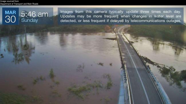
Kidd Bridge closed but Mary River moderate flood starts to recede
The Mary River has started to slowly recede after reaching its peak earlier on Sunday, though the Kidd Bridge is expected to stay closed until some time tomorrow. LATEST.

Gympie
Don't miss out on the headlines from Gympie. Followed categories will be added to My News.
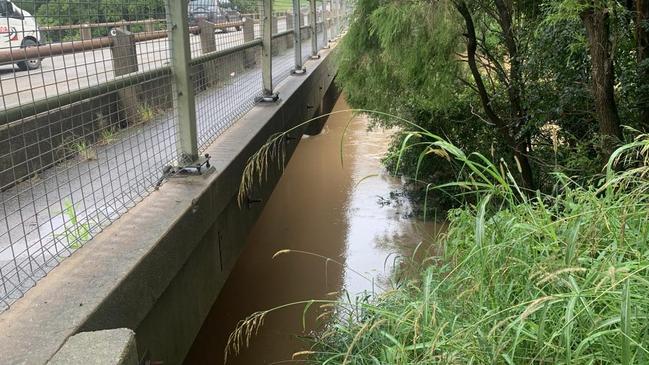
The Mary River at Gympie peaked just above the moderate flood level on Sunday and by mid afternoon was starting to slowly recede.
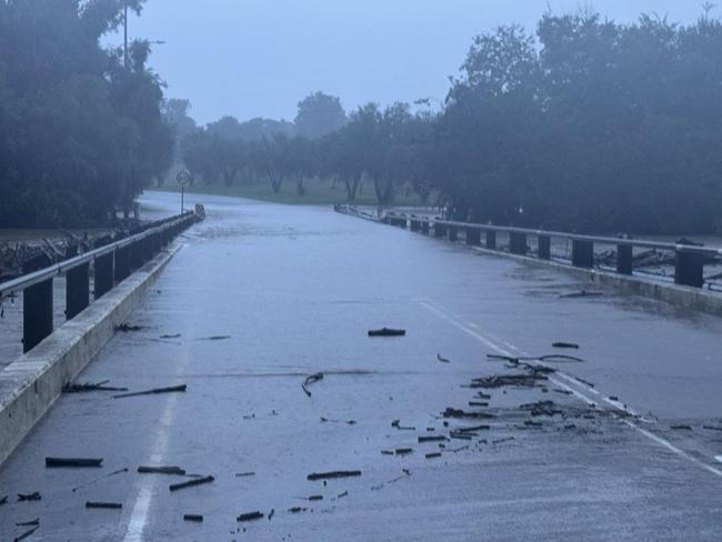
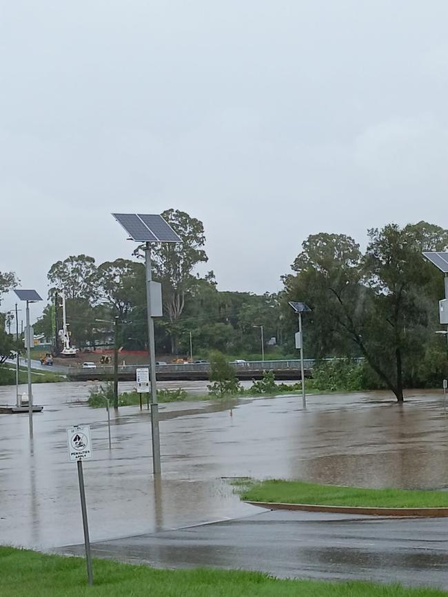
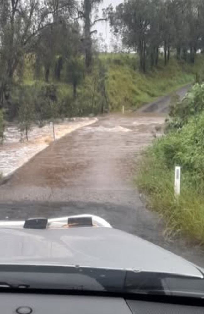
Kidd Bridge was still well under and not expected to reopen before Monday morning.
A Gympie Regional Council statement pointed out motorists can still access Gympie/ Southside via Normanby Bridge, and asked residents to be patient and allow extra time when heading back to work and school on Monday.
“Even when water recedes, it doesn’t necessarily mean the bridge structure or roadway is safe to drive on,” the statement said.
“Closed bridges and roads need to be cleared and inspected before they are able to be reopened to motorists, so we do ask people to be patient and understanding. Our teams have been working around the clock to respond to flooded roads and are doing everything they can to reopen them as quickly as possible.”
It follows a major flood warning for the Mary River at Tiaro over the weekend, minor flooding in Maryborough and moderate flooding in Gympie.
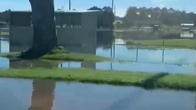
The Bruce Highway at Tiaro was cut by flash flooding then reopened about 6pm Saturday, and water from the Mary River had covered much of the One Mile Ovals and was across Power Road on the Southside and Brisbane Road on Sunday morning.
In Maryborough, the Granville Bridge reopened Sunday morning, enabling access between Maryborough and Granville, but Lower Kent Street remained closed due to lingering flood waters.
Granville residents were advised to access the bridge via Tiger and Mary Streets while Lower Kent Street remains closed.
Earlier, the Bureau update at midnight Saturday night said minor flooding continued to occur at Maryborough, moderate flooding in Gympie and Miva and major flooding at Tiaro.
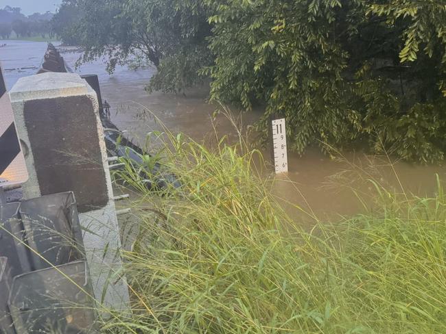
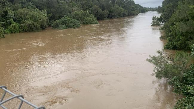
The Mary River at Gympie was 12.66m and rising, above the moderate flood level (12m) and could peak at 12.9m on Sunday morning, with moderate flooding.
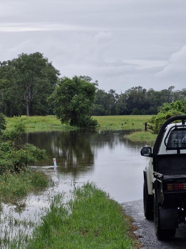
Elevated creek levels and minor to moderate flooding were occurring along Six Mile Creek, and major flooding was occurring downstream of Gympie.
A Gympie council statement released Sunday morning categorically stated Bells Bridge on the Wide Bay Highway was still closed and that Kidd Bridge was closed until further notice.
The Mary River at Miva was 13.07m and rising slowly, above the moderate flood level (9.5m). The Mary River at Miva was expected to peak about 13.3m on Sunday morning, with moderate flooding.
The Mary River at Tiaro at midnight was 12.29m and rising, above the major flood level (12m), and expected to peak at 12.5m on Sunday morning, with major flooding.
The Mary River at Maryborough (Portside gauge) was 5.65m and steady, above the minor flood level (5m) and expected to possibly reach around 6m Sunday morning, with minor flooding.
On Saturday night as storms heavy with rain moved across parts of the region, the Mary River at Gympie was at 10.16m (and rising), above the minor flood level (6m).
In a statement, Gympie Regional Council said it was “closely monitoring weather conditions and river levels across the region, especially along the Mary Valley catchment”.
Storms late Saturday brought some big falls on top of days of heavy rain: Tiaro got another 55mm, Cooroy 65mm, Pomona 43mm, Double Island Point 47mm
In the 24 hours to 9am Sunday here are the biggest rainfalls across the region:
Mt Elliott: 256mm to 9am Saturday, 110mm in the 24 hours to 9am Friday and 96mm in the 24 hours to 9am Thursday.
Maleny: 97mm to 9am Saturday, 66mm to 9am Friday, 5mm to 9am Thursday.
Conondale: 47mm, 25mm, 2mm
Gympie: 89mm, 68mm, 27mm
Brooweena: 136mm, 24mm, 2mm
Tiaro: 243mm, 59mm, 50mm
Goomboorian: 80mm, 9mm, 68mm
Bidwell: 229mm, 70mm, 27mm
“Residents can still access Gympie/Southside via Normanby Bridge,” Saturday’s Gympie council statement read.
“Due to increased traffic along Normanby, we remind the community to please be patient and drive with care.”
Emergency crews responded after two cars were trapped in floodwaters in the Gympie region on Saturday.
You can view the list of road closures here.
At Maryborough, the river rose quickly on Saturday, thanks to the combination of heavy falls and a high tide.
Both the Lamington and Granville Bridges were closed on Saturday night with the river predicted to rise to 5.9m at Maryborough.
Councillor Phil Truscott confirmed the Lamington Bridge connecting Tinana to Maryborough had closed and said those looking to come into the city would need to do to via the Bruce Highway.
A minor flood warning for Maryborough was in place.
EARLIER
The Mary River is expected to reach 10.3m on Friday night or Saturday, cutting the Kidd Bridge.
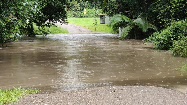
Flash flooding across the Gympie region stopped school buses on Friday and cut off multiple families as parts of the region that have already received more than 130mm of rain braced for more on the weekend.
An update issued by the Bureau of Meteorology on Friday afternoon said moderate to heavy rainfall across the Mary River catchment had led to river and creek level rises and flooding, and that minor flooding was occurring at Gympie, with minor flooding possible at Miva and Tiaro overnight Friday into Saturday.
Further showers and storms are forecast across the catchment for the remainder of Friday and into Saturday which may cause further river and creek level rises.
This situation is being closely monitored and this warning will be updated as required, the BoM said.
Minor flooding is occurring along the Mary River to Gympie.
The Mary River at Gympie was 7.36m and rising on Friday afternoon, above the minor flood level (6m).
“The Mary River at Gympie may reach around 10.30m overnight Friday into Saturday. Further rises are possible with forecast rainfall.
Elevated creek levels and minor flooding was occurring along Six Mile Creek Friday afternoon.
Minor flooding may occur along the Mary River downstream of Gympie.
The Mary River at Miva was at 5.9m and rising on Friday afternoon, below the minor flood level (7.5m). The Mary River at Miva may reach the minor flood level (7.5m) overnight Friday into Saturday.
The Mary River at Tiaro was 4.89m and rising on Friday afternoon, below the minor flood level (6m). The Mary River at Tiaro may reach the minor flood level (6m) overnight Friday into Saturday. Further rises are possible with forecast rainfall.
A flood warning has also been issued for the Noosa River at Tewantin.
Early Friday morning, the Mary River at Gympie was 4.61m and rising, below the minor flood level (6m), with the river expected to reach 6m Friday morning.
Roads were cut at Kin Kin, Anderleigh, Glastonbury, Widgee, Langshaw, the Mary Valley, Glenwood and towards Tin Can Bay.
At Kia Ora before sun up on Friday, dashcam footage captured a young man’s brave rescue of an elderly couple trapped after their car was caught in flash flooding. WATCH VIDEO HERE
In the 24 hours to 9am Friday, these are the regional rainfalls:
Gympie official: 68mm in the past 24 hours and 27mm in the 24 hours before that, though some private record showed 130mm falling in the past 48 hours
Kin Kin: 130mm in past 24 hours and 53mm in the 24 hours before that
Wahpunga Lane: 166mm in past 24 hours
Maleny: 66mm in the past 24 hours
Cedar Pocket Dam: 139mm in the past 24 hours and 31mm before that
Mt Wolvi: 125mm in past 24 hours, 78mm in the 24 hours before that
Cooran: 122mm in the past 24 hours and 19mm in the 24 hours before that
Glenwood: 69mm in the past 24 hours, 31mm in the 24 hours before that
Goomboorian: 99mm in the past 24 hours, 72mm in the 24 hours before that
Pomona: 69mm in the past 24 hours and 27mm in the 24 hours before that
Kandanga: 69mm in the past 24 hours, 8.4mm in the 24 hours before that
Cooroy: 65mm in the past 24 hours, 36mm in the 24 hours before that
Gympie was expected to receive up to another 35mm on Friday, then 50mm on Saturday.
The Goomeri, Kandanga, and Tin Can Bay Pools were closed on Friday due to staff impacted by flooded roads.
The Widgee Waste Transfer Station was closed and the Gympie Tip Shop closed.
Residents are urged to:
Keep an eye on the council’s Disaster Dashboard for the latest weather info, road conditions, and emergency news: https://disaster.gympie.qld.gov.au/
Plan your journey and drive safely. There are road closures in place in typical low-lying areas so obey signage and stay away from floodwaters.
Report any road damage to 1300 307 800.


Join the conversation

Cash boost call: Qld container rebates ‘should be doubled’
Queensland’s Container Refund Scheme returns should be doubled to 20c in a bid to keep up with inflation and encourage more residents to take part, a parliamentary committee has heard.
Read more

40+ photos: St Patrick’s seniors celebrate school formal in style
St Patrick’s College Class of 2025 paid no heed to the winter chill on Friday night, stunning a huge crowd at their arrival in an elegant array of gowns, suits and glamour. PHOTOS, VIDEO
Read more