
La Nina has ended – but there’s a sting in the tail
La Nina is over – rejoice! That should mean drier weather. But meteorologists have said a rarely-seen climate phenomenon could cause chaos.

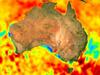
The La Nina climate driver, which has been the key factor behind much of Australia’s weather woes over the last two years, has finally ended.
But the Bureau of Meteorology (BOM) has warned the troublesome system has a sting left in its tail.
Not only could it remain wetter than average despite La Nina’s absence, but there are strong indications that it will be back in a few months anyway to bring yet more drenching weather conditions.
If La Nina does bubble up again in the spring, it will be the third year in a row it’s made an appearance. That is very rare.
“Back to back La Ninas are not uncommon,” said the Bureau of Meteorology’s head of long-range forecasting, Dr Andrew Watkins.
“In fact we get them about half the time since 1900.
“But a three-year La Nina is less common and we’ve only seen that three times since the middle of the last century.”
On Tuesday, the BOM confirmed the 2021-22 La Nina had finally dissipated, months after it was due to weaken.
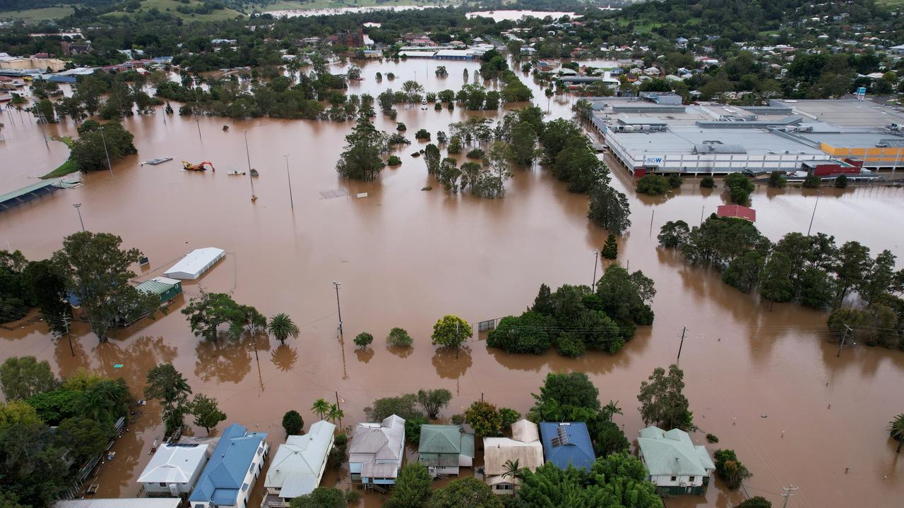
The atmospheric phenomenon had caused chaos on the east coast of Australia. Flooding in northern NSW and south-east Queensland caused at least $4.3 billion in damage, figures by the Insurance Council show. The actual figure may have been much higher.
Stream more news on the environment with Flash. 25+ news channels in 1 place. New to Flash? Try 1 month free. Offer ends 31 October, 2022 >
How does La Nina work?
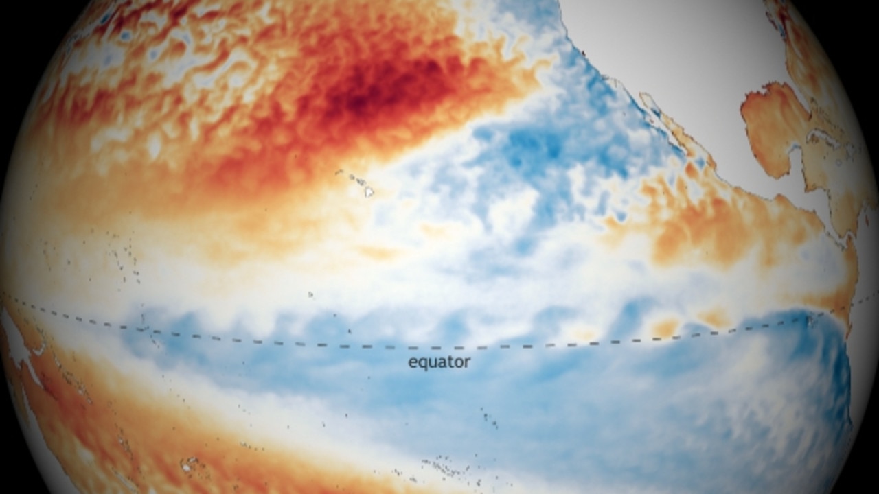
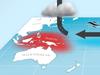
La Nina is one extreme of the climate driver known as the El Nino – Southern Oscillation (ENSO).
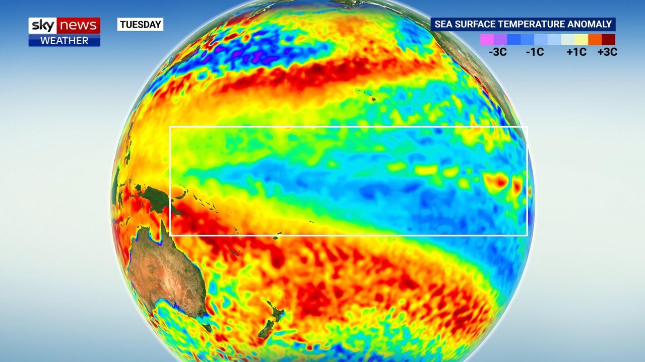
During a La Nina phase, cool waters from the depths of the Pacific Ocean are hauled up to the surface in the central and eastern equatorial region.
Stronger winds from east to west then push warmer seas closer to Australia. That aids in the creation of more clouds, moisture and windier conditions for the continent.
During an El Nino phase that moisture heads towards the Americas, leaving Australia drier.
According to the BOM’s definition, the ENSO has just entered a neutral phase – so neither La Nina nor El Nino. That’s likely to persist throughout winter.
Yet another La Nina could be just around the corner
However, Australia remains on La Nina “watch”, meaning it won’t take much for the system to kick back in again.
“A La Nina watch does not change the outlook of above average rainfall for most of Australia over coming months,” the BOM’s Dr Watkins said.
“The Bureau’s long-range outlook remains wetter-than-average, consistent with model outlooks from other global forecast centres.”
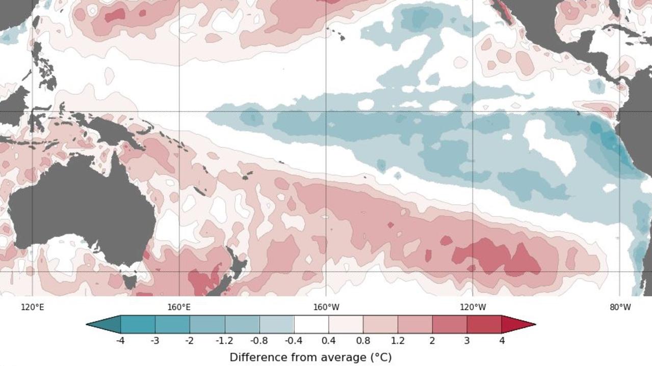
That’s due to the waters around Australia remaining stubbornly warm, particularly in the north and east, and a developing negative Indian Ocean Dipole (IOD).
The IOD is similar to ENSO, but forms in the Indian Ocean. A negative IOD can bring more moisture Australia’s way during the colder months.
The US National Weather Service has also forecast a triple La Nina.
Earlier this month, it said there was an almost 60 per cent chance of a strengthening La Nina in late 2022.
That should lead to less rain for the US, particularly in the west, increasing the chance of heatwaves and bushfires.
But for Australia, if La Nina 3 does come to pass, we can expect more rain and even more flooding. Just like we have had for the last two years.

Grim warning as ‘deadly’ fires sweep NSW

‘Callous’: Trees poisoned at up-market beach
