Bureau of Meteorology’s shock declaration on La Niña event
The Bureau of Meteorology has issued a surprise declaration about the La Niña climate event after months of cold and wet weather.
Australia’s Bureau of Meteorology has made a shock declaration about the La Niña climate event after months of cold and wet weather.
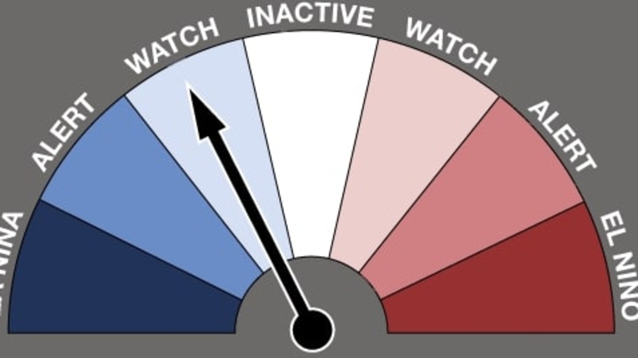
The bureau has declared La Niña over, countering American forecasts.
The prediction puts Australia on a “watch” alert, meaning there is about a 50 per cent change of La Niña forming again later this year.
“This is approximately double the normal likelihood,” the BOM said.
However, data from the US suggests the climate pattern is set to continue until the end of August, with a 55 to 60 per cent chance of hanging around until spring.

It comes as another cold front moves through southeast Australia, ensuring residents are shivering on the shortest day of the year.
The Winter Solstice has brought chilly conditions, rain and cloud cover for Victoria, NSW, South Australia, Tasmania and the ACT on Tuesday.
It began overnight and is expected to primarily impact parts of east Victoria and southeast NSW throughout the day, with Sky News Meteorologist Robe Sharpe saying this means snow is falling in alpine areas in those two states.

“With that (cold front) we’ve seen a decent amount of snow, particularly for the Victorian resorts. NSW has been raining up until now, but it’s just started snowing for Perisher and Thredbo,” he said on Tuesday morning.
Snow is forecast to fall above 1300m in both states throughout the day.
The showers are expected to reach Sydney and Wollongong by Tuesday afternoon before another patch of rain begins in southern South Australia and southwest Victoria.
While the cold front is not as bad as the extremes experienced in recent weeks, it still dropped the dial for Australians in those affected areas.
Melbourne, Sydney, Hobart and Canberra all hit minimum temperatures of below 10C, while Adelaide experienced a low of 11C this morning.
A weak #coldfront is moving over SE #Australia early this week. Showers are forecast for all the south-east capitals, and #snow across Alpine areas.
— Bureau of Meteorology, Australia (@BOM_au) June 20, 2022
Conditions ease quickly for #NSW by Wednesday, but cloud and showers hang around elsewhere.
Forecasts: https://t.co/ZcxKIEsuvhpic.twitter.com/Li9STwQwx9
The Bureau of Meteorology said the conditions should ease in NSW by Wednesday, but the clouds and showers are expected to continue elsewhere in the southeast.
Two more cold fronts are forecast to move throughout that area of the country later this week.
The next front will begin from Tasmania late on Thursday before crossing to southeast mainland Australia on Friday.
The third front will follow a similar course on Saturday from Tasmania to the mainland, but it is expected to have more cold air attached to it.
This means snow is forecast to fall at lower levels, particularly in Tasmania.
Read related topics:Weather


