
La Nina explained: How the climate driver forms, its effects and the difference climate change brings
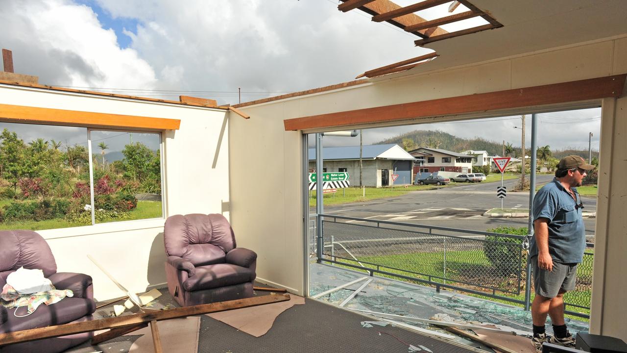
A massive climate driver could ruin a lot of people’s summers in Australia. But there is a silver lining to this big weather change.

It’s the one piece of good news following confirmation the fierce La Nina climate driver has returned for a second year. But, climate watchers have warned, it’s the merest sliver of a silver lining.
That positive news is that this La Nina is unlikely to be as powerful as the last double La Nina which occurred between 2010 and 2012 and saw both Cyclone Yasi and the catastrophic Brisbane floods. So the weather may not be quite as wild for quite so long.
“This is looking like a weak to moderate La Nina while ten years ago it was strong event,” Neil Plummer, a consultant with Monash University’s Climate Change Communications Research Hub told news.com.au.
“It’s also short lived – it’s started late – so the expectation would be that you wouldn’t see the extensive, longer duration flooding back we had 10 years ago.
“But you certainly can’t rule that out,” Mr Plummer cautioned.
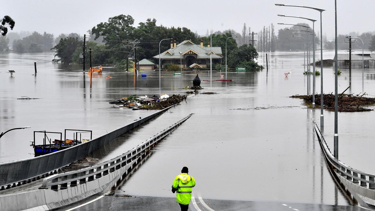
Nonetheless, meteorologists have said that this La Nina is very much on a par with last summer’s event. And that means that sporadic floods on the scale of the deadly floods that hit the Hawkesbury-Nepean in Sydney could be on the cards.
So what exactly is La Nina, how will Australia’s summer pan out and what does it mean for climate change?
What is La Nina?
The Bureau of Meteorology has said that its climate outlook for summer 2021/22 now includes a La Nina forming.
La Nina and its counterpart El Nino are the two extremes of a major climate driver known by its full name of the El Nino-Southern Oscillation, or ENSO.
ENSO can mean the difference between devastating droughts and bushfires, and much-needed rains but also far less welcome cyclones and floods.
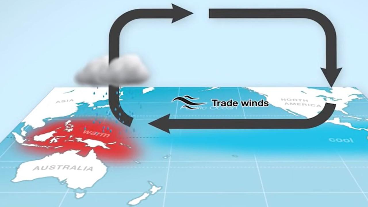
The climate driver is a measure of sea surface temperatures and winds in the Pacific Ocean.
During a La Nina event, which happen in and around summer, trade winds ramp up dragging cooler waters from the depths of the ocean to the surface in the central and eastern equatorial Pacific.
These winds, travelling from east to west, in turn push warmer seas closer to Australia. That helps in cloud formation which brings more rainfall. La Nina’s often coincide with more tropical cyclones.
Is everywhere around the Pacific wetter during a La Nina?
With all that rainfall concentrated on Australia, somewhere has to miss out and it’s usually the southern US.
While a La Nina can mean more rain for the US Pacific Northwest, it’s often far drier in California and other southern states and can coincided with more bushfires.
La Ninas often lead to drought conditions in Peru and Chile.

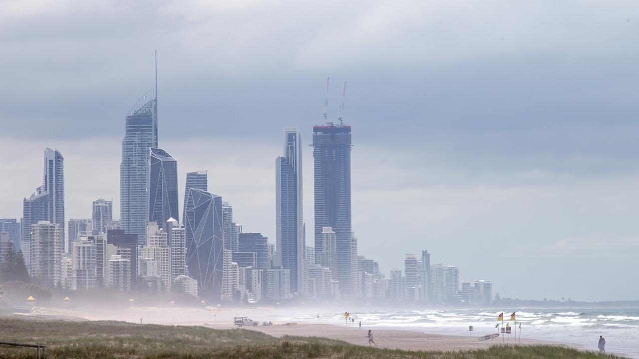
What can we expect from this La Nina event?
Rain, and lots of it, said Monash’s Mr Plummer.
“The expectation of an event like this that rainfall will very likely be above average for large parts of north and eastern Australia with a high chance of flooding events.”
Rainfall over eastern Australia can be around 20 per cent higher than usual from December to March when the average La Nina is in play.
However, given this La Nina could be short lived, its effects might vanish by the end of January or into February.
More cloud can bring down daytime temperatures but conversely make nights milder which can mean less frost.
Increased rainfall and more cyclones means the possibility of floods. But more rain also means fewer heatwaves and bushfires. Not none at all, but fewer.
Southern and western parts of Australia are less impacted by La Nina but can also see more rain depending on other climate drivers.
Will Australia’s summer only be impacted by La Nina?
La Nina rarely acts alone. A similar climate driver in the Indian Ocean, the Indian Ocean Diploe, is coming out of a negative phase. This phase helps bring more rainfall to Australia’s south and east adding to the moisture coming in from the Pacific.
But its effects are now waning as we head into summer.
The Southern Annual Mode, in the Southern Ocean, is in a positive mode which typically aids rainfall in Victoria. But it also reduces rain in parts of Tasmania.
Meanwhile, the Madden-Julien Oscillation to Australia’s north is expected to intensify as we head into December which should bring more rainfall across northern Queensland.
Western Australia, the Northern Territory and much of South Australia will likely avoid much of this weather drama with forecasts for average rainfall over summer.
Much of the country, aside from NSW and eastern Victoria could see warmer temperatures.
How frequent are La Ninas?
Generally, ENSO swings from La Nina to El Nino every three to five years but the gap can be much longer.
There was a nine year gap between La Nina events between 1989 and 1998 with four El Ninos in between.
What is the significance of back to back La Ninas?
“The last time back to back La Nina’s were declared, around a decade ago, Australia recorded its wettest 24 months on record,” Sky News Weather senior meteorologist Tom Saunders told news.com.au.
The weaker nature of this La Nina means conditions this year may not be so sodden. However, we’ve already seen November wet weather records broken in some areas.
What back to back La Ninas definitely mean is swollen water catchments because of above average rainfall over an extended period. And that can only help bring about flooding.
What about climate change and La Nina?
It’s one of the biggest confusions of La Nina – if it brings cooler temperatures and more rain, isn’t that the exact opposite of climate change which it’s assumed brings warmer temperatures and less rain?
No, say climate scientists. Even wet years can occur while climate change is at work. Indeed, one of the effects of climate change is less rainfall overall but an increasing number of short and sharp intense rainfall events.
“Australia has always been the land of droughts and flooding rains. It’s normal to be beset by a multi-year drought, before experiencing major floods,” CSIRO climate projections scientist Michael Grose wrote on academic website The Conversation.


“Of course there are wet years. But the longer-term trend has been (drier).
“Even if the whole of 2021 ends up being very wet, it won’t shift the long-term trend by much,” said Mr Grose.
“Only a persistent wet trend over decades or longer would raise questions about our assessment of climate change and current projections.”


