
Bureau of Meteorology officially declares that La Nina climate driver has returned
A powerful climate driver has just been declared for Australia and it could bring a summer of dangerous weather unlike the seasons we’re used too.

It’s been lurking in the wings for weeks, but the Bureau of Meteorology has today officially confirmed it – La Nina is back.
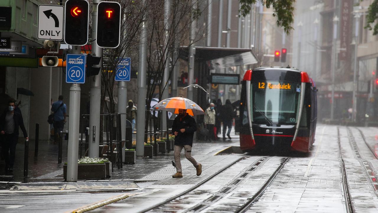
The climate driver is a major influencer of Australia’s weather and its return virtually guarantees a soggier summer – on the east coast particularly – as well as lower temperatures.
There is also the possibility of more tropical cyclones in Australian waters and flooding on land.
It means the current conveyor belt of rain events could stick around all summer long.
And back-to-back La Ninas can pack an even bigger punch, meteorologists have warned, with Cyclone Yasi and the Brisbane floods of 2011 both coming in a repeat La Nina.
“The wet landscape and the La Nina event mean that very serious flood events are a real chance this summer,” Sky News Weather meteorologist Rob Sharpe told news.com.au.
The BOM raised it’s climate outlook on Tuesday from La Nina alert to La Nina.
It added that climate models suggested La Nina would persist until late summer or early Autumn and it would be of weak to moderate strength.
The Indian Ocean Dipole, a climate driver in the seas to the west of Australia, is heading into a neutral phase. However, the BOM said clouds and wind patterns in the Indian Ocean have maintained some characteristics of a negative phase which could increases rainfall to the south and east of Australia.
Other climate drivers are also in play bringing rain to the north and east. But Western Australia may not see as much fainfall.
The US’ meteorological service had already called La Nina but the BOM, which has a slightly different criteria, said the climate driver had only just passed its threshold of being declared in the last fortnight.
La Nina and its counterpart El Nino are the two extremes of a major climate driver known by its full name of the El Nino Southern Oscillation, or ENSO.
ENSO can mean the difference between devastating droughts and bushfires, and much-needed rains plus far less welcome cyclones and floods.
Rainfall over eastern Australia can be around 20 per cent higher than usual from December to March when La Nina is in play.
How La Nina forms
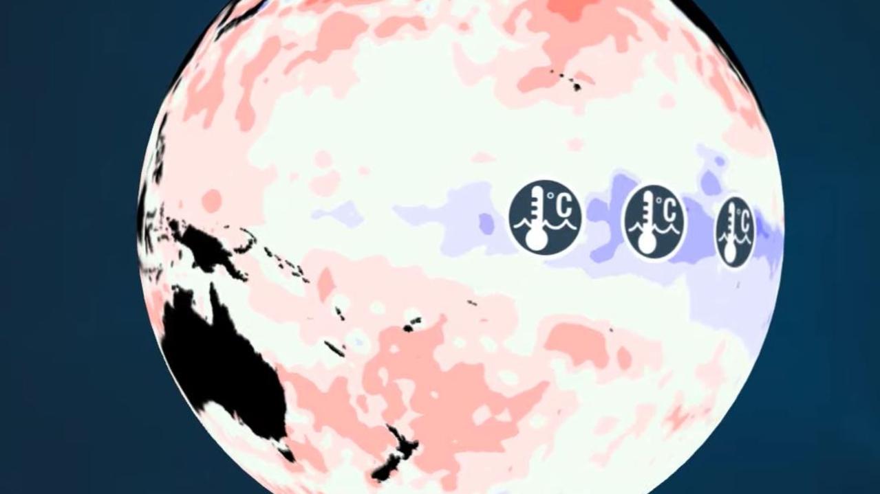
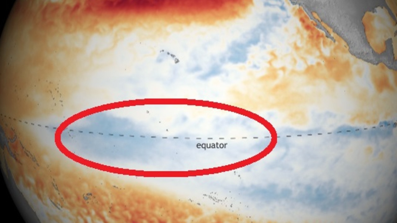
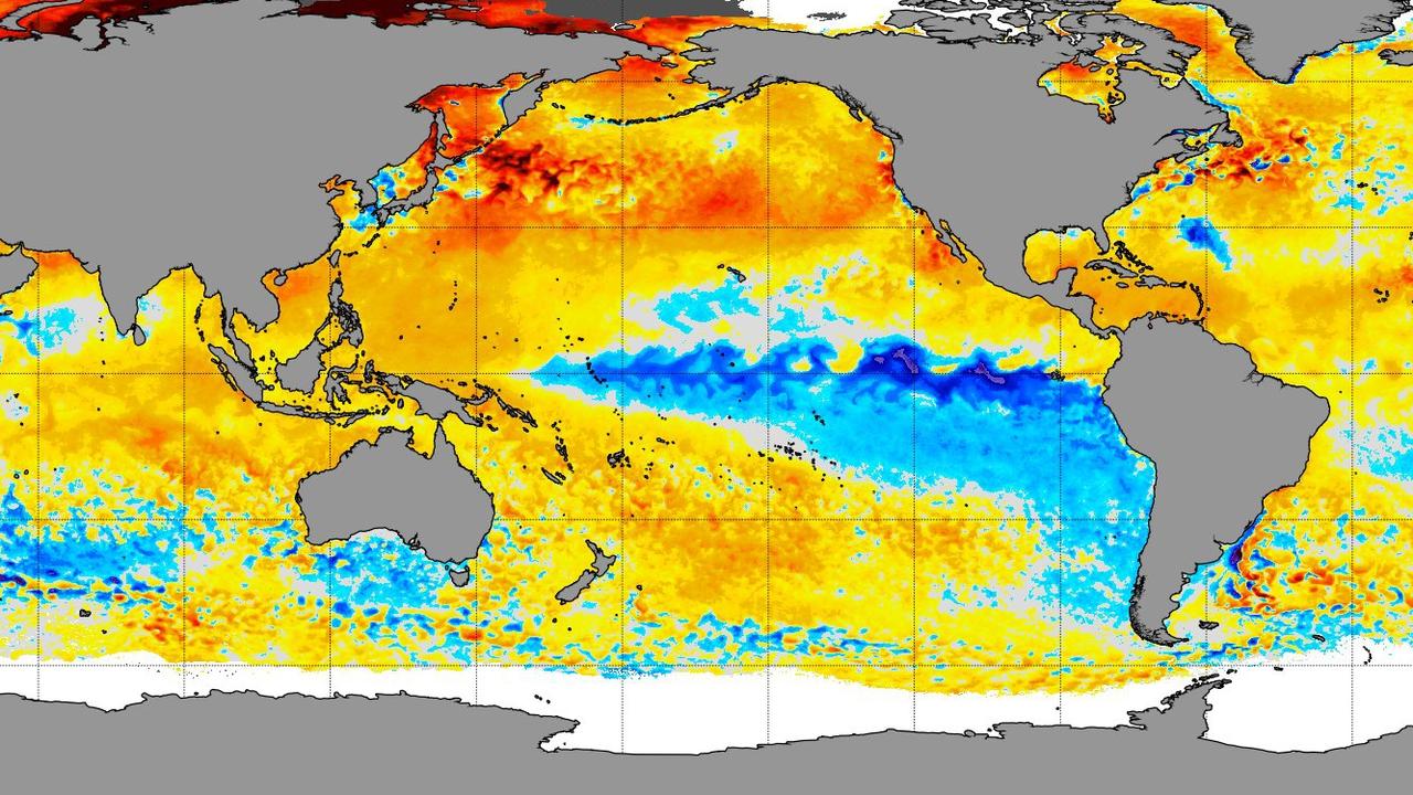
The climate driver is a measure of sea surface temperatures and winds in the Pacific Ocean that impacts not just us, but also the Asia Pacific region as well as the Americas.
During a La Nina event, trade winds ramp up dragging cooler waters from the depths of the ocean to the surface in the central and eastern equatorial Pacific.
The Bureau has declared that a #LaNiña has developed in the tropical Pacific. Typically during La Niña, there is above average rainfall for eastern, northern and central parts of  Australia. pic.twitter.com/4KJeKsVI6A
— Bureau of Meteorology, Australia (@BOM_au) November 23, 2021
These winds, travelling from east to west, in turn push warmer seas closer to Australia. That helps in cloud formation which brings more rainfall. La Ninas often coincide with more tropical cyclones.
But with all that rainfall concentrated on Australia, somewhere has to miss out and it’s usually the southern US. A La Nina year could mean even more bushfires for California.
La Nina’s bring ‘dangerous’ conditions
This La Nina may not be the strongest, but meteorologists have said it would be no surprise to see a repeat of the Hawkesbury-Nepean floods from March.
It was also significant that this La Nina was arriving so soon after its previous visit. The last time that happened was in 2009/2010 and then 2010/2011.
During that double event Australia recorded its wettest 24 months on record, including major Brisbane floods and Severe Tropical Cyclone Yasi.
“Australia’s landscape is in a similar position to in November 2010 – which was just two months before the deadly Queensland and Brisbane floods,” Mr Sharpe said.
“But it should be noted that December 2010 was Australia’s and Queensland’s wettest on record, so a repeat of the Brisbane floods is unlikely this summer.”
Nonetheless, Mr Sharpe warned against being “complacent” with La Nina.
Where floods might occur depended on where the big weather systems move across the country in the coming months.
“The most dangerous lows and cyclones are ones that are slow-moving or stall as the rain totals underneath them can be huge.
“It is very important for people to take heed of the advice of the BOM and the SES this summer as your local river could rise higher than you’ve seen it before or even higher than the record books.”
The greatest chance of flooding will be in the already swollen rivers of Queensland, NSW and Victoria.
More Coverage

La Ninas have a definite silver lining though – they generally bring a reduced chance of bushfires. That’s not across the board, though. There may be areas that are drier than others and bushfires don’t need a lot to get going.
But more moisture in the air and increased rainfall are not ideal conditions for severe, prolonged blazes.
Even during La Ninas there can be heatwaves and spells of dry conditions, but all the signs are that there will be more rain, more floods and cooler temperatures to come this summer.

Ignition point found in suspicious bushfire

Millions to be smashed by 4000km heatwave
