La Nina: Nino 3.4 – Pacific Ocean patch that could change Australia’s weather
A remote zone of the Pacific Ocean has just given us huge clue that our weather could be about to undergo a dramatic change.
It lies about 4000 kilometres north east of the Cape Byron lighthouse, Australia’s most easterly point, and stretches for several thousand kilometres further east straddling either side of the equator.
Much of it is desolate ocean, aside from the nation of Kiribati which is partly within it. But this patch of seemingly unremarkable water has a huge effect on Australia’s climate. And right now, all the signs are that changes are afoot within its deep Pacific depths that could lead to an imminent and dramatic shift in our weather.
Welcome to Nino 3.4. Sounds like an update to a computer program; actually a crucial part of the Pacific.
It lets meteorologists know the status of the El Nino-Southern Oscillation (ENSO) – essentially El Nino and La Nina – which together are one of Australia’s key climate drivers. ENSO can mean the difference between devastating droughts and much needed rains, even floods.
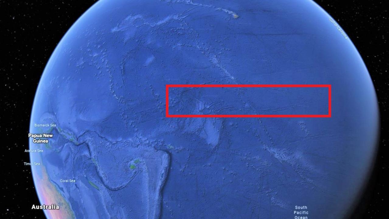
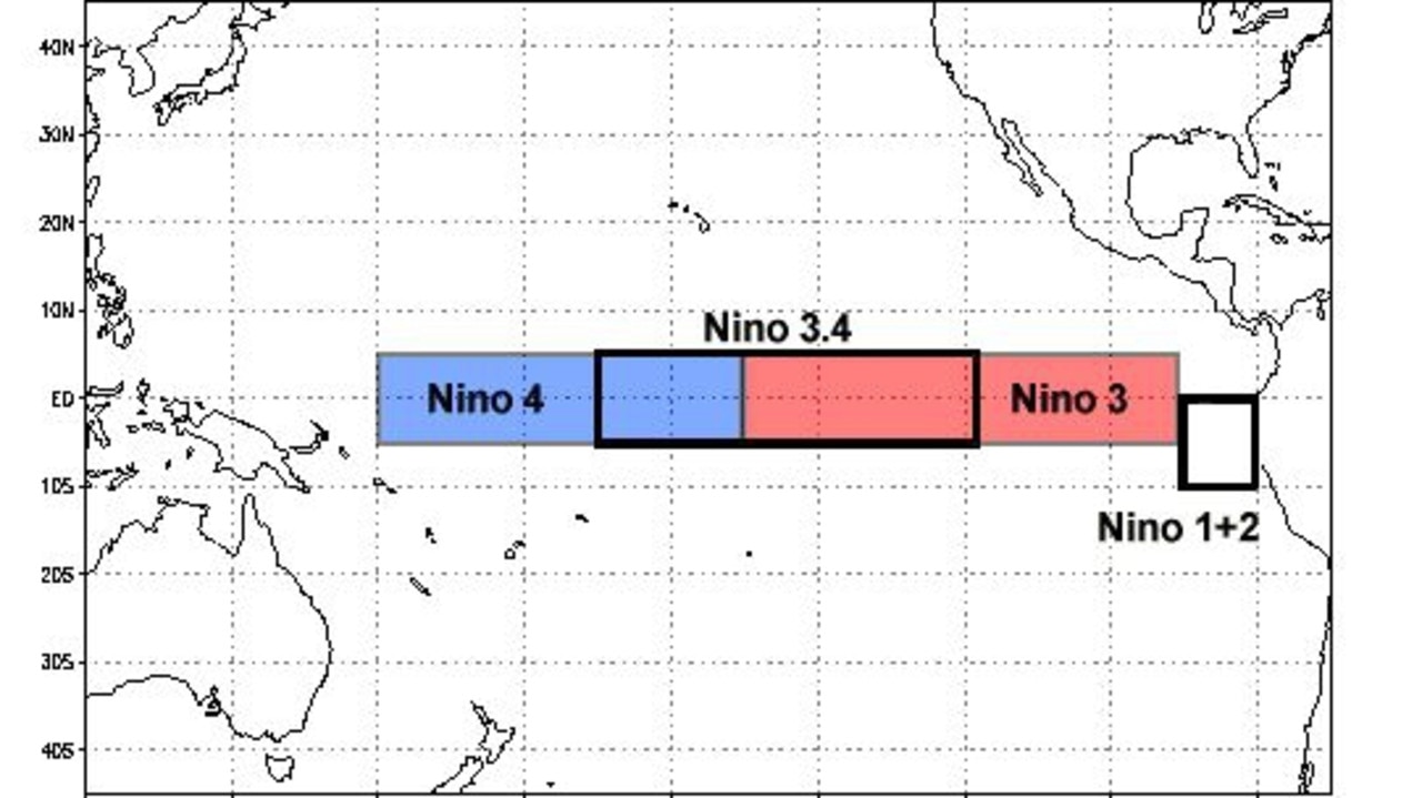
“Nino 3.4 is a special area in the equatorial Pacific Ocean. It’s right in the central part of the Pacific that drives the whole ENSO system and it’s an area used to calculate whether we’re in an El Nino or La Nina phase,” Sky News Weather meteorologist Tom Saunders told news.com.au.
Its location is in a band either side of the equator between Hawaii to the north, Tahiti to the south and with its western tip in the vicinity of Samoa.
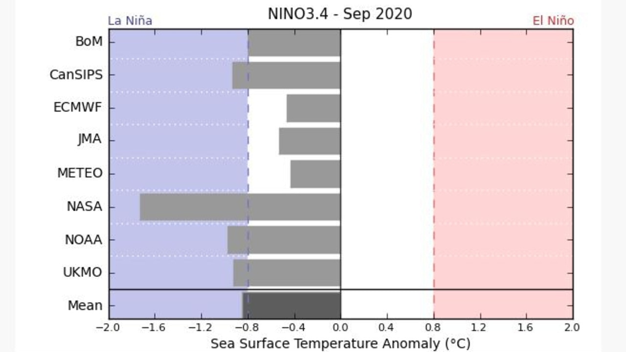
“We’re firmly in a neutral ENSO phase at the moment. But the latest data to come from Nino 3.4 is that sea surface temperatures there are 0.4C below average and the threshold for a La Nina to be declared is 0.8C below average for a period of three months,” said Mr Saunders.
“We’re on the La Nina side of neutral but five of the eight global climate models are predicting we will go into La Nina in September.”
WHAT CAN LA NINA DO?
At this point it might be good for a refresher on what El Nino and La Nina - Spanish for “the little boy” and “the little girl” respectively - are and what they can do, particularly as we’ve been in neither for ages.
The ENSO is a measure of sea surface temperatures and winds in the Pacific Ocean. It’s a climate driver that impacts not just us, but also the Asia Pacific and the Americas as well.
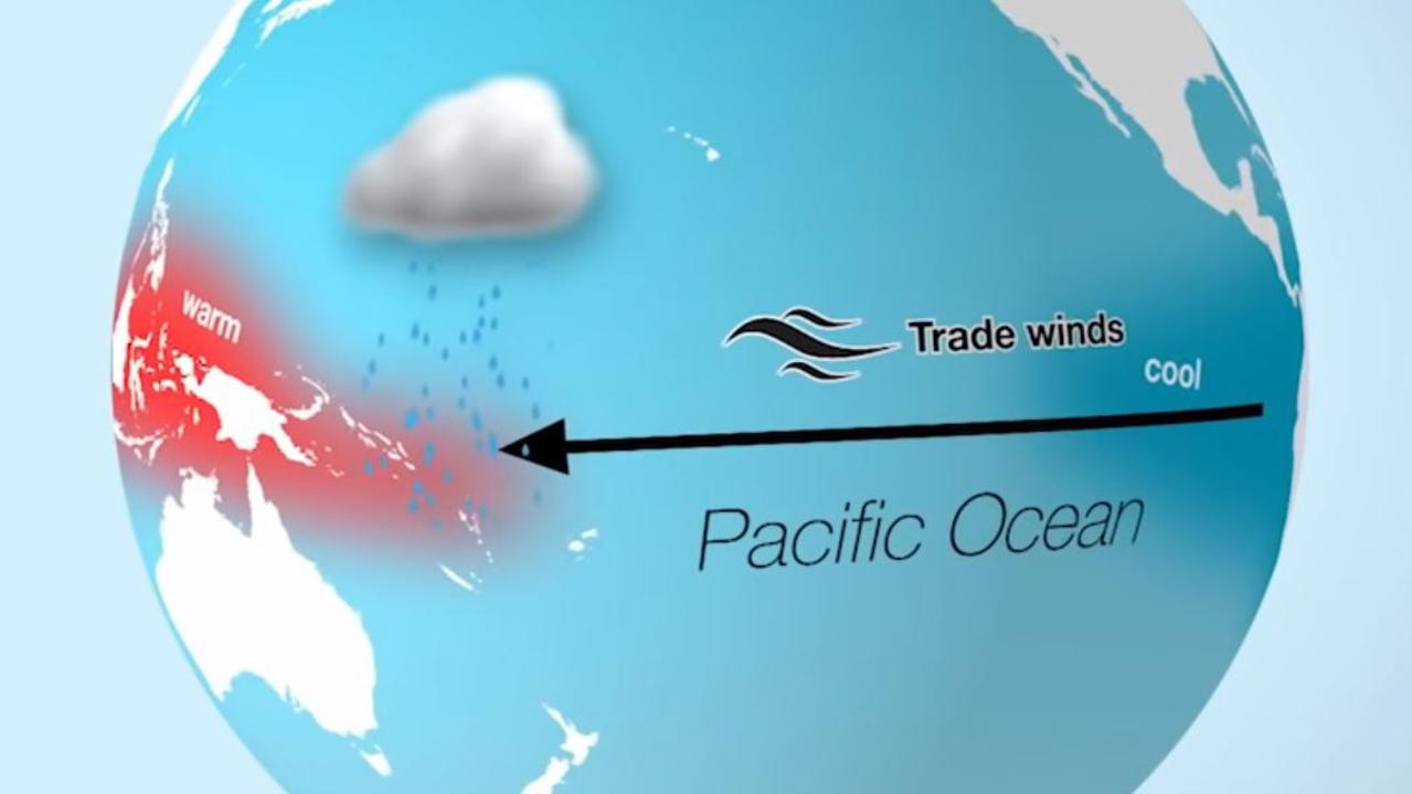
In a neutral phase, which we’re in now, trade winds blow from east to west gently leading to warmer waters around Australia.
This can lead to average conditions, but also leaves the continent susceptible to other climate drivers like the Indian Ocean Dipole which is similar to ENSO but to Australia’s west.
RELATED: Beach homes ‘partially collapse’ on NSW Central Coast
Last year was one of the strongest IODs on record. With no La Nina or El Nino in play, the IOD had free reign and that had a big role to play in it being Australia’s driest year on record leading into the horror bushfire season.
La Nina is like an extra powerful neutral phase with cooler waters from the depth of the ocean hauled up to the surface in the central and eastern equatorial Pacific region (around Nino 3.4). Stronger winds from east to west push even warmer seas closer to Australia. That aids in the creation of more clouds and so moisture and windier conditions for the continent.
An El Nino can see the opposite. The winds can reverse, or at least weaken hugely, as warm water drifts further from Australia leading to drier conditions.
“On average you go into an ENSO phase every two to seven years. It’s a cyclical pattern but not a steady pattern. You could have three El Ninos in a row or back to back La Ninas like in 2010 and 2012 when we had two years of constant rain and flooding across Australia,” said Mr Saunders.
The Bureau of Meteorology now has Australia on La Nina watch which means there is a 50 per cent chance of one forming, double the normal outlook.
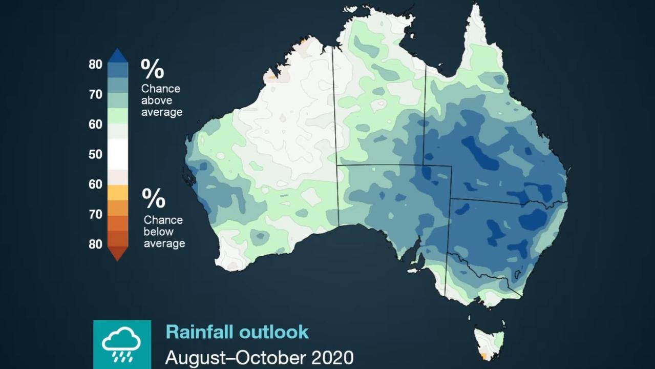
“If we continue to transition into a La Nina, it generally means above average rain for northern and eastern Australia for the second half of the year,” said Mr Saunders.
“And it’s definitely not just the coast but inland and right through into northern Australia.
“It’s only really Western Australia that won’t be as impacted.”
However, if it does eventuate, it’s probably not going to be a particularly strong La Nina. If it was, it probably would have formed in winter rather than taking its time to bubble up during the Southern Hemisphere spring.
That later debut also means it probably won’t last as long.
But even a weak La Nina is better than none at all with 67 per cent of Queensland and almost 80 per cent of New South Wales in drought.
The latest BOM climate outlook has either average or, most likely, above average rainfall across most of the country.
“It could mean wet weather for spring – perhaps around a 60 to 90 per cent chance of rainfall being higher than average,” said Mr Saunders.
“We have our fingers crossed we’ll be seeing a La Nina because that’s what Australia needs right now.”
The hope is the waters in Nino 3.4 will continue to drop in temperature and bring on La Nina.
benedict.brook@news.com.au | @BenedictBrook


