
Fire-hit areas including Briagolong expected to receive between 30-50mm of rain by Wednesday
Communities in the state’s east that were hit by bushfires at the weekend are now at risk of flash flooding in what’s been described as a “mixed weather phenomenon”.

Victoria
Don't miss out on the headlines from Victoria. Followed categories will be added to My News.
Gippsland communities on bushfire alert at the weekend have shifted their focus to flood preparations, with heavy wind and rainfall predicted in the coming days.
Winds of up to 100km/hr are expected to flow through Victoria’s central and eastern ranges by Wednesday morning, while some areas in Gippsland could see up to 100m of rain by Thursday.
A severe weather forecast for damaging wind gusts was issued for the central and eastern ranges on Tuesday.
The areas hit hardest by the weekend’s fires, including Briagolong, are expected to receive between 30-50mm of rain by Wednesday morning, with a similar second batch of rain expected to fall later on Wednesday.
BOM Meteorologist Christie Johnson predicted some areas could see “quite a lot of rainfall”.
“On Wednesday we could see widespread 30-60mm in the eastern part of the state, possibly 40-80mm up on the ranges and, up on the peaks maybe up to as high as 70-100mm,” she said.
“(The fires) are probably a little west of where the heaviest rainfall is predicted for Wednesday and Thursday but there will be some decent rainfall there,” Ms Johnson said.
Gippsland has been put on alert for flash flooding.
The areas most at risk of flash flooding are the eastern and northeast parts of the state from Bairnsdale to the NSW border.
Catchments including the Mitchell, Tambo, Snowy, Cann, Bemm and Genoa rivers are forecast to receive moderate flooding and are at risk of “low end major flooding” should the rainfall reach the higher end.
All other catchments in Gippsland are at risk of minor flooding, with the only exception being Traralgon Creek.
Minor flooding has also been forecast at the Upper Murray, Mitta and Kiewa rivers.
VICSES COO Tim Wiebusch said the eastern part of the state was set for a “mixed weather phenomenon”.
“We’re going to see heavy rainfall commence late on Tuesday and early Wednesday and then into parts of East Gippsland on Thursday,” he said.
“We can’t emphasise enough that in the coming days if you’re confronted with flood waters do not attempt to drive through those waters it could be the last decision to make.
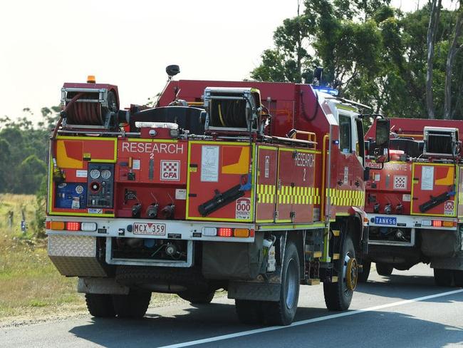
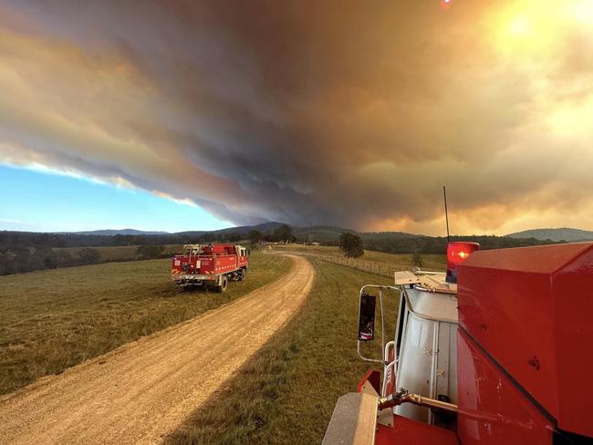
The flood warning comes as fire crews battled 220 bushfires and grassfires between Saturday and Tuesday afternoon.
CFA Chief Officer Jason Heffernan said the expected rain will “delay” fires in East Gippsland.
“The rain predicted by (BOM) will serve, in all likelihood, given the quantum of rain predicted to suppress the fires burning the landscape currently and is likely to hit the pause button for the East Gippsland community for a few weeks,” he said.
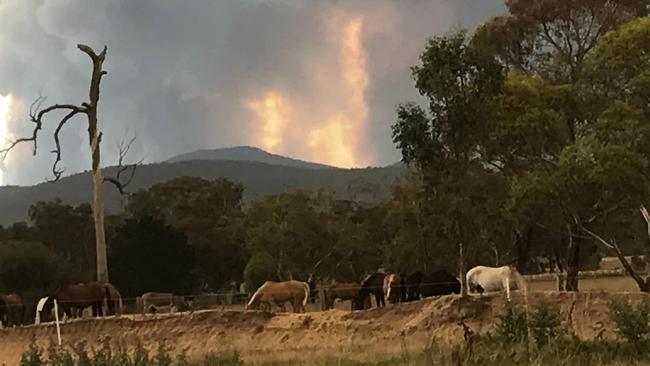
The fire at Briagolong spanned 5000ha and had a perimeter of 42km, with crews expected to be on alert at the scene when a significant wind gust moves through the area on Wednesday morning.
One home was lost in the fire.
Mr Heffernan was confident the other major fires at Lochsport and Rawson would fall under control.
“With the Briagolong fire … it is not likely that fire agencies will be able to contain that fire in the next 12 hours,” he said.
“The Loch Sport fire under the predicted winds is likely to run to the ocean so it’s not likely to run into any property in the path of that fire and Rawson fire has had some really good progress made there.”
Mr Heffernan said the weekend’s fires served as a “reminder” to Victorian communities.
“This state has seen its fair share of disasters … it goes to show how quick a fire situation can develop when we have dry conditions and East Gippsland has been dry for some time,” he said.
He said Victorians can expect a return to more of a “traditional” fire season this summer.
Watch and Act messages have been used for Cobbannah, Glenaladale, Moornapa, Culloden and Briagolong.


Nick Reece racks up six figure travel bill with China trip looming
Ratepayers have forked out more than $114,000 to cover Nick Reece’s travel expenses as the Melbourne Lord Mayor eyes a major $20,000 China tour.

Questions over acting Premier’s eligibility for top job
Victoria has a new leader in charge while Jacinta Allan and her deputy Ben Carroll are both on leave. The circumstances of the appointment haven’t been seen since 1868.