
Tropical Cyclone Oma predicted to bring severe erosion to Gold Coast beaches
Meteorologists have handed down their predictions for Tropical Cyclone Oma over the weekend as Mayor Tom Tate urges Gold Coast residents to prepare.
Lifestyle
Don't miss out on the headlines from Lifestyle. Followed categories will be added to My News.
QUEENSLAND’S treasured tourist beaches face their most severe erosion threat in decades as Tropical Cyclone Oma edges closer to the coastline.
While the Bureau of Meteorology has cancelled its Cyclone Watch warning and forecasts that Oma will remain offshore this weekend, fears are growing it may have a devastating impact on the southeast’s foreshores.
Oma has weakened to a Category One system but was expected to re-intensify.
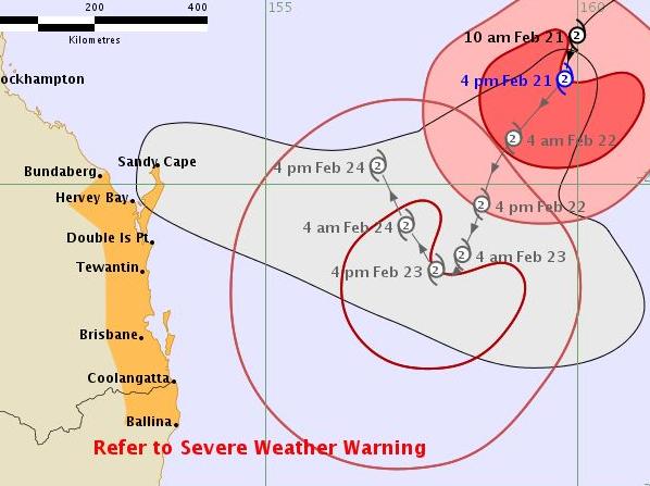
It is located 720km northeast of Brisbane and travelling south, southwest at 13km/h.
It is expected to re-intensify to Category Two through today and continue moving in a generally south to south-westerly direction into early Saturday.
Its motion was then expected to shift slowly to the north during Saturday, remaining offshore through the weekend and early next week.
While latest modelling shows the system, packing 90km/h winds and whipping up 6-8m seas, is becoming less likely to reach land, fears are growing it may have a devastating impact on the southeast’s foreshores.
COAST SET UP FOR 240MM OF RAIN FROM CYCLONE OMA
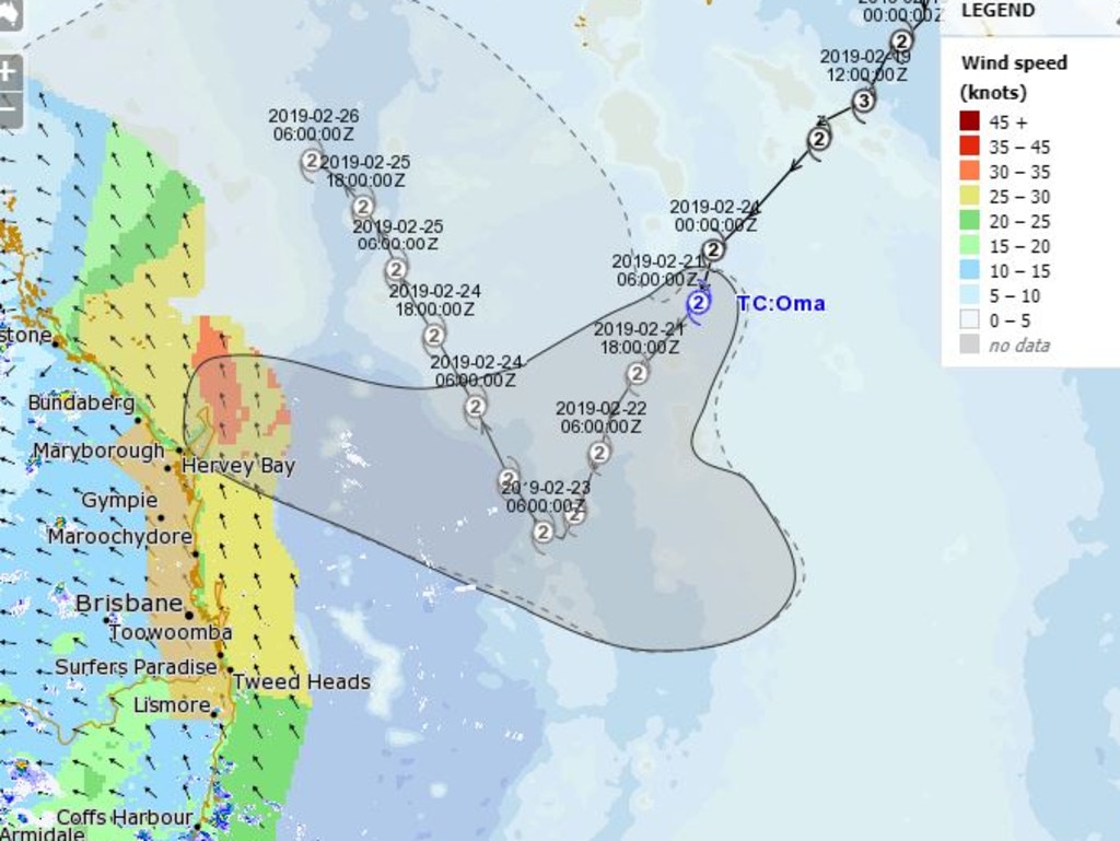
BOM forecaster Lauren Pattie said Oma would be less than 750km northeast of Brisbane by this morning, bringing stronger winds, even more powerful waves and showers.
Ms Pattie said modelling showed it was likely to slow about 300-400km offshore from Fraser Island on Saturday and into Sunday and then possibly track north offshore from Gladstone and Rockhampton.
OTHER NEWS:
Coast school hires security following bullying backlash
Labor ‘divided’ over second Gold Coast casino
“However, what Oma does from Sunday onwards remains uncertain. A couple of models show it heading north and one has it going back out into the Coral Sea,” she said.
MAYOR URGES RESIDENTS NOT TO PANIC, TO PLAN INSTEAD

Southerly winds will increase to 75km/h across the southeast today with seas rising to 4-7m. Tomorrow will see winds strengthening to 85km/h and seas surging to 6-8m.
A tropical cyclone watch is now in place covering the coast from Bundaberg in Queensland to Ballina in northern NSW.
Leading surf forecaster Ben Macartney, of Coastalwatch, said a cyclone behaving like Oma was unprecedented in this area.
Mr Macartney said he had not found any precedents in terms of a system creeping up so slowly and hovering offshore, driving sustained giant swells at the Gold Coast and Sunshine Coast.
THE BIG STORMS THAT SMASHED COAST IN 1954 AND 1967
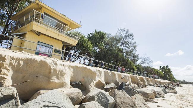
He said the relentless pounding, combined with king tides, was set to cause the worst erosion in decades.
“It’s phenomenal really,” he said.
“We are looking at an exceptional swell event. It’s going to get more chaotic and there will be a lot of water movement and damage to the coastline. Easily our most severe erosion event in decades.”
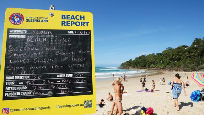
Beaches across the Coast have been closed until Sunday and winds of up to 90km/h an hour have been predicted as the Category 2 system approaches the east coast in the coming days.
BOM meteorologist Kimba Wong said it was difficult to predict exactly what Cyclone Oma will do over the coming 48 hours.
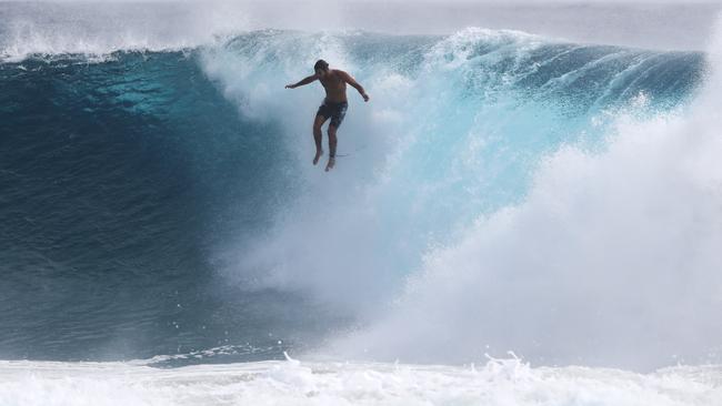
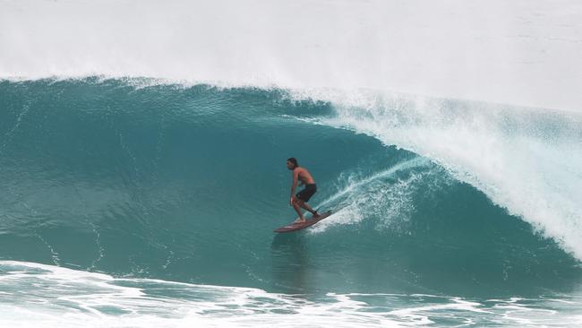
BIG SURF AND BIG NAMES AS OMA BRINGS THE GOODS
“It’s still a fair way off and tracking slowly towards the southern coast,” she said.
“Our current forecast is for it to slow down as it heads toward Saturday and from there possibly turn towards the northwest along the coast.
“If it does approach the Queensland coast it does look likely to affect areas a little further north than the Gold Coast, so possibly heavier rainfall might be experienced more around the Sunshine Coast and Fraser Island.”
Despite the uncertainty, Ms Wong warned the Gold Coast could still expect severe weather conditions across the weekend.
“Already we are seeing high tides this week just associated with the full moon, and those tides have been exacerbated by the increased swell,” she said.
“With those increasing swells and waves combined with the high tide, and increasing winds as well, coastal erosion and inundation of low-lying areas is a serious risk.
“We have issued a cyclone watch, and that watch-zone extends from Bundaberg all the way down to Ballina, including the Gold Coast.
“That watch-zone is the potential for gales within the next 48 hours. Gales are winds up to 90km/h, with gusts in excess of that as well.”
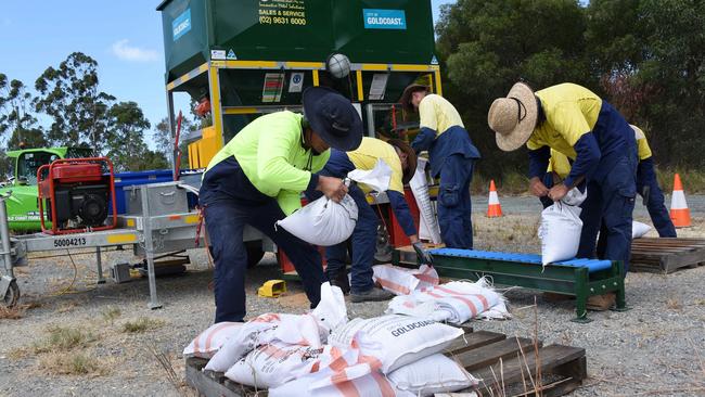
Gold Coast Mayor Tom Tate urged residents to “prepare themselves” in case of flooding.
“I have activated, for those who want to get ready, sandbagging and the machines are already filling up the bags,” he said.
“We looked at the likelihood that it would go up north but planning is everything, so if it does come straight for the Gold Coast we’ve got to be prepared for it.”
COAST BUSINESSES: ‘BETTER SAFE THAN SORRY’
Mayor Tate said the Gold Coast had prepared for Cyclone Oma since the damage caused by Cyclone Oswald in 2013.
“When you look at storm cells and cyclonic rain, Oma is a lot more passive but when you add the swell, the tides and the time, it adds to our coastal damage.
“I don’t see damage as bad as Oswald … but abundant caution is the key.
“Since 2013 we’ve invested heavily to protect property and people … a multifaceted solution has been invested in since then and now mother nature is going to test it.
“By my prediction it won’t be as bad as Oswald but we’ll wait and see.”
Cr Tate’s warnings have been echoed by representatives of Tweed Shire Council, which endured catastrophic flooding from Tropical Cyclone Debbie.
Tweed council general manager Troy Green said the council had taken on board key lessons from the March 2017 floods, enacting an “Emergency Dashboard’’ online to provide up-to-date information.
“It’s important to note that unlike on the Gold Coast, Tweed Shire Council is not the main agency in an emergency, it’s the SES on 132 500,” he said.
SUBSCRIBE TO THE GOLD COAST BULLETIN — JUST $1 FOR THE FIRST 28 DAYS
“While we don’t know how this weather system will play out, we’re taking action to prepare and protect council and the community’s assets.
“We’re moving our fleet to higher ground, inspecting and preparing flood gates and levees, filling our treated water supply reservoirs and getting equipment ready to close beach access points should erosion cause big drop-offs.
“In terms of water supply, we’re prepared for potential saltwater inundation at the Bray Park Weir, with blocks and sand bags in place to provide additional protection against abnormally high tides.”

‘Tenthouse’ views no longer as council take action
A homeless person’s innovative solution to secure beachfront accommodation at Burleigh Heads has been dismantled by council after residents raised the alarm.

‘Such a proud moment’: Cheer gym named best on the Gold Coast
A Gold Coast cheerleading gym has been named the best in the region for the second year in a row.