
Record rainfall for the Gold Coast as more than 300mm lands on the city
Official rainfall totals show the Gold Coast is officially the wettest place in Queensland after a weekend of heavy rain, flash flooding and storms. And there could be more to come.
Lifestyle
Don't miss out on the headlines from Lifestyle. Followed categories will be added to My News.
WHEN it rains, it pours on the Gold Coast with the city officially the wettest place in Queensland last week.
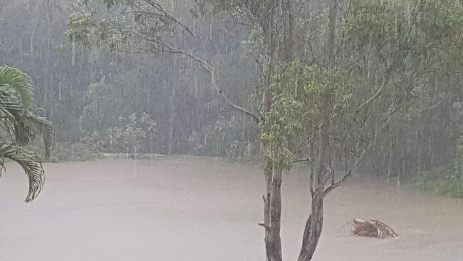
The Bureau of Meteorology confirmed the Coast had the state’s highest 7-day total from Monday to Monday, recording 307mm across the week.
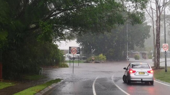
It was also the city’s wettest weekend of the year, marked by flash flooding, road closures and widespread power outages.
The Southport Spit was hammered with 159mm of rainfall in just 22 hours yesterday, with 83mm landing at Carrara, 80mm at Worongary and 71mm at Pacific Pines.
MORE NEWS
Future of Coomera Connector road now certain
‘Cull these cane toads of the sky’
Shocking pensioner death triggers inquiry call
A number of local roads were underwater because of flash flooding, with Hardys Rd through Mudgeeraba and Bonogin finally reopened this morning.
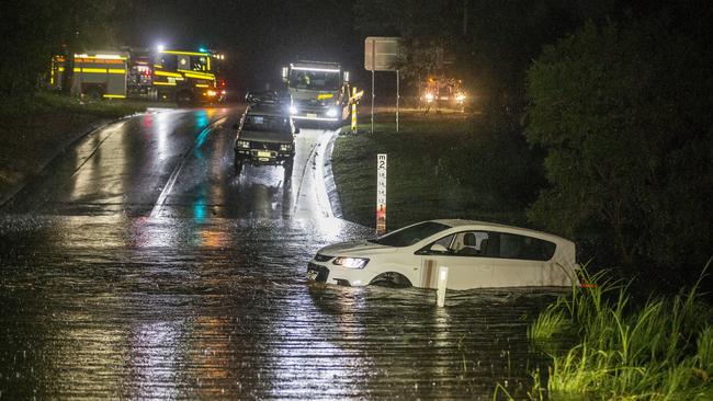
The SES attended more than 145 call-outs between 4pm Sunday and 7am Monday, with calls still pouring in from residents waking up to storm damage this morning.
Queensland Fire and Emergency Services teamed with the SES, using 14 rural trucks, to create a taskforce to help with the backlog of calls.
Pacific Pines and Arundel were the worst affected, but crews also attended homes from Upper Coomera to Burleigh, patching leaking roofs, providing sand bags and pumping water out of homes.
THREE DAY HEATWAVE WITH STORMS EXPECTED
And forecasters are warning the wild weather will likely continue.
The Bureau of Meteorology (BOM) predicts hailstones and damaging winds could cause chaos across the Coast later today before conditions ease into the week.
It was wet across the entire weekend, with widespread thunderstorms and downpours delivering more than 100mm to some parts of the Coast in less than 24 hours on Saturday and Sunday, including South Stradbroke Island where 105mm fell.
Record rainfall for the Gold Coast as more than 300mm lands on the city
Flash flooding caught some motorists by surprise, including a driver and her female passenger who were trapped inside their vehicle on Hardys Rd near Bonogin on Friday night.
The pair were forced to wade to safety, leaving the vehicle in the hands of emergency services.

Another car was caught out by flash flooding at New St at Nerang yesterday afternoon.
SUBSCRIBE TO THE GOLD COAST BULLETIN — JUST $1 FOR THE FIRST 28 DAYS
A number of other roads were closed yesterday afternoon, including Discovery Dr at Helensvale.
Meanwhile, more than 1500 homes were left without power after a tree branch took out electrical equipment at Currumbin on yesterday morning.
Homes in Tugun, Currumbin, Burleigh Heads and Palm Beach were cut off for several hours.
Coolangatta was soaked by more than 61mm yesterday — the suburb’s wettest day of the year — while the Spit also had its wettest day with 76mm of rain on Saturday.
Before Saturday, the wettest day of the year was February 6, when 12.4mm fell at the Seaway.
While some areas were wetter than others, BOM forecaster Jonty Hall said downpours and storms were felt across the region.
VERY DANGEROUS THUNDERSTORM BEARS DOWN ON COAST
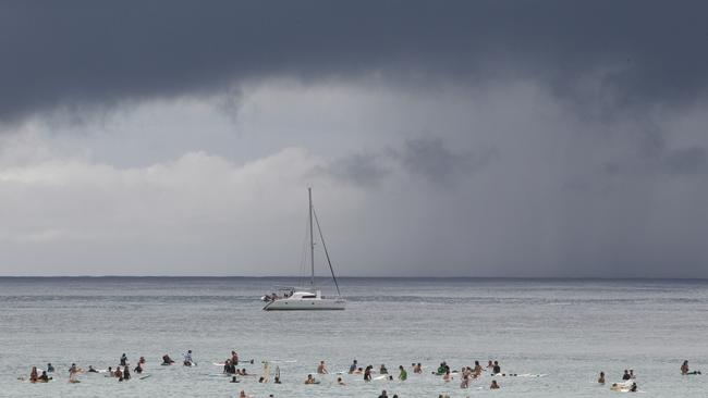
“We’ve got a good scattering of thunderstorms around southeast Queensland in general, including the Gold Coast,” he said.
“We’ve seen a couple of rounds of storms develop and move in from the northwest. There’s still some potential for further storms to develop through Monday.
“There is still instability around through the majority of next week actually. But it’s probably at its most active yesterday and Monday and then thunderstorms will generally become more isolated as we head through the remainder of next week.”

What to expect at this year’s Crafted Beer Festival
The excitement is brewing for the Gold Coast’s favourite frothy celebration, with beer lovers flying in from across the globe to crack a cold one and support the local scene. Here’s what you can expect.

Hot tub, fire pit, fine dining: Inside stunning glamping getaway
There’s no need to ruff it if you want to take your dog on holidays. We road test the Gold Coast hinterland’s most luxe glamping destination.