Lismore flood: Woman missing, Ballina hit by 900mm of rain, more towns evacuated
Emergency services are warning of a tough two days, with flood levels in Lismore tipped to peak above 12m. It comes as they released a fresh image of a woman who went missing in the floods
Lismore
Don't miss out on the headlines from Lismore. Followed categories will be added to My News.
Richmond Police have released an image of missing woman, Alina Brakel, in a plea for public assistance to locate the 55-year-old from Monaltrie, just south of Lismore.
The aged care nurse from Nowra has been identified as the missing woman stuck in floodwaters in Lismore since late Tuesday night.
Earlier on Wednesday, police and emergency services began looking for the woman at 9.50pm on Tuesday night near Wyrallah Road at Monaltrie, south of Lismore, after reports she was trapped in her car and in floodwaters.
Police spent several hours searching for the woman and her car but have still not found her despite recommencing the search in the early hours of Wednesday.
Police are calling on anyone who may have seen a 2017 white Holden Captiva station wagon, with NSW registration YHS 51F, in the greater Lismore area to contact police immediately.

The news comes as Acting Premier Paul Toole said “no one could have predicted” the catastrophic weather in the state’s north after the State Emergency Service admitted to a number of bungles in its management of the flood emergency unfolding in Lismore.
Flood levels in Lismore are set to reach a peak of more than 12 metres on Wednesday night as authorities warn of a “difficult 24 to 32 hours” for exhausted residents.
Prior to the floods earlier in March the highest recorded peak at Lismore’s Wilsons River was 12.1m -- making the expected weather event a significant concern.
Emergency Services Minister Steph Cooke said 28,000 people were collectively impacted by current flood warnings.
“We currently have 16 evacuation orders in place. That is changing as it needs to as we find out more information on where this weather centre is impacting communities,” she said in a snap press conference at 5pm on Wednesday.
“The weather system is tracking south and areas of concern include many communities along the mid-north coast.”
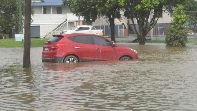
Bureau of Meteorology’s Dean Narramore said “numerous” rivers were facing major flooding.
“We’ve predicted a flood peak around the 12 metre mark in Lismore later tonight,” he said.
Corakai and Woodburn are expected to see major flooding tomorrow morning as the water moves from Lismore while Coffs Harbour has seen 50 to 100mm of rainfall since 9am on Wednesday morning and the Belinger and Erara Rivers are flooding.
SES Acting Commissioner Daniel Austin said the agency has conducted 55 flood rescues in the past 24 hours alone.
“We’ve seen conditions today that have also stopped our aviation assets from getting in the air... that in itself should be a warning to the community,” he said.
“We saw this morning the levee at Lismore overtop and that flooding continues... The flood waters are expected to move down the WIlsons and Richmond river systems.
“Communities in those areas we know are already stressed and already worried... Those flood waters will continue to eat their way into the coast.”

Ballina residents say they were never informed ahead of time flooding would occur, and by the time floodwaters came, they were already cut off from evacuation centres.
It has left Lismore locals like Adam Mazzarella scratching his head as to how predictions could have been so wrong as emergency services scrambled.
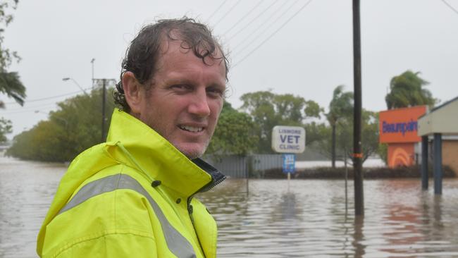
“It was very confusing,” he said.
“I’m not here to shoot people in the foot or anything but why say we are expecting a major flood and lift (the evacuation order) in the CBD to entice people to come back in?
“Then they tell everyone to get out, it doesn’t make sense.”
SES Acting Commissioner Daniel Austin said his agency’s decision to remove evacuation orders for Lismore at 4.30pm on Tuesday was the right one.
“Yesterday afternoon, based on the conditions that we saw, we did release the evacuation order for Lismore based on the local consultation that we undertook and also the advice on the weather conditions,” he said.
“That advice was the right advice to enable the community to try to restore and work through its recovery process. As we then saw some hours later, and then saw a significant thunderstorm.”
The comments came as new evacuation orders were issued for Woodburn and Swan Bay, Broadwater, Wardell, Cabbage Tree Island, Richmond River at Bungawalbyn, low lying areas of Coraki and New Italy.
Ballina has had almost a metre of rain
The Bureau of Meteorology released 24-hour rainfall totals from 9am Tuesday to 9am Wednesday.
They show Alstonville – between Ballina and Lismore – has received a staggering 431mm in those 24 hours.
Both Byron Bay and Ballina Airport have recorded 282mm in that 24-hour period.
Rainfall in the seven days to 9am reached up to 919mm near Ballina – with almost half of that falling the last 24 hours.
Lismore flood blunders: Sirens fail, rain gauges wrong
Lismore’s second major flood evacuation is underway after the Wilsons River topped the town’s flood levee, while a malfunction in the alarm system meant sirens did not sound.
Residents were issued with an evacuation order in the early hours of Wednesday, after being told earlier on Tuesday afternoon to return to their homes.
NSW SES Lismore City Unit posted the alert to Facebook on Wednesday, urging residents to “get out of the CBD immediately” as the overtopping of Lismore Levee is “imminent”.
It read that the sirens will not sound due to a malfunction.
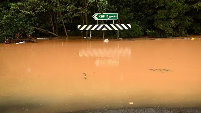
At 9am, the SES issued a major flood alert that the Wilsons River at Lismore “will overtop the levee” and is expected to exceed 10.6 metres.
Rain gauges around Lismore have also been found to be off by almost half a metre when State Emergency Service personal performed manual checks on Wednesday morning.
SES Lismore posted on social media there was a 400mm difference between the countdown display on the Browns Creek pump station and the actual water level.
RELATED: ‘Almost cyclonic’: Cars underwater, flash flooding in Byron
“This means if the levee overtops, the display will be still show 0.4 metres remaining, even as the water commences flowing over the levee,” the post read.
Lismore Mayor Steve Krieg said earlier he expected the levee would be breached within the next 30 to 40 minutes as he went to evacuate himself.
“I’m standing at the levee wall right now because we are about half a metre away from overtopping the levee and flooding our town for the second time of the month,” Lismore Mayor Steve Krieg told Sunrise. “When it gets to 10.6, we are buggered here.”
RELATED: ‘Incredibly wet and dangerous’: Coffs coast cops a hammering
Ballina Mayor Sharon Cadwallader spoke with 2GB on Wednesday morning about the evolving situation in Byron Bay and Ballina.
“It’s really not safe for people to go out,” Ms Cadwallader said.
“Our localised flooding is not coming from the levees overtopping, it’s coming from what’s falling from the sky, the rain bombs and the heavy wind gusts.”
Byron Mayor Michael Lyon followed on 2GB to say: “People are waking up who have had to sleep in their cars or vans in two feet of water. It’s just devastating. “We’ve been following it all night. It’s devastating after what we’ve just been through a month ago. It’s hitting different parts of the shire.”
Meanwhile the Pacific Highway has been cut off between Wardell to Tintenbar as Byron Bay and Ballina are inundated with rain with no evacuation warnings present as of 7.30am.
New photos have also shown Byron Bay being flooded.

New evacuations as major deluge now tipped
New early morning evacuation orders have been issued for flood-ravaged Lismore residents just hours after they were lifted as a low off the coast of Northern Rivers threatens to produce intense rain and thunderstorms.
The NSW State Emergency Service issued a direction for people in the Lismore CBD, Lismore Basin and low lying areas of East Lismore and Girards Hill to evacuate now about 4am.
Those in the high danger area were told to leave via New Ballina Road, Bruxner Highway and Dalley Street.
The areas affected are: Dawson Street, Parkes Street, Hayward Street, Allen Street, James Street, Anstey Street, Cathcart Street, Esyth Street, Goshmer Street, Elton Street, Esmonde Street, Darsham Street, Keen Street, Hutley Place, Gerard Street, Barrie Street and Shannon Street.
The evacuation centre is at Southern Cross University.
Businesses ‘won’t survive’: Fears Lismore will remain ‘ghost town’
Fears for Coffs Coast
The Bureau of Meteorology has said Coffs Harbour and Dorrigo will be focus points for Wednesday, as rain continues to hammer the Mid-North Coast.
A number of evacuation orders and warnings have been issued by the State Emergency Service.
The SES website on Wednesday morning noted an evacuation order is in effect for Bellingen River Tourist Park and parts of East Bellingen.
SES members are directing people along the Bellinger River within East Bellingen to evacuate the high danger area.
The areas affected are:
• Doepel Street
• Mill Street
• Cahill Street.
Evacuation warnings apply to:
Low lying areas of North Bellingen, Yellow Rock, North Macksville, Urunga, and Newry Island.
People in these areas need to closely monitor weather and road closures and make informed decisions early based on individual circumstances.
Residents should monitor the situation and be prepared to evacuate when instructed to do so.
Meanwhile, new severe weather warnings were issued by the Bureau of Meteorology overnight and again on Wednesday morning.
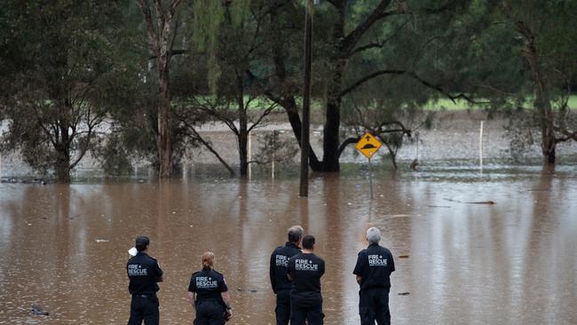
The latest warning, at 5.15am, said severe thunderstorms were likely to produce intense rainfall that may lead to dangerous and life-threatening flash flooding. Locations which may be affected include Lismore, Byron Bay, Ballina and Alstonville.
News of the fresh evacuation sparked anger among some on social media.
Robyn Waller said she could not believe evacuation orders were lifted at 4pm yesterday.
“These poor people should have been sent to evac centres for the night to be safe,’’ Ms Waller said.
Triple whammy: Family shelter in van after home burns in floods
Kristy Thomas agreed. “You did the smart thing getting everyone to evacuate by 4pm in daylight. Why did you not leave it in place until morning? Why lift it less than an hour later?”

Federal Labor MP for Richmond Justine Elliot questioned why an evacuation order had not been issued for Ballina and Byron Bay.
“I have contacted local disaster authorities advising them we urgently need evacuation centres in Byron Bay and Ballina. Apart from Lismore we also have received no SES warnings as of 5:30am.”
5:30AM UPDATE: I have contacted local disaster authorities advising them we urgently need evacuation centres in Byron Bay and Ballina.
— Justine Elliot, your local Labor MP (@JElliotMP) March 29, 2022
Apart from Lismore we also have received no SES warnings as of 5:30am. Will update everyone as soon as I have more info. #floods2022
Some have questioned the bureau’s weather predictions, including Renai Ross who blasted authorities on the council’s Facebook page.
“So how do you get this so wrong? In one of those meeting you have there needs to be discussions about the Northern Rivers having a weather Bureau that is independent from the BOM,’’ Ms Ross said.
“Idiots sitting on comfy chairs in Wollongong have failed Lismore yet again. 2 hours ago it was going to over top this afternoon.
“I am not down there but I imagine this is either happening already or going to very very soon. am not blaming (Lismore City Council) or SES but seriously. STOP taking orders from people who are 1000km away.”
How local intel is trumping BOM’s flood technology
In its advice for the Wilsons River issued at 5.05am, the weather bureau said renewed river level rises are expected during Wednesday with bands of heavy rain affecting the catchment.
“The Wilsons River at Lismore to overtop the levee this morning, with further rises in the afternoon possible.
“The Wilsons River at Woodlawn and Leycester Creek at Tuncester are still rising and peak predictions at Lismore will be made after upstream peaks are observed.
“The situation is being closely monitored and revised predictions will be provided if necessary.
“Major flooding is likely along the Wilsons River at Lismore. The Wilsons River at Lismore (AHD) is likely to exceed 10.60 metres 08:00am Wednesday with major flooding. Further rises possible in the afternoon.”
Earlier, the Bureau of Meteorology’s update at 4.51pm indicated that the Wilson River would peak below the major flood level on Tuesday night.
Moderate flooding was expected to occur with a peak of 8.40 metres at 8pm on Tuesday.
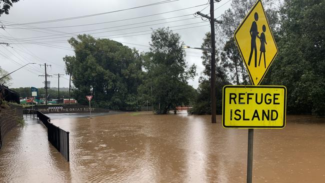
The Bureau originally forecasted heavy rain that could lead to river levels closer to the height of the Lismore levee at 10.6 metres.
The flood evacuation order was lifted at 4.30pm.
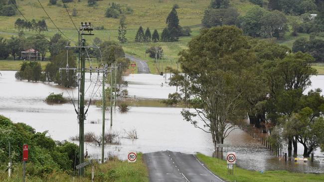
The SES are warning once flood water begins inundating the area road access, water, sewerage, power, phones and internet may be lost.
If residents remain in the area it may be too dangerous for the SES to rescue you.
More evacuation warnings as North Coast rivers rise
Evacuation warnings have been put in place for Condong and South Murwillumbah as the Tweed River continues to rise.
NSW SES is advising residents in low lying areas of the following locations that they may need to evacuate due to rising flood water.
These areas include properties along Tweed Valley Way north of Murwillumbah, Condong, Tygalgah and surrounding areas.
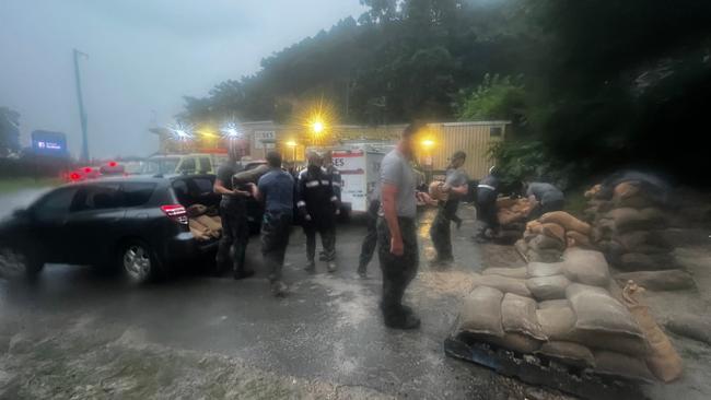
Low lying areas of South Murwillumbah may also experience impacts of flooding including around the industrial estate, Greenhills Caravan Park, residential and business areas bounded by the Tweed River, the railway line, Alma Street, the southern end of Wardrop Street, including Railway Street, and Tweed Valley Way between Mistral Road and Rose Lane.
The Tweed River at North Murwillumbah may reach 4.50 metres on Tuesday afternoon, with moderate flooding. Further rises are possible.
The Tweed River at Tumbulgum is likely to exceed the major flood level of 2.5m around midday and it may reach around 3 metres on Tuesday afternoon.
Further rises are possible.
Evacuation centres have been set up at
- Tweed: Banora Point – Salvation Army – cnr Woodlands and Leisure Drive, Banora Point
- Kingscliff and Chinderah: Kingscliff Tafe – 806 Cudgen Rd, Kingscliff
- Murwillumbah and surrounds: Murwillumbah TAFE – 146 Murwillumbah St, Murwillumbah
- Mullumbimby, Ocean Shores and Brunswick Heads: Ocean Shores Country Club – 113A Orana Rd, Ocean Shores (for Upper Burringbar residents).
Bureau warns up to 300mm rain coming as areas evacuated
Rainfall totals of up to 300mm have been predicted for the Northern Rivers with life-threatening flash flooding, sparking major evacuation orders across the region.
In its latest forecast on Tuesday morning, the Bureau of Meteorology said heavy rain was forecast for Tuesday night with six hourly rainfall totals of between 80mm to 140mm possible, reaching up to 200mm over coastal areas and ranges.
“Locally intense rainfall leading to dangerous and life-threatening flash flooding is possible with thunderstorms with six-hourly rainfall totals in excess of 200mm, possibly reaching up to 300mm,’’ the official warning said.
Damaging wind gusts of up to 90km/h are also tipped during Tuesday.
Locations which may be affected include Lismore, Grafton, Coffs Harbour, Port Macquarie, Tenterfield and Dorrigo.
Rainfall reported in the last 6 hours included Burringbar 149mm, Murwillumbah 147mm, Tumblegum 134mm, Mullumbimby 129mm and Alstonville 124mm.
In a separate warning the Lismore City Council reported that if the rainfall continues, levels would near the Lismore Levee Height (10.60m) Tuesday afternoon.
“The Wilsons River at Lismore is likely to exceed the moderate flood level (7.20m) around 11am Tuesday.
“The river level may exceed the major flood level (9.70m) around 02:00pm Tuesday and may reach around 10.60 metres Tuesday afternoon, with further rises possible.
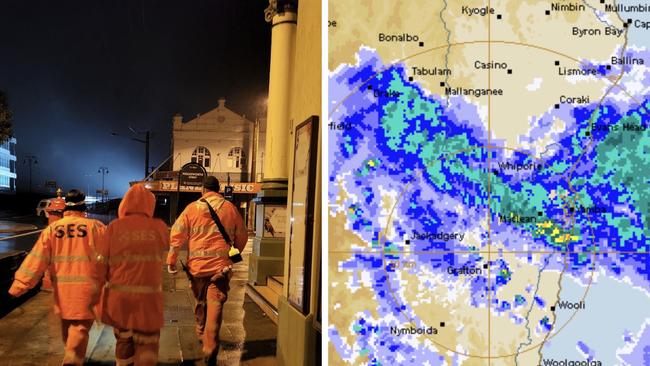
“ Levels are expected to remain below those experienced in late February 2022.
“Further heavy rainfall is forecast over the next 24 to 48 hours which may result in further rapid river level rises and localised flash flooding.
Leave now: Evacuation order in parts of Lismore, Kyogle
North and South Lismore and Kyogle residents are being urged to leave high danger areas as soon as possible.
NSW SES on Tuesday was also directing people within Tumbulgum and surrounding areas to evacuate the high danger area via the Tweed Valley Way.
Once floodwater passes 2.0 metres on the Tumbulgum Gauge, final access route from Tumbulgum will be closed.
The saturated Wilsons River is predicted to rise to moderate and major flood levels, with NSW SES directing affected residents to evacuate by 10pm via Union Street and the Bruxner Hwy.
In Kyogle, low-lying residents have been asked to evacuate by 10pm via Anzac Dr to Kyogle Memorial Hall, Summerland Way.
Once floodwater passes 15.5 metres on the Kyogle gauge, roads will begin to close.
Lismore CBD, East Lismore and Girards Hill residents also face an evacuation warning as of 8.05pm.
“The Bureau of Meteorology is predicting possible flooding along the Wilson River for the Lismore CBD Basin, and the low lying parts of East Lismore and Girards Hill and surrounding areas,” A Lismore City Council Facebook statement wrote.
The Bureau of Meteorology has warned moderate to major flooding is likely at Lismore from Tuesday as rain continues to pelt the Wilson River with levels the height of the levee (10.60 metres) possible from Tuesday afternoon.
“Once floodwater passes 9.15 metres on the Rowing Club gauge at North Lismore, and 8.84 metres on the Rowing Club Gauge at South Lismore, roads will begin to close,” Lismore City Council reported.
“Unfortunately it does include our already flood affected communities from Lismore, Coraki, Ballina down to Grafton even down to Coffs Harbour,” he said.
The Bureau of Meteorology has issued severe weather warnings for heavy rainfall for the Northern Rivers, Northern Tablelands, parts of the Mid North Coast in NSW as well as South East Queensland.
This was joined with a hazardous surf warning for the Northern NSW coast from midday on Monday and Mr Narramore told residents to expect conditions to change quickly.
“Things could escalate quickly on these rivers particularly with these isolated very intense falls,” he said.
“If they occur in the wrong part of the catchment we could see these rapid escalations and some the flooding on the rivers.”

NSW SES Assistant Commissioner Sean Kearns said response crews were in position and doorknocking homes ahead of severe weather warnings in northern NSW.
Related: Lismore Centra Tourist park evacuees flee new threat
Mr Kearns said residents were being warned that areas untouched in the recent floods were potentially at risk in the coming days.
“Just because you weren’t impacted last time doesn’t mean you won’t be impacted this time,” he said.
“People are pretty nervous to be honest with you,” Lismore Mayor Steve Krieg told Sunrise on Monday morning.
“Four weeks of cleaning up after the record flood that we‘ve just experienced and then to get the news of the weather event that’s coming for us.
“We don’t need to go through this again.”
In its latest advice on Monday afternoon, the weather bureau said rainfall had the potential to result in “moderate to major flooding along the Richmond, Wilsons, Orara and Bellinger Rivers from Tuesday”.
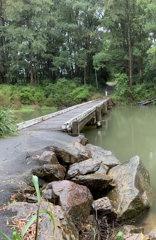
A Severe Weather Warning is also current for the Northern Rivers and parts of the Mid North Coast and Northern Tablelands, with up to 140mm possible or 180mm along coastal areas.
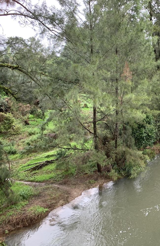
Emergency services fear the heavy rainfall could lead to further landslides and debris across roads.
âš ï¸â›ˆï¸A Severe Weather Warning for Heavy Rainfall is still current in NE #NSW. Locally INTENSE RAINFALL leading to dangerous and LIFE-THREATENING FLASH FLOODING is possible with thunderstorms. Flood Watch and Flood Warnings current. Details: https://t.co/QJyMmnJzetpic.twitter.com/dgELYqM9Co
— Bureau of Meteorology, New South Wales (@BOM_NSW) March 27, 2022
Locations which may be affected include Tweed Heads, Murwillumbah, Byron Bay, Lismore, Yamba, Grafton, Coffs Harbour and Dorrigo.

SES member Ashley Sullivan said additional personnel and trucks, boats, trailer aircraft were being brought in, including a brand-new high clearance vehicle at Coffs Harbour, which was used to save an elderly man on Friday.
“Not every flood is the same, this flood may not be the same as the last one,” he said on Sunday afternoon.
“It may respond differently, behave differently and act differently.
“We want people to be prepared but not be alarmed.”
Emergency Services Minister Steph Cooke told media on Sunday temporary accommodation motorhomes and community centres may have to be relocated as a result.
“I understand the deep impact these weather conditions are having on our community but … send a strong message of hope and optimism,” she said.
“We are not abandoning you, we are not leaving you.”
Bureau of Meteorology meteorologist Jane Golding said Alstonville picked up 200mm in just a few hours on Saturday.
Acting NSW Premier Paul Toole said the rain would undoubtedly hamper recovery efforts.
“To the people in the Northern Rivers I know this is not the news you want to hear (on Sunday),” he said.
Mr Toole said there would be emergency services and Australian Defence Force members deployed to increase doorknocking.
“I think that is important, what we’ve actually found with the floods is that a lot of people decided to stay in their homes,” he said.
“Nobody expected the floodwaters to be two metres higher than what they were.
“If you are asked to leave please do so.”
Lismore City Council has confirmed the levee system is aesthetically damaged in some location but structurally sound and functional.
All levee gates are operational and ready to go as is the Browns Creek pump station, the Lismore City Council statement confirmed on Sunday about 3.20pm.
More Coverage
Read related topics:NSW floods


