
Queensland weather: Severe thunderstorms to bring hail, damaging winds and flooding rain
Severe storm warnings are active as rapid-fire weather systems sweep across Queensland threatening giant hail, damaging winds and drenching rain.
QLD weather news
Don't miss out on the headlines from QLD weather news. Followed categories will be added to My News.
Queensland is bracing for a triple-whammy storm assault this week with severe thunderstorms forecast to bring giant hail, damaging winds and flooding rain.
The Bureau of Meteorology issued flood watch alerts on Tuesday for southern and western parts of the state, with an active and significant weather system developing throughout the day before moving east over coming days.
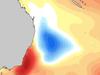
Storms were picked up on the radar about noon, with a severe thunderstorm warning issued at 12.22pm for people in the Gulf Country, Northern Goldfields and Upper Flinders, North West, Central West and Maranoa and Warrego Districts, while a broader was system seen covering much of western Queensland.

The storms were set to drench the region, with damaging winds and heavy rainfall that may lead to flash flooding over the next several hours.
Locations likely to be hit include Longreach, Winton, Cloncurry, Isisford, Barcaldine and Julia Creek.
A Bureau of Meteorology spokesman said once the current system moves off the Queensland coast, another will follow “right behind it”.
“Classic Queensland summer storm conditions,” he said.
The spokesman said the rapid fire weather systems were a direct result of La Nina and the negative Indian Ocean Dipole at play.


“When the two systems are in play, when you do get this type of set up, there is ample moisture to drive these storms and to really lift those rainfall amounts,” he said.
Flood warnings are in place for the Bulloo and Paroo rivers.
Flooding along the Paroo River south of Thargomindah is starting to ease, but there are fears of more flooding later in the week.
⛈ï¸Storm Forecast for TUESDAY 18/10⛈ï¸
— Bureau of Meteorology, Queensland (@BOM_Qld) October 17, 2022
Severe storms w damaging winds, large hail & heavy rain possible in western Qld tomorrow, likely in the far west. More dangerous storms w destructive winds, giant hail, intense rain possible in red area.
Local forecasts https://t.co/YST1SMRoT2pic.twitter.com/gwKmEddba2
“Moderate flooding is slowly easing to Eulo with moderate flooding continuing to rise downstream to Hungerford,” BOM warns.
“Forecast rainfall for Tuesday and Wednesday may cause renewed river rises later in the week.”
A severe heatwave warning remains active for the state’s Peninsula district with maximum temperatures expected to hit the high-30s.
Brisbane Lord Mayor Adrian Schrinner said residents needed to start preparing for flood weather now, and urged the 65 per cent of households who are yet to sign up to the council’s free weather alert system, to do so immediately.
“One of the most important things people can do is sign up to the free Brisbane’s Severe Weather Alert service,” he said.


Storm threat as 3000km-long front pushes toward SEQ
Rain and possible storms are moving toward southeast Queensland as part of a low pressure system covering almost a third of the country.

Wild storms, polar blast as 3000km monster low barrels towards Qld
The system, which stretches 3000km from north to south and encompasses 30 per cent of Australia, is forecast to pack a punch when it hits Queensland.