
Queensland weather: Rain records smashed, much more on the way
Southeast Queensland communities are being told to expect “triple digit” deluges this weekend, with up to 100mm expected to be dumped in some areas this evening alone. CHECK OUT THE FORECAST
QLD weather news
Don't miss out on the headlines from QLD weather news. Followed categories will be added to My News.
DOUBLE digit rainfall is being forecast for a “wide area” of the state this weekend, with some communities told to expect “triple digit” deluges, as the big wet that has already smashed records across the state ramps up.
Drought-hit communities in the Darling Downs and Granite Belt and parts of southeast Queensland are predicted to get the heaviest falls, with areas from the Gold Coast to Wide Bay in line for as much as 100mm.
Queensland weather: Roads flood as drenching continues
Gold Coast, Brisbane weather: Up to 100mm of rain expected in southeast
BOM Meteorologist Peter Markworth said on Saturday morning that severe thunderstorms and flash flooding were likely this evening.
“It’s looking pretty active over southern Brisbane and the Gold Coast area currently (and) that should persist for the rest of the day,” he said.
This week’s heavy rainfall has been caused by a slow-moving upper trough, Mr Markworth said.
“We’ve got an upper trough which is moving very slowly over southern Queensland, that’s really making a lot of these showers and storms and allowing them to form pretty easily, there’s plenty of moisture around.”
The Gold Coast is predicted to experience the heaviest falls with up to 100mm of rain while Brisbane can expect up to 70mm.
Some 40mm of rainfall is expected for the Sunshine Coast, with Mr Markworth predicting the heaviest falls will be over the east coast this evening.
Rivers and creeks in the Sunshine Coast, Brisbane and Gold Coast have a current flood watch warning.
“In terms of flash flooding that’s always possible with those heavy falls which is potential this afternoon and this evening.”
SEQ Water says the rain could boost the southeast’s dams, with the water grid now at 56.4 per cent, up 0.5 per cent since Thursday.
“This remaining run-off could contribute up to an additional one per cent to the combined Water Grid storages,” a spokesman said.
FEBRUARY RECORDS TUMBLE
The Bureau of Meteorology overnight confirmed a number of areas had already broken their February average, predicting more significant rainfall to come this weekend.
“We’re looking at double-digit falls across quite a wide area and the potential for some isolated triple digit figures as well, which is really good news for those drought stricken areas,” meteorologist Kimba Wong said.
She said the recent deluges would bring falls and king tides, increasing flood danger in the south-east of the state.
‘We’re talking 50-100mm scattered across the Sunshine Coast, Brisbane and the Gold Coast maybe stretching up as far as the Wide Bay as well,” she said.
Roma’s Shannon Crocker said her family was overjoyed by the rain, which totalled almost 90mm on her 2800ha property at Muckadilla.
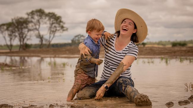
“Since the middle of January until now we are 10mm off our entire rainfall for last year,” she said. “It’s wonderful – it’s a definite game-changer, it was really tough.
“We were feeding stock every couple of days and that really wears you down.
“There are a lot of people who were running out of water and having to buy water so we’re really grateful for the rain and it’s just wonderful to see the smiles on people’s faces and the green around and the water.”
Ms Wong said the heaviest rainfall was likely to be in the Darling Downs and Granite Belt and Main Range area of south-east Queensland.
She said Roma received about 80mm in the past week. Tyrconnell (59mm), Morven (90mm), Alpha (112mm) and Mt Moffat (107mm) also experienced significant falls.
Tewantin edged towards its February record of 218mm with 196mm, while Brisbane city smashed its 138mm record, receiving 188mm.
Southeast Queensland dams have also continued to rise with some dams recording more than 200mm in the past week. Across the region, six dams – Wappa, Poona, Little Nerang, Lake Macdonald, Enoggera, and Gold Creek dams - have reached 100 per cent capacity and are spilling.
The Maroochy River dam catchments recorded rainfall totals of 204mm while 55mm hit Wivenhoe Dam catchments in the past week.
Others such as the Cooloolabin, Lake Macdonald, Baroon Pocket dams have recorded 204.4mm, 195.5mm and 140.4mm respectively.
Despite this, Wivenhoe Dam is still only 42.6 per cent full, and south-east Queensland’s second largest dam storage, Somerset Dam, is only 64.5 per cent full.
Up to 300mm of rain fell in parts of the NSW north coast

Feels like -5.3C: Icy blast sends temps plummeting again
South East Queensland has again shivered through a freezing start to the day, as a brutal cold front continues to blast the region with subzero temperatures, made worse by chilling winds.

Feels like MINUS 7.1C: Brutal cold front blasts southern Qld
A brutal cold front is blasting across southern Queensland with subzero temperatures and widespread frost.