Floods close Bruce Highway at Calen north of Mackay
Rain is smashing Qld flooding multiple highways and closing more than 100 roads as helicopters called in and the BOM keeps watch for a cyclone. LATEST, ROAD CLOSURES.
Business
Don't miss out on the headlines from Business. Followed categories will be added to My News.
- Threat could hit ‘anywhere’: Qld cyclone warning
- Drivers risking death as flooded roads left open without signs
- ‘400mm coming’: Flash floods, cars swallowed as deluge slams 700km of Qld coastline
Farmers are moving livestock to higher grounds and towns are isolated as large areas of Queensland prepare for rainfalls ranging from 400mm to a metre in coming days.
The downpours and floods over the past few days have unleashed mayhem across the state as helicopter crews rescued a police officer swept up in floodwaters and children stranded between swollen creeks.
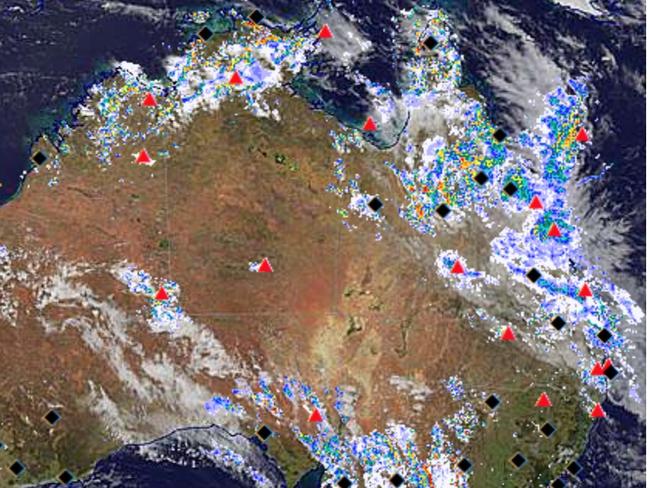
Meteorologists are now eyeing up whether the Coral Sea is brewing up a tropical cyclone.
The Bureau of Meteorology has issued severe thunderstorm, severe weather, and flood warnings across the state as deluges impact the Bruce, Gregory, Capricorn and Peak Downs Highways.
There are flood watches and warnings for the North Tropical Coast and Central Coast catchments as well as parts of the Capricornia and Gulf Country.
Bureau Senior Meteorologist Felim Hanniffy said trough action had brought falls over a matter of hours of 50-100mm just south of Townsville, centralised inland from Ayr.
Mr Hanniffy added these totals were expected to increase overnight Saturday, particularly for those areas south of Townsville.
Mackay Weather Chasers reported 372mm of rain fell at Farleigh just north of Mackay over the 72 hours to 10am Saturday morning with parts of the Mackay region receiving more than 200mm over Saturday.
In the Mackay region, there is a flood warning for the Pioneer River which may produce minor flooding at Mirani in the Pioneer Valley, about half an hour’s drive west of Mackay.
More than 200mm of rain has fallen in the Pioneer River catchment at Finch Hatton since 9am Saturday.
There are also flood warnings for the Isaac region as the Nogoa, Connors and Isaac Rivers continue to swell, as well as warnings for Georgina River at Marion Downs; at Eyre Creek with the peak approaching Bedourie; at Diamantina River; Flinders River; Norman River and the Gilbert River catchment.
Knocking over signs or driving on closed roads is not okay.
— Transport and Main Roads Queensland (@TMRQld) January 14, 2023
Queensland’s on flood watch—which means we all need to get serious and #BackItUp. Those signs and barricades are there to save lives so please don’t put yourself or others at risk. pic.twitter.com/BLiUsSSO51
Along with the rainfall, BOM has issued a severe thunderstorm warning for parts of the North Tropical Coast and Tablelands, and a severe weather warning for the Herbert and Lower Burdekin, Central Coast and Whitsundays, parts of North Tropical Coast and Tablelands, Northern Goldfields and Upper Flinders and Central Highlands and Coalfields.
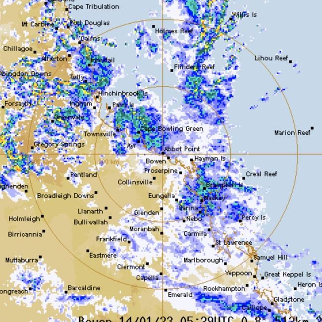
The risk for the Central Coast was not expected to dissipate until at least Wednesday as the focal point for the heavy rainfall drifts back northward.
“Before that the trough will drift slowly south to the Central Coast and Whitsundays over Monday and enhance rain on those areas,” Mr Hanniffy said.
“From Ayr down to Carmilla, localised heavy falls will possibly be intense on Sunday and Monday.
“The Clarke Ranges west of Mackay is where there will be a sizeable accumulation on Monday.”
The Bureau predicted heavy rainfall risk to continue on Tuesday until Wednesday as the activity contracts upward.
“Then there will be a bit of reprieve for the Central Coast but by then there will have been significant impact on the river systems,” Mr Hanniffy added.
Various weather enthusiasts and forecasters are posting to Facebook that North Queensland could receive anywhere between 400mm to 1m of rain in the days leading up to Wednesday.
Bureau watches for possible tropical cyclone formation
As a deepening trough creates heavy rainfall over Queensland’s Central Coast, BOM’s meteorologists are keeping watch over the Coral Sea.
“A tropical low could form within the trough later on the weekend and there is a low likelihood from Tuesday 17 January to Saturday 21 January that it will develop into a tropical cyclone,” the BOM stated at 2.30pm Saturday.
“In the unlikely event it does develop into a tropical cyclone it is expected to move east and away from the Queensland coast.”
The BOM estimates there is a 5 to 20 per cent chance the trough will turn into a tropical cyclone by Tuesday.
Farmers are making preparations to move their livestock in case of intensifying conditions.
Helicopter crew rescue nine “stranded”
The past three days of heavy downpours have smashed North and Central Queensland with a helicopter crew required to rescue nine people near Emerald in the Central Highlands.
#MackenzieRiver - @caprescue with a QAS Flight Critical Care Paramedic onboard have successfully completed the retrieval of nine people reported stranded on Grasstree Road at 6.17am. No injuries were reported. https://t.co/r6FB6HyN1w
— Queensland Ambulance (@QldAmbulance) January 14, 2023
The Queensland Ambulance Service has tweeted a Flight Critical Care Paramedic was on-board a RACQ Capricornia Rescue flight for the rescue of nine people “reported stranded” at 6.17am on Saturday at Mackenzie River along the Gregory Highway.
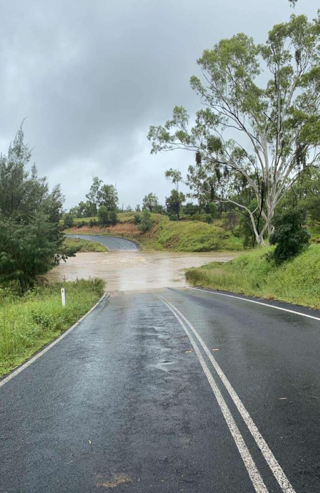
The crew rescued five adults and four children who were “stranded between rising flood waters”.
Flooded highway isolates Central Qld town
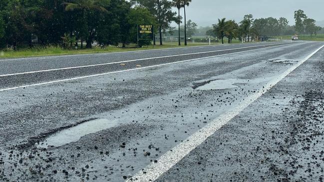
Potholes measuring up to 50cm are creating hazards along the Bruce Highway in North Queensland while further west, floodwaters are cutting off arterial roads and highways.
The town of Clermont is now isolated as rising flood waters cut off the Gregory Highway at Pink Lily with the road closed to traffic in both directions.
There are also reports food is running low in the Central Queensland town’s supermarkets.
It comes just days after a Cairns airline flew more than two tonnes of food to the Cape in Far North Queensland after severe weather isolated towns.
Peppercorn Motel manager Darryl Shaw said the roads in and out of Clermont had flooded and residents were hunkering down to ride out the rain.
“I had a few rooms last night, a few people had left in the morning and they have already turned around and come back,” he said.
Mr Shaw said tourists were stranded and miners could not get onto surrounding mine sites.
He said the town was regularly cut off, including in the 2022 floods.
“The supermarket is already out of milk and bread,” he said.
“It always runs out when it rains.
“Just enough rain to make people worried.”
He said his own delivery truck could not get through to the town from Emerald.
“You can’t get in or out,” he said.
“Everyone is used to it.”
Mr Shaw said the town had been cut off since Friday.
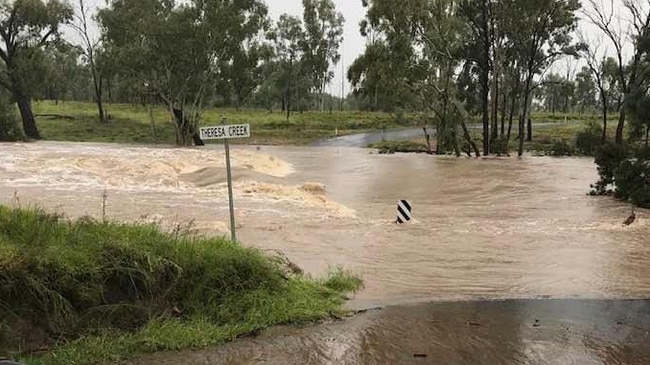
Central Highlands Regional Council warned residents on its Facebook page that the Gregory Hwy would likely close by Sunday due to rising floodwaters.
“The 96-hour total rainfall in the Clermont section of Theresa Creek catchment has exceeded 240mm,” the post read.
“The volume of water coming from upstream will eventually put water over the bridge on the Gregory Highway in the next 12 to 24 hours. This will close the Gregory Highway for at least 24 hours.”
SCROLL DOWN FOR MORE INFORMATION ON ROAD CLOSURES AND TRAIN DELAYS
Police officer caught in floodwaters as 4WD swept away
A Far North police officer is lucky to be alive after he had to abandon his vehicle and swim to safety after being caught in floodwaters on Friday afternoon.
The police officer was responding to a call when his 4WD was caught in floodwaters and swept off the Pump Creek Causeway at Almaden, 173km west of Cairns.
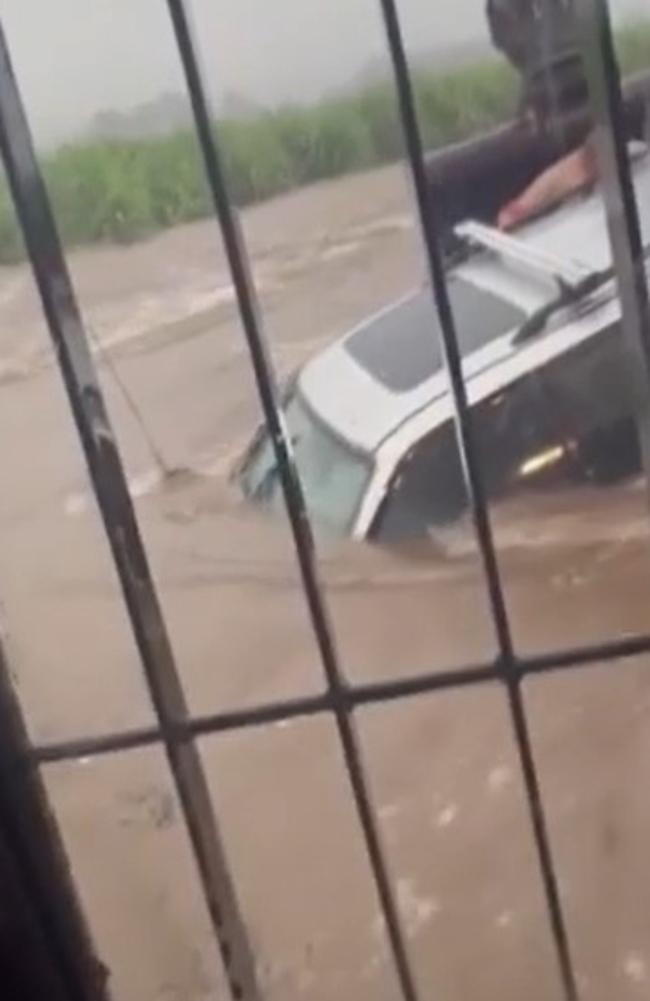
A day earlier, a Mackay driver became “panicked” after he had entered into floodwaters and required rescuing, with youth on boogie boards attempting to reach him.
It sparked criticism of Mackay Regional Council after it was reported multiple roads were left open despite being well under water.
Then west of Mackay in the Pioneer Valley, a good Samaritan used an excavator to scoop up a driver stranded on the rooftop of his 4WD after he was caught in flash flooding.
More intense rainfall ahead
The Bureau of Meteorology has warned intense rainfall with totals of up to 300mm were expected to drench the north of the state, especially for residents between Cardwell and Carmila, and inland to Charters Towers.
Bureau of Meteorology meteorologist Brooke Pagel said rainfall could lead to “dangerous and potentially life-threatening flash flooding”.
“Pretty much all of North Queensland is copping it at the moment,” Ms Pagel said.
“We are expecting that heavy to intense rainfall over the next couple of days … dangerous and potentially life-threatening flash flooding is possible.”
Multiple roads in Central and North Queensland are closed or impacted by flood waters, which Ms Pagel said could last a few days.
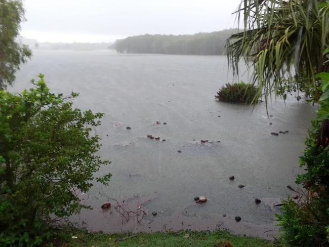
“Western Queensland has had a fair amount of roads cut off. The latest information I had was that the Landsborough Highway between Cloncurry and Winton was closed.
“There’s a lot of road closures out there just because they’ve had a lot of rainfall.”
Since 9am Friday, Forbes Rd recorded the highest rainfall totals with 222mm.
Calen, north of Mackay, recorded 192mm, Cungull recorded 190mm, and Finch Hatton recorded 183mm.
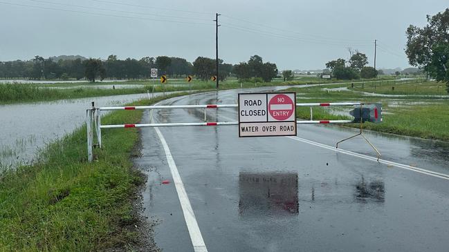
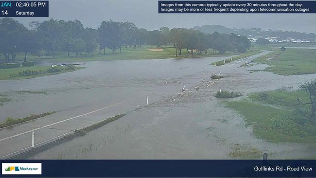
Ms Pagel urged people to stay off the roads if it wasn’t necessary.
“Stay off the roads if you can, plan before you head out, check the radar and check the warnings.”
SES area controller Michael Young said his team was ready for the weekend ahead.
“Look, there’s rain coming, but at this stage, everyone is prepared,” he said.
“We should be fine.”
Mr Young, who has been with the SES for more than 35 years, said jobs were slowly coming through but the early part of the weekend’s rain event was tracking well.
“I give credit to the Mackay’s residents,” he said.
“They have done their maintenance work and that has helped reduce the SES call outs.”
Mr Young said Flood and Swift Water Rescue were on standby in Proserpine but had not yet been called out.
“At this stage people need to be aware of the road closures and localised floods,” he said.
“If it is flooded, forget it.”
ROAD CLOSURES
The Bruce Highway was earlier cut off in both direction at Calen, a small township north of Mackay, after the road was inundated by 1m of floodwaters.
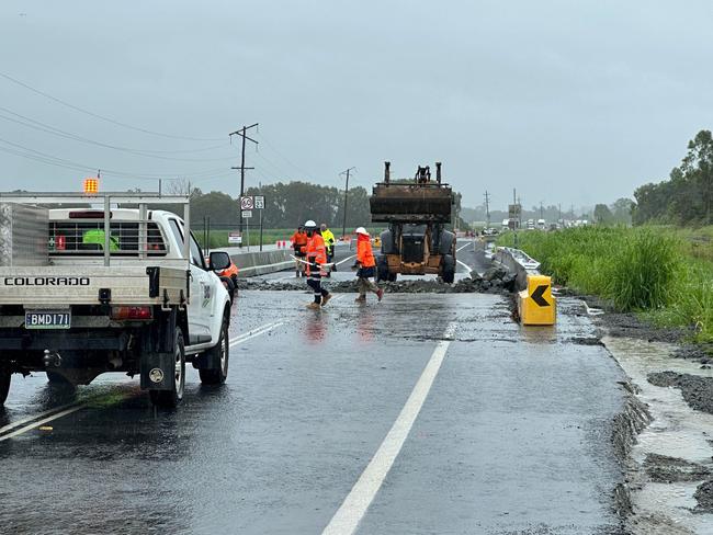
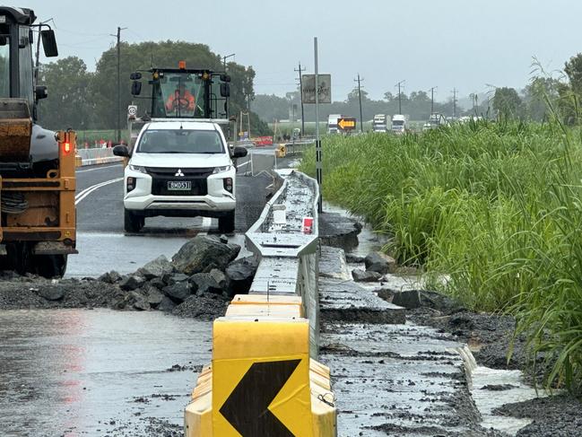
Traffic stretched back more than a 1km in both directions as backpackers, tourists, and residents keen to get to their destination trekked along the highway to try and gauge how long they would be stuck for.
One lane has since reopened, with police escorting vehicles through the area.
Authorities have urged locals to still avoid the area if they can.
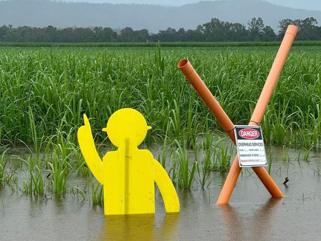
Bloomsbury resident Robert Hold was one of those cut off from his home at Midge Point after travelling back from Mackay.
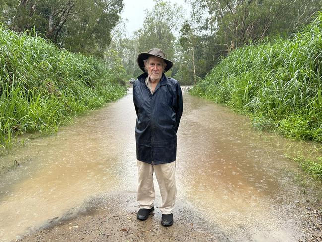
Mr Hold said it was the first time he had seen the highway at Calen go under.
Potholes could be seen around Kuttabul, with crews working in the rain to fill them in.
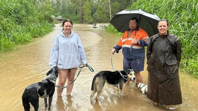
St Helen’s residents Sara and Nigel Utley and their daughter, Lily, meanwhile, watched on as floodwaters crossed Old Bowen Rd.
The road is used by locals as a detour from the highway but Sara said she suspected it would go under when it started rising about 5pm on Friday.
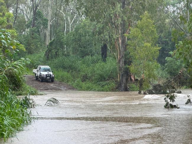
The Queensland government’s Queensland Traffic map states flash flooding has also hit the Bruce Hwy at Yarlboro, further north.
Sarina Marlborough Road and Rifle Range Road were also closed off to the south.
Other parts of Central Queensland are also flooded.
The Capricorn Highway between Emerald and Blackwater is also under.
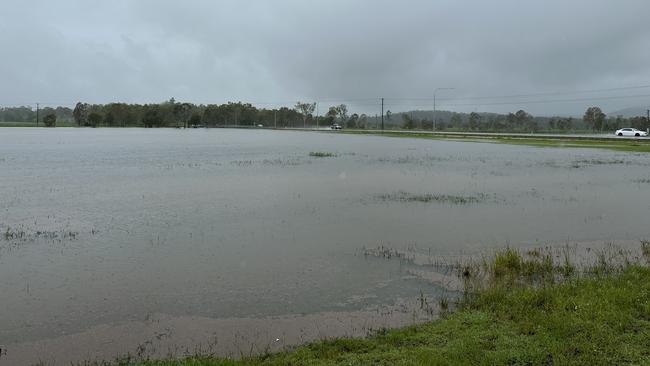
Meanwhile, Kinchant residents have been cut off as floodwaters close Kinchant Rd connecting the small township with North Eton.
Margaret Maher, writing on the Whitsundays Noticeboard Facebook group, said she could not get to her granddaughters birthday party due to a road closure.
“I have a beautiful cake that I want to re home are there any little girls having a birthday that would like this cake,” she writes.
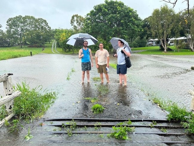
In Greenmount west of Mackay, Blake Ferris was forced to walk to the end of his driveway to pick up his mates Josh Hof and James Martell, after floodwaters stopped them from getting through.
There are numerous roads closed across much of QLD - monitor your local council & DTMR for road conditions / closures - https://t.co/b2kXiw7hna - In severe weather events re-think your need to travel - Flash flooding costs lives #qldtrafficpic.twitter.com/rqWUAdz1wz
— Queensland Police (@QldPolice) January 14, 2023
RACQ, QLD Traffic and regional council’s emergency dashboards show the following roads are closed from flooding:
- Kinchant Dam Rd
- Hicks Rd Windmill Crossing in Glenella
- Golf Links Rd Primavera Blvd in Beaconsfield
- Black Mountain Rd in Farleigh
- Bruce Highway at Calen (lanes affected)
- Orrs Rd, Barrie Lane and Palm Tree Rd at Homebush
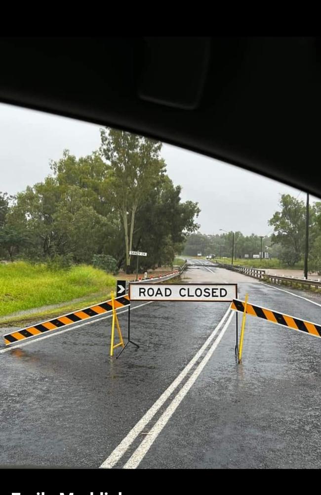
- Marian Eton Rd at Sandy Creek south of North Eton
- Leichhardt Rd at Mirani
- Bruce Highway at Gumlu (lanes affected)
- Bruce Highway at Yalboroo (lanes affected)
- Mount Ossa Seaforth Rd, Mount Ossa
- Sarina Marlborough Rd and Rifle Range Road at Sarina
- Burdekin Falls Dam Rd at Ravenswood
- Blackwater Cooroorah Rd at the Mackenzie River
- Degulla Rd, Laglan Pioneer Rd at Beylando River
- Golden Mile Rd at Dysart
- Dysart Clermont Rd at Dysart
- Dingo Mount Flora Rd at May Downs
- Rolfe Creek Booroondarra Rd at Middlemount
- Grasstree Rd at Middlemount
- Foxleigh Rd and Barwon Middlemount Rd at MacKenzie River
- Blackwater Cooroorah Rd at MacKenzie River
- Golf Course Access / Cheesborough Rd / Gregory Highway, Clermont
- Clermont Alpha Rd west of Clermont
- Kenlogan Rd north of Clermont
- Drummond St at Clermont
- Alpha Bypass Rd at Clermont
- Clermont Connection Rd, Charles St at Clermont
- Racecourse Rd at Clermont (lanes affected)
- Venus Rd at Clermont
- Huntley Rd east of Clermont, Cheesborough
- Gregory Highway east of Clermont
- Charles St in Clermont
- Laglan Rd at Clermont (lanes affected)
- Peakvale Rd in Clermont
- Clermont Rubyvale Rd south of Clermont at Theresa Creek
- Meares St at Blackwater
- Russell Park Rd at the Gemini Mountains
- Kilcummin Diamond Downs Rd at Kilcummin
- Kenlogan Rd at Kilcummin
- Russell Park Rd at Kilcummin
- Russell Park Rd at Gemini Mountains
- Huntley Rd at Cheesborough and Clermont
- Apis Creek Rd at Balcomba
- Cotherstone Rd at Capella
- Rileys Crossing Rd at Comet
- Comet River Rd at Comet
- Capella Rubyvale Rd at Hibernia
- Capricorn Highway at Blackwater/Emerald
- Dawson Developmental Rd at Mantuan Downs
- Pioneer Clyedale Rd – Albro Pioneer Rd at Mistake Creek
- Magenta Lagoon Rd at Retro
- Coreen Water Board Rd at Argoon near Biloela
- Zischkes Lane at Prospect near Biloela
- Blackgate and Ferguson Rd near Calliope
- Zischkes Lane, Prospect
- The Bend Rd, Taroom
- Cotherstone Rd, Khosh Bulduk / Magenta Creek
- Coreen Water Board Rd, Argoon
- Peninsula Developmental Rd (Laura River Bridge), Laura
- Peninsula Developmental Rd, Coen
- Peninsula Developmental Rd, Mission River
- Nymbool Rd, Mount Garnet
- Koolatah Oriners Rd, Dixie
- Kennedy Developmental Rd, Hughenden
- Gulf Developmental Rd, Croydon
- Gregory Highway, Einasleigh
- Dunbar Kowanyama Rd, Kowanyama Rd, Kowanyama
- Coolgarra Rd, Mount Garnet
- Burke Developmental Rd (Lynd River Bridge), Gamboola / Chillagoe / Maramie
- Burke Developmental Rd, closed at Trimbles Crossing, Wrotham, and Ferguson’s Crossing, Rookwood
- Talgai West Rd, Talgai
- Swan Creek School Rd, Swan Creek
- Spring Creek Rd, The Head
- Pfeffer Rd, Yandilla
- Mountain View Drive, Hatton Vale
- Merivale St, Allora
- Meandarra Talwood Rd, Westmar
- Ktal Rd, Berat
- Kadow Rd, Clintonvale
- Glen Niven Rd, Glen Niven
- East Egypt Rd, Egypt
- Cosmo Lane, Cottonvale
- Berlin Rd, Mount Berryman, Abels Rd, Goombungee
- Yaraka Retreat Rd, Isisford
- Yaraka Bimerah Rd, Isisford / Stonehenge
- Wokingham Stock Route, Corfield (between Corfield Richmond Rd and Landsborough Highway)
- Winton Jundah Rd, Opalton
- Winton Eskdale Rd, Corfield
- Ward Rd, Tambo / Ward
- Uradangi North Rd, Piturie / Waverley
- Urandangi Border Rd (Tobermorey Rd), Carrandotta
- Tumbar Rd (restricted to 4WD vehicles only), Jericho / Mexico
- Toolebuc Rd, Min Min / Warburton
- Tonkoro Rd, Longreach / Stonehenge
- Tocal Jundah Rd (Notus Rd), Longreach / Stonehenge
- Tenham Rd (restricted to 4WD vehicles only), Windorah
- Stonehenge Warbreccan Rd, Stonehenge
- Starlights Lookout Rd, Longreach (Captain Starlight’s Lookout from Muttaburra Westside Rd)
- Stagmount Rd, Galilee / Pelican Creek
- Springvale Rd, Min Min / Wills
- Slashers Creek Rd, Min Min
- Selwyn Rd, Boulia / Selwyn / Warenda / Wills
- Ravensbourne Rd, Blackall
- Politic Rd, Ingberry
- Pine Hill Rd, Pine Hill / Port Wine (restricted to 4WD vehicles only)
- Opalton Rd, Opalton (restricted to 4WD vehicles only)
- Tumbar Rd, Blackall / Mexico
- Olio Muttaburra Rd, Corfield
- Neverfail Rd, Blackall
- Muttaburra Bowen Downs Rd, Cornish Creek / Upper Cornish Creek
- Muttaburra Aramac Rd, Cornish Creek
- Mount Playfair Rd, Caldervale / Carnarvon Park / Tambo
- Morella Silsoe Rd, Longreach
- Longreach Tocal Rd, Longreach
- Longreach Silsoe Rd, Longreach / Vergemont
- Urandangi Rd, Urandangi South Rd, Dajarra / Waverley
- Langlo Rd, Langlo / MacFarlane (restricted to 4WD vehicles only)
- Kensington Rd, Bangall
- Kennedy Developmental Rd, Corfield / Warburton / Boulia
- Kelso Rd, Ilfracombe / Longreach
- Jundah Winton Rd, Winton Jundah Rd, Opalton / Stonehenge / Jundah
- Jundah Quilpie Rd, Jundah / Windorah
- Jundah Cork Rd, Opalton
- Jericho Texas Rd, Garfield / Jericho
- Isisford Emmet Rd, Isisford
- Isisford Blackall River Rd, Isisford
- Isisford Bimerah Rd, Isisford / Stonehenge
- Inside Track Rd, Birdsville
- Ilfracombe Aramac Rd, Ilfracombe / Aramac / Ibis
- Hughenden Muttaburra Rd, Tablederry
- Hobartville Rd, Hobartville / Surbiton (restricted to 4WD vehicles only)
- Hammond Downs Rd, Jundah / Windorah
- Flinders Highway / Hughenden Muttaburra Rd, Hughenden
- Eyre Developmental Rd, Bedourie / Birdsville
- Eastmere Rd, Aramac / Galilee / Upland
- Dunrobin Rd, Dunrobin / Galilee
- Donohue Highway, Carrandotta / Willis
- Dicks Creek, Elderslie Rd, Kyuna / Middleton
- Diamantina River Rd, Middleton / Opalton
- Diamantina Development Rd, Amaroo / Boulia / Bedourie / Farrahs Creek / Windorah
- Degulla Rd, Laglan Pioneer Rd, Laglan
- Degulla Rd, Hobartville / Surbiton
- Dawson Developmental Rd, Tambo / Windeyer
- Davenport Rd, Local Rd, Farrars Creek
- Darr River Downs Rd, Longreach
- Dandaraga Rd, Ilfracombe
- Crossmore Rd, Longreach Muttaburra Rd, Longreach / Sardine
- Crossmore Rd, Sardine (restricted to 4WD vehicles only)
- Crossmoor Rd, Cornish Creek / Sardine
- Cork Mail Rd, Corfield / Opalton
- Cork Macunda Rd, Middleton
- Corfield Richmond Rd, Albion / Corfield
- Coreena Rd, Inberry
- Cordillo Access, Birdsville
- Coorabulka Rd, Bedourie / Wills
- Camooweal Urandangi Rd, Barkly / Camooweal
- Cacoory Stony Crossing Rd, Birdsville
- Budgerygar Rd, Jundah
- Bladensburg Access, Corfield / Opalton (restricted to 4WD vehicles only)
- Blackall Adavale Rd, Blackall
- Birdsville Simpson Desert National Park Rd, Birdsville
- Birdsville Developmental Rd, Tanbar / Windorah / Birdsville (restricted to 4WD vehicles only)
- Bimerah Yaraka Rd, Stonehenge
- Betoota Mooraberree Rd, Farrars Creek
- Barcaldine Isisford Rd, Barcaldine Downs / Ilfracombe / Barcaldine
- Coorabulka Rd, Bedourie / Wills
- Camooweal Urandangi Rd, Headingly Rd, Barkly / Camooweal
- Barcaldine Aramac Rd, Aramac / Barcaldine
- Ballyneety Rd, Dunrobin
- Avington Rd, Blackall
- Arrabury Rd, Planet Arraburry Rd, Cordillo Downs / Tanbar
- Aramac Torrens Creek Rd, Pelican Creek / Torrens Creek
- Aramac Rd, Jericho Rd, Garfield / Pelican Creek
- Amor Downs Rd, Ilfracombe
- Alpha Tambo Rd, Blackall / Windeyer / Alpha
- Additional Area Rd, Ilfracombe
Follow this link to visit the road conditions map and this one for the Queensland Traffic map.
The floodwaters are also damaging the Bruce Highway.
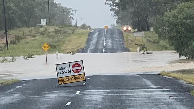
TRAIN DELAYS
Train passengers have been left stranded in rural towns as the state grapples with severe flash flooding expected to continue for multiple days.
Multiple Queensland Rail services are either seriously delayed, cancelled, or are being forced to terminate at an alternative location as flood waters cut off some routes.
The Inlander service, meant to depart from Townsville to Mount Isa on Saturday, was cancelled due to “ongoing heavy rainfall and flooding”.
The Spirit of Queensland train, travelling from Brisbane to Cairns, has also been cancelled with no alternative transport.
Other trains have been forced to terminate in alternate destinations, leaving passengers stranded in rural towns with no alternative travel arrangements.
Some trains are dealing with significant delays, with one southbound service approximately six hours behind schedule.
Queensland Rail Travel apologised for any inconvenience caused as a result of the cancellations.
More Coverage
Read related topics:Weather


