
Monsoon on the cards as ex-Tropical Cyclone Ellie heads for the Top End
The Territory will continue to cop heavy rain as ex-Tropical Cyclone Ellie heads north, with monsoonal conditions on the cards for the Top End. Find out when to expect the wild weather.
News
Don't miss out on the headlines from News. Followed categories will be added to My News.
Ex-Tropical Cyclone Ellie is heading back towards the Top End after dumping rain across the Territory in the past week, with monsoonal conditions possible towards the end of the week.
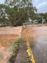
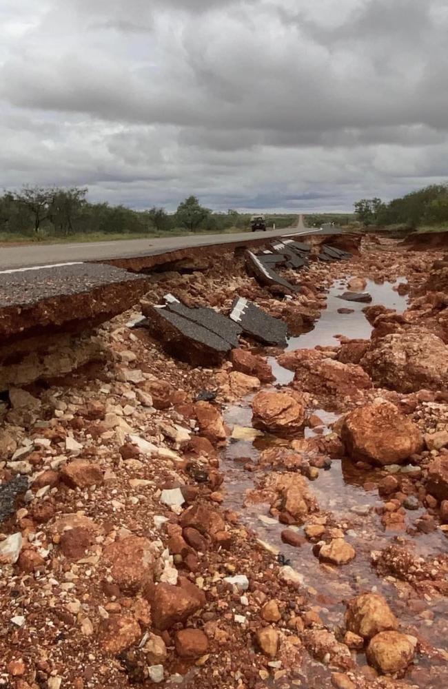
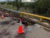
The tropical low, which made landfall as a category one cyclone on Thursday night, has moved across the NT, lashing several regions with heavy rainfall and causing flash flooding.
The Bureau of Meteorology has warned the wet weather will continue this week, with the system heading back towards the Top End before making its way to Western Australia.
Severe weather warnings are in place for the Gregory, Carpentaria, Barkly and Tanami regions.
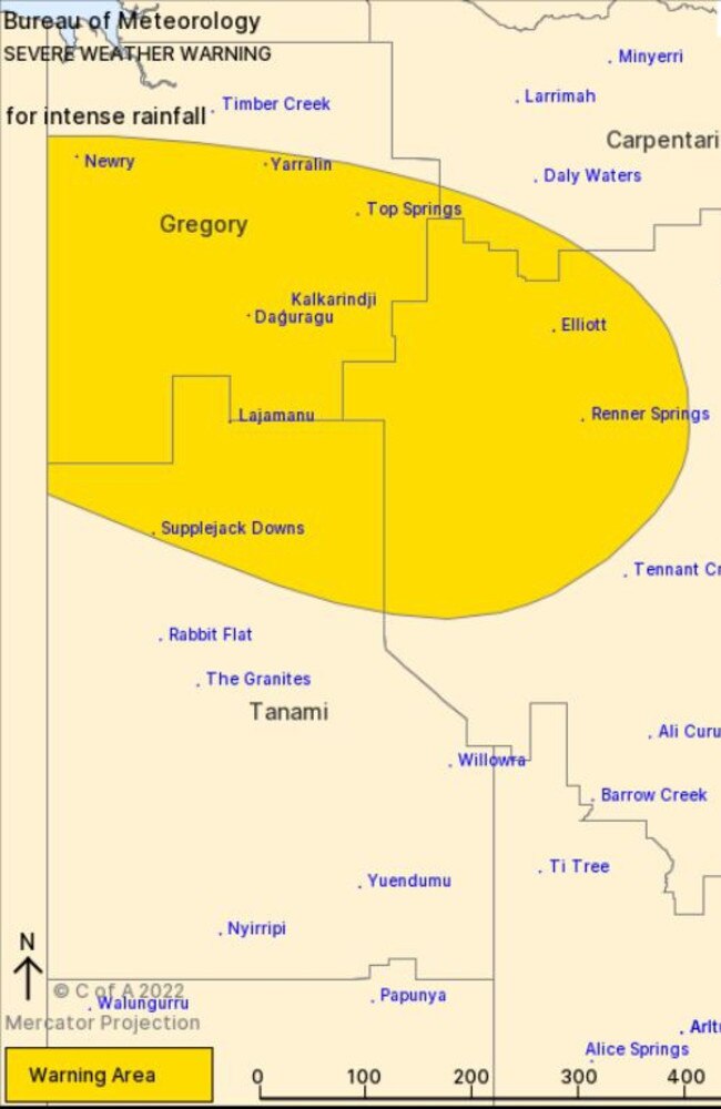
At 10.45am on Wednesday, ex-Tropical Cyclone Ellie was moving over northwestern parts of the Barkly and was forecast to move over the Gregory on Wednesday before making the Kimberley in Western Australia.
More heavy rainfall and life-threatening flash flooding was possible for the Barkly on Wednesday, with the low set to dump between 70mm and 100mm of rain in six hours and as much as 150mm over a 24-hour period.
Intense rainfall could cause dangerous and life-threatening flash flooding close to the centre of the low, with as much as 200mm of rain possible in 24 hours and between 100mm and 150mm a chance to fall in just six hours.
The Bureau said damaging wind gusts were no longer expected with the system but warned that threat could return to parts of the Top End as a monsoon redevelops.
A flood watch remained in place for a number of various rivers and catchments throughout the
Bureau senior forecaster Sally Cutter said the wet weather was likely to continue until the end of the week.
“We’re also going to see the monsoon trough reinvigorate,” Ms Cutter said on Tuesday.
“And that’s going to see the weather pick up across the Top End.”
Overnight, Gunn Point, about 75km northeast of Darwin, copped 117mm of rain, while the Todd River in Alice Springs was flowing after the Territory’s wild weather.
Chief Minister Natasha Fyles said ex-Tropical Cyclone Ellie was moving north faster than expected.
She said a dozen remote communities remained isolated due to flooding over roads.
“Communities are well prepared,” she said.
Ms Fyles said an assessment would be made on the railway, which could remain closed until the end of the week due to flooding.
“It’s not envisaged that will have a big impact on our supermarkets,” she said.
“There’s no need to go out and buy extra items.”
The Barkly Hwy remained close between Tablelands Hwy and the Queensland border, while motorists were urged to drive with caution on other major thoroughfares still covered in water and damaged.
More Coverage

Originally published as Monsoon on the cards as ex-Tropical Cyclone Ellie heads for the Top End

‘Homelessness is not a crime’: Darwin mayoral candidate’s plea to voters
“The truth is: I will lose by about 20,000 votes. But I will still go out every night on the streets and feed people out of my own pocket while Kon Vatskalis will be sitting there enjoying his election night victory party,” says this Darwin lord mayor candidate. Read about her policies here.

NT Greens endorse roller skating coach for Darwin council bid
“I’m running for council because I want to make sure that my generation feels that they can build their futures here,” said Greens-backed Darwin council candidate Ellyane Wall. Read the details.