
Cyclone Ellie downgraded, severe weather warnings for Top End
Heavy rains have shut at least one highway in the NT as the remnants of ex-cyclone Ellie is felt across the Territory.
Northern Territory
Don't miss out on the headlines from Northern Territory. Followed categories will be added to My News.
Travellers are being warned to avoid sections of the Victoria Hwy thanks to the week’s wet weather.
Emergency Services said flooding along the Western Australia and Northern Territory border had shut parts of the highway in Timber Creek and towards Katherine.
Incident Controller Virginia Read said motorists should reconsider travel due to heavy rain and rising waters over roads.
“It is highly dangerous for vehicles to attempt to cross flooded roads and causeways,” she said.
“Always stay away from flooded drains, rivers, streams and waterways and never to drive into floodwaters.
“Remember; if it’s flooded, forget it.”
The warning comes soon after ex-tropical Cyclone Ellie was downgraded to a tropical low – less than 12 hours after it reached the NT coast.
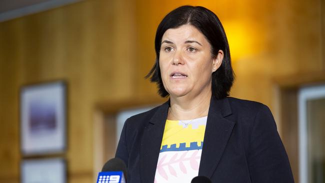
Chief Minister Natasha Fyles said there had been no reports of significant damage in affected areas of Wadeye and Peppimenarti.
However, she said parts of the Territory were still expected to experience heavy rainfall.
Ms Fyles said the Housing Department had been working to have as many homes in the communities available over the wet season.
Ex-Tropical Cyclone Ellie is likely to continue south, with 200mm to 300mm of rain expected in the Tanami district.
WEATHER PHOTOS: Email your photos to news@ntnews.com.au
“Our next focus is going to be as that tropical low moves through the Northern Territory, a significant amount of rainfall,” Ms Fyles said.
“I’d like to thank the residents in that Wadeye, Daly River region.
“They listened to our authorities last night.
“It appears that there hasn’t been any substantial damage but it is important that we listen to our authorities.”
Ms Fyles said the cyclone sped up and reached the NT coast earlier than expected on Thursday, which reduced its intensity.
“It’s now going to be a tropical low dumping a lot of water on the Northern Territory,” she said.
The government’s emergency sub-committee met on Friday morning before the cyclone was downgraded.
An emergency operations centre was also set up in Katherine.
Territory Controller and Acting Police Commissioner Murray Smallpage urged motorists to take care on the roads.
READ MORE: How Cyclone Ellie formed
“Just be careful if you’re travelling,” Mr Smallpage said.
“Flooded roads and the inclement weather conditions make our road conditions, particularly in remote locations, tricky.
“The last thing a Northern Territory police officer wants to be doing leading up to Christmas is knocking on someone’s door with some tragic news about a road death.”
Mr Smallpage also urged people to adhere to flood warnings.
“If it’s flooded, forget it,” he said.
“Don’t go into flooded roadways.”
Mr Smallpage said people should avoid flooded waterways due to an increased risk of crocodiles, as well as people becoming trapped.

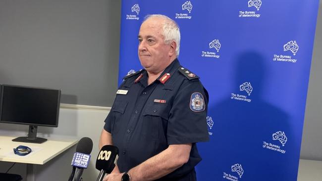
Bureau of Meteorology senior meteorologist Sally Cutter said it was “unlikely” the cyclone would reform but expected heavy rainfall across the Top End and much of the Territory in the coming days.
“As it moves south we are seeing some really heavy falls coming out,” she said
“There is still heavy rain associated with this system.
“It does still have some issues.
“It can cause some heavy rainfall.”
Ms Cutter said gusts on Thursday reached between 100km/h and 110km/h in affected areas.
She said up to 250mm per day of isolated rainfall could hit some areas in Central Australia.
“We are going to see some even bigger falls as it brings that moisture down,” she said.
After storms ease over Christmas, Darwin is expected to be hit with more monsoonal rains next week, with up to 40mm of rain predicted.
The Top End will experience more wild weather across the wet season, with at least three cyclones expected over the next few months.
Northern Territory Emergency Services deputy director Bob Evans echoed earlier warnings and urged motorists to take care on the road.
“The roads are going to be affected by the weather,” Mr Evans said.
“Be aware of the situation and just travel to the conditions.”
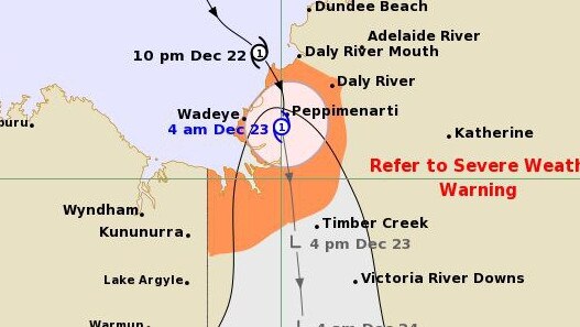
Tropical Cyclone Ellie tracked south through the Territory after forming off the NT coast late Thursday.
The system crossed the coast at 11pm Thursday in a sparsely populated area southwest of Daly River Mouth.
The Bureau issued its latest warning at 4am Friday when Ellie was about 55km east southeast of Wadeye and 230km west southwest of Darwin as it moved south, causing winds of up to 100km/h.
A severe weather warning was also issued for people in Daly, Tiwi, Gregory and parts of Arnhem, Carpentaria and Tanami districts, with monsoonal rainfall and damaging winds forecast for Friday and through Saturday.
The Bureau said six-hourly rainfall totals between 80mm and 120mm possible, with isolated totals up to 160mm possible.
Between 160mm and 200mm of rain could fall in a 24-hour period, with isolated totals up to 250mm in parts.
To keep residents in the Wadeye and surrounding areas updated, emergency services posted a warning video to Facebook in Murrinh Patha, the local language, along with the latest track map for Cyclone Ellie.
A West Daly Regional Council spokeswoman said there didn’t appear to be any damage in town.
“It’s business as usual here,” she said.
She said rain was still falling, but the winds had died down.
The Bureau said a separate severe thunderstorm warning would be issued if dangerous thunderstorms with destructive wind gusts or tornadoes were detected.
Affected areas would include Darwin, Jabiru, Wurrumiyanga, Kalkarindji, Pirlangimpi and Pine Creek.
Darwin could receive as much as 90mm of rain on Friday, while rainfall on Saturday is forecast between 15mm and 50mm.
Rainfall for Christmas Day in the capital is forecast between 2mm and 20mm.
More Coverage
Originally published as Cyclone Ellie downgraded, severe weather warnings for Top End

Matt Wright enters not guilty pleas ahead of chopper conspiracy trial
A Territory reality television star has officially pleaded not guilty to allegations he tried to cover up evidence in the wake of his mate’s fatal chopper crash.

Alice stabbing: First court mention for accused with murder charge
Slapped with a fresh murder charge, a man accused of a horrific daytime stabbing in the Red Centre capital has had his matter back in court. Read the latest.