
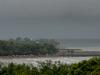
Category 1 Cyclone Ellie moving south towards Wadeye
Tropical Cyclone Ellie has formed off the NT coast with emergency services advising people in Wadeye and surrounds to take action. See the updates here.
Tropical Cyclone Ellie has formed off the NT coast and is likely to make its way across the Territory in the early hours of Friday morning.
Emergency services say Ellie, which was brewing as a tropical low over the Timor Sea on Thursday afternoon, was likely to make landfall as a category 1 cyclone before hitting areas between Dundee Beach and Wadeye.
Cyclone Ellie is expected to move south across the southern Daly region, weakening as it moves inland before dropping below cyclone-level strength by Friday afternoon.
Winds of up to 120km/h could hit affected areas between Dundee Beach and Wadeye and inland towards Daly River.
Gusts of up to 90km/h could also hit south of Wadeye towards the NT/WA border, with a chance of extending as far west as Wyndham in WA.
Heavy rainfall, likely to spread west, also set in over the Daly region as Cyclone Ellie formed.

High tides are expected between Dundee Beach and Wadeye, producing large waves that may lead to minor flooding in low-lying coastal areas.
Incident Controller Kylie Anderson said residents in Wadeye and surrounding areas should complete preparations, check their household plans and listen for the next advice.
“Emergency services are keeping a close eye on the possible tracks of this storm and our local emergency management teams have activated their plans and are making the necessary preparations to see their communities safely through this event,” Ms Anderson said.
She urged people to take safety precautions and not attempt to cross any flooded roads or crossings.
The Bureau of Meteorology issued a cyclone warning and advice on Thursday afternoon, advising a cyclone could develop before crossing the coast near the NT/WA border.

On Thursday, Bureau senior meteorologist Rebecca Patrick said the system was likely to form into a tropical cyclone on Friday morning before making landfall later that day.
“We are expecting conditions to be deteriorating in those areas over the south-western parts of the Top End, perhaps later tonight, so we could see some gale force winds developing as well as heavy rainfall,” she said on Thursday.
“The warning zone currently extends from Dundee Beach, across south-western coastal areas of the Top End including Wadeye and goes around to the Western Australian border.
“While the system is over water, we do keep a close eye on that.
“It did intensify overnight, a little bit stronger than we were anticipating and we’re now thinking that it may have just enough time over water before it hits landfall that it may reach a tropical cyclone intensity.”

The likelihood of a cyclone in the Top End has increased this week from very low, which is a less than 5 per cent chance, to low that puts the chances at between five and 20 per cent.
A warning for damaging winds and heavy rainfall has also been issued for Tiwi and parts of the Daly and Arnhem regions.
Winds of up to 90km/h could hit the affected area, which includes Darwin, as well as rainfall of up to 120mm in isolated areas in a six-hour period.
Across 24 hours, rainfall up to 200mm could hit some areas.
Ms Patrick said the Bureau had also issued a number of other warnings for severe weather for the NT’s north-western areas over the Top End where a low pressure system and monsoon troughs were delivering heavy rains and the increased gusty storms.
“We have issued that weather warning for potential damaging wind gusts as well as heavy rainfall,” she said.
“In addition, we do have some flood watches current as well as that tropical low moves further south it will be dragging the monsoon trough further as well as getting the potential for heavy rainfall around where that low pressure system tracks further south as it moves through the Northern Territory.”

Ms Patrick said the system, should it form into a cyclone, would weaken soon after making landfall but its strength would be determined by how it forms when over the water.
“But where it will remain as a deep depression and still bring heavy rainfall regardless of its intensity of the cyclone,” she said.
The inland catchments likely to cop the brunt of the wild weather include the Upper Victoria River, Tanami Desert, Barkly Region, Central Desert, MacDonnell Ranges, Simpson Desert, Georgina River and Eyre Creek, East Kimberley Rivers and the Sturt Creek District.
Darwin is also expected to get heavy rainfall towards the weekend, with up to 45mm forecast for Thursday, up to 60mm for Friday and up to 35mm for Saturday.
Across Tuesday and Wednesday, Darwin Airport received 52mm of rain.

According to the bureau, November was the seventh wettest on record for Northern Australia.
Northern Territory Emergency Services deputy director Bob Evans said communities in the potential firing line had been preparing since Wednesday as well as the southern regions that had been expecting flooding out of the low pressure system.
He said emergency services were not “looking at any evacuations at the moment” in Wadeye.
There would have to be a “significant increase in intensity” for that to happen, he said.
“The likelihood of that just isn’t there at the moment,” Mr Evans said.
“The prediction is that it might get to a top category one, bottom category two; we would need a significant increase nearly to a category four cyclone before we would consider evacuating communities.
“There are a number of government buildings, local government buildings or education buildings down there that can take up to 1000 people, and there are a significant number of residences that are built to interest level two which is catered for the stormwater expected at the moment.”
Mr Evans urged people to consider their travel plans and to monitor the weather situation.
“We recommend that emergency kits are prepared so it’s not just for cyclones, it’s for floods and fires etc,” he said.
“So an emergency kit or family emergency plan or household emergency plan and get it prepared in advance.
“Don’t wait to the last minute. There might not be the goods and services that you need available to you to put your plan together or put your package together.”
The forecast wild weather also raises concerns for pet owners.
Department of Industry, Tourism and Trade executive director of agriculture Phil Hausler said it was important to have plans in place for pets.
“Whether you are going away for Christmas or staying in the NT, it is important your pet is part of your emergency wet season plans,” he said.
“Your plan should include where to shelter as well as identification and emergency numbers, and your kit should include adequate food, water, toys and medication for yourself and your pet.”
Gemma Chohdri, who owns two shar peis, Brax and Mila, said pets shouldn’t be an afterthought in cyclone preparation.
“It’s thinking about them and having a plan,” she said.

Ms Chohdri said she would keep her dogs inside when the wild weather hit.
NT Police urged motorists to take care if travelling in wet conditions.
Southern Command Manager Ian Carlton said flash flooding could leave roads impassable for up to a week.
“Understandably it is Christmas time and families come together to celebrate but motorists are reminded to be cautious when travelling in wet weather conditions,” he said.
“If it’s flooded, forget it.
“It’s just not worth the risk.”
Emergency services advised travellers to prepare an emergency kit including canned food, water and medication that would last four days, ensure your vehicle’s fuel tank is full, avoid flooded drains, rivers, streams and waterways, avoid driving into flood waters, watch for changes in water levels, be prepared to evacuate and avoid parking or camping adjacent to rivers.

Join the conversation

Charged chief executive retains tourism chair position
Read more

Health workers to walk off the job on Wednesday
Read more