
Tallest waterfall, pink lakes: The most impressive outdoor sights in Victoria
From Victoria’s tallest trees to the state’s highest waterfall, the deepest gorge to the most colourful lake. These are the most impressive natural wonders right on our doorstep. Take a tour of the state’s most amazing attractions.
Giant trees, pink lakes and a massive rock larger than Uluru are some of the natural wonders which can be explored in Victoria.
From our longest scenic drive to the deepest gorge, these are the state’s most impressive outdoor features.
VICTORIAN ISLANDS YOU CAN ESCAPE TO OVER EASTER
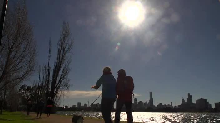
THE LONGEST WALK
Blast away the cobwebs with fresh sea air and a bracing walk along Victoria’s southwest coast.
Beginning in historic Portland, Victoria’s oldest European settlement, the Great South West Walk is a spectacular 252km circuit winding its way through the protected Lower Glenelg National Park, Discovery Bay Coastal Park, Cobboboonee National Park and Cape Nelson State Park.
From dense Australian eucalypt forest and the pristine waters of Glenelg River, to wild surf beaches and exposed coastal cliffs, there’s plenty of diversity on this rugged trek.
The 12-day walk can be broken up with 14 campsites dotting the journey, and day walkers can take a shortcut by trekking the many short loops making up the Great South West Walk.
Up for a bigger challenge? Stretch your legs on the 655km Australian Alps Walking Track and amble across multiple states.
The track begins in the Gippsland mining town of Walhalla, ending near Canberra and takes in Mount Kosciuszko, Mount Bogong, and Bimberi Peak — the tallest peaks in New South Wales, Victoria and ACT.
THE BIGGEST WATERFALL
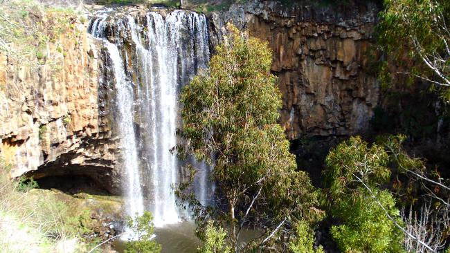
Most impressive after heavy rain, Trentham Falls lays claim to being the tallest single-drop waterfall in Victoria.
The Coliban River drops 32m over a craggy volcanic basalt cliff, making these powerful falls a popular destination for locals and spa country visitors.
While the base of the falls is now off-limits after landslides, the viewing platform is just a short walk from the nature reserve carpark.
These falls are best visited in autumn and spring.
The jury on Victoria’s tallest waterfall is still out, but Marysville’s Steavenson Falls (122m) and Mt Buffalo’s Eurobin Falls (unknown height) are among the contenders.
THE BEST WATERFALLS TO CHASE IN VICTORIA
THE TALLEST TREES
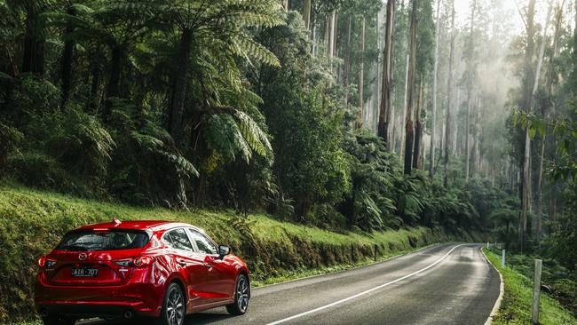
The world’s two tallest species of trees can be found in our state — the mighty mountain ash and towering Californian redwood.
The mountain ash is Australia’s tallest native tree species — second tallest in the world — and also the world’s tallest flowering plant.
Known to reach more than 100m in height, with a girth exceeding 15m, these colossal forest giants can be found all over Victoria, notably in the Dandenong Ranges, Otways, and Gippsland.
Motor along the Black Spur Drive and be awed by these magnificent trees. Nearby in Warburton, the Ada Tree near Warburton is a hulking species in the Yarra State Forest, estimated to be 300 years old.
IS THIS VICTORIA’S MOST EXPENSIVE BURGER?
WHERE TO EAT IN THE YARRA VALLEY
The Yarra Valley is also home to the world’s tallest tree species: a grove of National Trust-listed Californian redwoods in Warburton East.
Another pristine plantation of these incredible specimens can also be explored in the Otway ranges of Aire Valley, near Beech Forest.
Planted in the late 1930s, the coastal redwoods have grown to a height of around 60m — mere youths compared to the huge specimens growing up to 115m in the northern hemisphere.
THE DEEPEST GORGE
Little by name, but not by nature, Little River Gorge is Victoria’s deepest canyon, and one of the state’s final frontiers of unspoilt wilderness.
Downstream from the junction of the Little and Snowy rivers, this hidden gem is tucked deep in the Snowy River National Park, its sheer cliffs plunging up to 400m in some parts.
Exploring the 4km gorge requires experience in rope techniques and canyoning, with intrepid explorers rappelling their way down to the river.
Visitors who prefer their sightseeing without a side of adrenaline can take in the spectacular view from the top via an easily accessible clifftop lookout.
THE LONGEST RIVER
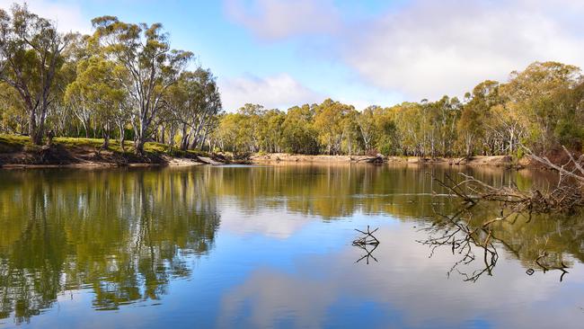
There are plenty of ways to explore the Murray River — the country’s longest — which stretches more than 2500km from the Great Dividing Range to South Australia.
You can swim, fish, canoe, paddle-steam and houseboat the Murray’s waters, and enjoy camping, picnicking and walking through national parks along its banks.
River redgums provide plenty of shade in the state’s sunny north, while sandy beaches and secluded creeks are the perfect spot for a cooling dip.
While you’re in the region, head to the Murray’s northwest to find the Murray lily, Victoria’s largest flower.
THE MOST SIGNIFICANT ROCK ART
The Grampians in Victoria’s west are best-known for dramatic landscapes, but most visitors are unaware the region contains 90 per cent of the state’s Aboriginal rock art.
Around 200 rock art sites have been recorded in the national park, with some dating back more than 20,000 years.
Five rock art shelters are open to the public, where visitors can view ancient hand stencils, along with paintings of people and wildlife: Manja and Billimina in the west, and Ngamadjidj and Gulgurn Manja in the north.
Black Range Scenic Reserve, near Stawell, is also home to the only known rock art painting of Bunjil, the spirit which appears in many creation stories of the Aboriginal people in southeastern Australia.
THE HIGHEST SAND DUNES
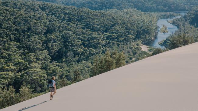
Close to Victoria’s southeastern corner lies one of our most remote national parks.
The region is called the Wilderness Coast for good reason, and Croajingolong National Park is also home to some of the biggest sand dunes in the state, giving adventurers a unique outlook over the Gippsland forest.
BEST ROCK POOLS TO EXPLORE NEAR MELBOURNE
Climb the 30m dunes near Point Hicks for spectacular views inland, across the Thurra River and out to sea.
Large inland dunes can also be found near the entrance to Wilsons Promontory at Big Drift, with the massive formations dwarfing hikers game to explore the area.
Its isolated location and lack of light pollution also makes this stunning a spot an ideal place for stargazing.
THE LONGEST SCENIC DRIVE
Trade the tranquil East Gippsland coast for Victoria’s highest peaks on the Great Alpine Road, which stretches more than 330km from Metung to Wangaratta.
A stunning road trip regardless of the season, the five-hour drive winds its way from the Gippsland Lakes region and through tiny gold rush towns, before climbing up the alps.
Snow gums, open meadows and rolling mountains set the quintessential Aussie scene as drivers pass the villages of Dinner Plain and Mt Hotham, taking in the alpine sights and fresh air.
The Cross (1825m) marks the highest point on the scenic drive.
BEST THINGS TO EAT IN BRIGHT AND VICTORIA’S ALPS
The journey down wouldn’t be complete without a stop in the postcard-perfect town of Bright, famed for its striking autumn displays as the local trees prepare to shed their leaves.
If you’re looking for a taste of adventure, Mt Buffalo is a haven for outdoor lovers, with waterfalls, picnic grounds, rock climbing crags and campgrounds to enjoy.
The final leg of the drive to Wangaratta calls for a stop to sample the King Valley’s gourmet delights, with Milawa Cheese Factory and Brown Brothers winery on the way.
Remember to check conditions and snow chain requirements if embarking on the Great Alpine Road during the cooler seasons.
THE HIGHEST MOUNTAIN
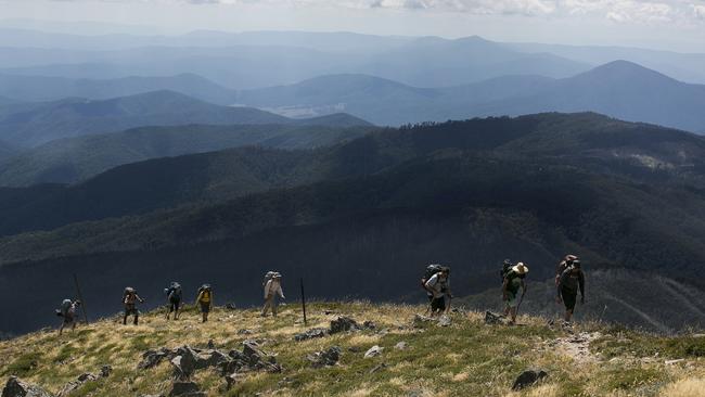
Hikers won’t need mountaineering experience to summit Mt Bogong, Victoria’s highest peak at 1986m elevation.
Though it can be reached in a day’s hike, the walk is an arduous uphill slog, with switchbacks and steep climbs sure to get the thighs burning.
But the reward is crisp alpine air and stunning panorama views across the peaks of the rolling mountain range.
Victoria’s second-highest mountain, Mount Feathertop (1922m), is also close by and can be reached via a 21km day hike.
Visitors should always be prepared for sudden weather changes, including snow — even in the middle of summer.
THE MOST SCENIC DRIVE
A list of our southern state’s most impressive sights wouldn’t be complete without including the Great Ocean Road.
From sleepy coastal hamlets and ripper surf breaks to lush rainforest and the iconic Twelve Apostles, there’s something to please everyone travelling on the heritage-listed tourist road.
Ever-changing views of the Southern Ocean are inviting in summer, before turning rough and moody come winter, making it a stunning road trip destination rain or shine.
Top gems to check out include the Kennett River koala walk, Teddy’s Lookout, the array of waterfalls in the Otways hinterland, Gibson Steps, Loch Ard Gorge and The Grotto.
THE HIGHEST DRIVABLE PEAK
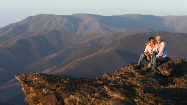
Why hike when you can drive? Mt McKay is a back-country wonderland for experienced snow lovers in winter, and is transformed into our highest drivable peak come summertime.
Standing at 1842m, the mountain is the highest spot in Australia accessible by road, making it a popular spot for sightseers and picnickers.
Offering views across the Bogong High Plains and Kiewa Valley, a clear day affords visitors a panorama of the majestic plains for hundreds of kilometres, with Victoria’s highest mountain, Mt Bogong, a prominent sight in the distance.
Those looking to work for the view can hike or bike in.
THE FIRST NATIONAL PARK
Tower Hill Wildlife Reserve, just outside Warrnambool, celebrated its quasquicentennial — 125th anniversary — in 2017, making it our oldest national park.
The reserve, declared a national park in 1892, is a remnant of Victoria’s volcanic past.
It was formed by a violent eruption some 32,000 years ago, creating a massive funnel-shaped crater which later filled with water.
The heart of the remarkable dormant volcano teems with wildlife, including koalas, emus, kangaroos, wallabies, echidnas, turtles and possums, as well as numerous waterbird and parrot species.
It was famously depicted by landscape artist Eugene von Guerard, whose painting was later used in efforts to reforest the reserve.
THE OLDEST LIGHTHOUSE
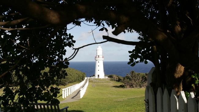
Dramatically perched on treacherous cliffs just off the Great Ocean Road, Cape Otway Lightstation has been known as the “beacon of hope” for more than 170 years.
It was built in 1848 after thousands were killed in the wild waters of the Shipwreck Coast, which have claimed more than 600 vessels since the early 1800s.
For thousands of 19th century migrants, this shining light was also often the first sight of land since leaving Europe.
The precinct today includes multiple layers of local history, including an recreated Aboriginal meeting hut, lighthouse keepers’ lodgings, the original 1859 telegraph station, and a World War II radar bunker.
Keep an eye out on the drive in for a glimpse of Cape Otway’s booming koala population.
THE BIGGEST ROCK
Climbing Uluru may be frowned upon — and banned as of this October — but a gigantic rock larger than the iconic monolith can be summited near Wodonga.
Pine Mountain is said to be 1½ times the size of the Aussie outback icon, but a long, strenuous climb to 1062m elevation is in store for hikers.
After tackling the steep ascents and rock scrambles, the view across the Great Dividing Range, including Mt Kosciusko on a clear day, is a sight for sore eyes.
A multitude of native fauna can be spotted, including wallabies, wombats, kangaroos and lyrebirds.
THE MOST COLOURFUL LAKE
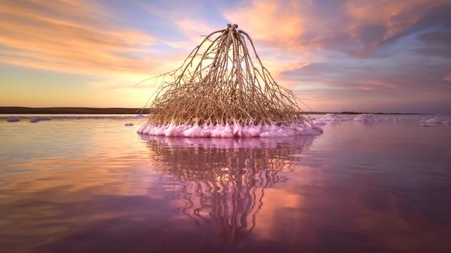
Covering more than 20,000ha in the Mallee wheat belt, Lake Tyrrell is the state’s largest salt lake.
But the lake’s colour change makes its salt-encrusted surface a mecca for Instagrammers, with the shallow waters turning a stunning pink when conditions are just right.
During wet, warm periods, micro-algae secretes a pigment into the water, painting it a pretty pastel hue.
The lake is also popular among with photographers for its mirror-like reflections, where stunning sunsets, sunrises and massive star-filled night skies are doubly as stunning.
Salt lakes Crosbie, Becking, Kenyon and Hardy are all located in Murray Sunset National Park and also turn shades of pink and lilac on occasion.
Closer to the city, Westgate Park’s salt lake also changes colour in response to very high salt levels, high temperatures, sunlight and lack of rainfall.
— With contributions by Parks Victoria
Originally published as Tallest waterfall, pink lakes: The most impressive outdoor sights in Victoria
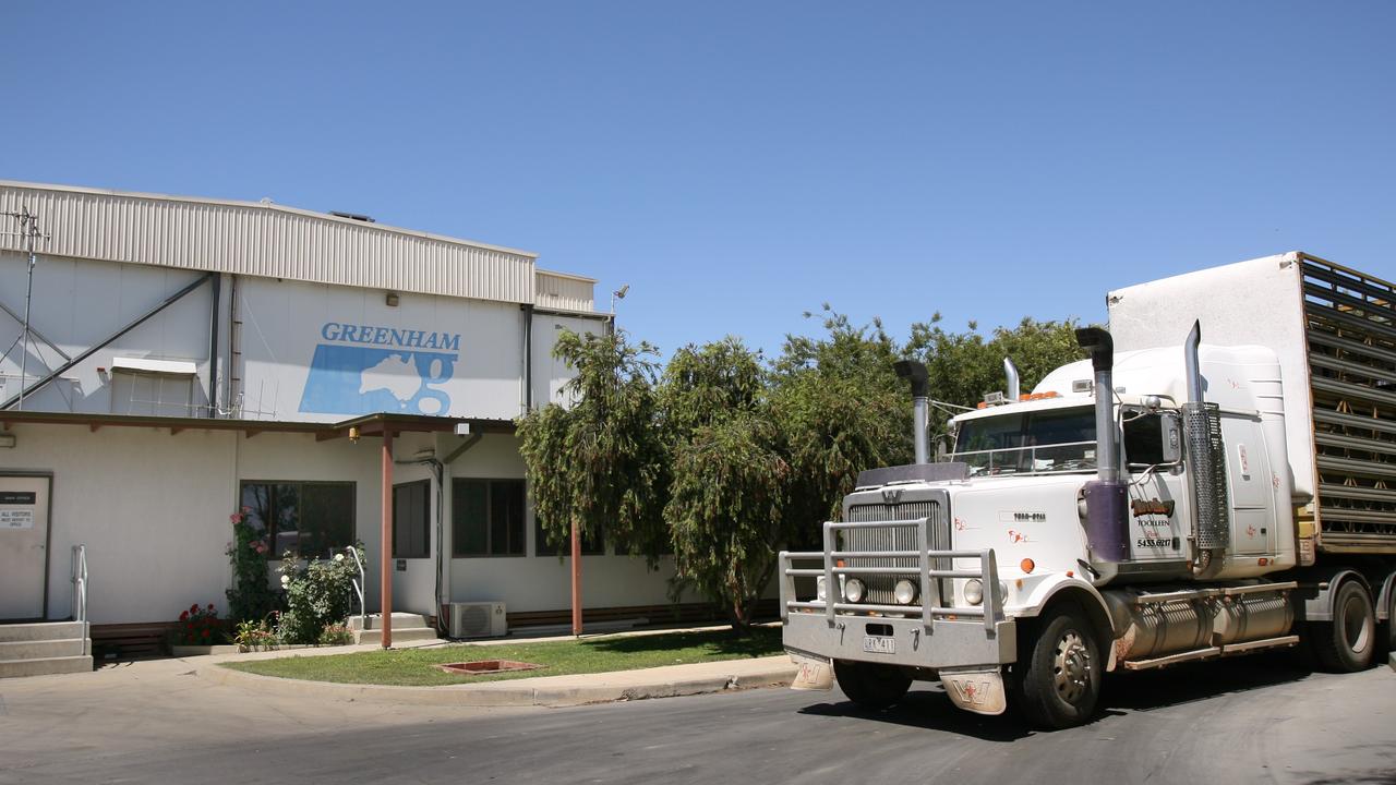
‘No one knew it was coming’: Tongala cow abattoir shuts
The livestock industry and local community have reacted to Greenham’s closure of its Tongala cow processing plant.
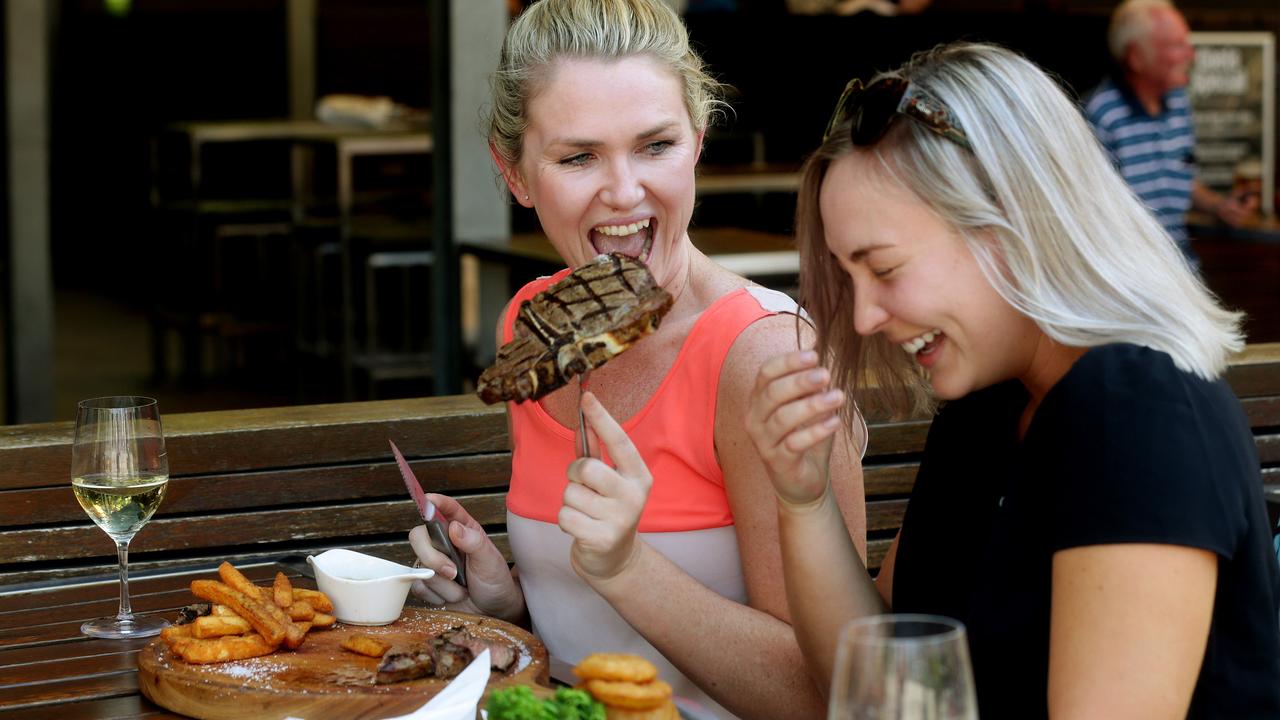
Victorians want to feel guilt-free about eating meat
Research – to guide a Victorian Government-funded pro-agriculture campaign – has revealed how consumers feel about the state’s farmers and what issues need to be addressed.