
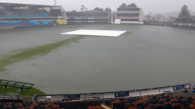
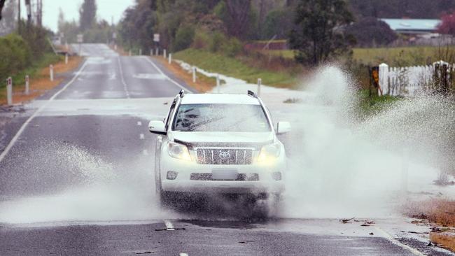
30mm in 30 minutes: Heavy rains leave Eastern Shore washed out
Wild weather that lashed the state left numerous businesses in need of drying out – and there are warnings the big wet might not be over yet. LATEST >>
Weather
Don't miss out on the headlines from Weather. Followed categories will be added to My News.
HEAVY rain that lashed the state on Friday has been described as a once or twice-a-year event – and there could be more wild weather on the way.
The SES responded to several calls for assistance as rains inundated stormwater systems that were unable to cope.
“We had around 90 calls into our dispatch centre resulting in 54 requests for assistance which we attended, right around Tasmania, predominantly in the southern region,” SES assistant director of operations Leon Smith said.
“We saw extended rainfall across the state during Thursday into Friday, which was expected.”
Mr Smith said buildings, residences and commercial properties were inundated with water and there was also significant flash flooding in parts of the state’s North.
“The rainfall caused minor damage to The Neptune Grand Hotel in Penguin, while in the south, the Sportsgirl store at Eastlands Shopping Centre was hit hard,” he said.
“We always knew there was going to be thunderstorm activity, but with those thunderstorm cells across populated areas we saw very high rainfall values in very short periods of time,” Mr Smith said.
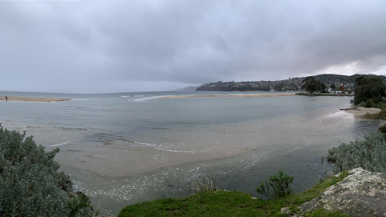
“30mm in 30 minutes across the Cambridge-Bellerive area which resulted in inability for roof gutter systems to get rid of that rain water and then subsequently stormwater systems unable to get rid of that stormwater run-off.”

Mr Smith said the weather was uncommon.
“These rainfall events, we do have them in Tasmania but they’re not that prevalent,” Mr Smith said.
“We see these occurrences maybe once or twice a year.”
The wild weather might not be over, with similar if less severe conditions predicted.
“What we’re looking at for the next week is rainfall events but not as significant and we’re not expecting thunderstorm events of that same magnitude,” Mr Smith said.
“However, we are expecting thunderstorm elements, albeit minor compared to yesterday, probably during the next 12 hours or so.”

Mr Smith said there were many ways the public could prepare for wild weather.
“It’s absolutely essential you undertake maintenance prior to these events around your property to ensure the storm water has the best ability to get away,” he said.
“During events with the rainfall value such as what we saw last night, the roof systems just can’t cope with that, so you can expect inundation under such circumstances.”
Shopping Centre soaked as gutters overflow
SHOPPERS got more than they bargained for when Eastlands Shopping Centre in Rosny Park was flooded on Friday afternoon amid a torrential downpour.
Several shops were forced to close early as the floors near the downstairs Coles were soaked with muddy gutter water.
One customer said she had slipped on the tiles, but was not seriously injured.

Eastlands Shopping Centre assistant operations manager Daniel Hochstadter said it appeared the stormwater gutters had overflown during the sudden downpour.
Mr Hochstadter said there was no damage to the roof nor to the inside of the building.
“The structural integrity of the centre is fine and intact. It seems there was just too much water for the stormwater system to handle. Basically, it’s just been a deluge of water, but there’s no damage to the roof,” Mr Hochstadter said.

“We don’t know of any damages [to the shops]. Some people have gone home, but we’re not aware of any water damage. It appears there’s just been some leakages.”
Mr Hochstadter said it would appear as though all the shops would be able to open as normal on Saturday after a quick wipe-down.
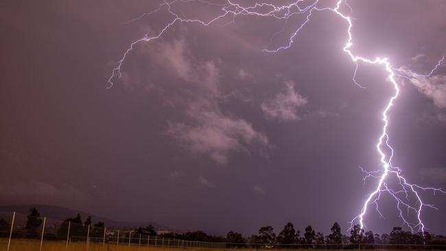
More wild weather, flash flooding strikes South
A SEVERE warning for thunderstorms has been issued as claps of lightning and peals of thunder can already be heard about the south.
The northern half of the state has battled severe damaging winds and flash flooding in recent days, but the latest storm warning will mostly affect the Upper Derwent Valley, Central Plateau, and parts of the Western, South East, North West Coast and Midlands Forecast Districts.
The rivulet outside the Eastlands Shopping Centre spilled over onto the road, temporarily flooding the intersection.
Parts of the shopping centre were also flooded, with Coles and Cellarbrations closing and other food court businesses affected.
About 24mm of rain fell in 30 minutes at Hobart Airport from 4.15pm, with Howrah, Bellerive and Rosny also affected by heavy rain.
Flash flooding may affect areas such as New Norfolk, Bothwell, Hobart, Geeveston, Dover and Dodges Ferry.
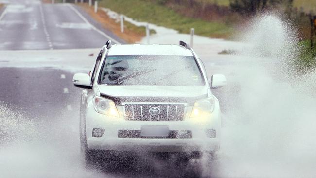
Tasmania Police has advised they are receiving numerous reports of hazardous road conditions and flooding due to the current weather conditions.
Motorists are reminded to drive to the conditions and monitor the community alerts website for a full list of road closures.
The Bureau of Meteorology Tasmania said on Friday afternoon a slow-moving trough was bringing a band of showers and storms from South-East to North-West regions.
“Severe thunderstorms are likely to produce heavy rainfall that may lead to flash flooding in the warning area over the next several hours,” the BOM website reads.
People are asked to avoid flood waters, seek shelter indoors, avoid using telephones during storms and keep an eye out for fallen trees and powerlines.
Emergency repairs are being undertaken about 6pm on Friday following an outage at Brighton, according to TasNetworks’ outages website.
The website says another potential Mount Nelson outage is under investigation.
For emergency assistance call the SES on 132 500.
Latest weather updates and warnings bom.gov.au/tas/
Thunderstorms brewing amid week of damaging winds, record rainfalls
WHOPPING rainfalls smashed a January record and before that “unusual” damaging winds slammed Tassie, now thunderstorms are brewing in another part of the state.
Bureau of Meteorology Tasmania senior meteorologist Simon Louis said a tropical band of moisture brought staggering totals about the northeast and North-West on Thursday evening and Friday morning.
“The heaviest rainfalls recorded in the 24 hours to 9am this morning were 281mm at Gray, which is the highest on record for that site in January,” he said.
The next highest volumes were 227mm at St Patricks Head, 187mm at Mount Barrow, and 101mm at Friendly Beaches.
“We saw broadly 30-100mm for most places across the northeast of Tasmania,” Mr Louis said.
Though blue patches have started to poke through the dreary skyline, Mr Louis said more havoc was set to unleash in another part of the state on Friday afternoon and into the night.
He said “quite a lot” of stormy weather was expected about Tasmania, particularly in the West and South.
“We have seen storms start to develop just now in the West out near Zeehan and Strahan but we expect those to continue to develop and move eastwards across the South of the state during the day,” he said.
“We could also see thunderstorms crossing the North and northeast of the state from mid-level thunderstorms that are moving across the Bass Strait during the afternoon and evening.
“Heavy rainfall is possible with the storms as it’s quite a humid air mass, and (there is) also some potential for damaging winds and large hail so we’ll be monitoring closely and issue a sever thunderstorm warning if required this afternoon.”
Mr Louis said the mayhem should clear the East Coast in the evening, with some storms possible in the North on Saturday afternoon.
The South Esk River has a moderate flood warning, with minor warnings for the North Esk, Mersey and Macquarie Rivers and a flood watch in areas of the North-West, North and northeast.
More information bom.gov.au/tas
State warned to brace for flash flooding, thunderstorms
FLASH flooding is predicted for much of the state on Friday as the weather bureau issues a severe weather warning for heavy rainfall.
It comes as a severe warning for damaging winds remains in place about the far North-West for the remainder of Thursday.
Bureau of Meteorology Tasmania senior forecaster Luke Johnston said the uncommon east to north-easterly wind direction meant areas would be affected differently compared to usual.
“We’ve already seen damaging easterly wind gusts around 90km/h observed on King Island and Cape Grim this morning and it’s likely that we’ll see winds of this magnitude continue for a good part of Thursday before gradually easing later this evening,” he said.
“The other thing happening in Tasmania today is the risk of rain and thunderstorms about the northern half of the state.”
Mr Johnston said a band of rain would bring heavy rainfall to the state’s north on Thursday evening and into Friday morning.
“There’s a risk of heavy rain that may lead to flash flooding,” he said.
“Thunderstorms are also expected, particularly about the north of Tasmania overnight … that may bring additional bursts of heavy rainfall.”
Mr Johnston said the North-West and northeast could receive 60-100mm of rain, while the Western Tiers and North East Highlands could receive more than 150mm.
“The Central North, including Launceston, is likely to only receive 25-60mm but the risk of thunderstorms will bring additional heavy bursts of rainfall even over the Launceston area overnight,” he said.
The rest of the state can expect 15-35mm.
A Severe Weather Warning is current for Heavy Rain that may lead to flash flooding this evening and Friday morn. Other Warnings are also current, including a Severe Weather Warning for Damaging Winds, Road Weather Alert, Flood Watch. Stay up to date: https://t.co/NHL3HY0zFO#Taspic.twitter.com/Aow9sJGUUq
— Bureau of Meteorology, Tasmania (@BOM_Tas) January 5, 2022
BOM Tasmania issued a riverine minor to moderate flood watch for North-West, North and northeast catchments.
A road weather alert for northern Tasmania was also issued with reduced visibility and the possibility of water covering roads.
“The good news is that the weather’s expected to clear pretty quickly on Saturday morning and it looks like we’ll have much more settled conditions right through next week,” Mr Johnston said.
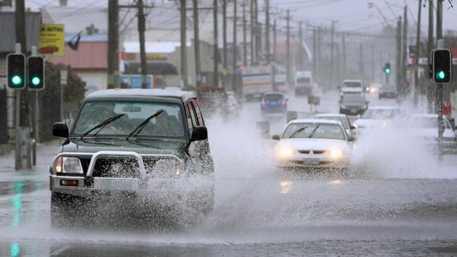
Tasmania Police reported cars had rolled over on Ridgley Highway, Highclere, in the North-West and on the Batman Highway near Sidmouth in the West Tamar on Thursday.
No one was injured in the Highclere incident, while the Sidmouth rollover prompted lane closures and no serious injuries.
“Many parts of the state are currently experiencing wet weather conditions so motorists are advised to slow down, drive with caution and put on their headlights,” Tasmania Police said.
The national BOM climate summary for last year revealed the country’s coolest year in almost a decade.
But Tasmania and some other parts of the country experienced a generally warmer than average year.
Senior climatologist Simon Grainger said Tasmania recorded temperatures 0.39C above the 1961-1990 average.
Dr Grainger said it had been Australia’s wettest year since 2016.
“Tasmania’s rainfall in 2021 was just over 1 per cent above average overall,” he said.
Latest weather forecasts and warnings bom.tas.gov.au/tas/
SEVERE WARNING: Damaging winds, flooding to batter Tassie
4.59pm January 5, 2022
Damaging winds coming from an “unusual direction” and flooding from heavy rainfall are making their way to Tasmania’s North West region.
The Bureau of Meteorology Tasmania has issued a severe weather warning for damaging winds, expected to arrive on Thursday.
King Island, and areas along the North West and West Coast like Currie, Smithton, Waratah and Rosebery will be impacted by winds averaging 60-70km/h.
The BOM Tasmania website said peak gusts could reach 80-90km/h from Thursday morning into the evening.
“A trough deepening over Victoria today will cause east to north-easterly winds to strengthen for Thursday about northwestern parts of Tasmania,” the BOM website reads.
“These winds are from an unusual direction, and may cause damage to different areas than normal for this wind strength.
“Winds are expected to ease below the warning threshold in the late evening.”
A minor to moderate flood watch is in place from Friday morning amid a forecast for heavy rain and thunderstorms.
âš ï¸ #Flood Watch issued for #NorthWest#North#NorthEast catchments. Heavy rainfall and storms expected Thursday and Friday. Minor to moderate flooding possible from Friday morning. See https://t.co/V9LYfDAYDq for details and updates; follow advice from @SESTasmania. #TasFloodspic.twitter.com/cq0rUsBUhB
— Bureau of Meteorology, Tasmania (@BOM_Tas) January 5, 2022
“Something to keep an eye on after the winds … is the potential for heavy rain about the northern half of Tasmania Thursday evening continuing into Friday with the potential for some very interesting thunderstorms,” senior meteorologist Luke Johnston said.
“It’s very likely we’ll be issuing another severe weather warning for heavy rainfall about northern Tasmania … for a period covering Thursday evening through to Friday afternoon.”
Between 60-100mm of rainfall is expected in the North West and North East during the 36 hours ending midnight Friday.
A Severe Weather Warning for Damaging Winds has been issued for northwestern #Tasmania. These damaging east to northeasterly winds are likely from Thursday morning until Thursday evening. Check the current warnings at https://t.co/NHL3HY0zFOpic.twitter.com/WfUZPlpKU5
— Bureau of Meteorology, Tasmania (@BOM_Tas) January 4, 2022
More than 150mm could lash the Western Tiers, and more than 120mm could fall in the northeast highlands.
The Central North could see 20-60mm, while the rest of the state can expect 15-35mm.
“River rises are expected,” the BOM website reads.
“Localised flooding is also expected in areas that receive heavy rainfall.”
Affected catchments could include the North Esk River, South Esk River, Meander River, Macquarie River, East Coastal Rivers north of Bicheno, Ringarooma River, North Coastal Rivers, Tamar near Launceston, Mersey River, Forth River, Northwest and Central Coastal Rivers and Arthur River.
For the latest weather forecasts, warnings and safety advice visit bom.gov.au/tas
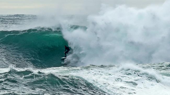
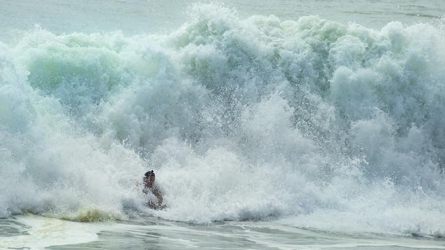
Big swells to emerge in east after Ex-tropical cyclone
Surfers on Tasmania’s East Coast are set for a wild ride thanks to the effects of Ex-tropical Cyclone Seth.
Grey and gloomy days will be interspersed with a wet Thursday and Friday this week, as the effects of Seth are felt around the country.
Australia watched on Monday as large swells battered the Gold Coast and areas in Queensland and Bureau of Meteorology Tasmania duty forecaster Anna Forrest said unusual swells were similarly expected in parts of Tasmania later this week.
“There will be a decent north-easterly swell down the East Coast courtesy of the ex-tropical cyclone on Thursday and Friday,” Ms Forrest said.
Ms Forrest said the swells would reach around 2-3m; a figure not typically observed in the East.
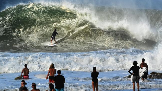
“The unusual thing is the 2-3m is what you’d usually see on the West Coast and it’s going to swap around to be on the East Coast,” she said.
“West Coast is going to be under two metres by Thursday.”
Ms Forrest said the state would get a thorough rinse on Thursday and Friday, caused in part by the ex-tropical cyclone, but more largely prompted by a high pressure system south of Tasmania combining with a deep trough coming to the state from Victoria and inland NSW.
“We’re going to get an easterly onshore flow, it’s going to be very moist,” she said.
Rainfall was predicted to reach 60-120mm in the northeast and northwest, 30-60mm in the central north, and 20-50mm in other parts of Tasmania.
The East Coast could expect the state’s lowest temperatures, sitting around the high teens and low 20s.
“The place to be is probably going to be the West Coast because the winds are still going to be south-easterly right through until Friday evening when they finally go back around to the west and southwest,” Ms Forrest said.
Before the rainy change on Thursday, Hobart can expect grey and gloomy days with occasional showers.
Maximum temperatures of 19C have been forecast in Hobart for Tuesday and Wednesday, followed by highs of 20 and 24C on Thursday and Friday.
Saturday brings the chance of a thunderstorm in the morning over Hobart, with cloudy weather and possible showers forecast for both days on the weekend.


Floods, snow and sun: A week in Tasmanian weather
The weather is keeping Tasmanians on its toes with a few changes on the way, including promising signs for a slightly warmer weekend before another wintry blast brings snow. FORECAST >>
Pictures: King tide rolls in as low-lying coastal community braces
An abnormally high tide has begun to roll in across the state’s South East after a coastal hazard warning was issued. Pictures >>