
Tasmanian weather: Autumn snow and icy roads across Tassie this weekend
Motorists and bushwalkers are being urged to prepare for cold temperatures, snow and icy conditions across Tasmania this weekend. FULL FORECAST >>
Weather
Don't miss out on the headlines from Weather. Followed categories will be added to My News.
Tasmanians motorists and bushwalkers are being urged to be prepared for cold temperatures, snow and icy conditions across the state this weekend.
The Bureau of Meteorology have forecasted snow falls to 400m levels on Saturday, with elevated roads potentially becoming icy.
Senior meteorologist Luke Johnston said there won’t be a significant accumulation of snow, just really cold air and light snow falls.
“The implication of 400m is that you start to get some potential road impacts,” he said.
“It’s always tricky to forecast how much snow you’re going to get lasting on roads at this time of the year because the ground is relatively warm.”
An unsettled and cooler start to May so far, with a cold blast likely this weekend. #Snowfalls to around 600 metres are likely Saturday & Sunday. We'll likely be issuing a Bushwalkers Weather Alert for the weekend, on Friday. #Brr ☃ï¸https://t.co/tytj8zDXdBpic.twitter.com/UZhvDf5JWm
— Bureau of Meteorology, Tasmania (@BOM_Tas) May 3, 2023
Mr Johnston said roads in elevated areas could have frost with road conditions potentially getting worse as road temperatures cool down.
“Some of the more elevated roads like the Lyell Highway that gets you over to the West Coast, that’s about 600m elevation, that often gets snow that sort of effects that main artery,” he said.
“But in the south, Vinces Saddle usually gets some snow flurries in these kinds of snow heights, and also, the southern Midlands usually get the odd snow flurry at around 400m because the southern Midlands is quite elevated.
“Having said that though, we’re probably not going to get large accumulations of snowfall, and it’s probably a good thing that’s happening overnight from Saturday night into Sunday morning which means that people who have gone away for the weekend will probably already be away.”
Bush walkers are being warned about trekking this weekend, with a bush walker alert expected to go out on Friday.
“If you’re going away during bush walks and stuff just be prepared for very cold conditions,” Mr Johnston said.

The BOM have forecasted a snow shower or two and a top of 3C for kunanyi/Mount Wellington on Saturday and Sunday.
Mt Field will have snow showers and frost throughout the weekend with temperatures reaching a top of 4C.
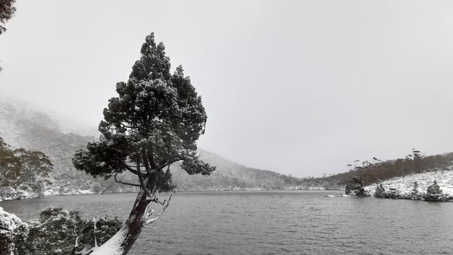
Cradle Valley will have a snow shower or two reaching a top of 5C on Saturday.
The Central Plateau will have a snow shower or two on Saturday reaching top of 6C, Sunday will have frost and possible snow showers with a top of 5C, with snow forecasted to continue throughout Monday.
The BOM has also issued strong wind warnings for the Far North West Coast, Central North Coast, Banks Strait and Franklin Sound, East of Flinders Island, Upper East Coast, South West Coast and Central West Coast on Friday.
Forecast
Hobart
Hobart will have showers and a top of 18C on Friday, a shower or two and top of 13C on Saturday and Sunday, a shower or two and maximum of 15C on Monday and Tuesday and possible shower and 15C on Wednesday.
Launceston
Launceston will have rain and a top of 16C on Friday, a top of 13C and partly cloudy on Saturday and Sunday and a partly cloudy and top of 16C on Monday and Tuesday.
Swansea
In the states East, Swansea will have a top of 17C and increasing showers on Friday, a shower or two and maximum of 13C on Saturday and Sunday, partly cloudy and 15C on Monday and a shower or two and top of 15C on Tuesday.
Queenstown
In the states West, Queenstown will have rain and 14C on Friday, showers and a top of 11C on Saturday and Sunday, showers and a maximum of 14C on Monday and Tuesday and possible showers and 15C on Wednesday.


Christmas Day weather could hit the sweet spot for Tassie
The holiday could serve up an extra sweet with above average temperatures expected during the day in Tasmania. Here’s what to expect on Christmas Day.

Santa’s summer: Heatwave won’t miss Tassie for Christmas pageant
The annual Christmas pageant is heating up as eastern Australia is set to be struck by a heatwave on Saturday. What to expect.