
PICTURES: Stunning underwater look at 3D model of Tasman Bridge wreck
A team of scientists and engineers have assembled the first full 3D model of the shipwreck that changed Hobart forever. SEE THE PICTURES + VIDEO >>

Hobart & South
Don't miss out on the headlines from Hobart & South. Followed categories will be added to My News.
A TEAM of scientists and engineers have assembled the first full 3D model of the shipwreck that changed Hobart forever.
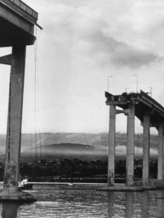
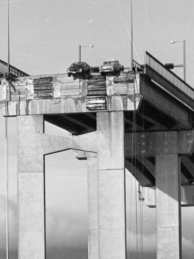
The SS Lake Illawarra has been completely captured in mapping by the CSIRO and Jacobs Engineering Group for the first time, nearly 50 years after it ploughed into the Tasman Bridge and horrifically killed 12 people on January 5, 1975.
The joint team led by CSIRO hydrographic surveyor Craig Davey have been able to pinpoint the exact location of the wreckage and show the finer details of its structure, which lies between 15 and 35 metres below the surface in the Derwent River.
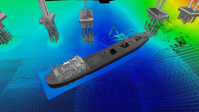
Stunning images of the 140m-long vessel were “really exciting” to put together, said Jacobs data capture technical director Paul Digney.
“It’s such an iconic structure but to get the whole story, to actually get the scale of what is sitting there below the water is quite surreal,” Mr Digney said.

CSIRO hydrographic surveyor Chris Berry said pulling together the complete model had been accomplished by pairing a higher-than-standard frequency sonar beam with a laser used to survey land features.
“We hadn’t used a laser scanner in combination with the sonar beam before, that created a better picture of the wreck and the bridge,” he said.
Mr Berry said the unusual location of the shipwreck had made the find possible rather than technological advances.
“It’s unique to have a shipwreck in such shallow water, close to a city and so close to our research facility,” he said.
“We were lucky to be able to test out our gear on it and come out of it with some new data.”
Mr Digney said as well as accurately capturing an important piece of history, the modelling could be important in the future.
“It’s got some real practical value in how the wreck may interact in the future with the bridge and other potential hazards,” Mr Digney said.
“This provides a much more holistic opportunity to measure whether the wreck itself is moving over time, and what’s happening with the field of debris around it.”
Mr Digney said his team had been in talks with the state government over the data as a major rework of the Tasman Bridge approaches.
“If (the government) is interested and they feel there’s any need, then there is the ability to do further analysis and find any potential risks,” he said.
“We will speak to TasPorts too – the wreck isn’t in the main navigation channel but there may be some value in it from their perspective.”
Jacobs had been involved in similar 3D modelling for the long-awaited Bridgewater Bridge project, Mr Digney said.
“We produced a very similar model for that project although obviously it was less dramatic without the wreck … a virtual 3D model, a digital twin like this is being used more and more for planning, design and construction.”
More Coverage


Person with serious injuries after NW single-car crash
Police have closed a northwest Tas road where a single vehicle has crashed, leaving one person with serious injuries. The latest.
Read more

Romance boom: Tassie author pens 100th book
Tasmania’s Ris Wilkinson became an author at 44 with romance juggernaut Mills & Boon. At 66, she’s penning her 100th book as Melanie Milburne – as writers converge on Hobart for a national event.
Read more