
New report mapping economic impact of COVID-19 finds state has most ‘high risk’ areas in Australia
A report mapping the economic impact of the coronavirus crisis has found Tasmania has the most “high risk” areas in the country. SEE THE SUBURBS ON RED ALERT >>
Coronavirus
Don't miss out on the headlines from Coronavirus. Followed categories will be added to My News.
A NEW report mapping the economic impact of the COVID-19 crisis has found Tasmania has the most “high risk” areas in the country.
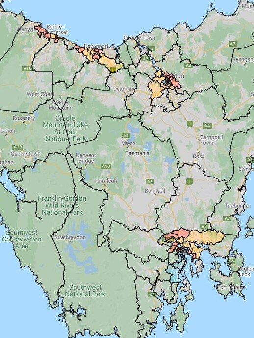
The Employment Vulnerability Index (EVI) uses Australian Bureau of Statistics Census data to calculate an index score for towns and cities with a population of more than 10,000 people.
Co-authors Professor Scott Baum from Griffith University and Professor Bill Mitchell from University of Newcastle combined previous EVI data and insights on the jobs most affected by an economic downturn to model COVID-19’s impact on more than 80 per cent of Australians.
They found the state with the most “high risk” areas was Tasmania at 34.92 per cent, followed by South Australia at 22.22 per cent.
Overall, 12.64 per cent of the country is in the high risk category.
The researchers placed areas into two groups — those that have existing disadvantage and those that have emerging disadvantage.
MORE NEWS:
- China trade spat could damage state economy
- Council to consider relaxing outdoor dining rules
- Premier defends new major projects law
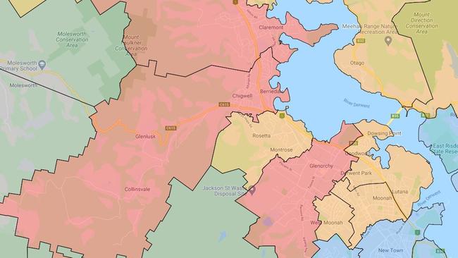
Those on “red alert” — having a high potential for job loss — in areas with existing disadvantage include:
- Bridgewater-Gagebrook
- Mornington-Warrane
- Rokeby
- Berriedale-Chigwell
- Claremont, Glenorchy
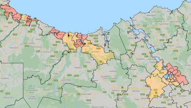
- Acton-Upper Burnie
- Burnie-Wivenhoe
- Wynyard
- Devonport
- East Devonport
- Invermay
- Mowbray
- Newnham-Mayfield
- Ravenswood
- Waverley-St Leonards
- West Ulverstone
Those in the emerging disadvantage category include:
- Brighton-Pontville
- Romaine-Havenview
- Somerset
- Quoiba-Spreyton
- Ulverstone
Areas in the ‘medium low risk’ category include:
- Lenah Valley-Mount Stuart
- Mount Nelson-Dynnyrne
- New Town
- Sandy Bay
- South Hobart-Fern Tree
- West Hobart
- Hobart
- Margate-Snug
- Kingston Beach-Blackmans Bay
- Kingston-Huntingfield
- Lindisfarne-Rose Bay
- Howrah-Tranmere
- Geilston Bay-Risdon
- Bellerive-Rosny
- Launceston
- Trevallyn
For a full list of all Australian locations, click here.

Long Covid: Tassie’s hidden epidemic
Covid lockdowns may be a distant memory for many, but for Tasmanians living with the often-debilitating symptoms of long Covid, the pandemic has left a lasting impact.
Experts push for double shot as new Covid wave looms
As deaths from Covid continue, Tasmanians are being urged to get boosters and flu shots with doctors saying infection rates are “taking off and complacency is setting in”. LATEST FIGURES >>