
More flash flooding likely as Darling Downs deluge continues
The rain is predicted to continue into Tuesday night as major flooding is reported in parts of the Scenic Rim.
Toowoomba
Don't miss out on the headlines from Toowoomba. Followed categories will be added to My News.
TUESDAY, 3.30PM: The Bureau of Meteorology is tipping heavy rain to continue across southeasy Queensland heading into Wednesday.
The rainband is expected to clear off the southeast coast during Wednesday with drier air and more settled conditions spreading across southern Queensland in its wake.
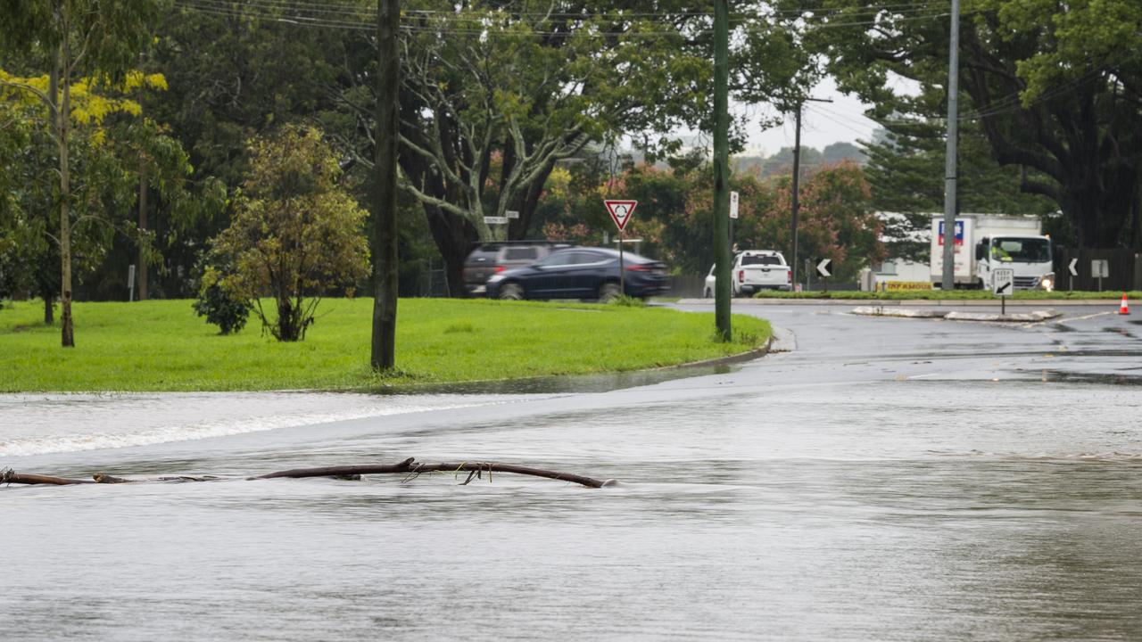
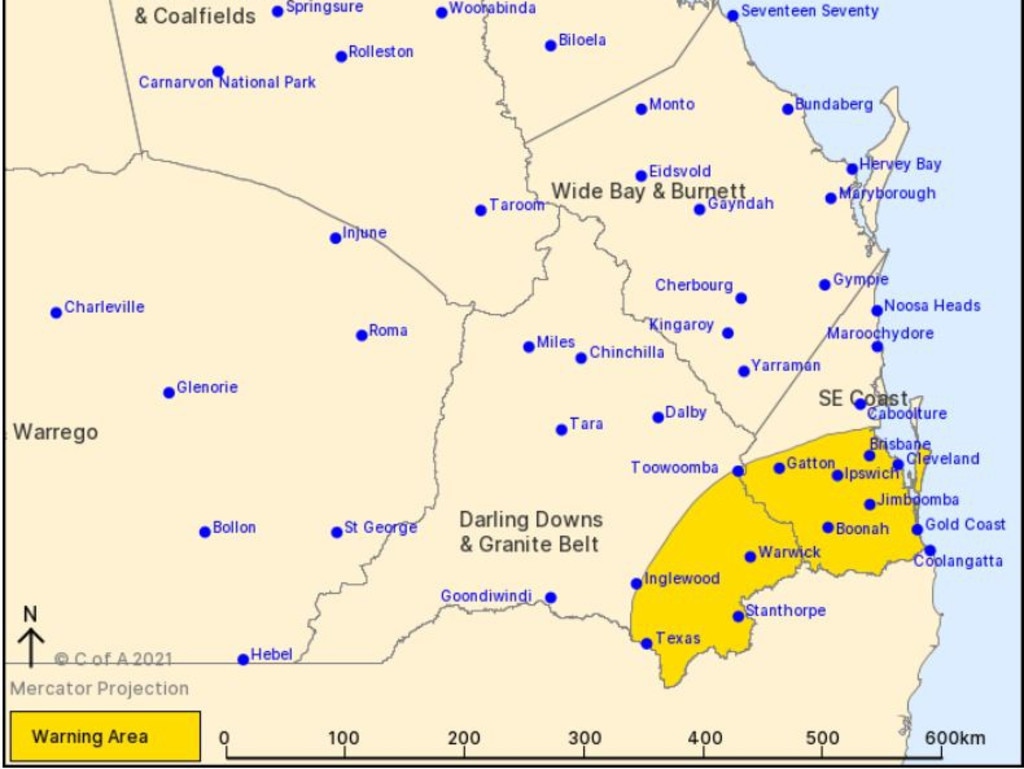
It comes as major flooding is reported at Beaudesert, Boonah and Rathdowney.
TUESDAY 11AM: According to the Bureau of Meteorology, the heavy rain band has contracted to the eastern Darling Downs and southeast coast districts with the rain areas likely to contract further east later today.
Afternoon and evening thunderstorms are expected to develop across southern and southeast Queensland, in the wake of the rain band.
These storms are likely to bring localised heavy rainfall and damaging winds.
A separate severe thunderstorm warning will be issued for these conditions.
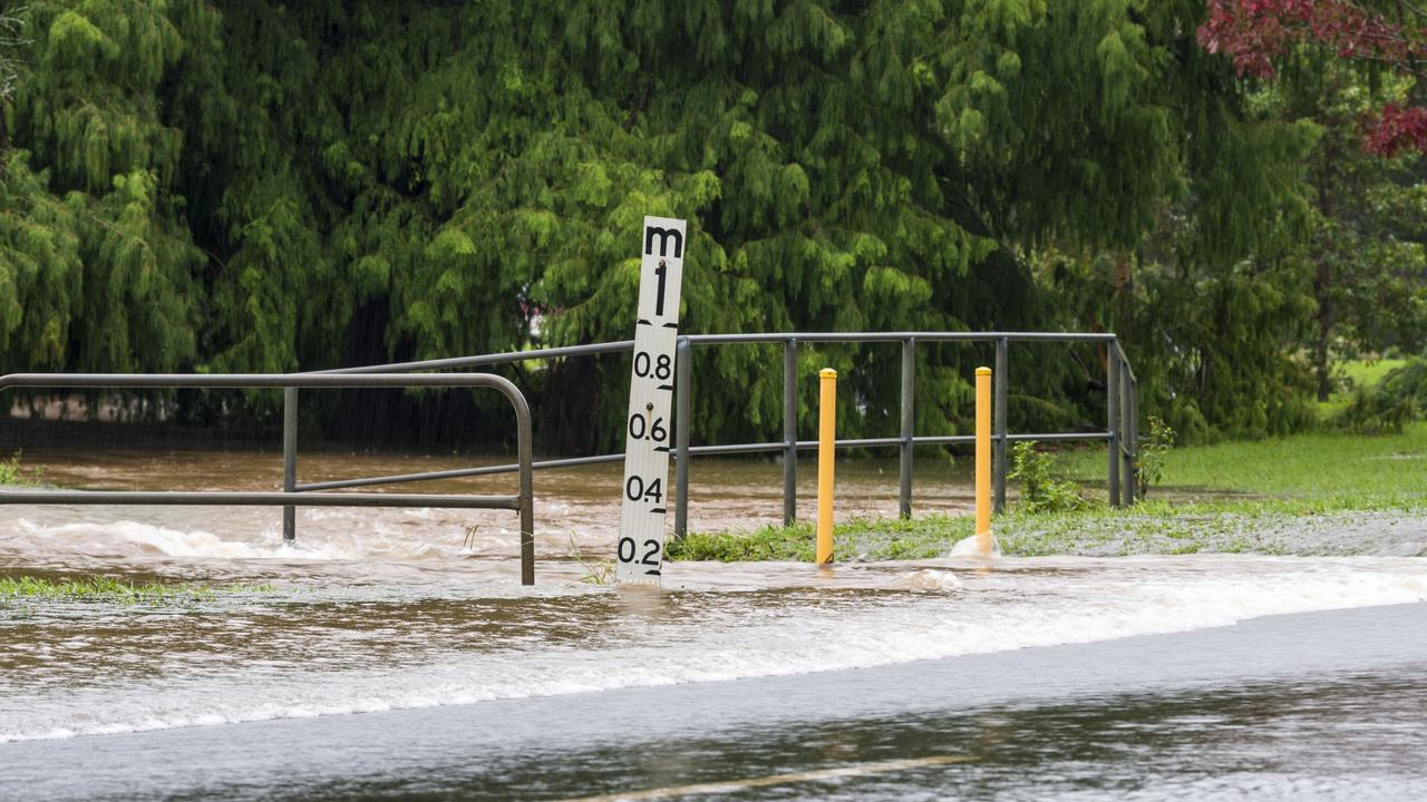
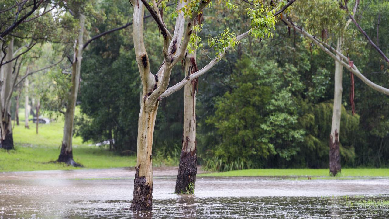
Heavy rainfall which may lead to flash flooding continues about the southern parts of the Darling Downs and southeast coast districts.
The situation continues to pose a serious risk to areas affected by heavy rainfall, including the risk of landslips in steep terrain, in these areas the situation may become life threatening.
Six-hourly rainfall totals of 100-150 mm are likely, and locally heavier falls are possible with thunderstorms.
In the last 24 hours (up until 9am Tuesday) The Bureau has recorded moderate rainfall measurements across the region including 65 millimetres in Gormons Gap, 61 millimetres in Highfields, 71 millimetres at the Athol Westbrook Creek station, 103 millimetres at Mt Berryman Road and 56 millimetres at Toowoomba.
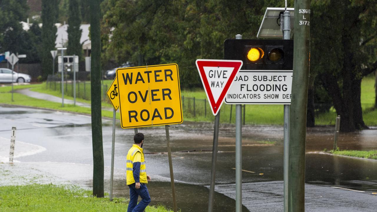
According to Department of Transport and Main Roads there are currently no weather related road closures within the Toowoomba region but there are flash flooding related road closures and cautions currently taking place across a number of Darling Downs locations.
For the full details of these locations, follow this link.
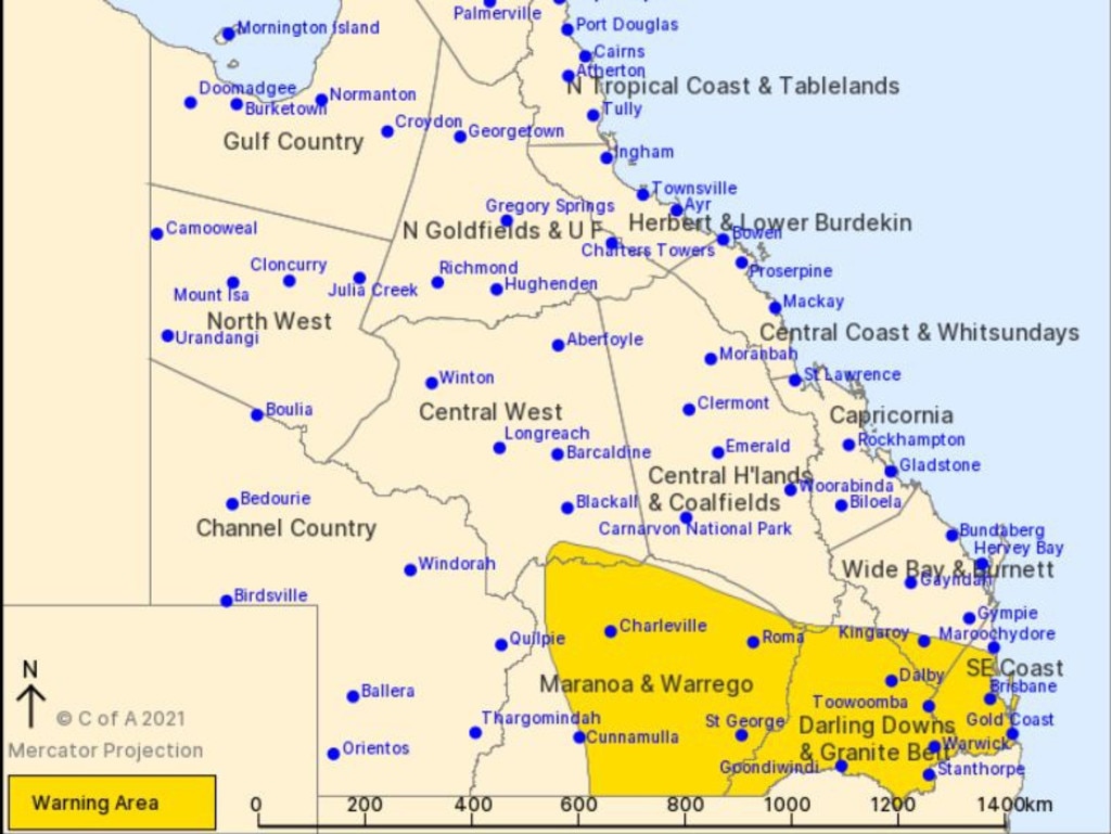
EARLIER: The Bureau of Meteorology has this morning again issued a severe weather warning for heavy rainfall for people in Maranoa and Warrego, Darling Downs and Granite Belt, southeast coast and parts of Central West and Wide Bay and Burnett with a rainband predicted to bring heavy rainfall to southern and southeast Queensland today and tonight.
BOM meteorologist James Thompson said while southeast Queensland has received a lot of rainfall, it’s not yet being classed as a historically significant event. such as what New South Wales is currently experiencing.
“New South Wales has definitely seen a historically significant rain event, but Queensland is not seeing these levels yet,” he said.
“The Bureau’s severe weather warning and flood watch is still in place and there is a chance of more severe thunderstorms for the region as storms continue to move through the region.
“We are looking at seeing widespread moderate rainfall totals expected for southern Queensland and this rainfall on top of what we’ve already had could lead to flooding.”
The Bureau’s severe weather warning was issued at 4.34am Tuesday morning and is currently predicting a strong upper trough combined with deep moist airflow expected to bring widespread areas of heavy rainfall and thunderstorms across southern Queensland to the southeast coast today and overnight into early Wednesday morning.
The Darling Downs and Granite Belt and Southeast coastal districts are also being urged to remain on alert for heavy rainfall which may lead to flash flooding today and overnight into early Wednesday morning.
The situation is likely to pose a serious risk to areas recently affected by heavy rainfall, including the risk of landslips in steep terrain and in these areas the situation may become life threatening.
Six-hourly rainfall totals of 100-150 mm are likely, and locally heavier falls are possible with thunderstorms.
The next severe weather warning will be issued by 11.00am Tuesday morning.


‘Absolute joke’: Mayor fires up as true cost of $700m budget revealed
Toowoomba mayor Geoff McDonald has fired up at the upper levels of government while defending enormous increases to rates, levies and charges. How much it will cost your family here:
Read more

Coal mine’s $6m injection into Darling Downs business
A coal mine west of Toowoomba has injected more than $6m into a Darling Downs business, its largest capital spend in more than a year.
Read more

Titans, moguls and pioneers who built Qld: Where are they now?
They’re our shopping centre owners, development titans and business entrepreneurs – and they all have one thing in common. SEE THE LIST
Read more

‘Do your homework’: Scary reality facing Qld transport projects
Major transport infrastructure projects across Queensland could be impacted. ALL THE DETAILS
Read more

‘Pinch points’: What to expect from 2024-25 Toowoomba council budget
Residents could be in for more financial pain ahead of Toowoomba council budget, with the mayor unveiling the major “pinch points” for the organisation. OUR PREVIEW HERE:
Read more

Mayor slams government over ‘bin tax’ as $25m missing piece revealed
Toowoomba mayor Geoff McDonald has launched a broadside at the Qld government over how the money raised from its waste levy is spent, calling on the state to help fund a critical $25m asset.
Read more