
Premier Annastacia Palaszczuk issues warning as severe weather event unfolds across southeast Queensland
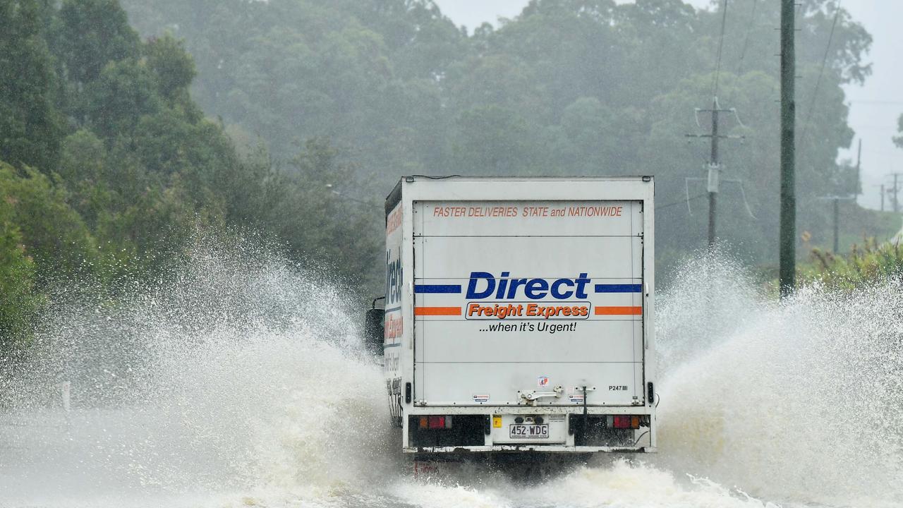
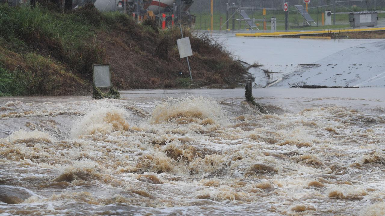
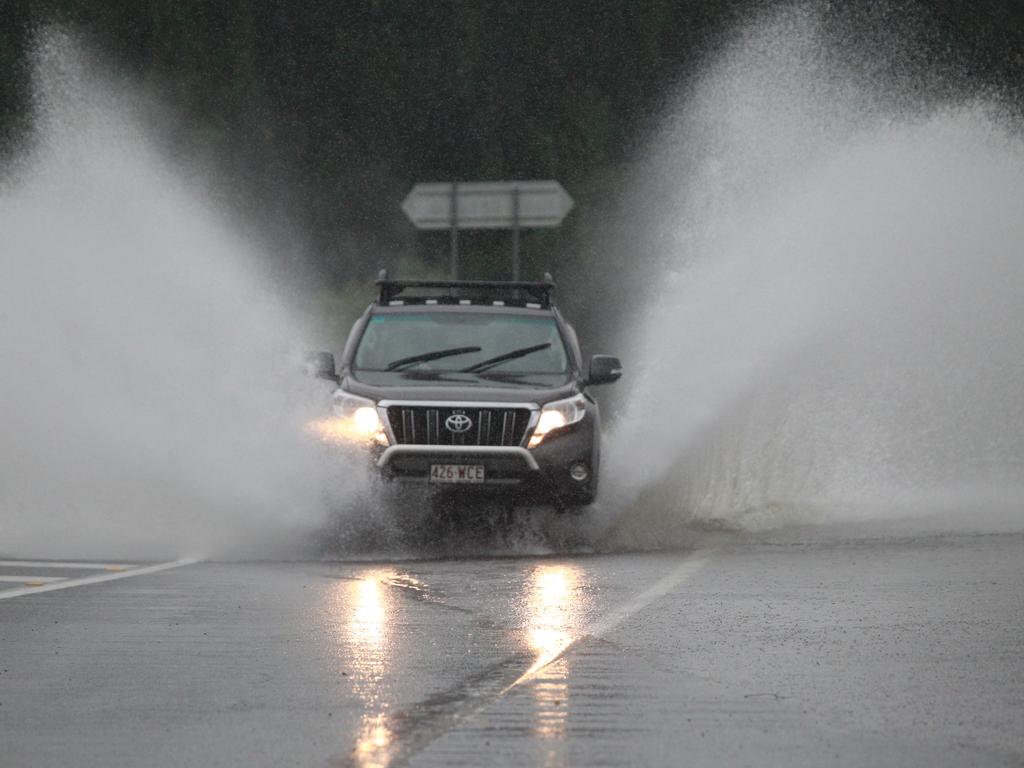
The SES has received more than 400 calls for help as the southeast continues to be hammered by torrential rain, causing landslides and flash flooding. Residents have been warned the flooding situation may become life-threatening.
QLD News
Don't miss out on the headlines from QLD News. Followed categories will be added to My News.
UPDATE 9PM: The SES has received more than 400 calls for help as the southeast continues to be hammered by torrential rain, causing landslides and flash flooding.
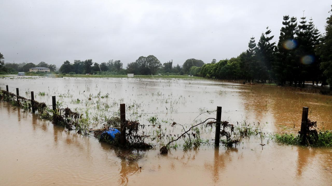
Several areas recorded more than 100mm of rain on Monday including Tamborine (109mm), Pimpama (107mm), Springbrook (101mm) and Carbrook (114mm).
The highest rainfall figure recorded in the southeast on Monday was Stradbroke Island with 121mm.
Most of the 408 calls to the SES by 8.30pm Monday were for sandbags and leaking roofs but there were several evacuations as well. It follows three swift water rescues conducted on Sunday.
SCROLL DOWN FOR THE LATEST RAINFALL FIGURES AND ROAD CLOSURES
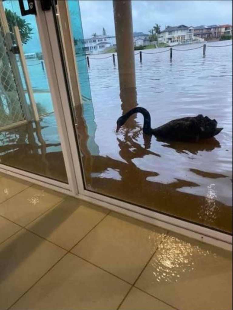
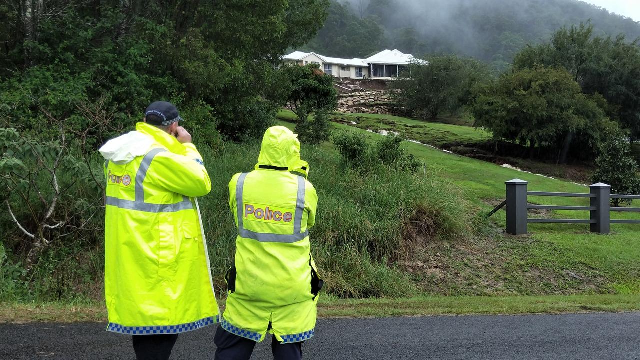
Among the evacuations was in Wongawallan on the Gold Coast, where about 25 people were evacuated after a landslip placed a home in danger of sliding down a hill.
The Crest Hill Drive home is in a precarious position after a small landslip left it sitting on a newly formed cliff. The residents and neighbours were asked to evacuate but as they tried to leave rising water levels left them stranded for several hours until levels dropped.
More than 3000 homes and businesses were without power across the southeast at about 6.30pm, mainly due to down powerlines. The worst hit areas were Logan and Brisbane.
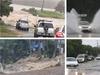
PHOTOS: SOUTHEAST QLD DEVASTATED BY WILD WEATHER
This was reduced to less than 100 by 9pm.
Hundreds of claims for insurance have been made since the big wet began, with RACQ alone receiving 176 house and 35 motor claims by 7.30pm Monday.
UPDATE 6.45PM: The Bureau of Meteorology has updated its warnings for Monday evening into Tuesday morning.
The bureau said Queensland’s flooding situation may become life-threatening and pose a serious risk to already affected areas across the southeast coast district and the Darling Downs and Granite Belt.
Already affected areas pose a serious risk of landslides and other potentially dangerous situations such as flash flooding as heavy falls continue this evening.
Rainfall totals in excess of 100-150mm are likely, with locally heavier falls possible due to thunderstorms.
Flash flooding is likely for parts of the Channel Country, Maranoa and Warrego districts overnight, with rainfall totals of around 50-70mm predicted, and local heavier falls possible due to thunderstorms.
A flood watch was active for southern parts of Queensland from the SA border to the southeast coast. Many catchments were relatively wet across the flood watch area from rainfall over the last several days.
Locations which may be affected include Warwick, Gold Coast, Thargomindah, Toowoomba, Brisbane, Dalby, Roma, Charleville, Birdsville, Kingaroy, Stanthorpe, Goondiwindi, Coolangatta and Ipswich.
UPDATE 4.40PM: The Bureau of Meteorology at 4pm issued its final flood watch summary for Monday.
It comes after Premier Annastacia Palaszczuk urged people to stay off the roads tonight due to a severe weather event unfolding across southeast Queensland.
The areas at risk stretch from the SA border right across southern Queensland to the southeast coast.
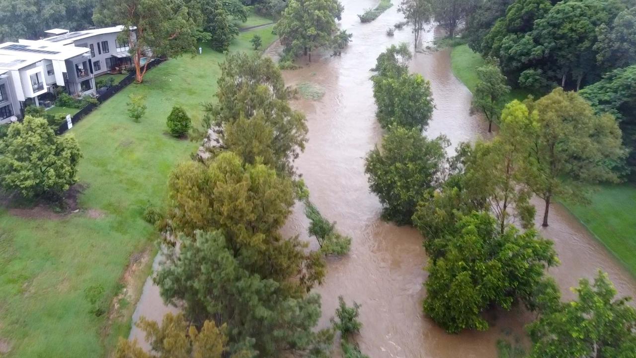
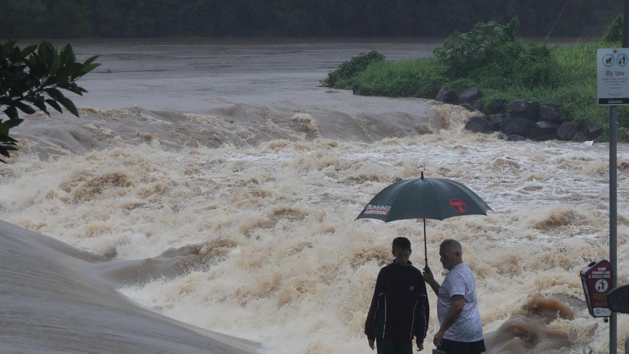
As localised flooding continues across many catchments in the Gold Coast region, four flood warnings have been issued specifically for the Pimpama and Coomera Rivers, Nerang River,
Mudgeeraba River, and the Tallebudgera and Currumbin Creeks.
The next warnings are due to be released at 9am Tuesday.
Almost all of the river heights in the region stretching north from Tallebudgera to Coomera were categorised as rising around 3.45pm.
Since 9am a further 10-70mm of locally intense falls have been recorded in the area following a weekend which recorded 60-230mm falls depending on the catchment.
Thunderstorms and heavy rain are forecasted to continue from late Monday afternoon through to at least Tuesday in the area
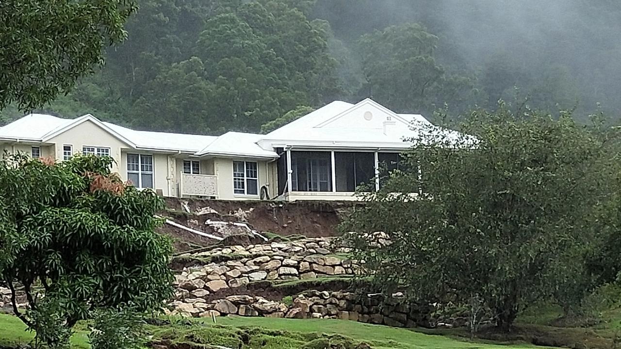
UPDATE 3PM: A property in the Gold Coast hinterland has been smashed by a landslide and a nearby home evacuated as wild weather continues to lash the region.
The fence of a Wongawallan home was damaged by the landslip with police ordering the occupants of a house across the road to evacuate amid fears the big wet could trigger further landslides in the area.
Premier Annastacia Palaszczuk has urged people to stay off the roads as a “severe weather event” is set to unfold tonight.
“We have already heard reports of the landslips that are occurring, especially around the Gold Coast Hinterland.
“The bureau has advised us at our meeting following cabinet that they expect the weather to increase overnight and spread further out into the southeast of our state as well so we want everyone to be on alert over the next 24 hours,” she said.
The Minister for Fire and Emergency Services Mark Ryan said Queenslander’s need to be prepared for the upcoming event.
“We’re talking about falls in the vicinity of 150mm over about six hours, that is significant, that will give rise to flash flooding in areas it will give rise to the potential for landslides,” he said.
“People need to be prepared, also think about this, there is the unknown in the dark that you won’t be able to see flood waters across the road.”
UPDATE 1.30PM: Severe thunderstorms could dump more than 180mm on a soaked southeast Queensland over the next six hours.
The Bureau of Meteorology has issued a severe storm warning for southern Queensland – from Birdsville to the Gold Coast – with heavy rainfall and flash flooding likely.
The bureau said the situation in the southeast could become ‘life threatening’.
The eastern Darling Down and Southeast Coast regions are at ‘serious risk’ especially to regions already affected by flooding.
The at-risk locations include Warwick, Gold Coast, Thargomindah, Toowoomba, Brisbane, Dalby, Maroochydore, Roma, Charleville, Birdsville, Emerald, Stanthorpe, Goondiwindi, Coolangatta and Ipswich.
UPDATE 1PM: The Gold Coast remains on high alert as rain lashes the region, despite Mayor Tom Tate saying so far the city has “dodged a bullet”.
Six-hourly totals between 100-150mm are likely with heavier falls possible due to thunderstorms.
âš ï¸Severe Weather Warning issued for southern Qld & #WesternQldâš ï¸
— Bureau of Meteorology, Queensland (@BOM_Qld) March 22, 2021
Heavy rain which may lead to flash flooding is likely today. Possible 6-hr rain totals: 50-70mm in the west, 100-150mm in the east. Significant risk to already flooded areas in #SEQ expected. https://t.co/h03cjbRuVdpic.twitter.com/WxHpKLfJ5J
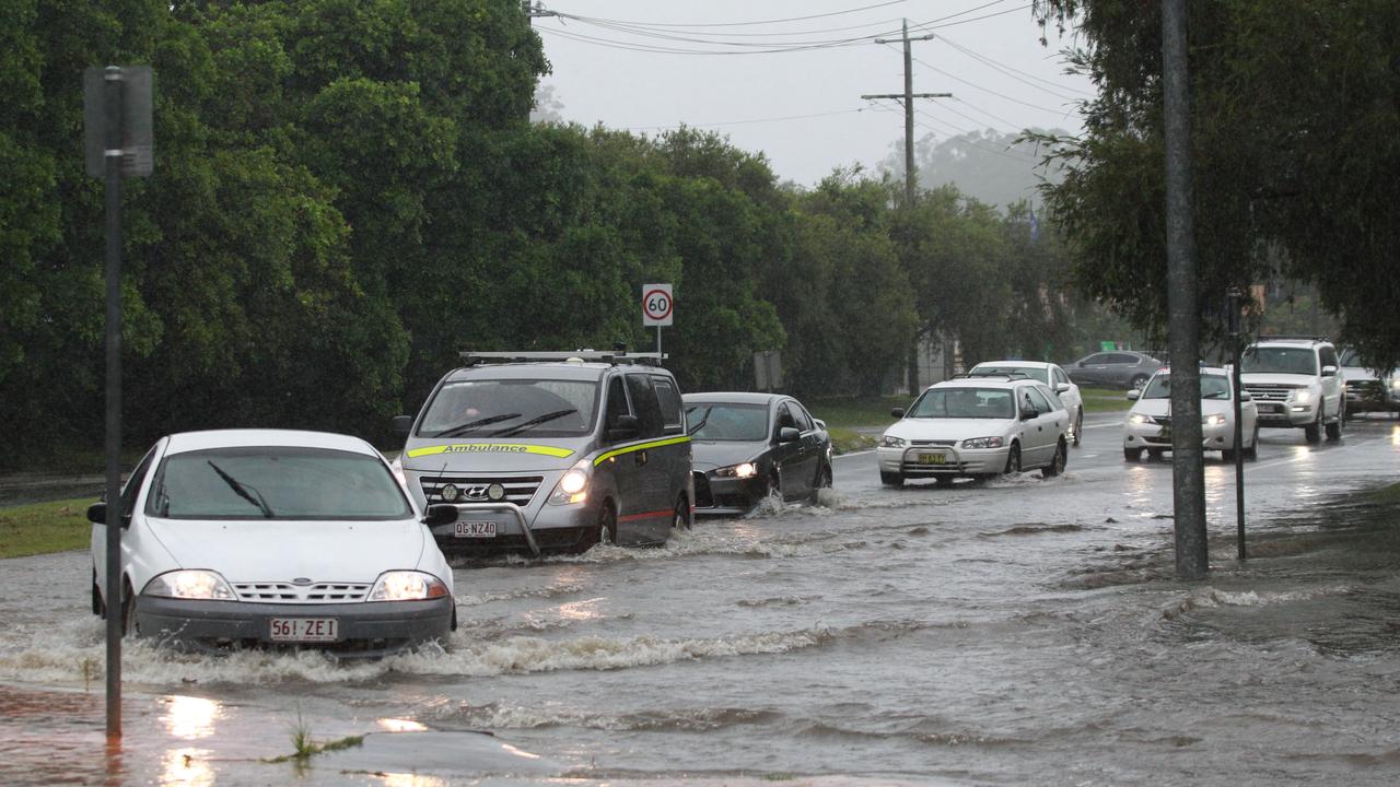
Almost 50 roads across the coast have been closed due to floodwaters but Councillor Tate said the situation could have been much worse.
“We’re very fortunate we didn’t have king tides,” he said.
“So far we’ve dodged a bullet.”
Sand bag depots have been opened across the coast with residents advised to avoid floodwaters.
“It’s one of those times for Foxtel, Netflix, if you don’t need to leave the house or can work from home, stay put,” Cr Tate said.
Wayne Hammer made a surprise find at the Jindalee boat ramp today, which he shared on the 4074 Community & Beyond page.
“Took a look at the Jindalee boat ramp this morning to see how the rain has effected the flow,” he wrote on Facebook.
“Surprised to see a dead baby bull shark floating at the base of the ramp.”

UPDATE 11AM: The latest warning came after a weekend of torrential downpours which caused flash flooding with some catchments recording more than 110mm of rain in less than one hour.
Since Saturday, RACQ has received 150 claims due to the wild weather. A total of 119 of those claims were for property damages and the remaining 31 for motor vehicles.
The worst hit areas so far have been the Gold Coast, Toowoomba and Ipswich regions.
RACQ spokeswoman Kirsty Clinton said with more wet weather predicted, families should discuss their emergency plan.
“This weather has already forced some residents to evacuate their homes, so now is the time to lock in what you would do if faced with rising floodwater,” she said.
“Discuss roles and responsibilities, like who will pick up children or pets, and where you will go if you need to evacuate.
“Don’t forget to discuss back up options, as circumstances can change and your first choice may become unavailable. You’ll also need an emergency kit, with essential food, water and medical supplies.”
Ms Clinton said “significant damage” to homes and cars from the wild weather has been reported on the Gold Coast.
UPDATE 10AM: Bureau Meteorologist Rosa Hoff said while the current coastal convergence causing the downpour on the southeast is weakening, a new system from the west will hit over the coming days.
“We have some coastal convergence thanks to a trough that is lying along the coastal fringe through today which is what has been bringing the significant totals to the southeast coast,” Ms Hoff said.
“But we also have a trough moving into southwestern Queensland which will be increasing the rainfall tomorrow and in the west today.”
QFES performed six swiftwater rescues in southeast Queensland overnight, with four of them instances of vehicles in floodwater.
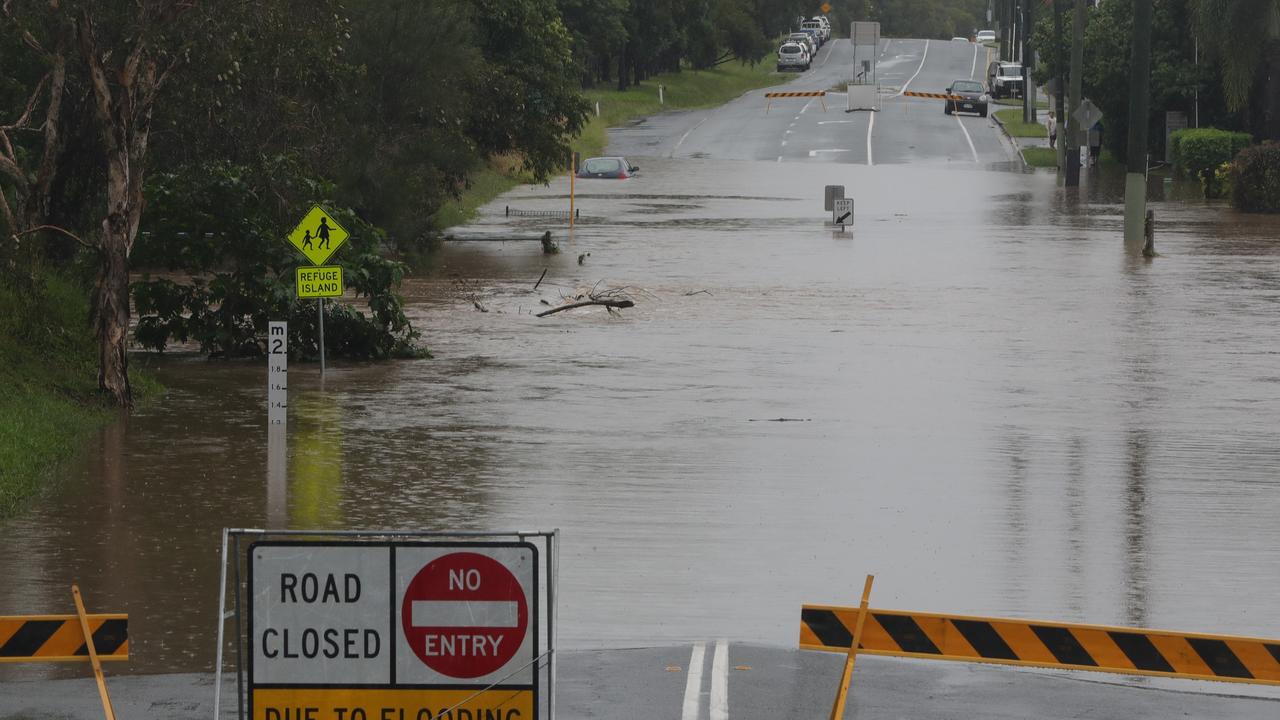
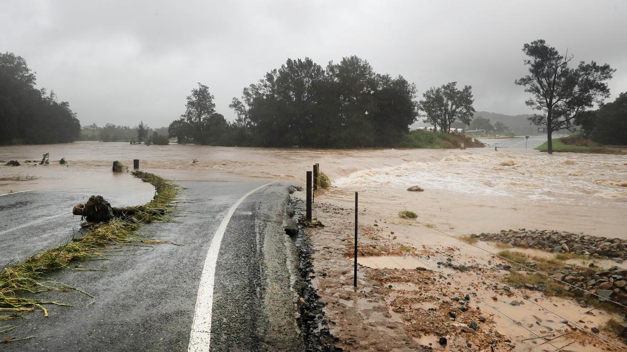
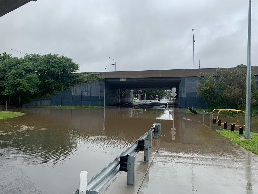
The emergency alert for Currumbin, Mudgeeraba and Tallebudgera catchments has been cancelled, but more than 160 roads have been closed due to flash flooding throughout Queensland.
Movie World on the Gold Coast has closed its doors due to the severe weather, a statement on social media confirmed.
“Please be aware that due to severe weather and flooding, Warner Bros. Movie World will be closed today for the safety of our guests and team members,” the statement read.
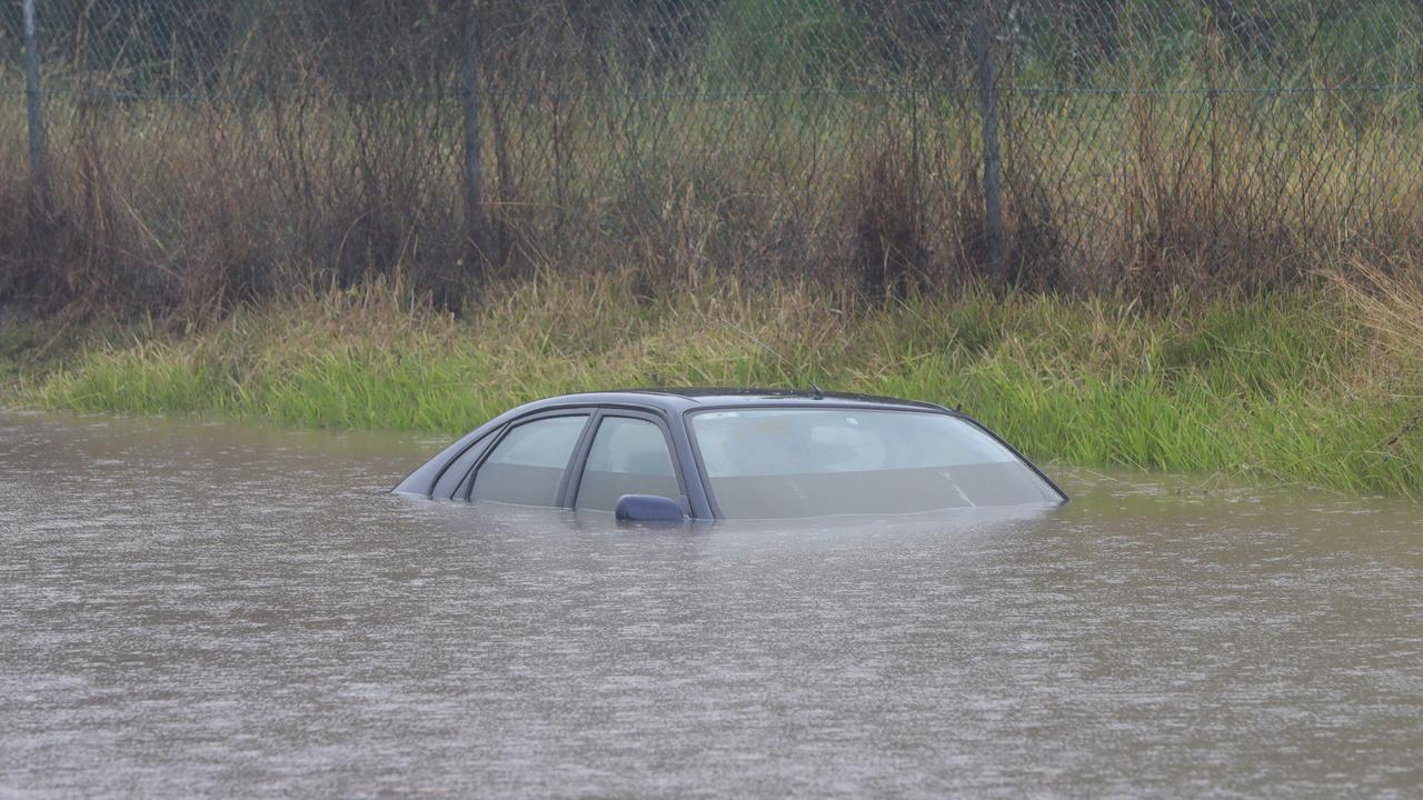
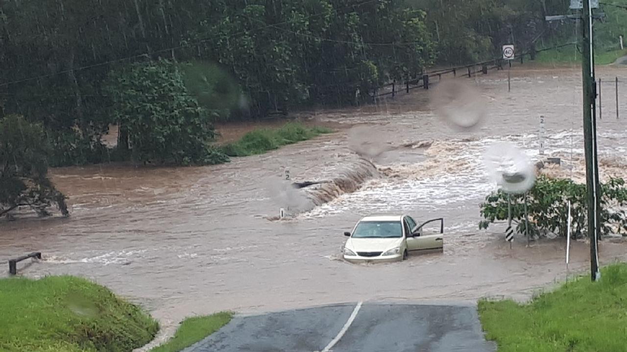
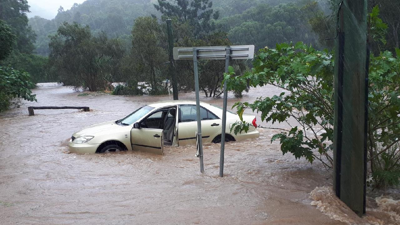
UPDATE 8AM: After a week of constant rain and a Sunday afternoon thunderstorm Logan was left drenched, with many roads off limits and a car submerged.
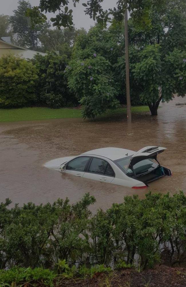
Worst hit were roads in and around Beenleigh with a red Mercedes-Benz sedan swept up in waters on Bahrs Scrub Rd at Windaroo just after 2pm.
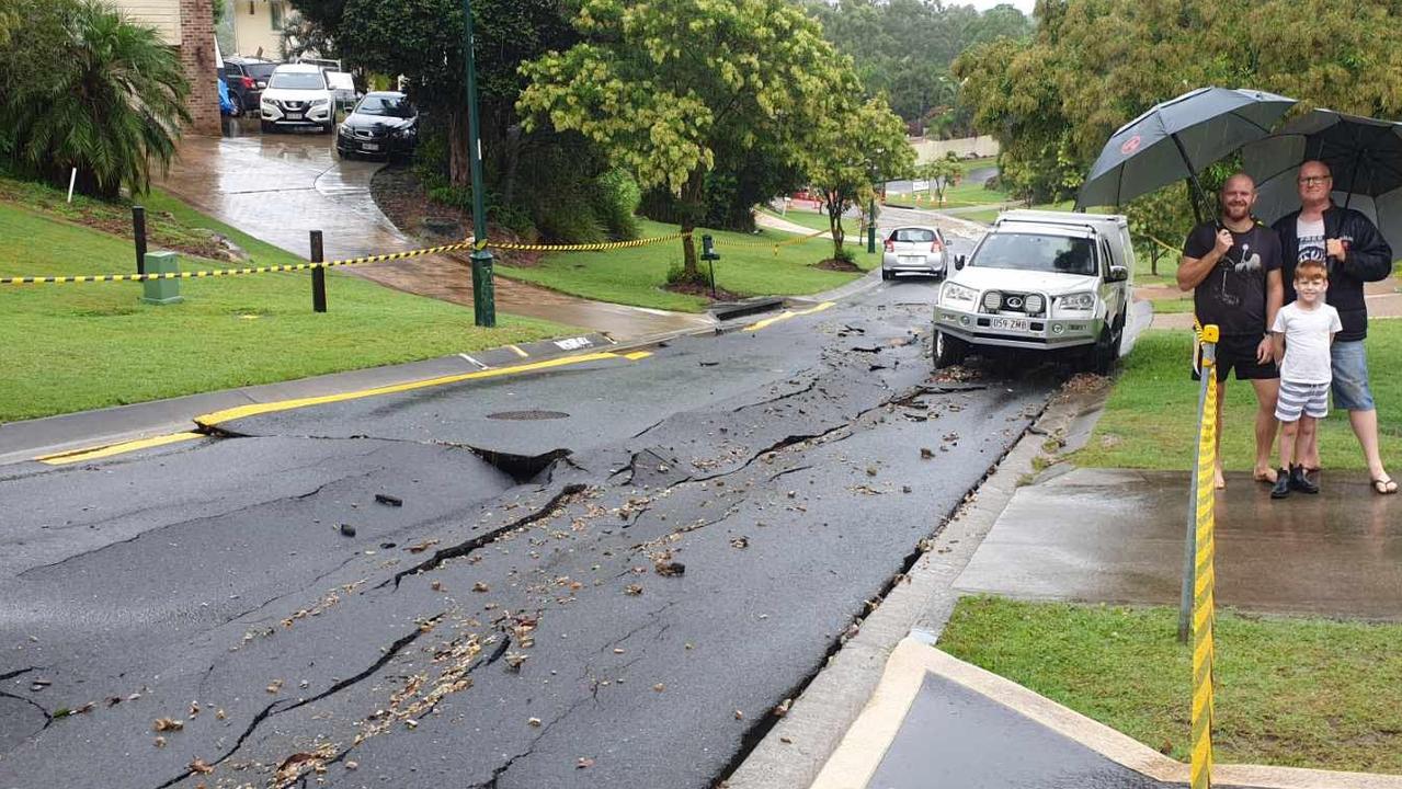
Cars parked on the side of Boxer Ave at Shailer Park became stuck as the bitumen rippled and cracked as water flowed under the road.
With more rain expected to fall on the region in the coming days, motorists are being urged to drive to the conditions and monitor road updates at www.qldtraffic.qld.gov.au.
A number of catchments have recorded more than 200mm of rain in the 24 hours from 9am on Sunday, with Upper Springbrook copping 226mm and Mt Tamborine getting 254mm.
UPDATE 7AM: The Bureau of Meteorology warned late last night a coastal trough was forecast to deepen overnight and into today which was expected to deliver heavy rainfall and flash flooding east of Jimna, Ipswich and Rathdowney.
“Six-hourly rainfall totals between 100mm to 180mm are likely in areas with isolated heavier totals possible in thunderstorms,” the warning said.
“A coastal trough that is located over eastern parts of the Southeast Coast is forecast to deepen overnight and into Monday.
“The trough is then expected to slip southward into Tuesday as a cold front approaches southeast Queensland from the west.”
The highest rainfall figures in Queensland to 10.20pm Sunday were at Bonogin, near Tallebudgera, and North Tamborine, both recording 178mm.
Other significant totals in surplus of 140mm and nearing 170mm included Springbrook, Coomera, Pimpama, Deception Bay, Burpengary, and Currumbin.
Between 9am and 7pm Sunday, Coolangatta received 79mm of rain, Beerburrum 103.6mm, Pimpama 169mm and Brisbane city recorded 81.6mm.
Hotham Creek on the northern Gold Coast received 113mm of rain in just one hour.
It came as the State Government yesterday pledged to send SES volunteers to assist in a rapidly escalating flood crisis in NSW, where homes have been washed away and authorities are bracing for a one-in-50-year rain event in coming days.
Chaotic scenes unfolded in southeast Queensland on Sunday as torrential rain and flash flooding saw cars submerged, swiftwater rescues, damaged roads and torrents of water gushing down streets.
In the 24 hours to 10pm Sunday there were 308 requests to the SES for assistance across the state.
More than half of those calls for help to the SES came from the Gold Coast with a number of swiftwater rescues taking place throughout the day.
A woman trapped in her car in floodwaters had to be rescued near the intersection of Valley Dr and Tallebudgera Connection Rd in Tallebudgera.
More than 120 roads closed across the state last night while cars were spotted submerged in floodwaters, including at Mudgeeraba Creek, near Austinville Rd, as well as in Logan.
Torrential rain turned one Tamborine Mountain street into a raging torrent of floodwaters after 98mm of rain fell in the area in less than two hours.
Video shows fast-moving floodwaters barrelling down the street before pouring over an embankment down the mountain.
An emergency alert was issued on the Gold Coast late yesterday for residents in the Currumbin, Mudgeeraba and Tallebudgera catchments.
The alert warned that due to heavy rainfall, low-lying properties in these areas were likely to be impacted by floodwater overnight and residents were urged to move to higher ground.
Mayor Tom Tate urged Gold Coasters to avoid driving on the city’s roads unless necessary.
“I have just been briefed by our disaster management team and the word is: do not travel on roads unless it is absolutely necessary,” he said.
“This is a slow-moving weather event with significant rainfall likely overnight.
“Our city staff are keeping a close watch on conditions and are responding to clean-up reports, when it is safe to do so while beaches are closed and will likely remain closed (today).
“The major creek systems across our city are in full flow so do not attempt to cross them, or go near the creek banks and causeway.”
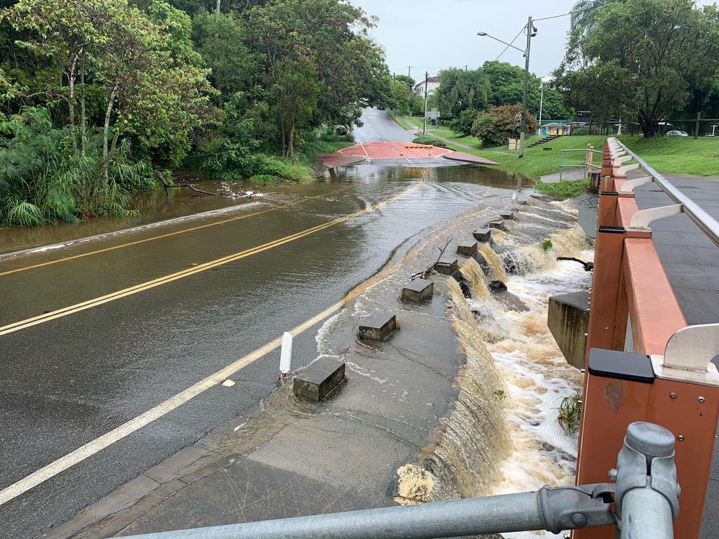
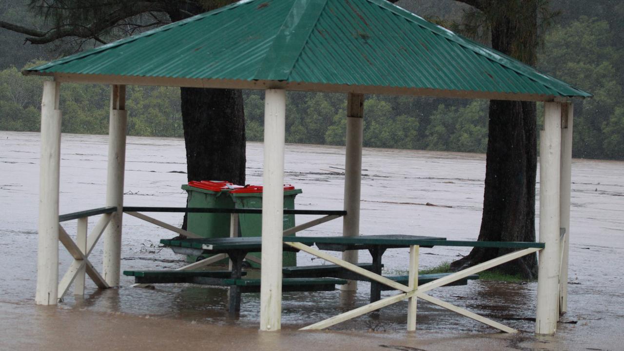
The heavy rain saw several dams spilling over.
BOM senior forecaster Matt Marshall said yet another band of rain was likely to bring further falls over a much broader area, stretching the entire bottom third of Queensland.
“Probably what we’ll see over the next couple of days is less of the more intense rainfall, but more widespread,” Mr Marshall said.
“Over the next couple of days we’re going to see another system coming in from the west,” he said.
“We’re probably not going to see a proper sunny day until Thursday.”
Brisbane is forecast to reach 26C today with 20mm rain possible.
The city can expect up to 35mm tomorrow and 25mm on Wednesday, before mostly sunny conditions return. Out west, towns like Cunnamulla, St George and Charleville could see up to 60mm of rain today and tomorrow before conditions clear on Wednesday.
More than 130 Queensland Fire and Emergency Services personnel are expected to be deployed to NSW to respond to the weather conditions.
Emergency Services Minister Mark Ryan said this would include 20 swift water rescue technicians, as well as 40 volunteers who will be equipped with 10 flood boats.
“We also have two experienced Incident Management Team officers travelling to Newcastle and two radio communication specialists deployed to support our crews, as well as a liaison officer who will be based at the NSW SES headquarters in Wollongong,” Mr Ryan said.
“An additional request for storm damage operators has been received and QFES is currently identifying around 70 SES volunteers to help with this task.
“They’ll head to Nambucca Heads, Kempsey, Port Macquarie and Taree.”
More Coverage
Originally published as Premier Annastacia Palaszczuk issues warning as severe weather event unfolds across southeast Queensland

Woman charged after alleged bomb hoaxes at school, childcare
A 50-year-old woman has been charged after she allegedly sent two bomb hoax messages in two days - one to a high school, the other to a childcare centre.

Mine giant says explosion no reason to stop $5.7b deal
Anglo American has rejected claims a recent explosion at its flagship Queensland mine will derail the $5.7bn sale of its coal assets to US giant Peabody.

Indecent assault charge after shopping centre citizens’ arrest
Shoppers have thwarted an alleged sex offender's escape attempt after he targeted a woman at a Brisbane shopping complex.

Cyclist fighting for life after crash
A man is fighting for his life after the bicycle he was riding and a car collided in Brisbane’s south.

‘Can’t be ruled out’: Potential for freak Qld snowfall this week
Queensland could see snow this week with weather models predicting up to 14cm falling on the Granite Belt.

Flaming garbage truck causes chaos on busy street
A garbage truck’s flaming contents has created an extraordinary spectacle in a sleepy Sunshine Coast town, when the load had to be dumped onto the street.