
Ex Tropical Cyclone Seth causes gale force winds and high tides on Sunshine Coast
A Bribie Island breakthrough even worse than expected has caused concern among residents as they brace for more damaging winds, high tides and wild surf.
Sunshine Coast
Don't miss out on the headlines from Sunshine Coast. Followed categories will be added to My News.
Beaches across the Sunshine Coast are in for more wild weather as ex-Tropical Cyclone Seth makes its way towards the state bringing strong gusts, high tides, and harsh surf conditions throughout the week.
The Bureau of Meteorology has issued warnings for gale force winds for offshore waters, abnormally high tides, dangerous surf, and swell generated by ex-tropical cyclone Seth.
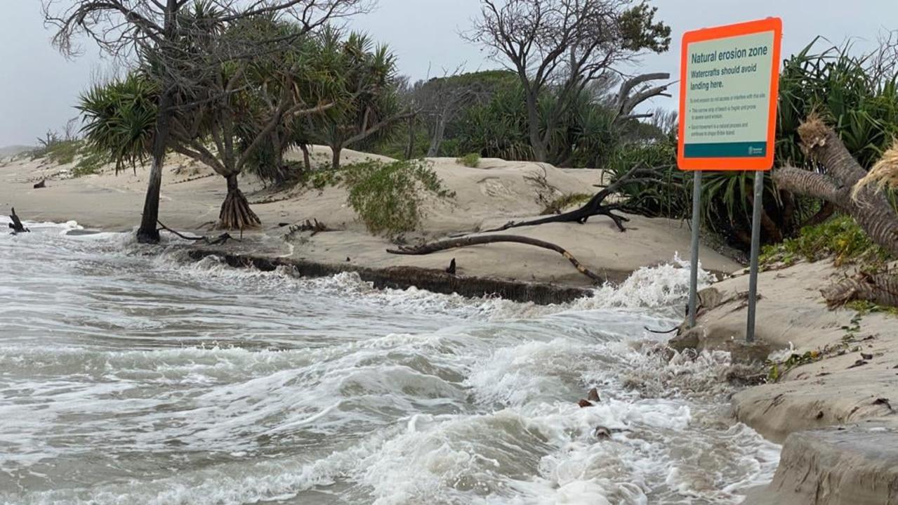
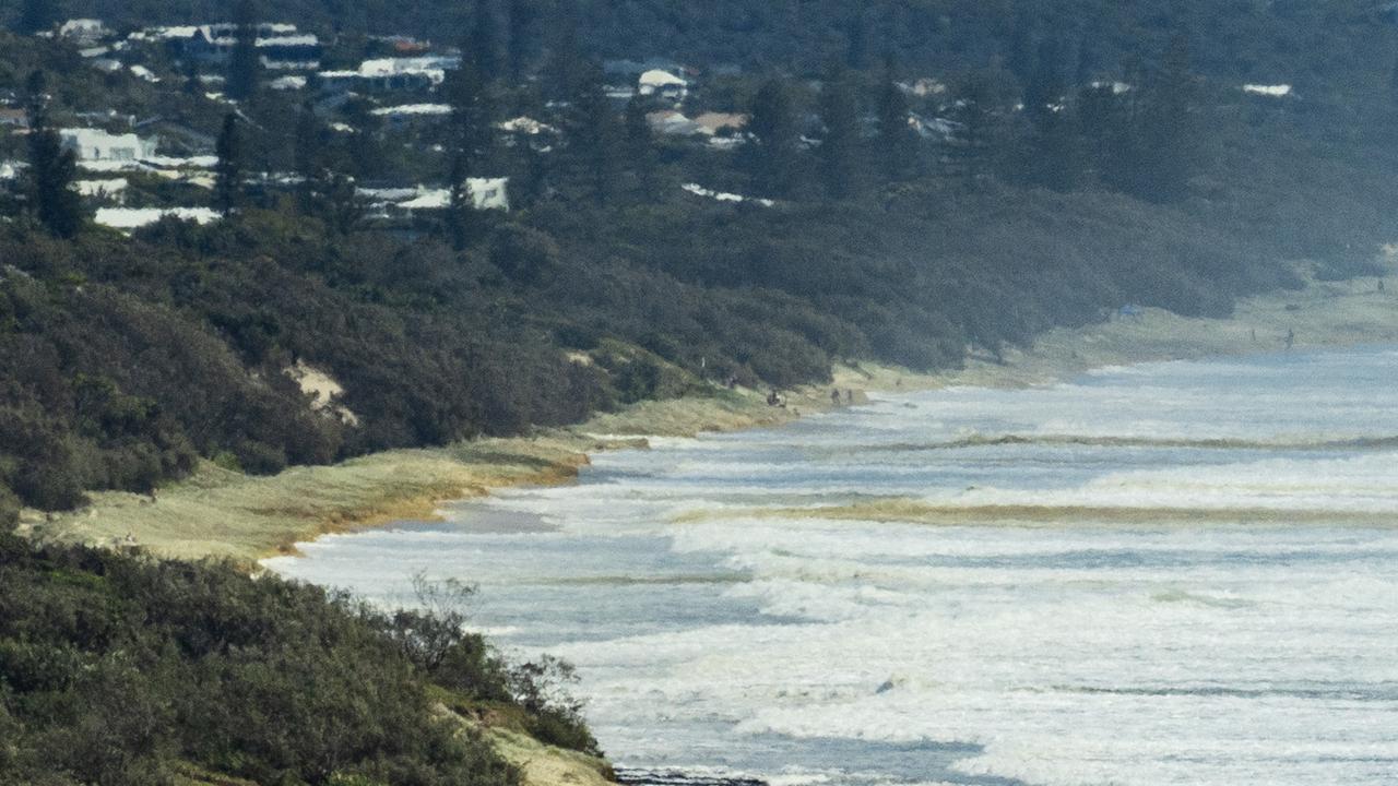
Already the weather event in combination with a king tide has caused seas to surge through Bribie Island, creating a second bar into the Pumicestone Passage and Golden Beach.
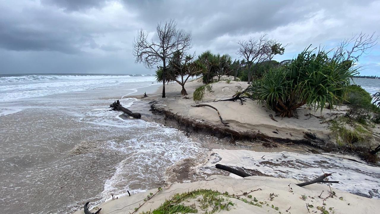
Coastguard Caloundra flotilla commander Roger Pierce said the event was even worse than expected when a 2.1m tide surged over the northern end of Bribie Island and claimed dozens of trees and vegetation from the sand dunes.
It was expected to repeat on Tuesday with a 2.1m tide forecast at 9.20am.
He said the long-term risk was Pumicestone Passage and Bulcock Beach would silt up in years to come, leaving only sand behind.
Community meetings will be held and the Department of Environment and Science and scientists will visit Tuesday morning.
“The last thing the community wants is for the area at Bulcock Beach to be sand, with no water, but in the 60s it was like that,” Mr Pierce said.
While storm surges have caused similar events in the past, Mr Pierce said it was never as damaging.
“The end of December through to January 7, 2021, we had a storm surge off the Coast but when it hit the island it didn’t completely obliterate the vegetation,” he said.
“The sand held together with the grasses and the tree roots … this time all of that is gone.”
He said during a meeting earlier this year attended by mariners and powerboat members they were told it was likely to happen within the next five years.
“It’s happened sooner than people would have liked,” he said.
“The scientists said right from the word go they were going to let it open – as nature wanted – but we didn’t think it would happen this quickly.”
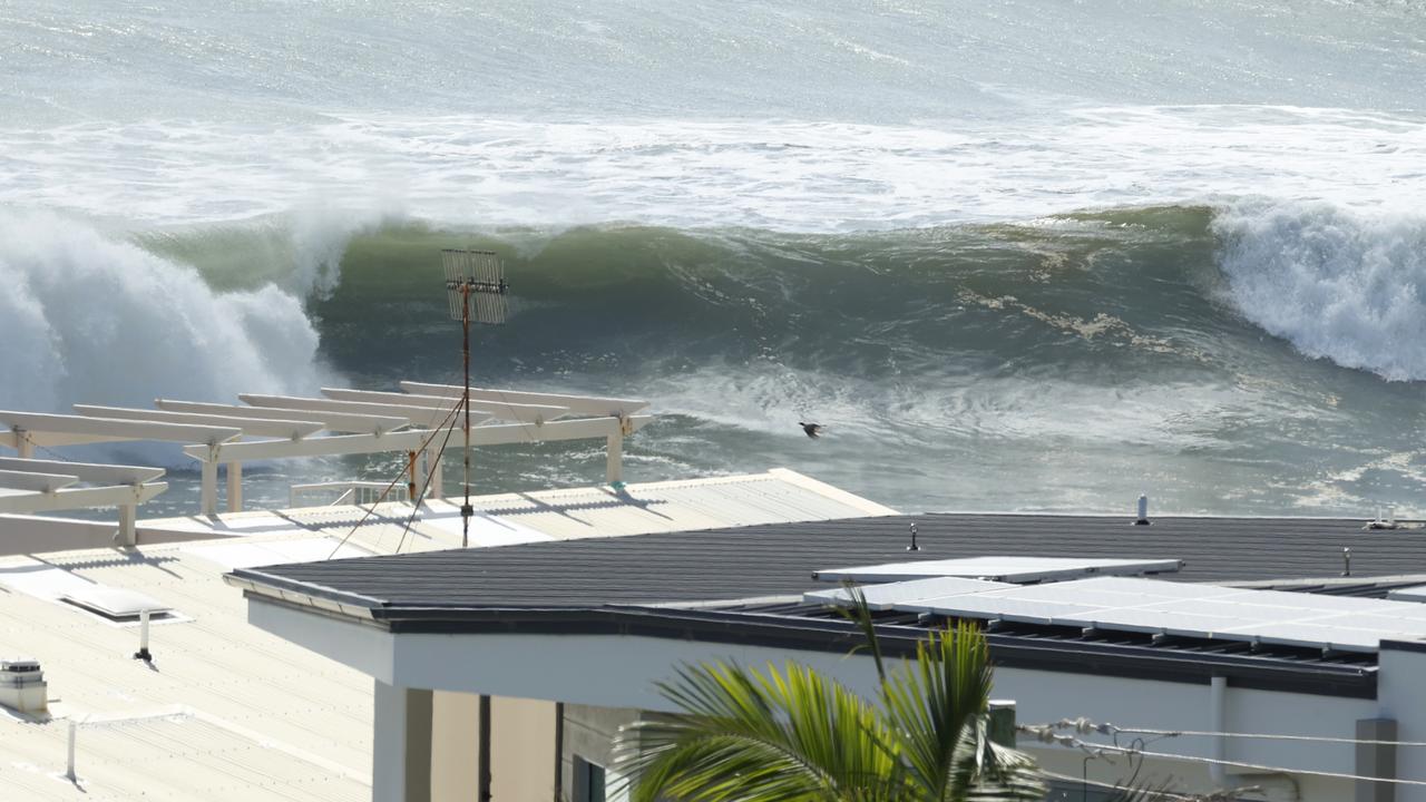
Meteorologist Helen Reid said ex-Tropical Cyclone Seth is gradually easing after it was downgraded on Sunday night but will still cause dangerous conditions on the Coast for the days ahead.
“The gale warning for the waters means we’re expecting average wind speeds to be above 34 knots there will be times it will be gustier then that,” she said.
“In terms of the swell coming in we’re expecting those waves from the east to be around the 3 to 4m mark, but on top of that you’ll have the wind waves as well and combined with tides that are above the astronomical tide you can add another half a metre to the water level there in some places.
“It’s all adding up to be very dangerous along the coastline at the moment.”
The warnings have prompted many of the Coast’s main beaches to remain closed including the Maroochydore area, Alexandra Headland, Coolum, Mooloolaba, Mudjimba, Peregian Beach, Sunshine Beach, and the Caloundra Metropolitan.
Reid said possible damaging winds are also being forecast which are predicted to pick up over the course of the afternoon.
“Today and tomorrow are looking like the most problematic but things will be gradually easing off,” Reid said.
“There will still be warnings current by the time we get to Wednesday and Thursday, but they’re expected not to be of such a severe nature.”
The Bureau has forecast dangerous surf conditions are expected to continue for the next two days with high tides and gale force winds predicted to ease later in the week.
More Coverage


Originally published as Ex Tropical Cyclone Seth causes gale force winds and high tides on Sunshine Coast

Branch, stones, star picket: Steel fixer’s savage toilet block brawl
“Do you really want to cop a murder charge?” a hinterland man was warned as he unleashed on another man with a tree branch.

‘Ultimate breach of trust’: Magistrate to siblings’ alleged killer carer
A carer who allegedly deliberately drove into a tree, killing two sibling clients, claims he’ll be ok if he’s released and can go back to work. *DISTRESSING*.

Senior sparkie’s boozy crash only metres from his home
A seasoned electrician has returned a whopping blood alcohol reading after he was involved in a multi-vehicle crash 20m from his Sunshine Coast unit.

Woman rushed to hospital after vicious carjacking attack
Darling Downs police are on the hunt for a man who violently attacked a woman who was walking to her car in an underground carpark.

MAPPED: How teens’ alleged deadly crime spree unfolded
The violent murder of a Sunshine Coast man in his front yard, allegedly committed by two teenage boys, was part of a broader 200km crime spree, police claim. SEE THE MAP.

Five to try: Top spots in SEQ to find cinnamon scroll heaven
Is there anything nicer than the perfect cinnamon scroll? Here’s where to get some of southeast Queensland’s best.