
Damaging winds, high tides: Ex-Tropical Cyclone Seth set to wreak havoc in coming days
Waves up to 9m have been recorded off the Queensland coast as ex-Tropical Cyclone Seth unleashes its full fury, with authorities warning an “astronomical peak” in tides is still to come, as 100km/h winds are forecast.
QLD News
Don't miss out on the headlines from QLD News. Followed categories will be added to My News.
Giant waves are smashing the Gold and Sunshine coasts as ex-Tropical Cyclone Seth unleashes its full fury, with even worse still predicted to come.
Monster waves of more than 9m have been recorded off Brisbane and Tweed Heads by government wave monitoring buoys, with authorities warning an “astronomical peak” in tides is still to come in the coming days.
Police Commissioner Katarina Carroll this morning said conditions were expected to get worse as tide levels grow.
At 4.53pm, the Bureau of Meteorology issued a severe wind warning, saying damaging gusts of up to 100km/h were expected to hit parts of the southeast.
A king tide of 2m was expected just before 8.30am, making conditions even more treacherous and worsening erosion.
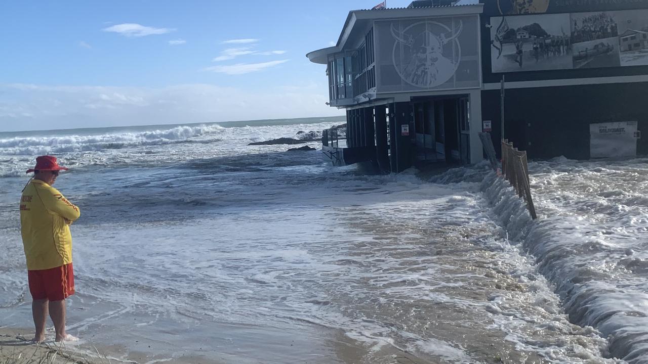
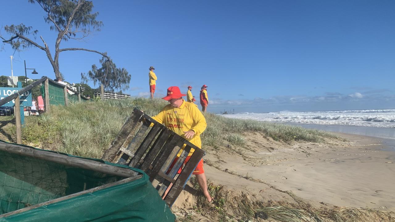
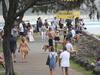
Surf Life Saving Queensland said all Gold Coast beaches were closed, along with some on the Sunshine Coast and in the Wide Bay Capricorn region.
“Please follow lifesavers and lifeguards’ advice by not swimming at a closed beach,” SLSQ warned.
However, authorities have reported reckless swimmers ignoring beach closures to venture into treacherous surf, putting their own lives and the lives of their rescuers at risk.
SCROLL DOWN FOR FULL LIST OF BEACH CLOSURES
The Bureau of Meteorology issued a warning early Monday morning of high tides, well above the astronomical high tide level that is likely to impact Gold Coast, Maroochydore, Coolangatta, Noosa Heads, Cleveland and Redcliffe.
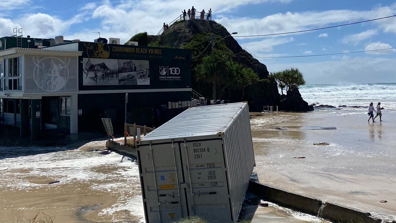
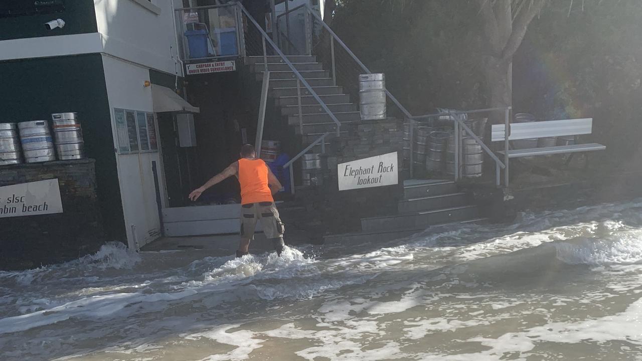
Water washes through Currumbin Surf Club carpark as giant waves smash the #goldcoastpic.twitter.com/YChdC0qJjR
— Greg Stolz (@GregStolzJourno) January 2, 2022
An increasing easterly swell and strong gale force winds are expected to create deep water waves of 4m high in southeastern waters.
The dangerous surf conditions are forecast to push through today and tomorrow but are expected to ease from Tuesday afternoon as the system weakens.
Surf was already washing though the Currumbin Surf Club carpark at 6.30am, sending beer kegs tumbling into the ocean.
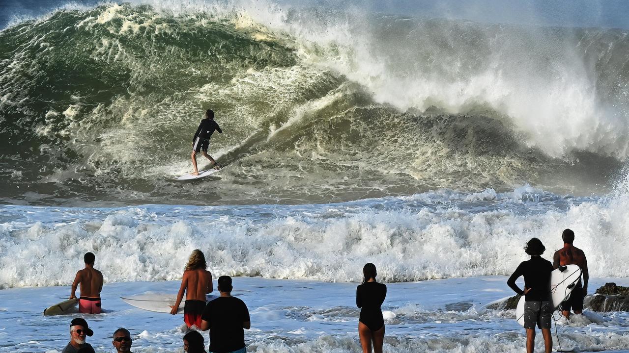
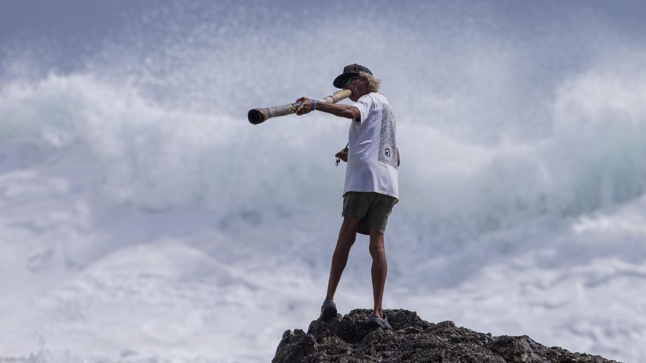
Experienced surfers are being towed into booming waves at Kirra Point and Currumbin Alley, watched by large crowds of spectators.
All beaches are likely to be closed today on both coasts given the perilous conditions.
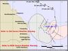
BOM meteorologist Helen Reid on Monday afternoon said while the ex cyclone was gradually weakening, it continued to move towards the coast.
IN PICTURES: MONSTER SURF GALLERY
“The future movement of ex-tropical cyclone Seth is uncertain,” Ms Reid said.
“We’re expecting it to drift slowly west and possibly north over the next few days and it’s uncertain whether it will even cross the Queensland coast.
“We can expect an increase in shower activity over the southeast as the week progresses and that’s all dependent on the movement of ex-tropical cyclone Seth.”
The swell and high tides are wreaking havoc for holiday-makers in other parts of Queensland too, with campers at Inskip caught out overnight.
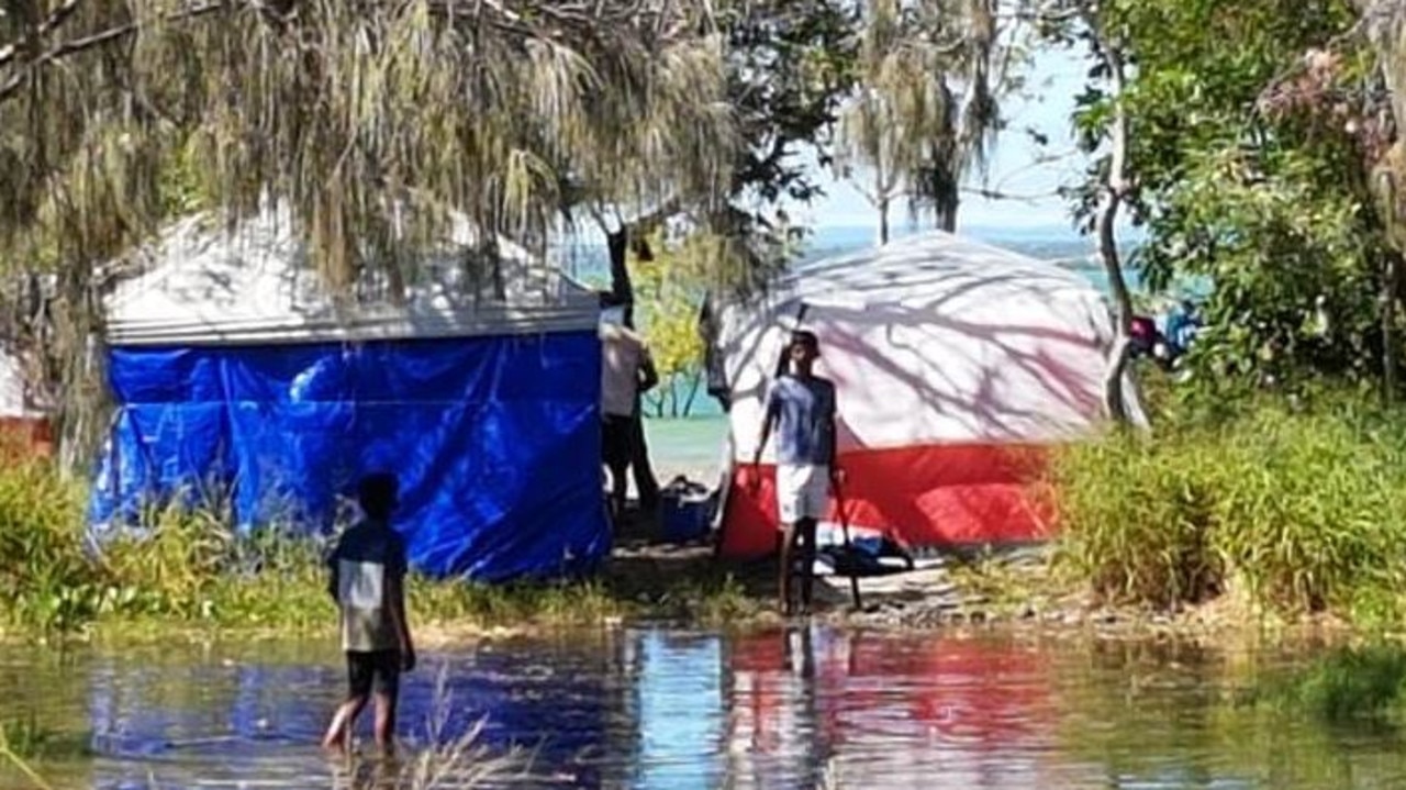
Gympie resident Wayne Dean has captured images of shocked visitors who have woken surrounded by water or struggling to get through to the beach and barge.
One family was left stranded on their own little island after water flooded in around their campsite.
“Their kids were just running around in the water and it’s probably well over their knees,” Mr Dean said.
“The water was going into the bottom of their campsite and they were just trying to pick everything up and get to higher ground.
“They had nowhere to go though and we can’t get cars over to where they are now.”
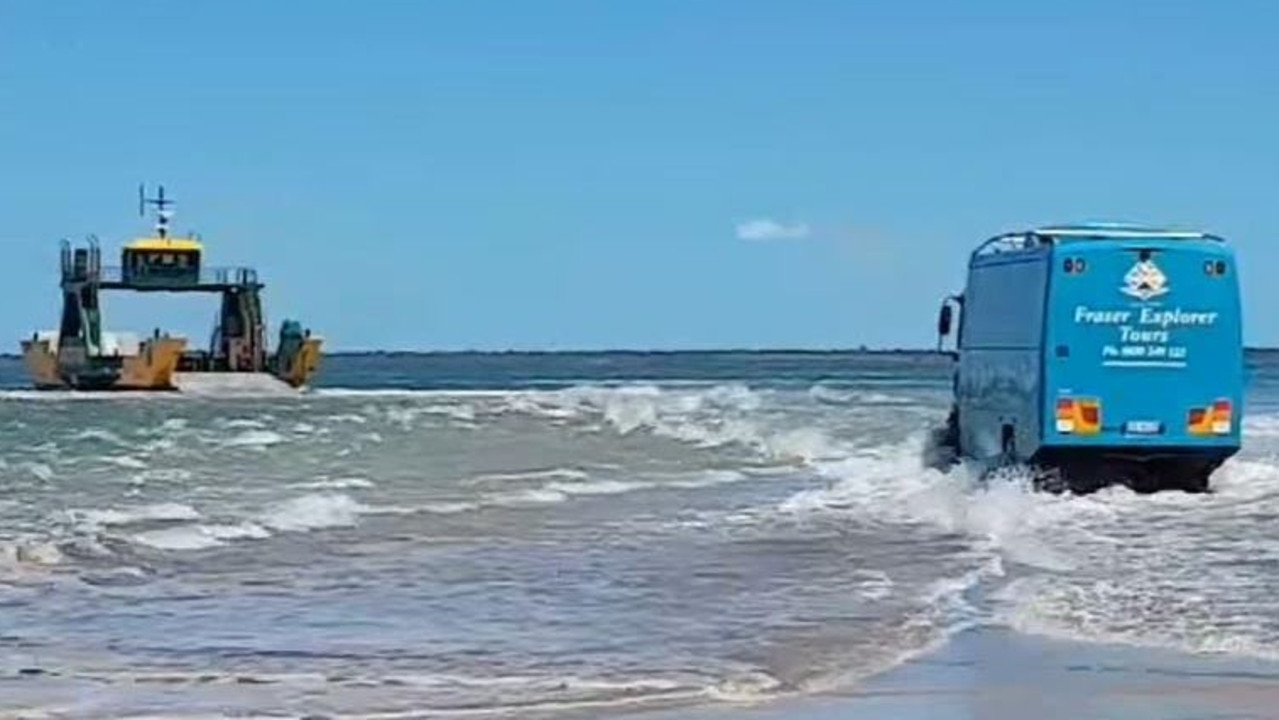
Mr Dean said tour buses were driving through the water to get onto the barge to Fraser Island and traffic lined access routes waiting for the tide to drop.
“The access road which goes down to the point is probably only wide enough now for one car,” he said.
“The council did a lot of work a few years ago when this happened before but now the damage is down further.
“It’s just been eaten in again and a lot of the road way is gone.”
Mr Dean said many sand dunes and beaches had also been washed away.
The water is expected to ease as the tide goes out, with low tide at Inskip about 3.30pm.
“Honestly, in 45 years I’ve never seen it like this where water is going where it is now,” he said.
“The same is happening at Tin Can Bay- they’ve had a lot more water pushed into the estuaries and it’s made everything come up higher and there’s nowhere for the water to go.”
Ms Reid said by the time the system nears the coastline, it’s unlikely to bring the significant rainfall associated with lows recently downgraded from a cyclone.
“We’re not looking at it being 100mm, but more like 20mm to 30mm,” she said.
“The position of the low means that New South Wales will likely catch it tomorrow, just up to maybe 15mm.
“It’s not until Thursday that we will see things picking up to 20mm to 30mm through the southeast of Queensland.”
She said the location of rainfall was entirely dependent on the movement of the ex-cyclone over the coming days.
The powerful south-easterly swell from the low will continue across the coming days and coincide with tides around the highest astronomical tide.
Gale warnings are current for southeast coast waters today and tomorrow while strong wind warnings are current for adjacent waters.
Thunderstorms are expected in the north and north western parts of the state over the coming days.
Ms Reid said storms expected today through the north west could become severe with the possibility of damaging winds.
Residents in north east and central parts of the state are experiencing severe to extreme heatwave conditions which aren’t expected to ease until later in the week.
Fire danger in southern and central inland districts is elevated on Monday and Tuesday, and expected to ease on Wednesday.
More Coverage

Join the conversation

Qld man charged with raping, impregnating 12-year-old girl
Queensland man Iosefo Lui, 39, has been extradited from Sydney to Townsville after being charged with raping and impregnating a 12-year-old girl.
Read more

Big guns survive cull as heads roll on 2032 Games organising committee
Some Qld powerbrokers have survived the dramatic purge of athletes and CEOs from Brisbane’s Olympic Games organising committee.
Read more