
Wide Bay disasters since 2010: Floods, cyclones and fires
With recent weather events battering the region we take a look back at some of the most significant disasters in recent years from Bundaberg to Gympie and the Burnett region.
South Burnett
Don't miss out on the headlines from South Burnett. Followed categories will be added to My News.
With recent weather events battering the region we take a look back at some of the most significant disasters in recent years.
It was only last year when Gympie was inundated as the Mary River rose to its second highest level in recorded history and just three years ago when K’gari (Fraser Island) suffered a devastating bushfire which lasted for weeks.
Here are some of the most memorable disasters from the past 13 years.
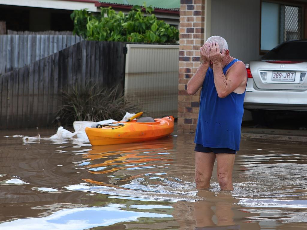
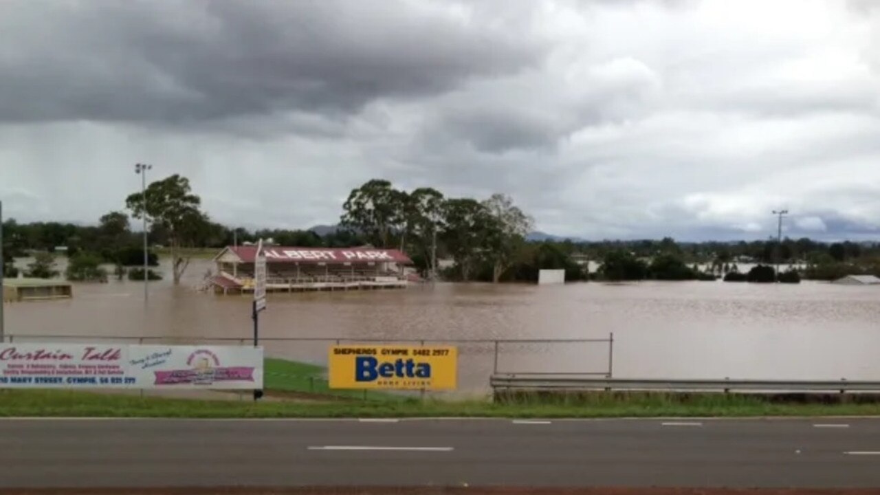
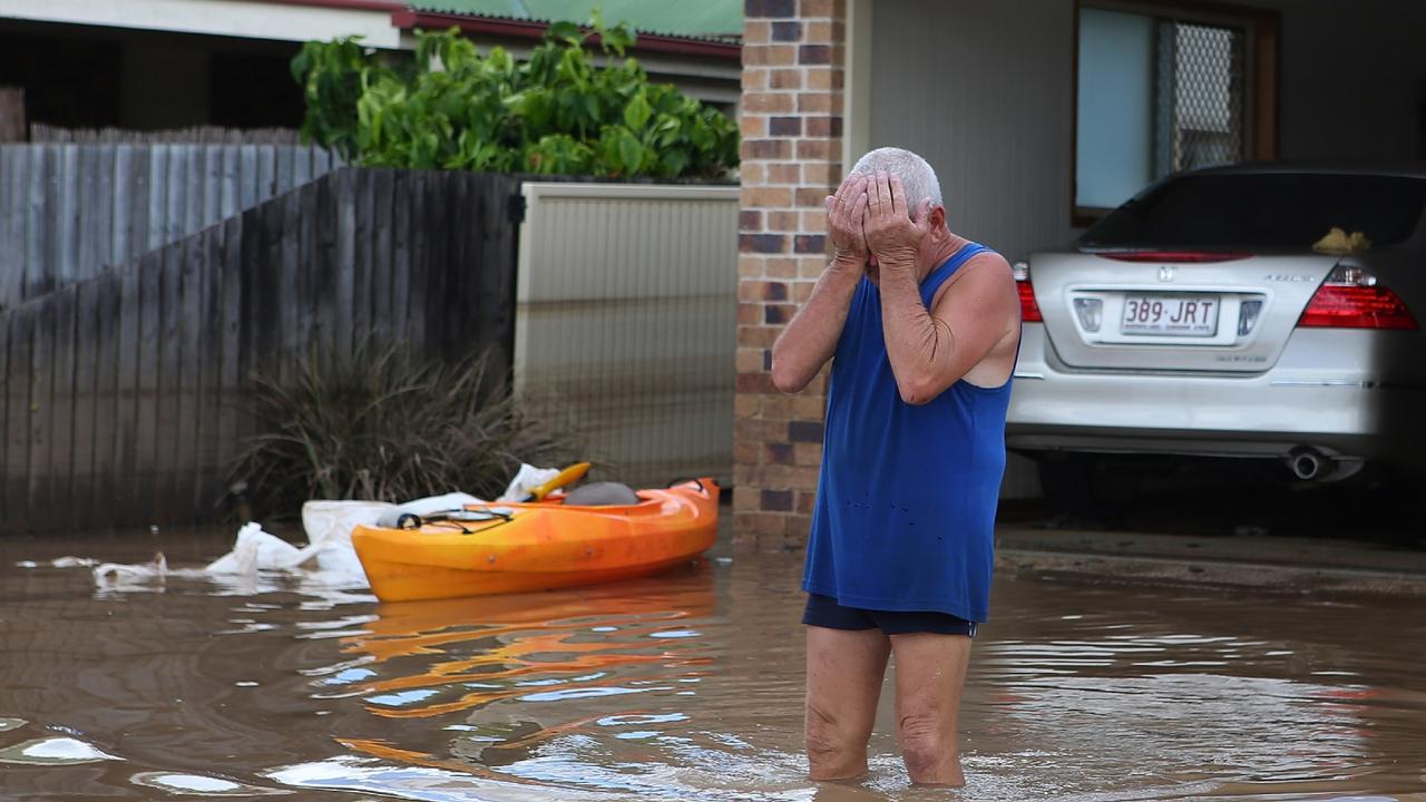
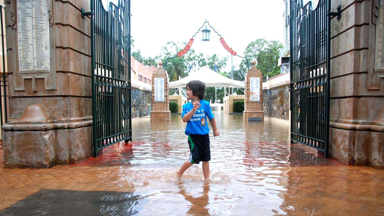
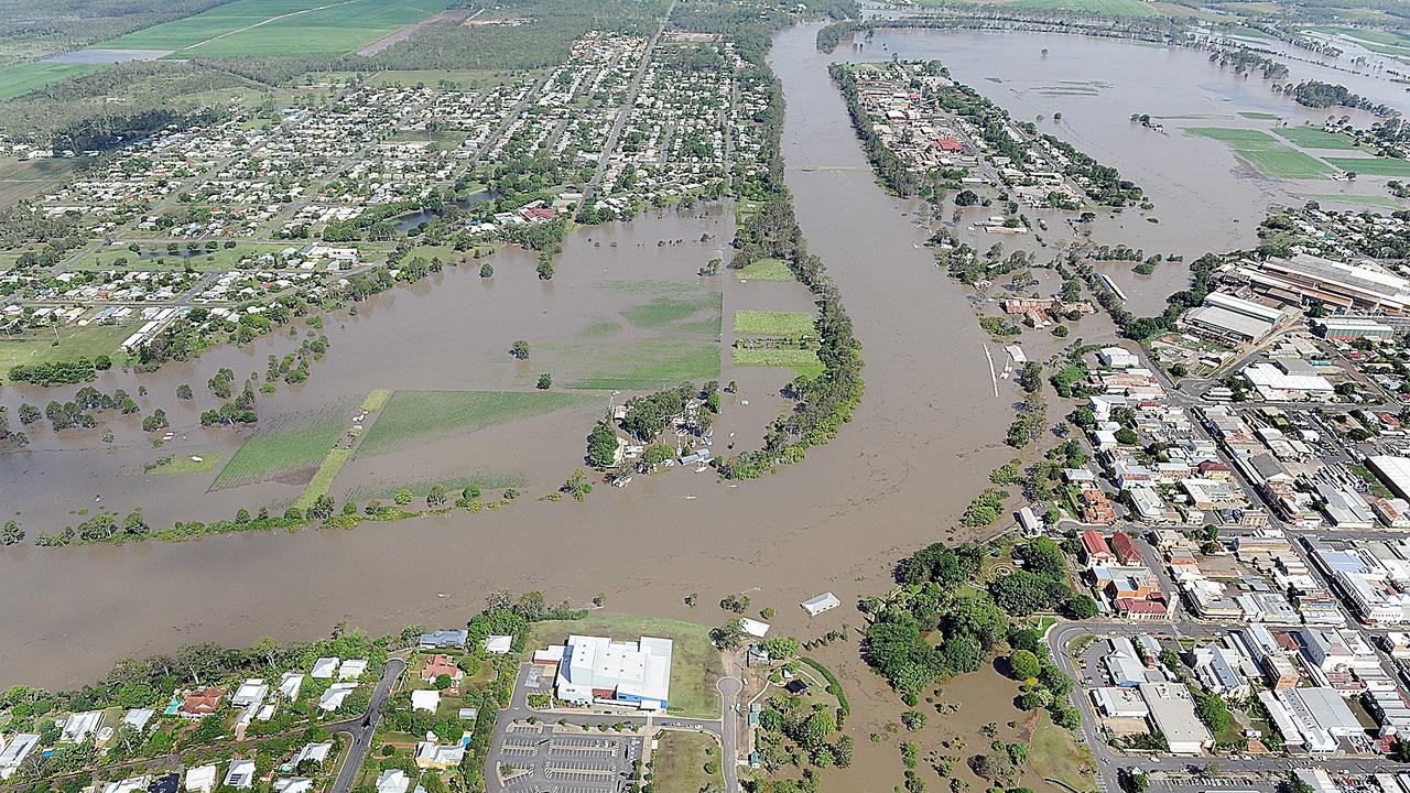
2022 Gympie and Maryborough floods
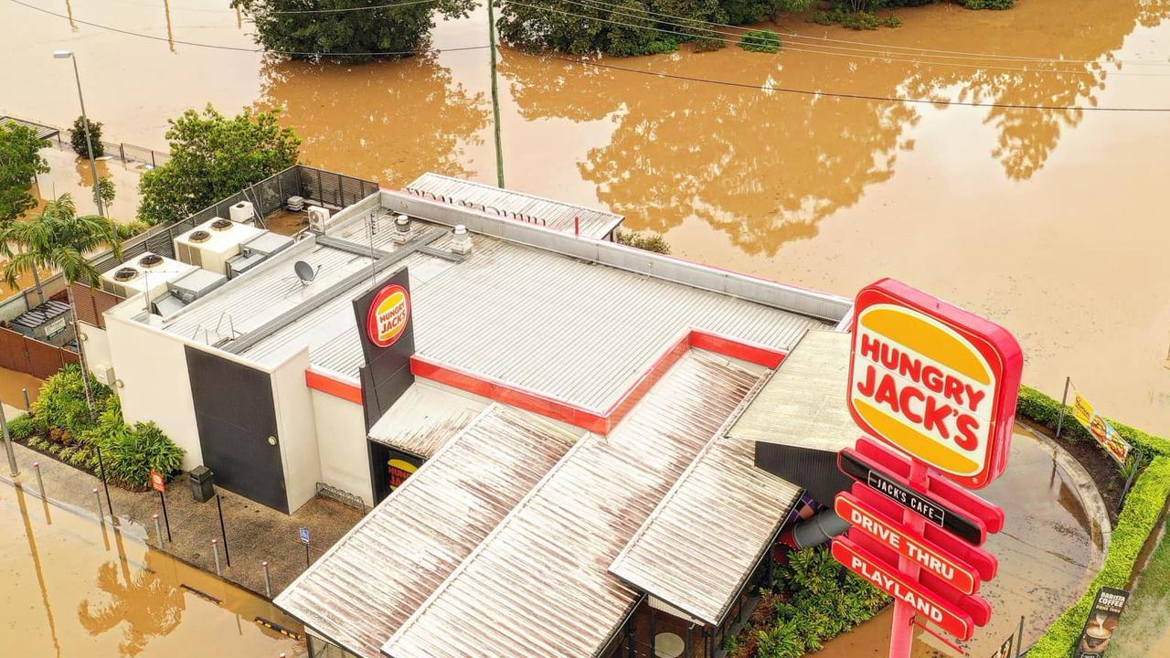
February, 2022 saw Gympie cut off for several days after the Mary River peaked at 22.96m, the second highest on record, inundating parts of the city with homes and businesses destroyed.
The Fraser Coast didn’t escape tragedy as several lives were tragically lost during the disaster.
Maryborough emergency crews worked day and night to keep the floodwaters out of the historic city centre.
The flooding became one of the region’s most expensive at well over $5bn and rebuilding continuing right throughout 2023.
See the gallery here.
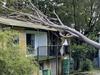
2013 Ex-Cyclone Oswald
In January 2013, a relatively weak storm, ex Tropical Cyclone Oswald nonetheless unleashed torrential rains across the state.
Flooding and storm activity resulting from Oswald wreaked havoc, causing severe flooding in Gympie, Bundaberg and North Burnett areas.
Bundaberg was struck by six tornadoes and rooftop rescues were needed across parts of the Gympie region.
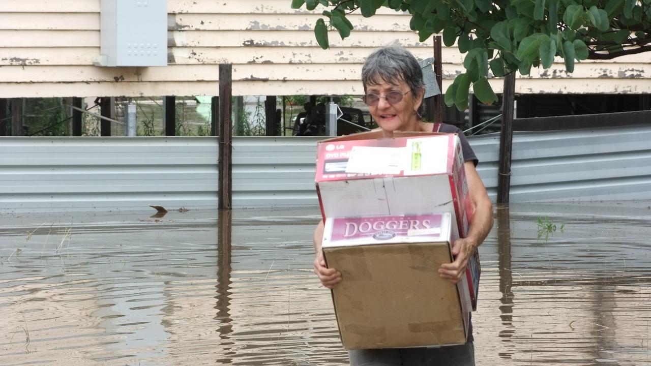
2013 Bundaberg floods
Although ex-cyclone Oswald caused destruction across the state in January 2013, Bundaberg was hit significantly hard by catastrophic floods with the Burnett River rising to a record 9.53 metres, damaging 3000 homes and 600 businesses and leaving 7000 people stranded.
Many people were left without power or fresh water to drink during the aftermath and it took weeks to clean up the mud with the army coming in to help.
Other regions such as the Fraser Coast and Gympie were also hit by flooding and devastation.
Read more here.
2018 Woolooga bushfire
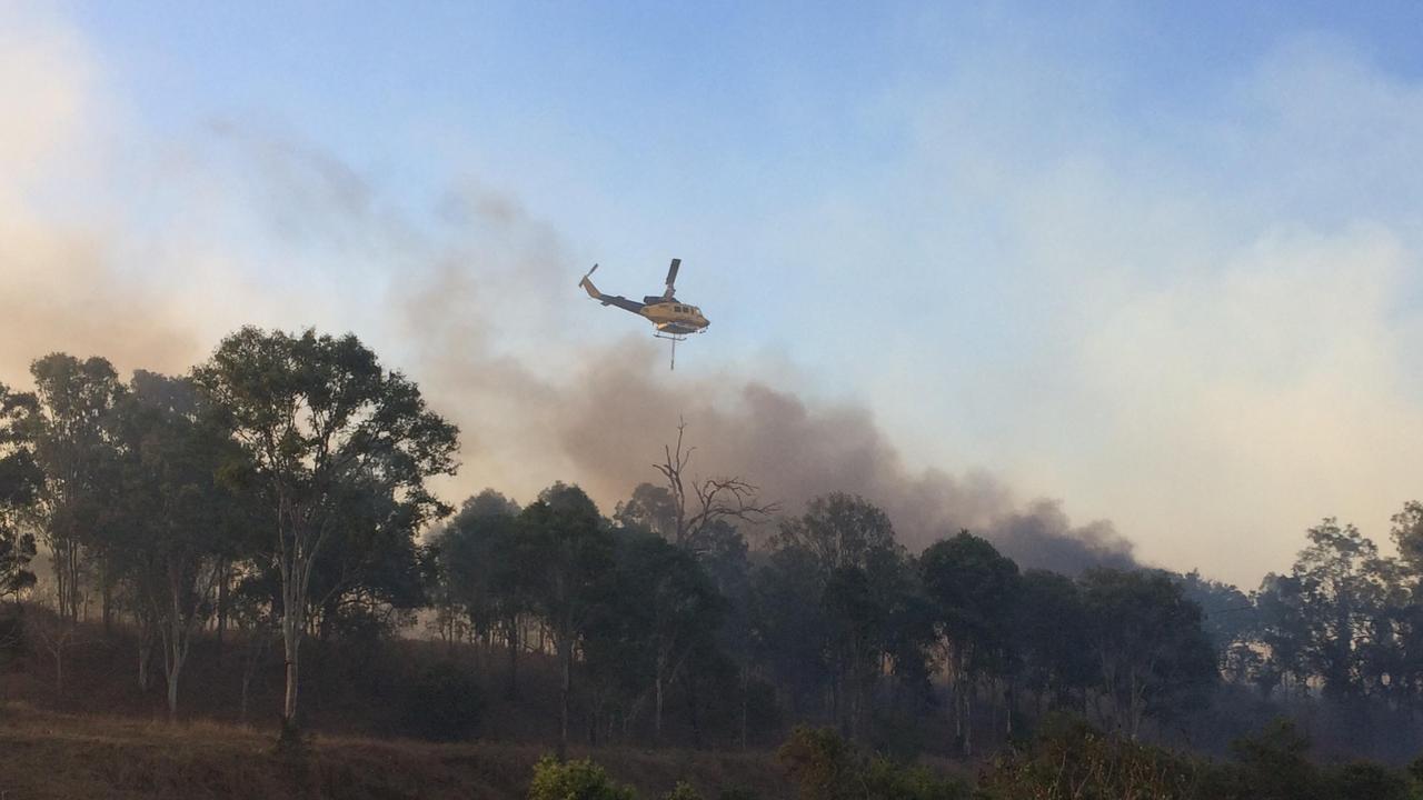
In September 2018, a bushfire ripped through 10,000ha of land to the northwest of Gympie in Woolooga’s worst bushfire.
Local residents Terry and Dale Rauchle were left stunned by the “wall of fire” that left a trail of destruction on their Old Boowoogun Station property at Woolooga.
The 1618ha (4000 acre) property that was once grazing land for 1000 cattle was blackened to nothing.
Although no human lives were lost, hundreds of cattle were killed in the fire across the region and several structures destroyed.
Read more here.
2020 K’gari (Fraser Island) Bushfire
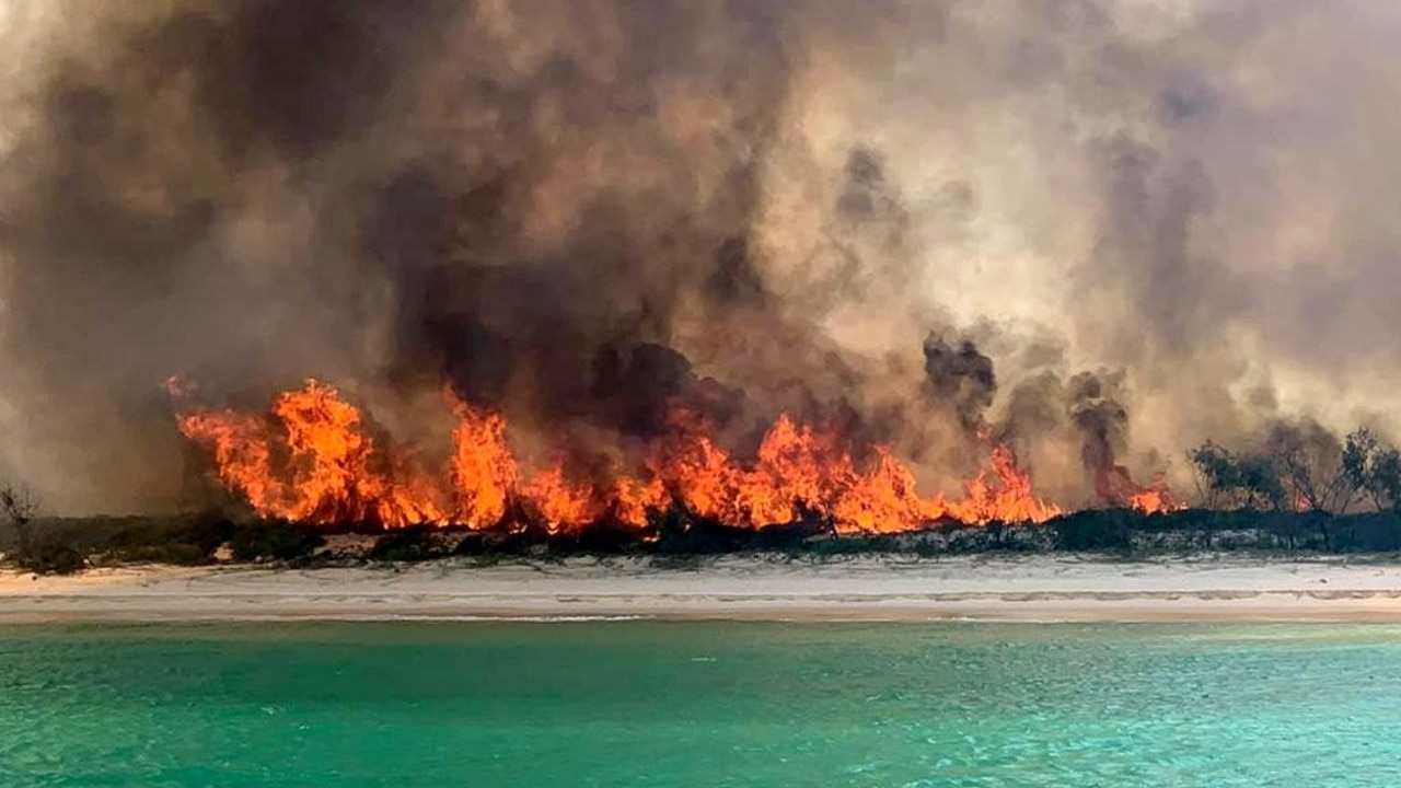
In October 2020, an illegally lit campfire that was not properly extinguished ended up wreaking havoc across the island.
It is estimated 87,000ha of the island was burned over seven weeks, destroying fauna and killing wildlife. Four men were fined for lighting the fires which police described as “an act of stupidity.”
Read more here.
2011 Wide Bay flooding
The 2013 Gympie flood often overshadows the events which happened only two years prior. The Mary River peak of 19.45m in January 2011 was part of a wider flooding disaster to unfold across the state’s southeast corner in 2011.
The city was cut off as a result of the rising river, and the CBD was inundated.
Other parts of the Wide Bay also suffered, with the South Burnett towns of Kingaroy, Cherbourg, Murgon, Blackbutt and Nanango all cut off by inundated roads.
2010 West Qld Flooding
Unprecedented rainfall caused serious flooding across Queensland in February, 2010, with more than a dozen waterways inundated by the downpour in the Mary and the Burnett catchments.
At Mundubbera, the peak came in the early evening at 18.25 metres, the highest level since 1942.
More than 20 homes were inundated and the town was cut off.
The river at Gayndah peaked at 16.1m, only three metres shy of the 1942 record.
Roads, railways and bridges were ruined as a result of the floods while agriculture and horticulture industries including farms, crops and livestock were severely impacted.
2013 Maryborough gas outage
The Mary River swept through 150 homes and 50 businesses as it worked its way to a peak of 10.7m in January 2013.
The most widespread economic impact for the Fraser Coast was not caused by floodwaters, but by a natural gas outage.
Hotels, dry cleaners, takeaways and restaurants became unexpected flood victims when the gas supply was cut off for almost a month.
About 450 businesses and 550 homes across Hervey Bay, Maryborough and Bundaberg were cut off after the main pipeline was heavily damaged where it crosses the Burnett River.
Read more here.
More Coverage
Originally published as Wide Bay disasters since 2010: Floods, cyclones and fires

‘A slap in the face’: Fight to save cherished park wrecked by vandals
Burnett residents are calling for help to save a ‘very special’ park in danger of closing permanently after vandals caused significant, expensive damage to it for the second time in three years.

Police blitz nabs 15 speeding drivers amid rising road toll
More than a dozen drivers have been busted speeding on the Wide Bay Burnett’s roads as police crack down on dangerous driving amid concerns over a rising road toll.

Police allegedly discover firearm, drugs during raid
A firearm and cannabis have allegedly been discovered when police carried out a raid in the South Burnett.

Almost 800km in five days! Aussie runner breaks record
A world record for backyard ultra-marathon has been broken at an iconic Queensland race event after five days of running.

Parents in dark for days after teacher aide charged with child sex abuse
A Queensland teacher aide has been charged with sexually abusing three children during the past decade, but parents had to wait three days until they heard from the state school where he’d been employed.

Dozens accused of drug, traffic offences after controversial festival
Dozens of people charged with drug or traffic offences during a controversial South Burnett music and arts festival have faced court for the first time.