
Giant hail, 73mm in 1hr: Wild storms cut power, cause traffic and flight chaos
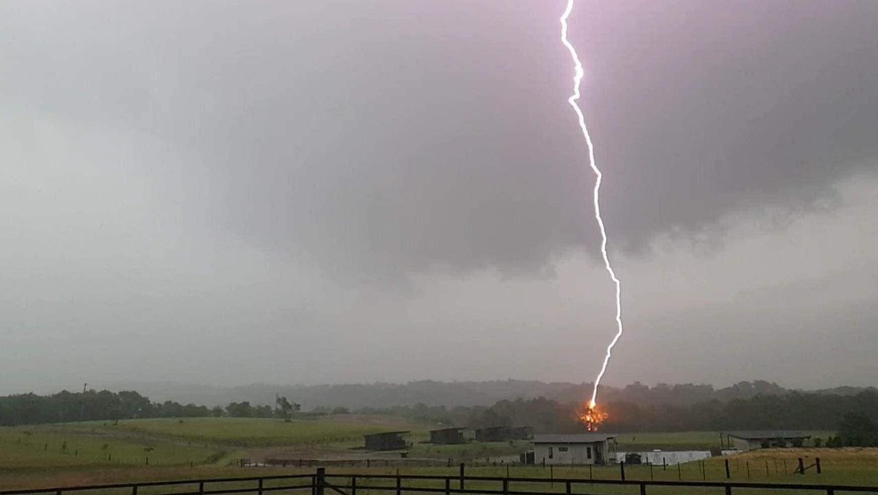
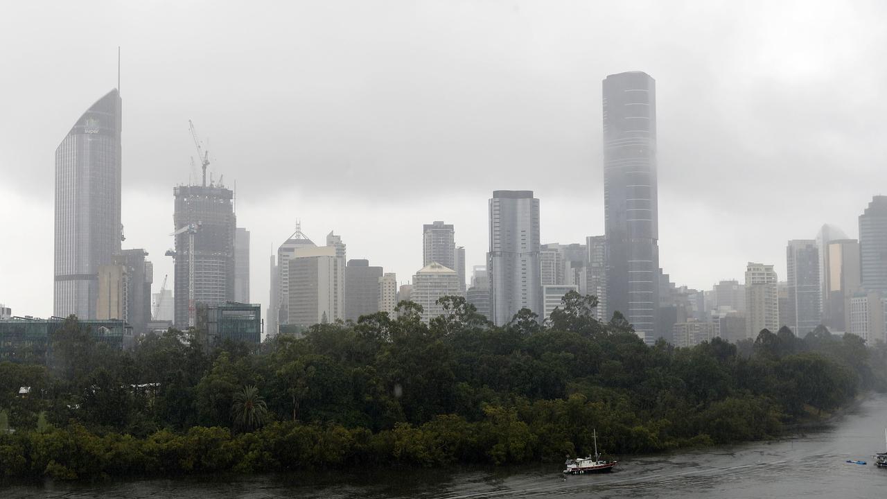
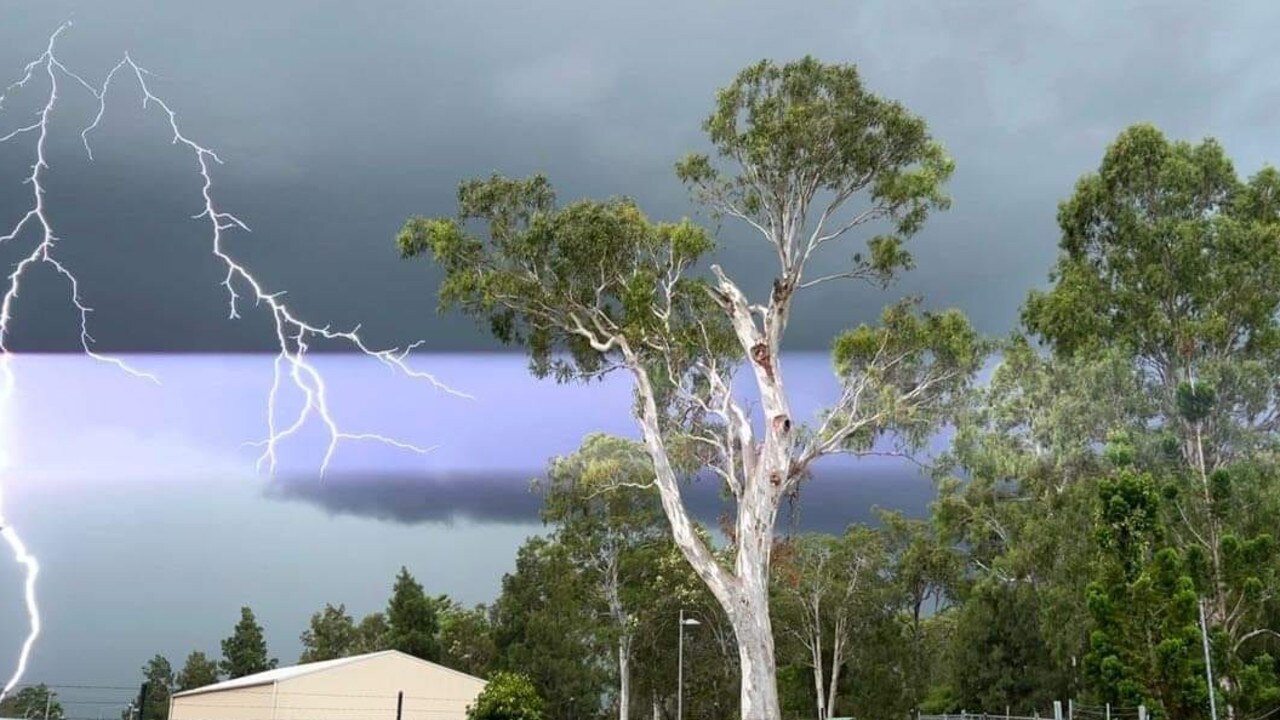
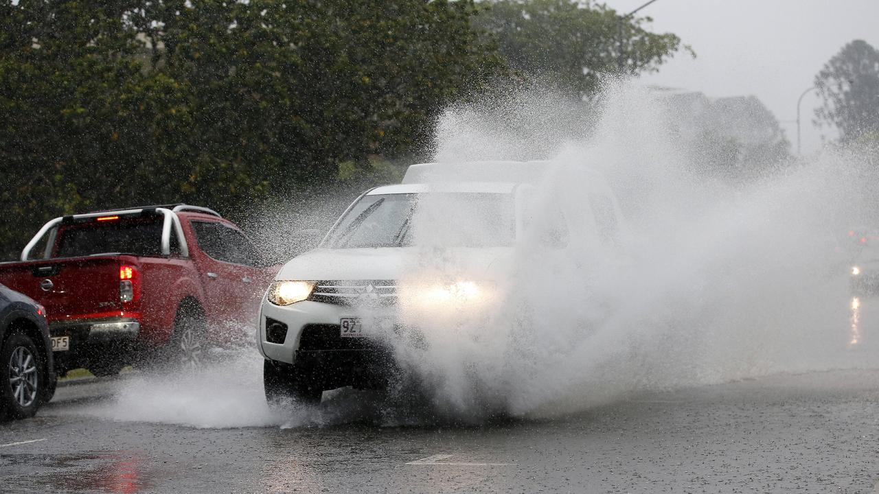
More than 200,000 lightning strikes were detected across South East Queensland during wild storms yesterday with Brisbane recording its heaviest rainfall since the February floods.

QLD News
Don't miss out on the headlines from QLD News. Followed categories will be added to My News.
More than 200,000 lightning strikes were recorded across South East Queensland with power cut to thousands of homes and reports of flash flooding during wild storms that hit late Tuesday afternoon.
Bureau of Meteorology Senior Meteorologist Helen Reid said Brisbane Airport received the highest rainfall yesterday, picking up 130mm.
“Rosalie also picked up a total of 82mm – and 73mm within an hour – with patches of 30mm-40mm through the region,” she said
Ms Reid said Redcliffe received 50-60mm of rainfall, the Gold and Sunshine Coast hinterlands picked up 50mm and Oxenford Weir had 58mm.
More than 10,000 Energex customers in SEQ were without power at the height of the storms, the impacts were felt far more widely than that.
“We have received calls for about 20,000 people that have been affected across the Southeast,” Energex spokesman Danny Donald
At least three flights due to arrive at Brisbane Airport on Tuesday were cancelled with dozens of others delayed.
The severe weather warnings were cancelled just after midnight.
“Golf ball-sized” hail fell at Mt Gravatt, while 2-3cm hailstones were observed at Highfields and 4-5cm hailstones observed at Kingsthorpe, both near Toowoomba.
At 5.30pm that number was down to 8225 and by 10.45pm there were just over 800 customers without power.
Mr Donald on Wednesday morning said crews were still working to restore the remaining outages for 300 people in the Sunshine Coast, but crews had been able to restore power to all Brisbane and Gold Coast properties.
The wild weather and wet roads caused commuter chaos in the evening, with some motorists experiencing delays of up to 80 minutes.
Heavy congestion on main roads continued well past 5pm, with entry ways into city tunnels causing the biggest delays.
Buses were also expected to be delayed by up to 45 minutes due to weather conditions with TransLink issuing a significant delay warning on city routes.
One driver said his usual 10-minute journey from Wavell Heights took 90 minutes.
Mr Hanniffy said there is a notable freshness in the Brisbane air today.
“There’s a brisk south easterly coming in this morning and cloud developments with a slight chance of showers,” Mr Hanniffy said.
Mr Hanniffy said there were no storms expected in the atmosphere today, but maximum temperatures will nudge up when winds start to relax.
Temperatures today are expected to reach 29C with 30C on Thursday and 31C following until Sunday.

HOW STORM WARNINGS UNFOLDED
TUESDAY NIGHT
The Bureau of Meteorology cancelled all warnings just after midnight.
The most recent warning before that was issued at 10:18pm and warned that severe thunderstorms were detected on the weather radar near Redcliffe and Jondaryan.
The thunderstorms were moving towards the north to northeast and were forecast to affect Scarborough and Deception Bay waters by 10.40pm and Cooyar and Yarraman by 11.10pm.
Heavy rainfall that may lead to flash flooding, damaging winds were likely.
A separate, more general warning remained in place until just after midnight for parts of Peninsula, Gulf Country, Wide Bay and Burnett, Darling Downs and Granite Belt and Southeast Coast Forecast Districts.
Severe thunderstorms were likely to produce damaging winds, large hailstones and heavy rainfall that may lead to flash flooding over the next several hours in parts of the Wide Bay and Burnett, Darling Downs and Granite Belt and Southeast Coast districts. Locations which may be affected include Toowoomba, Brisbane, Dalby, Ipswich, Lowood and Nanango.
A 90kmh wind gust was recorded at Thangool Airport at 5.04pm.
TUESDAY AFTERNOON
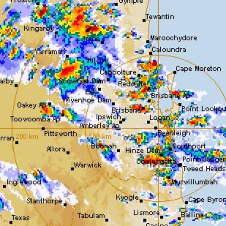
At 3.59pm, the Bureau warned that very dangerous thunderstorms were detected on the weather radar near Logan Central and Camp Hill.
These thunderstorms were moving towards the east to southeast.
Very dangerous thunderstorms were forecast to affect Logan Village, Slacks Creek and Tingalpa Reservoir by 4.10pm and Beenleigh and Mount Cotton by 4.40pm.
Other severe thunderstorms were detected on the weather radar near Brisbane CBD, Caboolture, Caloundra and Gympie.
They were forecast to affect the area east of Gympie, the area northeast of Gympie and Pomona by 410pm and Cleveland, Noosa Heads and the area north of Noosa Heads by 4.40pm.
Large, possibly giant hailstones, intense rainfall that may lead to dangerous and life-threatening flash flooding and damaging winds are likely, the Bureau warned.
The Bureau earlier warned that, at 3pm, severe thunderstorms were detected on the weather radar near Brisbane CBD, Strathpine, Redcliffe, northern Bribie Island, the area northeast of Kingaroy, Murwillumbah (NSW) and the area northwest of Toowoomba.
They were forecast to affect Toowoomba, the area southwest of Gympie and the ranges between Gympie and Murgon by 3.30pm and Logan Central, Cleveland and Gympie by 4pm.
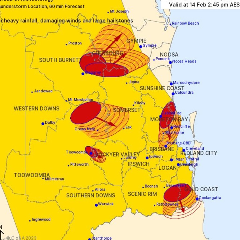
A more general severe thunderstorm warning is also current for parts of the Wide Bay and Burnett, Darling Downs and Granite Belt and Southeast Coast districts.
Senior Meteorologist Daniel Teece-Johnson said this weather system is likely to be a ‘one-off’ with weather returning to normal by Wednesday.
“It’s pretty much a big event this afternoon and then we’ll see some return to sort of settled weather around tomorrow,” he said.
The Brisbane Airport Corporation in a statement urged travellers to check with their airlines as to the impact of the flights.
An airport spokesperson said the threat of lightning that temporarily stopped ground activity and said delays were to be expected.
“Aircraft may land and takeoff, but services such as baggage handling, catering, refuelling, cleaning and maintenance are suspended as it is too dangerous to have people exposed to the threat of lightning,” the statement read.
“This includes the risk for passengers on the tarmac.”
According to the airport’s website, three flights from Emerald, Rockhampton and Gladstone, that were due to land today have been cancelled.
It comes after South East Queensland woke to severe thunderstorms that threatened “hazardous” rainfall and flash flooding, as the days-long build-up of heat and humidity takes effect, with the threat of more to come.
Bureau of Meteorology forecaster Felim Hanniffy said there was a cause for concern, despite the forecast south-easterly change and brief respite from the extreme heat on Tuesday.
“It will bring the risk of storms and potentially severe thunderstorms across the Brisbane area during this afternoon as well,” he said.
⛈ï¸Storm forecast for Tue 14/2. Severe storms likely over northern #SEQ, possible in the remainder of SEQ. Heavy to locally intense rain is the main risk, damaging wind and large hail also possible. Severe storms also possible over the Peninsula. Warnings: https://t.co/FBmpsInT9opic.twitter.com/6ItE5OnUkJ
— Bureau of Meteorology, Queensland (@BOM_Qld) February 13, 2023
Mr Hanniffy said the sunny blue skies southeast residents woke up to were misleading as the potential for the trifecta of damaging winds, large hail and heavy rain brought “risk.”
“It’ll cool things down … but probably heavy rainfall is the primary risk, even a risk of some intense rainfall as well,” he said.
A tropical low up north is expected to bring widespread monsoonal rain across the entire cape from Townsville through to Mount Isa later this week.
Mr Teece-Johnson said areas affected by the rainfall can expect 35mm on Wednesday, 60mm on Thursday and 40mm on Friday.
Mr Hanniffy said some of the rain may filter across the eastern areas of the Darling Downs, which would assist firefighters battling multiple bushfires across the region.
“Tomorrow would also probably just possibly hit the eastern half … not so much across the entire Darling Downs itself,” he said.
“It looks like this is very much your Eastern, kind of closer to the coast type event rather than wide spreading across much of the interior.
“So it’s to do with the southeast change which will not likely penetrate into much of the Darling Downs.”
Mr Hanniffy also told media that hazardous surf warnings were still in place, “the knock-on effects from tropical cyclone Gabrielle”.
“That’s just gone probably east of New Zealand, the North Island, so conditions are slowly improving.”
He said the “quite strong” east south easterly swell was still in play but was on a slow easing trend.
“We expect it tomorrow as well to ease further so perhaps this warning may be cancelled for tomorrow.”
LEAVE IMMEDIATELY - Kowguran, Myall Park and Hookswood (near Miles) - fire as at 5:34am Tuesday, 14 February 2023.
— Qld Fire & Emergency (@QldFES) February 13, 2023
For all current warnings, updates and mapping go to https://t.co/vqyJTUPBhe. pic.twitter.com/lk7Ip6NaJU
Tens of thousands of homes were left without power overnight, with emergency services responding to 900 call-outs as the nation battles devastating landslides and torrential rain.
Coastal communities west of Auckland – including Piha, and Muriwai – as well as Coromandel, Gisborne and Hawke’s Bay were among those hardest hit overnight.

Originally published as Giant hail, 73mm in 1hr: Wild storms cut power, cause traffic and flight chaos
Brutal ‘coward punch’ assault adds to beach suburb’s rising tide of violence
Another brutal assault has happened in the same beachside Gold Coast suburb where a young man was allegedly fatally bashed, and the latest victim’s family is calling for urgent action to stop a rising tide of violence.

Premier’s inner city raid squeezes Greens out of Brisbane
The elevation of the more progressive Steven Miles to Labor leader has eroded the Greens’ base in Brisbane and forced it to work harder to find support, writes Hayden Johnson.
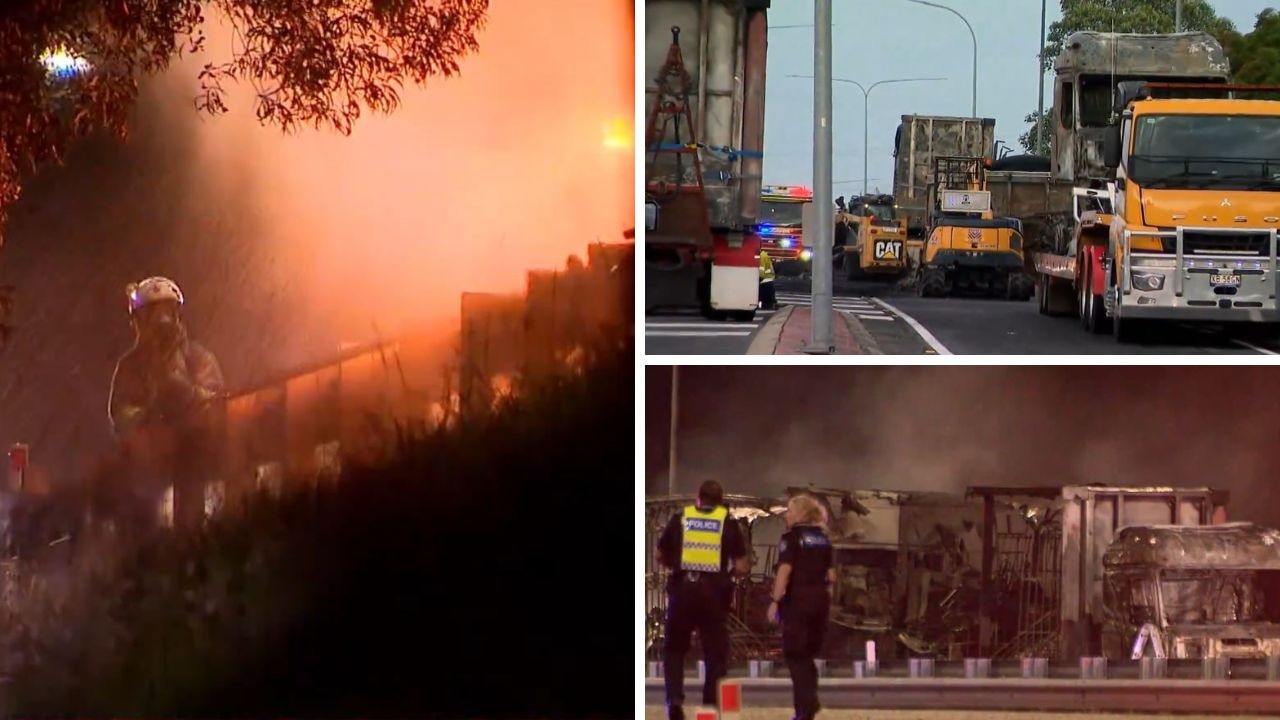
Duo flee after stolen Audi causes truck inferno
Two people are on the run after fleeing a fiery crash involving a stolen luxury car that shut down the Logan Mwy and forced homes to be evacuated.

Family dream team behind multimillion-dollar hair styling tool
A Sunshine Coast hair styling tool brand making millions of dollars in sales has revealed its tips to success after a family of three ran the business by themselves for 17 years.
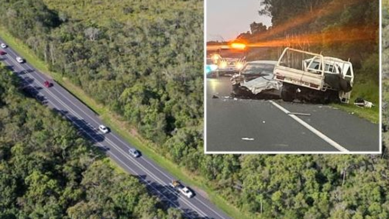
Cops weigh in on deadly motorway as huge surge in traffic revealed
Locals are begging for answers after a mother was killed on a busy Sunshine Coast road a week before another crash on the same stretch left three people fighting for life, as police reveal the reason why the road is so deadly. SEE OUR DRONE VIEW
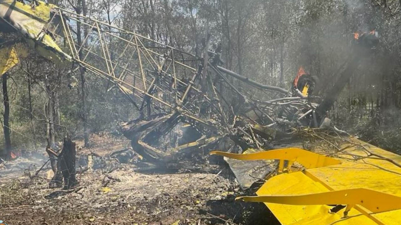
Pilot’s close call as cropduster crashes, bursts into flames
A pilot has miraculously walked away from a plane crash west of Rockhampton before the aircraft burst into flames.