
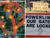
Powerlink transmission lines in Gympie and Burnett explained
The plan to connect Borumba Dam to the Woolooga and South Burnett substations is causing significant anxiety in the communities most likely to be saddled with high voltage power lines. Here is a brief outline of what they can expect to happen and when:
Community News
Don't miss out on the headlines from Community News. Followed categories will be added to My News.
News of possible high voltage transmission lines running through the heart of the Mary Valley and South Burnett from the Borumba Dam hydro project has sent ripples of fear and uncertainty through the rural neighbourhoods and communities in their path.
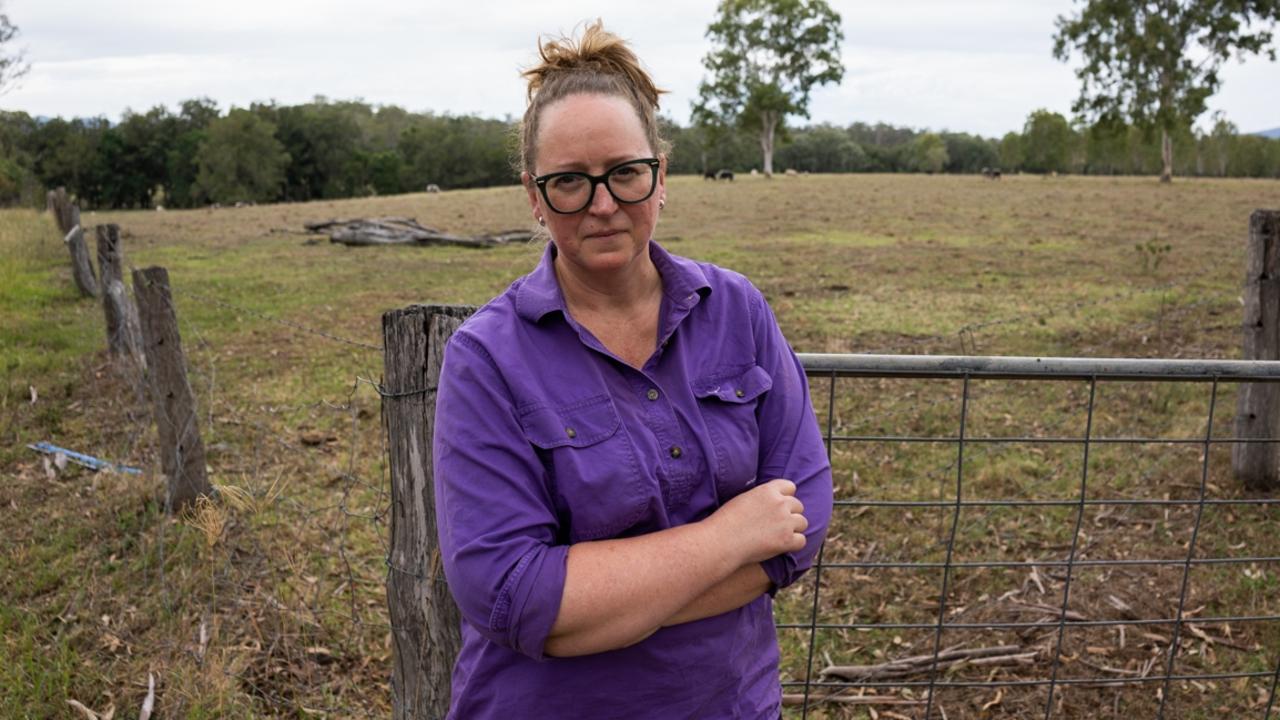
Farmers and landholders have expressed their concerns of land devaluation, biosecurity risks and mental anguish from having huge towers on their property.
What does it all mean for those who will be made to accommodate the lines? And how soon will it all happen?
In the next eight years, the state government plans to build and put into operation one of the largest pumped hydro projects in the world, powered by the water stored at Borumba Dam.
A detailed analytical report is being prepared for submission by Queensland Hydro to the government for investment approval at the end of March 2023.
In the meantime, submissions and feedback on the proposed corridors are open to Powerlink until March 31, 2023, and the selected corridor will be announced on April 27, 2023.
When (if) the green-light for pumped hydro at Borumba comes sometime after May 2023, exploratory works will start at the dam site between 2023 and 2025, construction in 2026, and completion penciled in by 2031.
Powerlink is expecting to be finalising the transmission alignment from mid-2024 with construction of the high voltage power line network starting in 2025.
The transmission lines are expected to be operational some time in 2029.
The project is still dependent on final state government approvals and both Queensland Hydro and Powerlink are preparing these reports from various consultations and studies.
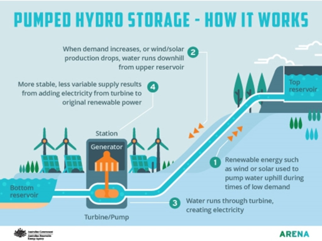
The electricity created from the pumped hydro is expected to power 2 million homes. It will form the backbone of Queensland’s plan to transition to 50 per cent renewable energy by 2030.
Borumba Dam will effectively become a giant rechargeable water battery through pumped hydro, with 24 hours of storage ability.
Queensland’s maximum grid demand in 2021-2022 was 10,100MW, so a pumped dam capacity of 2000MW has the potential to play a significant part in supplying the energy needs of the state.
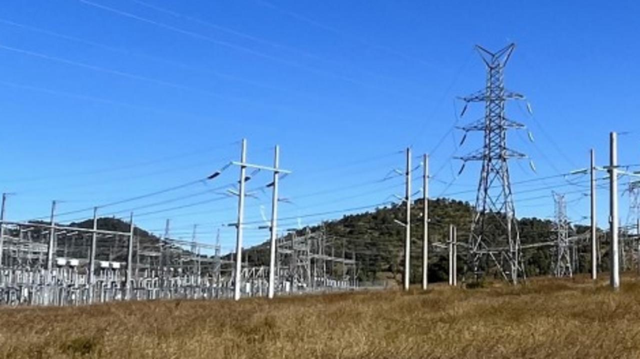
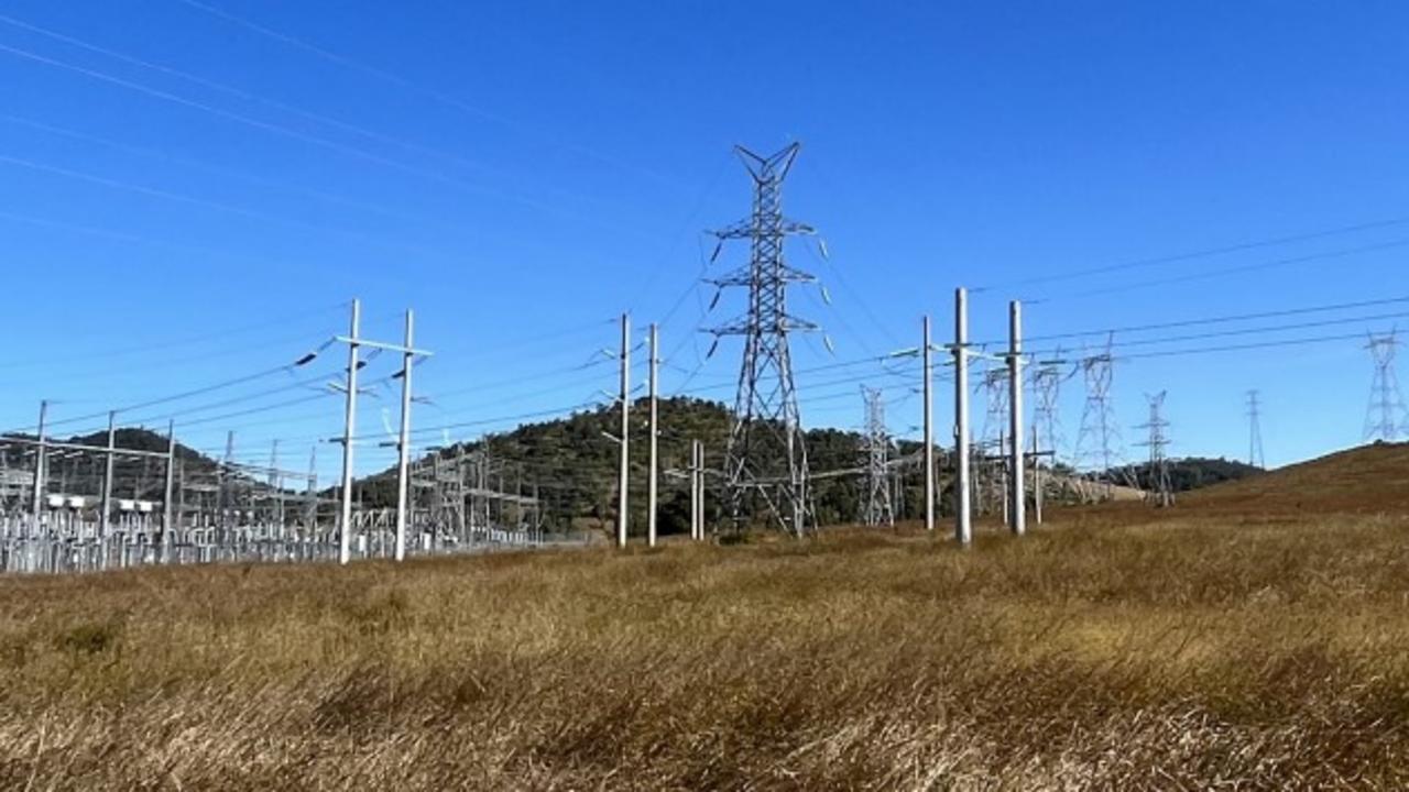
In order to connect the power from Borumba Dam to the state grid, high voltage transmission lines need to be built along pathways through the Mary Valley to the Woolooga substation.
Another line will be built to the southwest to either Tarong or Halys substations in the South Burnett, this will provide energy across the regions of southern and central Queensland.
Woolooga, Tarong and Halys have all been identified as substations with the capacity to upgrade from their current 250kV to 500kV.
Why new pathways? Why not upgrade existing lines?
There is no high voltage transmission infrastructure from Borumba Dam to the substations.
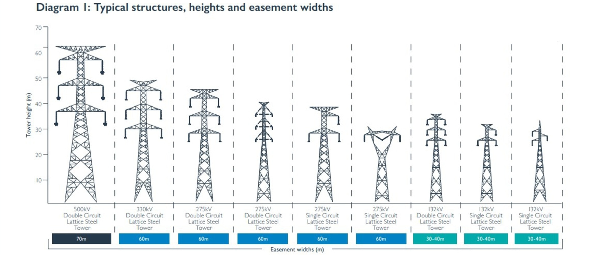
Transmission lines required to connect the power coming from Borumba Dam to the state electricity grid are planned to have the capacity to carry either 275 kV and 500 kV. Most transmission lines in Queensland carry electricity between 132 and 330 kV.
Putting 500 kV transmission network onto a 275 kV network can be likened to eight lanes of traffic merging onto a one lane highway. Investigating the likelihood of 500kV transmission lines is the state government’s investment into the energy needs of the future.
Should this transmission network carry the max voltage of 500 kV, it will mean towers from 60m in height, and will require easements 70m wide. Towers will vary in height and be tailored to the local topography.
There are currently three proposed pathways to connect the energy from the dam to the Woolooga substation.
At the moment corridors 4km in width have been identified. After one corridor is selected these will gradually be refined to a 70m wide easement for the final alignment. See the map for more exact details.
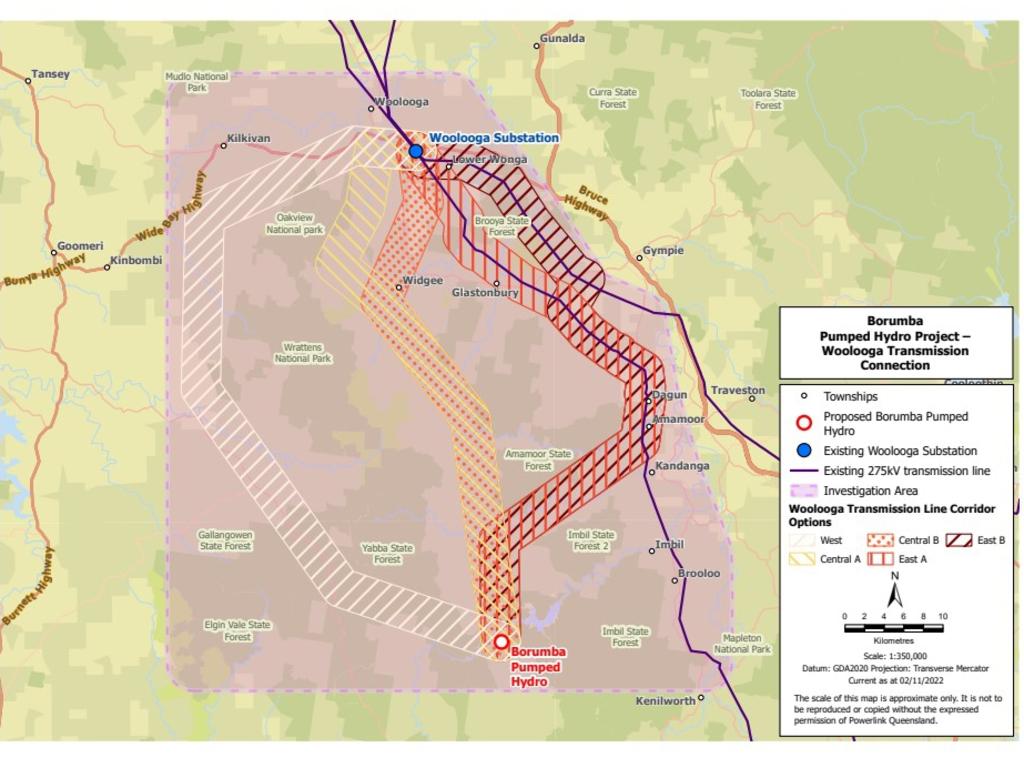
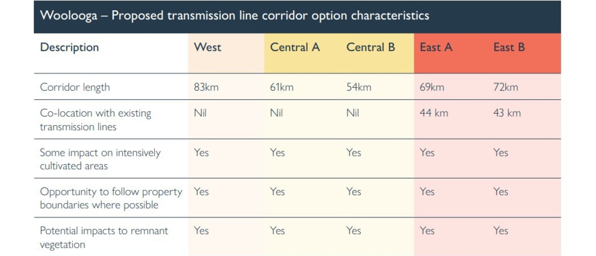
The longest proposed corridor is to the west and is estimated to be 83km long. It would roughly run through the areas of Manumbar, Black Snake and south Woolooga.
The shortest corridor is almost a straight line between the dam and the substation, either 61km or 54km and runs along the western side of Amamoor and Mary's Creek State Forest towards Widgee and splits to go either through the areas of Lower Wonga or east of Oakview National Park.
The eastern corridor is 72km long and is the only proposed route that is co-located along already established transmission lines for almost half of the route (43km). This would run between Amamoor and Imbil State Forest and join with the existing 275kV line north of Kandanga, Amamoor, Dagun and then either runz along on the southern or northern sides of Brooyar State Forest until reaching the Woolooga substation.
All of the proposed routes have the opportunity to follow property boundaries where possible, however, all would have some impact on intensively cultivated areas with potential impacts to remnant vegetation.
The proposed pathways to connect the power from Borumba to the Tarong or Halys substations follow a number of potential routes.
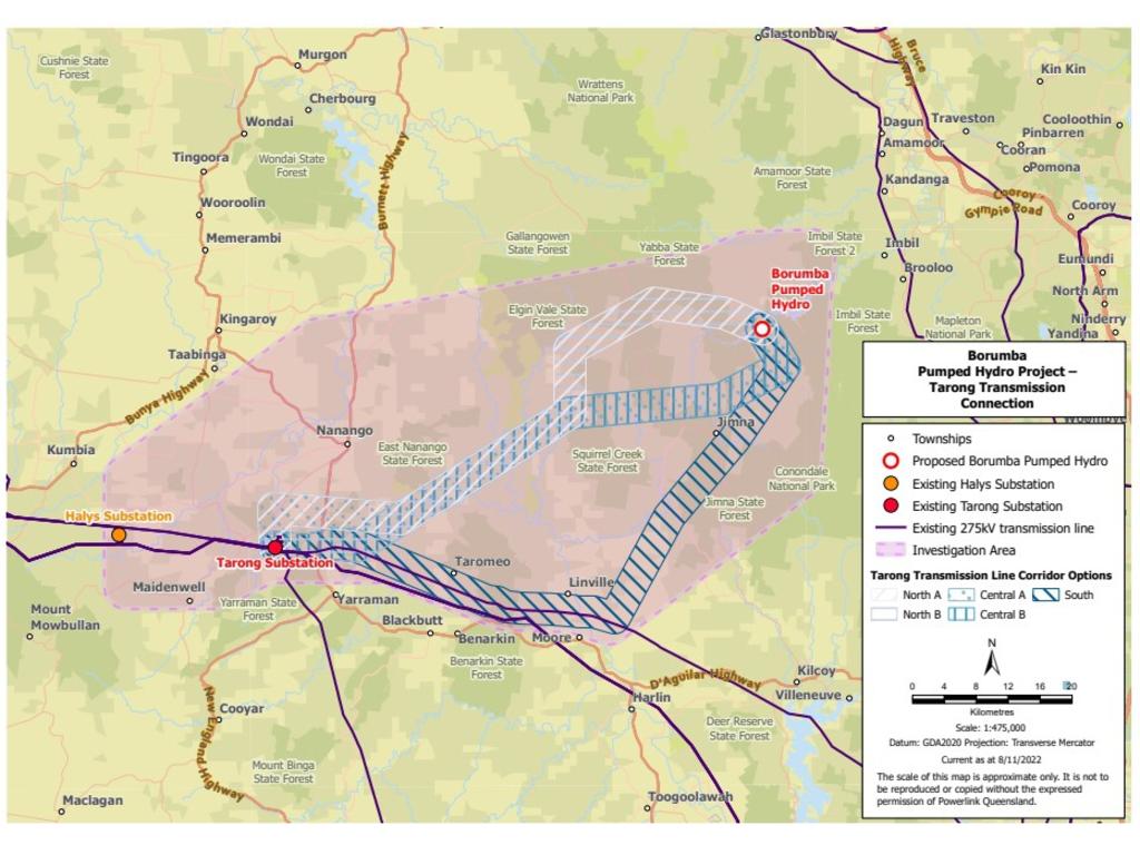
From the dam to Tarong the routes vary between 75km and 88km, with the southern route co-located to 44km of existing transmission lines. This route would run south to Jimna, skirting the western side of Jimna State Forest, down to Linville, Taromeo, until connecting at the Tarong substation.
The central and northern route would either run south of Yabba or Elgin Vale State Forest, or north of Jimna and Squirrel Creek State Forest. Both would meet up and run south of East Nanango State Forest until coming to connect at Tarong substation.
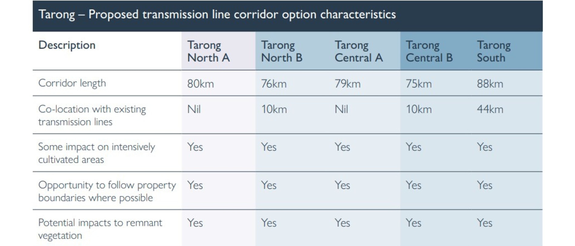
From the dam to Halys substation the routes would vary between 97km and 117km in length and could follow any of the aforementioned routes. Each option has the opportunity to be co-located with existing transmission lines for 1km up to 53km.
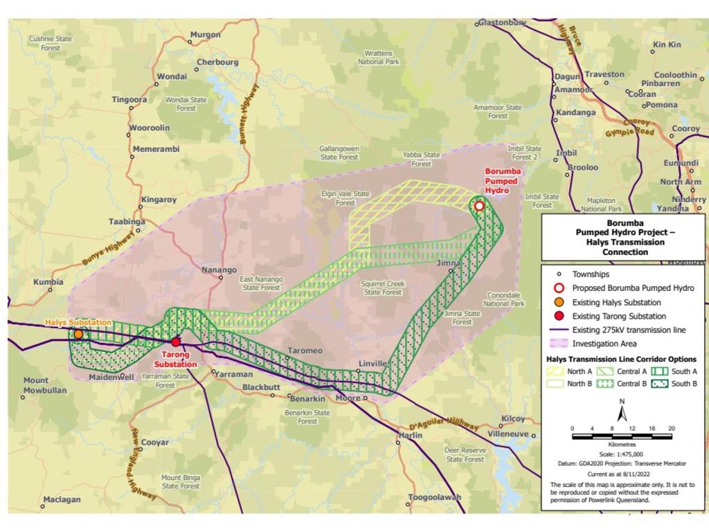
All of the proposed routes have the opportunity to follow property boundaries where possible, however, all would have some impact on intensively cultivated areas with potential impacts to remnant vegetation.
At the moment corridors 4km in width have been identified. When one corridor has been selected this will gradually be refined to a 70m wide easement composing the final alignment. See the map for more exact details.

What if your land is on a corridor?
Powerlink is looking at acquiring access to either a 60m or 70m wide easement along a chosen route, clearing the land for either towers or lines, building the towers, connecting the lines between the towers, and maintaining the lines over time.
Easements allow legal access to Powerlink to access the land to build, operate and maintain the transmission network, while the landholder retains ownership and responsibility for the land.
Landholders are entitled to compensation for any easements required over their property - see here for more detailed information from Powerlink.
Land underneath the transmission lines can be used for some activities, see information from Powerlink here.
If you have concerns over electric and magnetic fields from transmission lines, see more information from Powerlink here.
How long is the consultation process?
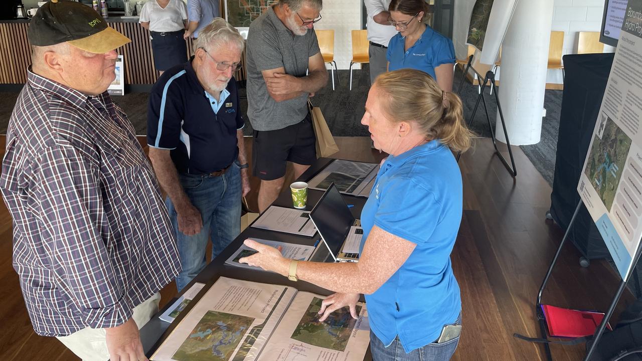
Powerlink is consulting with potentially impacted communities and landowners to come up with one draft corridor selection for Borumba Dam to Woolooga, and one draft corridor to either Tarong or Halys.
Submissions and feedback are open to Powerlink until March 31, 2023, and they will announce the draft corridor selection on April 27, 2023.
In May, another round of consultations with stakeholders, landholders and the community for the selected corridor will happen before another report is submitted mid-year 2023.
Consultations are expected to continue with the community and stakeholders until mid-2024.
More Coverage
Originally published as Powerlink transmission lines in Gympie and Burnett explained

Minute’s silence for Speedway veteran, teen after tragic losses
Just days after a hearse carrying a coffin draped in a checkered flag honoured a 53-year-old speedway legend, he and a teen racer, who also tragically died of cancer, are being remembered at a regional race meet. VIDEO, TRIBUTES.

‘One of a kind’ father, business owner remembered after death
Tributes are flowing for a “joyful” Sunshine Coast father of two and business owner after his sudden death left loved ones heartbroken.
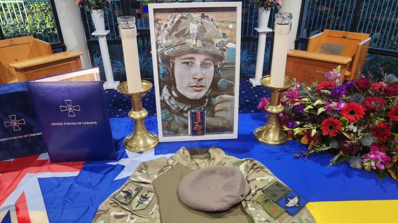
‘Went out like a hero’: Despair as family farewells Aussie soldier killed in hellish conflict
A Queensland family has been left ‘with no words’ to describe how much they will miss a young soldier who was killed fighting in the Ukraine.

Bruce Hwy fire: Delays expected after bread truck bursts into flames
Delays are expected on the Bruce Highway north of Gympie as crews work to retrieve a bread truck trailer which caught fire near a school early Saturday.
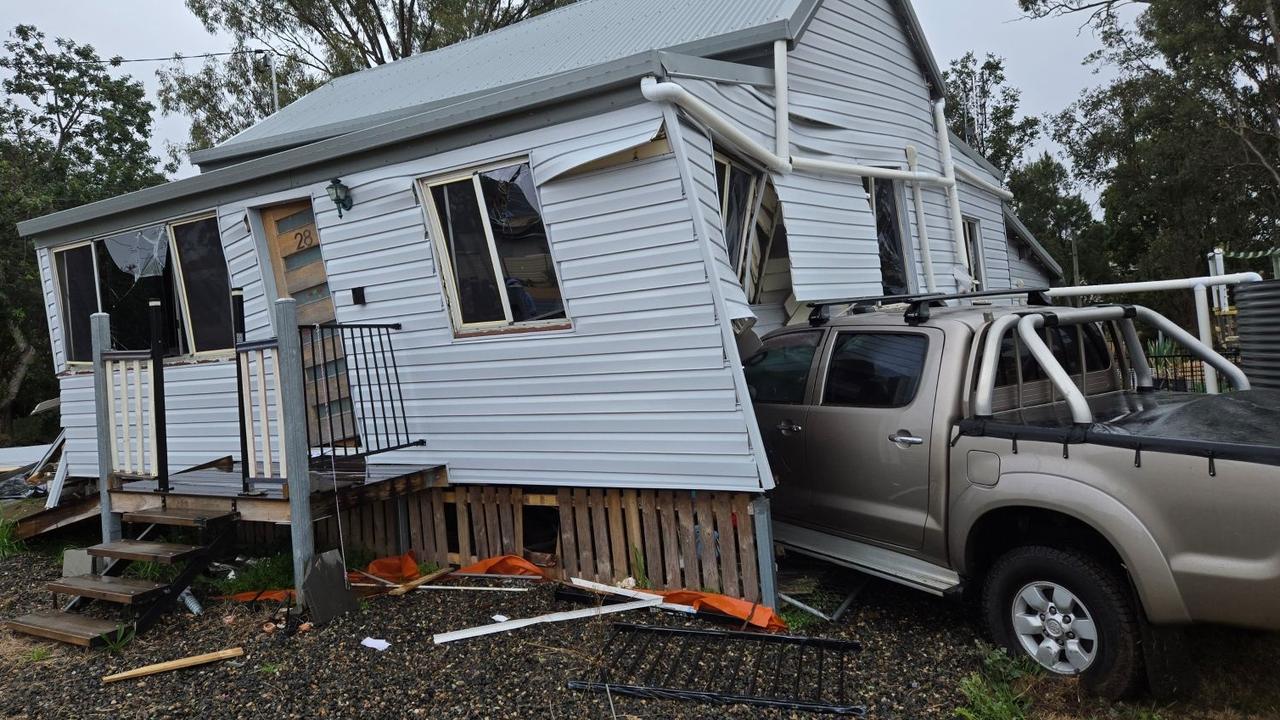
WATCH: Crash destroys historic Qld home, leaving family in crisis
A historic Queensland home has been declared uninhabitable after an uninsured driver crashed into it while the homeowner was inside with his two dogs. Watch the video.

From nightmare to joy: Yoda found safe a week after car crash
After a car crash near Murgon caused their beloved dog Yoda to flee into the wilderness, a family’s desperate week-long search which captured the community’s hearts has ended with a joyful reunion.