
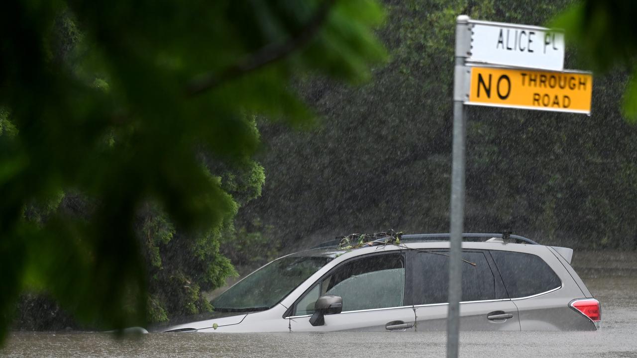
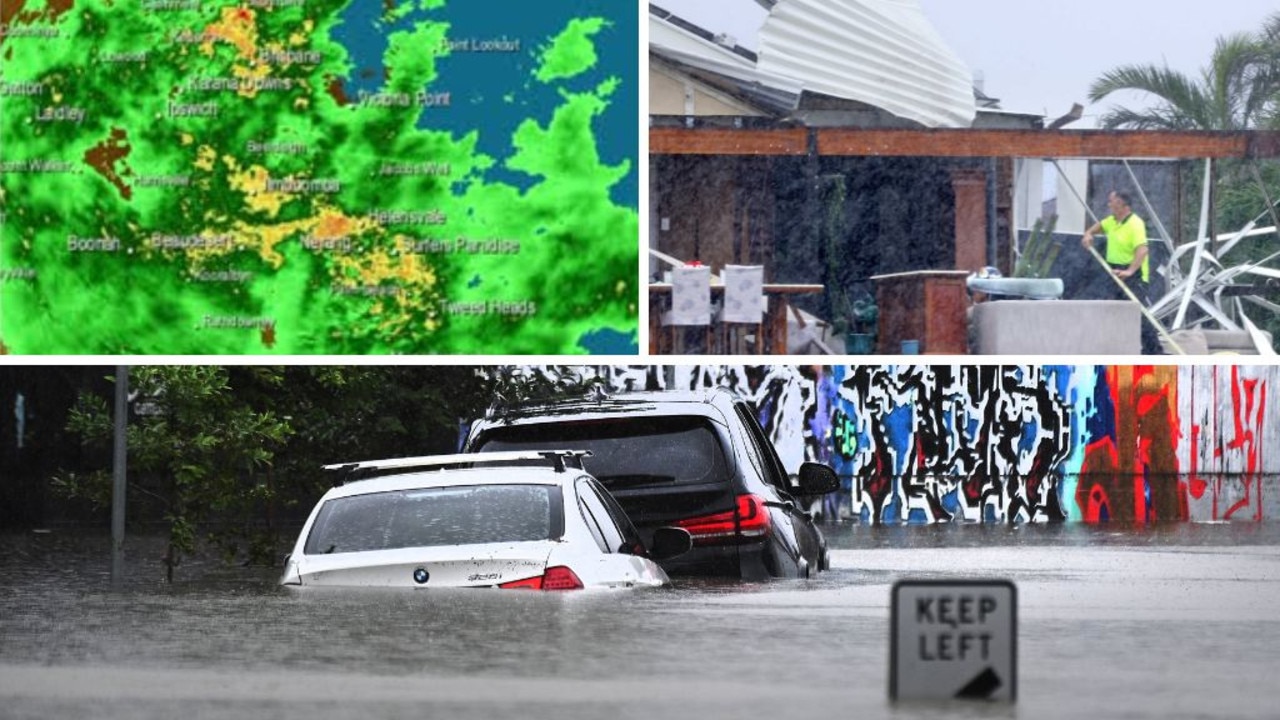
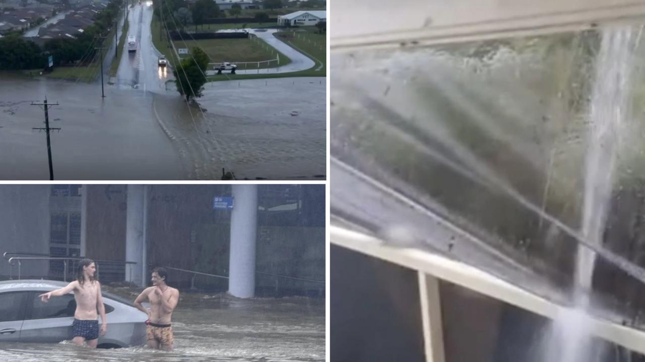
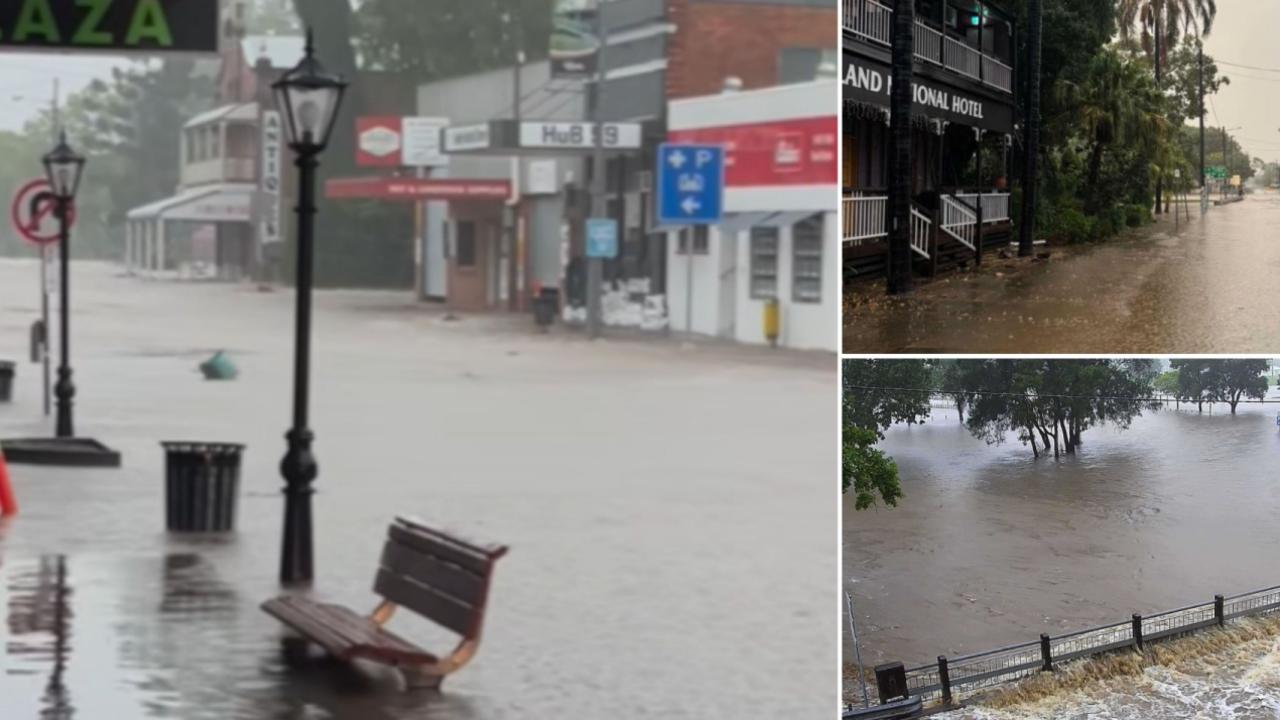
Every Brisbane, Gold Coast, Sunshine Coast road closed by flooding
Dozens of roads across South East Queensland are closed after torrential rain in the aftermath of ex-Tropcial Cyclone Alfred. Here is the full list.
QLD News
Don't miss out on the headlines from QLD News. Followed categories will be added to My News.
Dozens of roads are closed across South East Queensland today due to flooding in the aftermath of ex-Tropical Cyclone Alfred.
We’ve compiled a full list:
RED ALERT
- Toowoomba Connection Road, Toowoomba City - Multiple traffic signal outages occurring around Darling Downs due to EX-TC Alfred
- Pacific Motorway, Macgregor - Multiple road closures & traffic signal outages occurring in South East Queensland due to TC Alfred
- Bruce Highway, Narangba - Powerlines down across numerous Moreton Bay City areas impacting multiple traffic signals
AREA ALERT
- Nambour Connection Road, Nambour (All Nambour Area) - Debris on Road
- Mt Glorious Road, Dundas - Road closed due to flooding, land slips, fallen vegetation from Mount Nebo to Wivenhoe Somerset Road
FLASH FLOODING
- Gold Coast Springbrook Road, Mudgeeraba (Mudgeeraba Creek Causeway)
- Rosewood Laidley Road, Lanefield (Intersection flooded)
- Pacific Motorway, Mudgeeraba/Robina (Exit 80 off-ramp closed)
- Nudgee Road, Nudgee/Nudgee Beach (Between Golf Course & Nudgee Beach)
- Albany Creek Road, Albany Creek (Dual bridges at Albany Creek)
- Beaudesert Beenleigh Road, Luscombe/Wolffdene (Luscombe Bridge)
- Beaudesert Boonah Road, Bromelton/Beaudesert/Roadvale (Intersection of Ipswich Boonah Rd & Mount Lindsay Hwy)
- Bowen Bridge Road, Bowen Hills/Windsor (Between Northey St & Campbell St)
- Paradise Road, Willawong (Oxley Creek)
- Peachester Road, Beerwah (Near Old Gympie Road)
- Granard Road, Rocklea (After Beaudesert Road)
- Oxley Road, Oxley (At Oxley Creek)
- Dohles Rocks Road Off Ramp, Murrumba Downs
- Robina Parkway, Clear Island Waters/Merrimac/Robina
- Pimpama Jacobs Well Road, Pimpama
- Rickertt Road, Ransome/Wakerley (Closed between Green Camp Rd & Chelsea Rd)
- Wynnum Road, Tingalpa (Closed between Murarrie Road & Boundary Road)
- Bowen Bridge Road, Herston (Airport Link On Ramp)
- Camp Cable Road, Jimboomba (Mount Lindesay Highway)
- Boonah Rathdowney Road, Boonah (Near Dugndan Park)
- Yandina Bli Bli Road, Yandina (Near Caboolture & Ferntree Creeks)
- Waterford Tamborine Road, Logan Village/Waterford (Between Easterly St Waterford & Quinzeh Creek Rd Logan Village)
- Macquarie Street, Boonah
- West James Road, Rocksberg (Lower Crossing & Middle Crossing)
- Brisbane Street & Telemon Street, Beaudesert
- Litherland Road, Upper Caboolture
- Whiteside Road, Whiteside (At Patman Road)
- Moorina Road, Narangba (At Burpengary Creek)
- Richards Court, Bellmere
- Wade Road, Bellmere
- Caboolture River Road, Rocksberg (Zillmans Crossing, Cockies Crossing, Five Pound Crossing)
- McNamara Road, Rocksberg (Eliza Crossing)
- Riverview Street, Caboolture (At Bowls Club entrance to Centenary Lakes)
- Caboolture River Road, Lilywood (At Caboolture River Road)
- Best Road, Rocksberg (At Keillors Crossing)
- Murphy Road, Aspley (At Gympie Road)
- Torwood Street, Auchenflower (At Vincent St)
- Beck Street, Paddington (South of Ellena St)
- Cove Road, Stanmore (Between Dunning Lane & Millwood Road, at Kilcoy-Beerwah Road, at Old Cove Road)
- Visentin Road, Morayfield (Near Underpass Road)
- Morayfield Road, Caboolture (Morayfield Entrance to Rugby League Entrance)
- King Street, Caboolture
- William Berry Drive, Morayfield
- Cove Road, Commissioners Flat (At Commissioners Flat)
- Tallebudgera Connection Road, Tallebudgera/Tallebudgera Valley (Near Andrews Road & Gray Street intersection)
- Third Avenue, Marsden
- Chadwick Road, Golf Links Drive, Spencer Street, Gatton (Water over road)
- King Street, Woody Point
- Gold Coast Springbrook Road, Mudgeeraba (Mudgeeraba Creek)
- Ipswich Road & Shettleston Street, Rocklea (From Ipswich Mwy off-ramp)
- Mundoolun Connection Road, Tamborine (Near Biddaddaba Road)
- Tamborine Mountain Road, Tamborine (Near Bearded Dragon Hotel)
- Van De Weyer Road & Whiteway Road, Forest Hill/Laidley Heights (Water Over Road - Observe Signage)
- Commissioners Flat Road, Commissioners Flat (At Stanley River)
- Lobb Street, Churchill (ROAD & BRIDGE CLOSED due to flooding at Deebing Creek Crossings)
- Gladys Street, Greenslopes (Between Constance Street & Laura Street)
- Doyle Road, Stanmore (Near Cedarton Drive)
- Maryvale Road, Mango Hill
- Logan Motorway, Berrinba (Demeio Road, Berrinba - FRSWS)
- Advancetown Mudgeeraba Road, Gilston (Near Bridge Creek)
- Smith Street, Parkwood (Opposite Precision Drive on and off-ramps)
- Kinsellas Road West, Mango Hill
- Silcock Street, Clontarf
- Humpybong Esplanade, Redcliffe
- Rocky Gully Road, Coominya
- Massie Bony Mountain Road, Massie
- Whiteway Road, Forest Hill (Road Closed - Water Over Road)
- Beerburrum Road, Elimbah
- Golf Course Road, Woodford
- Richards Road, Samford Valley
- Mt Lindesay Highway, Jimboomba (Between Camp Cable Road & Tamborine Street - Contraflow in place)
- Birmingham Road, Carrara (Between Nielsens Road & Nerang Broadbeach Road)
- Hunt Street & Railway Street, Forest Hill (Road Closed - Water Over Road)
- Arshad Drive, Berrinba
- Anita Street & Cleveland - Redland Bay Road, Redland Bay/Victoria Point (Flooding due to Tropical Cyclone Alfred)
- Ipswich Rosewood Road & School Street, Amberley/Rosewood (Road Closed Due to Flooding)
- Burnham Street, Forest Hill (Road Closed - Water Over Road)
- Mundoolun Connection Road, Tamborine
- Boundary Street, Beenleigh
- Paradise Road & Springfield Crescent, Daisy Hill/Slacks Creek
- Rosewood Warrill View Road, Rosewood (Water Over Road - Brimblecombs Crossing)
- Grandchester Mount Mort Road, Grandchester (Water Over Road - McFarland Bridge)
- Whitehouse Road, Laidley Heights (Road Closed - Water Over Road)
- Forest Hill Blenheim Road, Glen Cairn (Water Over Road - Observe Signage)
- Church Street & Victoria Street, Forest Hill (Road Closed - Water Over Road)
- Gill Street & Robert Street, Forest Hill (Road Closed - Water Over Road)
- Karrabin Rosewood Road, Walloon (Water Over Road - Guilfoyles Gully)
- State Route 47, Redland Bay (Roads flooded with heavy rain)
- Duncan Road, Sheldon (Roads flooded with heavy rain)
- Bergins Hill Road, Brisbane Road, Tibbits Street, Bundamba (Road Closed Due to Flooding)
- Ipswich Rosewood Road & Keanes Road, Ebenezer (Bridge Closed Due to Flooding)
- Gatton Laidley Road West & Old Laidley Forest Hill Road, Forest Hill (Road Closed - Water Over Road)
- Rosewood Warrill View Road, Ebenezer (Bridge Closed Due to Flooding - Spressers Bridge)
- Haigslea Amberley Road & Hodgsons Road, Amberley/Walloon (Road Closed Due to Flooding)
- Ipswich Rosewood Road, Jeebropilly (Bridge Closed Due to Flooding - 7 Mile Bridge)
- Gatton Esk Road, Adare (Water Over Road)
- Poppy Lane, Robina (Between Cheltenham Drive & Poppy Lane)
- Brimblecombe Street & Victoria Street, Forest Hill (Road Closed - Water Over Road)
- Dyer Street & Gill Street, Forest Hill (Road Closed - Water Over Road)
- Church Street & William Street, Forest Hill (Road Closed - Water Over Road)
- Suscatand Street, Rocklea (EXIT 23 closed from Ipswich Mwy)
- Otto Road, Glenore Grove (Road closed)
- Buaraba Creek Road, Buaraba
- Winwill Connection Road, Lower Tenthill/Winwill (Water Over Road - Road Closed)
- Cunningham Street & Esplanade, Torquay
- Albert Street & Smiths Road, Goodna (Water Over Road)
- Watsons Road, South Ripley (Water Over Road)
- Weier Road & Woolshed Creek Road, Hatton Vale/Plainland (Water Over Road)
- Albert Street, Goodna (Road Closed Due to Flooding)
- Grandchester Mount Mort Road & Railway Street, Grandchester (Road Closed Due to Flooding)
- George Street, Ipswich Road, Ipswich Street, Railway Street, Rosewood Laidley Road, Grandchester (Road Closed Due to Flooding)
- Railway Street, Grandchester (Stokes Road Closed Due to Flooding)
- Drayton Street, Laidley (Water Over Road)
- Coates Street & Leonard Street, Laidley (Water Over Road)
- Rosewood Warrill View Road, Rosewood (Road Closed Due to Flooding)
- Myuna Place, Petrie (At North Pine River)
- Ambrose Street & Spicer Street, Laidley (Road Closed - Water Over Road)
- Thomas Street, Laidley (Road Closed - Water Over Road)
- Old Cove Road, Woodford (At Blackrock Creek)
- Buckingham Road, Delaneys Creek (Near Mount Mee Road)
- Stratton Road, Mount Pleasant (At Mount Brisbane Road)
- McCabe Road, Stanmore (At Cove Road)
- Donaldson Road, Rocklea (Near Dunn Street)
- Gardner Road, Rochedale (Between landfill & quarry)
- Stanley Road, Carina (Closed between Robbies Ave & Creek Road)
- Pacific Motorway, Daisy Hill (Left & Centre Lanes between Loganlea Rd & Paradise Rd)
- Eagle Street, Brisbane City (At Creek & Charlotte St)
- State Route 20 (Fursden Road), Carina (At Fursden Rd)
- Norris Road, Fitzgibbon (Between Telegraph Rd & Tasman Blvd)
- Muriel Avenue, Moorooka (From Fairfield Rd to Ipswich Rd)
- Newmarket Road, Wilston (Diversions in place)
- Lincoln Street, Stones Corner (At Regina St)
- Gailey Road, Saint Lucia (One meter deep floods)
- Fursden Road, Cannon Hill/Carina (Between Wood Ave & Ellen St)
- Welches Road, Wongawallan
- Fairfield Road, Yeronga (Prior to Hyde Road)
- Fingerboard Road, Dayboro (Near Lyndhurst Road)
- Bowman Parade, Bardon (At Ithaca Creek between Cecil Rd & Stephenson St)
- Winstanley Street, Carindale (Closed between Surbiton Crt & Firmiston St)
- Fernvale Road, Tarragindi (Diversions in place)
- Widdop Street, Hendra/Nundah (Closed)
- Ipswich Road, Woolloongabba (After Burke St)
- Levitt Road, Upper Kedron (At Cedar Creek)
- Grandview Road, Pullenvale (Between Lancing St & Pullenvale Rd)
- Lancing Street, Pullenvale (Between Grandview Rd & O’Brien Rd)
- King Avenue, Durack (Between Oleander Crescent & Treeline Place)
- Eggersdorf Road, Norwell
- Ruffles Road, Willow Vale
- Pine Mountain Road, Carina Heights / Holland Park (Between Wyncroft St & Cutuli St)
- State Route 26 (Roghan Road), Boondall (At Roghan Road)
- Sir Samuel Griffith Drive, Bardon / Toowong
- Wellington Road, Woolloongabba (At Logan Rd)
- Macpherson Road, Stapylton / Yatala
- Robina Town Centre Drive, Robina
- Blunder Road, Oxley (At Boundary Road)
- Gardner Road, Rochedale (After Mount Gravatt-Capalaba Rd)
- Boscombe Road, Brookfield (Between Brookfield Rd & Rafting Ground Rd)
- Gap Creek Road, Kenmore Hills (At Gap Creek)
- Illaweena Street, Drewvale / Stretton (Between Gowan Rd & Hashim Place at Karawatha Reserve)
- Billan Street & Wood Avenue, Carina (Gray St between Creek Rd & Wood Ave)
- Stanbrough Road, Gumdale (Between Ermelo Rd & Formosa Rd)
- Birdwood Road, Holland Park West (At Esher St)
- Siganto Drive, Helensvale (South of Grey Gum Street)
- Lytton Road, Murarrie (Left lane between the on & off-ramps)
- Vince Hinde Drive, Worongary
- Burnside Road, Gilberton
- Green Terrace, Northey Street, Swan Terrace & Victoria Street, Windsor (Flooded at intersection)
- Heritage Drive, Mount Nathan (South of Beaudesert Nerang Rd)
- Petsch Creek Road, Tallebudgera Valley
- Gunsynd Drive, Mudgeeraba (Between Todman Dr & Appaloosa Ct)
- Nielsens Road, Carrara (Between Nerang Broadbeach Road & Hickey Way)
- Goldmine Road, Ormeau
- Cuthbert Drive, Ormeau / Yatala
- Main Avenue, Coorparoo / Woolloongabba (Between Deshon St & Ninth Ave)
- Dalton Road, Tallebudgera Valley
- Bennett Road, The Gap (Enoggera Creek)
- Hotham Creek Road, Willow Vale (Between Fern Hill Dr & Rosemount Dr)
- Centenary Motorway, Kenmore (Left Lane after Kenmore Rd overpass)
- Sir Fred Schonell Drive, Saint Lucia (At Coldridge St)
- Brookfield Road, Brookfield (At Moggill Creek)
- Rosewood Laidley Road, Grandchester (At Stokes Rd)
- Mount Glorious Road, Samford Valley (Near Mount O’Reilly Road)
- Mount Glorious Road, Dundas / Mount Glorious (Between Wivenhoe Somerset Road & Alex Road due to flooding Northbrook Creek)
- Gympie Road, Kedron (At Wallin St)
- Wacol Station Road, Wacol (Wilruna St)
- Wynyard Street, Cleveland (Flooding due to Tropical Cyclone Alfred)
- Bicentennial Bikeway, Brisbane City (At North Quay Ferry Terminal)
- Strong Road, Rush Creek (At Terrors Creek)
- Glover Road, Armstrong Creek (At Juffs Road West)
- Walker Lane, Woodford (Near Kropp Road)
- Kobble Creek Road, Kobble Creek (At Pringles Road)
- Lees Crossing Road, Dayboro
- Ripley Road, Lyons / South Ripley (Water over road in various spots)
- Neurum Road, Woodford (Near Walker Lane)
- Curtis Road, Cedar Creek
- Hansen Road, Yugar (At Cedar Creek)
- Williams Street, Dayboro (Behind Dayboro Town Hall)
- William Street, Laidley (Road Closed - Water Over Road - Intersection)
- Cedar Creek Road, Cedar Creek (At Masseys Creek Court)
- Temporarily Closed Road, Woodford (At Webb Road)
- Cedar Creek Road, Cedar Creek (At Halls Road)
- Neurum Road, Woodford (At Monkeybong Creek)
- Gordons Road, Cedar Creek (At Upper Crossing)
- Gordons Road, Closeburn (At Lower Crossing)
- Bucca Crossing Road, Bucca (Bucca Crossing Closed Due to Flooding)
- Mt Alford Road, Frenches Creek (Harpers Road Bridge)
- Ziviani Road, Wamuran (Near Number 18)
- Ski Road, Kurwongbah (At Scout Road)
- Lowood Minden Road, Minden
- R Williams Road, Wamuran (Near D’Aguilar Highway)
- Sherwood Road, Sherwood (Over Oxley Creek)
- Ironbark Drive, Woodford (Near Fiddlewood Court)
- Kropp Road, Woodford (At Yates Road)
- Basin Road, Wamuran Basin (At Basin Road)
- Gill Street, Forest Hill (Road Closed - Water Over Road)
- North Branch Road, Goomburra
- Clintonvale Goomburra Road, Gladfield
- Condamine River Road, Killarney / The Head
- Tamborine Mountain Road, Witheren (Road support washed away in one section of the Goat Track)
- Beatty Road, Acacia Ridge (Beatty Rd over Oxley Creek)
- Basin Road, Wamuran Basin (At R Sampson Road)
- Neurum Road, Mount Archer / Neurum
- Gregory Highway, Hibernia (Road Closed Due to Flooding)
- Old Gympie Road, Elimbah (At Six Mile Creek)
- Malibu Road, Lawnton (At Todds Gully)
- Forbes Road, Kurwongbah (At Sideling Creek)
- Glamorgan Vale Road, Glamorgan Vale
- Lower Tenthill Road, Lower Tenthill (Water Over Road - Frankie Steinhardt Bridge - Observe Signage)
- Bells Pocket Road, Lawnton
- Kipper Creek Road, Dundas
- Boundary Street, Beenleigh (Near Chris Green Park)
- Banks England Creek Road, Banks Creek
- Banks Creek Road, Fernvale
- Browns Creek Road, Kurwongbah
- Moore Road, Kurwongbah
- Mumford Road, Narangba (At Browns Road)
- Station Road, Lawnton (From Gympie Road to Railway)
- Fairway Drive, Kensington Grove (Water Over Road)
- Challenge Avenue, Kensington Grove (Water Over Road)
- West James Road, Rocksberg (At Upper Crossing)
- Courts Lane, Mount Pleasant
- McNamara Road, Rocksberg (At Browns Crossing)
- Laceys Creek Road, Laceys Creek (At Laceys Creek Road)
- Wirth Road, Laceys Creek (At May Road)
- Stockleigh Road, Logan Village
- Laceys Creek Road, Laceys Creek (At Worths Crossing)
- Rasmussen Road, Mount Archer
- Baker Road, Laceys Creek (At Laceys Creek)
- Winn Road, Mount Samson (At Andrew Road)
- Costelloe Road, Laceys Creek (Near Costelloe Road)
- Juffs Road West, Dayboro
- Brady Street, Dayboro (Near Royston Street)
- Dongarven Drive, Eagleby
- Mott Street, Strathpine
- Pringles Road, Kobble Creek (At gravel road section)
- Leitchs Road, Brendale (At Leitchs Road)
- Goodrich Road East, Griffin (At entry to on-ramp to highway)
- Fingerboard Road, King Scrub
- Ramu Street, Eagleby
- Strain Road, Laceys Creek
- Dales Road, Kobble Creek
- Wights Mountain Road, Wights Mountain (Near Wights Mountain Road)
- Malin Court, Eagleby
- Williams Road, Moodlu (At Lagoon Creek)
- Dewhurts Road, Mount Delaney
- Whiteside Road, Whiteside (From 55 to 73)
- Whittington Road, Moodlu
- Hansen Road, Yugar (Past Jennifer Close)
- Ryder Road, Highvale (At Blue Gum Court)
- Dawson Creek Road, Highvale (Near number 187)
- Browns Road, Kurwongbah (Near McCormack Road)
- Cobalt Street & Mica Street, Carole Park (Water Over Road - Mica Street between Argon Street & Cobalt Street)
- Adare Road, Vinegar Hill (Water Over Road)
- Harm Drive, Glenore Grove (Water Over Road - Road Closed)
- Barbara Street, Camira (ROAD CLOSED DUE TO FLOODING - Cochrane Street closed)
- Addison Road, Camira (ROAD CLOSED DUE TO FLOODING)
- Jordan Street & Short Street, Laidley (Water Over Road)
- Patrick Street, Laidley (Road Closed)
- Ambrose Street, Laidley (Road Closed)
- Young Road, Narangba (Near Harris Ave)
- Coopers Road, Willowbank (WATER OVER ROAD)
- Market Place Drive, Beenleigh
- Bertha Street, Mill Street, Queen Street, Goodna (ROAD CLOSED DUE TO FLOODING - Mill Street between Queen Street & Bertha Street)
- Ebenezer Road, Ebenezer (WATER OVER ROAD - Near Mount Forbes Road intersection)
- Reinke Road & Stevens Road, Ashwell / Lanefield (ROAD CLOSED DUE TO FLOODING)
- McGearys Road, Thagoona (ROAD CLOSED DUE TO FLOODING)
- Blackwall Road, Brodzig Road, Coal Road, Francis Street, Robin Street, Chuwar / North Ipswich / Tivoli (ROAD CLOSED DUE TO FLOODING)
- Ebenezer Road, Rosewood (ROAD CLOSED DUE TO FLOODING - At intersection of Rosewood Warrill View Road)
- Savanah Court, Elimbah (North of Emu Road)
- Kassandra Court, Narangba (At Little Burpengary Creek)
- Hospital Road, Matthew Street, Mill Street, Rosewood Thagoona Road, Rosewood (ROAD CLOSED DUE TO FLOODING)
- Adelong Avenue, Thagoona (ROAD CLOSED DUE TO FLOODING - Kavanagh Rd E, Walloon)
- Williams Road, Elimbah
- Robertson Road & South Station Road, Raceview / Silkstone (ROAD CLOSED DUE TO FLOODING)
- Freya Street & Penfolds Road, Murphys Creek (Water Over Road)
- Fryar Road, Logan Village
- Mountain Road & Paroz Road, Laidley / Laidley North (Water Over Road)
- Delaney Creek Road, Delaneys Creek (At Delaneys Creek)
- Creek Street & Gledson Street, Bundamba / North Booval (ROAD CLOSED DUE TO FLOODING)
- Rosewood Laidley Road, Calvert (ROAD CLOSED DUE TO FLOODING - East of Bunney Road)
- Creek Street & Thomas Street, Blackstone / Silkstone (BRIDGE CLOSED DUE TO FLOODING - Jones-Phillips Bridge at Bundamba Creek Crossing)
- Gatton Esk Road & Orchard Road, Adare (Road Closed - Water Over Road)
- Glendene Road, Forest Hill (Road Closed - Water Over Road)
- Meakin Road, Slacks Creek
- Goodna Road, Greenbank
- Brisbane Road & Macartney Street, Booval (ROAD CLOSED DUE TO FLOODING - Vowles St, Booval)
- Stony Creek Road, Stony Creek (At Stony Creek)
- Brisbane Road & Ross Llewellyn Drive, Booval (ROAD CLOSED DUE TO FLOODING)
- Chermside Road, Mango Hill (Between John Street & Kinsellas Road West)
- Coolabah Court & Napier Street, Laidley (Water Over Road)
- Louisa Street & Queen Street, Marburg (ROAD CLOSED DUE TO FLOODING)
- Telegraph Road, Bracken Ridge / Fitzgibbon (Closed westbound - Sewerage running through flood water)
- Sturgeon Street, Ormiston (Roads flooded with heavy rain)
- Hamilton Street, Redland Bay (Roads flooded with heavy rain - Broadwater & Hamilton Intersection)
- Bunker Road, Victoria Point (Double Jump and Heinemann Road intersection - Roads flooded with heavy rain)
- Sippel Road, Blenheim (Road Closed - Water over Road)
- Bunker Road, Victoria Point (Roads flooded with heavy rain)
- Bishop Street, Kelvin Grove (Bishop Rd closed from #81 to end of street north)
- Hemp Hill Road, Russell Island (Roads flooded with heavy rain)
- Rachow Street, Thornlands (Roads flooded with heavy rain)
- Munro Street & Walcott Street, Saint Lucia (Coldridge St closed from Monroe St, 236m into Coldridge St)
- Centre Road, Russell Island (Roads flooded with heavy rain)
- Denison Court, Capalaba (Roads flooded with heavy rain)
- Smallwood Court, Samford Valley (Flood Damaged Road)
- Allan Day Drive, Wellington Point (Roads flooded with heavy rain)
- Pitt Street, Redland Bay (Roads flooded with heavy rain)
- Balham Road & Beatty Road, Archerfield (Corner of Beatty Rd to Balham Rd)
- Lovers Lane, Pine Mountain (ROAD CLOSED DUE TO FLOODING)
- Brewer Street, Capalaba (Road cut off - flooded)
- Rosewood Laidley Road, Grandchester (WATER OVER ROAD)
- Crowley Vale Road, Gunn Court, Lake Clarendon Road, Lake Clarendon (Water Over Road)
- Avalon Road, Sheldon (Roads flooded with heavy rain)
- Mary Street, Birkdale (Roads flooded with heavy rain)
- Agnes Street, Birkdale (Roads flooded with heavy rain)
- State Route 55, Birkdale (Roads flooded with heavy rain)
- Redgrove Avenue, Wellington Point (Tulloch and Redgrove - Road flooded with heavy rains)
- Burns Street, Capalaba (Burns and School Road flooded over)
- Cusack Lane, Jimboomba
- Stoney Camp Road, Park Ridge South
- Whitehall Avenue, Birkdale (Road flooded, seek alternative route)
- Mossip Court, Wellington Point (Water over road)
- Kurrajong Road, Jimboomba
- Olley Street, New Beith
- Ipswich Boonah Road & Purga School Road, Purga (ROAD CLOSED DUE TO FLOODING - Purga Creek Crossing)
- Edinburgh Castle Road & Fourteenth Avenue, Kedron / Wavell Heights (Flooding and water over road)
- Blue Pacific Road, Deception Bay (Near Little Burpengary Creek)
- Third Avenue, Marsden
- Redbank Plains Road, Redbank Plains (ROAD CLOSED DUE TO FLOODING - Storey Street - Sams Reserve)
- Logan Reserve Road, Logan Reserve
- Lansbury Parade & Tennis Avenue, Ashgrove (Road closed at intersection of Woodland St, Lansbury Pde, Warmington Avenue & Tennis Avenue)
- Noble Street & Widdop Street, Clayfield (Water over road)
- Franz Road & Gellibrand Street, Widdop Street, Clayfield (Gellibrand St closed from Franz St - Widdop St)
- Grandchester Mount Mort Road, Grandchester (ROAD CLOSED DUE TO FLOODING)
- Bittenbinder Avenue, Logan Reserve
- Old Laidley Forest Hill Road, Forest Hill / Laidley North (Road Closed - Water Over Road)
- Woodlands Road, Blenheim (Road Closed - Water Over Road)
- Mulgowie Road & Mulgowie Townson Road, Townson (Road Closed - Water Over Road - Near Crosby Park)
- Chambers Flat Road, Logan Reserve (School Road, Logan Reserve - FRSWS)
- Bergins Hill Road, Bundamba (ROAD CLOSED DUE TO FLOODING - Barclay Street)
- Taylor Street, Pialba (Flash Flooding)
- Kingsford Smith Drive, Hamilton (Closed from Cooksley St - Toorak St)
- Church Street & Woogaroo Street, Goodna (ROAD CLOSED DUE TO FLOODING - Northbound lane closed under railway bridge)
- Lance Road, North MacLean
- Mollenhagen Road, Stockleigh
- Black Duck Creek Road & East Haldon Road, Junction View (Road Closed - Water Over Road)
- Kurrajong Street & Treeline Place, Durack (Water over road)
- Cedar Pocket Road, Cedar Grove
- Millstream Road, Jimboomba
- Wyatt Road, Kagaru
- Easterly Street, Waterford
- Main Street, Pialba (Flash Flooding)
- Mount Berryman Road, Mount Berryman (Water Over Road)
- Storr Street, Laidley (Water Over Road)
- Glenrosa Road & Plant Street, Ashgrove / Red Hill (Glenrosa Rd closed from Todd St to Praed St)
- Perrins Road, Ashwell (Water Over Road)
- German Church Road, Carbrook
- Holmview Road, Holmview
- Shailer Road, Daisy Hill
- Stern Road, Carbrook
- Schmidt Road, Eagleby
- Schneider Road, Waterford
- Breadsell Street & Cadogan Street, Carindale (Water over road)
- Drayton Street, Laidley (Water Over Road - Observe Signage)
- Cooper Street & Edward Street, Laidley (Water Over Road - Observe Signage)
- Edward Street, Laidley (Road Closed - Water Over Road)
- Moss Road, Camira (Water Over Road - Corner of Moss Road and Amulla Court)
- Berry Street, Churchill (Water Over Road - Corner of Wegener Street)
- Junction Road, Karalee (WATER OVER ROAD - Junction Road at Elanora Way)
- Gladstone Street, Coorparoo (At No. 43)
- Queens Parade, Brighton (Road closed - Water Over Road at Townsend Street)
- George Street, Beenleigh
- Riddings Street, Coorparoo (At the intersection)
- Chambers Flat Road, Chambers Flat (FRSWS)
- Devon Drive & Warwick Court, Bellbird Park (ROAD CLOSED DUE TO FLOODING)
- Fern Street & Junction Street, Greenslopes / Woolloongabba (At 12 Junction St)
- Kokoda Street, Beenleigh (FRSWS)
- Jones Road & Katandra Crescent, Bellbird Park (Water Over Road)
- Belafonte Street & Trouts Road, McDowall (Road flooded - Road closed signs at Marx St & Nicholas)
- Church Street, Goodna (Water Over Road)
- Quilton Place, Crestmead (Flooded at 22 Quilton Pl)
- Pinjarra Road, Pinjarra Hills (Closed from Moggill Rd to 338 Pinjarra Rd)
- Albert Street, Audrey Street, Smiths Road, Goodna (WATER OVER ROAD)
- Albion Street & Hampton Street, East Brisbane / Woolloongabba (Closed)
- Nudgee Road & Raubers Road, Banyo / Nudgee (Nudgee Rd closed from Raubers Rd to Tufnell Rd)
- Flower Street, Woolloongabba (Closed)
- Cambogan Road, Waterford
- Kangaroo Gully Road & Sugars Road, Anstead / Bellbowrie (Sugars Rd closed)
- James Road, Pine Mountain (WATER OVER ROAD)
- East Tully Road, New Beith
- Orana Street, Redbank Plains (WATER OVER ROAD - Corner of Orana Street and Cedar Road)
- Bracken Ridge Road, Bald Hills (Bracken Ridge Rd to Hoyland St)
- Bodley Road & Redhill Road, Karrabin (ROAD CLOSED DUE TO FLOODING)
- Lower William Street & Woogaroo Street, Goodna (ROAD CLOSED DUE TO FLOODING)
- Livingstone Lane & Missigs Road, Haigslea (Water Over Road)
- Marble Drive, Kingston
- Nile Street & State Route 95, East Brisbane / Woolloongabba (Both directions)
- Livingstone Lane & Missigs Road, Haigslea (Water Over Road at causeway)
- Shailer Road, Daisy Hill
- Rafting Ground Road, Brookfield / Kenmore Hills (From 203 Rafting Ground Rd to Rees Way)
- Prunda Circuit & State Route 55, Birkdale / Wellington Point
- Siesta Street, Camira (ROAD CLOSED DUE TO FLOODING)
- Lovell Street, Slacks Creek
- Schmidts Road, Logan Reserve
- Murrays Road, Tanah Merah (FRSWS)
- Wuduru Road, Cornubia (FRSWS)
- Bangalow Circuit, Bahrs Scrub (FRSWS)
- Hallett Avenue, Camira (WATER OVER ROAD - Floodway on Woodlands Avenue)
- Mill Street, Goodna (WATER OVER ROAD - Corner of Mill Street & Parker Street)
- Bunker Road, Double Jump Road, Kingfisher Road, Springacre Road, Mount Cotton / Thornlands / Victoria Point
- Alpha Street & Heroes Avenue, Toowong (Heroes Ave closed both directions)
- Allan Day Drive & Anson Road, Wellington Point
- Green Road, Crestmead
- Quinzeh Creek Road, Logan Village
- Bayes Road, Logan Reserve
- Latimer Road, Buccan
- Plunkett Road, Tamborine
- Quarry Road & Rickertt Road, Ransome / Thorneside (Flooding due to Tropical Cyclone Alfred)
- Steele Road, Logan Village
- Third Avenue, Marsden
- Ford Road, Burbank (Ford Road, Priestdale - FRSWS)
- Eagleby Road, Eagleby
- Dairy Creek Road, Buccan (Dairy Creek Road, Buccan - FRSWS)
- Albert Street, Waterford
- West Coorang Road, Cornubia
- Fryar Road, Eagleby
- Clarks Road, Loganholme
- Bahrs Scrub Road & Park Lane, Bahrs Scrub
- Pinjarra Road, Pinjarra Hills (119 Pinjarra Rd to 83 Pinjarra)
- Watsons Road, South Ripley (ROAD CLOSED DUE TO FLOODING)
- Wards Road & Watsons Road, South Ripley (ROAD CLOSED DUE TO FLOODING)
- Mount Berryman Road, Mount Berryman (Water Over Road - Observe Signage)
- Derby Road, Chambers Flat
- Hawthorn Terrace & Mossvale Street, Ashgrove / Red Hill (#17 - #37)
- Distillery Road, Eagleby (Distillery Road, Eagleby - FRSWS)
- Henry Street & Shaw Road, Kalinga / Wavell Heights / Wooloowin (Shaw Rd from Huet St to Henry St)
- Cliveden Avenue, Corinda (From 433 to No. 372 Cliveden Ave)
- Cliveden Avenue & Deniven Street, Corinda / Oxley (Pratten St Corinda, from Deviven St to Cliveden St)
- Granger Road, Park Ridge South (Granger Road, Park Ridge South - FRSWS)
- Backwater Road, Greenbank (Backwater Road, Greenbank - FRSWS)
- Clutha Creek Road, Tamborine (Clutha Creek Road, Tamborine - FRSWS)
- Parkwood Street, Rochedale South (Parkwood Street, Rochedale South - FRSWS)
- Bowhill Road, Durack / Willawong (Sherbrooke Rd to Outlook Place)
- Coates Street, Laidley (Water over road - Observe Signage)
- Rossmore Road, Logan Reserve
- Wensley Road, Ripley (WATER OVER ROAD - Wensley Road near Ripley Road intersection)
- Fischer Road, Ripley (WATER OVER ROAD - Gully on Fischer Road near Nevis Street)
- Ipswich Road & Muriel Avenue, Moorooka / Rocklea (Ipswich Rd on-ramp to Fairfield Rd)
- Tamarind Street, Marsden (Tamarind Street, Marsden - FRSWS)
- Redwood Street, Marsden
- Carbrook Road, Cornubia
- Underwood Road, Rochedale South
- Coorang Road, Carbrook (Coorang Road, Cornubia - FRSWS)
- Princess Street, Marsden
- Albert Street, Waterford
- Kate Street & Preston Road, Carina (Corner of Preston and Kate)
- Lancing Street, Pullenvale (#50 - #111)
- Junabee Road, Junabee
- Dalmeny Street & Paradise Road, Willawong (Paradise Rd, Larapinta from Dalmeny St to Radius Drive)
- Baratta Street, Southport (East of Wardoo St)
- Reedmans Road, Ormeau (South of Banks Dr)
- Runway Drive, Upper Coomera (South of The Landings)
- Jerrold Street, Sherwood (At Sherwood Rd)
- Cleveland - Redland Bay Road, Redland Bay (At Serpentine Creek Road)
- Cavendish Road, Coorparoo (At Stanley Street East)
- Junction Street, Stones Corner (At Cornwall Street)
- Haigslea Amberley Road, Walloon (From Bell Street to Hodgsons Road)
- Ann Street, Brisbane City (After Roma Street)
- Cornwall Street, Greenslopes (At Norman Creek after Knight Street)
- Bishop Street, Kelvin Grove (Flooded)
- Cheltenham Drive, Robina (At Tullamarine Drive intersection)
- Trouts Road, McDowall (Over Downfall Creek)
- Clagiraba Road, Clagiraba (Between Beaudesert Nerang Rd and Gerara Ct)
- Elderslie Road, Yatala (Between Exit 38 roundabout and Stanmore Rd)
- Butterfield Street, Herston (At Garrick Terrace)
- Sugarmill Road, Pinkenba (Near rail crossing)
- Chisholm Road, Carrara (Between Farro Ct & Nerang Broadbeach Rd)
- Kopps Road, Oxenford (South of California Dr)
LONG-TERM FLOODING
- Moore Park Road, Welcome Creek (Between Eardleys Rd & Gooburrum Rd)
- Laidley Plainland Road, Laidley North/Plainland (Between Hardy Drive & Pats Road)
- Warrego Highway, Forest Hill (Intersection with Forest Hill Fernvale Rd)
- Mulgowie Road, Laidley South/Mulgowie (McGarrigal Road)
- Mt Crosby Road, Chuwar (Colleges Crossing)
- Gold Coast Highway, Arundel/Coombabah (After Marble Arch Place)
- Booral Road, Nikenbah (Main Street)
- Bundaberg Miriam Vale Road, Oakwood (Between Gin Gin Rd & Henkers Rd)
- Nerang Broadbeach Road, Nerang (Between Boulton Drive & Chisholm Rd)
- Cunningham Highway, Morwincha (Washpool Gully)
- Gympie Road, Bald Hills (South Pine River Bridge)
- Obi Obi Road, Obi Obi (Obi Obi Creek)
- Tamborine Oxenford Road, Oxenford (John Muntz Bridge Causeway)
- Blunder Road, Oxley (Ipswich Mwy off-ramp closed due to flooding)
- Beaudesert Road, Rocklea (Between Granard & Evans)
- Wivenhoe Somerset Road, Dundas (Near Northbrook Creek)
- Beerwah Road (Peachester Road), Peachester (Stanley River Bridge - 600m west of Bald Knob Road)
- Maleny Kenilworth Road, Conondale (Minchenton Gully between Gundon Rd & Reserve Rd)
- Gregory Developmental Road, Einasleigh (Einasleigh River)
- Burke Developmental Road, Wrotham (Walsh River - Trimbles Crossing)
- Kennedy Developmental Road, Lyndhurst (Bundock Creek)
- Kennedy Developmental Road, Lyndhurst (Einasleigh River)
- Burke Developmental Road, Gamboola (Lynd River)
- Cloncurry Duchess Road, Duchess/Kuridala (Chatsworth Phosphate Rd to Dajarra)
- Burke Developmental Road, Maramie (Dunbar Station to Mareeba Shire Council boundary)
- Burke Developmental Road, Howitt/Yagoonya (Walkers Creek to Gilbert River)
- Burke Developmental Road, Maramie/Yagoonya (Gilbert River to Dunbar Station)
- Haigslea Amberley Road, Walloon (South of Queen Street)
- Nudgee Road, Banyo (At Tufnell Road)
- Berrigans Road, Mudgeeraba (Between Gold Coast Springbrook Road & Mark Way)
- Somerset Drive, Mudgeeraba (Franklin Drive to Bonogin Road)
- Anzac Avenue, Mango Hill (Josey Road)
- Forest Hill Fernvale Road, Forest Hill (At Laidley Creek)
- Mulgowie Road, Laidley (At Laidley Creek)
- Laidley Creek Bridge, Laidley (Laidley Creek)
- Laidley Road, Laidley (Lagoon Creek)
- Neill Road (Mooloolah River Bridge), Mooloolah Valley (Mooloolah River)
- Warwick Killarney Road, Loch Lomond (Tannymorel Road)
- Woombye Palmwoods Road, Palmwoods (Chevallum Road)
- Ilfracombe Aramac Road, Aramac/Ibis (Aramac to Ilfracombe - Aramac to Longreach Council Boundary)
- George Street, Bahrs Scrub/Beenleigh
- Banffs Lane, Atkinsons Dam
- Mt Sylvia Road, Caffey (Zampechs Road)
- Anstey Road, Swanfels
- Andersons Crossing Road, Loch Lomond
- Hermitage Emuvale Road, Danderoo
- L Mauchs Road, Yangan
- Stephens Road, Swan Creek
- Wheatvale Plains Road, Upper Wheatvale
- Kangaroo Gully Road, Anstead (Kangaroo Gully Road off Mount Crosby Road - Road Closure)
- Glengallan Road, Deuchar
- Emu Creek Road, Emu Vale
- Victoria Street, Warwick
- Doomadgee Road, Gregory (Burketown to Doomadgee)
- Riversleigh Doomadgee Road, Riversleigh Road, Lawn Hill
- Gregory Downs Camooweal Road, Camooweal / Lawn Hill (Burke Shire Boundary to Yelvertoft - Thorntania Intersection)
- Burdekin Falls Dam Road, Ravenswood (Burdekin Falls Dam Spillway)
- Delta Downs Road, Howitt (Karumba Developmental Road to Delta Downs)
- Floraville Road, Gregory (Burketown to Leichhardt River Crossing)
- Gregory Downs Camooweal Road, Camooweal (From Thorntania Yelvertoft Rd to Camooweal)
- Rafting Ground Road, Kenmore Hills (Moggill Creek near Greentrees Avenue)
- Pratten Street, Corinda (At Pennyworth Creek)
- Bowhill Road, Durack (At Hanleys Creek)
- Lanes Road, Wongawallan
- Lakeside Drive, Carrara
- Springvale Road, Min Min / Wills (Wills to Min Min - Diamantina Council Boundary)
- Cliveden Avenue, Oxley (At Pennyworth Creek)
- Wright Street, Carindale (Near Gumdale Horse & Pony Club)
- Stanmore Road, Luscombe / Wolffdene
- Meadowlands Road, Belmont (At Wright Street)
- Franz Road, Clayfield (Intersection with Gellibrand Street)
- Highfield Drive, Merrimac / Robina
- Cacoory Stony Crossing Road, Birdsville (From Eyre Developmental Rd to junction with Birdsville Developmental Road)
- Norwell Road, Gilberton / Norwell
- Kate Street, Carina (Between Charlotte St & Preston Rd)
- Clagiraba Road, Mount Nathan (Between Thendara Drive & Little Clagiraba Reserve)
- Tarata Road, Guanaba (Between Guanaba Creek Road & SES Shed)
- Billiau Road, Guanaba
- Old Coach Road, Reedy Creek / Tallebudgera Valley (Between Tallebudgera Creek Road & Kingsmore Boulevard)
- Prairie Road, Prairie (Muttaburra to Prarie - Hughenden Muttaburra Rd turn off to Flinders Council Boundary)
- Additional Area Road, Ilfracombe (Junction with Isisford Ilfracombe Rd to junction with Silverwood Isisford Rd)
- Birds Road, Guanaba / Maudsland (300m west of Equestrian Dr)
- Piggotts Road, Guanaba
- Local Road, Urandangi Road, Urandangi South Road, Dajarra / Waverley (Dajarra - Waverley)
- Dandaraga Road, Ilfracombe (Landsborough Hwy turnoff to junction with Barcaldine Isisford Rd)
- Ballyneety Road, Dunrobin (From Aramac Rd to Eastmere Rd - Upland)
- Isisford Bimerah Road, Isisford / Stonehenge (Isisford to Stonehenge - Barcoo Council Boundary)
- Crossmoor Road (Longreach Muttaburra Road), Cornish Creek / Sardine (Muttaburra to Longreach - Muttaburra to Longreach Council Boundary)
- Eastmere Road, Aramac / Galilee / Upland (Aramac to turn off at Eastmere Lou Lou Park Rd)
- Barcaldine Isisford Road, Barcaldine Downs / Ilfracombe (Isisford Ilfracombe Rd to Barcaldine Downs - Barcaldine Council Boundary)
- Urandangi North Road, Piturie / Waverley (Waverley to Urandangi Township, Piturie)
- Politic Road, Ingberry (Barcaldine Aramac Rd to Coreena Rd)
- Davenport Road, Farrars Creek (Palparara Waterhole to Diamantina Dev Road)
- Inside Track Road (Birdsville Inside Track), Birdsville (Birdsville to SA Border)
- Hardys Road, Bonogin / Mudgeeraba (Between Bonogin Road & Glenmore Drive)
- Starlights Lookout Road, Longreach (Captain Starlight’s Lookout from Muttaburra Westside Rd)
- Wyampa Road, Bald Hills (Near Korina St)
- Queens Parade, Brighton (Near High Street)
- Muttaburra Bowen Downs Road, Cornish Creek / Upper Cornish Creek (From Muttaburra Aramac Rd to junction with Aramac Torrens Creek Rd)
- Gittins Road, Postmans Ridge / Withcott (Water Over Road)
- Mount Sylvia Road, Mount Sylvia (Black Mountain Sylvia Road)
- Round Mountain Road, Josephville / Laravale
- Tamrookum Church Road, Tabooba / Tamrookum
- Batheaston Isaac River Road, Valkyrie
- Innisplain Road, Innisplain
- Coburg Road & Monarch Drive, Canungra
- Burnham Road & Selwyn Toolebuc Road, Selwyn
- Hoopers Road, Inverlaw (Water over road due to flooding)
- Mount Sylvia Road & West Haldon Road, Woodbine
- Camooweal Road, Gregory / Lawn Hill (Gregory to Lawn Hill)
- Rafting Ground Road, Brookfield (At Moggill Creek near Reed Way)
- Jericho Texas Road, Garfield / Jericho (Jericho to Aramac Rd via Garfield)
- Coorabulka Road, Bedourie (Bedourie to Boulia)
- Tumbar Road, Blackall / Mexico (Blackall to Mexico)
- Isisford Bimerah Road, Stonehenge (Bimerah to Isisford)
- Barcaldine Isisford Road, Barcaldine Downs / Ilfracombe
- Isisford Blackall River Road, Isisford
- Slashers Creek Road, Min Min
- Pine Hill Road, Pine Hill / Port Wine
- Isisford Bimerah Road, Isisford / Stonehenge
- Tumbar Road, Jericho / Mexico
- Star Downs Road, Alpha / Sedgeford
- Portwine Road, Port Wine / Sedgeford
- Tonkoro Road, Longreach / Stonehenge
- Hobartville Road, Alpha / Hobartville
- Dicks Creek Elderslie Road, Kynuna / Middleton
- Diamantina River Road, Middleton / Opalton
- Yaraka Bimerah Road, Isisford / Stonehenge
- Mount Playfair Road, Caldervale / Carnarvon Park / Tambo
- Isisford Yaraka River Road, Isisford
- Dunrobin Road, Dunrobin / Galilee
- Cordillo Access, Birdsville (Birdsville Dev Rd to SA Border via Cordillo Downs)
- Coorabulka Road, Bedourie / Wills
- Selwyn Road, Boulia / Selwyn / Warenda / Wills
- Toolebuc Road, Min Min / Warburton
- Urandangi Border Road (Tobermorey Road), Carrandotta
- Cork Macunda Road, Middleton / Opalton
- Home Creek Moonbria Road, Home Creek / Moombria
- Yaraka Bimerah Road, Isisford / Stonehenge
For latest updates, go to https://qldtraffic.qld.gov.au/.
Originally published as Every Brisbane, Gold Coast, Sunshine Coast road closed by flooding

‘Rain hell’: Lehrmann’s shock rape case move
Bruce Lehrmann has made a shock move ahead of a pending criminal trial in Toowoomba, where he is facing two counts of rape.

‘How will we get out?’: Brisbane residents tell of flood horror
Brisbane residents have been forced to self evacuate and bunker on top floors as flood waters rose to dangerous levels. READ THEIR STORIES
Flood emergency unfolding, 433mm overnight drenching as cyclone aftermath continues
Queenslanders have been warned the dangerous aftermath of ex-Tropical Cyclone Alfred continues, with one area warned of 2011-level flooding as another copped a 433mm overnight drenching, with a number of disaster declarations in place.
WATCH: Roof collapses in rain as residents demand answers
Hervey Bay residents are demanding answers over the effectiveness of the council’s drainage system after flash flooding inundated homes and businesses.

Uber driver’s lucky escape after being trapped in Brisbane floods
An Uber driver found out the hard way just what the term ‘if it’s flooded, forget it’ means. WATCH THE VIDEO
‘Major focus’: Fears grow over Lockyer Valley flooding
Queensland Premier David Crisafulli says Lockyer Valley “is a major area of focus for us now” as flood and storm threats grow.