
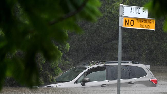
Every Brisbane, Gold Coast, Sunshine Coast road closed by flooding
Dozens of roads across South East Queensland are closed after torrential rain in the aftermath of ex-Tropcial Cyclone Alfred. Here is the full list.
Emergency Services
Don't miss out on the headlines from Emergency Services. Followed categories will be added to My News.
Dozens of roads are closed across South East Queensland today due to flooding in the aftermath of ex-Tropical Cyclone Alfred.
We’ve compiled a full list:
RED ALERT - adverse driving conditions
Toowoomba Connection Road, Toowoomba City - Multiple traffic signal outages occurring around Darling Downs due to EX-TC Alfred
Bruce Highway, Narangba - Powerlines down across numerous Moreton Bay City areas impacting multiple traffic signals
Pacific Motorway, Macgregor - Nultiple road closures and traffic signal outages occurring in South East Queensland due to TC Alfred
AREA ALERT - Road Hazards
Mount Glorious Road, Banks Creek / Dundas / Mount Glorious - Road closed due to flooding, landslips, fallen vegetation from Mount Nebo to Wivenhoe Somerset Road
FLASH-FLOODING
Nambour Connection Road, Nambour - All Nambour area
Oxley Road, Oxley - At Oxley Creek
Rosewood Warrill View Road, Ebenezer - Flash flooding
Oxley Road and Oxley Station Road, Oxley - From Gladstone Street to Oxley Station Road roundabout
Karrabin Rosewood Road, Thagoona - At Campbells Gully
Albany Creek Road, Albany Creek - Dual bridges at Albany Creek
Cunningham Highway, Amberley / Mutdapilly - Amberley to Aratula
Beaudesert Boonah Road, Mt Lindesay Highway (Bromelton Street), Beaudesert / Roadvale - Intersection of Ipswich Boonah Road to the intersection of Mount Lindsay Highway
Currumbin Creek Road, Currumbin Valley - Flash flooding
Smith Street Motorway (Smith Street), Parkwood - Opposite Precision Drive on and off ramps
Ipswich Boonah Road, Milbong / Peak Crossing - Between Washpool Road and Johnson Road
Tamborine Mountain Road, Tamborine - In vicinity of Steele Creek and the Bearded Dragon Hotel
Beaudesert Nerang Road (Albert River Bridge), Tabragalba - Radke Bridge
Pacific Motorway, Mudgeeraba / Robina - Exit 80 off-ramp closed due to flooding
Pimpama Jacobs Well Road, Pimpama - Flash flooding
Beaudesert Beenleigh Road, Luscombe / Wolffdene - Luscombe Bridge
Boowaggan Road, Carrara / Merrimac - Flash flooding
Camp Cable Road, Jimboomba - Prior to the intersection of Mount Lindesay Highway (Brisbane Street)
Stapylton Jacobs Well Road Off Ramp, Stapylton / Yatala - Exit 38 off-ramps
Waterford Tamborine Road, Logan Village / Waterford - Between Easterly Street Waterford and Quinzeh Creek Road Logan Village
Warrill View Peak Crossing Road, Harrisville - Near Charles Chauvel Drive
Gold Coast Springbrook Road, Mudgeeraba / Neranwood - From Belmont Park Drive to Austinville Road
Robina Parkway, Clear Island Waters / Merrimac / Robina - Flash flooding
Boonah Rathdowney Road, Boonah - Near Dugandan Park
Kingston Road (Scrubby Creek Bridge), Kingston - In vicinity of Bega Road and Scrubby Creek Bridge
Beaudesert Beenleigh Road, Tamborine - At Black Soil Gully Creek
Beaudesert Nerang Road, Tabragalba - Around 300 metres south of intersection with Beaudesert Beenleigh Road
Dohles Rocks Road Off Ramp, Murrumba Downs - Off ramp to Dohles Rocks Road
Rosewood Warrill View Road, Rosewood - At Western Creek
Blunder Road, Factory Road Loop (Factory Road), Ipswich Motorway, Oxley - Ipswich Mwy off ramp to Blunder Road closed in both directions due to flash flooding in the area
Paradise Road, Willawong - Oxley Creek
Molle Road, Ransome - At Overland Creek
Marshall Road, Rocklea - At Stable Swamp Creek
Gympie Connection Road, Veteran - Between Tin Can Bay and Ascot Road
Brookfield Road, Brookfield - At Moggill Creek
Karrabin Rosewood Road, Walloon - At Guilfoyles Gully
Rosewood Laidley Road, Grandchester - At Stokes Road
Lucy Street, Moorooka - Station Road at Moolabin Creek
Tamborine Mountain Road, Witheren - Road support washed away in one section of the Goat Track
Siganto Drive, Helensvale - South of Grey Gum Street
Ruffles Road, Willow Vale - North of Peanba Park Road
Petsch Creek Road, Tallebudgera Valley - Flash flooding
Nielsens Road, Carrara - Between Nerang Broadbeach Road and Hickey Way
Gunsynd Drive, Mudgeeraba - Between Todman Drive and Appaloosa Court
Advancetown Mudgeeraba Road (Worongary Road), Gilston / Tallai - In the vicinity of Bridge Creek
Tallebudgera Connection Road, Tallebudgera / Tallebudgera Valley - Near Andrews Road intersection
Gold Coast Springbrook Road (Mudgeeraba Creek Bridge), Mudgeeraba - In the vicinity of Mudgeeraba Creek
Heritage Drive, Mount Nathan - South of Beaudesert Nerang Road
Beenleigh Connection Road (Boundary Street), Beenleigh - Near Chris Green Park and Logan Lightning Football Club
Macpherson Road, Stapylton / Yatala - Flash flooding
Latimers Crossing Road, Gilston - Latimers Crossing Bridge
Eggersdorf Road, Norwell - Flash flooding
Dalton Road, Tallebudgera Valley - Flash flooding
Birmingham Road, Carrara - Between Nielsens Road and Nerang Broadbeach Road
Hotham Creek Road, Willow Vale - Between Fern Hill Drive and Rosemount Drive
Gold Coast Springbrook Road, Neranwood / Springbrook - From Pine Creek Road to Mary Leu Bridge
Beaudesert Beenleigh Road (Old Coach Road), Tamborine - North of Bullock Team Way
Port Alma Road, Bajool - East of Toonda Street
Welches Road, Wongawallan - Flash flooding
Pacific Motorway, Daisy Hill - Left and center lanes between Loganlea Road and Paradise Road
Mt Lindesay Highway, Jimboomba - Between Camp Cable Road and Tamborine Street, traffic control in place
Pringles Road, Kobble Creek - At gravel road section
Kobble Creek Road, Kobble Creek - At Pringles Road
Gordons Road, Cedar Creek - At upper crossing
Curtis Road, Cedar Creek - Flash flooding
Gordons Road, Closeburn - At lower crossing
Cedar Creek Road, Cedar Creek - At Kirk Road
Strain Road, Laceys Creek - Flash flooding
Lees Crossing Road, Dayboro - Flash flooding
Juffs Road West, Dayboro - Flash flooding
Glover Road, Armstrong Creek - At Juffs Road West
Mount Glorious Road, Dundas / Mount Glorious - Between Wivenhoe Somerset Road and Alex Road due to flooding at Northbrook Creek
Whittington Road, Moodlu - Flash flooding
Hume Road, Caboolture - Flash flooding
Ryder Road, Highvale - At Blue Gum Court
Morayfield Road, Caboolture - Morayfield Entrance to Rugby League Entrance
King Street, Caboolture - Flash flooding
Wirth Road, Laceys Creek - At May Road
Laceys Creek Road, Laceys Creek - At Laceys Creek Road
Laceys Creek Road, Laceys Creek - At Worths Crossing
William Berry Drive, Morayfield - Near William Berry Drive
Doyle Road, Stanmore - Near Cedarton Drive
Costelloe Road, Laceys Creek - Near Costelloe Road
Williams Road, Moodlu - At Lagoon Creek
Old Gympie Road, Elimbah - At Six Mile Creek
Bells Pocket Road, Lawnton - Flash flooding
West James Road, Rocksberg - At Upper Crossing
McNamara Road, Rocksberg - At Browns Crossing
Cove Road, Stanmore - Between Dunning Lane and Millwood Road
Best Road, Rocksberg - At Keillors Crossing
West James Road, Rocksberg - At Lower Crossing
Litherland Road, Upper Caboolture - Flash flooding
McNamara Road, Rocksberg - At Eliza Crossing
Moorina Road, Narangba - At Burpengary Creek
Hansen Road, Yugar - At Cedar Creek
Caboolture River Road, Rocksberg - At Zillmans Crossing
West James Road, Rocksberg - At Middle Crossing
Fletcher Road, Stony Creek - Flash flooding
Stony Creek Road, Stony Creek - At Stony Creek
McCabe Road, Stanmore - At Cove Road
Mott Street, Strathpine - Flash flooding
Rasmussen Road, Mount Archer - Flash flooding
Beenleigh Redland Bay Road (Carbrook Road), Cornubia - Prior to Mount Cotton Road
Myuna Place, Petrie - At North Pine River
Malibu Road, Lawnton - At Todds Gully
Whiteside Road, Whiteside - From 55 to 73
Riverview Street, Caboolture - At Bowls Club entrance to Centenary Lakes
Cove Road, Stanmore - At Kilcoy-Beerwah Road
Cove Road, Stanmore - At Old Cove Road
Old Cove Road, Woodford - At Blackrock Creek
Neurum Road, Woodford - At Monkeybong Creek
Neurum Road, Woodford - Near Walker Lane
Basin Road, Wamuran Basin - At Basin Road
Basin Road, Wamuran Basin - At R Sampson Road
Neurum Road, Neurum - Flash flooding
Dewhurst Road, Mount Delaney - Flash flooding
Old College Road, Gatton - Road closed due to water over the road
Old Laidley Forest Hill Road, Forest Hill / Laidley North - Road closed due to water over the road
Woodlands Road, Blenheim - Road closed due to water over the road
Kinsellas Road West, Mango Hill - Flash flooding
Chermside Road, Mango Hill - Between John Street and Kinsellas Road West
Bramston Court, Burpengary East - Near number 84
Railway Street, Helidon - Road closed due to water over the road
Mount Berryman Road, Mount Berryman - Water over road
Storr Street, Laidley - Water over road, observe signage
Edwards Road, Gatton / Woodlands - Water Over Road at Intersection, observe signage
Gatton Esk Road, Orchard Road, Adare - Road Closed, Water Over Road
Stoney Camp Road, Park Ridge South - Flash flooding
Ewarts Road, Smithfield Road, Gatton - Road Closed, Water Over Road
Logan Street, Robinsons Road, Gatton - Road Closed, Litfins Bridge
Adare Road, Adare / Vinegar Hill - Water Over Road, observe signage
Forestry Road, Adare - Road Closed, Water Over Road
Fords Road, Warrego Highway, Gatton - Water Over Road, observe signage
Drayton Street, Laidley - Water Over Road, observe signage
Cooper Street, Edward Street, Laidley - Water Over Road, observe signage
Edward Street, Laidley - Road Closed, Water Over Road
Gehrke Road, Laurette Drive, Glenore Grove / Regency Downs - Water Over Road between Laurette Drive and Lorikeet Drive
Niemeyer Road, Hatton Vale - Water Over Road, observe signage
Otto Road, Glenore Grove - Road Closed, Water Over Road
Mount Berryman Road, Mount Berryman - Water Over Road, observe signage
Rangeview Drive, Woodlands Road, Gatton / Woodlands - Water Over Road, observe signage
Brightview Road, Hewett Drive, Lorikeet Road, Brightview / Glenore Grove / Lockrose / Regency Downs - Road Closed, Water Over Road
Chadwick Road, Golf Links Drive, Spencer Street, Gatton - Road Closed, Water Over Road
Railway Street, Victor Street, Grantham - Water Over Road
Summerholm Road, Summerholm - Water Over Road, observe signage
Challenge Avenue, Thallon Road, Brightview / Kensington Grove - Water Over Road
Bicentennial Bikeway, Brisbane City - At North Quay Ferry Terminal, Flash Flooding
Boscombe Road, Brookfield - Between Brookfield Road and Rafting Ground Road
Lockyer Siding Road, Lockyer - Water Over Road
Blunder Road, Oxley - At Boundary Road
Gap Creek Road, Kenmore Hills - At Gap Creek
Bennett Road, The Gap - Enoggera Creek, Flash Flooding
Lockrose Road, Lockrose - Road Closed, Water Over Road
Whiteway Road, Forest Hill - Road Closed, Water Over Road
Coates Street, Laidley - Water Over Road, observe signage
Van De Weyer Road, Whiteway Road, Forest Hill / Laidley Heights - Water Over Road, observe signage
Hunt Street, Railway Street, Forest Hill - Road Closed, Water Over Road
Burnham Street, Forest Hill - Road Closed, Water Over Road
Whitehouse Road, Laidley Heights - Road Closed, Water Over Road
Forest Hill Blenheim Road, Glen Cairn - Water Over Road, observe signage
Lincoln Street, Stones Corner - At Regina Street
Bowman Parade, Bardon - At Ithaca Creek between Cecil Road and Stephenson Street
Lancing Street, Pullenvale - Between Grandview Road and O’Brien Road
Gill Street, Robert Street, Forest Hill - Road Closed, Water Over Road
Church Street, Victoria Street, Forest Hill - Road Closed, Water Over Road
Brimblecombe Street, Victoria Street, Forest Hill - Road Closed, Water Over Road
Dyer Street, Gill Street, Forest Hill - Road Closed, Water Over Road
Dyer Street, William Street, Forest Hill - Road Closed, Water Over Road
Thomas Street, Laidley - Road Closed, Water Over Road
Winwill Connection Road, Lower Tenthill / Winwill - Water Over Road, Road Closed
Weier Road, Woolshed Creek Road, Hatton Vale / Plainland - Water Over Road, various locations, whole length of road
Armstrongs Road, Grantham - Road Closed, Thistlethwaite Bridge
Connors Road, Grantham - Water Over Road
Ambrose Street, Spicer Street, Laidley - Road Closed, Water Over Road
Lawlers Road, Helidon - Water Over Road
Sandy Creek Road, Grantham - Road Closed
Empire Place, Berrinba - Flash Flooding
Bardon Road, Berrinba - Flash Flooding
Holmview Road, Holmview - Flash Flooding
Gill Street, Forest Hill - Road Closed, Water Over Road
Lower Tenthill Road, Lower Tenthill - Water Over Road at Frankie Steinhardt Bridge, observe signage
Fairway Drive, Kensington Grove - Water Over Road
Adare Road, Vinegar Hill - Water Over Road
Jordan Street, Short Street, Laidley - Water Over Road
Patrick Street, Laidley - Road Closed
Ambrose Street, Laidley - Road Closed
Gatton Laidley Road West, Old Laidley Forest Hill Road, Forest Hill - Road Closed, Water Over Road
Harm Drive, Glenore Grove - Water Over Road, Road Closed
Freya Street, Penfolds Road, Murphys Creek - Water Over Road
Courts Lane, Mount Pleasant - Flash Flooding
Mountain Road, Paroz Road, Laidley / Laidley North - Water Over Road
Williams Road, Elimbah - Flash Flooding
William Street, Laidley - Road Closed, Water Over Road at Intersection
Glendene Road, Forest Hill - Road Closed, Water Over Road
Coates Street, Leonard Street, Laidley - Water Over Road
Drayton Street, Laidley - Water Over Road
Coolabah Court, Napier Street, Laidley - Water Over Road
Sippel Road, Blenheim - Road Closed, Water Over Road
Cove Road, Commissioners Flat - At Commissioners Flat
Allenby Drive, Meadowbrook - Road Closed, Water Over Road at Golf Course Drive, Brisbane
Stockleigh Road, Stockleigh - Flooded Road at 461-471 Stockleigh Road
Tansey Street, Beenleigh
Mulgowie Road, Mulgowie Townson Road, Townson - Road Closed, Water Over Road near Crosby Park
Crowley Vale Road, Gunn Court, Lake Clarendon Road, Crowley Vale / Lake Clarendon - Water Over Road
Black Duck Creek Road, East Haldon Road, Junction View - Road Closed, Water Over Road
Sandy Creek Road, Grantham - Road Closed, Water Over Road
Phillip Street, Siemons Street, One Mile - Road Closed due to flooding
Ison Road, Greenbank - Water Over Road, 127-129 Ison Road
Hawkins Road, Jimboomba - Flash Flooding
Warwick Road, Churchill - Road Closed due to flooding, Berry Street closed
Belafonte Street, Trouts Road, McDowall - Road is flooded in sag between 385 and 387, possible stormwater blockage. Road closed signs have been set up
Buaraba Creek Road, Buaraba - Flash Flooding
Glamorgan Vale Road, Glamorgan Vale - Flash Flooding
Kipper Creek Road, Biarra - Flash Flooding
Keogh Street, Warrell Street, West Ipswich - Intersection Closed due to flooding
Beaudesert Road, Rocklea - Beaudesert Service Road to Tramore, Flash Flooding
Challinor Street, Tiger Street, West Ipswich - Intersection Closed due to flooding
Lake Clarendon Way, Main Green Swamp Road, Lake Clarendon - Road Closed, Water Over Road
Neurum Road, Mount Archer / Neurum - Flash Flooding
Theuerkaufs Road, Fairney View - Flash Flooding
Haslingden Road, Nandine Road, Waters Road, Lockyer Waters - Road Closed, Water Over Road
Kate Street, Preston Road, Carina - Flash Flooding at Corner of Preston and Kate
Clarendon Road, Clarendon - Flash Flooding
Henderson Road, Logan Reserve - Flash Flooding at 36 Henderson Road
Lake Street, Atkinsons Dam - Flash Flooding
Mount Beppo Road, Toogoolawah - Flash Flooding
Karrabin Rosewood Road, Karrabin - Water Over Road
Boonah Fassifern Road, Fassifern - Flash Flooding
Logan Reserve Road, Logan Reserve - Flash Flooding
Murrays Road, Tanah Merah - Flash Flooding
Bangalow Circuit, Bahrs Scrub - Flash Flooding
Derby Road, Chambers Flat - Flash Flooding
Distillery Road, Eagleby - Flash Flooding
Olley Street, New Beith - Flash Flooding
East Tully Road, New Beith - Flash Flooding
Backwater Road, Greenbank - Flash Flooding
Clutha Creek Road, Tamborine - Flash Flooding
Parkwood Street, Rochedale South - Flash Flooding
Shailer Road, Daisy Hill - Flash Flooding
Rossmore Road, Logan Reserve - Flash Flooding
Quilton Place, Crestmead - Road is flooded at 22 Quilton Place
Boundary Street, Beenleigh - Flash Flooding
Cambogan Road, Waterford - Flash Flooding
Tamarind Street, Marsden - Flash Flooding
Carbrook Road, Cornubia - Flash Flooding
Underwood Road, Rochedale South - Flash Flooding
Schmidts Road, Logan Reserve - Flash Flooding
George Street, Beenleigh - Flash Flooding
Kokoda Street, Beenleigh - Flash Flooding
Third Avenue, Marsden - Flash Flooding
Latimer Road, Buccan - Flash Flooding
Plunkett Road, Tamborine - Flash Flooding
Quinzeh Creek Road, Logan Village - Flash Flooding
Cedar Pocket Road, Cedar Grove - Flash Flooding
Millstream Road, Jimboomba - Flash Flooding
Wyatt Road, Kagaru - Flash Flooding
Easterly Street, Waterford - Flash Flooding
Bayes Road, Logan Reserve - Flash Flooding
Albert Street, Waterford - Flash Flooding
German Church Road, Carbrook - Flash Flooding
Eagleby Road, Eagleby - Flash Flooding
Lance Road, North MacLean - Flash Flooding
Mollenhagen Road, Stockleigh - Flash Flooding
Dairy Creek Road, Buccan - Flash Flooding
Wuduru Road, Cornubia - Flash Flooding
Ford Road, Burbank - Flash Flooding
Coorang Road, Carbrook - Flash Flooding
Stern Road, Carbrook - Flash Flooding
Meakin Road, Slacks Creek - Flash Flooding
Cusack Lane, Jimboomba - Flash Flooding
Fryar Road, Logan Village - Flash Flooding
Schmidt Road, Eagleby - Flash Flooding
Schneider Road, Waterford - Flash Flooding
West Coorang Road, Cornubia - Flash Flooding
Brisbane Street, Lobb Street, Old Toowoomba Road, West Ipswich - Road Closed, Upper One Mile Bridge
Ramu Street, Eagleby - Flash Flooding
Malin Court, Eagleby - Flash Flooding
Market Place Drive, Beenleigh - Flash Flooding
Clarks Road, Loganholme - Flash Flooding
Bahrs Scrub Road, Park Lane, Bahrs Scrub - Flash Flooding
Massie Bony Mountain Road, Massie
North Branch Road, Goomburra
Condamine River Road, Killarney / The Head
Clintonvale Goomburra Road, Gladfield
Cressbrook Caboonbah Road, Cressbrook
Banks England Creek Road, Banks Creek
Glamorgan Vale Road, Glamorgan Vale
Banks Creek Road, Fernvale
East Paulsens Road, Junction Street, Morris Road, Paulsens Road, Gowrie Junction - Road Closed, Water Over Road
Junabee Road, Junabee
Charlwood Road, Charlwood
Berry Street, Hall Street, Churchill / Yamanto - Road Closed due to Flooding
Esk Crows Nest Road, Toogoolawah Biarra Road, Biarra
Capella Rubyvale Road, Carbine Creek - Road Closed due to Flooding
Callaghans Road, Von Deest Street, Alloway / Kensington - Water Over Road on Woodward Road, Alloway. Road Closed.
Upper Coomera Road, Ferny Glen
Flying Fox Road, Beechmont / Ferny Glen
Blinco Street, Crows Nest - Traffic Hazard, Water Over Road
Three Mile Road, Crows Nest - Traffic Hazard, Water Over Road
Railway Street, Rosewood - Road Closed Due to Flooding
Middle Road, Purga - Water Over Road
Fairney View Fernvale Road, Fairney View - Water Over Road
Emu Creek Hall Road, Pierces Creek Road, Emu Creek / Pierces Creek - Traffic Hazard, Water Over Road
Cockburn Road, Jondaryan - Traffic Hazard, Water Over Road
Mary Street, Blackstone - Water Over Road
East Street, Elliot Road, Boonah - Flash Flooding
Macquarie Street, Boonah - Flash Flooding
Brisbane Road, Videroni Street, Wearne Street, Booval / Bundamba - Road Closed
Barry Street, Blackall Street, Bremer Street, East Street, Gordon Street, King Edward Parade, Milford Street, Olga Street, East Ipswich / Ipswich - Road Closed Due to Flooding
Rocky Gully Road, Coominya - Flash Flooding
Brightview Road, Brightview - Flash Flooding
Rosewood Warrill View Road, Rosewood - Water Over Road at Brimblecombs Crossing
Gregory Street, Sydney Street, Brassall / Wulkuraka - Road Closed Due to Flooding
Jensens Swamp Road, Lowood / Tarampa - Flash Flooding
Allan Day Drive, Wellington Point - Flooding Due to Tropical Cyclone Alfred
Avalon Road, Sheldon - Flooding Due to Tropical Cyclone Alfred
Lansdowne Way, Verney Place, Chuwar - Water Over Road
Brennan Street, Katandra Crescent, Bellbird Park - Water Over Road
Gentle Annie Road, Raglan - Water Over Road near Dundee Road, Epala Road Intersection
Tamrookum Creek Road, Tamrookum Creek - Flash Flooding
Washpool Road, Washpool - Flash Flooding
Ipswich Rosewood Road, School Street, Amberley / Rosewood - Road Closed Due to Flooding
Grandchester Mount Mort Road, Grandchester - Water Over Road at McFarland Bridge
State Route 47, Redland Bay - Roads Flooded with Heavy Rain
Duncan Road, Sheldon - Roads Flooded with Heavy Rain
Bergins Hill Road, Brisbane Road, Tibbits Street, Bundamba - Road Closed Due to Flooding
Ipswich Rosewood Road, Keanes Road, Ebenezer - Bridge Closed Due to Flooding at Bremer River Crossing
Rosewood Warrill View Road, Ebenezer - Bridge Closed Due to Flooding at Spressers Bridge
Haigslea Amberley Road, Hodgsons Road, Amberley / Walloon - Road Closed Due to Flooding
Ipswich Rosewood Road, Jeebropilly - Bridge Closed Due to Flooding at 7 Mile Bridge
Albert Street, Smiths Road, Goodna - Water Over Road Between Albert Street and Arne Street
Watsons Road, South Ripley - Water Over Road
George Street, Ipswich Road, Ipswich Street, Railway Street, Rosewood Laidley Road, Grandchester - Road Closed Due to Flooding
Grandchester Mount Mort Road, Railway Street, Grandchester - Road Closed Due to Flooding
Railway Street, Grandchester - Road Closed Due to Flooding at Stokes Road
Rosewood Warrill View Road, Rosewood - Road Closed Due to Flooding
Christoe Street, Clermont Rubyvale Road, Copperfield Road, Francis Street, Racecourse Road, Rubyvale Road, Clermont - Flash Flooding
Allan Creek Road, Gleneagle - Flash Flooding
Grande Avenue, Joseba Place, Old Logan Road, Springfield Lakes - Water Over Road
Karrabin Rosewood Road, Walloon - Water Over Road at Guilfoyles Gully
Champions Way, Willowbank - Road Closed Due to Flooding Near Dam at Rear of Racetrack
Glamorgan Vale Road, Larkhill Boundary Road, Glamorgan Vale - Flash Flooding
McDonalds Road, North Isis - Water Over Road at Rushy Creek, Road Closed
Allandale Road, Church Street, Boonah - Flash Flooding
Dath Henderson Road, Lake MacDonald - Water Over One Side of Road, Signs Out
McDougall Street, Glenvale - Traffic Hazard, Water Over Road
Old Toowoomba Road, Amberley - Road Closed Due to Flooding at 3 Mile Bridge
Lobb Street, Old Toowoomba Road, Churchill - Road and Bridge Closed Due to Flooding
Ripley Road, Lyons / South Ripley - Water Over Road at Various Locations
Bucca Crossing Road, Bucca - Bucca Crossing Closed Due to Flooding
Cobalt Street, Mica Street, Carole Park - Water Over Road
Barbara Street, Camira - Road Closed Due to Flooding
Addison Road, Camira - Road Closed Due to Flooding
Coopers Road, Willowbank - Water Over Road
Ebenezer Road, Ebenezer - Water Over Road at Mount Forbes Road Intersection
Reinke Road, Stevens Road, Ashwell / Lanefield - Road Closed Due to Flooding
McGearys Road, Thagoona - Road Closed Due to Flooding
Blackwall Road, Brodzig Road, Coal Road, Francis Street, Chuwar / North Ipswich / Tivoli - Road Closed Due to Flooding
Ebenezer Road, Rosewood - Road Closed Due to Flooding at Rosewood Warrill View Road Intersection
Hospital Road, Matthew Street, Mill Street, Rosewood Thagoona Road, Rosewood - Road Closed Due to Flooding
Adelong Avenue, Thagoona - Road Closed Due to Flooding
Creek Street, Gledson Street, Bundamba / North Booval - Road Closed Due to Flooding
Rosewood Laidley Road, Calvert - Road Closed Due to Flooding East of Bunney Road
Brisbane Road, Macartney Street, Booval - Road Closed Due to Flooding at Vowles Street
Brisbane Road, Ross Llewellyn Drive, Booval - Road Closed Due to Flooding
Louisa Street, Queen Street, Marburg - Road Closed Due to Flooding
Queen Street, Marburg - Road Closed Due to Flooding
Hamilton Street, Redland Bay - Roads Flooded with Heavy Rain at Broadwater and Hamilton Intersection
Hemp Hill Road, Russell Island - Roads Flooded with Heavy Rain
Rachow Street, Thornlands - Roads Flooded with Heavy Rain
Centre Road, Russell Island - Roads Flooded with Heavy Rain
Denison Court, Capalaba - Roads Flooded with Heavy Rain
Pitt Street, Redland Bay - Roads Flooded with Heavy Rain
Lovers Lane, Pine Mountain - Road Closed Due to Flooding
Rosewood Laidley Road, Grandchester - Water Over Road Near Ipswich Street
Mary Street, Birkdale - Roads Flooded with Heavy Rain
Agnes Street, Birkdale - Roads Flooded with Heavy Rain
State Route 55, Birkdale - Roads Flooded with Heavy Rain
Burns Street, Capalaba - Burns and School Road Flooded Over
Whitehall Avenue, Birkdale - Road Flooded, Seek Alternative Route
Ipswich Boonah Road, Purga School Road, Purga - Road Closed Due to Flooding at Purga Creek Crossing
Redbank Plains Road, Redbank Plains - Road Closed Due to Flooding at Storey Street (Sams Reserve)
Grandchester Mount Mort Road, Grandchester - Road Closed Due to Flooding
Bergins Hill Road, Bundamba - Road Closed Due to Flooding at Barclay Street (Gravel Road)
Perrins Road, Ashwell - Water Over Road
Junction Road, Karalee - Water Over Road at Elanora Way
Devon Drive, Warwick Court, Bellbird Park - Road Closed Due to Flooding
Church Street, Goodna - Water Over Road
Albert Street, Audrey Street, Smiths Road, Goodna - Water Over Road
James Road, Pine Mountain - Water Over Road
Orana Street, Redbank Plains - Water Over Road at Corner of Orana Street and Cedar Road
Bodley Road, Redhill Road, Karrabin - Road Closed Due to Flooding
Livingstone Lane, Missigs Road, Haigslea - Water Over Road at Causeway
Hallett Avenue, Camira - Water Over Road at Floodway on Woodlands Avenue
Bunker Road, Double Jump Road, Kingfisher Road, Springacre Road, Mount Cotton /Thornlands / Victoria Point - Flash Flooding
Quarry Road, Rickertt Road, Ransome / Thorneside - Flooding Due to Tropical Cyclone Alfred
Watsons Road, South Ripley - Road Closed Due to Flooding
Wards Road, Watsons Road, South Ripley - Road Closed Due to Flooding
Cliveden Avenue, Corinda - Water Over Road from 433 to No 372 Cliveden Ave
Cliveden Avenue, Deniven Street, Corinda / Oxley - Water Over Road from Deviven St to Cliveden St
Bowhill Road, Durack / Willawong - Water Over Road from Sherbrooke Rd to Outlook Place
Wensley Road, Ripley - Water Over Road Near Ripley Road Intersection
Fischer Road, Ripley - Water Over Road at Gully Near Nevis Street
Lancing Street, Pullenvale - Water Over Road Between #50 and #111
Dalmeny Street, Paradise Road, Willawong - Water Over Road from Dalmeny St to Radius Drive
Baratta Street, Southport - East of Wardoo St
Runway Drive, Upper Coomera - South of The Landings
Reedmans Road, Ormeau - South of Banks Dr
Clagiraba Road, Clagiraba - Between Beaudesert Nerang Rd and Gerara Ct
Elderslie Road, Yatala - Between Exit 38 Roundabout and Stanmore Rd
Kopps Road, Oxenford - South of California Dr
Chisholm Road, Carrara - Between Farro Ct & Nerang Broadbeach Rd
Trouts Road, McDowall - Over Downfall Creek
Haigslea Amberley Road, Walloon - From Bell Street to Hodgsons Road
LONG-TERM FLOODING
Kennedy Developmental Road, Lyndhurst - Einasleigh River
Burke Developmental Road, Wrotham - Walsh River - Trimbles Crossing
Gregory Developmental Road, Einasleigh - Einasleigh River
Burke Developmental Road, Gamboola - Lynd River
Somerset Drive, Mudgeeraba - Franklin Drive to Bonogin Road
Warrego Highway, Forest Hill - Intersection with Forest Hill Fernvale Road
Gatton Esk Road, Gatton - Near the Steinhardts Road intersection
Wivenhoe Somerset Road, Dundas - Near Northbrook Creek
Maleny Kenilworth Road, Conondale - Minchenton Gully between Gundon Road and Reserve Road
Neill Road (Mooloolah River Bridge), Mooloolah Valley - Mooloolah River
Connection Road (Mooloolah Connection Road), Glenview - In the vicinity of Stevens Road
Obi Obi Road, Obi Obi - Obi Obi Creek
Yandina Bli Bli Road, Parklands - Near Thompsons Road
Bli Bli Road, Nambour - Tuckers Creek between Rifle Range Road and Crusher Park Drive
Old Maroochydore Road (Forest Glen Road), Forest Glen - Eudlo Creek
Beachmere Road, Beachmere - Near Goong Creek
Ipswich Road, Oxley - From Blunder Road roundabout, access to Ipswich Mwy
Mt Crosby Road, Chuwar - Colleges Crossing
Haigslea Amberley Road, Walloon - South of Queen Street
Ipswich Motorway, Rocklea - Exit 23 closed for flooding and infrastructure repairs on Randolph Street
Gatton Helidon Road, Grantham / Helidon - Between Old Toowoomba Road and Flagstone Creek Road
Cunningham Highway, Silverdale - Kengoon Road
Cunningham Highway, Warrill View - South of Warrill View Peak Crossing Road
Boompa Road, Boompa - Between Boompa and Brooweena Woolooga Road
Brooweena Woolooga Road, Gigoomgan - Just north of Eaton Road
Warrego Highway, Brigalow - Long-term flooding
Crossmoor Road (Longreach Muttaburra Road), Cornish Creek / Sardine - Muttaburra to Longreach (Muttaburra to Longreach Council Boundary)
Muttaburra Bowen Downs Road, Cornish Creek / Upper Cornish Creek - From Muttaburra Aramac Road to junction with Aramac Torrens Creek Road
Ballyneety Road, Dunrobin - From Aramac Road to Eastmere Road (Upland)
Davenport Road (Local Road), Farrars Creek - Palparara Waterhole to Diamantina Developmental Road
Isisford Bimerah Road, Isisford / Stonehenge - Isisford to Stonehenge (to Barcoo Council Boundary)
Inside Track Road (Birdsville Inside Track), Birdsville - Birdsville to SA Border
Hardys Road, Bonogin / Mudgeeraba - Between Bonogin Road and Glenmore Drive
Starlights Lookout Road, Longreach - Captain Starlight’s Lookout from Muttaburra Westside Road
Eastmere Road, Aramac / Galilee / Upland - Aramac to turn off at Eastmere Lou Lou Park Road
Barcaldine Isisford Road, Barcaldine Downs / Ilfracombe - Isisford Ilfracombe Road to Barcaldine Downs (to Barcaldine Council Boundary)
Politic Road, Ingberry - Barcaldine Aramac Road to Coreena Road
Urandangi North Road, Piturie / Waverley - Urandangi North Road (Waverley to Urandangi Township, Piturie)
Springvale Road, Min Min / Wills - Wills to Min Min (to Diamantina Council Boundary)
Cacoory Stony Crossing Road, Birdsville - From Eyre Developmental Road to junction with Birdsville Developmental Road
Lakeside Drive, Carrara - Long-term flooding
Dandaraga Road, Ilfracombe - Landsborough Highway turnoff to junction with Barcaldine Isisford Road
Local Road, Urandangi Road, Urandangi South Road, Dajarra / Waverley - Dajarra - Waverley
Additional Area Road, Ilfracombe - Junction with Isisford Ilfracombe Road to junction with Silverwood Isisford Road
Prairie Road, Prairie - Muttaburra to Prairie (Hughenden Muttaburra Road turn off to Flinders Council Boundary)
Old Coach Road, Reedy Creek / Tallebudgera Valley - Between Tallebudgera Creek Road and Kingsmore Boulevard
Birds Road, Guanaba / Maudsland - 300m west of Equestrian Drive
Gatton Clifton Road, Winwill - Intersection with Winwill Connection Road
Ilfracombe Aramac Road, Aramac / Ibis - Aramac to Ilfracombe (Aramac to Longreach Council Boundary)
Mount Sylvia Road, Mount Sylvia - Black Mountain Sylvia Road
Gregory Downs Camooweal Road, Camooweal - From Thorntania Yelvertoft Road to Camooweal
Floraville Road, Gregory - Burketown to Leichhardt River Crossing
Delta Downs Road, Howitt - Karumba Developmental Road to Delta Downs
Riversleigh Doomadgee Road, Riversleigh Road, Lawn Hill - Riversleigh Road
Doomadgee Road, Gregory - Burketown to Doomadgee
Gregory Downs Camooweal Road, Camooweal / Lawn Hill - Burke Shire Boundary to Yelvertoft - Thorntania intersection
Hughenden Muttaburra Road, Hughenden / Tangorin - Between Hughenden and Muttaburra
Plantation Road, Beenleigh - Long-term flooding
Omaru Street, Loganholme - Long-term flooding
Bannockburn Road, Windaroo - Long-term flooding
Mclaughlans Lane, Brightview - Water Over Road, observe signage
Gittins Road, Postmans Ridge / Withcott - Water Over Road
Rafting Ground Road, Kenmore Hills - Moggill Creek near Greentrees Avenue
Bowhill Road, Durack - At Hanleys Creek
Cliveden Avenue, Oxley - At Pennyworth Creek
Pratten Street, Corinda - At Pennyworth Creek
Napper Road, Arundel - Long-Term Flooding
George Street, Bahrs Scrub / Beenleigh - Long-Term Flooding
Lanes Road, Wongawallan - Long-Term Flooding
Billiau Road, Guanaba - Long-Term Flooding
Piggotts Road, Guanaba - Long-Term Flooding
Tarata Road, Guanaba - Between Guanaba Creek Road and SES Shed
Norwell Road, Gilberton / Norwell - Long-Term Flooding
Stanmore Road, Luscombe / Wolffdene - Long-Term Flooding
Turner Street, Helidon - Road Closed, Water Over Road
Burdekin Falls Dam Road, Ravenswood - Burdekin Falls Dam Spillway
Forestry Reserve Road, Inverramsay Road, Goomburra - Long-Term Flooding
New Beith Road, Greenbank - Long-Term Flooding
Merivale Street, Allora
Grafton Street, Warwick
Longs Bridge Road, Junabee
East Street, Warwick
North Branch Road, North Branch
Backhouse Road, Killarney
Anstey Road, Swanfels
South Branch Road, Maryvale / Tregony
Dawn Lane - Long-Term Flooding
Andersons Crossing Road, Loch Lomond
Hermitage Emuvale Road, Danderoo
L Mauchs Road, Yangan
Stephens Road, Swan Creek
Wheatvale Plains Road, Upper Wheatvale
Glengallan Road, Deuchar
Emu Creek Road, Emu Vale
Victoria Street, Warwick
Churchill Drive, Warwick
Banffs Lane, Atkinsons Dam
Innisplain Road, Innisplain
Coburg Road, Monarch Drive, Canungra
Mutdapilly Churchbank Weir Road, Peak Crossing Churchbank Weir Road, Mutdapilly / Peak Crossing
Round Mountain Road, Josephville / Laravale
Iron Hut Road, Peakvale Road, Clermont / Peak Vale
Farnsfield Road, North Gregory - Water Over Road at Gregory River, Road Closed
Clermont Alpha Road, Gregory Highway, Industrial Road, State Route 41, Turrama Road, Clermont
Burnham Road, Selwyn - Water Over Road Due to Flooding
Hoopers Road, Inverlaw - Water Over Road Due to Flooding
Isisford Blackall River Road, Isisford - Isisford to Blackall (to Barcaldine Council Boundary)
Cordillo Access, Birdsville - Birdsville Dev Rd Turnoff to South Australia Border (via Cordillo Downs)
Pine Hill Road, Pine Hill / Port Wine - Between Capricorn Highway and Pebbly Creek Road
Portwine Road, Port Wine / Sedgeford - Portwine to Junction with Star Downs Rd, Sedgeford
Yaraka Bimerah Road, Isisford / Stonehenge - Yaraka to Bimerah (To Barcoo Council Boundary)
Slashers Creek Road, Min Min - Slashers Creek Rd, From Kennedy Dev Rd Turnoff
Isisford Bimerah Road, Isisford / Stonehenge - Isisford to Stonehenge (To Barcoo Council Boundary)
Tumbar Road, Jericho / Mexico - Jericho to Mexico (To Blackall Tambo Council Boundary)
Star Downs Road, Alpha / Sedgeford - Alpha to Sedgeford
Cork Macunda Road, Middleton / Opalton - From Kennedy Developmental Road to Old Cork Waterhole
Urandangi Border Road (Tobermorey Road), Carrandotta - Urandangi Township, Piturie to NT Border
Selwyn Road, Boulia / Selwyn / Warenda / Wills - Boulia to Selwyn (To Cloncurry Boundary)
Coorabulka Road, Bedourie / Wills - Boulia to Bedourie (Boulia to Diamantina Council Boundary)
Toolebuc Road, Min Min / Warburton - Warburton to Min Min (Warburton to Cloncurry Council Boundary)
Home Creek Moonbria Road, Home Creek / Moombria - Barcaldine to Isisford (Landsborough Hwy Turnoff to Junction with Isisford Blackall Rd)
Tonkoro Road, Longreach / Stonehenge - Vergemont - Stonehenge “Lochern National Park”
Hobartville Road, Alpha / Hobartville - Clermont Rd Turnoff to Degulla Rd
Dunrobin Road, Dunrobin / Galilee - From Aramac Road to Council Boundary
Dicks Creek Elderslie Road, Kynuna / Middleton - Between Kennedy Developmental Road and Old Landsborough Highway
Mount Playfair Road, Mt Playfair Road, Caldervale / Carnarvon Park / Tambo - Tambo to Carnarvon Park
Isisford Yaraka River Road, Isisford - Isisford to Emmet Wahroongha Rd
Diamantina River Road, Middleton / Opalton - Turnoff to Collingwood: Conn Waterhole to Old Cork Waterhole
Jericho Texas Road, Garfield / Jericho - Jericho to Aramac Rd via Garfield
Coorabulka Road, Bedourie - Bedourie to Boulia (To Boulia Council Boundary)
Isisford Bimerah Road, Stonehenge - Bimerah to Isisford (Longreach Council Boundary)
Rafting Ground Road, Brookfield - At Moggill Creek Near Reed Way
For latest updates, go to https://qldtraffic.qld.gov.au/.

Watch: Moment cops catch sauced Suzuki driver at servo
“You’ve been drinking while you’ve been sitting here”, a police officer tells an alleged drunk driver in an unbelievable exchange caught on camera. SEE THE VIDEO.

Tragic way truckie was killed in horror Gateway Mwy fatal
Police have revealed how a truck driver was killed on the Gateway Mwy in Brisbane’s east yesterday morning from an incident that caused massive peak-hour delays.