
Laidley, Lockyer Valley issued flood warning on March 10
Queensland Premier David Crisafulli says Lockyer Valley “is a major area of focus for us now” as flood and storm threats grow.
QLD News
Don't miss out on the headlines from QLD News. Followed categories will be added to My News.
Queensland Premier David Crisafulli says Lockyer Valley “is a major area of focus for us now” as flood and storm threats grow.
Lockyer Valley Regional Council at 7.30am on Monday issued an emergency warning to ask residents to take shelter due to flooding from ex-Tropical Cyclone Alfred.
Mr Crisafulli said the focus was turning to the region.
“A very serious storm cell is moving in that area and overnight there were door knocks in areas like Laidley and Grantham,” he said.
In a warning issued on Monday morning, locals were urged to find somewhere safe as southeast Queensland continued to endure the aftermath of the heavy rain and wind gusts.
“Take safe shelter now as dangerous flooding is occurring in the Lockyer Valley area in the coming hours,” the warning read.
“Warn neighbours if safe to do so, secure belongings and take safe shelter or go to higher ground.
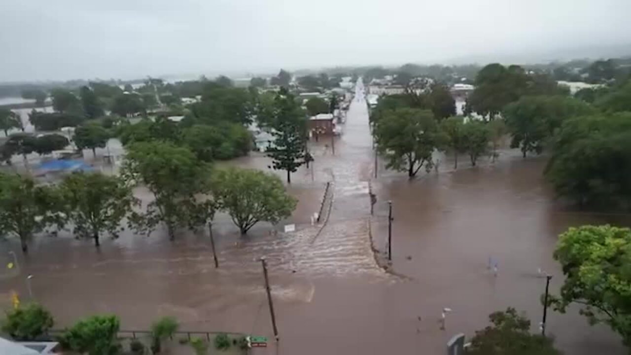
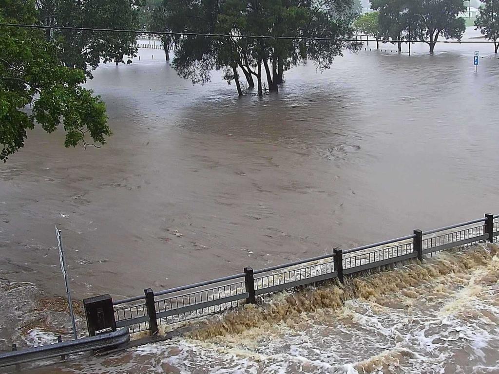
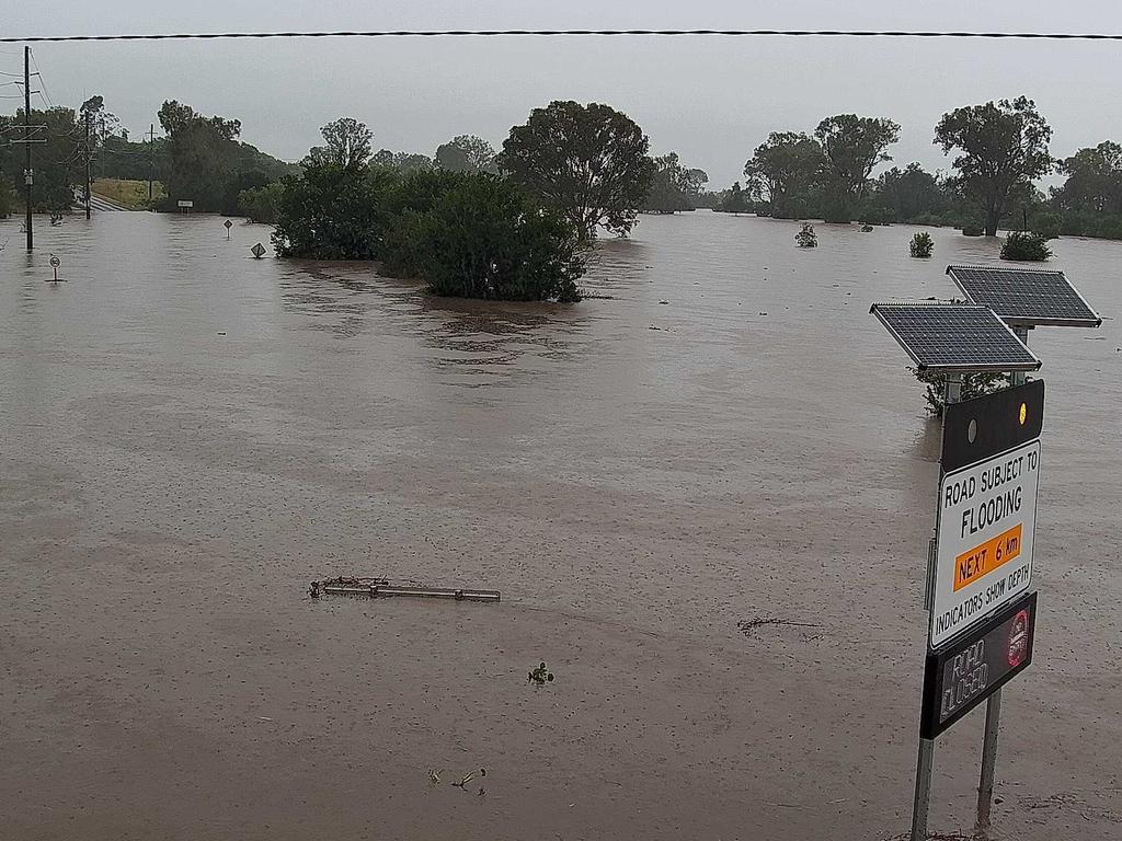
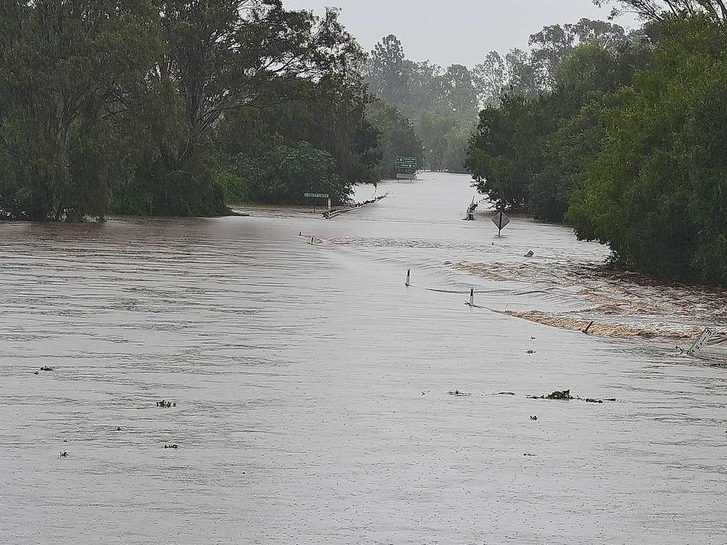
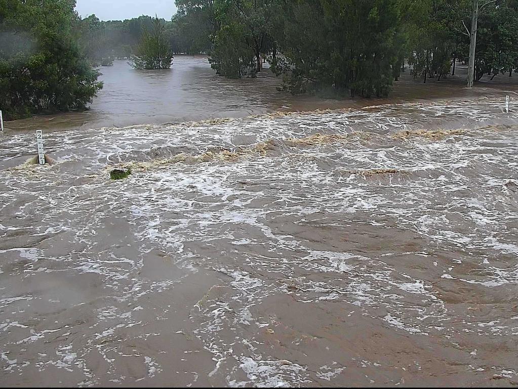
By 11am the Bureau of Meteorology warned major flooding was occurring along the Laidley Creek and possible moderate flooding along Lockyer Creek following rapid and dangerous creek level rises.
“Further moderate to locally heavy rainfall is forecast to continue during much of Monday, with further creek level rises expected to continue along the Lockyer and Laidley Creeks,” the warning read.
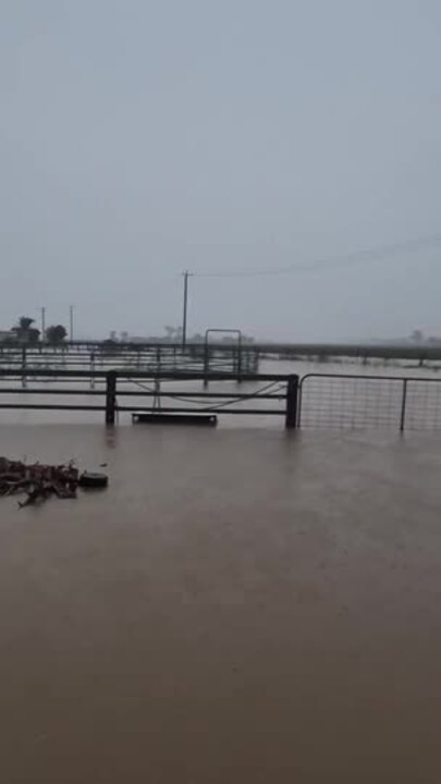
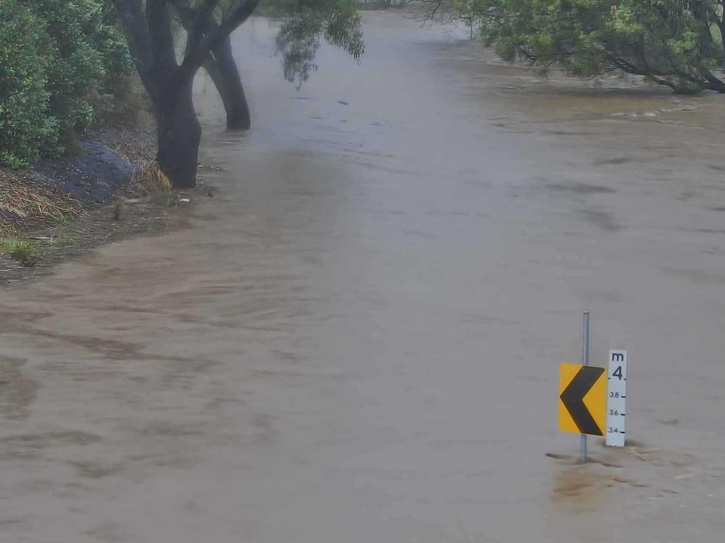
BOM said the Laidley Creek would remain above 7m for the day, with further rises possible, reaching the 2011 level of 8.85m.
Lockyer Creek was estimated to be around 7m at Gatton but may reach 11m on Monday with the forecast rainfall.
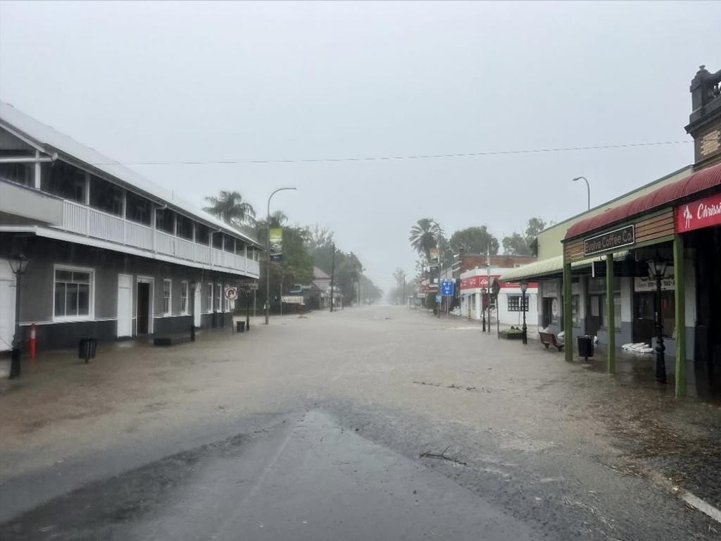
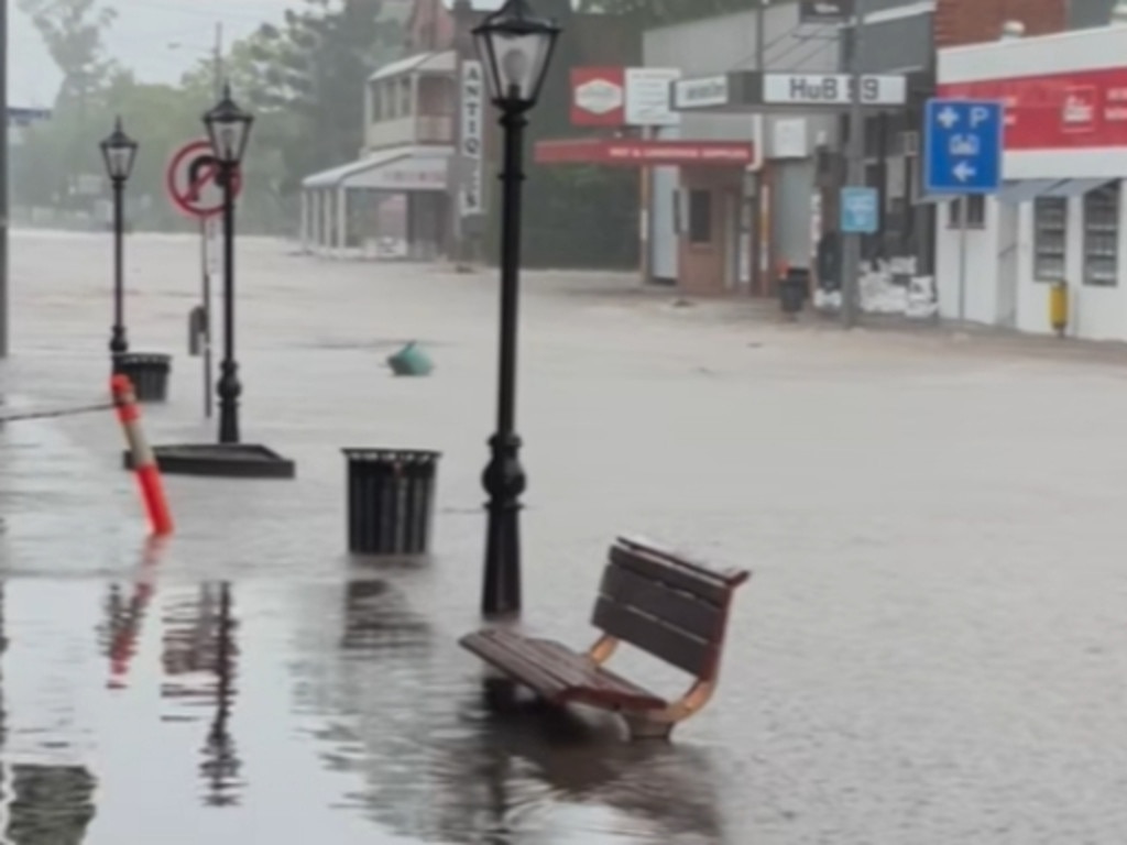
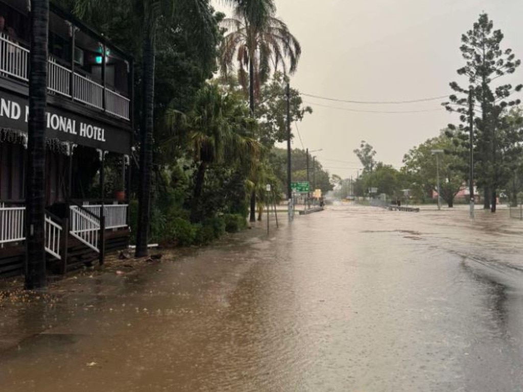
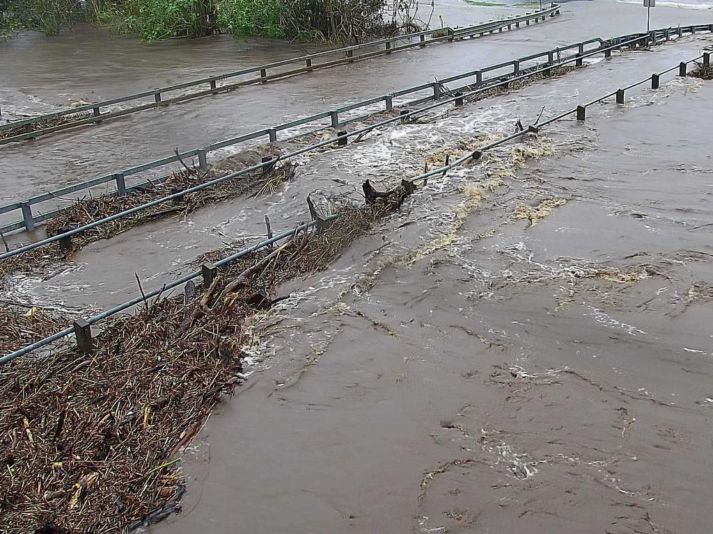
Laidley’s main street Patrick Street had already been flooded with water rising and the Warrego Highway has been cut, with water over the road.
At 8.49am a severe thunderstorm warning had been issued for Cherbourg and parts of Gympie, Somerset, South Burnett, Lockyer Valley and Toowoomba Council Areas.
The Bureau of Meteorology had deemed this weather system a “very dangerous thunderstorm” that was likely to produce intense rainfall. Dangerous and life-threatening flash flooding was detected near the area southwest of Esk, and west of Esk and Goomeri.
The storm would affect Murgon, Cherbourg and north of Gatton by 9:15 am and Gatton, northeast of Kingaroy and Wondai by 9:45 am.
See the gallery of Lockyer Valley’s 2013 floods below >>>
Meanwhile an initial minor flood warning was issued for the Upper Condamine River at 9am, with minor flooding possible at Warwick on Monday evening, and Pratten and Tummaville on Tuesday.
Minor flooding may occur along the Condamine River to Warwick and also at Killarney, Brosnans Barn, and Elbow Valley. Moderate flooding was occurring at Murrays Bridge.
Minor flooding could also occur along the Condamine River downstream of Warwick to Oakey Creek.
Moderate flooding was occurring at Glengallan Creek and minor flooding was occurring at Allora.
Originally published as Laidley, Lockyer Valley issued flood warning on March 10

Lehrmann’s shock move in Qld rape case
Bruce Lehrmann has made a shock move ahead of a pending criminal trial in Toowoomba, where he is facing two counts of rape.
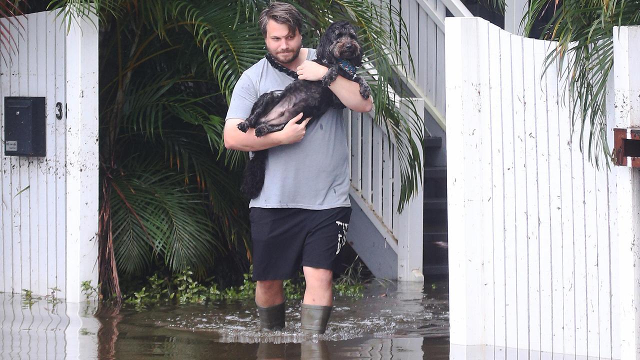
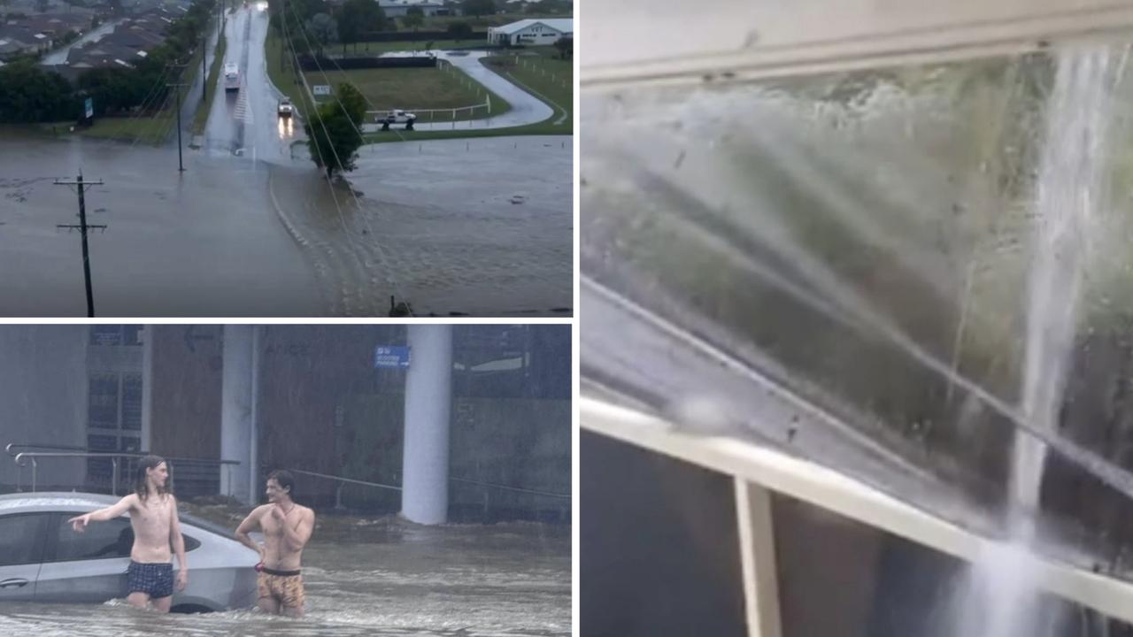
‘How will we get out?’: Brisbane residents tell of flood horror
Brisbane residents have been forced to self evacuate and bunker on top floors as flood waters rose to dangerous levels.
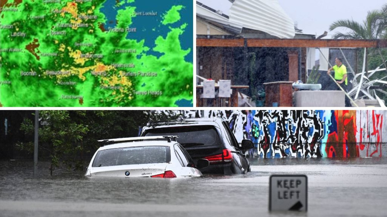
Flood emergency unfolding, 433mm overnight drenching as cyclone aftermath continues
Queenslanders have been warned the dangerous aftermath of ex-Tropical Cyclone Alfred continues, with one area warned of 2011-level flooding as another copped a 433mm overnight drenching, with a number of disaster declarations in place.
WATCH: Roof collapses in rain as residents demand answers
Hervey Bay residents are demanding answers over the effectiveness of the council’s drainage system after flash flooding inundated homes and businesses.

Uber driver’s lucky escape after being trapped in Brisbane floods
An Uber driver found out the hard way just what the term ‘if it’s flooded, forget it’ means. WATCH THE VIDEO
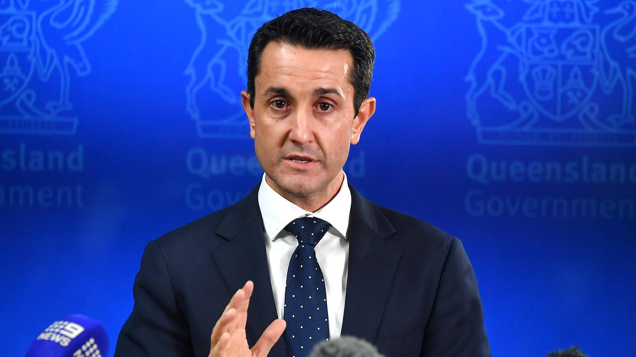
Will your kid’s school open tomorrow? Key points from Premier’s address
When will my child’s school reopen? Can I get into work? When will this be over? Here’s everything you need to know after David Crisafulli delivered his latest update.