
Brisbane flood alert slammed as ‘dodgy’ as SEQ hit with heavy rain, flash flooding
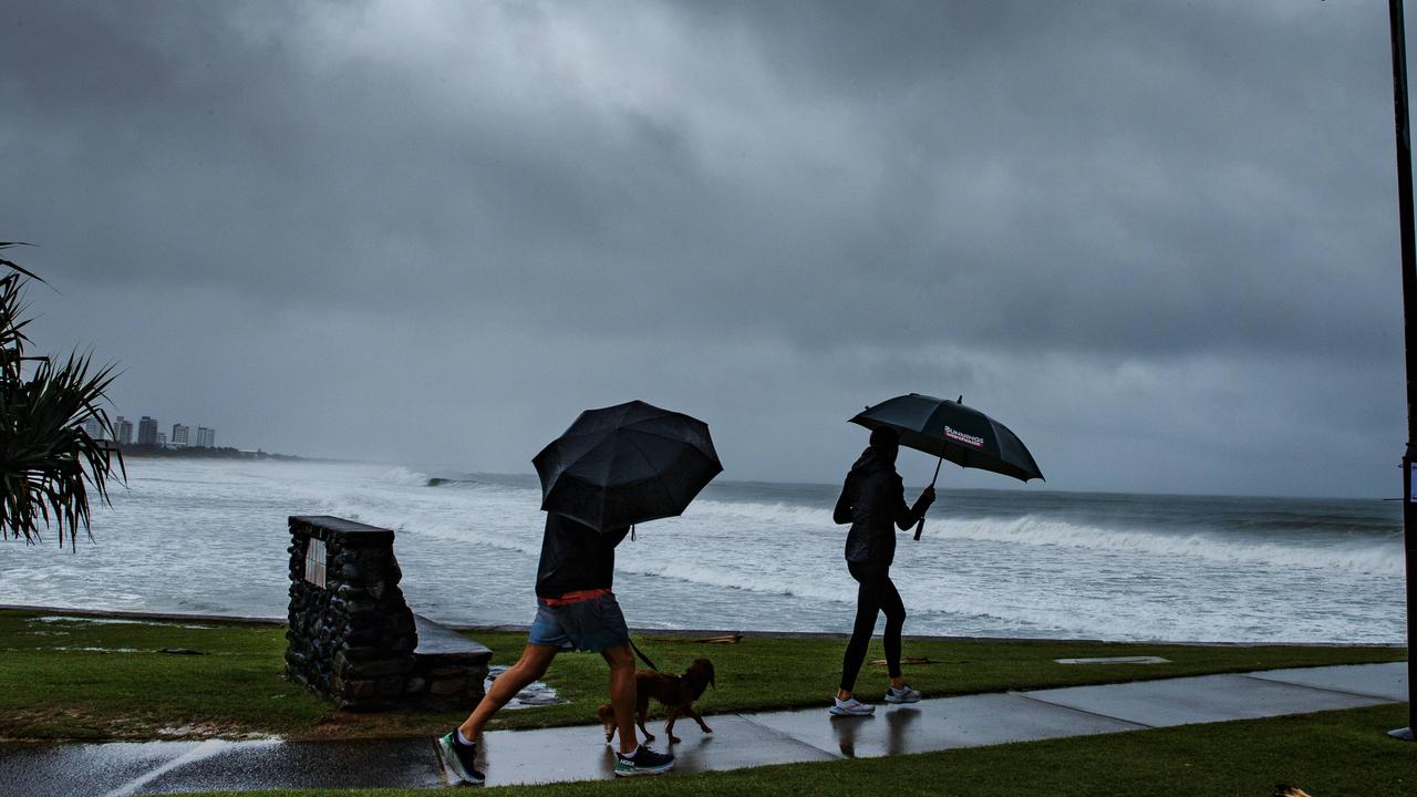
Brisbane’s Lord Mayor says it’s ‘unacceptable’ that it took up to six hours for a council flooding alert to send, as parts of the South East were hit with 200mm of rain over the weekend.
QLD News
Don't miss out on the headlines from QLD News. Followed categories will be added to My News.
Brisbane’s Lord Mayor has raised concerns about how long it took for council emergency alerts to be distributed to residents’ mobile phones as heavy rains hit the region.
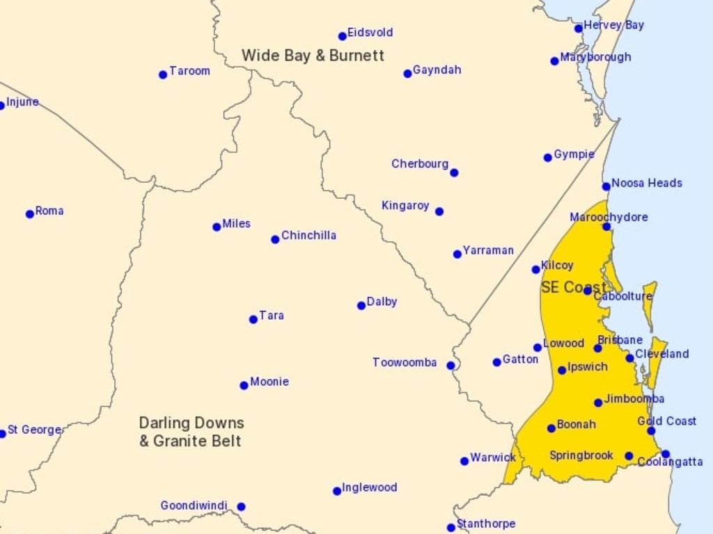
Some parts of the South East received 200mm of rain over the weekend. The Bureau of Meteorology has since cancelled its severe weather warnings.
Adrian Schrinner said an alert sent out by council at 12.35pm Saturday wasn’t received by some people until 7pm.
“So taking over six hours for them to receive an emergency alert is unacceptable,” he said.
Mr Schrinner said the system was a national system, with state governments responsible for operating it – as he made a renewed call for the system to be fixed.
A Queensland Fire and Emergency Services spokeswoman responded to Mr Schrinner’s comments by insisting the council was aware that its 2.8 million messages would be sent between 1pm and 7pm and that it “raised no concerns”.
“In the event of immediate danger to the community, an EA (emergency alert) will be sent with the highest priority – only to those directly at risk in a certain geographic area - to ensure messages are promptly received by the intended recipient,” the QFES spokeswoman said.
Mr Schrinner said it was nonsense to claim that no concerns were raised.
“We raised concerns about this dodgy system months ago and it seems nothing has been done,” he said.
The Courier-Mail understands the emergency alert needed to be broken into 19 campaign areas, with the council agreeing to target coastal areas first before moving inland.
Meanwhile, the Bureau of Meteorology has cancelled its severe weather warning for heavy rainfall.
It had warned at 4.07pm that some parts of the South East could receive three-hourly rainfall totals of up to 80mm due to a low pressure system “meandering” off the southeast coast.
The warning was cancelled at 5.44pm, as the sky started to clear.
Locally intense rainfall is also no longer expected over the South East coast. That earlier warning for this had said 250mm of rain could fall over the 12 hours from 2pm,
with “life-threatening” flash flooding a possibility.
A separate Severe Weather Warning for dangerous surf was also cancelled at 5.46pm.
The cancellations come after Upper Springbrook in the Gold Coast hinterland had already copped 135mm in the 24 hours to 9am on Sunday, while Bellthorpe, north of Brisbane, got 131mm in the same time frame and nearby Maleny got 114mm.
Further falls on Sunday took the Springbrook region’s weekend total to about 200mm, while much of the Sunshine Coast saw 100 to 150mm fall over the weekend.
The state’s north, however, is bracing for a heatwave, with temperatures in Townsville to ‘feel like’ 40C by Wednesday and Thursday.
It comes as Lismore in northern NSW is bracing for heavy rain which could see the Wilsons River swell to a “major flood” level on Monday.
SES is warning residents to watch and prepare to evacuate in Lower North Lismore, North Lismore, South Lismore and Tumbulgum, while Nimbin and The Channon were on Sunday afternoon being warned to prepare to isolate themselves as rainfall intensifies.
COUPLE TRAPPED AS FLOOD WATCH CONTINUES
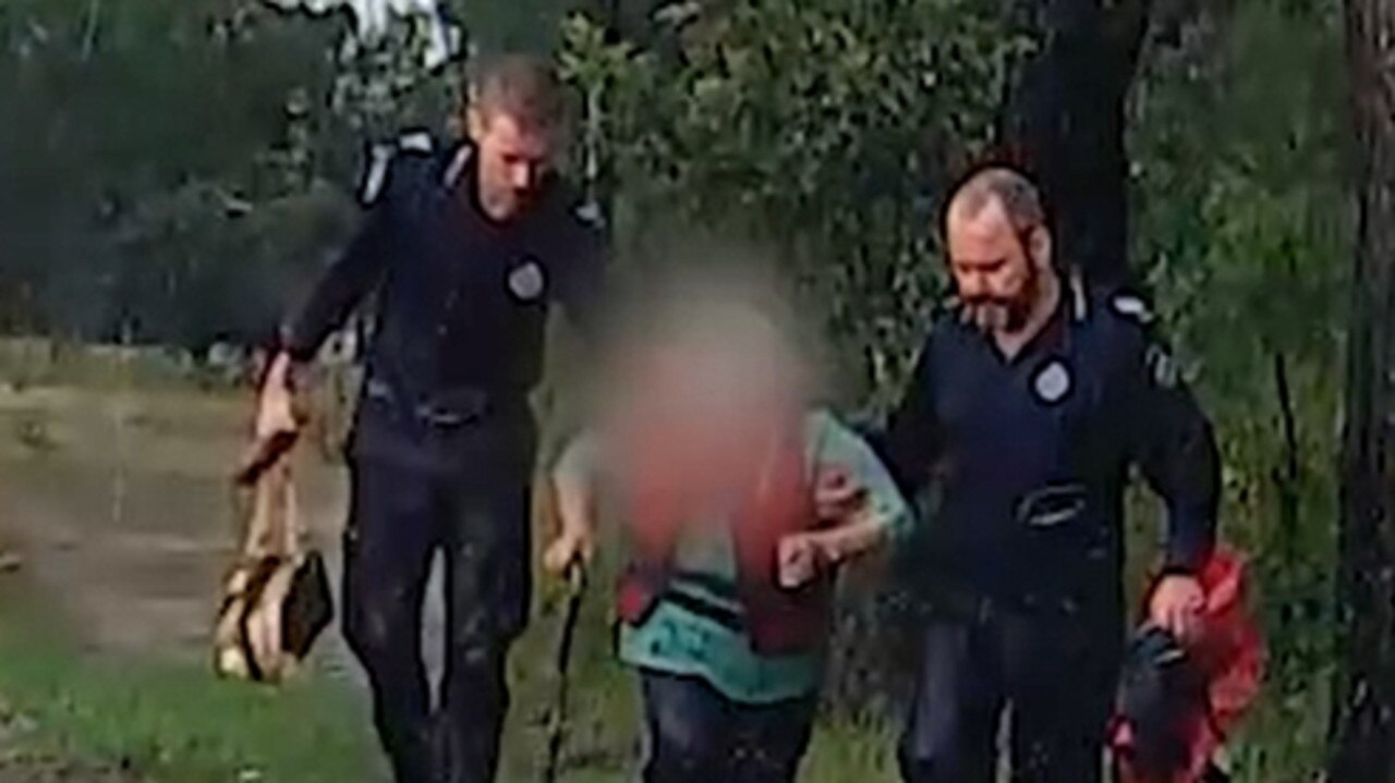
An elderly couple were left trapped between two creeks south-west of Toowoomba on Sunday afternoon.
Queensland Fire and Emergency have said the couple became trapped between two bodies of water on the Gore Highway north of Goondiwindi shortly before 1.30pm.
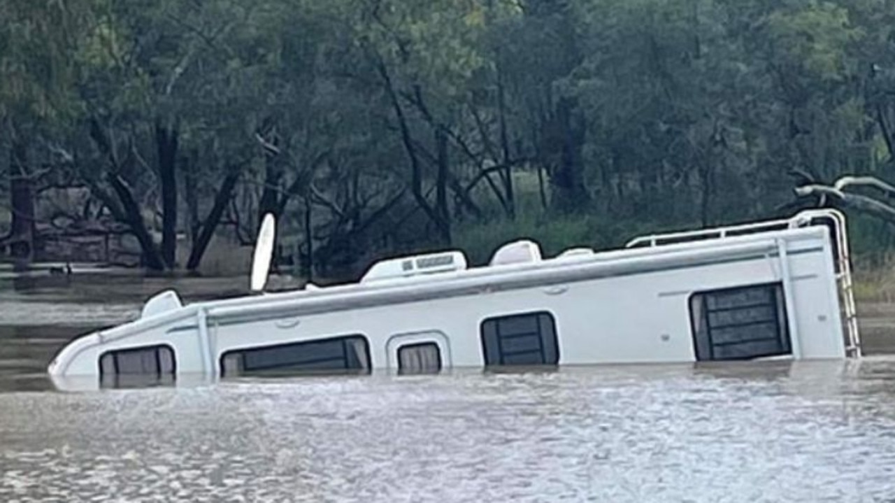
The rescue operation follows an incident on Saturday where a woman in her 70s and man in his 30s were taken to Goondiwindi Hospital after their motorhome was inundated by floodwaters.
A Bureau of Meteorology flood watch for South East Queensland and the Eastern Darling Downs remained in effect on Sunday afternoon.
“A trough and low pressure system lies just off the Sunshine Coast, and is likely to move southwards near to the southeast coast over the weekend, bringing widespread heavy rainfall to southeastern Queensland,” the bureau says.
“Catchments across the Flood Watch area have experienced periods of rain over the last few days, with catchments relatively wet and responsive to rainfall.”
The Bureau has warned that river and creek rises, as well as minor and “rapid” flash flooding, are likely across the warning area, with isolated areas of moderate flooding.
Sunshine Coast Mayor Mark Jamieson said the area did not receive “near the amount” of rain that was forecast.
“That’s generally been a good outcome, we haven’t even reached minor flood levels in most waterways,” he said.
“But people should still be cautious and landslips are still an issue in steep areas.”
He said Currimundi Lake had silted up at the ocean mouth and that was cleared to allay residents’ concerns regarding water flow in that area.
SCROLL DOWN FOR LATEST FLOOD WARNINGS AND ROAD CLOSURES
Cr Schrinner said almost 20,000 sandbags were collected from Brisbane City Council depots on Saturday ahead of the wet weather.
“And that 20,000 is in addition to the more than 50,000 that we distributed in recent weeks with our super sandbag weekends,” he said.
“So there’s a lot of sandbags out there in the community.”
Mr Schrinner said on Sunday that council was not aware of any homes that had flooded off the back of the heavy falls, but he warned “that could change quite quickly”.
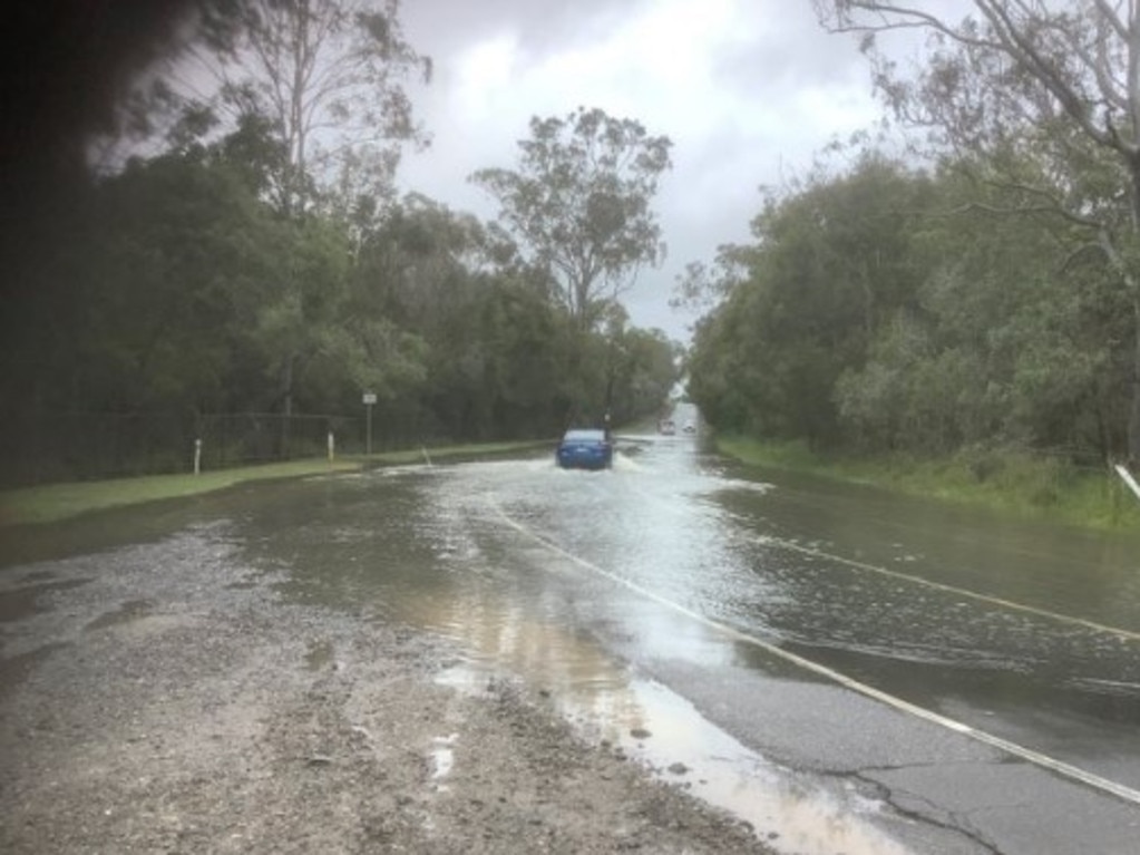
“At this point in time, it’s been mainly flooded roads that we’ve been dealing with,” he said.
“There have been some SES jobs registered. There have been reports of leaky roofs.”
Mr Schrinner also backed the state government’s decision to proactively keep Wivenhoe Dam at 80 per cent capacity during the La Nina season.
“We know at the moment that when they control the release of the dam, they do so with consideration of the tides,” he said.
🚧 Colleges Crossing at Mount Crosby Road closed 🚧
— Transport and Main Roads Queensland (@TMRQld) October 22, 2022
Colleges Crossing at Mount Crosby Road is now closed. Once the water recedes, our inspection teams and engineers will open the road as soon as it is safe to do so. Thanks for your patience and #IfItsFloodedForgtIt! pic.twitter.com/qOOUm4acpJ
Police Minister Mark Ryan said the government had received advice from the dam operators that the dams “holding up” during the wet weather.
“As announced two weeks ago by the Premier, there have been some proactive releases from Wivenhoe,” he said.
“Those proactive releases are obviously continuing, but that is in accordance with the best advice from dam operators as well as also the (weather) bureau.”
Mr Ryan said the state was starting to feel the beginning of the wet season, as he urged Queenslanders to listen to advice from the weather bureau and authorities.
“What the weather bureau has forecast is of course more intense heavy rainfall over this spring period and into the summer period,” he said.
“That means that there is a greater risk of more flash flooding and riverine and creek rises in your area.”
Police on Sunday once again urged motorists to steer clear of floodwaters, with one driver caught-out by police driving through a flooded road at Illaween Rd, Karawatha in Brisbane’s south.
WHAT HAPPENED OVERNIGHT AND ON SUNDAY MORNING
The slow-moving weather system brought widespread heavy falls overnight, with more than 100mm falling between 9am Saturday and 7am Sunday in at least one area.
Bellethorpe, southeast of Kingaroy in the Burnett region, recorded 117mm, while there were heavy falls in the Sunshine Coast region.
Tanawha, just inland of Mooloolaba, recorded 90mm while the Glasshouse Mountains notched up 91mm.
Caboolture, too, saw significant rainfall with 83mm in 22 hours.
Ewen Maddock Dam is now spilling excess water and outflows have increased from Sideling Creek Dam. Details https://t.co/6b9lv0gpdA
— Seqwater (@Seqwater) October 22, 2022
South on the Gold Coast, Upper Springbrook was once again smashed by heavy falls, with 102mm falling between 9am Saturday and 7am Sunday, while several areas from the coast through to Mount Tamborine received around 50mm.
Brisbane, though, appeared to be spared the worst.
Just before 9am on Sunday, Beerburrum had recorded 95mm in the preceding 24 hours, while Brisbane Airport copped 53mm in the same time frame.
The Brisbane CBD got 44.8mm, while Nambour copped 74.8mm and the Sunshine Coast Airport got 58mm.
A number of active flood warnings have been issued since Friday, including moderate flooding at Tiaro on the Fraser Coast.
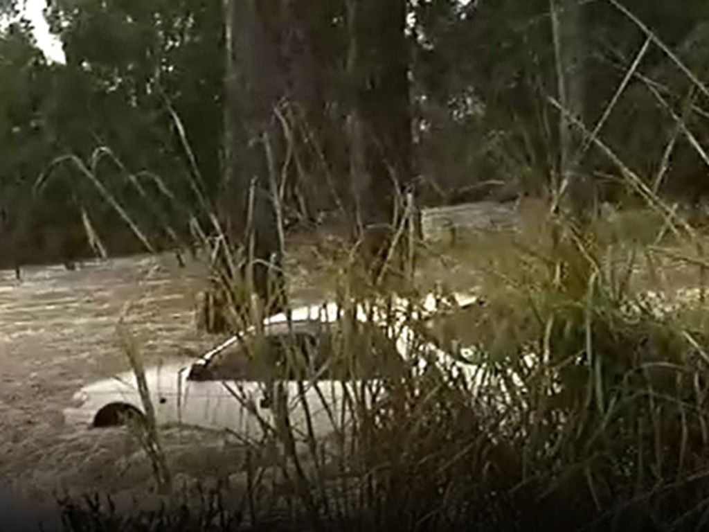
Police issued a warning to drivers to take care on the roads after an elderly woman was rescued when her car was swept away in floodwaters at Scrubby Creek Crossing south of Maryborough on Friday.
Road Policing and Regional Support Command Acting Chief Superintendent Christopher Stream said the woman was “extremely lucky” to survive the ordeal.
“We have seen people, again, driving into flooded roadways and placing themselves at risk,” Superintendent Stream said.
Meanwhile, in Rainbow Beach where 378mm fell in 24 hours to Saturday morning, a local fishing charter owner generously used his boat to get kids back to Cooloola Cove safely on Friday.
The Bureau of Meteorology’s Helen Reid said she expected the rainfall to peak on Sunday morning before easing off on Monday.
“Monday and Tuesday, we’ll see a continuation of showers and storms probably again dependent on the low pressure trough, but the bulk is expected to clear by Wednesday,” she said.
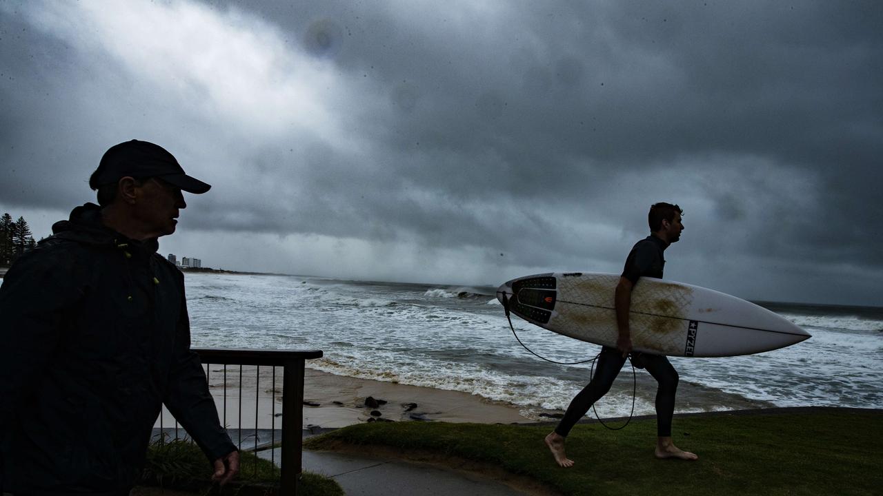
The bureau has also issued a hazardous surf warning for Fraser Island Coast, Sunshine Coast Waters and Gold Coast Waters until midnight Sunday.
Surf Life Saving Queensland has advised beachgoers to “consider staying out of the water and avoid walking near surf-exposed areas”.
ROAD CLOSURES
- Haigslea Amberley Road, Walloon
- Illaweena Street, Drewvale
- Gap Creek Road, Brookfield
- Paradise Road, Larapinta
- Bowhill Road, Durack
- Grandview Road, Pullenvale
- Donaldson Road, Rocklea
- Ebenezer Road, Ebenezer
- Marshall Road, Rocklea
- Allan Dale Drive, Wellington Point
- King Ave, Durack
- Boscombe Road, Brookfield
- Currumbin Creek Road, Currumbin Valley
- Mount Cougal Road, Tallebudgera
- Tallebudgera Creek Road, Tallebudgera Valley
- Ipswich Boonah Road, Peak Crossing
- Cunningham Highway, Aratula
- Birds Road, Guanaba/Maudsland
- Araluen Road, Tallebudgera Valley
- Clagiraba Road, Clagiraba
FLOOD WARNINGS
Catchments likely to be impacted:
Baffle Creek (Isolated minor flooding forecast at Essendean Bridge)
Kolan River (Minor flooding forecast at Bucca Weir)
Burnett River
Burrum and Cherwell Rivers (Minor flooding forecast at Howard)
Mary River (Minor to moderate flooding forecast)
Noosa River
Sunshine Coast Rivers and Creeks
Pine and Caboolture Rivers
Upper Brisbane River
Lower Brisbane River (Minor flooding occurring in creeks and tributaries only, flooding not expected in lower Brisbane River itself at this stage)
Logan and Albert Rivers
Gold Coast Rivers and Creeks
Condamine Rivers (Chance of river rises and flooding for the upper Condamine through to Loudons Bridge, and the Myall Creek to Dalby if rainfall extends west from the current coastal focus area)
Flood warnings current for:
Baffle Creek and Kolan River, Burrum and Cherwell rivers, Mary River, Warrill Creek and Bremer River (lower Brisbane River catchment), Logan and Albert rivers.
RAINFALL TOTALS FROM 9AM SATURDAY-7AM SUNDAY:
Bellethorpe (southwest of Kingaroy) – 109mm
Tanawha – (Sunshine Coast) – 90mm
Glasshouse Mountains – 91mm
Caboolture – 83mm
Mt Nebo – 64mm
Brisbane City – 39mm
Carbrook (Gold Coast) – 68mm
Tomewin (near Springbrook) – 91mm
Rapley’s Alert (between Gladstone and Bundaberg) – 64mm
More Coverage

Originally published as Brisbane flood alert slammed as ‘dodgy’ as SEQ hit with heavy rain, flash flooding
Join the conversation

‘Come back to haunt him’: Premier’s jetsetting sparks war of words
It’s the jet drama that has sparked outrage among Queenslanders. HAVE YOUR SAY
Read more

‘Bloody hell, there’s a croc!’: Authorities ramp up search after multiple sightings
Authorities are continuing to scour waters surrounding a Sunshine Coast tourist hot spot after multiple reports of a crocodile being sighted.
Read more

Family of slain millionaire’s brutal call on business empire
The family of a Brisbane father stabbed to death in his own home have made the ‘tough call’ about a number of business operations just days after his funeral.
Read more

Qld man accused of rape to be tested for ‘sexsomnia’
A man facing charges of rape and attempted rape will undergo a special study to determine if he suffers from a rare sleeping disorder in which people engage in sexual behaviour while unconscious.
Read more

Who are the victims? What is the fallout? Everything we know about Qld’s horror road toll
A string of road tragedies has left Queensland reeling, as the state spirals towards a grim record. EVERYTHING WE KNOW
Read more

How does it work? What are the dangers? Qld’s sunset clause explained
The sunset clause continues to cause angst between those involved in the building industry. Here’s what it all means.
Read more