Qld weather: Storms rip through Brisbane and SEQ
A severe storm left its mark on SEQ, including Brisbane city overnight, after power was lost to thousands of residents after a 107km/h wind gust ripped through Outback towns.
Gold Coast
Don't miss out on the headlines from Gold Coast. Followed categories will be added to My News.
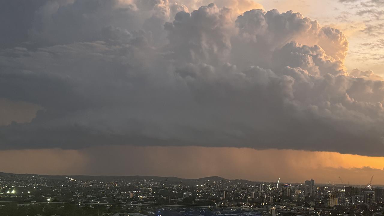
A ferocious storm left its mark on South East Qld, including Brisbane city on Friday night. It comes after power was lost to thousands of residents after a 107km/h wind gust ripped through Outback towns.
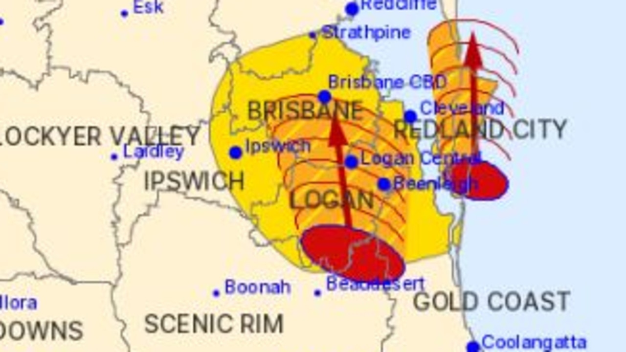
At 7.40pm the Bureau warned the severe thunderstorm was detected near Woodridge and Sunnybank Hills and would continue moving north. It reached Brisbane CBD, Aspley, Boondall and Sandgate by 8.10pm and Strathpine, Redcliffe, Deception Bay waters and Beachmere by 8.40pm.
Hail was reported in Brisbane CBD including parts of Bowen Hills and Lutwyche.
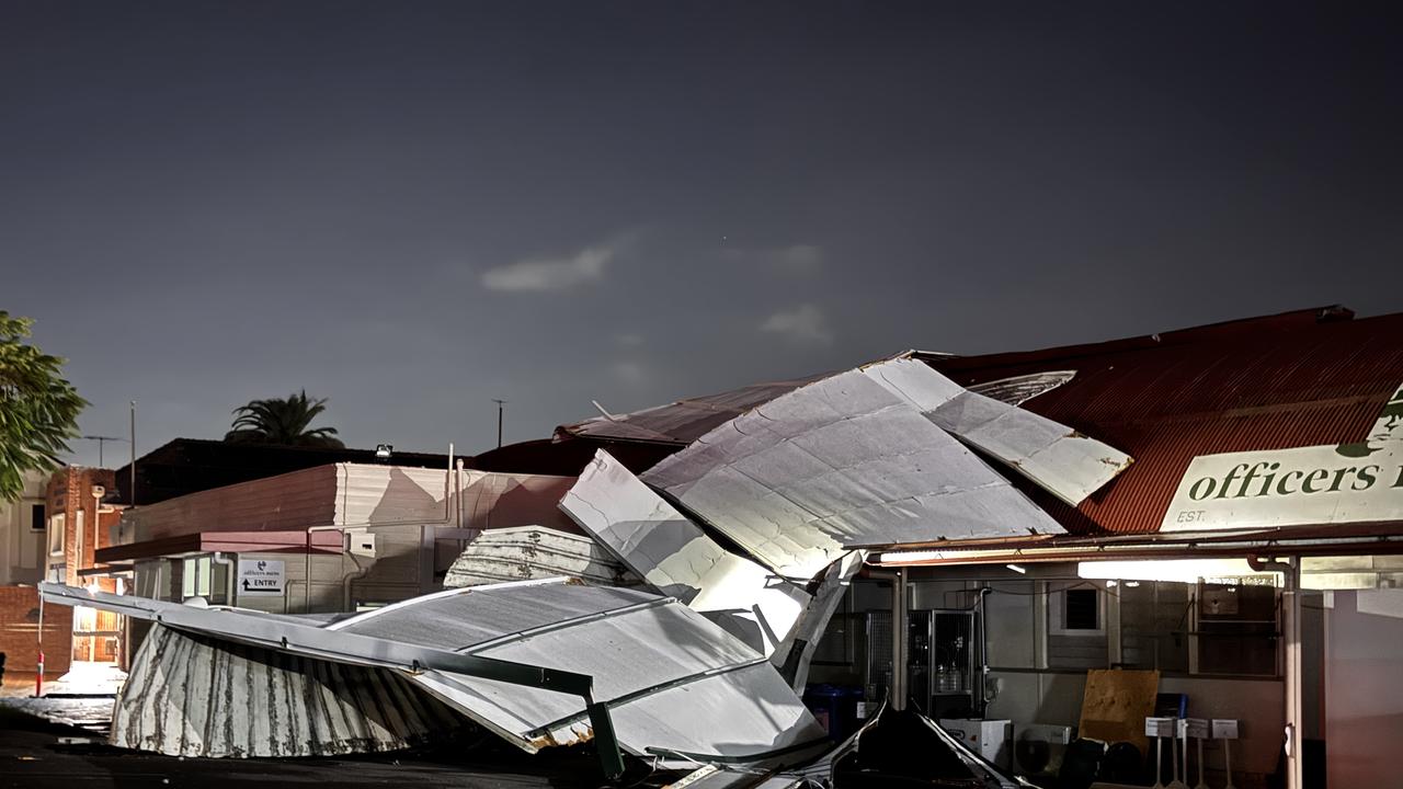
Officers Mess in New Farm was subject to what some described as a “mini tornado” where the roof was blown off from one side of the building to the other.
More than 10,000 households across the south east have lost power thanks to the severe storms, with temperatures lingering at around 30C.
On Saturday, the weather bureau has forecast maximum temperaturs of 31C, with a 5 per cent change of rain.
As of 5.50am, storms have not been forecast.
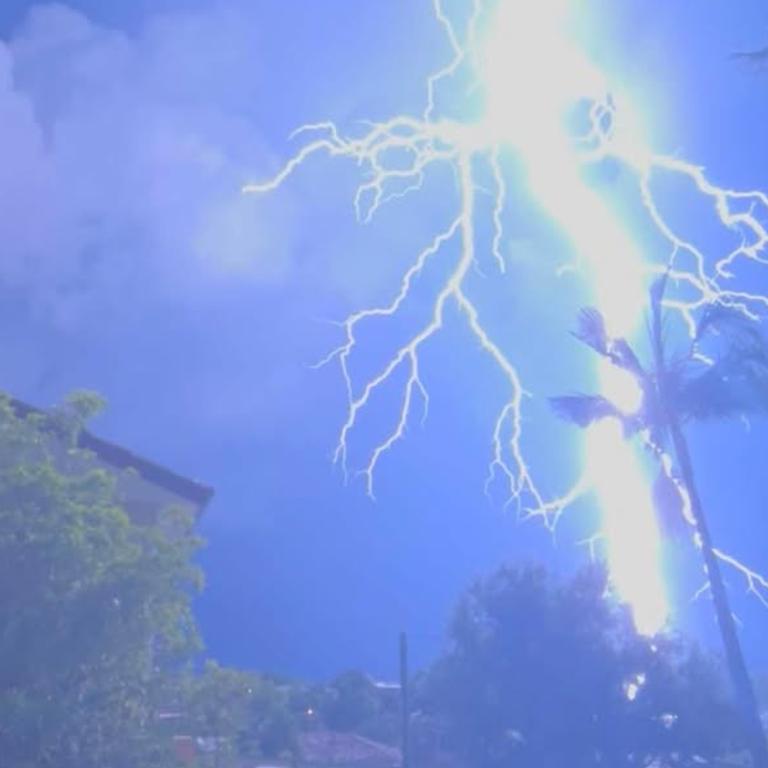
More than 80,000 lightning strikes had been recorded in SEQ up until 8.30pm.
An Energex spokesperson confirmed there was storm damage to some areas of the south east, including fallen powerlines.
This has resulted in 7,869 SEQ residents to be without power more than an hour after storms began lashing the area.
The majority of which came from Brisbane City Council areas and Logan with a combined 6,964 customers without power at 8.30pm.
In Ipswich, 300 customers remained without power after more than 2000 were hit during the storms.
“Energex crews are responding, but when there is lightning they need to wait until conditions ease,” the Energex spokesperson said.
“Restoration timeframes will depend on damage assessments and Outage Finder will be updated accordingly.
“We are keeping a close eye on weather warnings and we urge our customers to do likewise, so they can stay safe and be prepared for power outages.”
10,731 Energex customers across the south east were without power at 7.45pm, with the bulk in the Brisbane City Council areas.
5,556 were without power throughout Brisbane City, 2,171 in Ipswich and 2,648 without power in Logan.
The Luke Combs concert at Suncorp stadium faced delays with crowds initially told to clear the venue. After taking shelter from the storm, there was relief when the crowd was able to return a short time later.
The Bureau of Meteorology warns that severe thunderstorms likely to produce damaging winds, large hail and heavy rainfall that may lead to flash flooding were detected near Tamborine and Jimboomba.
The storms are moving to the north and are forecast to affect Beenleigh, Greenbank and Dunwich by 7:25 pm and Brisbane CBD, Logan Central and southern Moreton Island by 7.55 pm.
A warning is also in place for more remote parts of Queensland, where damage has been reported after a 107km/h wind gust was recorded at 3.21pm.
More 7000 properties were without power tonight in Blackwater, Emerald, Cloncurry and Clermont tonight after storms ripped through.
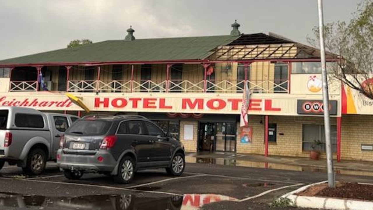
The Leichhardt Hotel had part of its roof ripped off this afternoon when the storm front passed through.
One of the employees at the hotel told The Courier-Mail the storm only lasted 20 minutes, but it was “quite crazy” but that nobody was injured.
The hotel remains open for takeaway and counter service in the main bar.
A gust of 104km/h was recorded at Emerald at 4.34pm and a 94km/h gust at Blackwater at 5.04pm.
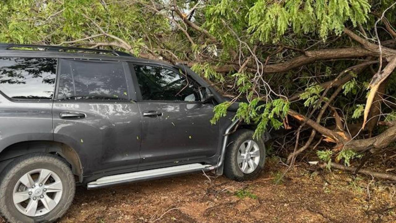
Images posted to Higgins Storm Chasing show damage to the roof of the Leichhardt Hotel Motel at Cloncurry, and a 4WD vehicle under a tree.
The Bureau warns that severe storms are occurring across the Central Highlands and Coalfields, Capricornia, Wide Bay and Burnett and Southeast Coast districts.
Locations which may be affected include Emerald, Clermont, Coolangatta, Blackwater and Mount Tamborine.
Severe thunderstorms are likely to produce damaging winds over the next several hours in parts of the North West district.
It comes after another hot day across Queensland.
The mercury rose to 35.5C in Brisbane but the city was still stifling late in the afternoon, with an apparent temperature of 39.4C after 6pm.
The highest temperature across the state was at Winton, where the mercury hit 45.8C just after 3pm. It was still a stifling 42.8 at 6.20pm
Earlier on Friday, senior meteorologist Sarah Scully warned severe thunderstorms were likely to redevelop on the east coast
“These severe storms may bring heavy rainfall, damaging winds or large hail, and we can’t rule out high end storms, bringing giant size hail, so that’s hail with a diameter greater than five centimetres or destructive wind gusts in excess of 120km/h,” she said.
“With these types of hazards, the community impacts that could occur would include damage to property, particularly with large or giant size hail causing damage to cars or homes, and also the heavy rainfall leading to flash flooding may cause road closures and detours, and the damaging to destructive winds bringing down trees, powerlines and causing power outages.”
The bureau issued a minor flood warning for the Boyne River ahead of the storms as Boondooma Dam reached its peak.
Originally published as Qld weather: Storms rip through Brisbane and SEQ

