
Heavy falls for Far North as Cyclone Megan forms in The Gulf of Carpentaria
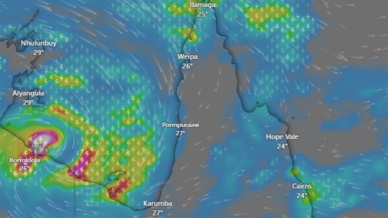
Parts of the Far North are set for a drenching with Cyclone Megan strengthening in The Gulf of Carpentaria and a monsoonal trough sitting over the Cape driving rainfall totals that could hit 300mm early this week.

Cairns
Don't miss out on the headlines from Cairns. Followed categories will be added to My News.
Parts of the far north are set for a drenching thanks to Cyclone Megan strengthening in The Gulf of Carpentaria and a monsoonal trough sitting over Cape York, which could drive rainfall totals as high as 300mm early this week.
Impacts from Tropical Cyclone Megan were expected to begin by Sunday in the southwestern Gulf of Carpentaria coast.
On Sunday the system was sitting off the coast of Groote Eylandt as a category 3 cyclone and was expected to crossing the Northern Territory coast south east of Port McArthur on Monday, with the warning zone extending to Mornington Island.
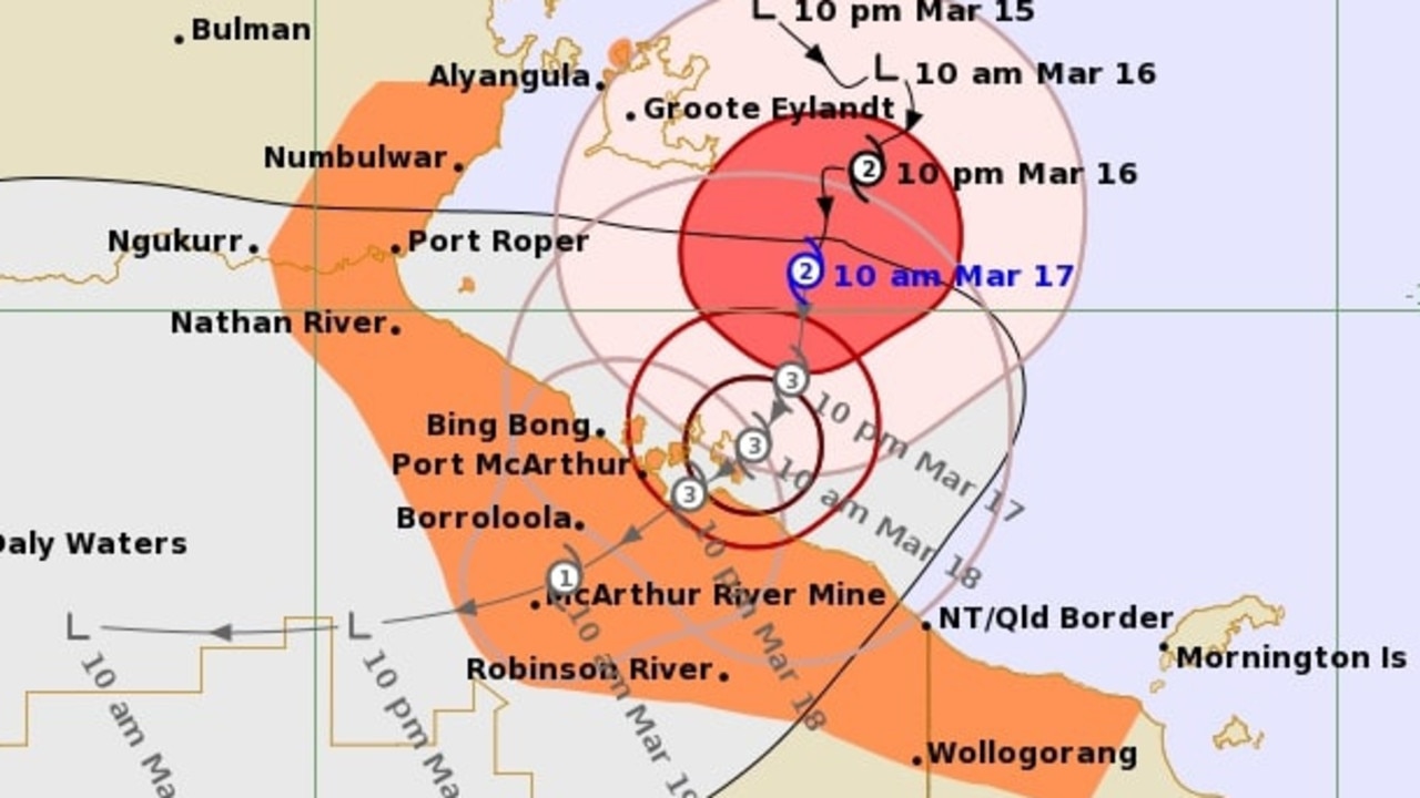
Bureau Meteorologist Steven Hadley said that while the system will then move west there could be strong impacts for areas of Queensland’s gulf country.
“Areas around Doomadgee and Burketown could see strong winds and there are flood warnings in place for the Norman River,” Mr Hadley said.
The wider effects of the cyclone as well as a monsoonal trough sitting across The Cape are set to bring heavy rainfall to The Cape and Northern tropical coast from Cooktown down to Cardwell.
“There is definitely a risk of some higher falls in areas of the north tropical coast where we could see some pretty significant falls over 100mm daily totals through the start of the week and some possibility to see totals hit from 200-300mm in some areas,” Mr Hadley said.
Overnight Saturday Innisfail had already received 130mm in 24 hours with similar totals expected till Wednesday.
A minor flood warning has been issued for the Daintree and Mossman rivers as well as an initial minor flood warning for the Mulgrave and Russell Rivers south of Cairns.
“These heavier falls should ease by Wednesday or Thursday but raining conditions are really expected through to the next week.”
More Coverage


Originally published as Heavy falls for Far North as Cyclone Megan forms in The Gulf of Carpentaria

Millions dropped on upmarket Cairns hostel
Take a look inside Cairns newest hostel that make mouldy bathrooms and stuffy rooms a thing of the past. TAKE VIRTUAL TOUR

‘One of the best in the country’: Riders chase rodeo glory at professional bull riding event
The biggest names in professional bull riding will go head-to-head in Cairns on Saturday night, with a Mareeba rider taking to his hometown arena leading the national championship rankings.

Boat thief targeted luxury yachts
A crayfish diver whose crimes sound like a criminal variation of a popular nursery rhyme – stole a boat, to break into luxury yachts, to steal some keys, to take a car, to tow a stolen caravan – has been jailed.

Dundee’s announces last splash at Cairns Aquarium venue
The end of an era has come for one of the city’s premier CBD dining venues as the Cairns Aquarium reveals a new player and the Far North’s first “steak specialist” outlet as a replacement.

Kids heart specialist win for FNQ
Recruitment for a second paediatric cardiologist for Cairns will begin immediately after the state government announced a $1.35m expansion to the region’s critical health service.

Cairns Show edges closer to record: Key drawcard revealed
The Cairns Show will edge closer to the record year that helped it achieve the tag of largest regional show in Australia. Here’s 60-plus photos of the people who helped tick over the numbers.