NSW floods live coverage: month of rainfall forecast in next 48 hours; PM flags ADF, aerial support in state of disaster
As Kempsey enters another night hoping its levee holds and western Sydney residents receive fresh ‘prepare to leave warnings’, the forecast gets worse.
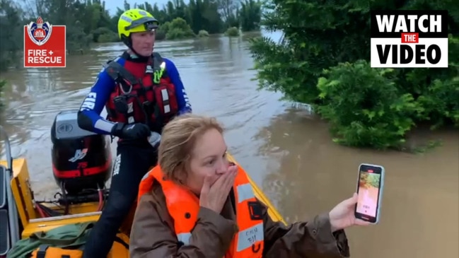
- It’s still coming: month of rain in two days
- PM flags ADF, aerial support for flood areas
- Kempsey: town’s levee set to overtop
- ADF expected to be called in for flood relief
- Twenty evacuation orders issued
- New flood alerts issued for Sydney
- More evacuations as weather worsens
Welcome to live coverage of the latest alerts and updates from NSW’s once-in-50-year flood event. The PM has flagged ADF and aerial support as twenty evacuation orders are issued for areas in NSW … but the worst may be yet to come, with a month of rain still forecast to fall in 48 hours.
More than 18,000 people have been evacuated – the majority of them on NSW’s mid-north coast, with the Macleay River at Kempsey expected to burst its banks within hours.
A total of 38 areas of NSW have been declared disaster zones.
In Queensland, areas around Brisbane are also facing increased flooding as heavy rain continues.
Joseph Lam9.45pm:ADF to help NSW south coast
The Australian Defence Force will deploy two search and rescue helicopters to the south coast after the NSW government filed its first request for support, according to a spokesman from the Prime Minister’s office.
The request has called for ADF support to begin as early as Tuesday, with the first wave of support including the 24-hour helicopter operation.
The PMO spokesman said the Home Affairs Emergency Management department received an official request from NSW on Monday, reported the Sydney Morning Herald.
“The request is for two search and rescue helicopters operating out of the NSW south coast for 24-hour operations. ADF will be able to provide this support and will commence service tomorrow,” they said.
The request was received just hours after NSW Premier Gladys Berejiklian said she had discussed ADF support with the Prime Minister but was only likely to request help to clean up the aftermath of the flood.
“Once the rainfall subsides and the real clean up starts, that’s when we may need ADF assistance,” Ms Berejiklian said.
“I’ve already had those conversations with the Prime Minister and he’s said he’d be willing to provide that support.
It’s an evolving situation and if we need their support, of course we’ll ask for it, my suspicion is we will given the extent of the recovery.”
Patrick Commins9pm:Health, hospitality jobs safe bet
Australians studying for jobs in the health and welfare sector have the best chance of securing employment in the coming five years, a new report from the National Skills Commission says.
The National Skills Commission’s latest Industry Employment Outlook report said Australia’s ageing population, demand associated with the National Disability Insurance Scheme, and a growing number of working parents in need of childcare would help drive another 250,000 new healthcare and social assistance jobs in the coming five years.
Total employment nationally was projected to climb by 991,600, or 7.8 per cent, by November 2025. There will be more jobs by 2025 in 17 of the 19 industries, the report said, with fewer jobs in the manufacturing and media and telecommunications sectors.
Mackenzie Scott 8.35pm: Residents told to brace for another deluge
Residents in southeast Queensland are bracing for more wet weather on Tuesday after forecasters predicted torrential rain overnight.
Parts of Brisbane and the Gold Coast received between 100mm and 200mm on Monday, which only worsened the already swollen waterways that had received similar rainfall levels throughout the region on Sunday.
The Gold Coast hinterland was the worst hit, with the suburb of Tambourine drenched with more than 250mm of rain.
The Bureau of Meteorology placed a warning for heavy rain across south Queensland, stretching from Birdsville in the west to Brisbane and as far north as Emerald. Flood warnings were issued for the Pimpama and Coomera rivers, Nerang River, Mudgeeraba River, and Tallebudgera and Currumbin Creeks, all of which were said to be “rising” on Monday afternoon.
All Gold Coast theme parks were closed on Monday, alongside a majority of local beaches due to dangerous surf conditions.
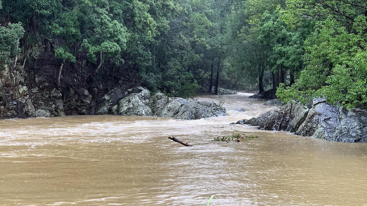
Joseph Lam8.05pm:Rain to push floods from moderate to major levels
Overnight rainfall could see push the flood alert from moderate to major in several NSW, the Bureau of Meteorology says.
Major flooding hit Penrith, north Richmond, Windsor, Wollombi Brook on Monday, with areas downstream of Penrith at risk.
Areas most at risk overnight included those neighbouring the Hawkesbury and Nepean rivers, the Macleay river and Menangle.
The Macleay River, about 60km northwest of Kempsey, reached a high of 6.4m at 5am on Monday and was likely to reach major levels with any additional rainfall overnight. Wollombi Brook was expected to reach a high of 8.6m.
BOM said several areas experienced the highest waters in decades. Penrith saw a high similar to the 1961 flood, north Richmond water levels were at that of the 1988 flood and Sacksville, currently at a moderate level, saw a high equal to the 1990 flood.
Weather is expected to begin to clear late on Tuesday with a clear forecast for Wednesday.
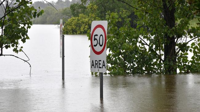
Rhiannon Down7.25pm: Rainstorm danger zone grows
Thunderstorms and another deluge are predicted to lash NSW and southeast Queensland on Tuesday as a second rain band bears down on the east coast, sparking fears of further flooding, with conditions not expected to clear until Wednesday.

The Bureau of Meteorology warned Tuesday would be another “critical day” as already flooded rivers overflow and volatile storm pockets threaten to bring torrential rain. Heavy rain of 100-200mm, which caused widespread flooding across Sydney’s west, the Hunter and mid-north coast on the weekend, has moved into Queensland.
North Tamborine, near the Gold Coast, recorded 263mm and Brisbane 125mm on Sunday, with about 37mm recorded between 9am on Monday and Monday night in Logan City near Brisbane.
Meanwhile, Kurrajong in the Blue Mountains recorded 174mm, North Richmond 95mm and Penrith 88mm on Sunday, as numerous evacuation orders and major flood warnings were issued on the weekend and Monday.
The mid-north coast was also pummelled by rain, and houses and livestock completely submerged, with Red Oak near Port Macquarie recording the highest total, 889mm falling between Thursday night and Monday.
Tuesday was predicted to be another wet day across the map with 30-40mm forecast for Brisbane, 45-80mm in Sydney and 40-70mm in Port Macquarie.
The rain band was also predicted to move south into eastern Victoria and Tasmania, with Mallacoota predicted to receive between 40-70mm on Tuesday and 10-35mm on Wednesday.
Remy Varga6.40pm:Victoria sends 30 rescue crew to NSW
Victoria has sent nearly 30 emergency personnel to NSW to assist with the flood response.
The State Control Centre is supporting this deployment with planning, resources and logistics, Emergency Management Commissioner Andrew Crisp said on Monday.
“Such is the scale of what we’re seeing in NSW, we expect the request for VICSES field crews will still come,” he said.
“We’re preparing how we can help out now, while ensuring we maintain operational capability in Victoria as this rain system heads further south.”
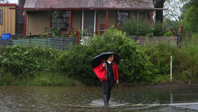
Joseph Lam6.30pm:Warning for area ‘the size of Alaska’
More than two-fifths of the nation, spanning every state except Western Australia, have been affected by torrential rain on the country’s east coast.
The Bureau of Meteorology has said about 10 million people will be affected by heaving rain, damaging winds and floods.
“Warnings for heavy rain, damaging winds and heavy surf cover a size area similar to #Alaska,” BOM said.
Around 10 million Australians in every mainland state and territory- except WA- are currently under a #weather warning as two major systems collide.
— Bureau of Meteorology, Australia (@BOM_au) March 22, 2021
Warnings for heavy #rain, damaging winds and heavy surf cover a size area similar to #Alaska.
Check here:https://t.co/K6DH85LfDvpic.twitter.com/usD2pmbZ82
Joseph Lam 5.45pm:‘Prepare to leave’, Western Sydney residents told
Western Sydney residents have been warned to prepare to evacuate as rising water levels have left several suburbs at a dangerous risk of flooding.
âš WIDEMERE DETENTION BASIN- PREPARE FOR EVACUATION As a result of rising flood waters residents should monitor the situation and be prepared to evacuate when instructed to do so.MORE:https://t.co/BCnxAe6tsR
— NSW SES (@NSWSES) March 22, 2021
The NSW State Emergency Service has issued two alerts late Monday afternoon warning residents of Clarendon by Rickabys Creek, about 55km from the Sydney CBD, and Wetherill Park, to be ready to leave when directed.
An evacuation centre is available for those in need at Castle Hill RSL on 77 Castle Street.
âš RICKABYS CREEK AT CLARENDON - PREPARE FOR EVACUATION âš Residents should monitor the situation and be prepared to evacuate when instructed to do so. MORE:https://t.co/FZooFaii4k
— NSW SES (@NSWSES) March 22, 2021
Debbie Schipp 5.30pm:Flood wedding a bright light amid the gloom
A mid-north coast bride has shared a happy story amid the desolation, with an epic picture of her marrying amid disaster.
Kate Fotheringham, a former journalist, shared the stunning image of her and her new husband embracing in front of the flooded bridge and roadway that almost put paid to their wedding day.
They were blocked from making the five minute drive into town until a helicopter firm from Port Macquarie stepped in.
She had sent out a plea for help after becoming trapped on the wrong side of rising floods.
“Help me!!! It’s my wedding day and we’re flooded in! We need help to get to Wingham over the flooded creek. Anyone know someone willing to help?” she posted on Twitter is desperation on Saturday morning. Today’s update shows she made it to the church on time.
Update, I made it to the church and married the love of my life! Affinity Helicopters in Port Macquarie came to the rescue and made sure we all got there. This is the bridge that blocked us from making the 5minute drive into town! What a day! #fotherbellwedding#floodwinghampic.twitter.com/u7OlsFsTjQ
— Kate Fotheringham (@KatelFog) March 22, 2021
Joseph Lam 5.20pm:It just keeps coming: month of rain in 48 hours
The Bureau of Meteorology has warned that some parts of western NSW could experience as much as a month’s worth of rain in just a couple of days.
“Some of the western areas (of the state) could see up to a month of rainfall falling in just 48 hours,” BOM said in a forecast on Tuesday.
“Rainfall of up to 100 to 150mm are possible along the great NSW divide.”
Rainfall will stretch from the Queensland border to as far south as Victoria and as west as Alice Springs.
Emergency services have begun preparing to co-ordinate a multi-agency response to risk of flooding in the western and southern regions of NSW.
NSW Police on Monday said discussions were underway with the State Emergency Service to provide a co-ordinated response.
State Emergency Operations Controller deputy commissioner Gary Worboys asked residents in flood-stricken areas to heed the advice of emergency services personnel and to stay home until advised otherwise.
“We are preparing and planning to ensure we are ready to respond as the weather event spreads to the western part of the state and the south coast,” commissioner Worboys said.
“The message from Police and SES has been consistent for the last few days – if possible, avoid going outside and if you do drive, plan ahead – pay attention to RMS message boards for road closures or hazardous conditions, and never drive, ride or walk through floodwater.”
BOM said a coastal low would be moving toward the Bass Strait on Tuesday leaving NSW relatively rain-free on Wednesday.
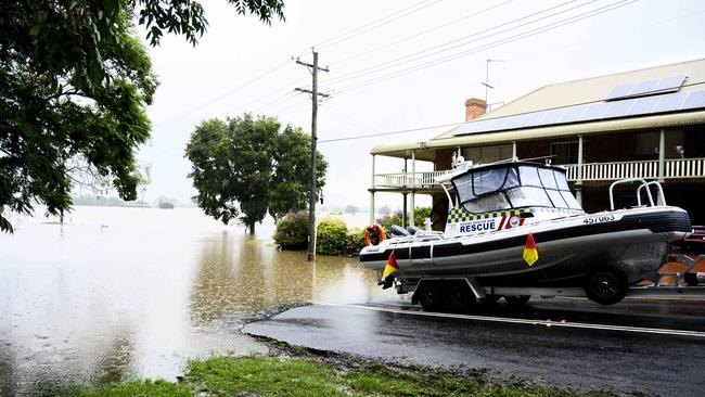
Joseph Lam 4.55pm:Elderly woman with broken hip rescued from flood
An elderly lady with a broken hip has been rescued from flood-stricken waters on NSW’s mid-north coast.
The rescue mission took place just after midday on Monday and saw at least a dozen personnel from NSW Ambulance, Fire and Rescue NSW and NSW State Emergency Services.
The multi-agency mission saw the woman transported through flood waters in a boat captained by NSW SES while Fire and Rescue water technicians helped navigate the move.
NSW Ambulance took over on land, transporting the woman to a facility to be checked
The rescue mission took place just after midday on Monday in Kempsey, NSW, and saw at least a dozen personnel from NSW Ambulance, Fire and Rescue NSW and NSW State Emergency Services.
MEDICAL EVACUATION An exceptional multi-agency effort to transport an elderly lady with a broken hip to safety. @NSWSES captained the boat to dry land in Kempsey, where our flood rescue crew was able to carefully lift her to the awaiting @NSWAmbulance where paramedics took over pic.twitter.com/E4EgUOFw2X
— Fire and Rescue NSW (@FRNSW) March 22, 2021
Joseph Lam 4.10pm:Flooding threat spreads south: Gippsland on alert
Residents in East Gippsland have been asked to remain on high alert as the region braces for minor flooding on Tuesday.
Heavy rain is expected to move south easterly from western NSW to eastern Victoria overnight, with between 70 to 100mm of rainfall forecast for East Gippsland.
The rainfall is expected to produce minor flooding along rivers close to the NSW Victoria border.
VIC Emergency expects minor flooding from the Genoa Catchment, on the border, down through to Cann and Bemm in the late afternoon.
The warnings arrived on the back of minor flooding alerts issued earlier in the day for the McKillops Bridge and Basin Creek area, about 80km apart, along the Snowy River.
Minor Flood Warning for Snowy River. For more info: https://t.co/fcQWETbk8L#vicfloods
— VICSES News (@vicsesnews) March 22, 2021
Joseph Lam 3.40pm:Respite for Laurieton as Camden Haven River drops
NSW State Emergency Service has issued a final flood warning for the Camden Haven River, with no further flooding expected.
The announcement arrived mid afternoon on Monday after the area experienced record levels over the weekend, with highs of 8.7 metres on Friday night.
Those levels have continued to drop below flood level of seven metres, reaching 1.19 metres earlier in the day.
âš ï¸ Final #Flood Warning issued for #CamdenHaven River. The Camden Haven River at Laurieton has fallen below the minor flood level. No further flooding is expected. See https://t.co/ED1wlwP9Y7 for details and updates; follow advice from @NSWSES. #NSWFloodspic.twitter.com/o7KScjFTTk
— Bureau of Meteorology, New South Wales (@BOM_NSW) March 22, 2021
Anton Nilsson 3.20pm:List of declared NSW disaster zones
Dozens of NSW localities have been declared disaster areas due to the ongoing floods, unlocking the possibility for residents to apply for government funds.
Services Australia lists 34 local government areas in NSW as eligible for the Australian Government Disaster Recovery Payment.
People living in those areas can claim up to $1,000 per adult and $400 for each child under 16 years old.
The local government areas that have been declared eligible are as of midday Monday:
- Armidale
- Bellingen
- Blacktown
- Blue Mountains
- Camden
- Campbelltown
- Canterbury Bankstown
- Central Coast
- Cessnock
- Clarence Valley
- Coffs Harbour
- Cumberland
- Dungog Shire
- Fairfield
- Hawkesbury
- The Hills
- Hornsby
- Inner West
- Kempsey
- Ku-ring-gai
- Lake Macquarie
- Liverpool
- Maitland
- Mid-Coast
- Nambucca
- Newcastle
- Northern Beaches
- Parramatta
- Penrith
- Port Macquarie-Hastings
- Port Stephens
- Sutherland
- Tenterfield
- Wollondilly
READ the full story here.
Lachlan Moffet Gray2.50pm:Suncorp‘s 1300 flood insurance claims, and growing
Insurer Suncorp has received around 1300 claims relating to flooding and heavy rain in northern NSW and South East Queensland, and expects more to be made over the coming days as it prepares to deploy customer support teams to the area.
“Our Customer Support Teams will be deployed to the most impacted regions when waters recede, and our affected bank customers can access our emergency relief package,” CEO Steve Johnston told the ASX on Monday.
“Our customers can be assured that we’re committed to their recovery and we will be with them every step of the way.”
The company said it had a $950m hazard allowance for FY21 and had recorded hazard costs of $643m across Australia and New Zealand as of February 28, which is “approximately $80 million favourable to the year-to-date allowance.”
Adeshola Ore2.12pm:PM flags ADF, aerial support for flood areas
Scott Morrison has flagged aerial support for NSW which has been lashed by once-in-50-year flooding.
But the Prime Minister said the NSW government had not yet made a formal request for defence assistance.
“The ADF is readying itself for this task that lies ahead, particularly in the recovery phase,” Mr Morrison said.
He noted it would be a “very difficult week” for thousands of Australians.
“There will be many difficult months ahead as the clean-up and recovery from this natural disaster gets under way,” he said.
Mr Morrison said he had spoken with NSW premier Gladys Berejiklian and the ADF was preparing for an official request for assistance, which he expected would be made today.
“We understand that this is likely to be for recovery support and clean-up operations including personnel, vehicles and machinery stopping the premier and they were discussing that over the weekend. We have also been just advised now in discussions on the potential for heavy lift aerial support but this is also still to be scoped,” he said.
Ellie Dudley1.44pm:Some western Sydney residents given all clear
Several western Sydney areas, including Penrith and Jamisontown, have been given the all-clear, and residents have been permitted to return home.
People in the following areas are allowed to return home:
– Properties within the area bounded by the Nepean River, south of the Great Western Highway and west of Peach Tree Creek. Includes: Captains Road; Fitch Avenue; Ladbury Avenue; Memorial Avenue; Nepean Avenue; and Recreation Avenue.
– Properties in the immediate vicinity of Cables Wake Park. The area bounded by Nepean River, Jamison Road and Peach Tree Creek.
– Properties bounded by Jamison road, Surveyors Creek, Blaikie Road, Rear of Penrith Homemaker Centre, Western Motorway and Nepean River.
– Properties bounded by Jamison road, Surveyors Creek, Blaikie Road, Rear of Penrith
Homemaker Centre, Western Motorway and Nepean River.
Emergency Management Minister David Littleproud said 2800 residents were evacuated from the area from Sunday evening through til Monday.
Many areas across #NSW currently resemble an inland sea. Once the rain stops & the water begins to reside, there will be a massive combined effort to clean up. However until that happens, listen to warnings, follow the @NSWSES advice, look out for family, friends & neighbours. pic.twitter.com/vhDqxkw40E
— NSW RFS (@NSWRFS) March 22, 2021
Ellie Dudley1.15pm:Kempsey: town’s levee likely to overtop
The Macleay River at Kempsey, on the NSW mid-north Coast, is set to burst its banks in the next few hours as residents nervously watch the town’s levee wall, and those who can shop at the only grocery store left open in town.
A flood evacuation order has been issued for the Kempsey CBD and authorities are warning the town’s levee is likely to overtop.
Evacuated Kempsey residents are anxiously watching the rising tide of the Macleay River, as floods continue to wreak havoc on the town.
The mid-north coast town was issued an alert at 9.30am for around 2000 residents in the CBD to leave their homes and flee to safety.
The Macleay River peaked at 6.4m this morning, about 50cm below the levee height. The State Emergency Services (SES) have given warning of further possible rises, as high tide hits at 7.30pm.
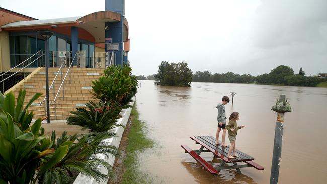
Floodwater may cross Macleay Valley Way (Old Pacific Highway) preventing access between Kempsey and Fredrickton.
The areas of Kinchela, Smithtown, Gladstone, South West Rocks, Hat Head, Jerseyville, Crescent Head, Stuarts Point and Belmore River are thought to have become isolated by flood waters.
Smithtown and surrounding areas may experience isolation when the Macleay River exceeds 5.7m at the Kempsey Gauge.
Should river heights continue to rise, the SES asks residents to consider the impact of potential isolation.
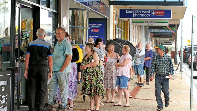
Residents are stocking up the local IGA — the only supermarket left open in town, as the nervous wait continues.
.@NSWSES crews are travelling up and down the swollen Macleay River in Kempsey, dropping off supplies to stranded residents.
— John Barilaro MP (@JohnBarilaroMP) March 22, 2021
A flood evacuation order has been issued for the Kempsey CBD and authorities are warning the town's levee is likely to overtop. pic.twitter.com/bRsU1W8qlu
Ellie Dudley12.40pm:Blame climate change: Climate Council
The multiple natural disasters Australia has experienced over the past 18 months — such as the floods currently ravaging NSW — should be blamed on climate change, say experts from the Climate Council.
“The intense rainfall and floods that have devastated NSW communities are taking place in an atmosphere made warmer and wetter by climate change, which is driven by the burning of coal, oil, and gas,” Climate Council spokesperson Will Steffen said in a statement on Monday.
“For many communities dealing with floods right now, this is the latest in a line of climate change-exacerbated extreme weather events they have faced, including drought, the Black Summer bushfires, and scorching heatwaves,” he added.
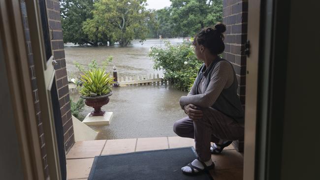
Global temperatures have risen 1.1C since pre-industrial levels, and this has led to a 7 per cent increase in water vapour in the atmosphere-increasing the likelihood of extreme downpours.
“Climate change is harming the health, safety, and livelihoods of Australians, racking up billions of dollars in economic losses, and damaging many of our unique ecosystems. It’s time for all levels of government and businesses to step up their climate action efforts to protect people, our environment and the economy,” said Professor Steffen.
“We must take decisive action this decade to bring climate change under control. Australia must get to net zero emissions well before 2040, and accelerate efforts to shift away from coal and gas to a fully renewables-powered economy,” he said.
Ellie Dudley12.20pm:Queensland flooding worsens as heavy falls continue
Areas on the south coast of Queensland surrounding Brisbane are also experiencing extreme amounts of rain today.
Minor flood warnings have been issued for the Balonne River, Moonie River, lower Warrego River, Paroo River and the Barcoo and upper Thomson Rivers.
A severe weather alert has also been given to people in Maranoa and Warrego, Darling Downs and Granite Belt, Southeast Coast and parts of Central Highlands and Coalfields, Central West, Channel Country, Capricornia and Wide Bay and Burnett Forecast Districts.
Incredible pictures coming in from the Gold Coast Hinterland after heavy rainfall.
— Annastacia Palaszczuk (@AnnastaciaMP) March 22, 2021
Thank you to our SES volunteers who worked through the night and answered 327 calls for help in 24 hours.@QldFES crews have also rescued 11 people in swift water rescues. pic.twitter.com/BbstnBNYNE
The Queensland SES has received more than 300 requests for assistance over the past 24 hours, with crews working through the night.
Fire and Rescue Service swiftwater crews conducted six rescues in south-east Qld overnight, including four instances of vehicles in floodwater. With more wet weather on the horizon, we’re urging residents to back it up when faced with floodwater. #ifitsfloodedforgetit 📷Clagiraba pic.twitter.com/P9OMfbsIJQ
— Qld Fire & Emergency (@QldFES) March 21, 2021
The majority of calls came from residents on the Gold Coast, Brisbane and the surrounding areas.
Six rescues were conducted in east Queensland overnight, including four instances of vehicles in floodwater.
Queensland Fire & Emergency and Premier Annastacia Palaszczuk are urging residents to “back it up” when facing floodwater.
Nicholas Jensen11.55am:Insurers declare floods a catastrophe
The Insurance Council of Australia (ICA) has declared a catastrophe for large parts of NSW following the weekend’s devastating storms and floods.
The ICA’s catastrophe declaration will aim to ramp-up the insurance industry’s response for affected policyholders, prioritising claims of those affected by the weather emergency.
Chief executive of the ICA, Andrew Hall, said “it’s too early to understand the extent of the damage to property in affected areas and to estimate the insurance damage bill, however insurers have received over 5000 claims in the past few days.”
“The insurance industry has made this catastrophe declaration to activate services and support for affected homeowners and businesses,” he said in a statement.
Earlier this morning, Insurance Australia Group (IAG) said it was increasing support for its customers affected by heavy rainfall and flooding in NSW.
IAG chief executive Nick Hawkins said the company was prepared for the high volume of claims and would be ready for assessment work.
“We now have additional resources in place to help our customers get back on their feet and we encourage customers to contact us to lodge their claim,” he said.
In a statement to the ASX this morning, the insurer said 2100 claims had been lodged since 8pm last night.
The company also said it was too early to determine the cost of damage.
Ellie Dudley11.40am:ADF focus ‘once the rain has stopped’
Gladys Berejiklian anticipates New South Wales will need the support of the Australian Defence Force “once the rain has stopped”.
“If we need their support of course we will ask for it,” she told a press conference. “My suspicion is we will.”
The Premier said the authorities have “no idea” what the fallout the floods will look like, but “that will be when we need that ADF support”.
Ms Berejiklian will go up in a helicopter today to surveil the Nepean river region which she said is “very concerning”.
She has also pleaded for residents who are asked to evacuate to do so.
“We do ask people for their patience,” she said. “When you’re asked to be evacuated, please know it is for your own safety.”
Ellie Dudley11.25am:Premier’s warning as alerts issued for new areas
Gladys Berejiklian has urged residents to follow advice from NSW emergency services, as the state continues to be ravaged by floods.
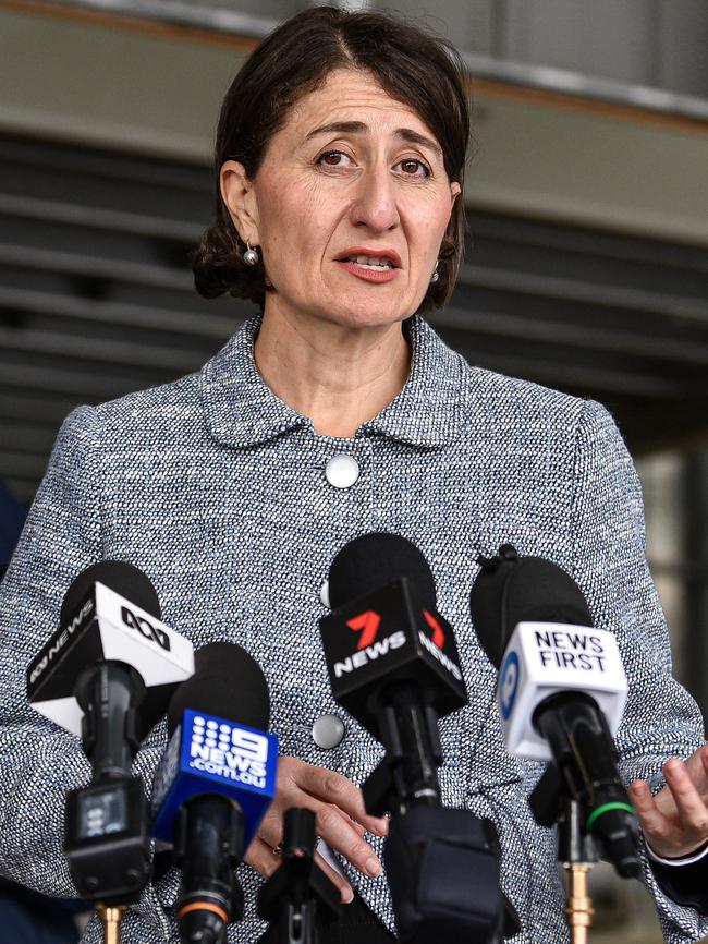
The NSW state agencies – including the Premier’s office – will gather together in Homebush in the mornings to work “holistically” to fight the floods, Ms Berejiklian told a press conference today.
“We ask everybody who is in those flood areas to please be cautious and listen to the orders,” she said.
“Please be ready if you have been asked to be on alert, be sure you are packed and ready to go in case you need to be evacuated at short notice.”
Ms Berejiklian also noted new alerts for minor flooding in the Illawarra and south coast regions, showing the storm is moving south.
Ms Berejiklian also asked those finding shelter from the floods to do so in a COVID-Safe manner.
Ellie Dudley11.06am:Raising dam wall would put more in danger: expert
Flood plain expert Jamie Pittock says raising the wall of the Warragamba Dam would not prevent future flood issues, but instead put more people in danger.
The Warragamba Dam, Sydney’s primary water supply, reached full capacity on Saturday and has been spilling hundreds of gigalitres of water since then, threatening communities along the Nepean River.
Professor Pittock is behind the campaign against raising the dam wall, and said the project backed by the NSW government would encourage urbanisation in the firing line of any future spillage.
Warragamba Dam continues to spill today. These photos of the dam were taken from the 7NEWS helicopter at 10:15am today. https://t.co/kRdCy5WM9E#NSWfloods#7NEWSpic.twitter.com/EpUGJB5E1X
— 7NEWS Sydney (@7NewsSydney) March 21, 2021
“Raising the dam is a very bad idea,” he told the ABC.
“The international experience is that when you build this kind of flood control infrastructure, it only encourages more development in harm’s way, and indeed that is exactly what has been proposed for western Sydney.”
Professor Pittock also spoke to the NSW government’s plans to develop the area into a CBD by 2050.
“There are around 70,000 residents on the flood plain that are in harm’s way, and the NSW government has plans to move another 130,000 people into this area by 2050,” he said. “That’s a really silly idea.
“I would argue that the best approach … is to prevent development on the flood plain, to leave the flood plains as places that can flood safely, use that land for agriculture and recreation and nature conservation, but don’t put more houses there.”
Adrian McMurray11am:NSW Premier Gladys Berejiklian to speak shortly
NSW Premier Gladys Berejiklian is due to provide an update on the floods across NSW at 11.15am.
NSW Emergency Services Minister David Elliott has already confirmed that the ADF will be deployed by the end of the day, and we expect the Premier will also cover this.
You can watch the press conference live at the top of this blog.
Ellie Dudley10.28am:ADF called in for flood relief effort
NSW Emergency Services Minister David Elliott says the Australian Defence Force (ADF) are expected to be deployed by the end of the day.
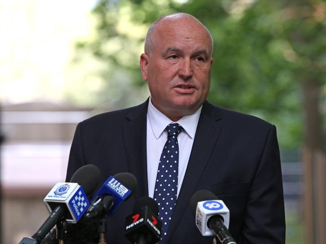
While the State Emergency Services (SES) are the “primary agency” fighting the floods, Mr Elliott confirmed the ADF will be used to assist with amphibious vehicles and other assets available only to the federal agency.
“They will be using whatever assets they have available,” Mr Elliott told Sky News.
Mr Elliott emphasised the ADF would be more heavily depended on in assisting with the clean up once the floods end.
“That’s exactly what happened after the bushfires,” he said. “I assume that is something that will occur after this event after we see how much damage has been done.”
Lachlan Moffet Gray10.15am:Insurer ‘ramping up’ support for flood-affected customers
Insurance Australia Group (IAG) says it is “ramping up” support for its customers affected by heavy rain and flooding in NSW’s North Coast and South East Queensland to ensure people in need of emergency accommodation are rehoused and there are no long wait times for those wanting to lodge a claim.

In a statement to the ASX, the $12bn insurer said more than 2100 claims had been lodged since 8pm on Sunday night, mostly in relation to property damage.
IAG CEO and Managing Director Mr Nick Hawkins said the company is well placed to handle a continued high volume of claims and would soon have boots on the ground for repair and assessment work.
“We now have additional resources in place to help our customers get back on their feet and we encourage customers to contact us to lodge their claim as soon as possible so we can organise immediate assistance,” he said.
“As soon as it’s safe to access the impacted areas, we’ll have our teams on the ground to begin the assessment and repair process, but our customers can access immediate help, including emergency accommodation, as soon as they contact us.”
The company said it was too early to determine the net cost of the recent flooding and storms but said it had a maximum event retention – an estimate to the largest claim an insurer is exposed to – of $169m.
READ MORE: Keep up with the latest business reaction in our live blog, Trading Day
Adeshola Ore10.04am:True extent of hit to vaccine rollout to be determined
Deputy Chief Medical Officer Michael Kidd says the federal government is yet to determine how many GP clinics have been impacted by flooding in NSW, as the next phase of the rollout commences today.

The federal government has warned that there will be inevitable delays as large parts of NSW are lashed with once-in-50-year flooding. Some GP clinics have been unable to open due to flooding while others have not received their vaccine COVID doses.
“The most important thing, of course, is safety,” Professor Kidd said.
“People should make sure that they are not putting themselves at risk by being on the roads. They should be following of course all of the instructions that are in place.”
READ MORE: Keep up with the latest in politics and the COVID-19 vaccine rollout in our blog, PoliticsNow
Ellie Dudley9.52am:The plan today for the NSW mid-north coast
The police commander of the mid-north coast district, Shane Cribb, has outlined today’s response to the floods ravaging the area.
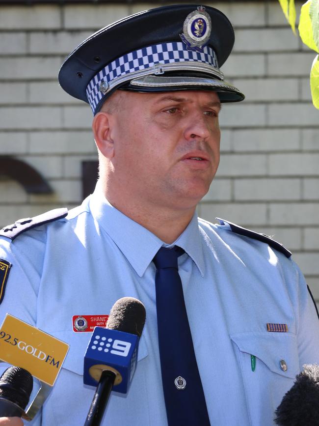
Superintendent Cribb said emergency workers have pulled shifts of more than 24-hours to try and support the community as people remain stranded by floodwaters.
“Today, our main aim is to formulate a number of plans where we can provide some restocking into those isolated people and those isolated communities,” he told the ABC.
“We have got some townships that have been isolated for a number of days now, for example we have a town with no water, so we need to come up with a way to get water into that township.”
People have been in evacuation centres for two or three days, Superintendent Cribb said.
“We have to get those people out of those locations,” he said.
“We have evacuation centres setup in ex-service clubs, golf clubs, and that is fantastic for providing that support, but we can’t leave people there forever, so today we’re trying to seek alternative accommodation.”
He added that these were the biggest floods he had seen in his career.
“I have never seen rainfall like this. I have worked in a number of floods and this is the biggest one I have worked in in my career, so, yes, it is extensive and serious,” Superintendent Cribb told the ABC.
Ellie Dudley9.45am:Full list: roads closures, public transport cancellations
Scores of roads have been closed as a result of floods and heavy rainfall across NSW today, and numerous public transport lines have been shut off.
As rain continues to ravage parts of the state, authorities have warned people to avoid floodwaters at all costs and be prepared to evacuate if necessary.
Drivers and public transport users have also been told not to travel if it can be avoided.
“Motorists are urged to avoid unnecessary travel,” a Transport for NSW statement said on Monday.
“Those who do not need to drive should exercise extreme caution and allow plenty of extra travel time.”
The full list of road closures can be seen below, along with public transport routes that have been affected by the weather.
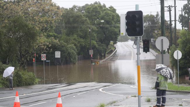
Roads
Greater Sydney area
• Windsor Bridge is closed between Macquarie Street and Wilberforce Road at Windsor
• Macquarie Street is closed between Brabyn Street and Bell Street at Windsor
• North Richmond Bridge is closed on B59 Bells Line of Road between Pitt Lane and Chapel Street at Richmond
• Wisemans Ferry Road is closed across the Cattai Creek Bridge at Cattai
• Pitt Town Road is closed between Saunders Road and Glebe Road at Pitt Town
• Garfield Road West is closed between West Parade and Carnarvon Road at Riverstone
• Springwood Road is closed across the Yarramundi Bridge at Yarramundi
• Wilberforce Road is closed between Freemans Reach Road and Rose Street at Wilberforce
• Castlereagh Road is between Thornton Drive and Jane Street at Penrith
• Mulgoa Road is closed between Glenmore Parkway and Water Street between Glenmore Park and Wallacia
• Wakehurst Parkway is closed between the Academy of Sport and Oxford Falls Road from North Narrabeen to Oxford Falls
• Oxford Falls Road is closed between Wakehurst Parkway and Aroona Road at Oxford Falls
• Audley Road at Audley Weir is closed in the Royal National Park
• Douglas Park Drive (causeway) is closed at Nepean River between Moreton Park Road and Mitchell Place
• Menangle Road is closed over Nepean River at Menangle Park
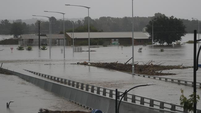
In the state’s north
• The A1 Pacific Highway is closed between George Gibson Drive and Manning River Drive/Old Bar Road from Coopernook to Glenthorne
• Manning River Drive is closed over the Manning River Bridge Between Glenthorne and Taree
• B56 Oxley Highway is closed between Henry Street at Long Flat and Billabong Drive in Sancrox
• B56 Oxley Highway is closed between Walcha to Mount Seaview due to a landslide
• Giinagay Way is closed between the A1 Pacific Highway and Edgewater Drive between Macksville and Nambucca Heads
• Failford Road is closed between the A1 Pacific Highway and The Lakes Way in Failford
• Waterfall Way is closed between Dorrigo Mountain and Thora due to a landslide in Thora
• The Bucketts Way is closed due to a landslide between Saxbys Road and Roys Road at Krambah
• Lismore Road/Bangalow Road is closed at Binna Burra between Bungalow and Lismore
• B84 Golden Highway is closed between Range Road and A15 New England Highway through the Singleton Military Area
• Main Road/Cessnock Road is closed between Avery Lane and Russell Street between Cliftleigh and Gillieston Heights
In the state’s west
• Jenolan Caves Road is closed in both directions between Hartley to Jenolan
In the state’s south
• A48 Illawarra Highway is closed between Mount Murray Rd and Yellow Rock Rd at Macquarie Pass
• A48 Illawarra Highway is closed between Tongarra Road and Croome Lane at Albion Park
Public Transport
Trains and regional coaches
• T1 North Shore line: Delays due to track repairs
• T7 Olympic Park line: reduced service
• Hunter line: Buses replace trains between Newcastle, Maitland and Dungog or Scone
• Blue Mountains line: Trains running slower
• Central Coast and Newcastle line: Buses replacing trains between Newcastle Interchange and Fassifern; shuttle train between Newcastle Interchange and Broadmeadow
• Train and coach services north of Sydney to and through regional NSW delayed, cancelled or replaced by coaches
Ferries
• Buses are replacing F3 ferries between Meadowbank, Rydalmere and Parramatta
Light Rail
• Delays to Newcastle Light Rail services
Ellie Dudley9.13am:The three areas to watch in NSW today
NSW Resilience Commissioner Shane Fitzsimmons has identified three areas to watch over NSW today: the mid-north coast, the Hawkesbury Nepean Valley system, and western NSW.
Parts of the state’s mid-north coast could see another 200mm of rain today, while those inland will see around 50-100mm.
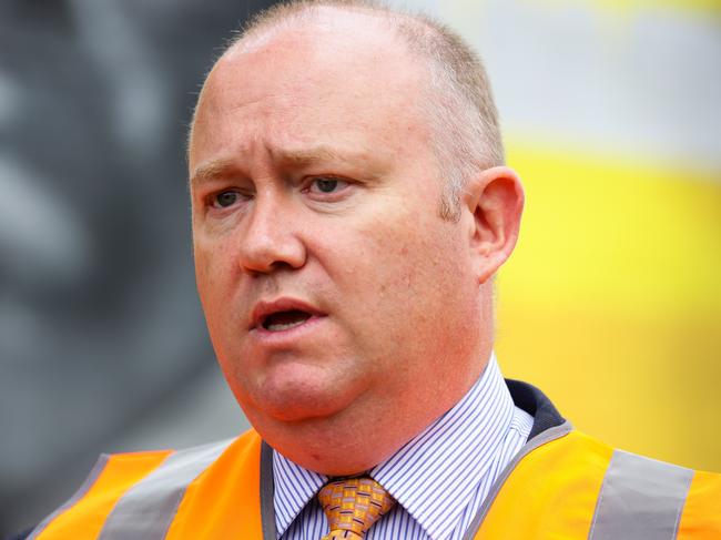
Sydney CBD will expect another 40-70mm of rain today and tomorrow, while western parts of the city could see up to 150mm.
“Already, thousands of people are affected,” Mr Fitzsimmons told Sunrise. “We have seen wonderful responsible people need to stay in tune with those responses.”
Additional support will be necessary in rebuilding affected areas, Ms Fitzsimmons said, as the state and federal governments work together to help those worst affected.
“There is support going into local government areas so they can focus on rebuilding and repairing essential community infrastructure,” he said.
“We are already working very closely with the state authorities and our commonwealth partners. We are readying ourselves what will be a very sizeable response to support recovery.”
Ellie Dudley8.30am:Dam release needed prior to floods an ‘impossible task’
NSW Water Minister Melinda Pavey has defended the decision of state authorities not to release water from the Warragamba Dam before the floods, in a growing dispute over dam management.

The Warragamba Dam, Sydney’s primary water supply, reached full capacity on Saturday and has been spilling hundreds of gigalitres of water since then, threatening communities along the Nepean River.
Communities surrounding the Nepean River were instructed to flee to safety on Sunday night.
While flood control specialists have said the water from the dam should have been released earlier, Ms Pavey said it was “an impossible task”.
“We would have needed to drop the dam to 25 per cent to stop any spill,” she told Sunrise. “That is an impossible task.
“I understand the concern that residents have, but we’ve also seen record rainfall into the Sydney basin itself.”
Ms Pavey implored NSW residents to listen to emergency services who are “working so hard to protect us all”.
Adeshola Ore8.05am:ADF will move quickly if asked: Morrison
Scott Morrison says he expects the federal government will receive requests for the defence force to be involved in recovery efforts later on Monday as large parts of NSW are lashed with once-in-50-year flooding.
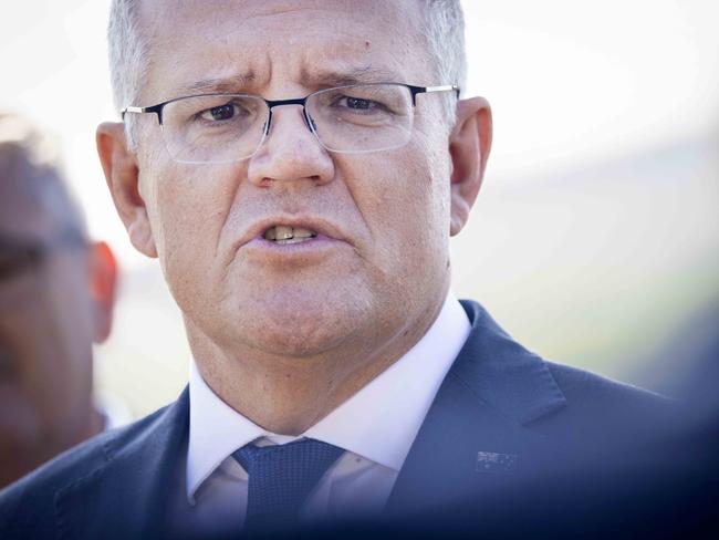
A total of 20 evacuation orders have been issued to areas across New South Wales, as the state prepares for another two days of heavy rains and floods.
“We expect later today we will start getting requests for the recovery operations on the other side,” the Prime Minister told 2GB radio.
“The NSW government has very, very good and significant resources and capable agencies to deal with the floods and they’ve got that in hand. Should they need anything further, I’ve got no doubt they will request it and will move very quickly.
“It’s a matter of pulling through together once again.”
Mr Morrison said emergency payments of $1000 for adults and $400 were already in place for affected areas.
Ellie Dudley7.50am:Sydney, Hunter residents told to work from home
Sydney and Hunter residents have been told to avoid unnecessary travel on Monday, particularly in flood affected areas.
Bus services in the Hawkesbury, Penrith and Blacktown area will not operate today due to flooding.
Just got this rather ominous warning from @TransportforNSW - “work from home†but this time due to weather, not viruses. #SydneyFloodspic.twitter.com/UzdYdgjf8x
— Benedict Brook (@BenedictBrook) March 21, 2021
Authorities are also urging people to work from home where possible.
In a message deployed on Sunday evening, Transport for NSW said: “With the current weather conditions affecting roads and public transport across Greater Sydney, we are urging customers to avoid unnecessary travel particularly in flood affected areas.”
Ellie Dudley7.40am:Almost 200 schools closed across NSW today
Almost two hundred schools have been closed across New South Wales on Monday due to the continuing flood emergency.
Kids must stay at home at several locations along the mid-north coast, Western Sydney and the Hawkesbury-Nepean Valley.
NSW Education Minister Sarah Mitchell said she expects “significant school closures today and in the coming days as well if this rain persists”.
“Please keep an eye on the (Department of Education) website and (each) school’s website because we will be giving information to families through those channels over the next couple of days,” she told Sunrise.
Students from independent, Catholic or private schools have been directed to check their individual school’s website for closures.
The following public schools will be non-operational on Monday due to localised flooding:
Barrington Public School, Beechwood Public School, Bellbrook Public School, Bellingen High School, Bobin Public School, Booral Public School, Brewongle Environmental Education Centre, Bungwahl Public School, Camden Haven High School, Carool Public School, Cattai Public School, Chatham High School, Chatham Public School, Chester Hill High School, Colo Heights Public School, Colo High School, Comboyne Public School, Congewai Public School, Coolongolook Public School, Coopernook Public School, Crescent Head Public School, Cundletown Public School, Dungog Public School, Elands Public School, Eungai Public School, Frederickton Public School, Gladstone Public School, Glenbrook Public School, Glenvale SSP (North Entrance Campus), Glossodia Public School, Green Hill Public School, Hannam Vale Public School, Hastings Public School, Harrington Public School, Hawkesbury High School, Herrons Creek Public School, Hinton Public School, Hopetown Public School, Jiliby Public School, John’s River Public School, Kempsey East Public School, Kempsey High School, Kempsey West Public School, Kendell Public School, Kinchela Public School, Krambach Public School, Kurrambee School, Laguna Public School, Lake Cathue Public School, Lansdowne Public School, Laurieton Public School, Lisarow High School, Lisarow Public School, Long Flat Public School, Longneck Lagoon Environmental Education Centre, MacDonald Valley Public School, Manning Gardens Public School, Medlow Public School, Megalong Valley Public School, Melville High School, Millers Forrest Public School, Mitchells Island Public School, Moorland Public School, Mount George Public School, Mount, Kanwary Public School, Nabiac Public School, Nambucca Heads High School, Narara Valley High School, North Haven Public School, Old Bar Public School, Orama Public School, Pacific Palms Public School, Penrith Valley Learning Centre, Pitt Town Public School, Port Macquarie Public School, Rolland Plains Upper Public School, South West Rocks Public School, Smithtown Public School, Taree High School, Taree Public School, Taree West Public School, Telegraph Point Public School, Tinonee Public School, The Pocket Public School, Upper Lansdown Public School, Wauchope High School, Westport Public School, Willawarrin Public School, Windsor High School, Wingham Brush Public School, Wingham High School, Wingham Public School, Wooli Public School, Wyong Creek Public School.
Ellie Dudley7.32am:Another 24, 48 hours to get through: Littleproud
Emergency Management Minister David Littleproud has urged NSW residents to remain vigilant as heavy rain and flooding continues for the early parts of the week.
Mr Littleproud said the state has another “24, 48 hours to get through”.
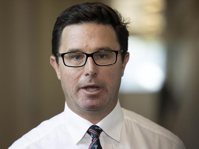
“I just had an update from the bureau saying they believe there will be heavy rain again today into Tuesday,” he told Channel 9’s Today.
“With the catchment so wet you have to expect that water will cause flash-flooding.”
Mr Littleproud also warned residents not to put emergency service workers in danger by not following the rules.
“We’re saying to people you have a responsibility to yourself and your family to understand the risks that are coming your way,” he said. “Particularly for those men and women that are putting themselves on the line.”
The federal government is prepared to deploy the Australian Defence Force to assist with the emergency if needed, Mr Littleproud confirmed.
Rebecca Urban7.26am:Schools closed across NSW
More than 100 public schools have been forced closed across NSW on Monday as parts of the state are hit by floods.
Schools along the mid-north coast affected include: Kempsey East Public School, Kempsey West Public School, Kempsey High School, Taree High School, Taree Public School, Taree West Public School, Port Macquarie Public School, Gladstone Public School.
North west of Sydney, schools to close include Marsden Park Public School, Casuarina School, Riverstone High School, Riverstone Public School, Quakers Hill Public School, Vineyard Public School, Pitt Town Public School, Penrith Valley School, Megalong Valley Public School and Hawkesbury High School.
A further 30 non-government schools will also close.
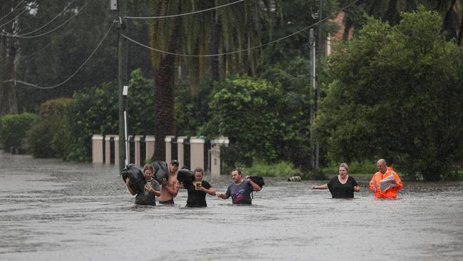
Ellie Dudley7.25am:Evacuation orders issued for 20 parts of NSW
A total of 20 evacuation orders have been issued to areas across New South Wales, as the state gears up for at least two more days of heavy rains and floods.
The following places have been given evacuation orders, with the State Emergency Services (SES) directing people to move away from the “high danger” areas.
■ Western part of Jamisontown;
■ Western parts of Penrith;
■ Northern end of Mulgoa;
■ Hawkesbury River at the northern end of low-lying areas of Agnes Banks;
■ Hawkesbury River at Cornwallis;
■ low-lying parts of northern Richmond;
■ Pitt Town North;
■ Hawkesbury River at Grono’s Point;
■ Hawkesbury River at Pitt Town Bottoms;
■ low-lying areas of Central Wingham;
■ Taree Estate, Dumaresq Island and Cundletown;
■ low-lying areas of Laurieton, North Haven and Dunbogan;
■ low-lying properties of Bulahdelah;
■ low-lying properties in Kings Point and Macksville CBD;
■ low-lying properties on the lower Macleay;
■ low-lying properties in Kempsey CBD;
■ low-lying properties in Port Macquarie;
■ Paterson and Williams Rivers Dungog;
■ Gloucester River at Gloucester and Manning River at Wingham; and
■ low-lying areas in North Macksville
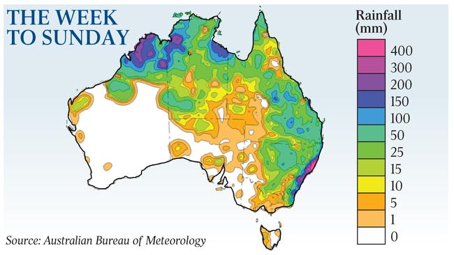
Thousands of people have evacuated already, with 2800 residents being moved in the western Sydney area alone.
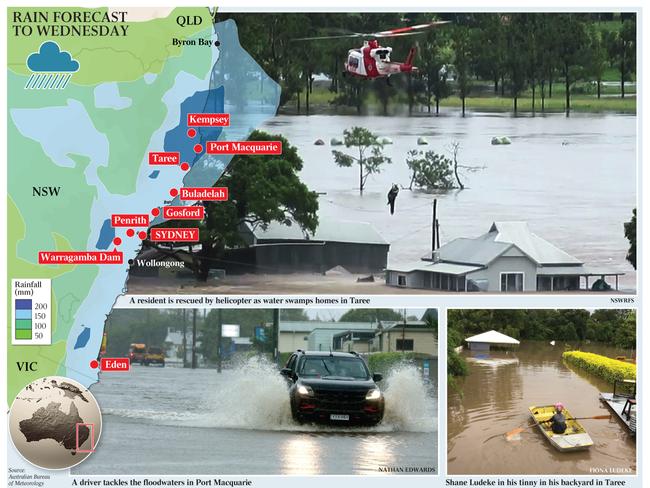
Overnight, emergency workers conducted 150 more flood rescues and responded to 1500 calls for help, taking the total for the weekend so far to more than 10,000.
Parts of the state’s mid-north coast could see another 200mm of rain today, while those inland will see around 50-100mm.
Sydney CBD will expect another 40-70mm of rain today and tomorrow, while western parts of the city could see up to 150mm.
Ellie Dudley6.55am:Kempsey alert issued after large rain cell strikes
A new flood alert has been issued for Kempsey, on NSW’s mid-north coast, after a large rain cell struck the region overnight.
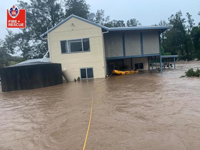
“We are expecting some renewed peaks on the river,” NSW SES Assistant Commissioner Nicole Hogan told ABC News. “There is an evacuation order for Kempsey CBD.”
“We have got approximately over 2000 people who have requested to evacuate under our evacuation orders at this stage. It is likely there will be more evacuations in low-lying areas.”
Ms Hogan urged people across the state to remain up to date with the latest orders, and stay vigilant.
Ellie Dudley6.30am:New flood alerts issued for Sydney
With the weather system dumping more than 850mm of rain on parts of the state over the past week, authorities continue to warn residents of risks as the floods hit Sydney.
Overnight, the Bureau of Meteorology issued a flood peak alert for people in western Sydney’s Hawkesbury Nepean, Penrith and North Richmond regions, as well as a major flooding forecast for Windsor.
The flooding is expected to be higher than the levels the state experienced in 1961, considered to be NSW’s most recent event of this scale, the State Emergency Services (SES) says.
Residents surrounding the Nepean River in western Sydney were also instructed to flee to safety on Sunday night.
A major flood warning was his morning issued for the Macleay River on the mid-north coast.
While the levels of the Hastings River in Wauchope on the mid-north coast are starting to fall, the BOM has told residents to remain alert for moderate flooding. The river is currently at 6.11 metres.
Moderate to major flood warnings remain in place for the Deua River, Orara River, Nambucca River and the Camden Haven River.
For the Tuggerah Lake, Wallis Lake, Myall River and the Snowy River, minor flood alerts were issued.
Warnings for potential flash flooding have been issued for:
■ Northern Rivers;
■ Mid-north coast;
■ Upper western and parts of Hunter;
■ Central tablelands;
■ North west slopes and plains;
■ Central west slopes and plains;
■ Lower western and the northern tablelands;
Stephen Rice6am:Weather to worsen; more evacuations imminent
NSW Premier Gladys Berejiklian has warned that potentially another 4000 people may have to evacuate in and around the Hawkesbury region, given “weather conditions will actually get worse, in terms of rainfall”.
“It is not just the dam, it is the rivers which are overflowing, it is sustained rainfall,” Ms Berejiklian said yesterday.
“The main focus is of course the Richmond community, the Hawkesbury Valley community, and parts of western Sydney,” Ms Berejiklian said.
“We weren’t envisaging a one-in-50-year event yesterday — we were hoping it would only be a one-in-20-year event.
“Now it looks like a one-in-50-year event, and that means potentially another 4000 people may be asked to evacuate in and around that Hawkesbury region and parts of western Sydney.”
The NSW State Emergency Service said the Hawkesbury River at North Richmond could exceed 14.4m late on Sunday, with further heavy rainfall forecast today. The Nepean River at Penrith was also expected to rise to as much as 10m on Sunday night and peak at Richmond and Windsor today.
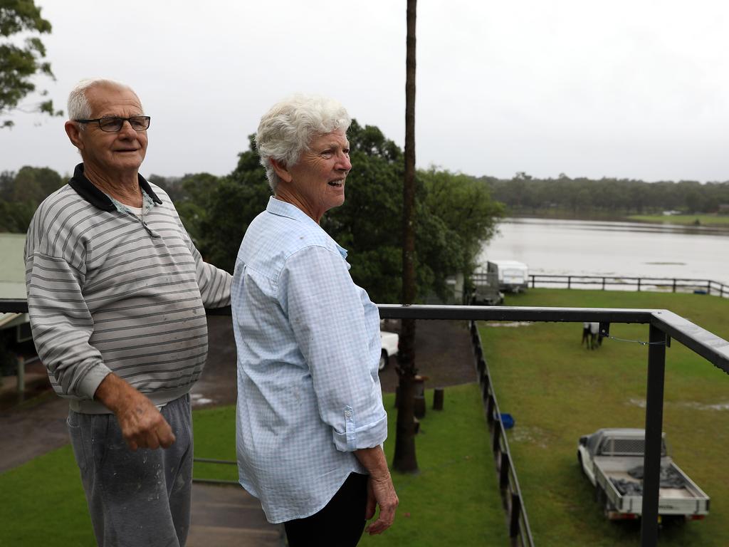
Kieran Gair5.45am:Livelihoods disappear in Sydney flooding
All Lorraine Smith could do was watch from her kitchen window as water swirled around her house in McGraths Hill on Sydney’s outskirts, rising quickly above her paddocks.
“The road went under at 6pm,” the 74-year-old said.
“Pitt Town is completely cut off from McGraths Hill, and it will be a lot worse on Monday.”
By 7pm on Sunday, Lorraine’s paddock had disappeared from view, submerged under 8m of muddy and potentially contaminated water.
While Lorraine and her husband Reg, 73, are determined to ride out this flood, as they did in 1990, they concede evacuating could be their only option.
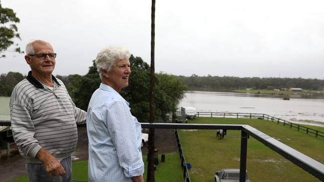
“We were completely blocked off in 1990,” she said.
“We effectively became an island. We’ve never had to evacuate before, but this is horrendous stuff. It’s going to be worse than the 1990 flood, and that was big.”
Read the full story here.



To join the conversation, please log in. Don't have an account? Register
Join the conversation, you are commenting as Logout