Extreme weather: NSW residents to prepare for days of torrential rain, floods
More wild weather is on the way for parts of northern NSW that have already been lashed by torrential downpours and flash flooding.
Several flood warnings are in place and NSW residents are being urged to prepare for torrential rain and damaging wind as forecasters warn there’s more to come.
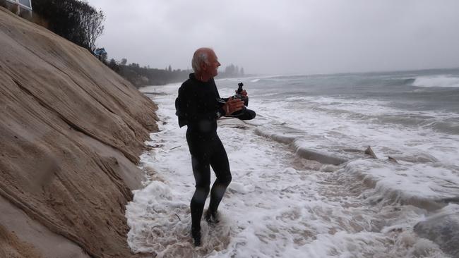
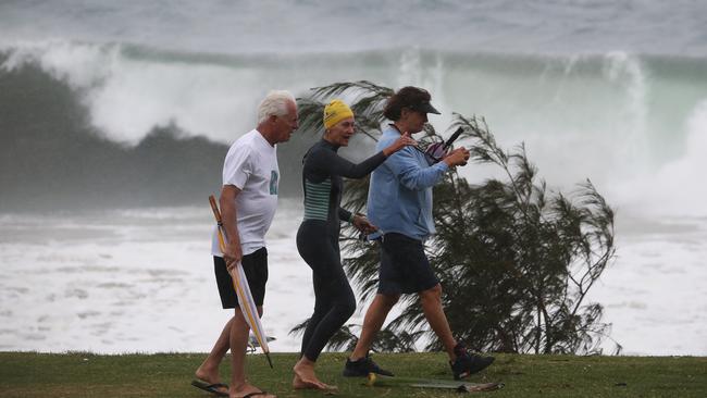
The wet weather conditions and super storms are expected to last until Wednesday morning, with enormous swells swallowing beaches, including Byron Bay’s popular Main Beach.
More than 400mm of rain has already fallen over the NSW and Queensland border, but there could be at least 100mm to come over the next few days.
The Bureau of Meteorology has issued several warnings for NSW, mainly for the far north coast where thunderstorms could deliver more rain and flash flooding to an already battered part of the state.
BOM said the weather event was caused by a low pressure trough off Queensland’s south coast that is expected to redevelop again on Monday as “the trough deepens”.
Look at that energy! The system that's causing heavy rain & localised flooding in northern NSW is seen here gathering pace as it tracks south from Qld. People in affected areas are urged to keep up to date with latest warnings, & put safety first: https://t.co/0ikQE2NKzl@NSWSES pic.twitter.com/3yTyhAAueQ
— Bureau of Meteorology, New South Wales (@BOM_NSW) December 13, 2020
Damaging winds of up to 90km/h are possible along the coastal fringe north of Yamba, possibly extending south to Crescent Head on the mid north coast during the day.
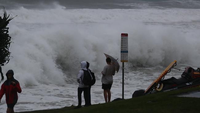
Five-metre swells could slam the coast all the way south to Port Macquarie, while high tides will continue to lash the coast at Ballina.
“The combination of damaging surf and abnormally high tides may enhance the risk of significant beach erosion north from about Ballina,” the bureau warns.
High tides on Sunday washed away the popular sandy Main Beach in Byron Bay as waves crashed up against rocks next to a levelled footpath and road.
Hazardous surf warnings are in place for the Byron Coast, Coffs Coast, Macquarie Coast and Hunter Coast, with that warning extending to Sydney and Illawarra on Tuesday.
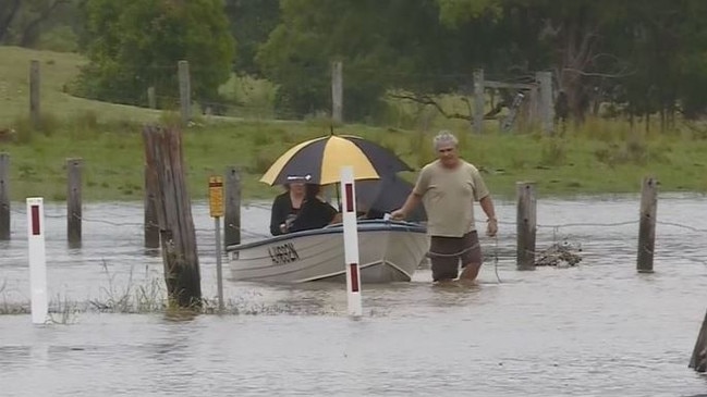
Flood warnings have been issued for the Tweed, Wilsons, Bellinger and Brunswick Rivers as well as for Marshalls Creek.
Heavy rainfall is expected to ease late Tuesday or early Wednesday, but it will be wet all week.
Sunday’s abnormally high tides could also put homes in danger, with those living on the waterfront warned of significant erosion.
BOM meteorologist Jonathan How described the overnight rainfall on Saturday night as “relentless”.
He said 326mm came down in Limpinwood in NSW and more was to come.
“King tides and dangerous surf could generate considerable coastal erosion (and) … flooding is already occurring in some areas,” Mr How said.
“The community should prepare for minor to major flooding, so please check for warnings and updates over the coming days.”
Forecasters said Monday would be a “critical time” for NSW as the trough moved further south and saturated rivers rose even further.
NSW SES media officer Ilana Pender-Rose said the La Nina event had mostly brought “a lot of rain” without damaging winds on Friday and Saturday.
“With the second system expected (from Sunday evening) we’re asking people to please never drive, walk or ride through floodwater,” Ms Pender-Rose said.
The State Emergency Service has received more than 700 calls for help since midnight on Thursday, with that number expected to climb.
A spokesman said the Tweed, Coffs and Mullumbimby areas had suffered the most damage, mainly fallen trees and leaking roofs.
Residents are urged to move the cars undercover away from trees, secure loose items, not to walk or drive in floodwater and stay away from powerlines.
A flood watch is also in place for southeast Queensland, including minor warnings for the Logan and Albert rivers.

High ranking cop charged with stalking
One of Western Australia’s highest ranking police officers has been stood down and will appear in court next month on a stalking charge.

Man dead after being tasered by police
An investigation has been ordered after a man suffered a fatal medical episode just minutes after he was tasered by police.