
Satellite images show shock extent of Sydney floods
Arresting satellite images have vividly shown just how bad the Sydney floods have become with the worst inundation for decades hitting some areas.

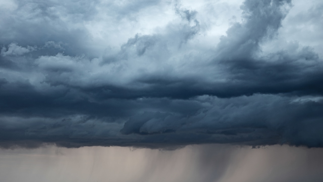
Startling images have emerged showing the extent of the floods that have left scores of Sydney suburbs underwater.
In recent years, Sydney and the surrounding areas have become no strangers to flooding. But in some places, the inundation from the East Coast Low on the weekend was the worst seen in decades.
The NSW government has declared the floods a natural disaster, allowing emergency funding to be distributed to people in 23 affected local government areas.
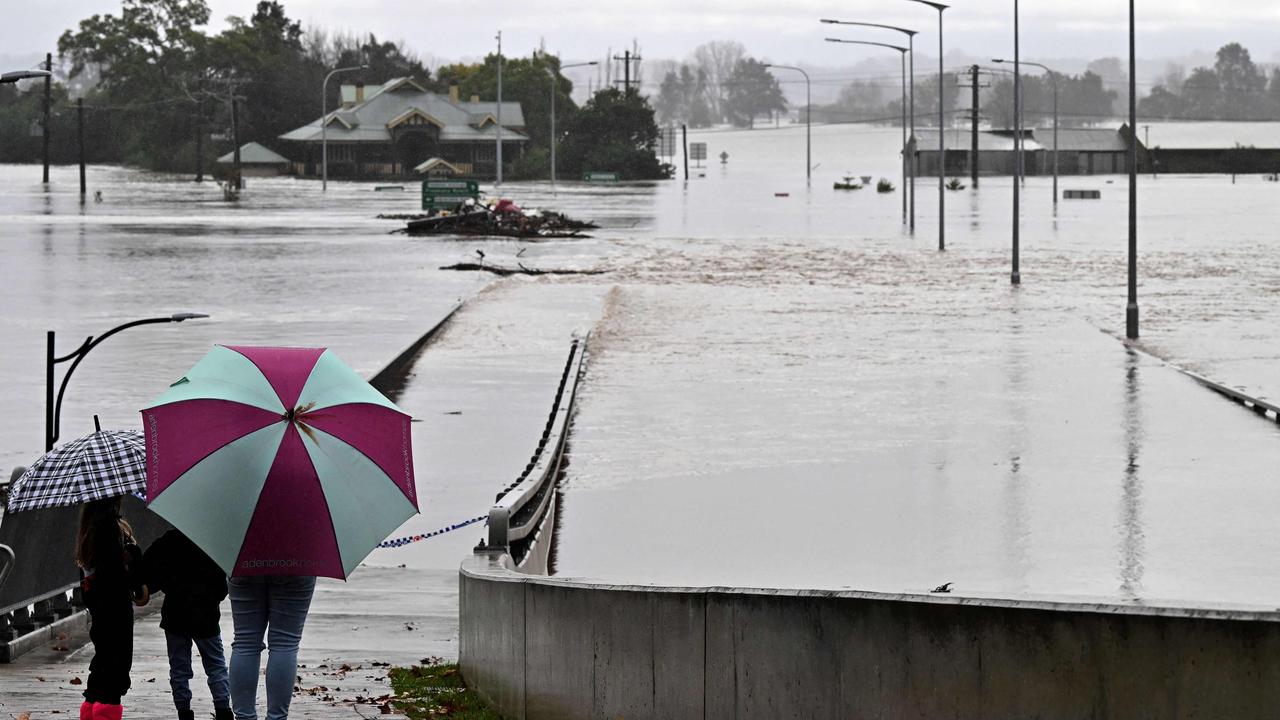
Windsor, on the city’s north western fringe, saw the river rise to just above the 13.8 metre high point from March’s floods, leading to it recording its worst flooding for 44 years.
Sky News Weather meteorologist Rob Sharpe said much of the damage had occurred across the Hawkesbury-Nepean river system that snakes its way around western and northern Sydney.
“As a whole, this is the worst of the flood events for the catchment as other events were particularly bad but in just one portion of the river system.
“This event is consistently bad across the whole catchment with multiple areas now worse than in recent years.”
Stream more weather news live & on demand with Flash. 25+ news channels in 1 place. New to Flash? Try 1 month free. Offer ends 31 October, 2022 >
Latest warnings
The Bureau of Meteorology on Wednesday morning issued warnings for Wollombi Brook and the Lower Hunter, warning major flooding was expected for Singleton from Wednesday afternoon.
Levels were expected to exceed those in March, a statement from BOM said.
Major flooding is occurring at North Richmond, Windsor, Sackville, Lower Portland and Wisemans Ferry. Minor flooding is occurring at Penrith.
Moderate flooding is occurring along the Upper Nepean River at Wallacia while minor flooding is occurring at Menangle.
Major flooding is also occurring along the Colo River, with the river at Putty Road currently peaking at about 11.20 metres, and expected to peak at similar levels to the March 2021 flood.
BOM told people in affected areas to call Triple Zero in life threatening emergencies and to call NSW SES if they needed rescuing or help with evacuating.
Residents were told to “avoid drowning” and to “stay out of rising water, seek refuge in the highest available place”.
Other advice included moving vehicles undercover and away from areas likely to flood, avoid being swept away by staying out of fast-flowing creeks and storm drains, and never driving, walking or riding through flood water as it can be deceptive and dangerous.
âš ï¸ #Flood Warning issued for #WollombiBrook and #LowerHunter. Major flooding likely at #Singleton from Wednesday afternoon with levels exceeding March 2022 event. See https://t.co/AdztI2rqg1 for details and updates; follow advice from @NSWSES. #NSWFloodspic.twitter.com/fKdhUBg4us
— Bureau of Meteorology, New South Wales (@BOM_NSW) July 5, 2022
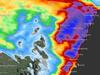
Satellite images of floods
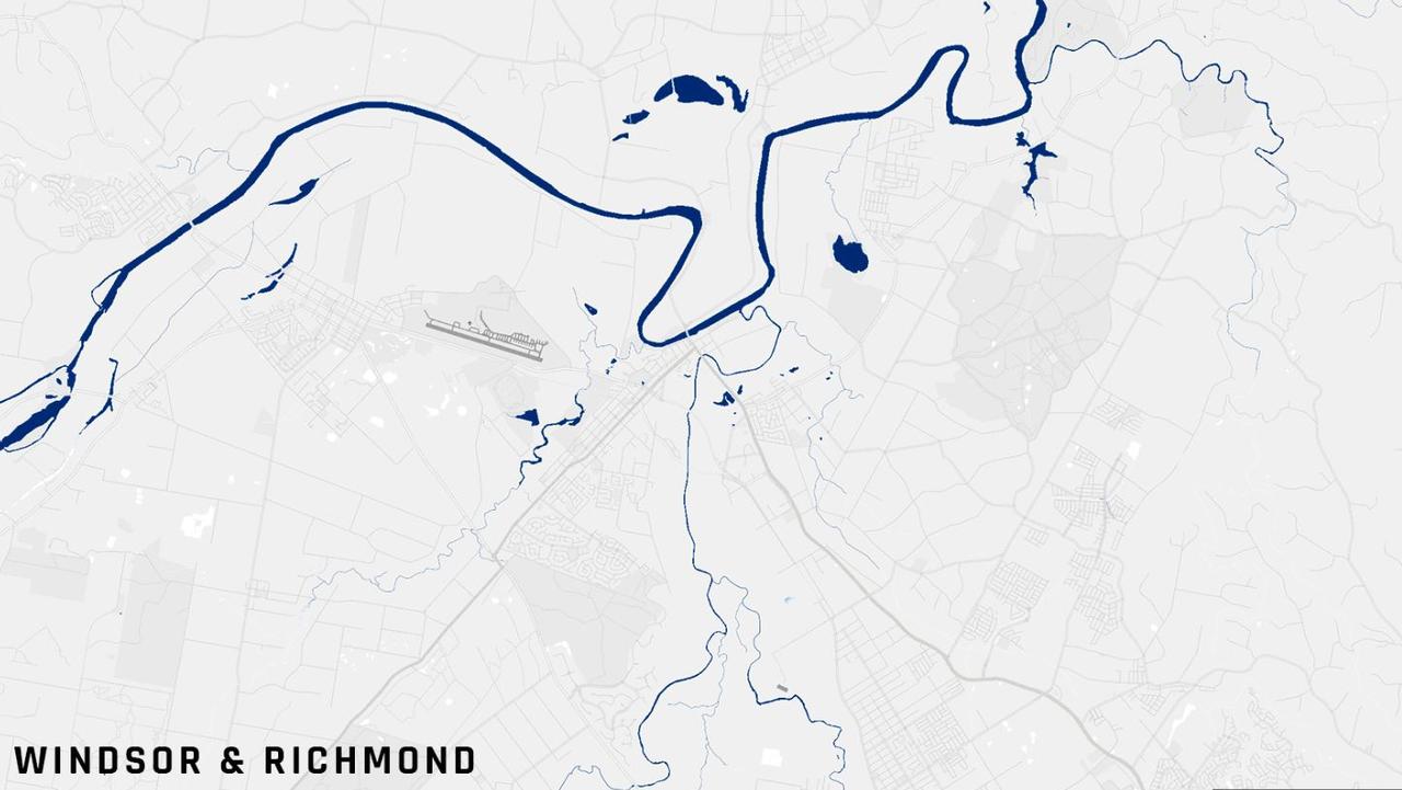
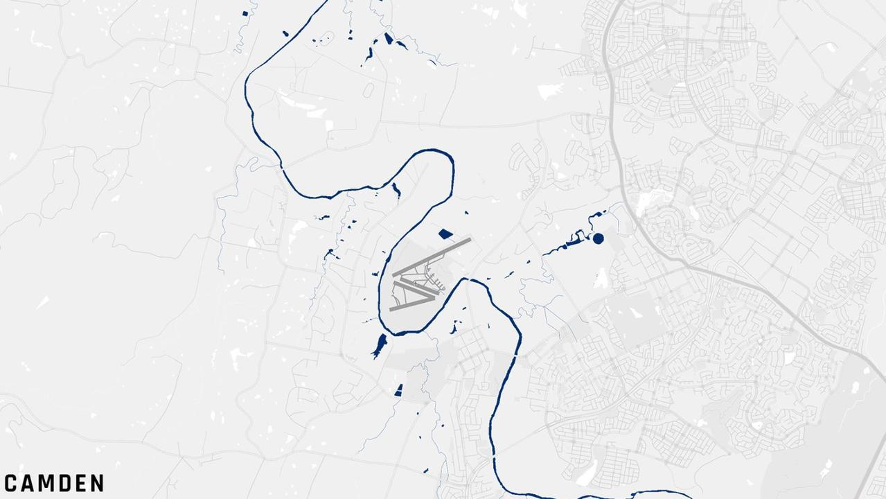
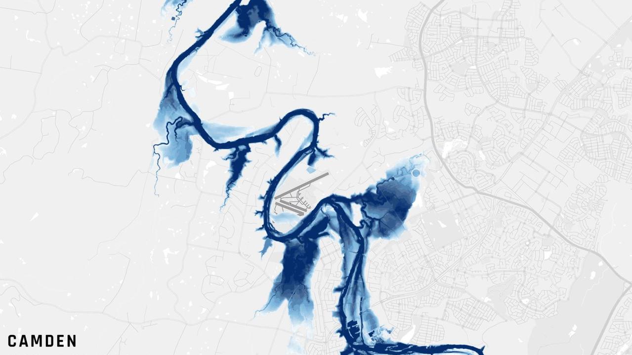
Images from Finnish satellite company ICEYE, provided to news.com.au, have graphically shown just how much water burst through the banks of the Hawkesbury and Nepean rivers. ICEYE’s satellites provide flood insights and data to governments and insurance companies.
One image shows Windsor and Richmond under normal conditions with the blue of the Hawkesbury flowing through with a number of small tributaries converging into the main river.
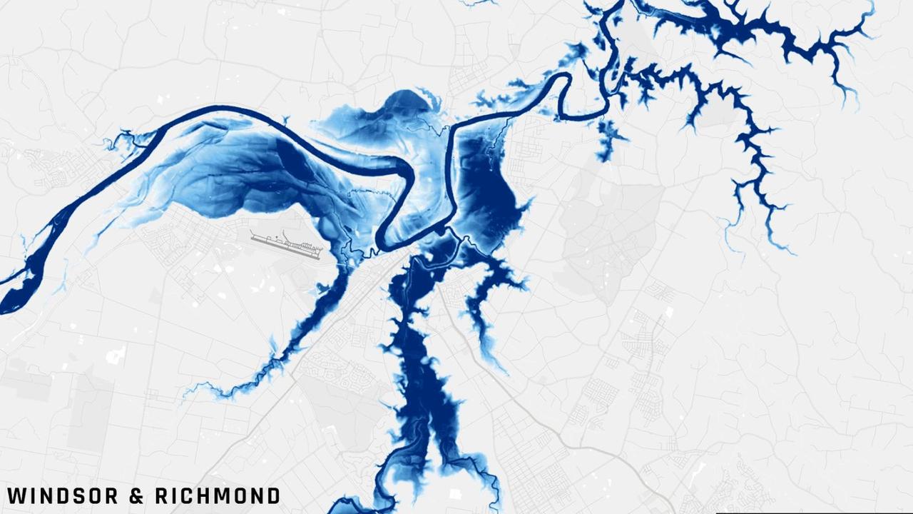
A second shows the dire situation on July 4 with large patches of blue showing how far the water had spread. It vividly shows how many of the tributaries fed large amounts of water into the Hawkesbury by the two towns.
Richmond air base, one of the RAAF’s biggest air bases, is a dry beachhead among the rising water. The central part of the town is close to the base and missed the water but pockets were flooded as well as the countryside surrounding the community.
The new Windsor Bridge went beneath the rising river for the second time this year.
Parts of Windsor and Richmond – as well as nearby Cattai, Pitt Town and Wisemans Ferry – had to be evacuated.
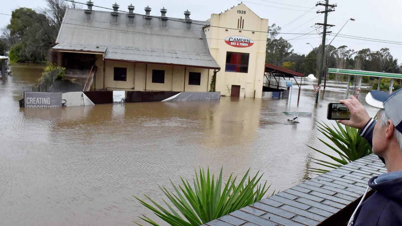
It was the same in Camden in Sydney’s south west. Hundreds of homes had to be abandoned as the waters continued to rise from the Nepean River which hugs the semirural suburb.
The satellite images illustrate the devastation caused by the waters which encroached on the town turning its centre into a soggy peninsula. Several streets vanished beneath the murky water.
Flood threat moves north
Across the flood zone, around 50,000 people have been ordered to leave their homes.
The State Emergency Service (SES) has received more than 500 requests for help.
The worst of the wet weather has now eased from Sydney and has moved north, meaning the flood threat has increased to the north of the city.
On Wednesday, the SES began issuing evacuation orders for areas around the central coast and Hunter regions.
People in parts of Combo, Whittingham, Glenridding, Dunnolly, Tuggerah, Budgewoi Lakes and Wollombi have been asked to leave their homes.
Forecasters have said relief is on the way with the low now dissipating. However, the sheer amount of water dumped in the rivers systems of NSW means the flooding may take days to cycle through.
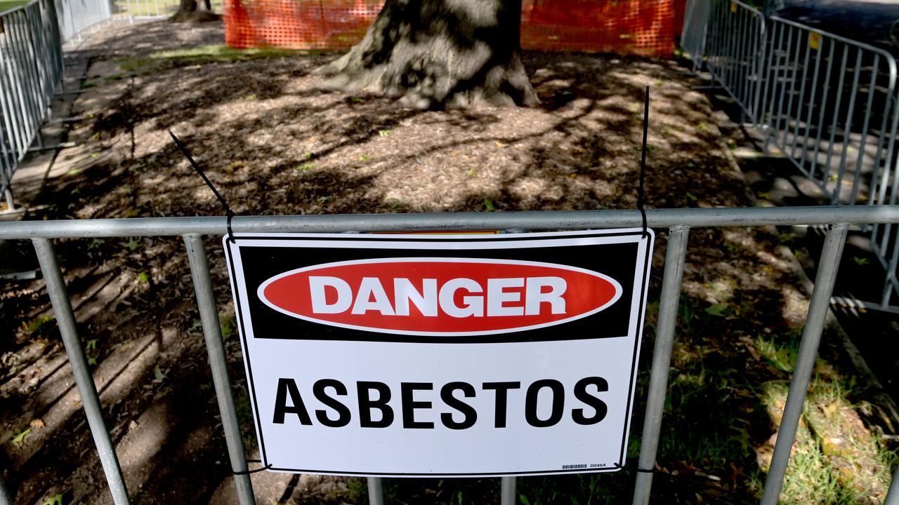
Concerns after asbestos found in park
Warning signs and metal fences have been put up around a park in one major city’s most recent asbestos-related incident.
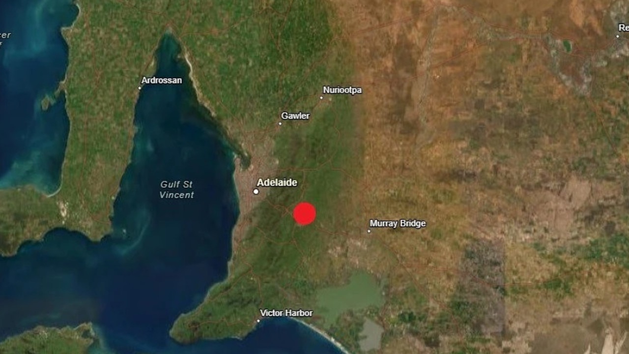
Twin quakes rock two Aussie cities
Hundreds of residents reported feeling the ground move as two separate earthquakes struck Victoria and South Australia just hours apart overnight.
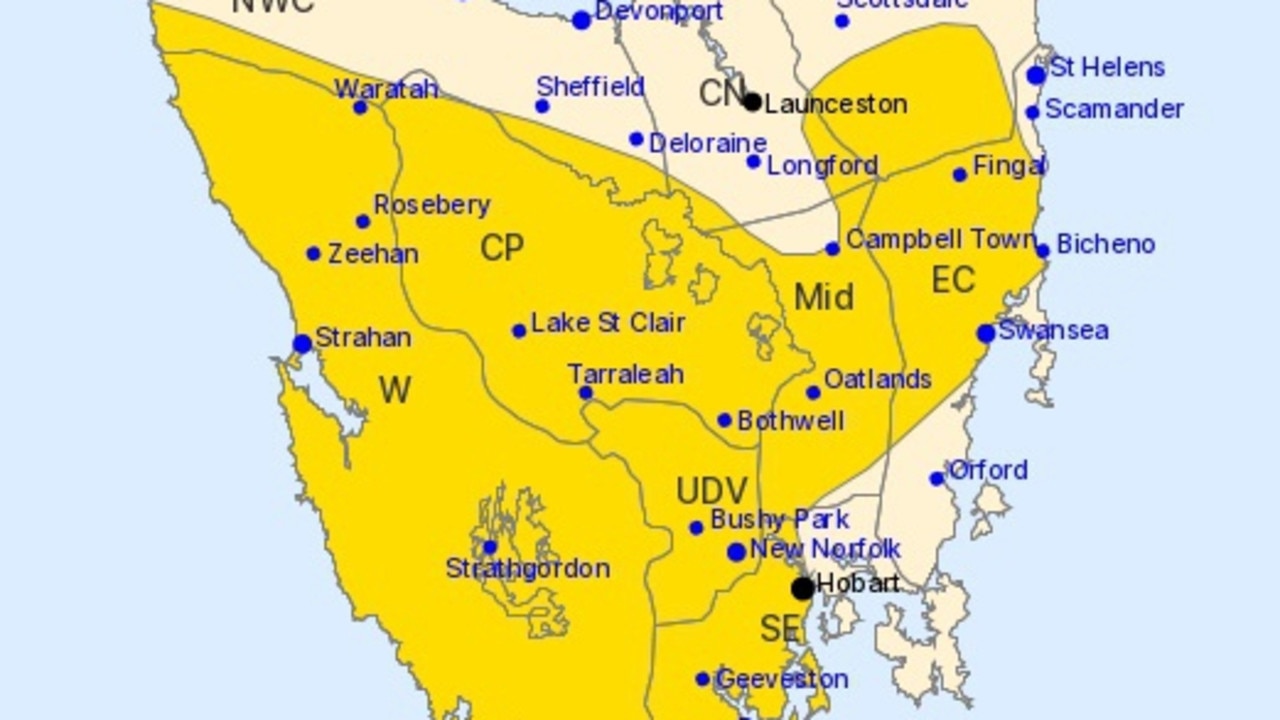
State to be battered by 120km/h winds
One state’s residents are being urged to prepare for a blast of wild weather, with dangerous wind gusts, thunderstorms, and rain forecast for days.