
SES issues new evacuation orders as flood disaster wreaks havoc across NSW
Thousands of NSW residents are facing evacuation tonight as dangerous weather smashes the state, with fears the worst is yet to come.


Tens of thousands of NSW residents are facing evacuation tonight as wild and dangerous weather smashes the state.
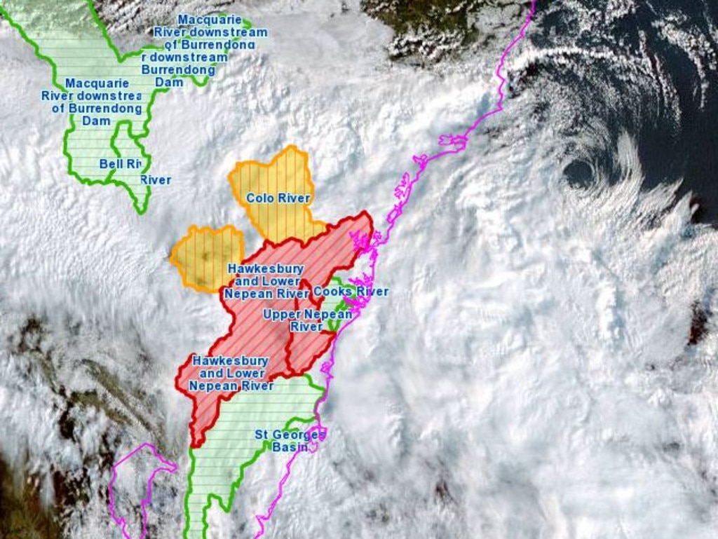
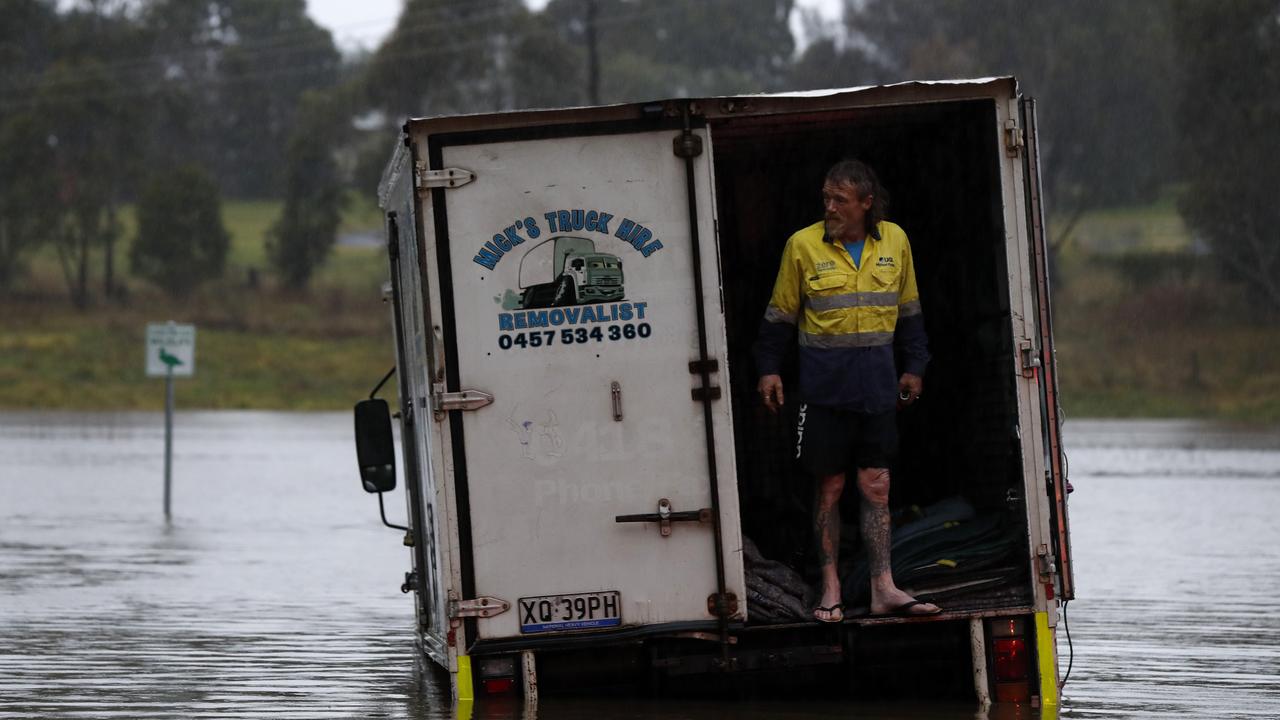
As torrential rain hammers some areas and Warragamba Dam spills at a rate greater than during the floods in March and April, approximately 32,000 people have either being ordered or advised by the SES to evacuate their homes.
That’s a massive 41 evacuation orders and 44 evacuation warnings, which have been issued to communities in the Illawarra, Western Sydney and Hawkesbury-Nepean areas.
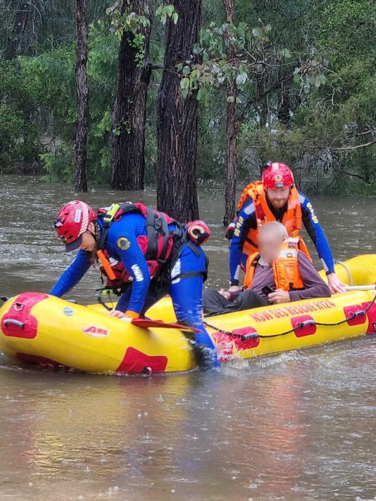
Meanwhile, SES members have responded to some 3111 requests for assistance since the start of the weather event, with 137 rescues taking place.
NSW Premier Dominic Perrottet has shared his concern about the distressing scenes unfolding around NSW, amid fears the worst is yet to come.
“It’s hard to put into words what some communities across NSW are going through, again," he said.
“We’re seeing distressing scenes from the flood zones across our state.
“Times like these are difficult. It will test our resilience. But it is also in these times that we see the best in people and the best in our communities.
“We have mobilised significant resources and all relevant agencies to get help to those in need. And we will pull together, as we always do, to get through this.”
It’s hard to put into words what some communities across NSW are going through, again.
— Dom Perrottet (@Dom_Perrottet) July 3, 2022
We’re seeing distressing scenes from the flood zones across our state.
Times like these are difficult. It will test our resilience.
‘The situation will escalate overnight’
A man died after being pulled from a Sydney waterway on Sunday. Emergency services including Polair attended the Parramatta River off Abbotsford Parade after reports a boat had capsized and a man was struggling in the water.
Despite being assisted by a member of the public, the kayaker died at the scene.
The sad news was shared in a flood update from emergency services, where NSW SES Commissioner Carlene York warned residents in affected areas to be prepared for things to get worse overnight.
“What we have is a particularly serious event that has escalated over the days and is forecast to escalate over the night,” Ms York said.
“We want the community to be aware of the risk.”
Parramatta River in full flow today. High tide earlier today didn't make it any easier. #SydneyWeather#NSWFloodspic.twitter.com/OwLlZex5SJ
— @Petar Vodogaz (@PetarVodogaz) July 3, 2022
Emergency services minister Steph Cooke added that residents should not wait for an evacuation order given Warragamba Dam is spilling at fast rate.
“If you were safe in 2021, do not assume you will be safe tonight. This is a rapidly evolving situation, and we could very well see areas impacted that have never experienced flooding before,” she said.
“Don’t put your life at risk or the lives of your loved ones at risk and the lives at risk of our emergency services volunteers who are turning out in force.
“It was a long night last night. It’s been a very long day today, and tonight will be another long night for our emergency services workers and our volunteers.”
She later tweeted about how fast the situation was escalating.
“Flooding in the Hawkesbury Nepean Valley is escalating very quickly. Torrential rain continues to fall and Warragamba is spilling at a rate of 500GL.
“Tonight we are likely to experience river rises higher than the previous three floods.”
Flooding in the #Hawkesbury#Nepean Valley is escalating very quickly. Torrential rain continues to fall and #Warragamba is spilling at a rate of 500GL. Tonight we are likely to experience river rises higher than the previous 3 floods.
— Steph Cooke MP (@stephcookemp) July 3, 2022
@ResilienceNSW has established 6 evacuation centres at #CanleyVale, #CastleHill, #Gymea, #Narellan, #NorthRichmond and #Richmond. Details available at: https://t.co/GdZKxMxWA1. For emergency help call 132 500, and for life-threatening emergencies call 000.
— Steph Cooke MP (@stephcookemp) July 3, 2022
Thousands of homes at risk
Commissioner York also warned that there are hundreds, if not thousands, of homes that may be subject to evacuation warning and potential flooding in the coming days.
“We ask that those communities really be aware of the messaging that we’re putting out,” she said.
“There are thousands of people that are affected by what we’re looking at tonight.”
It comes after the SES issued an urgent new evacuation order for parts of Sydney, urging residents to get out now – before it’s too late.
It also pleaded with people to avoid unnecessary travel.

Six new evacuation orders are now in place for parts of the Hawkesbury, with locals ordered to get out immediately.
The new orders cover all parts of Cornwallis and Pitt Town Bottoms, as well as parts of Ebenezer, Pitt Town, Cattai and eastern parts of the Richmond Lowlands.
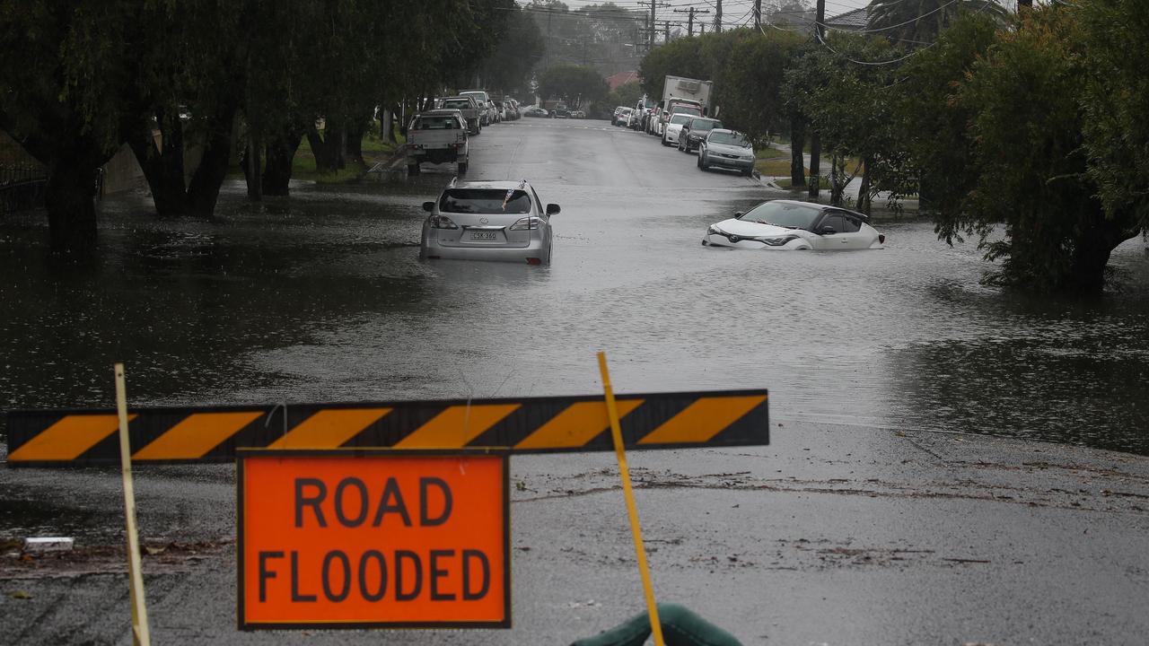
A string of full or partial evacuation orders were also issued earlier on Sunday, impacting parts of Pleasure Point, the Bents Basin area, parts of Wallacia, parts of Woronora, parts of Camden, parts of Moorebank, parts of Chipping Norton and Warwick Farm, parts of Liverpool, parts of Lansvale and Georges Hall on Beatty Parade.
A submerged road intersection at Chipping Norton. Nearby streets have been evacuated as the Georges River reaches moderate flooding #sydneyfloodspic.twitter.com/Xva86lnREA
— Gavin Coote (@GavinCoote) July 3, 2022
Residents of several suburbs in and around Sydney were told to leave their homes overnight as a monster storm bears down on the city, with predictions as much as half a metre of rain could fall in total.
Forecasters have said the worst of the weather is yet to come with an East Coast Low set to near the coast on Sunday and drag into Monday.
The outlook is now for the East Coast Low to have multiple centres to it which could turbocharge its impact.
“There are numerous threats,” said Sky News Weather senior meteorologist Tom Saunders.
“There’s torrential rain, the risk of major flooding, landslides as well as damaging winds which could bring down trees and lead to property damage and power outrages”.
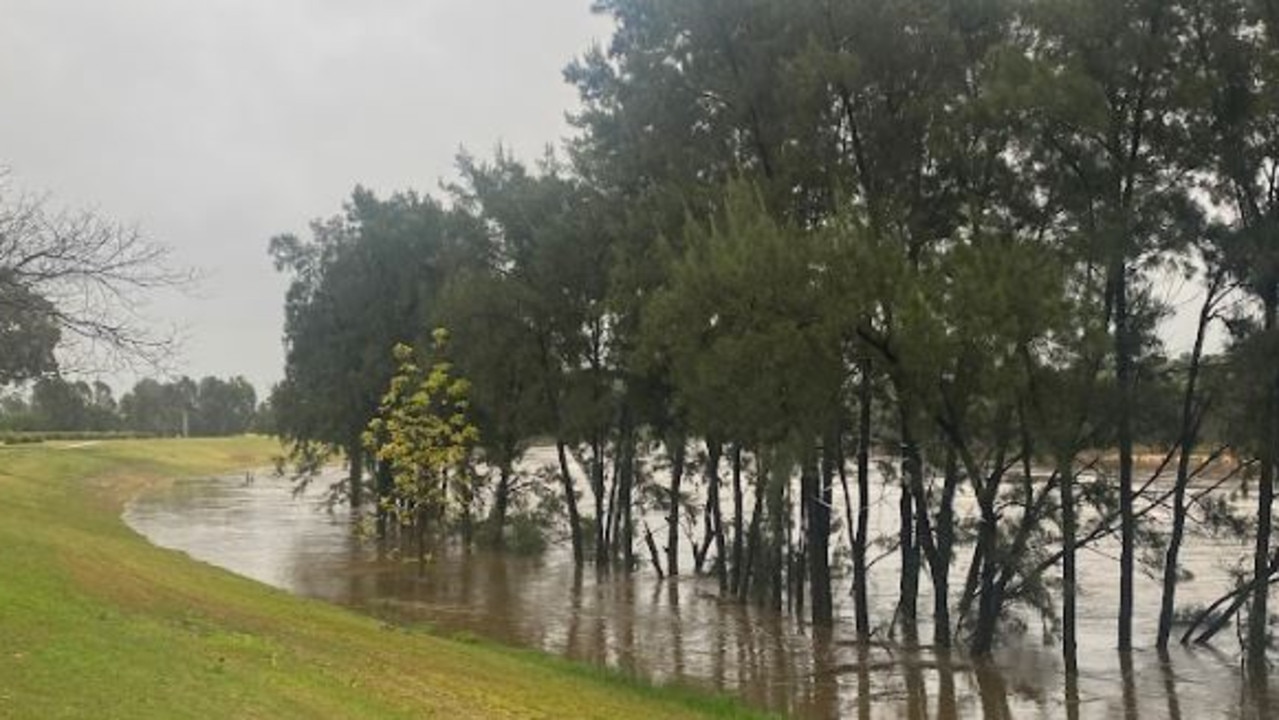
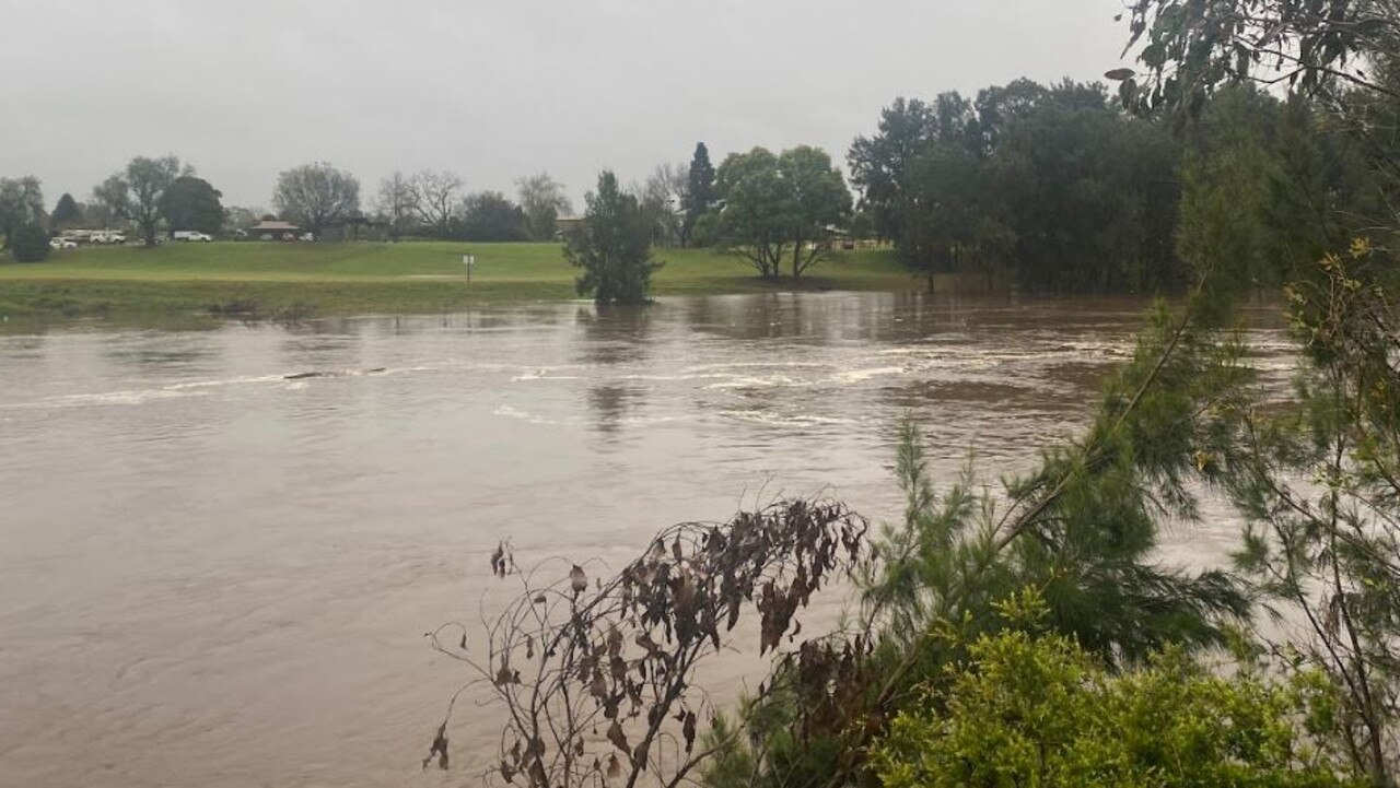
Major flooding areas
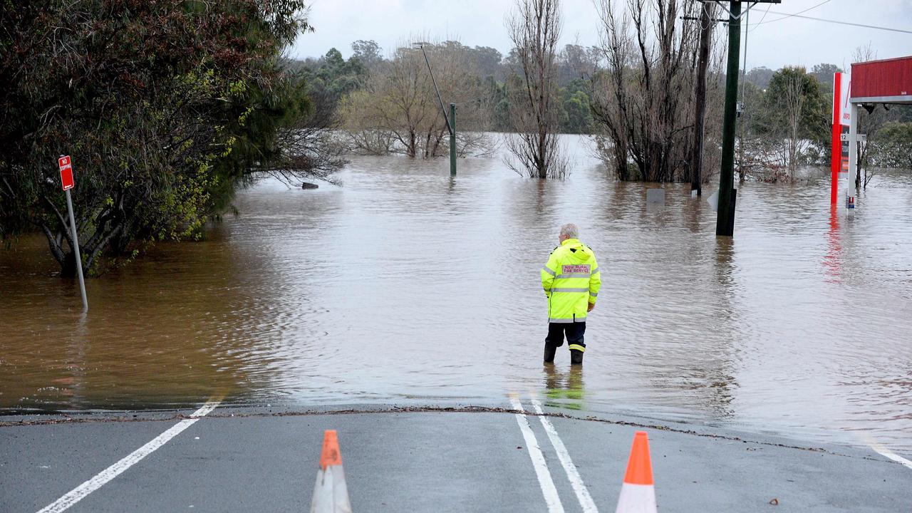
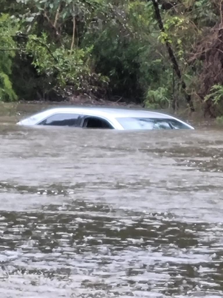
Major flooding is occurring at Menangle, Wallacia, North Richmond with river levels reaching as high as March’s disastrous flood event. While Camden, Penrith and Windsor are experiencing moderate flooding
And major flooding is forecast for Windsor, Sackville and Wisemans Ferry.
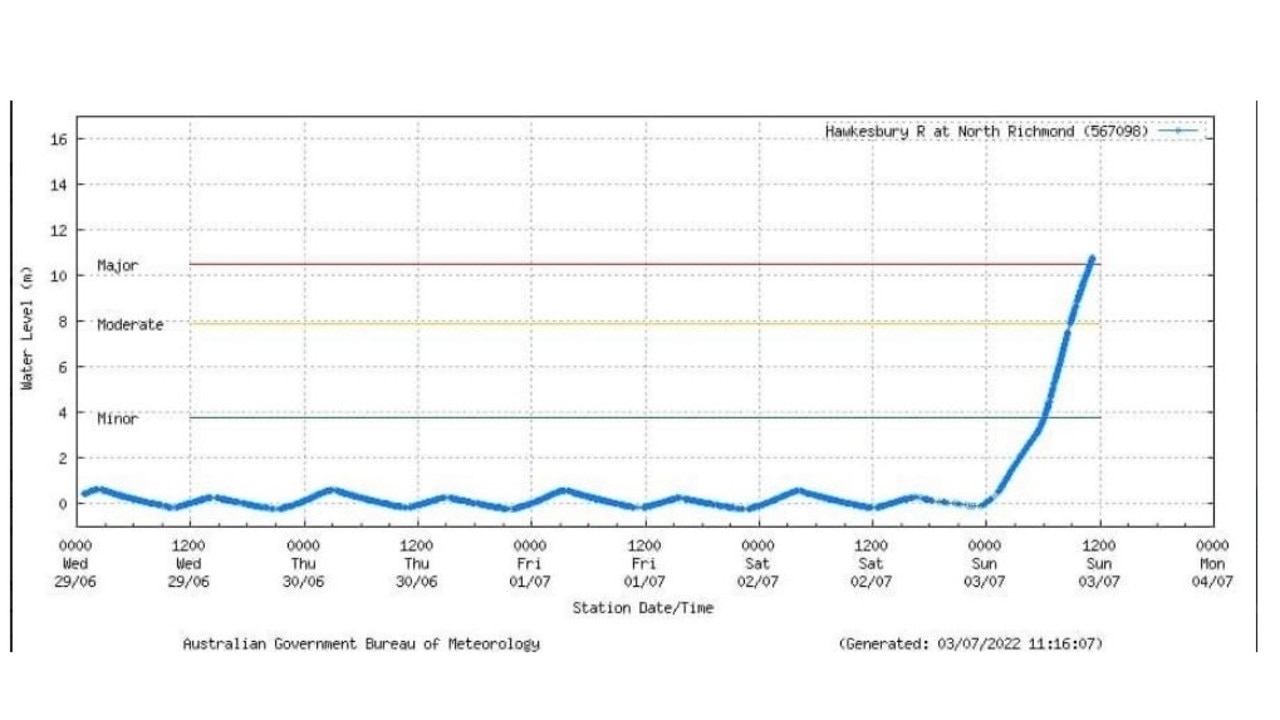
According to the Bureau of Meteorology, North Richmond has gone up a staggering 10m from midnight to Sunday afternoon.
River levels in the Nepean River at Menangle have exceeded the flood height reached in the March 2022 flood event – 15.92 metres – and peaked slightly below the April 2022 flood height of 16.83 metres.
The latest information shows the Nepean River at Camden Weir has fallen to 12.3 metres, and at Penrith it’s at 9.32 metres and peaking, while Hawkesbury River at North Richmond WPS has recorded 13.79 metres.
Meanwhile, the Hawkesbury River at Sackville is rising at 5.59m and the Macdonald River at St Albans is rising at 1.27m.
âš ï¸ #MAJOR FLOODING Hawkesbury River at North Richmond (WPS) may exceed the March 2021, March 2022 and April 2022 flood events SUNDAY NIGHT. Warning info https://t.co/iJsDmnTjAX
— Bureau of Meteorology, New South Wales (@BOM_NSW) July 3, 2022
follow advice from @NSWSES#NSWFloodspic.twitter.com/jM8whJ2zoi
Stream more weather news live & on demand with Flash. 25+ news channels in 1 place. New to Flash? Try 1 month free. Offer ends 31 October, 2022 >
‘Life-threatening emergency’
Emergency Services Minister Steph Cooke has warned that NSW now faced a “life-threatening emergency” as floods wreak havoc.
The warning comes after Warragamba Dam spilled at around 2am last night, “well ahead of predictions”.
Speaking at a press conference on Sunday morning, Ms Cooke said the disaster had been caused by an east coast low weather system developing off the coast, which is tipped to remain for several days.

“This means even more torrential rain, it means strong damaging winds, and it means coastal erosion in Sydney, the Central Coast, the south coast and the Illawarra,” she warned.
“We are now facing dangers on multiple fronts … If you live anywhere between Newcastle and Batemans Bay, please don’t be caught unaware by the current weather situation.
“This is a life-threatening emergency situation. If you know your local community is prone to flooding, then please be prepared to evacuate and at short notice.”
9,500 people are now subject to evacuation orders and warnings, and this number continues to rise. NSW faces a number of dangers: flash flooding, riverine flooding and coastal erosion. I’m encouraging all communities to heed the advice of @NSWSES and @BOM_NSW.
— Steph Cooke MP (@stephcookemp) July 3, 2022
‘Extremely dangerous out there’
At the same press conference this morning, NSW State Emergency Services Commissioner Carlene York said lives could be lost.
“It is extremely dangerous out there. Stay out of the floodwaters, and we always warn don’t drive through floodwater and particularly don’t walk through them or allow children to play near them,” she said.
“There is no room for the rain to stay in the dams, and they are starting to spill. The rivers are flowing fast and dangerous and then there is the risk of flash flooding depending on where the rains are.
“There are a lot of risks the community needs to be aware of, and I ask you to heed the warning.”
Aussies rescued in dramatic scenes
Thousands of residents in areas of Sydney’s southwest have been ordered to leave their homes, and the SES received more than 1400 calls for help overnight following scores of rescues on Saturday.
In one incident, a young woman was rescued after floodwaters left her clinging to a tree for safety for more than an hour in Holsworthy.
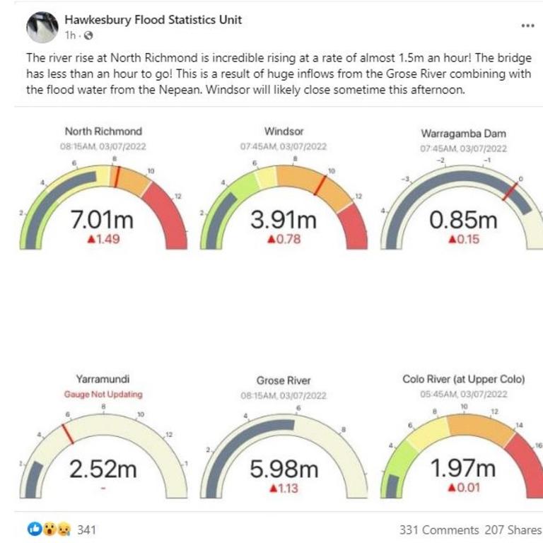
On Sunday morning, the Hawkesbury Flood Statistics Unit reported that the river at North Richmond was “rising at a rate of almost 1.5m an hour” as a result of “huge inflows from the Grose River combining with the flood water from the Nepean”.
The bridge has since closed, with the nearby Windsor bridge likely to shut in the next few hours.
Meanwhile, the federal government has announced 100 defence force troops and two helicopters are ready to assist NSW as the situation unfolds, with Defence Minister Richard Marles confirming the government was on the “front foot” as flash flooding threats loom.
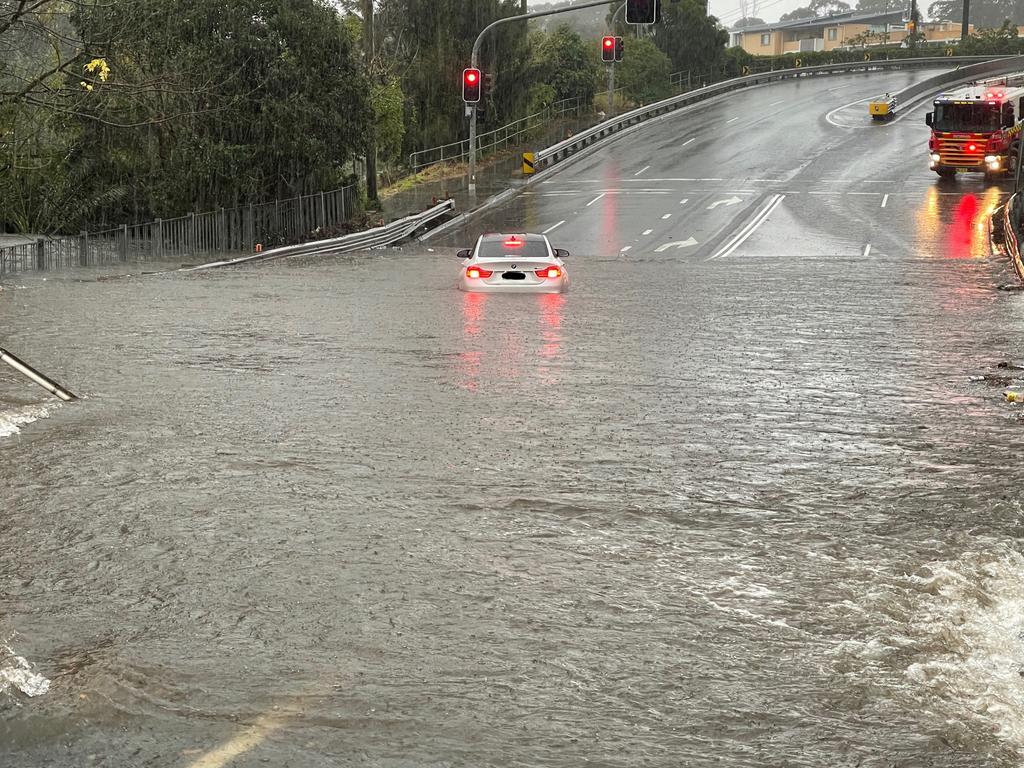
Authorities have pleaded with motorists not to drive through flooded roads – one of the leading causes of deaths following extreme rain events.
Overnight, the State Emergency Service issued a number of emergency evacuation or prepare to evacuate notices across west, south west and southern Sydney.
Suburbs in danger of flooding include Wallacia, Camden, Lansvale, Woronora as well as areas of the Liverpool local government area. Parts of Richmond, in the city’s north west, are also on notice.
That’s due to rain pouring into the already swollen Hawkesbury and Nepean rivers on Sydney’s fringe.
SES: ‘You may be trapped’
Many suburbs are in danger of being completely cut off, the SES said early on Sunday.
“You may be trapped without power, water and other essential services and it may be too dangerous to rescue you,” the organisation warned.
Emergency evacuation centres have been set up in Narellan and Canley Vale.
Rainfall totals around Sydney and the Illawarra region have been immense.
At 5am on Sunday, Holsworthy, in Sydney’s south west, had recorded more than 200mm of rain since 9am on Saturday.
‼ EVACUATION ORDER Low lying parts of Woronora ‼
— NSW SES (@NSWSES) July 2, 2022
NSW SES is directing residents and businesses within low lying parts of Woronora to evacuate now.
Go to https://t.co/BCnxAe6tsR for the complete evacuation order with exact locations affected and nearest evacuation centre. pic.twitter.com/GhJSyA1e79
âš EVACUATION WARNINGâš parts of Lansvale and parts of Camden.
— NSW SES (@NSWSES) July 2, 2022
NSW SES is advising residents and businesses within parts of #Lansvale and parts of #Camden to prepare to evacuate.
Go to https://t.co/FZooFaii4k for complete evacuation warnings with exact locations affected. pic.twitter.com/d81kT0hrOB
Lucas Heights, in the city’s south, bettered that with 215mm. Areas near Wollongong have seen almost 170mm and 150mm fell in the Southern Highlands.
The system is currently off the coast but will steadily get closer as Sunday continues.
“It will be a complex low that means there’s more than one centre,” said Mr Saunders.
“One of the main centres could be sitting right near the NSW Central Coast during Sunday night and into Monday morning.
“If that were to occur, we’re not only looking at heavy rain but also damaging winds on the southern side of the system.
“We could see gusts up to about 100 kilometres per hour and with very wet ground that could see trees uprooted.”

Half metre of rain possible
Sydney could see 80-150mm of rain on Sunday and up to another 40mm on Monday. It won’t be much different in Wollongong.
Mr Saunders said some areas might see as much as 500mm of rain over the multi-day event – that’s half a metre of moisture coming down.
However, the direction these systems take can change, meaning the area of the heaviest falls could alter.
The Bureau of Meteorology has issued a severe weather warning for heavy rainfall, damaging winds, flash flooding and heavy surf along the NSW coast from Newcastle to Ulladulla.
NSW SES Commissioner Carlene York said because dams and rivers were already full, there was “significant” concern about what is to come for communities across the state.
“This significant rain event could have some major effects across communities from Port Stephens down to Batemans Bay so we’re preparing and getting community messaging out to let them know they’re in some of these areas of risk and to be ready.”
Queensland to be drenched
Widespread rain continues across Queensland. After easing on Saturday it should start bubbling up again on Sunday with the heaviest falls seen early in the week.
Across northern parts of the coast, rain totals of 100mm are on the cards.

Townsville will see some showers as the weekend progresses, but Monday is when it will chuck it down, with 40-60mm forecast, and more of the same for Tuesday.
Brisbane should be mainly dry on Sunday. But Tuesday could again see downpours. The other capitals will have a very different weekend with Melbourne, Adelaide and Hobart all remaining dry and partly cloudy with almost uniform mid-teen highs.
Darwin will see some blue skies with maximums of 29C. But it’s Perth that will be gloriously sunny, with relatively mild temperatures only just nudging 20C.


